Bureau of Meteorology
Climate and Water Outlook, issued 31 October 2019
- Title
- Climate and Water Outlook, issued 31 October 2019
- Runtime
- 4:08
- Date posted
- 7 years ago
- Description
- The Climate and Water Outlook video provides a look at likely rainfall, streamflow and temperature for the months ahead. See http://ow.ly/EcZM50wXSEe for more detail.
Our climate outlooks now include weekly and fortnightly outlooks, bridging the gap between our seven-day forecasts and the existing monthly and seasonal climate outlooks.

- Title
- Severe weather update: fire weather conditions continuing through NSW & Queensland, 18 October 2019
- Runtime
- 2:01
- Date posted
- 7 years ago
- Description
- Severe Weather Update: fire weather conditions continuing through NSW and Queensland. Video current at 1pm AEST Friday 18 October 2019.
Know your weather. Know your risk. For the latest weather forecasts and warnings visit http://ow.ly/Roph50wOdSz and follow advice from emergency services.

- Title
- Climate and Water Outlook, issued 17 October 2019
- Runtime
- 2:01
- Date posted
- 7 years ago
- Description
- The Climate and Water Outlook video provides a look at likely rainfall, streamflow and temperature for the months ahead. See http://ow.ly/D9dL50wNgz9 for more detail.
Our climate outlooks now include weekly and fortnightly outlooks, bridging the gap between our seven-day forecasts and the existing monthly and seasonal climate outlooks.

- Title
- Severe Weather Outlook 2019—20
- Runtime
- 4:37
- Date posted
- 7 years ago
- Description
- Although severe weather can occur at any time of the year, October to April is the peak time for Australia's bushfires, heatwaves, flooding, tropical cyclones and severe thunderstorms. This video looks at likely conditions for the 2019–20 severe weather season in Australia. Understanding how severe weather happens, knowing it's on the way and being ready to act all help you to stay safe. Explore our severe weather information to be better prepared when hazardous weather looms: More at: http://www.bom.gov.au/knowyourweather/.
- Title
- Severe weather update: record heat and elevated fire dangers for parts of NSW & Qld, 8 October 2019
- Runtime
- 2:29
- Date posted
- 7 years ago
- Description
- Severe Weather Update: record heat and elevated fire dangers for northern New South Wales and southeastern Queensland. Video current at 10 am AEST Tuesday 8 October 2019.
Yesterday a number of October temperature records were broken in northern New South Wales, including Grafton, which reached a high of 40.6 °C—breaking the previous record of 39 °C set in 2002.
The heat is pushing up towards the coast today, with Brisbane forecast to reach 36 °C, before a change moves through northeastern NSW this afternoon, and southeast Qld later this evening. In the meantime, a number of fire weather warnings are current for these areas, so stay vigilant and listen to advice from emergency services.
Know your weather. Know your risk. For the latest weather forecasts and warnings visit http://ow.ly/TjK650wFfLo.

- Title
- Severe Weather Update: dangerous fire conditions & heat through parts of NSW & Qld, 7 Oct 2019
- Runtime
- 1:49
- Date posted
- 7 years ago
- Description
- Severe Weather Update: dangerous fire conditions and record-breaking heat through northern New South Wales and southern Queensland. Video current at 12.30 pm AEST Monday 7 October 2019.
Know your weather. Know your risk. For the latest weather forecasts and warnings visit http://ow.ly/Q3LC50wEedn and follow advice from emergency services.

- Title
- Severe Weather Update: Hot conditions bring above average heat and elevated fire dangers
- Runtime
- 3:09
- Date posted
- 7 years ago
- Description
- Meteorologist, Kimba Wong, gives the latest update on the increased heat and fire dangers impacting NSW, ACT and QLD from today into next week.
NSW will see temperatures in the high 30s for many areas in the west today and northern coast on Monday, with some locations likely exceeding 40 degrees. Hot and windy conditions are bringing elevated fire danger through inland and northeast areas of the state.
Temperatures increase over QLD from today, with potentially record breaking temperatures expected on Monday and Tuesday for southern areas with Severe fire dangers forecast in multiple locations. Isolated thunderstorms in the southeast with little rainfall may bring increased fire risk from dry lightning on Monday and Tuesday.
Stay updated and follow advice for emergency services. Know your weather. Know your risk.
- Title
- SEVERE WEATHER UPDATE: Hot conditions continuing through much of Australia, 3 October 2019
- Runtime
- 2:06
- Date posted
- 7 years ago
- Description
- Severe Weather Update: Hot conditions continue through much of Australia, with fire dangers increasing. Video current at 3 pm AEST Thursday 3 October 2019.
For the latest weather forecasts and warnings visit http://ow.ly/Vbaw50wAakV and follow advice from emergency services.

- Title
- Queensland floods: the water journey to Kati Thanda-Lake Eyre
- Runtime
- 5:15
- Date posted
- 7 years ago
- Description
- Huge downpours of rain brought devastating floods to parts of northern Queensland and the Northern Territory early in 2019. This water made a slow and torturous journey of nearly 1000 km, filling the Georgina, Diamantina and Warburton rivers and flooding desert towns as it travelled. A second rain system in late March brought more water, extending across vast flood plains and eventually flowing into Kati Thanda-Lake Eyre many weeks after it fell, bringing life, colour and a surge of visitors to this dry country.
- Title
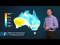
- Climate and Water Outlook October—December 2019, issued 26 September
- Runtime
- 3:37
- Date posted
- 7 years ago
- Description
- This Climate and Water Outlook video covers rainfall, streamflow and temperature for the next three months. It includes a wrap-up of recent conditions and a look at which drivers are influencing our climate. Read more at http://ow.ly/OVjp50wrGR2 Our first look at likely conditions for November 2019 to January 2020 will be available on Thursday the 17th of October.

- Title
- 2019 AFL Grand Final weather forecast
- Runtime
- 1:53
- Date posted
- 7 years ago
- Description
- Weather forecast for the 2019 AFL Grand Final between the Richmond Tigers and GWS Giants on Saturday 28 September 2019.
Issued on Wednesday 25 September at 4pm AEST. For the latest weather forecasts and warnings visit http://ow.ly/9p8850wrpzT
- Title
- Severe Weather Update: Fire danger on the rise again for northern NSW and southern Qld, 16 Sept 2019
- Runtime
- 1:43
- Date posted
- 7 years ago
- Description
- Severe Weather Update: Fire danger on the rise again for northern NSW and southern Queensland. Video current at 12 pm AEST Monday 16 September 2019.
Know your weather. Know your risk. For the latest weather forecasts and warnings visit http://ow.ly/qZeW50waYDY and follow advice from emergency services.

- Title
- Climate and Water Outlook, issued 12 September 2019
- Runtime
- 2:37
- Date posted
- 7 years ago
- Description
- The Climate and Water Outlook video provides a look at likely rainfall, streamflow and temperature for the months ahead. See http://ow.ly/xvb950w6mEg for more detail.
Our climate outlooks now include weekly and fortnightly outlooks, bridging the gap between our seven-day forecasts and the existing monthly and seasonal climate outlooks.

- Title
- Severe Weather Update: fire weather over parts of Queensland and NSW, 11 September 2019
- Runtime
- 1:52
- Date posted
- 7 years ago
- Description
- This video provides an update on the ongoing fire situation over parts of eastern Queensland and northeast New South Wales. Video current at 12 pm AEST, Wednesday 11 September 2019.
Know your weather. Know your risk. For the latest weather forecasts and warnings visit http://ow.ly/QUWE50w50WG and follow advice from emergency services.

- Title
- BOM Webinar 5 September 2019: Spring 2019 climate and water outlook
- Runtime
- 59:49
- Date posted
- 7 years ago
- Description
- This webinar covered an in depth analysis of recent conditions, as well as the temperature, rainfall and streamflow outlook for spring. This webinar also highlighted the new climate outlook system – more outlooks, more often - at http://www.bom.gov.au/climate/outlooks/#/overview/summary

- Title
- Climate outlooks—more outlooks, more often
- Runtime
- 1:07
- Date posted
- 7 years ago
- Description
- 'Climate outlooks—more outlooks, more often' showcases new features of our service including likely rainfall and temperature conditions now available for the weeks, months and seasons ahead.
Find more at http://ow.ly/fFWC50vNvnQ

- Title
- Climate and Water Outlook, September—November 2019
- Runtime
- 3:24
- Date posted
- 7 years ago
- Description
- The end-of-month Climate and Water Outlook video covers rainfall, streamflow and temperature for the next three months. It includes a wrap-up of recent conditions and a look at which drivers are influencing our climate. Read more at http://ow.ly/lYZ650vNcMk Our first look at likely conditions for October to December will be available on Thursday the 12th of September.

- Title
- First look at the Climate and Water Outlook for September–November 2019, issued 15 August 2019
- Runtime
- 1:01
- Date posted
- 7 years ago
- Description
- The mid-month Climate and Water Outlook video provides a first look at likely rainfall, streamflow and temperature for the next three months. See http://ow.ly/yRhs50vxSGx for more detail.
An updated outlook for will be available on Thursday 29 August 2019.

- Title
- Severe Weather Update: Damaging winds, rainfall and snow across southeast Australia, 9 August 2019
- Runtime
- 2:40
- Date posted
- 7 years ago
- Description
- Video current at 12 pm AEST, 9 August 2019. For the latest weather and warnings info visit http://ow.ly/ox5j50vstAl and follow advice from emergency services.

- Title
- Severe Weather Update: strongest weather system this winter for southeast Australia, 7 August 2019
- Runtime
- 2:25
- Date posted
- 7 years ago
- Description
- Video current at 12 pm AEST 7 August 2019. For the latest weather and warnings info visit http://ow.ly/NpNo50vqiQZ and follow advice from emergency services.
- Title
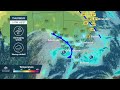
- Series of cold fronts to affect southeastern Australia: 6 August 2019
- Runtime
- 0:36
- Date posted
- 7 years ago
- Description
- 6 August 2019: a series of strong cold fronts are forecast to cross South Australia on Wednesday and move through Victoria, Tasmania and New South Wales by Saturday. We expect to see very windy conditions, rain, hail and potentially snow in low lying areas (highlighted at 0:17 in this video) ❄️ Alpine areas could expect damaging winds and gusts up to 120 km/h.
For the latest warnings: http://ow.ly/CjdX50vp2q1
Looking for more information for snow? Take a look at Meteye and click on snow in the left side menu http://ow.ly/snbC50vp2oG.

- Title
- Understanding drought
- Runtime
- 2:17
- Date posted
- 7 years ago
- Description
- Drought is a defining feature of Australia. But not all droughts are the same. They can vary in the size of the area affected, the intensity, and how long they last. So what do we mean by drought? Improve your understanding with our Understanding Drought video.
Find more at: http://ow.ly/6OyZ50v9Gdn

- Title
- Climate and Water Outlook, August–October 2019
- Runtime
- 3:57
- Date posted
- 7 years ago
- Description
- The end-of-month Climate and Water Outlook video covers rainfall, streamflow and temperature for the next three months. It includes a wrap-up of recent conditions and a look at which drivers are influencing our climate. Read more at http://ow.ly/dNja50vaJuB
Our first look at likely conditions for spring will be available on Thursday the 15th of August.
- Title
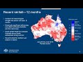
- BOM Webinar 18 July 2019: Drought conditions update
- Runtime
- 1:02:59
- Date posted
- 7 years ago
- Description
- Recorded Thursday 18 July 2019.
Dr David Jones (climate) and Matthew Coulton (water) gave an in-depth analysis of recent drought conditions in Australia and the impact on water resources—including a discussion of the Bureau's Climate and Water Outlook for the coming months (http://ow.ly/y1MA50v7n6W).

- Title
- Cold front and swell conditions: southeastern Australia, 11 July 2019
- Runtime
- 0:25
- Date posted
- 7 years ago
- Description
- 11 July 2019: Large areas of the southeast coast can expect large swells and dangerous surf conditions—our forecast shows swell heights in above of 6 m from today (11 July) until Saturday (13 July).
Please take care, listen to emergency services and plan your travel and outdoor activities safely using our current warnings: http://www.bom.gov.au/australia/warnings/index.shtml.

- Title
- Climate and Water Outlook for August–October 2019, issued 11 July 2019
- Runtime
- 1:18
- Date posted
- 7 years ago
- Description
- The mid-month Climate and Water Outlook video provides a first look at likely rainfall, streamflow and temperature for the next three months. See http://ow.ly/sTLN50uX8Ml for more detail.

- Title
- Cold front: southeastern Australia, 10 July 2019 evening update
- Runtime
- 0:32
- Date posted
- 7 years ago
- Description
- The first of several cold fronts has delivered strong winds to the southeast, and we expect these conditions to continue over the next few days. Current as at 10 July 2019, 3 pm AEST.
⚠️Many areas of SA, Vic and Tas have Damaging to Destructive Wind Warnings current and Road Weather Alerts: http://www.bom.gov.au/australia/warnings/index.shtml. Please take care while on the road or outdoors.
❗ For those in Victoria, the Severe Weather Warning has been updated to destructive winds across Alpine areas – possible gusts up to 130 km/h overnight and up to 100 km/h across most of Victoria.

- Title
- Cold front: southeastern Australia 10 July 2019 morning update
- Runtime
- 0:24
- Date posted
- 7 years ago
- Description
- A broad area of southeastern states will see a strong blustery cold front will bring damaging winds and squally gusts, possible thunderstorms and small hail, squally showers (potential isolated heavy rainfalls), snow to elevated areas, and dangerous coastal conditions with big swells. Current as at 10 July 2019, 9am AEDT.
⚠️We have issued several Severe Weather Warnings across SA, Vic, Tas and ACT/NSW, check your local area here: http://ow.ly/r9UP50uX4KT and listen to your local emergency services.
For our Adelaide community who will experience the first impacts, gusty winds (potentially damaging) will arrive during the afternoon commute between 4.30-6.30 pm. There will be a Road Weather Alert for Adelaide as winds and potential thunderstorms will affect visibility on roads. Motorists please use caution on the road.
Keep connected to your local weather and prepare for the chill factor to continue into the weekend (including snow to the alpin...

- Title
- Climate and Water Outlook, July–September 2019
- Runtime
- 3:47
- Date posted
- 7 years ago
- Description
- The end-of-month Climate and Water Outlook video covers rainfall, streamflow and temperature for the next three months. It includes a wrap-up of recent conditions and a look at which drivers are influencing our climate. Read more at http://ow.ly/Esrd50uLZvk.
Our first look at likely conditions for August–October 2019 will be available on Thursday 11 July.

- Title
- National Water Account 2018
- Runtime
- 3:04
- Date posted
- 7 years ago
- Description
- The Bureau of Meteorology’s National Water Account provides an annual picture of water use and availability for 11 key regions around Australia. It plays a critical role in water planning and decision-making by governments and industry.
Looking back at 2017–18, most of Australia received below-average rainfall. The collective impacts of these dry conditions were: a decline in surface water storage volumes; increased water use; and a shift towards more groundwater being used. Read more at http://ow.ly/V49D50uMTW4.

- Title
- First-look Climate and Water Outlook for Jul–Sep 2019
- Runtime
- 1:11
- Date posted
- 7 years ago
- Description
- This mid-month Climate and Water Outlook video, issued 13 June 2019, provides a first look at likely rainfall, streamflow and temperature for July–September 2019. See http://ow.ly/1uLY50uC1BL for more detail.
An updated outlook for July–September will be available on Thursday 27 June 2019.

- Title
- BOM Webinar 6 June 2019: Winter 2019 climate and water update
- Runtime
- 56:29
- Date posted
- 7 years ago
- Description
- Recording of webinar 6 June 2019, in which our climate experts talked through on recent conditions around Australia and the climate and water outlook for the next three months (Winter 2019). For more information on the outlook, see http://www.bom.gov.au/climate/outlooks/#/overview/summary.

- Title
- Understanding the Southern Annular Mode (SAM)
- Runtime
- 4:16
- Date posted
- 7 years ago
- Description
- Improve your understanding of the Southern Annular Mode (SAM). To find out more visit: http://www.bom.gov.au/climate/sam.

- Title
- Understanding the Madden–Julian Oscillation (MJO)
- Runtime
- 3:46
- Date posted
- 7 years ago
- Description
- Improve your understanding of the Madden–Julian Oscillation (MJO). Find more at http://www.bom.gov.au/climate/about/?bookmark=mjo.

- Title
- Climate and Water Outlook, June–August 2019
- Runtime
- 3:51
- Date posted
- 7 years ago
- Description
- The end-of-month Climate and Water Outlook video covers rainfall, streamflow and temperature for the next three months. It includes a wrap-up of recent conditions and a look at which drivers are influencing our climate. Read more at http://ow.ly/cpIT50usqmV.
Our first look at likely conditions for July–September 2019 will be available on Thursday 13 June.

- Title
- Weather Update: Cold front over southeastern Australia 23 May 2019
- Runtime
- 0:26
- Date posted
- 7 years ago
- Description
- Weather Update 23 May 2019: A series of cold fronts over the next few days will end recent warm weather in southeastern Australia. The fronts will bring lower temperatures, stronger winds, rain and possibly storms. Check http://www.bom.gov.au for your local forecasts and warnings, and please follow any advice from emergency services.
Know your weather. Know your risk.

- Title
- National Volunteer Week 2019: Skender and Abbey.
- Runtime
- 2:01
- Date posted
- 7 years ago
- Description
- Volunteers come in all shapes and sizes. 14-month-old Golden Retriever X Labrador, Abbey, is on work experience at our Melbourne office with Skender—a volunteer for Guide Dogs Victoria. Bureau accommodation manager Skender is helping Abbey become used to an office environment, so she can one day accompany a person with low vision as they go about their day.
Other Bureau staff around the country give their free time to groups including the SES, volunteer fire agencies (RFS, CFA, etc) and Surf Life Saving Australia.
As an organisation, we work closely with volunteers in emergency roles to keep Australian communities safe, and volunteer weather observers contribute every day to our national climate record.
- Title
- Weekly weather wrap from the Bureau of Meteorology: Sunday 19 May 2019
- Runtime
- 1:56
- Date posted
- 7 years ago
- Description
- Our meteorologist Sarah Scully presents next week's weather forecast as aired today on ABC Landline. Our forecasts update daily, please visit www.bom.gov.au for current information.

- Title
- First look at the Climate and Water Outlook for June–August 2019, issued 16 May 2019
- Runtime
- 1:22
- Date posted
- 8 years ago
- Description
- The mid-month Climate and Water Outlook video provides a first look at likely rainfall, streamflow and temperature for the next three months. See http://ow.ly/xFlm50udPPl for more detail.
An updated outlook for June–August will be available on Thursday 30 May 2019.

- Title
- Weather Update: Ex-tropical cyclone Ann crossing northern Queensland 15 May 2019
- Runtime
- 0:31
- Date posted
- 8 years ago
- Description
- This animation provides an update on the movement and impacts of ex-tropical cyclone Ann over northern Queensland. Video current at 10 am AEST, Wednesday 15 May 2019.
This tropical low is moving in a west–northwesterly direction and is expected to make landfall later today, to the south of Lockhart River.
Cyclone warnings are no longer in effect, but a Severe Weather Warning is current for damaging winds and locally heavy rainfall for northeastern Queensland: see http://ow.ly/vaQc50uc9Bm for updates.
Please follow advice from emergency services.
Know your weather. Know your risk.

- Title
- Severe Weather Update: Tropical cyclone Ann approaching northern Queensland, 14 May 2019
- Runtime
- 1:38
- Date posted
- 8 years ago
- Description
- This video provides an update on tropical cyclone Ann, which is expected to weaken to a tropical low later today before approaching the Queensland coast (Video current at 1 pm AEST 14 May 2019).
Know your weather. Know your risk. Check http://ow.ly/NQJE50uayfw for updated cyclone advice, warnings and track maps; and please follow advice from emergency services.

- Title
- Weekly weather wrap from the Bureau of Meteorology: Sunday 12 May 2019
- Runtime
- 2:31
- Date posted
- 8 years ago
- Description

- Title
- Weather Update: Tropical cyclone Ann in the Coral Sea, 13 May 2019
- Runtime
- 0:20
- Date posted
- 8 years ago
- Description
- This animation gives an update on the movement of tropical cyclone Ann in the Coral Sea and its forecast impacts on rainfall in northern Queensland. Video current at 10.36 am AEST, Monday 13 May 2019. Tropical cyclone Ann currently poses no direct threat to the Queensland coast, but will enhance strong winds along the east coast (with offshore gales) and increase the chance of showers and rain over eastern Queensland this week.
Know your weather. Know your risk. Check http://ow.ly/nTp050u8VrZ for updated track maps and cyclone advice; follow advice from emergency services.

- Title
- Severe Weather Update: Cold front, showers and storms over southeastern Australia from 9 May 2019
- Runtime
- 1:39
- Date posted
- 8 years ago
- Description
- This video provides an updated on the cold front, showers and storms moving over southeastern Australia. Video current as of 11.30 am AEST, Thursday 9 May 2019. Check our BOM Weather app or website (http://www.bom.gov.au) for your local forecasts and warnings, and follow advice from emergency services. Know your weather. Know your risk.

- Title
- Weather Update: Cold fronts over southeastern Australia from 7 May 2019
- Runtime
- 0:26
- Date posted
- 8 years ago
- Description
- Weather Update: Brace yourself for a duo of cold fronts moving through SA, Vic, Tas. and NSW—bringing gusty winds, showers, thunderstorms and possibly even snow (shown pink and purple on our model) in alpine areas. Forecast data current as of 11 am AEST Tuesday 7 May.
South Australia can expect rain, showers and thunderstorms today (Tuesday) in southern parts of the state with fresh gusty northwesterly winds, turning west to southwesterly behind the first front, easing later this evening. There's potential for raised dust over the Mid North and Flinders districts and southern parts of the Pastoral district.
In Victoria, the first front will move across from the west this afternoon (Tue) and bring welcome follow-up rains to most of the state between now and Friday. The combination of wet weather and cold winds means a chance of snow in alpine areas, plus a sheep graziers' alert for many areas.
New South Wales will shift towards cool, wintry condi...

- Title
- Bureau of Meteorology Live Stream
- Runtime
- 0:00
- Date posted
- 8 years ago
- Description

- Title
- Weekly weather wrap from the Bureau of Meteorology: Sunday 5 May 2019
- Runtime
- 2:01
- Date posted
- 8 years ago
- Description
- Our meteorologist Dr Adam Morgan presents next week's weather forecast as aired today on ABC Landline. Our forecasts update daily, please visit www.bom.gov.au for current information.

- Title
- May the Fourth forecast 2019
- Runtime
- 1:21
- Date posted
- 8 years ago
- Description
- Jedi meteorologist Grace Legge has the force-cast for Saturday 4 May 2019. Video current at 3 pm AEDT, Friday 3 May. Check http://ow.ly/g0Er50tVGud and our official BOM Weather app for updates.

- Title
- Severe Weather Update: Cold front to impact southeastern and eastern Australia, 30 April 2019
- Runtime
- 2:06
- Date posted
- 8 years ago
- Description
- Severe Weather Update: Where is the rain expected to fall over southeastern and eastern Australia in the next few days? Video current at 2 pm AEST, Tuesday 30 April 2019.
Know your weather. Know your risk. Check http://ow.ly/MrwW30oAcnM for your local forecasts and warnings, and follow advice from emergency services.

- Title
- Severe Weather Update: Showers and thunderstorms for southeastern Australia, w/c 29 April 2019
- Runtime
- 2:11
- Date posted
- 8 years ago
- Description
- This video provides an update on the rain showers and thunderstorms forecast for parts of southeastern Australia over the coming few days. Video current at 1.30 pm ACST, Monday 29 April 2019. Know your weather; know your risk. Check http://www.bom.gov.au for your local forecasts and warnings, and follow advice from emergency services.





