Bureau of Meteorology
Climate and Water Outlook, July–September 2015

- Title
- Climate and Water Outlook, July–September 2015
- Runtime
- 4:13
- Date posted
- 11 years ago
- Description
- Our monthly Climate and Water Outlook video covers rainfall, streamflow and temperature for the next three months. The next video will be available on 30 July 2015. For more detail, go to http://www.bom.gov.au/climate/ahead.
Please note our ENSO Tracker is updated every two weeks. Check http://www.bom.gov.au/climate/enso/tracker to see its current status.
For an e-alert each month for the latest video, please subscribe to Climate Outlooks at http://bom.is/enviro-news.
You can also follow the Bureau of Meteorology on Facebook (http://www.facebook.com/bureauofmeteorology) and Twitter (http://twitter.com/bom_au)

- Title
- Climate and Water Outlook, June–August 2015
- Runtime
- 3:53
- Date posted
- 12 years ago
- Description
- The monthly Climate and Water Outlook video covers rainfall, streamflow and temperature for the next three months. The next video will be available on 25 June 2015. For more detail, please go to http://www.bom.gov.au/climate/ahead
Please note our ENSO Tracker is updated every two weeks. Check http://www.bom.gov.au/climate/enso/tracker to see its current status.
For an e-alert each month for the next video, please subscribe to Climate Outlooks at http://bom.is/enviro-news
You can also follow the Bureau of Meteorology on Facebook: http://www.facebook.com/bureauofmeteorology/ Also Twitter at http://twitter.com/bom_au
- Title
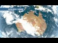
- Climate and Water Outlook, May–July 2015
- Runtime
- 3:51
- Date posted
- 12 years ago
- Description
- The monthly Climate and Water Outlook video covers rainfall, streamflow and temperature for the next three months. The next video will be available on 28 May 2015.
For more detail, please go to http://bom.is/sco
Please note our ENSO Tracker is updated every two weeks. Check http://bom.is/ensotracker to see its current status.
For an e-alert each month for the next video, please subscribe to Climate Outlooks at http://bom.is/enviro-news
To share this video, or to tell us what you think, go to Facebook: http://on.fb.me/1Od8VKa
More information on the international climate models available as follows:
UK model: http://bom.is/0e749b
USA model: http://bom.is/35ae6a
European model: http://bom.is/4b9a7b

- Title
- Climate and Water Outlook, April–June 2015
- Runtime
- 3:47
- Date posted
- 12 years ago
- Description
- The monthly Climate and Water Outlook video covers rainfall, streamflow and temperature for the next three months. The next video will be available on 23 April 2015.
For more detail, please go to www.bom.gov.au/climate/ahead
Please note our ENSO Tracker is updated every two weeks. Check www.bom.gov.au/climate/enso/tracker to see its current status.
For an e-alert each month for the next video, please subscribe to Climate Outlooks at http://bom.is/enviro-news
To share this video, or to tell us what you think, go to https://www.facebook.com/bureauofmeteorology

- Title
- Climate and Water Outlook, March–May 2015
- Runtime
- 3:54
- Date posted
- 12 years ago
- Description
- The monthly Climate and Water Outlook video covers rainfall, streamflow and temperature for the next three months. The next video will be available on 26 March 2015.
For more detail, please go to www.bom.gov.au/climate/ahead
Please note our ENSO Tracker is updated every two weeks. Check www.bom.gov.au/climate/enso/tracker to see its current status.
For an e-alert each month for the next video, please subscribe to Climate Outlooks at http://bom.is/enviro-news
To share this video, or to tell us what you think, go to Facebook.
- Title
- Offshore Automatic Weather Stations
- Runtime
- 1:23
- Date posted
- 12 years ago
- Description
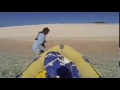
- The Bureau of Meteorology operates a network of offshore, automatic weather stations in the Great Barrier Reef, that form part of an integrated observing network, used for providing timely weather warnings and forecasts for Queensland communities, especially in tropical cyclone events.
- Title
- Annual Climate Statement 2014
- Runtime
- 3:03
- Date posted
- 12 years ago
- Description
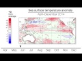
- The Annual Climate Statement is a snapshot of the Australian climate for the previous year including rainfall, temperature and significant events. This video is a summary of the online report available at http://bom.is/acs

- Title
- Understanding ENSO
- Runtime
- 4:14
- Date posted
- 12 years ago
- Description
- Improve your understanding of the El Niño and La Niña and their impacts on our climate and weather with our new Understanding ENSO video
This video explains what El Niño–Southern Oscillation (ENSO) is, how the cycle works including the science behind the phases, and the potential impacts on Australia’s climate and weather.

- Title
- Climate Outlooks: A fresh look for our website
- Runtime
- 1:49
- Date posted
- 12 years ago
- Description
- Updated video now available at https://www.youtube.com/watch?v=jGSOU8c-DX4.

- Title
- Bureau of Meteorology Annual Report 2013-14
- Runtime
- 4:02
- Date posted
- 12 years ago
- Description
- Bureau of Meteorology Director and CEO Dr Rob Vertessy introduces the Bureau's annual report for 2013–14. Read the full report at http://bom.is/annual-report.
- Title
- Geofabric: a digital street directory of Australia’s water features
- Runtime
- 2:34
- Date posted
- 12 years ago
- Description
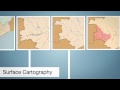
- Find out more about the Bureau of Meteorology’s Geofabric. This specialist geographic information system lets you map how water is moved, used and store throughout the landscape. For more information please visit: http://bom.is/geofabric
- Title
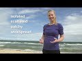
- Rain forecasts: New words for a better understanding
- Runtime
- 1:13
- Date posted
- 12 years ago
- Description
- The Bureau of Meteorology is changing the rainfall terminology used in its forecasts. Words such as isolated, scattered and widespread will be replaced with probabilistic terminology such as slight, medium, high and very high. For more detail, please go to http://bom.is/rain-terminology

- Title
- Monitoring sea level across the Pacific
- Runtime
- 8:49
- Date posted
- 12 years ago
- Description
- The Pacific sea-level monitoring network consists of tide monitoring facilities in 12 countries across the Pacific. Watch this video to find out more about the monitoring equipment, how it works and why it’s important to the Pacific and Australia.
More information: http://www.bom.gov.au/pacific/projects/pslm/index.shtml
This project operates under the Climate and Oceans Support Program in the Pacific (COSPPac) and is funded by the Australian Government – AusAID and Department of Foreign Affairs and trade.
- Title
- Seasonal Streamflow Forecasts: a vital water management tool
- Runtime
- 2:55
- Date posted
- 12 years ago
- Description
- Find out more about the Bureau of Meteorology’s Seasonal Streamflow Forecasts and how they are used to inform water management decisions around Australia.
Access the latest Seasonal Streamflow Forecasts via http://www.bom.gov.au/water/ssf

- Title
- Climate Outlooks: Stacking the odds in your favour
- Runtime
- 2:39
- Date posted
- 12 years ago
- Description
- Climate Outlooks: Stacking the odds in your favour, explains how to interpret climate outlook information to assist decision-making.
Special thanks to Tripod Farms, Bacchus Marsh.

- Title
- Bureau of Meteorology Mobile Weather Website
- Runtime
- 1:17
- Date posted
- 13 years ago
- Description
- The new Bureau of Meteorology mobile weather website makes it quick and easy for you to check Australia's official weather forecasts, where ever you are using your mobile device.
You can access our current weather information, weather forecasts, warnings and our popular rain radar so you can plan your day on the go. At any time you can switch to the Bureau's full website for detailed information.
For instant access to Australia's most reliable weather forecasts, visit http://m.bom.gov.au on your mobile device and remember to bookmark the site.
- Title
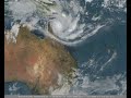
- Severe Tropical Cyclone Ita 5-13 April 2014
- Runtime
- 0:18
- Date posted
- 13 years ago
- Description
- This satellite loop from the Japanese MTSAT satellite orbiting approximately 35 000 km above the Earth's surface, captures the formation and movement of severe tropical cyclone Ita, which made landfall as a category 4 cyclone around 10pm on Friday April 11 near Cape Flattery, Queensland.
The loop shows the system which began life as a tropical low southwest of the Solomon Islands in the northeastern Coral Sea on 2 April, 2014, before intensifying into a category 1 cyclone and being named on the afternoon of 5 April. Tropical cyclone Ita became a category 3 severe tropical cyclone on 8 April and then on the afternoon of 10 April rapidly intensified during a six hour period to become a category 5 system.
A day later, Ita then weakened almost as quickly, approaching the coast as a category 4 system and crossing land around 10:00pm on 11 April. By the next morning it had weakened into a category 1 cyclone, remaining at this level for a two day trek southwards al...

- Title
- Australian climate model
- Runtime
- 2:12
- Date posted
- 13 years ago
- Description
- The Australian Community Climate and Earth System Simulator (ACCESS) helps predict what will happen to our weather in the coming months and provides projections of our climate decades ahead.
The model is a collaboration between CSIRO and the Bureau of Meteorology.

- Title
- State of the Climate 2014: Behind the science - our changing atmosphere
- Runtime
- 1:54
- Date posted
- 13 years ago
- Description
- The State of the Climate report focuses primarily on climate observations and monitoring carried out by the Bureau of Meteorology and CSIRO in the Australian region, as well as on future climate scenarios.
This video looks at how CSIRO research is helping us better understand the composition and sources of our changing atmosphere
For more information, see the full report at www.bom.gov.au/state-of-the-climate

- Title
- State of the Climate 2014: Behind the science - climate data collection and analysis
- Runtime
- 1:37
- Date posted
- 13 years ago
- Description
- The State of the Climate report focuses primarily on climate observations and monitoring carried out by the Bureau of Meteorology and CSIRO in the Australian region, as well as on future climate scenarios.
This video looks at how the Bureau collects and analyses data including observations from its high quality, long-term climate data sets.
For more information, see the full report at www.bom.gov.au/state-of-the-climate

- Title
- eReefs: Providing water quality information for the Great Barrier Reef (30 seconds)
- Runtime
- 0:41
- Date posted
- 13 years ago
- Description
- eReefs is a collaborative project to help protect and preserve the iconic Great Barrier Reef.
The eReefs Project will provide vital tools for decision making and communication spanning the entire Reef spectrum -- from catchment to ocean. Timely access to sea surface temperatures and water quality information is essential for researchers and marine managers in maintaining a healthy reef ecosystem.
This project is part of the new generation of environmental intelligence products and services offered under the framework of the Government's National Plan for Environmental Information -- an initiative jointly led by the Bureau of Meteorology and the Department of the Environment.
eReefs brings together corporate Australia through the Great Barrier Reef Foundation and its partner BHP Billiton Mitsubishi Alliance; Australia's leading operational and research agencies in the Bureau of Meteorology, CSIRO, and the Australian Institute of Marine Science; th...

- Title
- eReefs: Providing water quality information for the Great Barrier Reef
- Runtime
- 3:17
- Date posted
- 13 years ago
- Description
- eReefs is a collaborative project to help protect and preserve the iconic Great Barrier Reef.
The eReefs Project will provide vital tools for decision making and communication spanning the entire Reef spectrum -- from catchment to ocean. Timely access to sea surface temperatures and water quality information is essential for researchers and marine managers in maintaining a healthy reef ecosystem.
This project is part of the new generation of environmental intelligence products and services offered under the framework of the Government's National Plan for Environmental Information -- an initiative jointly led by the Bureau of Meteorology and the Department of the Environment.
eReefs brings together corporate Australia through the Great Barrier Reef Foundation and its partner BHP Billiton Mitsubishi Alliance; Australia's leading operational and research agencies in the Bureau of Meteorology, CSIRO, and the Australian Institute of Marine Science; th...

- Title
- Tropical Cyclone Christine 25-31 December 2013
- Runtime
- 1:30
- Date posted
- 13 years ago
- Description
- This special satellite loop, with images at 10 minute intervals from the Japanese MTSAT satellite orbiting approximately 35 000 km above the Earth's surface, dramatically captures the formation and movement of Severe Tropical Cyclone Christine, which crossed the WA coast around midnight on the 30th December near the Pilbara town of Roebourne.
During the movie (which starts on Christmas Day), you can see the incredible amount of shower and thunderstorm activity through the NT/WA border preceding the eventual formation of Christine.
As the days progress the characteristic clockwise rotation of the clouds becomes apparent, heralding the formation of Christine.
The cyclone then intensifies to a Category 3 and produces winds estimated to be over 200 km/hr around its eye prior to making landfall.
As it crosses the coast and moves over land the cyclone rapidly weakens as a result of being removed from its energy source, the warm tropical wa...

- Title
- Annual Climate Statement 2013
- Runtime
- 2:09
- Date posted
- 13 years ago
- Description
- Climate of 2013: the hottest year on record -- a 2-minute video outlining some key points of Australia's climate in the past year. See www.bom.gov.au/climate for more information.

- Title
- Climate records
- Runtime
- 1:21
- Date posted
- 13 years ago
- Description
- The Bureau of Meteorology has observed a series of records over the past 12 months. Dr Karl Braganza describes a sequence of heat records over Australia.
Climate monitoring data is one of the building blocks for climate change science. Understanding how the frequency of extremes is changing helps us understand our future vulnerability.

- Title
- Ice core atmospheric record
- Runtime
- 1:41
- Date posted
- 13 years ago
- Description
- Dr David Etheridge shows how polar ice cores provide a record of atmospheric composition over time. We have seen large increases in greenhouses gases that can be attributed to use of fossil fuels and land clearing.

- Title
- Extreme weather events
- Runtime
- 1:10
- Date posted
- 13 years ago
- Description
- Dr Julie Arblaster has worked in climate change since she was 19. She works on extremes like heatwaves, flood and drought, using climate models to see the role of global warming in these extremes and how they might change in the future. She is a lead author in the Intergovernmental Panel on Climate Change Fifth Assessment Report chapter on long-term projections.

- Title
- Impacts of climate change on coasts
- Runtime
- 1:03
- Date posted
- 13 years ago
- Description
- Dr Kathy McInnes looks at the impacts of climate change on coasts. Changes in mean sea-level and the atmosphere result in changes to the frequency and intensity of coastal flooding. It is important that we understand how the climate is going to change so we can better prepare for it.

- Title
- The Australian Climate Change Science Program
- Runtime
- 3:17
- Date posted
- 13 years ago
- Description
- This video provides an overview of the Australian Climate Change Science Program, a collaboration between the Bureau of Meteorology, CSIRO and the Australian Government. It is the longest running climate change science program in Australia.

- Title
- The climate of Australia 2012: a year of contrasts
- Runtime
- 2:21
- Date posted
- 14 years ago
- Description
- Dr Andrew Watkins presents Australia's 2012 climate highlights -- an overview of temperature, rainfall and significant events. Discover further information on the Bureau of Meteorology website at http://bit.ly/Xgn0sO

- Title
- eReefs - Next generation information for the Great Barrier Reef
- Runtime
- 2:31
- Date posted
- 14 years ago
- Description
- eReefs is a collaborative project to help protect and preserve the iconic Great Barrier Reef.
The eReefs Project will provide vital tools for decision making and communication spanning the entire Reef spectrum -- from catchment to ocean. Timely access to sea surface temperatures and water quality information is essential for researchers and marine managers in maintaining a healthy reef ecosystem.
This project is part of the new generation of environmental intelligence products and services offered under the framework of the Government's National Plan for Environmental Information -- an initiative jointly led by the Bureau of Meteorology and the Department of Sustainability, Environment, Water, Population and Communities.
eReefs brings together corporate Australia through the Great Barrier Reef Foundation and its partner BHP Billiton Mitsubishi Alliance; Australia's leading operational and research agencies in the Bureau of Meteorology, CSIRO, and ...

- Title
- National Climate and Water Briefings, September 2012 - Severe Weather
- Runtime
- 21:38
- Date posted
- 14 years ago
- Description
- John Bally, Head of Disaster Mitigation & Severe Weather Services, Bureau of Meteorology.
Presented at the National Climate and Water Briefings on 20 September 2012.
This presentation gives an outlook for the upcoming severe weather season, including a preliminary tropical cyclone outlook, an outline of areas with above average bush and grassfire risk, and a discussion on the likelihood of summer flood.
For the climatic and hydrological current conditions and outlook, check out the National Climate and Water Briefing for Climate and Water via http://bit.ly/TtXmf3.
These monthly briefings provide information about current and upcoming climatic and hydrological conditions to assist decision-makers plan for the next three months.
Prepared by the Bureau of Meteorology.

- Title
- National Climate and Water Briefings, September 2012 - Climate and Water
- Runtime
- 27:10
- Date posted
- 14 years ago
- Description
- Gary Allan, Climate Liaison, Bureau of Meteorology.
Presented at the National Climate and Water Briefings on 20 September 2012.
This presentation gives the climatic and hydrological current conditions and outlook.
For an outlook of the upcoming severe weather season, check out the National Climate and Water Briefing for Severe Weather via http://bit.ly/Qquvdo.
These monthly briefings provide information about current and upcoming climatic and hydrological conditions to assist decision-makers plan for the next three months.
Prepared by the Bureau of Meteorology.

- Title
- Seasonal Streamflow Forecasting Service
- Runtime
- 5:11
- Date posted
- 15 years ago
- Description
- The Bureau provides a Seasonal Streamflow Forecasting Service for the south east Murray Darling Basin on our website. This service estimates how much water is likely to flow past a specific location in a stream over the next three months.
The information is based on probabilities which means, the likelihood or chance of water flowing into a stream based on relationships with recent climate and catchment conditions.
Forecasts are issued around the seventh day of every month -- covering that month and the following two months. We use statistical modelling that provides 5000 forecast possibilities for each site.
These forecasts are presented as probability distributions and exceedance probability charts and maps. These products are helping water managers and users make better informed decisions.
The forecast service with be extended over time to more catchments across Australia. Watch our Youtube clip on the Seasonal Streamflow Fore...
- Title
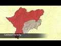
- The Australian Hydrological Geospatial Fabric
- Runtime
- 1:41
- Date posted
- 15 years ago
- Description
- The Bureau of Meteorology (the Bureau) is building the Australian Water Resources Information System (AWRIS) to deliver high quality water information essential to managing our Nation's valuable water resources.
The system will be spatially enabled using the Australian Hydrological Geospatial Fabric (or Geofabric), a spatial framework for discovering, querying, reporting and modelling water information.
The Geofabric is a specialised Geographic Information System (GIS) that registers the spatial relationships between important hydrologic features such as rivers, dams, lakes, aquifers, diversions, drains and monitoring points.
By detailing the spatial dimensions of these hydrofeatures and how they are connected, we are able to see how water is stored, transported and used through the landscape.
Contracted nodes - the enduring nature of the Geofabric is based on a set of
points called contracted nodes that represent known...

- Title
- Large Swells Impact Southeastern Australia
- Runtime
- 1:26
- Date posted
- 15 years ago
- Description
- This video explains swells that affected Southeastern Australia from 7-11 July 2011.
Some impacts of the major weather system include:
- Closure of Victoria's seaport of Portland for the first time in ten years due to eight-metre swells.
- $150 million dollars in damage due to significant beach erosion along Victoria's coast.
- Waves washing against the historical buildings of Port Arthur in Tasmania.
Images were captured using the Bureau's forecasting systems:
- ACCESS
- AUSWAVE
- OceanMAPs
Forecast products can be accessed via the Bureau's Marine Weather Services web page: http://www.bom.gov.au/marine/
Have a look at our article on the recent swells activity in Southeastern Australia:
http://www.bom.gov.au/social/2011/08/large-swells-impact-Australia/
Fore more information about swells and the Bureau's Marine Weather Services go to:
http://www.bom.go...

- Title
- Tropical Cyclone Yasi Forecast Track Map
- Runtime
- 0:18
- Date posted
- 15 years ago
- Description
- Tropical Cyclone YasiForecast Track Map
This is the Bureau's Tropical Cyclone Forecast Track Map for tropical cyclone Yasi which made landfall in North Queensland in February, 2011. These maps are graphical products that provide the track of a cyclone showing recent movement and forecasted movement. It also shows the current extent of damaging winds and a graphical representation of the areas affected by current cyclone Watch and Warnings. The most popular way of accessing this product is via the Bureau's web page http://www.bom.gov.au/cyclone/index.shtml
When a Tropical Cyclone Threat Map is issued, it contains the following information:
* The cyclone name
* Reference to the associated Tropical Cyclone Advice
* A map including the recent track of the cyclone and a forecast track of up to 48 hours in advance.
* The latest position with a graphical representation of the current and forecast extent of gale-force.
* A grey zone unc...

- Title
- Climate Information Explained
- Runtime
- 2:54
- Date posted
- 16 years ago
- Description
- Watch this video to find out about the Bureau of Meteorology's climate analysis services.
The Bureau compiles one of the world's most comprehensive and highly regarded climate records. For more than 100 years the Bureau has collected temperature and rainfall data from monitoring stations placed in every type of environment across Australia. During that time we have provided forecasting and climate services. The Bureau's climate monitoring, climate prediction and climate data services provide a clear picture of past, present and possible future climate conditions.
For more information about the Bureau's role in climate information and services go to http://www.bom.gov.au/climate/

- Title
- Careers at the Bureau of Meteorology
- Runtime
- 3:19
- Date posted
- 16 years ago
- Description
- The Bureau of Meteorology provides the opportunity to grow, to learn, to innovate, to succeed and to build a stimulating and rewarding career. In this video we meet Bureau employee Clare Yeo who talks about how she became a Meteorologist.
We aim to attract talented people who strive to be the best at what they do and are passionate about providing world-class services to the Australian community. Whether you are a graduate who wants to forge a successful career, or a senior industry professional with the desire to make a major contribution, the Bureau is the ideal place to pursue your career aspirations.
For more information about Bureau careers go to http://www.bom.gov.au/careers/

- Title
- Water for the Future
- Runtime
- 2:27
- Date posted
- 16 years ago
- Description
- This video explains the Bureau of Meteorology's role in 'Water for the Future'.
The Bureau is establishing itself as the national water information authority for Australia. Part of an ambitious national water reform program, Water for the Future, is being led by the Australian Government. Our new national water information function builds upon our national flood-forecasting role. It will support water policy makers, planners and managers to address the water security challenge posed by climate change and population growth.
For more information about the Bureau's role in water information go to http://www.bom.gov.au/water/

- Title
- Tohoku Tsunami Animation
- Runtime
- 0:25
- Date posted
- 16 years ago
- Description
- The Tōhoku tsunami resulted from a magnitude 9.0 (Mw) undersea earthquake which occurred off the earth coast of northern Honshu, Japan at 4:46 pm EDT on Friday 11 March, 2011. This animation shows the way in which and the time it took for this tsunami to travel across the Pacific Ocean.
For information about the Joint Australian Tsunami Warning Centre which is operated by the Bureau of Meteorology and Geoscience Australia go to http://www.bom.gov.au/tsunami/





