Bureau of Meteorology
BOM Webinar 16 April 2019: Using the new design rainfalls for Australia

- Title
- BOM Webinar 16 April 2019: Using the new design rainfalls for Australia
- Runtime
- 59:13
- Date posted
- 8 years ago
- Description
- When designing infrastructure—from drains and culverts to bridges and large dams—engineers, planners and local councils across Australia use the Bureau's design rainfall service (http://www.bom.gov.au/water/designRainfalls/index.shtml).
In this webinar (broadcast Tuesday, 16 April 2019) we showed the latest and most appropriate design rainfall data, explained what went into the new estimates, and highlighted new features of our website.
- Title
- Climate and Water Outlook, May–July 2019
- Runtime
- 4:02
- Date posted
- 8 years ago
- Description
- The end-of-month Climate and Water Outlook video covers rainfall, streamflow and temperature for the next three months. It includes a wrap-up of recent conditions and a look at which drivers are influencing our climate. Read more at http://ow.ly/q8w150rhU5k.
Our first look at likely conditions for Winter (June–August) 2019 will be available on Thursday 16 May.

- Title
- Severe Weather Update: strong cold front to sweep across southern Australia, 17 April 2019
- Runtime
- 1:30
- Date posted
- 8 years ago
- Description
- Severe Weather Update: strong cold front to sweep across southern Australia. Video current at 9.30 am AWST Wednesday 17 April 2019.
As we head into Easter it will be a story of two halves for southern Australia: very warm in the east, and very cold in the west. Stay up to date with the latest weather and warnings at http://ow.ly/D8CJ30osbjp and follow advice from emergency services.
Know your weather. Know your risk

- Title
- Weekly weather wrap from the Bureau of Meteorology: Sunday 14 April 2019
- Runtime
- 2:01
- Date posted
- 8 years ago
- Description
- Our meteorologist Diana Eadie presents next week's weather forecast as aired today on ABC Landline. Our forecasts update daily, please visit www.bom.gov.au for current information.
- Title
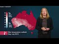
- First look at the Climate and Water Outlook for May-July 2019, issued 11 April 2019
- Runtime
- 1:11
- Date posted
- 8 years ago
- Description
- The mid-month Climate and Water Outlook video provides a first look at likely rainfall, streamflow and temperature for the next three months. See http://ow.ly/9m1S50pOoN7 for more detail.
An updated outlook for May–July will be available on Friday 26 April 2019.

- Title
- Severe Weather Update: Developing tropical low to the north of WA, 5 April 2019
- Runtime
- 1:43
- Date posted
- 8 years ago
- Description
- Severe Weather Update: developing tropical low to the north of WA. Video current at 10 am AWST, Friday 5 April 2019.
The low is expected develop into tropical cyclone Wallace later tonight or in the early hours of Saturday morning, north of the Kimberley coast. For the latest cyclone warnings and advice visit http://ow.ly/6rzg30okFWr and please follow advice from emergency services.

- Title
- Severe Weather Update: developing tropical low northwest of the Top End, 4 April 2019
- Runtime
- 1:55
- Date posted
- 8 years ago
- Description
- Severe Weather Update: developing tropical low northwest of the Top End. Video current at 12 pm ACST, Thursday 4 April 2019.
The low is expected to continue intensifying and may develop into Australia's eighth cyclone of the season as early as Friday, or during Saturday, with potential for it to approach the Pilbara coast early next week. For the latest weather warnings and cyclone advice visit: http://ow.ly/uZBJ30ojQF2

- Title
- Ask the Bureau: What are rainbows?
- Runtime
- 3:50
- Date posted
- 8 years ago
- Description
- Rainbows are one of the most beautiful phenomena that we see in meteorology. But the science behind these displays can be even more dazzling. Read more at http://ow.ly/B0yU30oiKaN.
- Title
- BOM Webinar 28 March 2019: Urban water across Australia
- Runtime
- 56:23
- Date posted
- 8 years ago
- Description
- Recording of one-hour webinar on 28 March 2019. Our experts answered questions about our latest National Water Account (http://www.bom.gov.au/water/nwa/2018) for urban regions—with insights into water sources, water rights and water use.
The webinar also covered the Urban National Performance Report—an annual bench-marking of Australian water utilities, comparing urban water use and cost in major cities and towns (http://www.bom.gov.au/water/npr).
- Title
- Climate and Water Outlook, April–June 2019
- Runtime
- 3:54
- Date posted
- 8 years ago
- Description
- The end-of-month Climate and Water Outlook video covers rainfall, streamflow and temperature for the next three months. It includes a wrap-up of recent conditions and a look at which drivers are influencing our climate. Read more at http://ow.ly/w1oc30ocMVe.
Our first look at likely conditions for May–July 2019 will be available on Thursday 11 April.
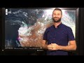
- Title
- Flooding in the north of Western Australia, 27 March 2019
- Runtime
- 0:54
- Date posted
- 8 years ago
- Description
- This video provides an update on the flooding in the Pilbara Coastal Rivers and De Grey River catchments in the north of Western Australia, following the passage ex-tropical cyclone Veronica. Video current early Wednesday 27 March 2019. Check http://ow.ly/5Cj730ocHCe for the latest WA flood and weather warnings; and follow advice from your local emergency services.

- Title
- Severe Weather Update: ex-tropical cyclone Veronica, Tuesday 26 March 2019
- Runtime
- 1:39
- Date posted
- 8 years ago
- Description
- The wind and very heavy rainfall associated with ex-tropical cyclone Veronica has now eased, however flooding continues in parts of the Pilbara region. Video current at 10.30 am AWST Tuesday 26 March 2019.
Know your weather. Know your risk. Check http://ow.ly/FAcL30obO2o for the latest Western Australia weather warnings, and follow advice from local emergency services.

- Title
- Severe Weather Update: severe tropical cyclone Veronica, Sunday 24 March 2019
- Runtime
- 1:56
- Date posted
- 8 years ago
- Description
- The full impact of severe tropical cyclone Veronica is beginning to occur on the Pilbara coast with extreme winds, very heavy rain and dangerous storm tides. Video current at 11 am AWST Sunday 24 March.
Due to the system's unusual slow movement, these conditions will continue for a sustained period today and tomorrow. The very destructive core of the system has begun to affect areas approximately midway between Karratha and Port Hedland.
Know your weather. Know your risk. Check http://ow.ly/oQtZ30oakw5 for the latest cyclone advice and warnings, and follow advice from your local emergency services.
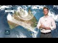
- Title
- Weekly weather wrap from the Bureau of Meteorology: Sunday 24 March 2019
- Runtime
- 2:00
- Date posted
- 8 years ago
- Description
- Our meteorologist Rohan Smyth presents next week's weather forecast as aired today on ABC Landline. Our forecasts update daily, please visit www.bom.gov.au for current information.

- Title
- Ex-Tropical Cyclone Trevor, Sunday 24 March 2019
- Runtime
- 0:22
- Date posted
- 8 years ago
- Description
- Ex-tropical cyclone Trevor weakened to a tropical low at 3.30 am ACST this morning (Sunday 24 March 2019).
While sustained gales are no occurring near the centre of the low, damaging and locally destructive wind gusts are still possible with thunderstorms. Heavy rainfall is likely to cause significant stream rises and localised flooding in the southern Carpentaria and eastern Barkly Districts, extending into the northern Simpson District on Monday. Latest warnings and advice at http://ow.ly/Je6D30oahX1

- Title
- Severe Weather Update: Severe tropical cyclone Veronica approaching Pilbara coast, WA, 23 Mar 2019
- Runtime
- 2:18
- Date posted
- 8 years ago
- Description
- This video provides an update on severe tropical cyclone Veronica as it approaches Western Australia's Pilbara coast. Video current at 10.30 am AWST Saturday 23 March 2019. Check http://ow.ly/cY7I30o9S5k for the latest cyclone warnings and follow advice from emergency services.

- Title
- Severe Weather Update: Severe tropical cyclone Trevor near NT/Qld border, 23 March 2019
- Runtime
- 2:23
- Date posted
- 8 years ago
- Description
- Severe Weather Update: currently a Category 4 system, severe tropical cyclone Trevor is expected to cross the coast between Port McArthur and the NT/Qld border this morning. Video current at 9am ACST Saturday 23 March 2019.
Know your weather. Know your risk. Check http://ow.ly/Pypj30o9S0Z for the latest cyclone advice and warnings, and follow advice from your local emergency services.
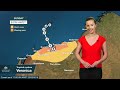
- Title
- Severe Weather Update: Severe tropical cyclone Veronica, Friday 22 March 2019
- Runtime
- 2:28
- Date posted
- 8 years ago
- Description
- Severe tropical cyclone Veronica remains a Category 4 system off Western Australia and is moving slowly towards the Pilbara coast. Video current at 11 am AWST Friday 22 March 2019.
Know your weather. Know your risk. Check http://ow.ly/ahnw30o8Xft for the latest cyclone advice and warnings, and follow advice from your local emergency services.

- Title
- Severe Weather Update: Severe tropical cyclone Trevor, Friday 22 March 2019
- Runtime
- 2:13
- Date posted
- 8 years ago
- Description
- Currently a Category 3 system, severe tropical cyclone Trevor continues to intensify, and is on track to strengthen to Category 4 later today. Video current at 11.30 am ACST Friday 22 March 2019.
Know your weather. Know your risk. Check http://ow.ly/VODb30o8Ww0 for the latest cyclone advice and warnings, and follow advice from your local emergency services.
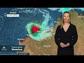
- Title
- Severe Weather Update: Severe tropical cyclone Veronica continues to intensify, 21 March 2019
- Runtime
- 2:00
- Date posted
- 8 years ago
- Description
- Severe tropical cyclone Veronica has intensified to a Category 4 system. Video current at 10 am AWST Thursday 21 March 2019.
As the cyclone approaches the Pilbara coast over the weekend, communities are likely to experience very destructive winds, very dangerous storm surge and heavy rain that's conducive to major flooding.
Know your weather. Know your risk. Check http://ow.ly/V4oD30o82Fl for the latest cyclone advice and warnings, and follow advice from local emergency services.

- Title
- Severe Weather Update: tropical cyclone Trevor rapidly intensifying, 21 March 2019
- Runtime
- 2:08
- Date posted
- 8 years ago
- Description
- Tropical cyclone Trevor will rapidly intensify in the Gulf of Carpentaria today. Video current at 10 am AEST Thursday 21 March 2019. We expect Trevor to reach severe Category 3 already by this afternoon, and then reach Category 4 intensity from Friday as it approaches the Northern Territory coast.
*Note: For Queensland, the Watch Zone has now been extended further east from Burketown to Karumba.
Know your weather. Know your risk. Check http://ow.ly/PitD30o80gB for the latest cyclone advice and warnings, and follow advice from your local emergency services.
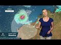
- Title
- Severe Weather Update: Tropical cyclone Veronica northwest of Western Australia
- Runtime
- 1:44
- Date posted
- 8 years ago
- Description
- Category 1 tropical cyclone Veronica, northwest of Western Australia. Video current at 11 am AWST, Wednesday 20 March 2019.
The system is likely to continue to intensify in the coming days, with a severe tropical cyclone coastal crossing possible for the Pilbara coast over the weekend.
Know your weather. Know your risk. Check http://ow.ly/Jzj730o79Dr for the latest cyclone advice and warnings, and follow advice from your local emergency services.
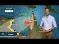
- Title
- Severe Weather Update: tropical cyclone Trevor to move into the Gulf of Carpentaria, 20 March 2019
- Runtime
- 2:07
- Date posted
- 8 years ago
- Description
- Category 1 tropical cyclone Trevor is currently located over the Cape York Peninsula and is slowly moving west. Video current at 12 pm AEST Wednesday 20 March 2019.
The cyclone will move into the Gulf of Carpentaria this evening, where it is expected to re-intensify rapidly to a Category 2 cyclone. At this stage the system is likely to cross the Northern Territory coast on Saturday as a Category 4 severe tropical cyclone.
Know your weather. Know your risk. Check http://ow.ly/ZEPv30o78Bw for the latest cyclone advice and warnings, and follow advice from your local emergency services.

- Title
- Severe Weather Update: developing tropical low to the northwest of the Kimberley, 19 March 2019
- Runtime
- 1:20
- Date posted
- 8 years ago
- Description
- Video current at 12 pm AWST Tuesday 19 March 2019. The system is forecast to move parallel to the WA northwest coast over the next few days, and is likely to intensify into a tropical cyclone on either Wednesday or Thursday.
Keep an eye on our three-day Tropical Cyclone Outlook for the Western Region at http://ow.ly/9KqA30o6czc

- Title
- Severe Weather Update: Severe tropical cyclone Trevor to cross the coast today, 19 March 2019
- Runtime
- 2:20
- Date posted
- 8 years ago
- Description
- Severe Weather Update: Severe tropical cyclone Trevor to cross the Cape York Peninsula coastline TODAY. Video current at 12 pm AEST 19 March 2019.
Communities in the Warning area on the eastern side of Cape York should complete preparations quickly and be prepared to shelter in a safe place. People in western parts of the Cape should continue preparations today.
Check http://ow.ly/ly5S30o691Z for the latest cyclone advice and warnings, and follow advice from your local emergency services.

- Title
- Severe Weather Update: Tropical cyclone Trevor in the Coral Sea near northern Qld, 18 Mar 2019
- Runtime
- 1:46
- Date posted
- 8 years ago
- Description
- This video provides an update on tropical cyclone Trevor, which is in the Coral Sea and moving towards the Cape York Peninsula in northern Queensland. Video current at 11.30 am AEST Monday 18 March 2019. Check http://ow.ly/pMQj30o51gb for the latest cyclone advice and warnings, and follow advice from your local emergency services.

- Title
- Severe Weather Update: tropical lows expected to impact Australian region next week, 17 March 2019
- Runtime
- 1:46
- Date posted
- 8 years ago
- Description
- This video provides an update on three tropical systems we're currently monitoring, including a tropical low in the Coral Sea; a low developing south of Indonesia; and Tropical cyclone Savannah in the Indian Ocean. Video current at 9.30 am AEST, Sunday 17 March 2019. Check http://ow.ly/hFlC30o4vVG for updated cyclone advice and warnings, and follow advice from emergency services.

- Title
- Severe Weather Update: Tropical cyclone Savannah near Cocos Islands; tropical lows East Timor/PNG
- Runtime
- 2:17
- Date posted
- 8 years ago
- Description
- This video provides an update on Tropical cyclone Savannah just west of the Cocos Islands in the Indian Ocean, a tropical low to the east of East Timor, and another low in the Solomon Sea to the east of Papua New Guinea. Video current at 11 am AEST, Friday 15 March 2019. Check http://ow.ly/eq7O30o3cWM for updated cyclone advice and warnings, and follow advice from emergency services.

- Title
- A look back at the Queensland floods, January–February 2019
- Runtime
- 3:53
- Date posted
- 8 years ago
- Description
- Our thoughts are with all those affected by the devastating floods in Queensland last month—and those involved in supporting recovery and reconstruction efforts, which will continue for some time to come. Meteorologist Andrea Peace takes a look at the stats and impacts from the heavy rainfall and flooding in this video—plus you can find our Special Climate Statement on the event at http://ow.ly/oDp930o3895.

- Title
- First look at the Climate and Water Outlook for April–June 2019, issued 14 March 2019
- Runtime
- 1:14
- Date posted
- 8 years ago
- Description
- The mid-month Climate and Water Outlook video provides a first look at likely rainfall, streamflow and temperature for the next three months. See http://ow.ly/h8OA30o0BEW for more detail.
An updated outlook for April–June will be available on 28 March 2019.

- Title
- Severe Weather Update:Heavy rainfall forecast for eastern NSW, 13 Mar 2019
- Runtime
- 1:33
- Date posted
- 8 years ago
- Description
- This video provides an update on the potential for heavy rainfall over eastern New South Wales over the next few days. Video current at 1 pm AEDT Wednesday 13 March 2019. Check the latest warnings at http://ow.ly/yZSG30o1tkU and follow advice from emergency services.
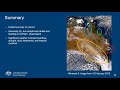
- Title
- BOM Webinar 7 March 2019: Autumn 2019 climate and water update
- Runtime
- 1:01:34
- Date posted
- 8 years ago
- Description
- Recording of live webinar on 7 March 2019, featuring an in-depth analysis of summer 2018–19 from our climate experts (see also http://ow.ly/EICM30o0C3f) and the rainfall, temperature and streamflow outlook for the upcoming season (see http://ow.ly/cd0R30o0C5F). Hear from our climate experts on what is driving the climate, and how expected conditions might affect heatwaves, bushfire risk and other extreme events.

- Title
- Severe Weather Update: Heatwave in southern Australia, 28 February 2019
- Runtime
- 2:13
- Date posted
- 8 years ago
- Description
- This video provides an update on heatwave conditions and elevated fire danger across southern Australia. Video current at 11 am AEST Thursday 28 February 2019. Check http://ow.ly/Dlln30nRCTd for weather forecasts and warnings; see local fire authorities for updated Fire Danger Ratings and other advice.
- Title
- Climate and Water Outlook, March–May 2019
- Runtime
- 4:22
- Date posted
- 8 years ago
- Description
- The end-of-month Climate and Water Outlook video covers rainfall, streamflow and temperature for the next three months. It includes a wrap-up of recent conditions and a look at which drivers are influencing our climate. Read more at http://ow.ly/eYPe30nuixX.
Our first look at likely conditions for April–June 2019 will be available on Thursday 14 March.
- Title
- BOM Webinar 21 February 2019: State of the Climate 2018
- Runtime
- 58:54
- Date posted
- 8 years ago
- Description
- The fifth Bureau of Meteorology and CSIRO State of the Climate report draws on the latest monitoring, science and projection information to describe variability and changes in Australia's climate. Watch this webinar recording (from 21 February 2019) to find out more about what's changed and what it means—covering changes in temperature, fire weather, rainfall, oceans, greenhouse gases and our future climate.
Read the full State of the Climate report at http://ow.ly/dyUa30nPQqe.

- Title
- Weekly weather wrap from the Bureau of Meteorology: Sunday 24 February 2019
- Runtime
- 2:00
- Date posted
- 8 years ago
- Description
- Our meteorologist Miriam Bradbury presents next week's weather forecast as aired today on ABC Landline. Our forecasts update daily, please visit www.bom.gov.au for current information.

- Title
- Severe Weather Update: Category 1 tropical cyclone Oma expected to remain offshore, 22 February 2019
- Runtime
- 1:29
- Date posted
- 8 years ago
- Description
- Severe Weather Update: Category 1 tropical cyclone Oma expected to remain offshore. Video current at 2 pm AEST, Friday 22 February 2019.
For the latest weather warnings visit http://ow.ly/FhES30nNcup and follow advice from emergency services.

- Title
- Severe Weather Update: Tropical cyclone Oma, 21 February 2019
- Runtime
- 2:01
- Date posted
- 8 years ago
- Description
- Video current at 1 pm AEST, Thursday 21 February 2019. A cyclone WATCH is current for areas of southeast Queensland and northern NSW, with gale force winds possible in the next 24–48 hours. Significant marine impacts are expected from today. For the latest cyclone information and warnings visit http://ow.ly/JlZ430nMkZ9

- Title
- Severe Weather Update: Tropical cyclone Oma moving slowly southwest in the Coral Sea, 20 Feb. 2019
- Runtime
- 3:24
- Date posted
- 8 years ago
- Description
- Tropical Cyclone Oma is currently a Category 2 system, and is likely to approach the southeast Queensland coast late this week or over the weekend, with a coastal crossing possible. Video current at 12 pm AEST 20 Feb. 2019.
Abnormally high tides, dangerous surf and strengthening winds are expected for coastal areas with heavy rainfall possible from Saturday. As conditions deteriorate with the approach of Cyclone Oma, significant coastal erosion and inundation of low-lying areas are serious risks. Please stay up to date with the latest cyclone advice and warnings at http://ow.ly/q6Jm30nLluf and follow advice from emergency services.

- Title
- Severe Weather Update: Hazardous Surf conditions from Tropical Cyclone Oma, 19 February 2019
- Runtime
- 2:32
- Date posted
- 8 years ago
- Description
- The effects of Tropical Cyclone Oma are already being felt along the Queensland coast with Hazardous Surf conditions stretching from Gladstone to the Gold Coast, and likely to extend down the NSW coast over the next few days. Video current at 12 pm AEST, Tuesday 19 February 2019.
The future movement of Tropical Cyclone Oma remains uncertain with competing steering mechanisms making it challenging to forecast at this point. Some scenarios see Cyclone Oma moving away from the Queensland coast in a south-easterly direction, remaining close to the coast and moving in a northerly direction or possibly even crossing the coast. Keep an eye out for warnings, and in the meantime you can see the three-day outlook for the Coral Sea at: http://ow.ly/bHaA30nKsHn

- Title
- Severe Weather Update: Hazardous surf, central and southeast Queensland coast 18 Feb. 2019
- Runtime
- 3:09
- Date posted
- 8 years ago
- Description
- Severe Weather Update: Dangerous surf and high tides forecast for Queensland's central and southeastern coast—due to tropical cyclone Oma in the southwest Pacific Ocean, plus king tides this week. Video current at 1.30 pm AEST, Monday 18 February 2019. Check http://ow.ly/AEtD30nJB5I for Queensland weather and marine forecasts and warnings; follow advice from emergency services.

- Title
- First look at the Climate and Water Outlook for March–May 2019, issued 14 February 2019
- Runtime
- 1:22
- Date posted
- 8 years ago
- Description
- The mid-month Climate and Water Outlook video provides a first look at likely rainfall, streamflow and temperature for the next three months. See http://ow.ly/akPm30nGfMB for more detail.
For more information on recent flows in northern Queensland, see our 7-day streamflow forecasts at http://ow.ly/kbKE30nGfN2
An updated outlook for March–May (autumn) 2019 will be available on 28 February 2019.

- Title
- Severe Weather Update: Fire Weather Warnings for NSW and ACT, 11 February 2019
- Runtime
- 0:16
- Date posted
- 8 years ago
- Description
- Elevated fire danger is forecast for large parts of New South Wales and the Australian Capital Territory tomorrow (Tuesday 12 Feb. 2019)—due to a cold front driving gusty, strong-to-gale-force, northwesterly to southwesterly winds through the ACT and southern and western parts of NSW. Associated with this front, a gusty southerly change will move up the southern coast, arriving in Sydney around midnight Tuesday night. 'Severe' fire danger is forecast for central eastern parts—incl. parts of Sydney, the Blue Mountains, the Illawarra and the Hunter Valley. Check http://www.bom.gov.au/nsw/warnings for the latest warnings and follow advice from your local emergency services.
- Title
- Satellite view over Queensland 25 Jan. – 7 Feb. 2019
- Runtime
- 0:33
- Date posted
- 8 years ago
- Description
- We've seen significant rainfall across Queensland over the past week (to 8 Feb. 2019), but rain is easing as the monsoon moves into the Coral Sea.
Multiple flood warnings still continue for north and west of Queensland.
Waters continue to move downstream with rises continuing at some locations, particularly inland.
Some notable river rises recorded so far include the Flinders River in Richmond, which exceeded its 1974 record peaking at 9.17 m early Thursday morning.
Our team of dedicated meteorologists and hydrologists will continue to monitor the situation as warnings are expected to remain in place across the weekend.
Please stay up-to-date with all forecasts and warnings at http://www.bom.gov.au/qld and continue to follow advice from your local emergency services.

- Title
- Satellite footage and forecast rainfall for Queensland, 7 February 2019
- Runtime
- 0:23
- Date posted
- 8 years ago
- Description
- Satellite images of the system over Queensland so far this week, and forecast rainfall for the rest of today (Thursday 7 Feb.) and tomorrow.
Moderate rainfall continues across NW Qld, the Pensinula, and Northeast Tropical Coast. Locally heavy rainfall is still possible with thunderstorms in these areas, and warnings will be issued if this is observed. Rainfall should continue to ease across most flood-affected areas from tomorrow as the monsoon and tropical low move east into the Coral Sea. Around the southeast of the state, showers are expected until at least Monday.
Flood Warnings are still in place across the north of the state: see http://ow.ly/jMgf30nBRLQ. The Flinders River at Richmond reached 9.17m at 6am this morning, surpassing the 1974 record and still rising. Long-period easterly swell will also increase along the southeastern coast early next week.

- Title
- Severe Weather Update: heavy rainfall and flooding in northern Queensland, 6 February 2019
- Runtime
- 2:57
- Date posted
- 8 years ago
- Description
- Meteorologist Jonathan How and hydrologist Claire Mills provides an update on the heavy rainfall and flooding in northern Queensland. Video current at 12 pm AEST Wednesday 6 February 2019. Check http://ow.ly/yOBY30nAZix for the latest Queensland weather and flood warnings, and follow advice from emergency services.

- Title
- Severe Weather Update: intense rainfall and flooding in northern Queensland, 5 February 2019
- Runtime
- 1:35
- Date posted
- 8 years ago
- Description
- Meteorologist Grace Legge provides an update on the intense rainfall and flooding in northern Queensland. Video current at 10 am AEST Tuesday 5 February 2019. Check http://ow.ly/TPnv30nA2Gr for the latest Queensland weather and flood warnings, and follow advice from emergency services.

- Title
- Severe Weather Update: Flood emergency in Queensland, 4 February 2019 (2)
- Runtime
- 2:21
- Date posted
- 8 years ago
- Description
- Second update today on the flooding in northern Queensland, from meteorologist Adam Morgan and hydrologist Claire Mills. Video current at 2.30 pm AEST Monday 4 February. Check http://ow.ly/SSxC30nz8VE for the latest Qld weather and flood warnings, and follow advice from emergency services.

- Title
- Severe Weather Update: Flooding around Townsville, Queensland, 4 February 2019
- Runtime
- 2:03
- Date posted
- 8 years ago
- Description
- This video provides an update on the heavy rainfall and flooding in northeastern Queensland. Video current at 9.30 am AEST, Monday 4 February 2019. Check http://ow.ly/aMjk30nyYdr for updated forecasts and warnings; and follow advice from emergency services.

- Title
- Severe Weather Update: urgent message State Mgr Bruce Gunn, flooding Ross River catchment 3 Feb 2019
- Runtime
- 0:44
- Date posted
- 8 years ago
- Description
- Urgent message for the north Queensland community living near the Ross River catchment area with dangerous and high velocity flows. There is RISK TO LIFE AND PROPERTY.





