Bureau of Meteorology
Severe Weather Update: widespread rainfall and potential flooding for coastal NSW, 4 February 2020

- Title
- Severe Weather Update: widespread rainfall and potential flooding for coastal NSW, 4 February 2020
- Runtime
- 1:53
- Date posted
- 7 years ago
- Description
- This Severe Weather Update provides information on widespread rainfall and potential flooding for coastal NSW, 4 February 2020
Video is current at 3:00 pm AEDT 4 February 2020.
For the latest weather and warnings, information visit http://ow.ly/MgZY50y8EaP and follow advice from emergency services.

- Title
- Climate and Weather conversation: January rainfall 2020
- Runtime
- 3:47
- Date posted
- 7 years ago
- Description
- Dr Adam Morgan and Dr Andrew Watkins take a look at the January rainfall 2020 situation. As a whole while the rainfall was slightly above average for the country, there are still serious rainfall deficiencies.

- Title
- Severe Weather Update: heatwaves, fire dangers and thunderstorms for ACT & NSW, 1 February 2020
- Runtime
- 2:19
- Date posted
- 7 years ago
- Description
- This Severe Weather Update provides information on heatwaves, fire dangers and potential thunderstorms for ACT & NSW
Video is current at 3:00 pm AEDT 1 February 2020.
For the latest weather and warnings, information visit http://ow.ly/MgZY50y8EaP and follow advice from emergency services.

- Title
- Severe Weather Warning: thunderstorms, heavy rainfall and flooding for SE Australia, 31 January 2020
- Runtime
- 2:10
- Date posted
- 7 years ago
- Description
- This Severe Weather Warning provides information on thunderstorms, heavy rainfall and flooding for SE Australia, 31 January 2020
Video is current at 3:00 pm ACDT 31 January 2020.
For the latest weather and warnings, information visit http://ow.ly/MgZY50y8EaP and follow advice from emergency services.

- Title
- Severe Weather Update: heatwaves and dangerous fire weather, 31 January 2020
- Runtime
- 2:07
- Date posted
- 7 years ago
- Description
- This Severe Weather Update: heatwaves and dangerous fire weather, 31 January 2020
Video is current at 10 am AEDT 31 January 2020
For the latest weather and warnings, information visit http://ow.ly/MgZY50y8EaP and follow advice from emergency services.

- Title
- Climate and Water Outlook for February - April 2020, issued 30 January 2020
- Runtime
- 3:39
- Date posted
- 7 years ago
- Description
- The Climate and Water Outlook video provides a look at likely rainfall, streamflow and temperature for the months ahead. See http://ow.ly/LVEM50xWH5a for more detail.

- Title
- Severe Weather Update: high humidity and heavy rainfall 30 January 2020
- Runtime
- 2:30
- Date posted
- 7 years ago
- Description
- This Severe Weather Update provides information on high humidity and heavy rainfall across much of the country.
Video is current at 11am 20 January 2020
For the latest weather and warnings, information visit http://ow.ly/MgZY50y8EaP and follow advice from emergency services.
- Title
- Severe Weather Update: heatwave conditions and significant rainfall, 29 January 2020
- Runtime
- 2:07
- Date posted
- 7 years ago
- Description
- This Severe Weather Update provides information on forecast heatwave conditions and significant rainfall. Video is current at 12pm AEDT 29 January 2020.
For the latest weather and warnings, information visit http://ow.ly/Omq950y7C5N and follow advice from emergency services.

- Title
- Severe Weather Update: heavy rain and flooding for northern Queensland, 28 January 2020
- Runtime
- 3:20
- Date posted
- 7 years ago
- Description
- A tropical low is moving slowly through the Gulf Country (Qld), with heavy rainfall and damaging winds. In 24 hrs 500 mm rainfall fell around Ayr with slow moving storms. Warnings for heavy rainfall, damaging winds and flooding are still current for many areas. Current warnings here: http://ow.ly/H4lR50y6A7X.

- Title
- Weather Update: Monsoonal conditions developing over the NT and QLD, 23 January 2020
- Runtime
- 2:02
- Date posted
- 7 years ago
- Description
- At the start of the week, the Northern Territory was experiencing it's driest wet season to date—by the end of the week, a deluge of rain has fallen. We have now eclipsed the amount of rain we had this time last wet season. The showers and thunderstorms brought heavy rainfall to northern Queensland.
This raises the discussion 'is this the monsoon?' or are we still waiting for the official onset?
Andrea Peace and Grace Legge discuss the current situation.
Video current at 2pm AEST 23 January 2020
- Title
- Climate and Water Outlook for February–April 2020, issued 16 January 2020
- Runtime
- 3:00
- Date posted
- 7 years ago
- Description
- The Climate and Water Outlook video provides a look at likely rainfall, streamflow and temperature for the months ahead. See http://ow.ly/LVEM50xWH5a for more detail.

- Title
- Weather update: heavy rain for NSW and East Vic, 14 Jan 2020
- Runtime
- 2:12
- Date posted
- 7 years ago
- Description
- Weather Update: Heavy rain and the potential dangerous impacts to fire grounds in NSW and East Victoria. Video is current at 12pm AEDT 14 Jan 2020.
For the latest weather and warnings, information visit http://ow.ly/HAGb50xUEPN and follow advice from emergency services.

- Title
- Severe Weather Update: tropical low crosses the Top End coast, 9 January 2020
- Runtime
- 1:45
- Date posted
- 7 years ago
- Description
- Severe Weather Update: tropical low crosses the Top End coast. Video current at 1 pm ACST Thursday 9 January 2020.
Know your weather. Know your risk. For the latest cyclone warnings and advice visit http://ow.ly/YuMy50xQOJU and follow advice from emergency services.

- Title
- Smoke from bushfires across Australia, 9 January 2020
- Runtime
- 3:55
- Date posted
- 7 years ago
- Description
- Since the New South Wales and Queensland bushfires started back in September last year, smoke has become a real feature of the Australian landscape.
As more fires have started we've seen the smoke become even more extensive, travelling around the globe and even reaching South America. So, what are the factors that contribute to bushfire smoke lingering, and when can we expect it to clear? Meteorologist Andrea Peace explains.
For the latest weather updates see http://ow.ly/kz9K50xQKUj. For health or air quality advice on bushfire smoke, please check with your local health or environmental monitoring authorities.

- Title
- Severe Weather Update: fire danger weather for SA, Vic, NSW 9 Jan 2020
- Runtime
- 2:25
- Date posted
- 7 years ago
- Description
- This Severe Weather Update provides information on fire danger weather in SA, Vic and NSW. Video is current at 10am AEDT 09 January 2020.
For the latest weather and warnings, information visit http://ow.ly/Gvwo50xQJ3Z and follow advice from emergency services.

- Title
- Severe Weather Update: tropical low intensifies north of Northern Territory, 8 January 2020
- Runtime
- 2:05
- Date posted
- 7 years ago
- Description
- Severe weather update: tropical low intensifies in the north of Northern Territory. Video current at 2 pm ACST Wednesday 8 January 2020.
Know your weather. Know your risk. For the latest cyclone warnings and advice visit http://ow.ly/kkBm50xOJs3 and follow advice from emergency services.

- Title
- Annual Climate Statement 2019
- Runtime
- 3:30
- Date posted
- 7 years ago
- Description
- The Annual Climate Statement is a snapshot of the Australian climate for the previous year including rainfall, temperature and significant events.
This video is a summary of the online report available at: http://ow.ly/kooO50xPJXg
- Title
- Severe weather update: tropical cyclone Blake off WA and tropical low north of NT, 7 January 2019
- Runtime
- 2:47
- Date posted
- 7 years ago
- Description
- Severe weather update: tropical cyclone Blake off Western Australia's west Kimberley coast, and developing tropical low north of the Top End. Video current at 12 pm AWST Tuesday 7 January 2020.
Know your weather. Know your risk. For the latest cyclone warnings and advice visit http://ow.ly/kkBm50xOJs3 and follow advice from emergency services.

- Title
- Severe Weather Update: tropical cyclone Blake - 6 January 2020
- Runtime
- 2:23
- Date posted
- 7 years ago
- Description
- This Severe Weather Update provides information on tropical cyclone Blake. Video is current at 10:30am AWST 6 January 2020.
For the latest weather and warnings, information visit http://ow.ly/AV6R50xNGgU and follow advice from emergency services.

- Title
- Severe Weather Update: tropical low developing into a cyclone west Kimberley coast WA, 5 Jan 2020
- Runtime
- 1:57
- Date posted
- 7 years ago
- Description
- Severe Weather Update: monsoon to our northwest and the likely development of a tropical cyclone off the west Kimberley coast over the coming days. Video is current at 10am AWST. For the latest weather and warnings, information visit http://ow.ly/8G8250xMZTq and follow advice from emergency services.

- Title
- Severe Weather Update: monsoon and development of a cyclone west Kimberley coast WA, 4 Jan 2020
- Runtime
- 1:15
- Date posted
- 7 years ago
- Description
- This Severe Weather Update provides information on the monsoon to our northwest, and the likely development of a tropical cyclone off the west Kimberley coast over the coming days. Video is current at 1pm AWST. For the latest weather and warnings, information visit http://ow.ly/8G8250xMZTq and follow advice from emergency services.

- Title
- Severe Weather Update: dangerous fire weather for SA, Vic and NSW, ACT, 4 January 2020
- Runtime
- 2:29
- Date posted
- 7 years ago
- Description
- Severe Weather Update provides information on the very dangerous fire weather conditions for South Australia, Victoria, New South Wales and ACT. Video is current at 9.30am AEDT 4 January 2020.

- Title
- Severe Weather Update: dangerous fire weather conditions 3 January 2020
- Runtime
- 2:06
- Date posted
- 7 years ago
- Description
- This Severe Weather Update provides information on the dangerous fire weather conditions.
Video is current at 11am AEDT 3 January 2020.
For the latest weather and warnings, information visit http://ow.ly/2cXY50xM5C5 and follow advice from emergency services.

- Title
- Severe Weather Update: Elevated fire danger & heat for WA, SA, Vic & NSW 02 Jan 2020
- Runtime
- 2:06
- Date posted
- 7 years ago
- Description
- This Severe Weather Update provides information on the fire danger conditions for WA, SA, Vic & NSW 02 Jan 2020
Video is current at 12pm AEDT 02 Jan 2020
For the latest weather and warnings, information visit http://ow.ly/zR4050xCLG9 and follow advice from emergency services.

- Title
- Severe Weather Update: Elevated fire danger and heatwave conditions for NSW, 30 December 2019
- Runtime
- 1:55
- Date posted
- 7 years ago
- Description
- This Severe Weather Update provides information on the fire danger conditions for NSW on New Year's Eve. 31 December 2019
Video is current at 4pm AEDT 30 December 2019.
For the latest weather and warnings, information visit http://ow.ly/zR4050xCLG9 and follow advice from emergency services.
- Title
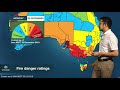
- Severe Weather Update: Elevated fire danger and heatwave conditions, 30 December 2019
- Runtime
- 2:03
- Date posted
- 7 years ago
- Description
- This Severe Weather Update provides information on the fire danger conditions in SA, Tas and Vic. Video is current at 10:30 am AEDT 30 December 2019.
For the latest weather and warnings, information visit http://ow.ly/zR4050xCLG9 and follow advice from emergency services.

- Title
- Severe Weather Update: heatwave update and increased fire danger weather 20 December 2019
- Runtime
- 5:30
- Date posted
- 7 years ago
- Description
- Severe Weather Update: heatwave update and increased fire danger weather. Video current at 1pm AEDT Friday 20 December 2019.
Know your weather. Know your risk. For the latest weather forecasts and warnings visit http://ow.ly/ngK050xEOC5 and follow advice from emergency services.

- Title
- Climate and Water Outlook for January–March 2020, issued 19 December 2019
- Runtime
- 3:04
- Date posted
- 7 years ago
- Description
- The Climate and Water Outlook video provides a look at likely rainfall, streamflow and temperature for the months ahead. See http://ow.ly/qRHe50xDPCu for more detail.
Our climate outlooks now include weekly and fortnightly outlooks, bridging the gap between our seven-day forecasts and the monthly and seasonal climate outlooks.

- Title
- Severe Weather Update: elevated fire danger and heatwave conditions for NSW, 19 December 2019
- Runtime
- 2:24
- Date posted
- 7 years ago
- Description
- This Severe Weather Update provides information on the fire danger conditions in NSW. Video is current at 12 pm AEDT 19 December 2019.
For the latest weather and warnings, information visit http://ow.ly/zR4050xCLG9 and follow advice from emergency services.

- Title
- Severe Weather Update: extensive heatwave update 18 December 2019
- Runtime
- 1:52
- Date posted
- 7 years ago
- Description
- Preliminary results suggest that the 17 December was Australia's hottest day on record at 40.9 ºC, with the average maximum across the country as a whole, exceeding the previous record of 40.3 ºC on the 7 January 2013.
This Severe Weather Update provides information on the current heatwave. Video is current at 12 pm AEDT 18 December 2019. For the latest weather and warnings, information visit http://ow.ly/zR4050xCLG9 and follow advice from emergency services.

- Title
- Severe Weather Update: extensive heatwave affecting large parts of Australia, 16 December 2019
- Runtime
- 2:22
- Date posted
- 7 years ago
- Description
- Severe Weather Update: extensive heatwave affecting large parts of Australia. Video current at 1.30 pm AEDT, Monday 16 December 2019.
Meteorologist Dr. Adam Morgan gives us an update on the heatwave conditions sweeping from west to east through the week.
By midweek, severe to extreme heatwave conditions will extend right across southern and central Australia, particularly through the interior, with some locations forecast to reach up to 20 degrees above average.
Check your local forecast here: http://ow.ly/OhAt50xAF7L
- Title
- Weather and Climate Update: The climate drivers behind our weather 13 December 2019
- Runtime
- 4:50
- Date posted
- 7 years ago
- Description
- We're only 13 days into summer and bushfires have been burning for weeks, Sydney is blanketed in thick smoke, and many locations have experienced exceptionally hot weather. So, what's driving this?
Our meteorologist Andrea Peace and senior climatologist Dr Lynette Bettio explain the climate drivers behind the recent weather.
To learn more about Australia's climate visit: http://www.bom.gov.au/climate/

- Title
- BOM Webinar 5 December 2019: Summer 2019–20 climate and water update
- Runtime
- 57:33
- Date posted
- 7 years ago
- Description
- Get an in depth analysis of recent conditions, as well as the temperature, rainfall and streamflow outlook for summer. Ask our experts all your climate and water questions to help make decisions for the months ahead.

- Title
- Understanding Flood Classifications
- Runtime
- 2:16
- Date posted
- 7 years ago
- Description
- If you live in a flood prone area, it’s important to know your risk and understand how severe a flood is likely to be. This video will help improve your knowledge of flood classifications, as well as help you understand the difference between flood watches and warnings.

- Title
- Understanding Floods
- Runtime
- 3:15
- Date posted
- 7 years ago
- Description
- Flooding is among Australia's most deadly natural disasters—but it's also important for agriculture and the life cycle of many plants and animals. So, what are floods and what causes them? Improve your knowledge of floods with this Understanding flood video.

- Title
- Marine weather safety: Check the forecast first
- Runtime
- 1:48
- Date posted
- 7 years ago
- Description
- If you're a boater, you need to check the weather forecast before heading out on the water. This will help you make the right choice about where and when it’s safe to go boating. Go to http://www.bom.gov.au/marine for marine warnings, forecasts and information, and https://www.youtube.com/watch?v=bqp_x... to learn the five vital weather checks to make before you leave.
Remember: If you’re the skipper, you’re responsible.
Creative Commons footage courtesy of:
https://www.youtube.com/user/mikerbwind
https://www.youtube.com/user/19tm62

- Title
- Marine weather safety: 5 vital checks
- Runtime
- 2:51
- Date posted
- 7 years ago
- Description
- If you're a boater, find out what five vital weather checks you should do before you head out on the water. These checks will help you to make the right choice about where and when it's safe to go boating. Go to http://www.bom.gov.au/marine for marine warnings, forecasts and information.
Remember: If you're the Skipper, you're responsible.
Creative Commons footage courtesy of:
https://www.youtube.com/user/aualbyau2
https://www.youtube.com/user/zormsk
https://www.youtube.com/user/19tm62

- Title
- Climate and Water Outlook for summer 2019–20, issued 28 November 2019
- Runtime
- 3:40
- Date posted
- 7 years ago
- Description
- The Climate and Water Outlook video provides a look at likely rainfall, streamflow and temperature for the months ahead. See http://ow.ly/nyHI50xmHMz for more detail.
Our climate outlooks now include weekly and fortnightly outlooks, bridging the gap between our seven-day forecasts and the monthly and seasonal climate outlooks.
- Title
- Bushfires and exceptional heat: what's driving our weather right now?
- Runtime
- 4:52
- Date posted
- 7 years ago
- Description
- Summer hasn’t even started, yet we've already seen months of devastating fires across Australia and periods of exceptionally hot conditions. So, what's driving this severe weather, and when will the current pattern break?
Two key climate influences are affecting our weather right now: a positive Indian Ocean Dipole (IOD) and a negative Southern Annual Mode (SAM).
Watch our video to find out more, including when these climate patterns are likely to break down.
You can also find more details on the IOD at: http://ow.ly/MsRq50xhG1x and SAM http://ow.ly/p1v550xhG2H
- Title
- BOM Webinar 21 November 2019: Wet season outlook 2019–20
- Runtime
- 56:43
- Date posted
- 7 years ago
- Description
- In this webinar, the Bureau's experts presented an in-depth analysis of the wet season outlook for tropical Australia for November to April.
We discussed the monsoon onset, the tropical cyclone outlook, and tropical rainfall climate drivers.

- Title
- Severe Weather Update: dangerous fire conditions and record breaking heat 21 November 2019
- Runtime
- 1:40
- Date posted
- 7 years ago
- Description
- Severe Weather Update: dangerous fire conditions and record-breaking heat through south eastern Australia. Video current at 11:30 am AEST Thursday 21 November 2019.
Know your weather. Know your risk. For the latest weather forecasts and warnings visit http://ow.ly/cqBt50xgB6a and follow advice from emergency services.

- Title
- Severe Weather Update: very dangerous fire conditions across southern Australia, 20 November 2019
- Runtime
- 2:18
- Date posted
- 7 years ago
- Description
- Severe Weather Update: very dangerous fire conditions across southern Australia. Video current at 12 pm AEDT Wednesday 20 November 2019.
Know your weather. Know your risk. For the latest weather warnings visit http://ow.ly/qKQu50xfyrr and follow advice from emergency services.

- Title
- Severe Weather Update: dangerous fire conditions across southern Australia, 19 November 2019
- Runtime
- 1:32
- Date posted
- 7 years ago
- Description
- Severe Weather Update: dangerous fire conditions across southern Australia. Video current at 3 pm AEDT Tuesday 19 November 2019.
Know your weather. Know your risk. For the latest weather warnings visit http://ow.ly/7rqh50xevP0 and follow advice from emergency services.

- Title
- Severe Weather Update: elevated fire danger in SA and heatwave building in the east, 18 Nov 2019
- Runtime
- 1:27
- Date posted
- 7 years ago
- Description
- Severe Weather Update: elevated fire danger in South Australia and heatwave building in the east.
Video current at 1 pm AEDT Monday 18 November 2019.
Know your weather. Know your risk. For the latest weather forecasts and warnings visit http://ow.ly/ECew50xdjXL and follow advice from emergency services.
- Title
- Climate and Water Outlook, issued 14 November 2019
- Runtime
- 2:19
- Date posted
- 7 years ago
- Description
- The Climate and Water Outlook video provides a look at likely rainfall, streamflow and temperature for for November–February. See http://ow.ly/QDzB50xasaz for more detail.
Our climate outlooks now include weekly and fortnightly outlooks, bridging the gap between our seven-day forecasts and the existing monthly and seasonal climate outlooks.

- Title
- Severe Weather Update: elevated fire dangers continue in northeast NSW & southern Qld, 13 Nov. 2019
- Runtime
- 2:05
- Date posted
- 7 years ago
- Description
- Severe Weather Update: Very High to Severe fire dangers continue over northeast New South Wales and southern Queensland. Video current at 10.30 am AEST Wednesday 13 November 2019.
Know your weather. Know your risk. For the latest weather warnings visit http://ow.ly/JldW50x9nGA and follow advice from emergency services.

- Title
- Severe Weather Update: Severe to Catastrophic fire danger in NSW & Qld, 12 Nov. 2019
- Runtime
- 2:10
- Date posted
- 7 years ago
- Description
- Severe Weather Update: Severe to Catastrophic fire danger in New South Wales & Queensland. Video current at 3 pm AEDT Tuesday 12 November 2019.
The southerly wind change is moving up the New South Wales coast today and overnight, before moving into southeast Queensland Wednesday morning, possibly widening fire fronts. Ahead of the change this afternoon and tonight, strong and gusty winds are still posing challenging condtions in NSW and southeast Qld.
Know your weather. Know your risk. For the latest weather warnings visit http://ow.ly/kgas50x8mXG and follow advice from emergency services.

- Title
- Severe Weather Update: wind change affecting bushfires in NSW, 12 November 2019
- Runtime
- 1:18
- Date posted
- 7 years ago
- Description
- Severe Weather Update: wind change affecting bushfires in NSW, 12 November 2019. Video current at 12 pm AEDT Tuesday 12 November 2019.
Know your weather. Know your risk. For the latest weather warnings visit http://ow.ly/E14W50x8iYw and follow advice from emergency services.

- Title
- Severe Weather Update: very dangerous fire weather conditions for eastern NSW & SE Qld, 11 Nov. 2019
- Runtime
- 1:51
- Date posted
- 7 years ago
- Description
- Severe Weather Update: very dangerous fire weather conditions for eastern NSW and southeast Queensland. Video current at 3 pm AEDT Monday 11 November 2019.
Know your weather. Know your risk. For the latest weather warnings visit http://ow.ly/5Len50x7iuxand follow advice from emergency services.

- Title
- Severe Weather Update: dangerous fire weather conditions for northeast NSW & SE Qld, 7 Nov. 2019
- Runtime
- 1:37
- Date posted
- 7 years ago
- Description
- Severe Weather Update: dangerous fire weather conditions for northeast NSW and southeast Queensland. Video current at 3 pm AEDT Thursday 7 November 2019.
Know your weather. Know your risk. For the latest weather forecasts and warnings visit http://ow.ly/5Ayo50x4jPj and follow advice from emergency services.





