Bureau of Meteorology
Australian Weather Calendar 2017
- Title
- Australian Weather Calendar 2017
- Runtime
- 0:28
- Date posted
- 10 years ago
- Description
- The Australian Weather Calendar, on sale at http://shop.bom.gov.au/?cid=022yt01, showcases Australia's amazing weather across our magnificent landscape.
It features 13 carefully selected photographs from all corners of Australia, plus simple explanations of the weather in each photograph by the Bureau’s experts—with full-colour diagrams.
- Title
- Climate and Water Outlook, November 2016 – January 2017
- Runtime
- 4:34
- Date posted
- 10 years ago
- Description
- The monthly Climate and Water Outlook video covers rainfall, streamflow and temperature for the next three months. For more detail, go to http://www.bom.gov.au/climate/ahead/?cid=001yt17.
The next video will be available Thursday 24 November 2016.
Our ENSO Tracker is updated every two weeks at http://www.bom.gov.au/climate/enso/tracker/?cid=001yt18.
For an email each month about the next video, subscribe to Climate Outlooks at http://bom.is/enviro-news.
You can also follow the Bureau of Meteorology on Facebook, LinkedIn, and on Twitter at @BOM_au.
Flood footage courtesy of Albury City.

- Title
- State of the Climate 2016: Behind the science—climate data collection and analysis
- Runtime
- 1:31
- Date posted
- 10 years ago
- Description
- How has Australia’s climate changed and how will it change in the future?
Get the facts in our latest State of the Climate report: http://www.bom.gov.au/state-of-the-climate/ Co-developed with @CSIRO, the report draws on the latest climate monitoring, science and projection information.
This video looks at how the Bureau collects and analyses data including observations from its high quality, long-term climate data sets.

- Title
- State of the Climate 2016: Behind the science—our changing atmosphere
- Runtime
- 1:47
- Date posted
- 10 years ago
- Description
- How has Australia’s climate changed and how will it change in the future? Get the facts in our latest State of the Climate report: http://www.bom.gov.au/state-of-the-climate/ Co-developed with @CSIRO, the report draws on the latest climate monitoring, science and projection information. This video looks at how CSIRO research is helping us better understand the composition and sources of our changing atmosphere.

- Title
- State of the Climate 2016
- Runtime
- 1:53
- Date posted
- 10 years ago
- Description
- How is Australia’s climate changing? Get the facts in our latest State of the Climate report: http://www.bom.gov.au/state-of-the-climate/. Co-developed with @CSIRO, the report draws on the latest climate monitoring, science and projection information.
Creative commons audio SFX courtesy of https://freesound.org/
https://freesound.org/people/monica137142/
https://freesound.org/people/mystiscool/
https://freesound.org/people/Robinhood76/
https://freesound.org/people/soundscalpel.com/
https://creativecommons.org/licenses/by-nc/3.0/

- Title
- Ask the Bureau: What is 'feels like' temperature?
- Runtime
- 2:13
- Date posted
- 10 years ago
- Description
- There's the air temperature, and there's what it 'Feels like'. Bureau of Meteorology senior meteorologist Jenny explains how we calculate and forecast 'apparent temperature'—taking into account wind chill and humidity. For more details, read our blog at http://media.bom.gov.au/social/blog/1153/apparent-feels-like-temperature/?cid=002yt02.

- Title
- BOM Weather smartphone app
- Runtime
- 1:08
- Date posted
- 10 years ago
- Description
- BOM Weather is the Bureau of Meteorology's weather app, giving you the most accurate weather information as you move around.
BOM Weather gives you:
● Current conditions
- temperature
- what it actually feels like outside
- wind, humidity and rainfall
● Forecasts
- for the next 24hrs (in 3-hourly blocks)
- temperature, humidity, wind, chance of rain
- details for the week ahead
● Radar
- our popular rain radar
- pause the radar loop at any time
- zoom in and out easily
● Warnings
- summaries listed by State
- detailed warnings
- live updates
● Locations
- save your favourite locations
- quickly navigate to capital cities or places you've recently visited
- view your current location's weather with one touch
You can check the weather—wherever you are—from Australia's official weather...
- Title
- Severe Weather Outlook 2016—17
- Runtime
- 3:21
- Date posted
- 10 years ago
- Description
- October to April is the peak time for Australia's tropical cyclones, floods, thunderstorms, bushfires, and heatwaves. This video provides the outlook for severe weather in the coming months for 2016—17. For the latest forecasts and warnings visit the Bureau's website http://www.bom.gov.au/
Footage credits: Lars Daniel Benes https://www.youtube.com/user/LarsDanielBenes and Tom Fairman http://www.instagram.com/t_fairman

- Title
- 2016 AFL Grand Final footy forecast
- Runtime
- 1:33
- Date posted
- 10 years ago
- Description
- The 2016 AFL Grand Final footy forecast for Saturday - 1 October 2016.

- Title
- ⚠Weather Update: Low pressure system, 30 September 2016
- Runtime
- 3:01
- Date posted
- 10 years ago
- Description
- This Severe Weather Update provides information on the low pressure system affecting southeastern Australia. Video is current at 12pm AEST 30 September 2016. For the latest weather and warnings information visit http://www.bom.gov.au/australia/warnings, and follow advice from emergency services.
- Title
- ⚠Weather Update: Intense low pressure system, 29 September 2016
- Runtime
- 2:56
- Date posted
- 10 years ago
- Description
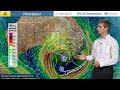
- This Severe Weather Update provides information on the intense low pressure system affecting southeastern Australia. Video is current at 4pm AEST 29 September 2016. For the latest weather and warnings information visit http://www.bom.gov.au/australia/warnings, and follow advice from emergency services.
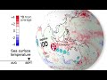
- Title
- Climate and Water Outlook, October–December 2016
- Runtime
- 3:46
- Date posted
- 10 years ago
- Description
- The monthly Climate and Water Outlook video covers rainfall, streamflow and temperature for the next three months.
For more detail, go to http://www.bom.gov.au/climate/ahead/?cid=001yt15.
The next video will be available Thursday 27 October 2016.
Our ENSO Tracker is updated every two weeks at http://www.bom.gov.au/climate/enso/tracker/?cid=001yt16.
For an email each month about the next video, subscribe to Climate Outlooks at http://bom.is/enviro-news.
You can also follow the Bureau of Meteorology on Facebook, LinkedIn, and on Twitter at @BOM_au.
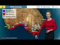
- Title
- ⚠Weather Update: Intense low pressure system and cold front, 28 September 2016
- Runtime
- 3:02
- Date posted
- 10 years ago
- Description
- This Severe Weather Update provides information on the intense low pressure system and cold front affecting southern Australia. Video is current at 4pm AEST 28 September 2016. For the latest weather and warnings information visit http://www.bom.gov.au/australia/warnings, and follow advice from emergency services.

- Title
- ⚠Weather Update: Gale-force winds and heavy rain to affect southern Australia, 27 Sept 2016
- Runtime
- 2:47
- Date posted
- 10 years ago
- Description
- This Severe Weather Update provides information on gale-force winds and heavy rain which will affect southern Australia this week. Video is current at 3pm AEST 27 September 2016. For the latest weather and warnings information visit http://www.bom.gov.au/australia/warnings, and follow advice from emergency services.

- Title
- ⚠Weather Update: Gale-force winds and heavy rain, 26 September 2016
- Runtime
- 2:50
- Date posted
- 10 years ago
- Description
- This Severe Weather Update provides information on gale-force winds and heavy rain that will affect southern Australia. Video is current at 2pm AEST 26 September 2016. For the latest weather and warnings information visit http://www.bom.gov.au/australia/warnings, and follow advice from emergency services.

- Title
- ⚠Weather Update: Rain and flooding in eastern Australia, 21 September 2016
- Runtime
- 2:20
- Date posted
- 10 years ago
- Description
- This Severe Weather Update provides information on rain and flooding in eastern Australia. Video is current at 3pm AEST 21 September 2016. For the latest weather and warnings information visit http://www.bom.gov.au/australia/warnings, and follow advice from emergency services.

- Title
- ⚠Weather Update: Rain and flooding in eastern Australia, 20 September 2016
- Runtime
- 2:35
- Date posted
- 10 years ago
- Description
- This Severe Weather Update provides information on rain and flooding in eastern Australia. Video is current at 12pm AEST 20 September 2016. For the latest weather and warnings information visit http://www.bom.gov.au/australia/warnings, and follow advice from emergency services.

- Title
- ⚠Weather Update: Rain and flooding in central and eastern Australia, 16 September 2016
- Runtime
- 3:05
- Date posted
- 10 years ago
- Description
- This Severe Weather Update provides information on rainfall and flooding in central and eastern Australia. Video is current at 2pm AEST 16 September 2016. For the latest weather and warnings information visit http://www.bom.gov.au/australia/warnings, and follow advice from emergency services.

- Title
- ⚠Weather Update: Rain and flooding in eastern Australia, 14 September 2016
- Runtime
- 3:02
- Date posted
- 10 years ago
- Description
- This Severe Weather Update provides information on rain and flooding in eastern Australia. Video is current at 11 am AEST 14 September 2016. For the latest weather and warnings information visit http://www.bom.gov.au/australia/warnings, and follow advice from emergency services.

- Title
- ⚠Weather Update: Rain and flooding in southeastern Australia, 13 September 2016
- Runtime
- 2:23
- Date posted
- 10 years ago
- Description
- This Severe Weather Update provides information on rain and flooding in southeastern Australia. Video is current at 12pm AEST 13 September 2016. For the latest weather and warnings information visit http://www.bom.gov.au/australia/warnings, and follow advice from emergency services.

- Title
- ⚠Weather Update: Rain and flooding Victoria, 12 September 2016
- Runtime
- 2:47
- Date posted
- 10 years ago
- Description
- This Severe Weather Update provides information on rain and flooding in Victoria, current at 4pm AEST 12 September 2016. For the latest weather and warnings information visit http://www.bom.gov.au/australia/warnings, and follow advice from emergency services.

- Title
- Ask the Bureau: What is a thunderstorm?
- Runtime
- 3:12
- Date posted
- 10 years ago
- Description
- Thunderstorms are associated with very tall clouds called cumulonimbus that produce turbulence, lightning and thunder. So what causes them, and what's really going on up there?
For more information, read our blog at http://media.bom.gov.au/social/blog/1025/askbom-what-is-a-thunderstorm/?cid=002yt01.
Adapted Creative Commons imagery courtesy of:
https://commons.wikimedia.org/wiki/File:Big_Cumulonimbus.JPG
https://commons.wikimedia.org/wiki/File:Turkey_tower_(Cumulus_congestus).jpg
https://en.wikipedia.org/wiki/File:Pelion_Range_from_Mt_Oakleigh.jpg
https://creativecommons.org/licenses/by-sa/3.0/deed.en

- Title
- Climate and Water Outlook, September–November 2016
- Runtime
- 4:30
- Date posted
- 10 years ago
- Description
- The monthly Climate and Water Outlook video covers rainfall, streamflow and temperature for the next three months. For more detail, go to http://www.bom.gov.au/climate/ahead/?cid=001yt13.
The next video will be available Thursday 29 September 2016.
Darling River footage courtesy of The Australian http://www.theaustralian.com.au/
Our ENSO Tracker is updated every two weeks at http://www.bom.gov.au/climate/enso/tracker/?cid=001yt14.
For an email each month about the next video, subscribe to Climate Outlooks at http://bom.is/enviro-news.
You can also follow the Bureau of Meteorology on Facebook, LinkedIn, and on Twitter at @BOM_au.
- Title
- National Water Account 2014–15
- Runtime
- 2:51
- Date posted
- 10 years ago
- Description
- The Bureau of Meteorology’s National Water Account provides an annual picture of water availability. It plays a critical role in the planning and decision-making processes of governments and industry.
This video summarises key findings from the National Water Account 2015. For more information, go to http://www.bom.gov.au/water/nwa/2015/?cid=012yt01.

- Title
- Climate and Water Outlook, August–October 2016
- Runtime
- 4:06
- Date posted
- 10 years ago
- Description
- The monthly Climate and Water Outlook video covers rainfall, streamflow and temperature for the next three months. For more detail, go to http://www.bom.gov.au/climate/ahead/?cid=001yt13.
The next video will be available Thursday 25 August 2016. Our ENSO Tracker is updated every two weeks at http://www.bom.gov.au/climate/enso/tracker/?cid=001yt14.
For an email each month about the next video, subscribe to Climate Outlooks at http://bom.is/enviro-news.
You can also follow the Bureau of Meteorology on Facebook and LinkedIn, and on Twitter at @BOM_au.
Footage of dry to green paddock thanks to John Ferrier and the Birchip Cropping Group (www.bcg.org.au).

- Title
- Understanding the Indian Ocean Dipole
- Runtime
- 3:33
- Date posted
- 10 years ago
- Description
- This video explains what the Indian Ocean Dipole (IOD) is; the three phases of the IOD—positive, neutral and negative; and its influence on Australia's rainfall. For more information visit: www.bom.gov.au/climate/iod
- Title
- Climate and Water Outlook, July–September 2016
- Runtime
- 4:21
- Date posted
- 10 years ago
- Description
- The monthly Climate and Water Outlook video covers rainfall, streamflow and temperature for the next three months. For more detail, go to http://www.bom.gov.au/climate/ahead/?cid=001yt10.
The next video will be available Thursday 28 July 2016. Our ENSO Tracker is updated every two weeks at http://www.bom.gov.au/climate/enso/tracker/?cid=001yt11. Our Seasonal Streamflow Forecasts will next be updated on 11 July 2016 at http://www.bom.gov.au/water/ssf/?cid=001yt12.
For an email each month about the next video, subscribe to Climate Outlooks at http://bom.is/enviro-news.
You can also follow the Bureau of Meteorology on Facebook, and on Twitter at @BOM_au.

- Title
- Ask the Bureau: What is an East Coast Low?
- Runtime
- 3:29
- Date posted
- 10 years ago
- Description
- East Coast Lows are intense low pressure systems that occur off the eastern coast of Australia, often bringing damaging weather conditions. This video explains how they form, including how they differ from tropical cyclones, and why they can be dangerous. For the latest weather warnings always check http://www.bom.gov.au.

- Title
- Climate and Water Outlook, June–August 2016
- Runtime
- 3:55
- Date posted
- 11 years ago
- Description
- The monthly Climate and Water Outlook video covers rainfall, streamflow and temperature for the next three months. The next video will be available on Thursday 30 June 2016. For more detail, please go to http://www.bom.gov.au/climate/ahead/?cid=001yt08.
Please note our ENSO Tracker is updated every two weeks. Check http://www.bom.gov.au/climate/enso/tracker/?cid=001yt09 to see its current status.
For an email each month for the next video, subscribe to Climate Outlooks at http://bom.is/enviro-news.
You can also follow the Bureau of Meteorology on Facebook, and on Twitter at @BOM_au.

- Title
- Climate and Water Outlook May–July 2016
- Runtime
- 4:04
- Date posted
- 11 years ago
- Description
- The monthly Climate and Water Outlook video covers rainfall, streamflow and temperature for the next three months. The next video will be available on Thursday 26 May 2016. For more detail, please go to http://www.bom.gov.au/climate/ahead/?cid=001yt06
Please note our ENSO Tracker is updated every two weeks. Check http://www.bom.gov.au/climate/enso/tracker/?cid=001yt07 to see its current status.
For an email each month for the next video, please subscribe to Climate Outlooks at http://bom.is/enviro-news.
You can also follow the Bureau of Meteorology on Facebook, and on Twitter at @BOM_au.

- Title
- Ask the Bureau: How is temperature measured?
- Runtime
- 1:45
- Date posted
- 11 years ago
- Description
- What's in those big white boxes at weather stations? We open the door on how temperature is measured across Australia.

- Title
- Climate and Water Outlook, April–June 2016
- Runtime
- 4:10
- Date posted
- 11 years ago
- Description
- The monthly Climate and Water Outlook video covers rainfall, streamflow and temperature for the next three months. The next video will be available on Thursday 28 April 2016. For more detail, please go to http://www.bom.gov.au/climate/ahead/?...
Please note our ENSO Tracker is updated every two weeks. Check http://www.bom.gov.au/climate/enso/tr... to see its current status.
For an email each month for the next video, please subscribe to Climate Outlooks at http://bom.is/enviro-news.
ReefTemp Next Generation maps available at http://www.bom.gov.au/environment/act....
You can also follow the Bureau of Meteorology on Facebook, and on Twitter at @BOM_au.
- Title
- Climate and Water Outlook, March–May 2016
- Runtime
- 4:15
- Date posted
- 11 years ago
- Description
- The monthly Climate and Water Outlook video covers rainfall, streamflow and temperature for the next three months. The next video will be available on Thursday 24 March 2016. For more detail, please go to http://www.bom.gov.au/climate/ahead/?cid=001yt01
Please note our ENSO Tracker is updated every two weeks. Check http://www.bom.gov.au/climate/enso/tracker/?cid=001yt02 to see its current status.
For an email each month for the next video, please subscribe to Climate Outlooks at http://bom.is/enviro-news.
You can also follow the Bureau of Meteorology on Facebook, and on Twitter at @BOM_au

- Title
- Ask the Bureau: What's that cloud?
- Runtime
- 2:32
- Date posted
- 11 years ago
- Description
- Think you know your Nimbostratus from your Cirrocumulus? Our new video takes you through the ten main cloud classifications, helping you get a sense of what weather conditions may be on the way.
Adapted Creative Commons imagery courtesy of:
https://commons.wikimedia.org/wiki/File:Altocumulus_cloud.jpg
https://commons.wikimedia.org/wiki/File:Cirrocumulus_to_Altocumulus.JPG
https://commons.wikimedia.org/wiki/File:Img20050526_0007_at_tannheim_cumulus.jpg

- Title
- Ask the Bureau: How do tropical cyclones get their names?
- Runtime
- 2:20
- Date posted
- 11 years ago
- Description
- Tropical cyclones are named to provide ease of communication between the Bureau and the community. Names also raise the profile of the tropical cyclone, heightening public awareness and helping reduce confusion if multiple cyclones occur at the same time. This video explains the history of naming tropical cyclones, beginning in 1887 with colourful character Clement Wragge. For the most up-to-date cyclone warnings and information in the Australian region, go to www.bom.gov.au/cyclone.

- Title
- Climate and Water Outlook, February–April 2016
- Runtime
- 4:29
- Date posted
- 11 years ago
- Description
- The monthly Climate and Water Outlook video covers rainfall, streamflow and temperature for the next three months. The next video will be available on Thursday 28 January 2016. For more detail, please go to http://www.bom.gov.au/climate/ahead.
Please note our ENSO Tracker is updated every two weeks. Check http://www.bom.gov.au/climate/enso/tracker to see its current status.
For an e-alert each month for the next video, please subscribe to Climate Outlooks at http://bom.is/enviro-news.
You can also follow the Bureau of Meteorology on Facebook, and on Twitter at @BOM_au

- Title
- Climate statement 2015
- Runtime
- 3:31
- Date posted
- 11 years ago
- Description
- The Annual Climate Statement is a snapshot of the Australian climate for the previous year including rainfall, temperature and significant events. To view the online Statement go to: http://www.bom.gov.au/climate/current/annual/aus/2015

- Title
- Season's greetings from the Bureau of Meteorology
- Runtime
- 1:11
- Date posted
- 11 years ago
- Description
- Our festive seasonal outlook: cloudy with a chance of reindeer!
Best wishes for a safe and happy festive season.

- Title
- Climate and Water Outlook, January–March 2016
- Runtime
- 3:54
- Date posted
- 11 years ago
- Description
- The monthly Climate and Water Outlook video covers rainfall, streamflow and temperature for the next three months. The next video will be available on Thursday 28 January 2016. For more detail, please go to http://www.bom.gov.au/climate/ahead
Please note our ENSO Tracker is updated every two weeks. Check http://www.bom.gov.au/climate/enso/tracker to see its current status.
For an e-alert each month for the next video, please subscribe to Climate Outlooks at http://bom.is/enviro-news.
- Title
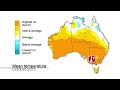
- Climate and Water Outlook, December 2015 – February 2016
- Runtime
- 4:03
- Date posted
- 11 years ago
- Description
- The monthly Climate and Water Outlook video covers rainfall, streamflow and temperature for the next three months. The next video will be available on Thursday 17 December 2015. For more detail, please go to http://www.bom.gov.au/climate/ahead
Please note our ENSO Tracker is updated every two weeks. Check http://www.bom.gov.au/climate/enso/tracker to see its current status.
For an e-alert each month for the next video, please subscribe to Climate Outlooks at http://bom.is/enviro-news.
You can also follow the Bureau of Meteorology on Facebook, and on Twitter at @BOM_au.

- Title
- Australian Weather Calendar 2016
- Runtime
- 1:39
- Date posted
- 11 years ago
- Description
- Take a look behind the scenes of the Bureau of Meteorology’s Australian Weather Calendar. To order your 2016 calendar, or have copies sent to friends and family anywhere in the world, go to http://shop.bom.gov.au/?cid=yt01.

- Title
- Climate and Water Outlook, November 2015 — January 2016
- Runtime
- 4:54
- Date posted
- 11 years ago
- Description
- The monthly Climate and Water Outlook video covers rainfall, streamflow and temperature for the next three months. The next video will be available on 19 November 2015. For more detail, please go to http://www.bom.gov.au/climate/ahead
Please note our ENSO Tracker is updated every two weeks. Check http://www.bom.gov.au/climate/enso/tracker to see its current status.
For an e-alert each month for the next video, please subscribe to Climate Outlooks at http://bom.is/enviro-news.
You can also follow the Bureau of Meteorology on Facebook, and on Twitter at @BOM_au.

- Title
- Himawari-8: The weather comes alive
- Runtime
- 2:11
- Date posted
- 11 years ago
- Description
- Japan Meteorological Agency’s new geostationary weather satellite, Himawari-8, will give the Australian public high-resolution, true-colour, spectacular images of the earth. It also provides more detailed, more precise and more frequent data to the Bureau of Meteorology’s forecasters and weather prediction models. To explore imagery from Himawari-8 for yourself, visit http://www.bom.gov.au/satellite.

- Title
- Himawari: Using the Satellite viewer
- Runtime
- 1:25
- Date posted
- 11 years ago
- Description
- How to use the Bureau of Meteorology’s new, map-based satellite viewer—featuring high-definition imagery from the Japan Meteorological Agency’s new geostationary weather satellite, Himawari. To try the viewer yourself, visit http://www.bom.gov.au/satellite.
Please note: while this video references Himawari-8, the current satellite in use is Himawari-9. These 2 satellites have the same function and capability.
- Title
- Climate and Water Outlook, October—December 2015
- Runtime
- 4:42
- Date posted
- 11 years ago
- Description
- **UPDATE** This Climate Outlook has been updated since filming. For more details, see http://www.bom.gov.au/climate/outlooks
The monthly Climate and Water Outlook video covers rainfall, streamflow and temperature for the next three months. The next video will be available on 29 October 2015. For more detail, please go to http://www.bom.gov.au/climate/ahead
Please note our ENSO Tracker is updated every two weeks. Check http://www.bom.gov.au/climate/enso/tracker to see its current status.
For an e-alert each month for the next video, please subscribe to Climate Outlooks at http://bom.is/enviro-news.
You can also follow the Bureau of Meteorology on Facebook, and on Twitter at @BOM_au.

- Title
- 7-day streamflow forecasts
- Runtime
- 2:07
- Date posted
- 11 years ago
- Description
- An introduction to the Bureau's 7-day streamflow forecasts service (http://www.bom.gov.au/water/7daystreamflow), which predicts how much water is likely to flow at specific river and stream locations up to seven days ahead.
- Title
- Climate and Water Outlook, September–November 2015
- Runtime
- 4:41
- Date posted
- 11 years ago
- Description
- The monthly Climate and Water Outlook video covers rainfall, streamflow and temperature for the next three months. The next video will be available on 24 September 2015. For more detail, please go to http://www.bom.gov.au/climate/ahead.
Please note our ENSO Tracker is updated every two weeks. Check http://www.bom.gov.au/climate/enso/tracker to see its current status.
For an e-alert each month for the next video, please subscribe to Climate Outlooks at http://bom.is/enviro-news.
You can also follow the Bureau of Meteorology on Facebook, and on Twitter at @BOM_au.

- Title
- Climate and Water Outlook, August–October 2015
- Runtime
- 4:18
- Date posted
- 11 years ago
- Description
- Our monthly Climate and Water Outlook video covers rainfall, streamflow and temperature for the next three months. The next video will be available on 27 August 2015. For more detail, go to http://www.bom.gov.au/climate/ahead.

- Title
- National Water Account 2013–14
- Runtime
- 3:11
- Date posted
- 11 years ago
- Description
- In our variable climate, as our population increases and industries change, competition for Australia’s precious water resources intensifies. To ensure we have enough water for everyone, it is important to account for how water is managed across Australia. We need to know how much water is available, where it is, and how it’s being used.
The Bureau of Meteorology’s National Water Account provides an annual picture of water availability. It plays a critical role in the planning and decision-making processes of governments and industry. This video summarises the key findings of the National Water Account 2014 from a national perspective. For more information, go to http://www.bom.gov.au/water/nwa/2014/

- Title
- Climate and Water Outlook, July–September 2015
- Runtime
- 4:13
- Date posted
- 11 years ago
- Description
- Our monthly Climate and Water Outlook video covers rainfall, streamflow and temperature for the next three months. The next video will be available on 30 July 2015. For more detail, go to http://www.bom.gov.au/climate/ahead.
Please note our ENSO Tracker is updated every two weeks. Check http://www.bom.gov.au/climate/enso/tracker to see its current status.
For an e-alert each month for the latest video, please subscribe to Climate Outlooks at http://bom.is/enviro-news.
You can also follow the Bureau of Meteorology on Facebook (http://www.facebook.com/bureauofmeteorology) and Twitter (http://twitter.com/bom_au)





