WeatherWatchTV
Oz: A spluttering start to the wet season due to spring in the south (13/11/25)
- Title
- Oz: A spluttering start to the wet season due to spring in the south (13/11/25)
- Runtime
- 8:30
- Date posted
- 10 months ago
- Description
- The wet season/monsoon is trying to ramp up in Tropical Australia and WA, NT and Qld will notice it over the coming days with increased humidity, heat, downpours and thunderstorms, some severe outbreaks too.
But at the southern end of the country a southerly quarter flow (SW, S & SE) dominates most places, dropping temperatures at times (yes that polar boundary keeps bumping into Tas and Vic in particular) and that drier southerly flow will next week push that tropical boundary back northwards and bring back large dry areas into the tropical north.
Around Darwin and the Top End we're monitoring a small low pressure zone next week, about one week from now. It's not showing up as a storm today, but the position it's in means it's well worth keeping an eye on incase it does. For now, it may just bring heavy rain into the Darwin area.

- Title
- Oz: Cooler winds for southern Aust., but a tropical low worth monitoring next week in the north
- Runtime
- 9:18
- Date posted
- 10 months ago
- Description
- Spring-like weather with gales, polar (or cooler) southerly surges and showers continues for southern parts of Australia while pockets of thunderstorms and downpours exist elsewhere - although a high pressure zone over NSW today brings a settled 24 hours there.
Over the coming days high pressure exits NSW over the Tasman Sea allowing low pressure zones to grow, producing more hit and miss downpours and thunderstorms across parts of Australia (with large dry areas still in the mix too - ie, it's a bit "messy").
There's a chance of Severe Thunderstorms or some heavy rain into the SE of Queensland and NE of NSW too, while plenty of inland showers and downpours continue over WA.
A week from now a low pressure zone north of WA and west of Darwin may be worth monitoring. For now it poses no threat to Australia - but some modelling suggests it may become the first Tropical Depression, or even tropical cyclone, of the season. But this is certainly not loc...

- Title
- NZ: Low pressure for the NI today & tonight, A cold change on Fri PM/Sat AM for the SI
- Runtime
- 8:27
- Date posted
- 10 months ago
- Description
- Low pressure is moving into the upper North Island today and tonight and will sink southwards overnight, clearing NZ later tomorrow. With it comes a burst of strong East to North-East winds and patchy rain with pockets of heavy downpours. Keep up to date with any MetService watches and warnings.
Windy weather also affects the south-east South Island (like coastal Otago) as a windy nor'easter kicks in today due to high pressure out over the Chatham Islands and low pressure south of Stewart Island making a "squash zone" of wind.
By Friday the next polar change moves into the South-West corner of the South Island - and overnight and into Saturday morning spreads right over the South Island and may even brush Wellington and the lower North Island for a time, before clearing NZ by night time with warmer weather arriving on Sunday and into early next week.
Subtropical winds and subantarctic winds are forecast for NZ over the next 7 days.

- Title
- Typhoon Fung-wong (UWAN) heads to Taiwan next, clears Philippines today
- Runtime
- 5:55
- Date posted
- 10 months ago
- Description
- Taiwan is next in line for Typhoon Fung-wong as the storm leaves the Philippines today.
Fung-wong is expected to weaken as it approaches Taiwan, perhaps bringing more rain then wind. The typhoon is expected to fall apart entirely by the time it leaves Taiwan - and could merge with other low pressure over Taiwan to bring heavy rain in some locations this week, possibly well over 300 or 400mm.
This is our final update on this typhoon. Thank you for viewing and commenting, liking and subscribing. We wish everyone in the Philippines all the best with the clean up and rebuilding.

- Title
- Oz: Tropical wet weather increasing, cold airflows continue in south
- Runtime
- 9:23
- Date posted
- 10 months ago
- Description
- Thunderstorms and areas of heavy rain are expected to increase in tropical Australia over the next 7 days as low pressure zones continue to dominate large parts of the continent.
High pressure does briefly come into the south and south-east, but doesn't linger long. Behind that anticyclone there may be an expansion in severe thunderstorms through inland and northern parts of Oz.
But in the south that pesky polar boundary will pop back up again into Tas and potentially parts of SA and Vic again. Spring weather continues on.
And we end with a 7 day rainfall map to make sense of the messy forecast.

- Title
- NZ's weather pattern getting "messier"
- Runtime
- 6:47
- Date posted
- 10 months ago
- Description
- Spring often brings chaos to the weather maps but often you can find patterns within that chaos - but over the next week or so there is less pattern and more random when it comes to the placement of highs and lows. That doesn't always mean stormy weather - but it means varying wind directions and airflows, cloud cover, and some fluctuating temperatures.
We track the next week of lows and highs and potential rainmakers, plus have a 7 day rainfall map to make sense of it.

- Title
- Saturday update: Philippines - Typhoon Uwan latest tracking
- Runtime
- 7:45
- Date posted
- 10 months ago
- Description
- In this special Saturday update we look at the latest tracking of now officially named Typhoon Fung-wong (known as Typhoon UWAN in the Philippines) with landfall expected later on Sunday and early Monday in Luzon.
Please keep up to date with official warnings from local authorities in the Philippines.
Apologies but we have no video on Sunday or Monday - this is our final update. We suggest: @WestPacWx as another channel to follow if you need further details.
Thank you for watching.

- Title
- Oz 7-Day: Spring changes in the south, isolated thunderstorms elsewhere
- Runtime
- 8:36
- Date posted
- 10 months ago
- Description
- Another burst of rain and showers with low pressure is crossing Australia's south-eastern corner today and tomorrow before a colder change arrives early next week with briefly wintry conditions in some locations (like TAS and parts of Vic, maybe even the mountains of NSW). The cold doesn't linger too long for most, but it's another swing in temperatures.
Elsewhere there isn't so much energy, with the usual tropical downpours and thunderstorms over parts of Qld, NT and the top half of WA.
And there's the 7 day rainfall map to make sense of it all.
*Programming Note:
Phil is away on Monday so our next Australia-only weather video will be published on Tuesday November 11th.

- Title
- NZ 7 Day: Spring weather returns next week, but driest and warmest in the east
- Runtime
- 8:38
- Date posted
- 10 months ago
- Description
- Spring hasn't finished with us yet despite the summer-like weather in a number of regions this week and coming weekend.
By next week more low pressure is in the mix bringing some windier weather and also more western and northern rain. However eastern areas may again mostly miss out as some of the rain bands are fairly weak. The West Coast, especially the southern half, is where most of the rain is likely.
Despite the changes temperatures will still likely be above normal - but one week from now a wintry change is possible in the lower South Island. Not yet locked in this far out.
*Programming note:
We are away on Monday, our next NZ weather video will be on Tuesday November 11th.
- Title
- Update: Philippines in path of Typhoon Fung-wong (UWAN)
- Runtime
- 8:06
- Date posted
- 10 months ago
- Description
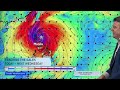
- We have the latest update on Typhoon Uwan as it powers up over the coming days and likely hits northern parts of the Philippines directly later on Sunday and going into Monday.
As with all typhoons in the Philippines it has a local name - this one globally is named Fung-wong, but in the Philippines it will be known as Typhoon Uwan.
At the time we recorded this video on Friday morning it was still technically a "Tropical Storm" which is one category below becoming an official named Typhoon. This will likely happen later today, or at the latest on Saturday based on the modelling.
We discuss likely tracking, damaging wind zone, rainfall and wave heights over the coming several days ahead.
Programming Note:
On Saturday morning WeatherWatchTV here on YouTube will produce another typhoon video for the Philippines - but will be unable to update again on Sunday and Monday. Please use local Philippines weather authorities for all officia...

- Title
- OZ: Cold blasts in the south, tropical hit & miss downpours elsewhere
- Runtime
- 9:56
- Date posted
- 10 months ago
- Description
- Despite some large dry areas there's still a lot of spring energy in the south, and low pressure in the west sparking more pockets of rain and thunderstorms and temperature swings.
The south-east of Australia is most exposed to polar airflows over the coming week - check your local forecast to see when your temperatures drop (and by how much).
Low pressure zones are still creating thunderstorms, some severe, but they are more hit and miss in places like Queensland and NT, but more widespread in the northern half of WA.
This week's Flight Sim flyover is again in Victoria, this time Geelong!

- Title
- Potential Super Typhoon threat for Philippines, as another typhoon aims for Vietnam
- Runtime
- 8:17
- Date posted
- 10 months ago
- Description
- In our special Western Pacific Typhoon update we're tracking two storms. The first is Typhoon Kalmaegi (which has already passed over the Philippines with deadly weather) which is heading to Vietnam tonight, then will fall apart over Laos, Cambodia and Thailand as a big rain event.
The second tropical storm was technically still only a "Tropical Depression" when we recorded this on Thursday AM, but it is expected to power up this weekend and grow into a Super Typhoon as it approaches Luzon, Philippines.
Landfall in the northern Philippines may be as early as Sunday PM or some time on Monday. We track these two storms to give you the big picture.
- Title
- NZ's weather pattern looks to shift next week as lows return
- Runtime
- 6:12
- Date posted
- 10 months ago
- Description
- Apart from some isolated showers (and maybe an isolated northern thunderstorm) the North Island looks mostly dry over the days ahead, while some wet weather affects the south-west corner and western side of the South Island, otherwise dry around much of the South Island too.
Subtropical airflows, Australian airflows and north to north-west winds will keep many regions warmer than average over the days ahead.
Next week low pressure comes back - bringing a higher chance for rain and showers in the west and north - and perhaps some pockets of windier weather.
We have your NZ forecast out to the middle of next week + your 7 Day Rainfall Map.

- Title
- Oz: Some high pressure returns, but more lows & a cold blast next week
- Runtime
- 8:29
- Date posted
- 10 months ago
- Description
- For many places the weather is settling down (except WA in particular) as high pressure builds - but the high isn't powerful, nor will it linger long. Next week a polar southerly will drop temperatures as far north as NSW bring a windy south to south-easterly flow for southern parts of Australia.
At the same time we're seeing more thunderstorms and hit and miss downpours developing over the NT and parts of Queensland and WA.
We have your 7 day Australia forecast.

- Title
- NZ's on the edge of high pressure until next week - but then rain/showers return
- Runtime
- 8:41
- Date posted
- 10 months ago
- Description
- High pressure affects most of NZ over the days ahead but because it's mostly centred offshore it's pulling down warmer winds for most regions, with sub-tropical and Australian connections.
Despite stormy weather in Australia this high pressure belt over NZ is keeping severe weather away from us.
But next week low pressure returns - and could see a return to some heavy western rain and stronger winds.
We also update you on soil moisture levels over the past couple of weeks and what rain is expected over the next 7 days.

- Title
- Oz: The return of the polar boundary as spring continues in the south
- Runtime
- 9:29
- Date posted
- 10 months ago
- Description
- Large areas of low pressure are bringing rain (both welcome and unwelcome) into parts of Australia with a west to south-west flow likely around Melbourne today with showers about for the Melbourne Cup.
Thunderstorms have cleared much of the east, but a few remain around the low pressure zone spiralling in the south-east.
Colder air is going to continue to push into southern and south-eastern Australia, with potentially a decent pulse of polar air as far northwards as NSW one week from now (although not locked in yet, due to the shape of the high pressure zone helping create it not yet confirmed this far out), and colder airflows continuing to affect the south of the country off and on over the next week.
The spring chaos continues south of Oz bringing more low pressure zones and some wet weather to the south, while elsewhere northwards it's more about hit and miss downpours, tropical heat and thunderstorms with still some large areas of dry and ca...

- Title
- NZ: Low pressure returns to NZ next week - here's what happens between now & then
- Runtime
- 8:42
- Date posted
- 10 months ago
- Description
- It's the Melbourne Cup today, Guy Fawkes tomorrow and high pressure continues to cover much of NZ bringing lighter winds and sunnier skies. There is a slight southerly that has brought in a few isolated showers and cloud to some South Island areas today.
Over the coming days high pressure moves around, mostly centred around the North Island but bringing milder airflows right across NZ for the most part.
But stormy weather in Australia - bringing showers and westerlies and a temperature drop into Melbourne later today - isn't likely to affect NZ much, but may bring some lower West Coast rain later this week.
Next week low pressure grows - and it's a large area - which may bring in more western rain and showers to NZ and some windier days, although compared to October it doesn't look too severe at this early stage.

- Title
- Oz: Low pressure swamps large parts of Australia
- Runtime
- 9:38
- Date posted
- 10 months ago
- Description
- There is a lack of high pressure over Australia this week, with large lows producing rain, thunderstorms and showers over all the states and territories.
We track the wet weather, the pockets of high pressure (mostly south of the nation) and what the 7 day rainfall map looks like.
Melbourne Cup weather looks showery and cool/cold.
Low pressure zones are spinning in south-east and west as we kick off this week - and more low pressure is coming in producing pockets of rain relief, but despite the lows there is still some large dry zones remaining with no signs yet of any significant tropical rains.
We have your Australia-only weather forecast through until this Sunday.
- Title
- NZ: High pressure in charge, who gets the showers & wind between now & Sunday
- Runtime
- 7:55
- Date posted
- 10 months ago
- Description
- High pressure is controlling NZ's weather this week and coming weekend, but there are still some windy and wet areas in the mix, but compared to previous weeks and months this week is very settled for most.
Most regions are drier than usual over the next 7 days with a lack of frosty weather too as warmer airflows come into the mix, both from north of NZ and out of Australia.
The polar boundary will, for the first time in months, remain south of NZ all week.

- Title
- ClimateWatch: NOVEMBER's outlook as high pressure lifts in NZ, low pressure grows in Oz.
- Runtime
- 12:23
- Date posted
- 10 months ago
- Description
- In our monthly "ClimateWatch" forecast the first week of November in NZ looks settled and mostly dry, while Australia and the subtropics see more low pressure zones producing rain, showers and thunderstorms.
One of the main takeaways from our latest monthly outlook is seeing how the worst of spring's winds look to shift further southwards out of NZ and Australia - and not so much smack bang over us. This is usually what happens in November and can fast see some regions drying out over the weeks ahead. It doesn't mean it's all over - but there should be much longer stretches of calmer weather coming into the mix.
But storms are still south of our nations and over Australia and the Tasman Sea area during the coming weeks - and Australia's southern coastline looks more exposed than NZ does (at least for the first half of the month) as far as Southern Ocean storms are concerned. This means more temperature fluctuations and cold fronts, especially in November's fi...

- Title
- Oz 7 Day: Stormy for some as large lows form + the usual thunderstorms
- Runtime
- 10:14
- Date posted
- 10 months ago
- Description
- The first week of November in Australia looks stormy for some as large low pressure zones, mostly in the southern half of the nation, produce temperature fluctuations, thunderstorms, showers and rain.
Victoria and south-east Queensland may see some of the highest rainfall totals, but Tas and NSW (and the A.C.T) are also affected to some degree.
The NT, SA and WA have plenty of showers and thunderstorms too - with low pressure zones especially around WA and SA.
We break it down for you and give an update on Melbourne Cup weather + we compare two 7 day rainfall maps (not a huge amount of difference between them) to make sense of it all.

- Title
- NZ 7 Day outlook as high pressure finally returns to the country
- Runtime
- 6:59
- Date posted
- 10 months ago
- Description
- The 7 day rainfall map looks nothing like anything we've had in the past few months as high pressure finally dominates the country starting this weekend and, for most of NZ, lingering right through next week.
There will be some frosts this weekend - but they look less likely by Sunday and going through next week for most places.
We do have some showers, despite all the high pressure, we try to make sense of where those might be.
Have a good weekend!

- Title
- Oz: Large lows to dominate Australia's weather next several days
- Runtime
- 9:46
- Date posted
- 10 months ago
- Description
- Despite some high pressure in the mix, it is low pressure that is dominating Australia's weather going into next week, producing some decent rainfall totals as thunderstorms and convergence lead to slow but narrow areas of heavy rain.
The large low that is expected to storm into life early next week in the south-east is still not totally locked in - but various modelling is showing more confidence in this event.
At the same time there is low pressure elsewhere, driving in some localised pockets of wind, along with further showers and thunderstorms amongst the dry.
We try to break it down for you to make sense of it all.

- Title
- NZ: Wind, frosts for some, then dry & calm for many
- Runtime
- 7:29
- Date posted
- 10 months ago
- Description
- High pressure is coming in for November's first week, finally bringing a break in the gales and heavy rain for the entire nation.
Despite the high there will be some showers above, mainly in the upper North Island this weekend.
Frosts are mostly South Island focused and increasingly becoming more alpine, especially as milder airflows come into New Zealand next week.
We briefly cover the Melbourne Cup next week in Victoria, and update you on the windy weather expected today in some parts of NZ before our November anticyclone arrives.

- Title
- Oz: Severe thunderstorms Qld & NSW, big lows for the southern parts of Australia
- Runtime
- 9:01
- Date posted
- 10 months ago
- Description
- Severe thunderstorms are looking likely again in Queensland with NSW in the firing line too in the days ahead. At the same time two large areas of low pressure over the south-west and south-east of the nation are likely to drive in more spring weather with hot and cold days, thunderstorms and rain in the forecast.
It's not all locked in yet, but there's a fair bit of low pressure developing around Australia over the coming week and with highs moving past it brings more instability with air pressure moving around and airflows changing.
We have 2x 7 day rainfall maps to help paint the picture of how it's generally shaping up.
As for the Melbourne Cup next week - a chance of wet weather and a drop in temperatures as a large low pressure zone covers the south-east. Because this low is yet to develop more time is needed to lock it all in. We'll update again on Thursday with the latest updates.

- Title
- NZ: Wind, frosts, then high pressure + Hurricane Melissa update
- Runtime
- 8:50
- Date posted
- 10 months ago
- Description
- NZ has windy and colder/cooler weather for the rest of October - but November 1st sees a change as a large anticyclone crosses the country for both Saturday and Sunday and also the start of next week. It means lighter winds and drier weather for most of the country for a few days - once we get through this week.
Frosts are in the forecast, mostly for the South Island, and windy weather is still off and on this week, but the high this weekend will make for much lighter winds.
Also, at the end of today's video we again have a quick update on Hurricane Melissa after making landfall this morning in Jamaica as the nation's first ever Category 5 storm. Air pressure inside the hurricane dropped to 892 hPa, the third lowest Atlantic air pressure ever recorded. The hurricane is heading to Cuba later today.
*Hurricane Hunter video is courtesy of US Airforce.

- Title
- Oz: Eastern showers this week, spring weather continues in south
- Runtime
- 8:13
- Date posted
- 10 months ago
- Description
- The eastern coastal side of Australia has the best chance of wet weather this week, but spring blasts will continue to surge past southern Australia bringing temperature fluctuations - and for SA, Vic and Tas we may not yet be done with that polar boundary bringing another drop in temperatures within the next week.
Thunderstorms are bubbling up in the NT and Qld (some in NSW) but despite the Cyclone Season kicking off officially this Saturday (Nov 1) we aren't yet seeing any significant changes to the tropical pattern just north (and over) northern tropical Australia.
We have your Australia weather forecast out to Monday of next week.

- Title
- High pressure is coming (for all NZ!), + Cat 5 Hurricane Melissa aims for Jamaica
- Runtime
- 9:53
- Date posted
- 10 months ago
- Description
- The last week of October will still be windy in NZ, but nothing like last week - with November 1st kicking off with a giant high pressure zone right over the country finally bringing lighter winds nationwide and dry skies. For eastern parts of the North Island wanting rain this won't help - but it will see winds ease and temperatures settle there, which may help.
Next week kicks off even milder across New Zealand with high pressure still in control and sliding out to east, with some places getting a subtropical or northerly wind kicking in.
INTERNATIONAL - ATLANTIC
We also quickly update you on Category 5 Hurricane Melissa - now the most powerful storm of 2025 as it churns just south of Jamaica today - and makes landfall there on Wednesday NZT, before heading to Cuba. We have a brief update on this storm and compare it to the power of the storm near NZ's South Island last week.

- Title
- Oz: Severe Thunderstorms developing, cooler airflows in the mix
- Runtime
- 9:07
- Date posted
- 10 months ago
- Description
- Thunderstorms are spreading across WA and into SA today, then will move in the eastern half of Australia this weekend.
Next week the eastern coastline will have patches of rain and showers, while a few thunderstorms develop around the Top End.
We have your forecast for the weekend and the last week of October + the upcoming 8 day rainfall map.

- Title
- NZ: Labour Weekend weather + the outlook for the last week of October
- Runtime
- 9:37
- Date posted
- 10 months ago
- Description
- The long weekend is upon us and for some regions it will be sunny, dry and mild - but for others, windy, wet and colder.
We track the rain, showers, snow flurries and when the next surge(s) of gale westerlies arrives (we're not done with them yet, but they don't look as intense as they've been this week).
The polar boundary will also continue to bring colder weather to the South Island at times.
There's also an 8 day rainfall map to make sense of it all.
*Apologies for the late publication today - YouTube had processing issues.

- Title
- Oz: Southern low brings cooler change, eastern downpours next week
- Runtime
- 6:48
- Date posted
- 10 months ago
- Description
- The southern heat is going to retreat this weekend and early next week as the next low pressure system moves through. The cooler/colder change is not a major event, but it will bring a drop in temperatures for at least the southern half of the nation.
Next week showers and thunderstorms will develop in eastern parts of Australia with Queensland having some better chances of get some wet weather - but there are going to be large dry areas still in the mix, not just for Qld but for many other parts of Australia.

- Title
- NZ: Tracking Thursday's severe gales + Labour Weekend weather
- Runtime
- 8:41
- Date posted
- 10 months ago
- Description
- Severe gales (reaching hurricane force in places with gusts over 220km/h this morning in exposed parts of Marlborough) will blow through across Thursday in a number of regions as a deep low pressure system tracks past Stewart Island.
Heavy rain and thunderstorms spread up the West Coast while damaging winds are possible across parts of the South Island and lower North Island. The good news is that the worst of these winds should ease tonight. Keep up to date with MetService warnings and watches.
The long weekend forecast is a bit messy - but still some dry, sunny, weather for a number of places. But some areas won't shake those windy westerlies - with another surge coming in on Sunday and Monday, and again Tuesday.
We break it all down for you.

- Title
- Oz: Polar blast this weekend in SE, downpours for Qld next week
- Runtime
- 7:51
- Date posted
- 10 months ago
- Description
- Hit and miss sums up the rain and downpours tracking over Australia this week, weekend and next week. Despite some stormy weather in the south and south-east there is still high pressure in the mix too.
Some people will get rain relief, others will miss out - as is the nature of the somewhat messy set up over the coming week.
We track the temperature swings and the rainfall on the way.

- Title
- NZ: Significant gales for Thursday + Labour Weekend Update
- Runtime
- 7:17
- Date posted
- 10 months ago
- Description
- The next surge of damaging winds are moving into the South Island overnight tonight and through Thursday, along with the lower half of the North Island.
Canterbury (and regions near it) may be in for damaging severe gales from overnight tonight until Thursday evening - when windy weather looks to ease back from the daytime peak.
Heavy West Coast rain is in the mix too.
This long weekend is partially unsettled but still many regions have dry weather and/or lighter winds. But the next surge of rain and gales develops later on Sunday and into Labour Day Monday for some regions.

- Title
- NZ: (TUES) Updated Labour Weekend forecast
- Runtime
- 8:22
- Date posted
- 10 months ago
- Description
- We have the latest on the long weekend weather - and the build up to the weekend - as significant storms south of NZ churn by, and high pressure remains just to our north.
This classic spring pattern means the 'squash zone' of air pressure lies right over NZ - so windy weather will surge off and on this week - and again this long weekend. There will be calmer spells too.
The bulk of the rain is on the West Coast with showers into the western North Island too. Eastern areas look driest - although heavy West Coast rain may affect the waterways in Otago and Canterbury.
On Labour Day Monday (still not 100% locked in) low pressure looks to bring another surge of nor'west gales and heavy western rain, although some in the north and east may not have wet weather (or not until later at least).
This is yet to be fine tuned, but here's the current forecast for the next week ahead.

- Title
- Oz: Severe weather risks expand next 7 days: Thunderstorms, low pressure, polar air
- Runtime
- 9:26
- Date posted
- 10 months ago
- Description
- Thunderstorms are widespread across SA today with Vic, NSW and Qld also in the firing line for hit and miss downpours and thunderstorms over the next week. There are still plenty of large dry areas too - but surrounded by more wet weather.
We're not done with the polar air yet - it flirts with south-west WA and then also comes over the top of Tas. and into Vic. later on Sunday or Monday.
Hot weather in NSW will also be replaced by cooler airflows.
We track the thunderstorms - and a potential central Australia low pressure zone in 7 days from now which MIGHT bring some pockets of rain relief into dry parts of Qld and NSW.

- Title
- NZ Severe Weather Update: Damaging gales, heavy rain: TUE-WED-THU
- Runtime
- 9:25
- Date posted
- 10 months ago
- Description
- There are two main windy surges: Today (Tuesday) and Thursday - although windy weather will still linger for Wednesday and Friday in some locations.
Rain will be heaviest on the West Coast with over 400mm possible in some areas over the coming week.
Subtropical and Australian nor'westers will also boost temperatures in NZ into the mid to upper 20s, while the lower South Island still has polar wintry air coming in at times - mostly later in the week.
Keep up to date with official warnings and watches from MetService.

- Title
- Oz - Thunderstorms, southern gales and large dry areas
- Runtime
- 9:25
- Date posted
- 10 months ago
- Description
- The stormy weather pattern south of Australia continues this week with more gales and fluctuation temperatures - while tropical heat will push southwards into NSW for a time before a southerly pushes it back northwards.
Despite the extra heat and humidity Queensland has far more isolated chances of heavy downpours than all the other states and territories.
We tracks the highs, the lows and the general rainfall for the week (and weekend) ahead.

- Title
- Severe weather for NZ before Labour Weekend
- Runtime
- 8:53
- Date posted
- 10 months ago
- Description
- Bursts of damaging gales are in the forecast for NZ this week ahead of some settled weather for Labour Weekend itself.
Severe NW gales are expected around NZ this week - we break down where and when.
As we head into the long weekend there will be some large dry and fairly calm areas - but in true long weekend style for NZ there may be some severe weather, especially going into Labour Day Monday in the South Island.

- Title
- Oz: Tracking the wet weather as spring & tropical heat meet
- Runtime
- 9:30
- Date posted
- 11 months ago
- Description
- Heat pushes east over the next week with 30+ days on the way for a number of places, but at the same time the polar airflows are still in the mix for parts of the very southern coastline and Tasmania.
We track the temperature ups and downs over the coming week, who gets rain relief and who does not.
This week's Flight Sim flyover is Phillip Island, Victoria!
Have a great weekend 🙂

- Title
- NZ 10 Day + Labour Weekend sneak peek
- Runtime
- 9:10
- Date posted
- 11 months ago
- Description
- Spring weather conditions carry on but some places will be hotter and drier over the week ahead, despite polar changes still brushing the country, especially southern NZ.
Rain will be heaviest on the West Coast with over 300mm forecast in the southern half of the region over the next week and a half. Driest will likely be the eastern North Island between Gisborne and Napier, along with other eastern and very northern parts of New Zealand.
We have your Labour Weekend forecast too - and while not locked in at this early stage (especially with all the spring chaos around at the moment) we are currently forecasting a high pressure zone into NZ. We'll be able to confirm that with more certainty one way or the other by early next week.
+ We have NZ's 10 day rainfall map.

- Title
- Oz: Tracking showers & cold fronts as heat grows
- Runtime
- 8:27
- Date posted
- 11 months ago
- Description
- Polar air is going to brush southern WA and again return to Tas (and brush SA & Vic) with gales for a time over Tas, but there are signs the spring-like severe weather risks are easing as we press on further into October.
We cover the upcoming cold fronts, winds - and of course that heat that is growing further in the week ahead and will push temperatures up in the east late this week and again going into next week. Sydney may reach mid 30s by Monday (for example).
We have a 7 day rainfall map - and while showers are throughout much of the country there will be many areas that do not.
*Programming Note: We may not have a video on Thursday (October 16) - If not, back again Friday!

- Title
- NZ: Gale westerlies off & on, we track them + the high pressure zones
- Runtime
- 8:39
- Date posted
- 11 months ago
- Description
- Windier weather is coming back in this Friday and weekend - and again early next week, but high pressure is also in the mix bringing drier skies and lighter winds (even if only briefly for some of you).
Rainfall may be significant in the southern half of the West Coast, while much of the North Island and eastern NZ have drier than usual conditions carrying on.
We tracks the weather ups and downs + your 7 day New Zealand rainfall outlook.
*Programming Note: We may not have a video on Thursday (October 16) - If not, back again Friday!

- Title
- Oz 7-Day: Wet weather in every state and territory - with large dry areas
- Runtime
- 9:07
- Date posted
- 11 months ago
- Description
- We have some wet weather forecast in a number of places across Australia over the next week, but still some stubborn dry areas too.
There are more shower and thunderstorms - and more heat being injected southwards, and next week that may create a rain event across SA, VIC and maybe NSW (not yet locked in). At the same time the polar boundary comes up into southern WA, Tas and maybe Vic too - so the ups and downs of spring carry on.

- Title
- NZ: Some (brief) high pressure coming, but the weekend goes downhill again for some
- Runtime
- 8:19
- Date posted
- 11 months ago
- Description
- Some drier, more settled, weather is coming late week for a number of regions - but it won't hang on long as we go into the weekend thanks to the next incoming cold front. This will bring a burst of potentially damaging winds for some, and more western rain/showers.
The westerly driven pattern still looks set to remain for the rest of the month - and in our video update tomorrow/Thursday we aim to take the first sneak peek at the Labour Weekend forecast (which looks a bit unsettled at this stage, probably no surprises there!).
We cover the NZ forecast out to Monday of next week.

- Title
- Oz: We're not done with the polar air, despite more heat coming
- Runtime
- 6:54
- Date posted
- 11 months ago
- Description
- Polar blasts will return to southern WA, Tas and Vic this week/weekend as yet more Southern Ocean energy spills northwards.
At the same time tropical heat, thunderstorms and isolated downpours will continue to bubble up over the top half of Australia, with that tropical heat sinking southwards to southern coastal WA around the same time as the next polar blast comes in.
We track the big picture main weather features controlling your local weather this week and upcoming weekend.

- Title
- NZ: A mixture of everything this week & coming weekend
- Runtime
- 6:33
- Date posted
- 11 months ago
- Description
- As far as a spring pattern is concerned, we're not even at the half way mark yet and the weather coming up this week and weekend sure supports this, with surges of warmer airflows mixed in with the cold.
While polar air brushes southern NZ for a time this week, things do warm back up again as those nor'westers return, especially in southern NZ going into the weekend. But by Sunday and next Monday a brief shot of polar air may be worth tracking.

- Title
- Oz 10 Day Weather: A lot more heat & t-storms - but polar blasts continue in the SE
- Runtime
- 9:51
- Date posted
- 11 months ago
- Description
- Heat is definitely expanding across Australia over the coming 10 days but the polar boundary continues to move northwards over Tasmania and into Victoria.
The forecast over the next 10 days tracks plenty of showers, thunderstorms and downpours across all states and territories - along with swings in temperatures.
Tasmania has severe weather risks across today, Friday October 10, due to a storm bringing damaging westerlies and thunderstorms over the island.
We also take another look at the Bathurst weather forecast as afternoon showers/thunder are possible on Sunday PM, but as you can see it's still borderline.
Have a great weekend - catch you again on Monday!

- Title
- NZ 7 Day: Tracking the rain, showers and windy weather
- Runtime
- 8:31
- Date posted
- 11 months ago
- Description
- More windy weather is in the forecast this weekend along with some wet weather, with rain/showers most likely in the west - and driest weather in the very north and eastern side of NZ.
The polar boundary comes back into the lower South Island for a time following some warmer weather.
But the big picture shows no significant changes to our October weather pattern - but intensity of the wind and rain events may be relaxing a little bit for some areas compared to previous weeks.

- Title
- Oz: Tas gales, NSW, QLD thunderstoms & downpours
- Runtime
- 9:07
- Date posted
- 11 months ago
- Description
- A burst of severe gales is blasting Tassie on Friday, with thunderstorms and showers developing across Qld, NSW and the NT. Some may also brush SA.
For the most part the spring-like windy, cooler, showery weather continues in Australia's SE with Vic and Tas most exposed to the colder air - although Vic's rainfall totals are still down for some in this forecast.
Hit and miss rain relief is on the way for some parts of NSW and Qld, while the NT sees the most showers and thunderstorms it has had for several months - although rainfall totals aren't great.
WA looks driest - especially the western coast and southern half of the state.
We also have an updated forecast for the Bathurst 1000 this Sunday.





