WeatherWatchTV
10 Day weather outook + why NZ is so windy

- Title
- 10 Day weather outook + why NZ is so windy
- Runtime
- 9:07
- Date posted
- 11 months ago
- Description
- Spring is peak windy weather for NZ and this year this is even more so, we break down the next surges of windy stuff - and where any calmer spells may be.
Phil also explains the Roaring Forties and why they are bringing so much windy weather this year - but also explaining NZ's normal set up too.
We have an extended video today, covering 10 days out as the country remains in a mix of warmer and colder airflows and windy westerlies in between.
+ a 10 day New Zealand rainfall outlook.

- Title
- Oz: Thunderstorms & showers expand this weekend across Australia
- Runtime
- 9:51
- Date posted
- 11 months ago
- Description
- Polar blasts keep hitting the south-east while showers & thunderstorms increase further northwards.
This weekend we see more downpours/thunderstorms, including into parts of NSW (and maybe Bathurst!).
As for Vic and SA, some showers but not a lot overall. Today has widespread thunderstorms in the top half of SA.
Tas continues with the severe weather risks, starting Thursday and peaking Friday another surge of damaging W to NW winds move through. Polar air returns behind it, and will even come back into Vic.

- Title
- NZ: Warmer windier weather coming but more polar air by Monday
- Runtime
- 7:28
- Date posted
- 11 months ago
- Description
- High pressure is finally tracking over/near northern NZ, but that placement keeps the westerlies alive and by Friday and this weekend we may again have surges of severe nor-west gales moving into both islands, especially east of the main mountains/divide.
On Sunday the next colder, polar, change arrives in the Deep South and by Monday/Tuesday that will likely cover most of the South Island and maybe the lower North Island.
We have your NZ forecast, frost outlook and 7 day rainfall in today's update.

- Title
- Oz: Tropical heat vs polar cold - thunderstorms in between!
- Runtime
- 7:25
- Date posted
- 11 months ago
- Description
- Tropical heat and humidity is sinking southwards as polar air continues to blast the south-east, especially Tasmania where severe weather risks continue in the days ahead thanks to gales, polar air and heavy west coast rain/showers.
There are showers and thunderstorms in all other states and territories in the week ahead - but not all making big rainfall and the hit and miss nature means large areas will still remain dry.
We have your big picture forecast for Australia - explaining what is driving your current local weather forecast.

- Title
- Huge storms south of NZ, high pressure north of us - windy westerlies in between
- Runtime
- 4:55
- Date posted
- 11 months ago
- Description
- Another cold front is clearing NZ today ahead of some brief high pressure which will cross the top of the country over the next day or two. As the high moves out east of NZ by Friday a subtropical airflow increases for many - but also becomes windier this weekend with gales in some exposed places.
We track the upcoming ups and downs - and how next week is kicking off.

- Title
- Oz: Polar air, westerly gales - and more tropical heat & showers
- Runtime
- 9:37
- Date posted
- 11 months ago
- Description
- Severe weather risks continue in the south-east of Australia while tropical heat sinks south sparking isolated showers and thunderstorms.
The messy weather pattern smacks of mid-spring for those in the south, while those in the north (Qld, NT, northern half of WA) will feel a lot more heat and humidity and the tropical boundaries continues to sink southwards as we approach the wet season.
We cover all the changes and who gets sun/dry in your Australia-only forecast out to Sunday.

- Title
- NZ: Peak spring as windy westerlies surge back this week (and weekend)
- Runtime
- 8:43
- Date posted
- 11 months ago
- Description
- Temperatures will be up and down this week as subtropical and polar air swirls around us, but it's the windy westerlies that will be the main feature of NZ's weather with surges of gales, potentially severe gale, coming and going.
Around Wednesday high pressure does briefly track over the very upper North Island - and as it departs Thu/Fri it drags down subtropical winds for some, windy nor'westers out of Australia for others - either way, it's warmer.
But this weekend a large low south of the country will bring yet another surge of windy westerlies, especially through the mountains/ranges and out to the east. Severe gales are possible in both main islands.

- Title
- Australia: 10 Day Weather: Thunderstorms, tropical showers & polar air
- Runtime
- 10:17
- Date posted
- 11 months ago
- Description
- Spring weather continues in the south while the wet season shows signs of waking up in the northern half of Australia as tropical heat expands and sinks south and south-eastwards over the coming 10 days, and more showers and thunderstorms (hit and miss overall - but more are showing up than previous months in WA, NT and Qld).
For southern parts of WA and across SA, Vic and Tas spring weather continues with more rain, showers, thunderstorms (some severe) and a brief dusting of snow (or two) in the south-east mountains/highest elevation.
NSW and the A.C.T have a combo of dry, calm days, windy days and some showers and thunderstorms too.
We have your big picture forecast for Australia the next 10 days. Have a great weekend!

- Title
- NZ: 10 Day Kiwi Weather Forecast as we track the windy spring weather
- Runtime
- 8:41
- Date posted
- 11 months ago
- Description
- Low pressure is moving in bringing rain, showers and isolated heavy downpours to both main islands over the coming days, before winds turn cooler/colder on Sunday - ahead of windy westerlies next week.
In true spring style we have subtropical airflows, polar airflows and systems out of Australia all in the mix - bringing some ups and downs to temperatures.
Today's video covers 10 days out to give you the general big picture shaping the weather in our part of the world going into the middle of October.

- Title
- Oz: Temperature swings, windy westerlies and some wet weather
- Runtime
- 9:42
- Date posted
- 11 months ago
- Description
- Thunderstorms and more isolated showers are forecast around Australia - along with some large dry, hotter, areas in the mix too as high pressure tracks along the south dredging up colder air to begin with and ending with hotter/warmer conditions.
A thunderstorm outbreak is expected in southern parts of WA before drifting into SA and falling apart.
Most of the driest weather is in NSW over the coming week - with only a few showers (possibly heavy for some) tracking through.
Meanwhile Tasmania, coastal Victoria and parts of SA will continue to have more surges of spring winds, and showers - with the West Coast of Tassie looking to be wettest with over 150mm possible in the next 7 days there.
This week's Flight Sim flyover is Batchelor, south of Darwin, NT.

- Title
- NZ: Weekend low brings wet weather for some, windy westerlies kick in next week
- Runtime
- 8:49
- Date posted
- 11 months ago
- Description
- A large low pressure zone will move across New Zealand on Friday and this weekend bringing area of rain, showers and dry spells too. Winds will be changeable as the low moves through, with more of a colder/cooler southerly twist as we go through Sunday.
But next week we're back to the windy westerlies, which will surge off and on all week long across the country, especially the South Island and lower North Island as high pressure remains well north of the country and deep lows churn by to our south.
We have your 7 day forecast + 7 day rainfall map for NZ.

- Title
- Oz: Heat sinks south, but storms still brush south
- Runtime
- 8:44
- Date posted
- 11 months ago
- Description
- Apologies for later broadcast today --- Hotter weather is dropping southwards but at the same time low just south of Australia continue, bringing burst of heavy rain, thunderstorms, showers and pulses of polar air for some locations (mostly the south-east for the cold).
We track the movement of high and low pressure - and what that means across Australia rain and temperature-wise over the coming days.

- Title
- ClimateWatch - OCTOBER - heading into peak spring weather
- Runtime
- 12:30
- Date posted
- 11 months ago
- Description
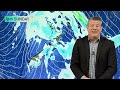
- NZ - Australia - South Pacific --- A fairly text-book spring pattern continues in the Southern Hemisphere as a Sudden Stratospheric Warming (SSW) event over Antarctica adds a bit more "oomph" to the usual spring westerly chaos.
For the most part Spring 2025 is what we'd call a typical "classic spring" with a mixture of lows and highs moving through - but there's also a definite boost in westerlies across New Zealand and the southern half of Australia.
Despite the blustery spring for some, those in northern Australia continue to lean drier - but more signs of the wet season are now showing up as thunderstorms and tropical showers start to develop. More low pressure is also forming in the north, although not yet producing much rain.
Eastern New Zealand is also drying out, while the west of NZ and the deep south of the South Island remain average to maybe wetter than average in some locations.
Despite near La Nina conditions now develop...
- Title
- NZ: Weekend low followed by windy westerlies next week
- Runtime
- 8:34
- Date posted
- 11 months ago
- Description
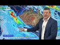
- Low pressure is moving into New Zealand this weekend bringing some rain and showers, before exiting the country next week, ushering in more windy westerlies.
The westerly flow looks set to remain off and on for the next week or two as we enter what is typically one of the windiest times of the year for NZ.
Westerlies also bring heavy West Coast rain - and drier conditions to the east. We have your full NZ forecast for 7 days, through to next Wednesday.
- Title
- OZ: Severe weather boxes make a return as spring does its thing
- Runtime
- 9:03
- Date posted
- 11 months ago
- Description
- We have some pockets of severe in the coming days, once again it's mostly in the south-east and south-west of the nation as spring storms continue to churn by.
Sinking low pressure in the tropics will also help feed hotter weather for many northern, central and western region - and for those in the south you'll get both hot and cold airflows in the mix.
We cover the Big Picture, helping you make sense of what is driving your local weather forecast.

- Title
- NZ: Southern snow, weekend low pressure nationwide - windy westerlies next week
- Runtime
- 8:02
- Date posted
- 11 months ago
- Description
- Low pressure exiting Australia will move into New Zealand this weekend bringing rain and showers into both main islands. Before this arrives a wintry southerly moves into the South Island tonight, bringing snow down to just 300 or 400m for a time, before clearing on Wednesday.
Frosts, some heavy, are expected through the South Island's interior, especially Northern Southland.
Warmer winds come in ahead of the weekend low pressure - then next week, windy westerlies are expected to crank back up again.
*Programming Note: Our next ClimateWatch monthly forecast is out later on Wednesday afternoon covering NZ, Australia and the South Pacific over the next few weeks ahead.

- Title
- Oz: Spring blasts continue in south as tropical heat sink southwards too
- Runtime
- 8:38
- Date posted
- 11 months ago
- Description
- Low pressure will bring further rain, showers - and even some snow - into parts of Australia's south-east over the coming week, but hot air is sinking southwards too, with the tropical boundary even reaching the Great Australian Bight by Sunday.
Also on Sunday, a polar blast may be coming into (or near) WA's south-west - this brings real ups and downs wih the temperatures along the southern coastline in particular.
Apart from a few isolated thunderstorms/showers most other states and territories are fairly quiet still, although westerlies may be gusty south of Sydney at times.

- Title
- NZ: We explain the Sudden Stratospheric Warming (SSW)
- Runtime
- 8:28
- Date posted
- 11 months ago
- Description
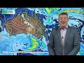
- Cold fronts, subtropical winds, Australian airflows, polar air, highs and lows - that shapes up NZ's next 7 days as weather as peak spring weather continues.
We also explain the Sudden Stratospheric Warming occuring high up in the skies above Antarctica and what that very generally means for the weather in our part of the world (basically, more spring-like!).
NZ's weather forecast is covered through until Sunday with rainfall out to then too.
- Title
- Oz: Showers & thunderstorms spread east next week
- Runtime
- 7:07
- Date posted
- 11 months ago
- Description
- Wintry weather continues off and on in the south and south-east of the nation at times, but next week thunderstorms and downpours/showers will spread eastwards into Qld and NSW, along with NT and the A.C.T.
In SA, Vic and Tas large lows in the area will bring varying wind directions and speeds, with a burst of wet weather likely in Victoria and Tas next week, with some spillover northwards into NSW and the A.C.T.
The Tasman Sea has showers for Lord Howe Island, while Norfolk Island is closer to high pressure for much of the time.
WA has a few showers - but high pressure is trying to expand there in the coming week.
Have a great weekend - catch you again on Monday!

- Title
- NZ: Weekend weather, daylight saving begins - and how October will kick off
- Runtime
- 6:50
- Date posted
- 11 months ago
- Description
- A cold front is moving up NZ today bringing West Coast thunderstorms and windier weather into a number of regions, especially going into the North Island.
Saturday morning will be colder for some, with the chance of frosts through the South Island's interior and sheltered areas - this frost risk melts on Sunday as windier nor'westers kick back in again.
Monday kicks off wil cooler air - and by later next week windier, warmer, subtropical or Australian nor-westers will move in, along with some calmer days too.
We have your full forecast for the next 7 days ahead - and a reminder Daylight Saving starts on Sunday, spring your manual clocks forward one hour.

- Title
- Oz: Some rain for Vic, while heat & humidity increases in tropics
- Runtime
- 7:08
- Date posted
- 11 months ago
- Description
- Some wet weather may be coming in to parts of Victoria next week as showers continue today in Australia's south-east.
It's a fairly quiet weather forecast for many people but we do see tropical heat expanding southwards, sparking some showers next week.
In Western Australia high pressure is trying to move in - but not fully doing it, so a few southern showers are likely, and also at the very top of Kimberley.
SA and the south-east have windy weather at times - especially TAS - and some of the windy westerly weather will spillover into parts of NSW.
![[Thursday] RAGASA & now BUALOI (Opong): Vietnam, Philippines, South China](https://i.ytimg.com/vi/zDU6d5Vibyw/1.jpg)
- Title
- [Thursday] RAGASA & now BUALOI (Opong): Vietnam, Philippines, South China
- Runtime
- 6:14
- Date posted
- 11 months ago
- Description
- As Ragasa falls apart today over northern Vietnam a new typhoon is strengthening east of the Philippines.
This next typhoon is named BUALOI - but locally in the Philippines is also named "Opong".
At this stage the Philippines may have some localised wind damage, but rain may be a bigger problem with 300mm+ falling in some locations.
But it's what happens to BUALOI once it leaves the Philippines this weekend and heads out westwards over the South China Sea. This storm may grow into a much more powerful system on Sunday and Monday as it potentially heads to Vietnam of Hainan Island/South China. Computer modelling is in agreement about general tracking - but not intensity.
Please note - for now this is our final update on the current typhoon activity - we will be monitoring BUALOI on Friday and this weekend incase things change. If they do, we may provide another update.

- Title
- NZ: Polar air, subtropical air, gales, sunshine and showers
- Runtime
- 8:04
- Date posted
- 11 months ago
- Description
- Peak spring weather continues over NZ with another windy, colder, surge of weather this weekend and again early next week. However we're seeing more mixing of airflows over the next week - in other words, not always cold. Subtropical and Australian airflows will be added into the mix, along with the surges of polar air.
Basically this set up brings more windy weather - but some periods of calm too, as high pressure zones skirt to the north of NZ and the big storms remain well to our south.
Westerly driven weather is the main feature of NZ's weather pattern over the next 7 days.

- Title
- Oz: Polar air won't quit the south-east, as weather settles elsewhere
- Runtime
- 9:11
- Date posted
- 11 months ago
- Description
- Stormy weather continues off and on for the south-east of Australia with gusty westerlies going as far north as about Sydney/Blue Mountains in the coming days.
Windiest will be Tasmania and the southern portion of the Great Dividing Range, while Victoria is also a bit windy at times.
Most of the rain/showers will be in western Tasmania, but also Victoria - especially next week with a chance of some soaking rains moving through - but it's not for everyone.
We bring you the latest Australia-only forecast + your 7 Day rainfall map (not much to see for many places though!).

- Title
- NZ: Cold fronts, windy surges - but dry/sunny spells for many too
- Runtime
- 8:26
- Date posted
- 11 months ago
- Description
- In true spring style the weather is all over the place, but continues to be westerly driven for the most part over the rest of this week, weekend and into next week.
There are a few surges of polar air over the coming week - this will keep temperatures down in the South Island and into the North Island at times too.
But the winds aren't all cold - some subtropical wind is around today, and over the next several days we see milder airflows back in the mix too.
Monday next week kicks off with a cold and windy change though - before (hopefully) some high pressure briefly visits.
![[Wednesday] Typhoon RAGASA update - Hong Kong, China mainland, Vietnam](https://i.ytimg.com/vi/hD8bGOSkkmw/2.jpg)
- Title
- [Wednesday] Typhoon RAGASA update - Hong Kong, China mainland, Vietnam
- Runtime
- 10:58
- Date posted
- 11 months ago
- Description
- [Happening Now] --- We have the very latest maps and tracking this morning as Typhoon Ragasa reaches its closest point to Hong Kong - and then will move further in mainland China across today and tonight with landfall expected later.
We track the damaging winds, the heavy rain - and a new typhoon forming behind it for the Philippines and potentially Hainan Island and Vietnam later this weekend or early next week [this is not yet locked in].
Ragasa is a very serious and potentially catastrophic typhoon for those in its path.

- Title
- Oz: Showers, polar air and a lot of sunshine
- Runtime
- 10:46
- Date posted
- 11 months ago
- Description
- Wintry weather will continue off and on around Tas and Vic over the coming week with gales, a dusting of snow higher up and more showers (especially Tasmania).
Elsewhere there are bursts of windy weather - but nothing too major, along with large areas of dry.
We also have a look at marine conditions on Thursday, as storms in the Southern Ocean send large waves up around Tasmania and even into parts of NSW.
We have your 7 day Australia only forecast from today to next Tuesday.
![[Tuesday] Typhoon RAGASA - Latest tracking, maps & rainfall](https://i.ytimg.com/vi/gIa7gqKV1tA/2.jpg)
- Title
- [Tuesday] Typhoon RAGASA - Latest tracking, maps & rainfall
- Runtime
- 10:15
- Date posted
- 11 months ago
- Description
- We have the latest tracking as Typhoon Ragasa clears the Philippines and heads towards Hong Kong and China.
We explain how powerful the storm is compared to yesterday and where the worst wind and rain will likely be in the coming days.
Latest guidance suggests Wednesday morning will be peak wind/rain for Hong Kong and by Wednesday Evening the storm will be a few hundred kilometres west of the city.
Our next update will be issued on Wednesday morning.

- Title
- NZ: Tracking the next surge(s) of gales & polar air
- Runtime
- 8:37
- Date posted
- 11 months ago
- Description
- The unsettled westerly driven weather pattern continues - although a subtropical flow for the upper North Island brings northerlies and some rain today and tonight and into Wednesday.
Later this week more windy westerlies return with polar air - especially central and southern NZ.
Monday next week kicks off with a polar change and more windy south-westerlies - but this may be ahead of a high pressure zone for the first of October.
![[Monday] Super Typhoon Ragasa (Hong Kong, China, Philippines, Taiwan, Vietnam)](https://i.ytimg.com/vi/bAcCWCo_S2A/2.jpg)
- Title
- [Monday] Super Typhoon Ragasa (Hong Kong, China, Philippines, Taiwan, Vietnam)
- Runtime
- 9:16
- Date posted
- 11 months ago
- Description
- (DEVELOPING) The latest on Super Typhoon Ragasa (Nando) as it is expected to head towards Hong Kong on Wednesday with flood, landslide and significant wind damage potential.
The Super Typhoon is forecast to have air pressure go down to 894hPa (millibars) in the coming 24 to 48 hours as it moves into the South China Sea and heads closer to Hong Kong then mainland China further to the west.
We have the latest tracking, rainfall and wind maps to make sense of it all.
Our next update will be before 2pm Tuesday NZST (10am Tuesday Hong Kong time) as this is a developing situation and the forecasts are not yet locked in.
Follow the Hong Kong Observatory for all local official warnings.

- Title
- Oz: High pressure grows, but not in the south-east
- Runtime
- 9:20
- Date posted
- 11 months ago
- Description
- A large anticyclone will help calm the winds and bring more dry weather than wet - but Tas and Vic are still most exposed to wintry snaps and windier weather.
Windy weather may be a feature at times across Australia, but damaging winds are less likely. In saying that, Tas, Vic, the A.C.T and NSW all have some wind damage risks (but short lived) as the westerlies continue.
The polar air flow is stuck over Tassie at times this week - no significant change from recent weeks.
We have your Australia weather forecast out to this Sunday.
Programming Note: We also have a special video update today on Super Typhoon Ragasa which is aiming towards Hong Kong and China in the next two days.

- Title
- NZ: Windy westerlies won't quit - and who gets the rain this week
- Runtime
- 8:23
- Date posted
- 11 months ago
- Description
- Rain will cross the North Island over the next two days as the next cold front also approaches the South Island - bringing burst of rain and varying temperatures.
By Wednesday the westerlies begin to return with potentially damaging gusts on Friday and into the weekend (although not as intense as the past week has been for most places).
We track the wind, rain and snow - and who gets the sunshine - with your NZ forecast through to Sunday.
*Programming note - we have a special video update today on Super Typhoon Ragasa which is near the Philippines and is heading towards Hong Kong and China.

- Title
- OZ: Thunderstorms, polar air - and one huge high
- Runtime
- 9:12
- Date posted
- 12 months ago
- Description
- Hello, Kia ora, G'day! -- A large high pressure zone is trying to move into Australia but the slow nature of it means more polar bursts of air in the south-east, with one even reaching near Queensland for a time (bringing a cold blast to Tas, Vic, the A.C.T and parts of NSW).
High pressure will building in WA and SA drying the skies out over the coming week with lighter winds too.
Some frosts are forecast for Australia this weekend and next week - check your local forecast provider for more local info on your temperatures.
We're also tracking thunderstorms today and into the weekend plus the potential for a Super Typhoon in (or near) Hong Kong and China next week.
*Programming Note: It's possible our Monday video may be delayed a couple hours. It's not for sure, but in case it's late here's your heads up! Have a great weekend 🙂

- Title
- NZ: Heavy rain, frosts, gales & a solar eclipse - how the next week is shaping up
- Runtime
- 10:39
- Date posted
- 12 months ago
- Description
- High pressure is briefly bringing a bring to the wind and rain for many over Friday and Saturday - but gales return to the South Island overnight Saturday and across Sunday - with windy nor'westers reaching "damaging" criteria around the Southern Alps. These strong winds move further into the North Island on Sunday but also ease by night time.
Rain may also become an issue in the north-west corner of the South Island (like Tasman region) and up to about Mt Taranaki. Keep up to date with MetService warnings and watches.
Monday, for the partial solar eclipse, looks a bit unsettled - with cloudy weather covering large parts of NZ. Don't forget the free WeatherWatch NZ App, and our RuralWeather.co.nz website has cloud forecasts for every NZ location under "Trends" to help guide you.
Next week some wet weather continues as another low moves in from the Tasman Sea bringing more windy westerlies at times. But for some, it may not be as cold next week as...

- Title
- Oz 7 Day: Warmer before cooler + huge high on the way
- Runtime
- 10:50
- Date posted
- 12 months ago
- Description
- Warmer weather with downpours and thunderstorms is spreading across northern and eastern parts of Australia ahead of colder/cooler air arriving early next week.
Storms in the Southern Ocean area will still blast past Tasmania bringing gale westerlies at times to the south-east. Parts of WA may also have windy easterlies for a time too - but this is due to high pressure building in southern WA.
Next week a large high pressure zone (anticyclone) moves into southern Australia - but affects much of the continent with drier conditions (and cooler/colder in the east to south-east).
Frosts are possible inland this weekend (check your local forecast for more details) and some snow as the polar line briefly reaches southern Queensland early next week (and is very short lived).
Today's Flight Sim flyover is Rottnest Island, just off the coast of Perth!

- Title
- NZ: Frosts, gales - but then an uptick in temperatures next week
- Runtime
- 8:43
- Date posted
- 12 months ago
- Description
- There may be a bit of a breather coming for those tired of the wind and cold - but in spring style it's "complicated".
The next polar surge is moving up NZ today and Friday, before easing this weekend. This brings in frosts for Friday (South Island mostly) and again Saturday (now spreading into the upper North Island).
Next week we may have subtropical winds in the mix - but this might also fuel a narrow area of heavy rain. This is worth monitoring - but nothing yet is locked in (top of the South Island, western North Island).

- Title
- Oz: Tropical downpours, but more polar air coming
- Runtime
- 9:28
- Date posted
- 12 months ago
- Description
- Scattered thunderstorms will develop over the top half of Australia in the days ahead, with wind, rain and polar air returning to the south-east (did it even go away?!).
In fact, a cold change may even push into Queensland - but first, warm weather will continue.
We track the southern blasts still on the way - but also a giant high pressure zone slowly moving in from the Indian Ocean, ushering in drier, calmer and colder weather for some.

- Title
- NZ: Severe weather risks as next blast moves in, frost risk to follow
- Runtime
- 8:32
- Date posted
- 12 months ago
- Description
- Severe gales, subtropical winds, polar air, mountain snow and widespread frosts are all in the forecast for the coming days ahead - including some sunny, dry, weather as well!
A cold front is moving up NZ today and tomorrow with gales and warm, windy, nor-westers - followed by a colder south to south-west flow.
This weekend high pressure briefly moves through - bringing another surge of windier weather as it departs, and yet another cold front behind it all.
We break it all down for you in today's New Zealand weather video.

- Title
- Oz: Westerly gales in south-east as tropical showers increase
- Runtime
- 11:53
- Date posted
- 12 months ago
- Description
- (Sorry for the late publish!) The spring gales will continue off and on, especially over Tassie and Australia's south-east, meanwhile in the tropical region we're seeing more showers and thunderstorms develop over the week.
Today's video is a little longer than usual as we added a few wind gust maps to it all to make sense of some of the peak windy moments.
We have your Australia only forecast for the rest of this week, the upcoming weekend - and how next week is kicking off!
*Late publish today was due to internet issues at our end (for 7 days now) - hopefully finally resolved once and for all.

- Title
- NZ: Several cold fronts for rest of September - we track the next two fronts
- Runtime
- 8:48
- Date posted
- 12 months ago
- Description
- More windy westerlies, sometimes damaging, are on the way as cold fronts with polar air continue to blast over New Zealand.
We track the peak winds over the next several days and when the cold fronts arrive.
Much of the rain will be on the West Coast, with some spillover into Southland and also a bit into the east - but generally speaking the east of NZ has the lowest rainfall totals.
There's even a subtropical flow in the mix for a time too as the classic spring set-up continues. Traditionally mid September to mid October can be the windiest time of the year in New Zealand.

- Title
- OZ: More southern gales but now northern showers/thunderstorms
- Runtime
- 9:46
- Date posted
- 12 months ago
- Description
- More stormy weather is brushing southern parts of Australia while tropical/northern areas see an uptick in scattered showers and inland thunderstorms in the week ahead.
Most places don't have large amounts of rain, but the hills and mountains in Victoria, the west coast of Tasmania and the south-west of WA are looking to the be the wettest - and maybe a part of the tropical eastern Queensland coastline too.
We track the damaging wind potential and temperature changes over the week ahead too.

- Title
- NZ: Damaging gales possible this week & weekend as spring winds continue
- Runtime
- 8:27
- Date posted
- 12 months ago
- Description
- More gusty westerlies are in the forecast this week and weekend with gales and damaging gales possible.
Rain will be heaviest on the West Coast, while eastern areas look driest.
We bring you the forecast through to Sunday, plus upcoming 7 day rainfall - and we highlight the windiest moments coming up.

- Title
- Oz: High pressure expands, but more severe weather in the south
- Runtime
- 9:14
- Date posted
- 12 months ago
- Description
- Lighter winds and drier skies are returning to a number of places that have had thunderstorms and rain/showers - but gales, polar air and heavy downpours/thunderstorms are going to return to the southern half of WA on Sunday and this spreads eastwards towards Vic, NSW and Tasmania for early next week.
We track the highs, lows, thunderstorms and temperature swings for the coming weekend and across next week for Australia.

- Title
- NZ: Tracking the spring westerly gales over the coming weekend & next week
- Runtime
- 8:53
- Date posted
- 12 months ago
- Description
- Surges of windy weather, with some damage potential, is in the NZ forecast off and on for at least another week, if not the rest of September.
High pressure north of NZ and low pressure south of us is why we're in the middle of spring westerlies.
Although, for Friday, low pressure is crossing the North Island with some rain and showers - as this clear tonight it ushers in a very windy Saturday nationwide - easing back later on Sunday.
Next week westerly quarter winds and cold fronts continue.
We also have your 7 day rainfall outlook for New Zealand.
Have a great weekend!

- Title
- Oz: 7 Day outlook as southern storms continue
- Runtime
- 9:33
- Date posted
- 12 months ago
- Description
- A stormy low in the Tasman Sea today will move to NZ tomorrow, with powerful high pressure settling things down across large parts of Australia - but it's only temporary. The next southern storm arrives in WA's south-west on Sunday, and spreads eastwards along the southern coastline going into next week with pockets of severe weather and wintry airflows.
Tropical areas see a few showers and isolated thunderstorms - otherwise mainly dry.
We have Australia's 7 day rainfall outlook.
This week's flight sim flyover is Dalby, Qld (and also Ducklo!).

- Title
- NZ -Stormy Saturday as gales move in nationwide
- Runtime
- 8:39
- Date posted
- 12 months ago
- Description
- A low pressure zone (currently exiting Sydney area) will quickly track across the Tasman Sea today, with rain and some winds developing in northern NZ tonight and into Friday for the North Island. At the same time as the low arrives in the north, a windy, colder, south-westerly change will move in - this peaks on Saturday nationwide with potentially damaging gusts in a number of regions in both islands.
In true spring style it eases for many on Sunday - only for windy westerlies and more cold fronts to return next week as high pressure tracks north of the country.

- Title
- Oz: Downpours & Gales in the mix, high pressure returns for some too
- Runtime
- 9:53
- Date posted
- 12 months ago
- Description
- A low is tracking across NSW today bringing rain, showers and thunderstorms with it. Windy west to north-west winds are ahead of the low, with a colder, windy, southerly or south-westerly behind it.
Colder air moves into the south-east over the next couple of days - along with a burst of coastal gales for NSW as the low departs.
But high pressure comes in behind this - bringing settled weather for many regions... although the next cold front and burst of gales approaches south-western WA going into Sunday and Monday - and that heads eastwards for early next week.

- Title
- NZ: Surges of spring gales, low pressure and some polar air all in the mix
- Runtime
- 8:40
- Date posted
- 12 months ago
- Description
- Windy weather isn't finishing anytime soon with westerly quarter winds blowing off and on over the coming several days.
Low pressure will exit New South Wales tomorrow and by Friday that low will move over the North Island bringing some messy wet weather that isn't totally locked in yet.
As the low departs eastwards on Saturday another surge of westerly quarter gales move in.
Next week high pressure is north of NZ - encouraging more westerly driven weather.
We have your NZ forecast through to Tuesday.

- Title
- Oz: Thunderstorm outbreak + who gets sun/dry vs cloud/wet
- Runtime
- 9:03
- Date posted
- 12 months ago
- Description
- A long line of thunderstorms stretches from the Kimberley south-east down to NSW today, with a low near SA moving into Vic & NSW/A.C.T going into the next day or so.
There are a lot of moving parts - but the general theme is a low moving east over NSW/Vic bringing pockets of severe weather - as high pressure returns behind it (a huge high!).
After the high, the next cold front pounces on southern WA late this weekend - bringing another chance of damaging winds, squally showers and thunderstorms.
In the tropics a little more life is showing up - in the form of showers and weak low pressure. No major shifts yet from your dry season to the wet.
*Please note, due to broadband issues in our studio this week, today's video is again recorded at 720p and not 4K (ie, Standard Definition not High Definition) due to uploading times to YouTube. We aim to be back to normal in the next day or two. Apologies if this causes any visual issues at your...
- Title
- NZ: Spring gales, frosts, sunshine & thunder - about as spring as it gets!
- Runtime
- 8:49
- Date posted
- 12 months ago
- Description
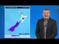
- Weather energy from Australia and the Tasman Sea will bring a surge of gales, thunderstorms, downpours and temperature changes to New Zealand over this week and the coming weekend as spring weather continues on.
We cover the peak blasts of wind, the latest frost maps - and who gets the wet stuff, and who stays dry with plenty of sun.
Your New Zealand weather forecast covered out to Monday of next week.
*Please note, due to broadband issues in our studio this week today's video is again recorded at 720p and not 4K (ie, Standard Definition not High Definition) due to uploading times to YouTube. We aim to be back to normal in the next day or two. Apologies if this causes any visual issues at your end. This slower connection is also limiting our ability to reply/like comments sent in to us via YouTube, but we're still reading them all! 🙂





