WeatherWatchTV
Oz: Some pockets of heavy rain, otherwise dry skies & temperature changes

- Title
- Oz: Some pockets of heavy rain, otherwise dry skies & temperature changes
- Runtime
- 8:26
- Date posted
- 6 months ago
- Description
- Heavy rain in parts of Qld continues today but eases going into Tuesday for most places, as high pressure dominates the skies further southwards.
A southerly change will move eastwards along the southern coastline this week, and while a brief warming up period mid-week for parts of NSW and SE Qld, that slightly cooler airflow will be in the mix at some point.
We track the highs and lows generating Australia's weather as we head into the middle of the month of March and Autumn's weather pattern continues to form in the south.

- Title
- NZ: Subtropical low vs subantarctic energy = typical early Autumn setup
- Runtime
- 7:21
- Date posted
- 6 months ago
- Description
- A low pressure zone leaving Queensland tonight may brush the very top of the North Island midway through this week bringing cloud, some showers or rain, and a building easterly quarter flow.
But this week kicks off with both a southerly flow (fading) and high pressure again in our area.
By the end of the week a colder southerly comes back in again, with some windy weather around Friday and/or Saturday, before easing again further on Sunday.
High pressure is still the more dominant force to New Zealand's weather despite energy from both the subtropics and subantarctic region both trying to move in - a classic Autumn setup.

- Title
- Oz: Qld, NSW & NT wet weather potential, cold change in the south next week
- Runtime
- 9:34
- Date posted
- 6 months ago
- Description
- A number of tropical lows are bringing areas of wet weather around northern Australia, with Queensland looking to have the most widespread rain and showers in the days ahead. The low pressure zones around Queensland are messy in shape, which means rainfall is also messy with some places leaning fairly dry, others more exposed to significant daily rainfall.
NSW, the NT and WA also have wet weather potential - we have the maps to explain it.
Next week a colder southerly change may create wet weather in southern parts of WA, SA, Vic and into Tas too - this far out rainfall totals aren't really known, but showers look likely with the colder airflow, while heat may expand in some other parts of Australias. The ups downs of Autumn coming in for the south.
Have a great weekend!

- Title
- NZ: Subtropical low next week worth monitoring as high pressure controls all
- Runtime
- 8:58
- Date posted
- 6 months ago
- Description
- High pressure smothers NZ today and will weaken a little on Sunday and Monday to allow a cooler southerly flow to head northwards, then expands back over the country again next week.
However, also next week, a new low pressure zone that will form east of Brisbane will move towards the upper North Island. It's all about high pressure in the NZ area though - some weakness or movement away with that high pressure zone could see rain and wind move into northern NZ...likewise, of the high gets more powerful or drifts just a little closer back to NZ it could hold that subtropical low mostly offshore.
We show you the latest maps - and how next weekend might have another taste of Autumn with the next bigger cold front possible.

- Title
- Oz: Coral Sea low, heavy rain risks Qld & Top End
- Runtime
- 9:54
- Date posted
- 6 months ago
- Description
- A tropical storm lies over the Coral Sea and will drift towards the northern Queensland coastline but will also likely weaken, making it more of a rain event. The low itself is fairly weak and messy - and that means, unlike a powerful storm, it hasn't got a clear path so rain will be broken up, and there's uncertainty about how much of the heavy offshore rain will make it to land/inland. (see our 7 day rainfall maps at the end to see what we're talking about).
NSW has heavy downpours, mainly around the Great Dividing Range and to the east and north, but many other parts of Australia are dry, or mostly dry. The Top End and Katherine are also exposed to monsoon rains, along with FNQ.
Heat will also become more of a factor for southern WA, SA and Qld in the days ahead - and may expand over NSW for a time mid-next week.

- Title
- NZ: High pressure in charge, but also monitoring a tropical storm
- Runtime
- 8:30
- Date posted
- 6 months ago
- Description
- High pressure continues to dominate NZ's weather as a tropical cyclone forms in the Coral Sea today. The cyclone, which may not even be named due to its short-lived nature up near Cairns, may end up drifting towards the upper North Island mid-next week, but high pressure in the NZ area may rip the low apart. We show you the latest tracking.
A colder change on Sunday in the South Island will move into the North Island on Monday - but isn't looking too significant for most places, especially with high pressure still dominating much of the weather around NZ going into next week.
The tropical storm near Queensland today may well reform into a new low pressure system next week as it drifts down towards NZ - but high pressure in the NZ area may hold it away from us.
We also have a 7 day rainfall map to make sense of where any showers will likely be.

- Title
- Oz: Tonight's lunar eclipse + Qld may be next for rain
- Runtime
- 9:49
- Date posted
- 6 months ago
- Description
- There are four tropical lows directly around northern Australia as high pressure expands over southern states bringing drier weather.
Of the four lows only one may become more significant, and at this early stage it might be the one over the Coral Sea, which has chances of drenching parts of eastern Queensland (anywhere along the coastline) and even making it further inland central and southwards. We should be able to lock this in with more detail in our Thursday update.
For now we have fairly similar weather each day coming up with heat sinking southwards in WA this weekend, and large dry areas for many other places.
NSW has shower chances for a number of days ahead as the low, that was over central Australia last week and brought the rain to SA and Vic in particular, falls apart over the next day or so across parts of NSW as far less intense set-up.
*Programming Note:
Phil is away tomorrow so we have NO VIDEO on WEDNESDAY. W...

- Title
- NZ: Rare blood moon lunar eclipse tonight + Yes, NZ's weather is warming back up again
- Runtime
- 9:11
- Date posted
- 6 months ago
- Description
- We had our coldest morning of the year so far today and tonight will also be a little cool (but not as cold for most as last night) with a southerly flow helping to make for clearer skies in many regions for tonight's rare full lunar eclipse. Tonight's lunar eclipse is a rare "blood moon" - making the moon change to a red/orange colour as earth perfectly blocks the sun's sunlight for a time and our atmosphere changes the colour of the light that makes it to the moon. We have the latest forecast for that, with it occuring mid to late tonight and peaking just after midnight.
Weatherwise for the rest of this week - it's all about high pressure and mostly dry skies and lighter winds. Temperatures lift on Wednesday, then further going into Thursday and Friday as subtropical and/or nor'westers return.
But this weekend another, weaker, southerly flow moves up the South Island on Saturday and fades out over the North Island by Sunday, bringing another (smaller than to...

- Title
- ClimateWatch: MARCH pattern is looking quite orderly to start with
- Runtime
- 11:10
- Date posted
- 6 months ago
- Description
- Storms near Antarctica, Autumn's westerlies building south of Australia & NZ, high pressure again affecting both nations and the tropics has low pressure - those are the layers of weather over the coming weeks which, for the most part, are sticking to their lanes. Of course March is the peak of the tropical cyclone season, so any tropical storm can break a long range outlook, but for the most part we're seeing drier weather in southern Australia and large parts of NZ, while the tropics get more active - especially around Australia.
We track the highs and lows on the way, the status of La Nina (continues to weaken and should be gone soon) and the chances of El Nino forming later this year.
We also look back over the past month to track soil moisture levels in NZ and Australia, and sea surface temperatures right around Australasia and the south-west Pacific.
ClimateWatch videos are a monthly outlook tracking the weather patterns and climate drivers.

- Title
- Oz: Tropics wake up this week as southern skies dry up
- Runtime
- 8:23
- Date posted
- 6 months ago
- Description
- Rain and showers continue in the south-east, but is finally starting to break apart and clear as we go into Tuesday. There has also been some heavy rain south of Cairns over the past day or two, and north of Sydney over thew weekend.
Now the attention shifts to the tropics as high pressure dominates the south of Australia, bringing a mostly dry week (once today/tomorrow's wet weather clears).
A series of tropical lows will spin up over the coming week, with some chances of a tropical cyclone - but because there is so much low pressure it's a bit tricky to work out in advance which one may become a storm. For now, we're monitoring the potential rain, wind and tracking of these lows, and we'll have more details tomorrow and in the days ahead.

- Title
- NZ: Colder tonight for many, Lunar eclipse Tuesday, high pressure dominates
- Runtime
- 6:20
- Date posted
- 6 months ago
- Description
- A lot of low pressure is spinning east of the country while a large high is moving in - this creates windy southerlies and south-easterlies in a number of regions today and into tomorrow (especially eastern parts of the North Island) with cloud and showers in the east easing over the next 24 hours.
A rare "blood moon" lunar eclipse is tomorrow night (Tuesday night/Wednesday AM) over NZ - we have the cloud forecast for that (and go to www.RuralWeather.co.nz to see hourly cloud graphs for your part of NZ).
High pressure builds this week, warmer air comes in later in the week - and most regions are dry, or mainly dry.

- Title
- Oz: Heavy rain for parts of SA, NSW, Vic - then all eyes on the tropics
- Runtime
- 11:05
- Date posted
- 6 months ago
- Description
- More heavy rain, downpours and thunderstorms for southern states are on the way this weekend as low pressure sinks southwards and finally falls apart by the start of next week. This will bring again some narrow but heavy areas of rain with flooding potential, especially if rain/showers stall and significantly increases totals. Not everyone in these states will get heavy rain but we breakdown which areas are most exposed to it.
Many other parts of Australia are dry but eastern states have showers and some pockets of rain setting in, but rainfall totals aren't as great in the east as those in central/southern parts of the country.
Next week a series of tropical lows are worth tracking as at least one, and maybe two, might become tropical cyclones around northern WA and the NT. We update you on that.
And the 3 different rain forecast maps at the end - to help make sense of it all.
Have a great weekend, catch you again on Monday.

- Title
- NZ March Madness: Tropical Cyclone URMIL, a cold change and a 'mountain range of high pressure'
- Runtime
- 9:55
- Date posted
- 6 months ago
- Description
- March often brings in some wild changes in our weather - and we do have both a tropical cyclone north of NZ and a brief polar southerly moving up eastern NZ as we go into Sunday and early next week. But despite those big systems, the main feature of New Zealand's weather over the coming week will be mostly high pressure and drier skies.
In fact by the middle to later part of next week one anticyclone centred east of NZ may stretch from Sydney, over the Tasman Sea and NZ, out past the Chathams and the International Date Line and extend almost 7000km across from west to east. It's like a mountain range of high pressure it's so large.
The tropical cyclone near Vanuatu has now formed (as of Friday Feb 27) - but at the time of recording this it was yet to be officially named by the Fiji Met Service. On Friday afternoon it was officially named Tropical Cyclone URMIL.
We've done some research and from what we can see this is the South Pacific's lates...

- Title
- Oz: Weekend downpours/rain in SA, Vic, NSW, + monitoring the tropics next week
- Runtime
- 10:27
- Date posted
- 6 months ago
- Description
- Wet weather returns to southern parts of Australia this weekend and into early next week with some hit and miss pockets of significant rainfall in 24 hour periods - but it won't be for all. We break down which areas are most exposed to wet weather - and which areas are borderline, and those that look dry.
It's still a bit of a messy set-up but 7 day rainfall maps show a similar story of rain in central and southern Australia spillover eastwards going into next week around Vic and southern NSW after likely bringing decent rain to parts of SA first.
The tropics is fairly quiet at the moment, with the usual thunderstorms and rain/showers - but next week a few lows will be worth tracking as they could deliver more severe weather risks.
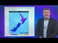
- Title
- NZ: Monday's temperature drop, latest on tropical low, + more high pressure in early March
- Runtime
- 8:45
- Date posted
- 6 months ago
- Description
- A cold front is today (Thursday) moving up the South Island, falling apart over the North Island going into Friday/Saturday. On Sunday an even colder change will move up NZ, dropping temperatures going into Monday and making for a cooler/colder Tuesday morning.
While all of this is happening a tropical low will be exiting the tropics, and likely will remain north-east of NZ as it passes by early next week. For now it poses no real threat to New Zealand, but is one to keep an eye on.
Next week, warmer, drier, weather moves back in as high pressure grows again - lifting temperatures following the colder/cooler start to the week.
+ We have a 7 day rainfall map to make sense of it all.
**SMALL ERROR**
- Please note on the Monday map Phil accidently says "eastern Northland" instead of "western Northland" with regards to where the driest weather should be.
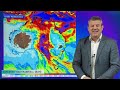
- Title
- Oz: Weekend rain chances in south, tropics may wake up next week
- Runtime
- 10:34
- Date posted
- 6 months ago
- Description
- There are more chances of saturating rain in parts of southern Australia over the next several days, especially from this weekend onwards as low pressure in the heart of Aussie sinks southwards. But offshore winds south of Australia may play a role in where that convergence line will be - so there is still decent uncertainty about precisely how widespread these thunderstorms, downpous and localised heavy rain will become.
In a nutshell SA is most exposed to the incoming wet weather chances, along with parts of NSW, Vic and the NT. When it comes to set-ups like this it can be helpful to compare various rain forecast maps from different models - some find it confusing as they just want "the answer" but in messy set-ups of instability seeing a few different view points can help you work out if you're in a "dry zone", a "heavy rain zone" or on the edges of it all - and that in itself can be useful at building up (or lowering) your own confidence of rain chances at your place. ...
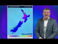
- Title
- NZ: High pressure, cold fronts & a potential offshore tropical storm
- Runtime
- 9:23
- Date posted
- 6 months ago
- Description
- We still have summer weather left - but as end the month of February and kick off March we do have a couple of cold fronts that will definitely bring an Autumnal feeling to most regions around Sunday and Monday.
The first cold front comes in tomorrow/Thursday - then moves into central parts of the country (Upper SI, lower NI) on Friday with some showers or patchy rain. By Friday northern and southern NZ should be dry or mainly dry. But also on Friday a tropical low near Vanuatu does have the potential to become a tropical cyclone - and it will likely strengthen this weekend out at sea north of New Zealand.
By Sunday a strong high pressure zone will be offshore west of the lower South Island - this placement will usher in a colder/cooler southerly, especially for Monday March 2nd. That's also when we expect the tropical low to be north-east of NZ where, hopefully, it will remain - falling apart around the Chatham Islands next week as it merges with other low pr...

- Title
- Oz: Update on the "hit & miss" rain in the south & south-east
- Runtime
- 11:32
- Date posted
- 6 months ago
- Description
- Today's video is again mostly focused on the wet weather chances across SA, NSW and Vic as low pressure spins over southern NT and creates areas of rain, thunderstorms and showers/downpours. We explain why the rainfall maps are so frustrating for some that need rain, and why even some people in the high risk rain areas may still be missing out. This is what we call "hit and miss" rainfall - when it's not one big front sweeping through with almost guaranteed rain, but insead downpours that are yet to develop - and so exact placement, especially more than 48 hours out, can be tricky.
Elsewhere around Australia there are a few rainy areas and showery spots - but also some large dry zones with not a lot of change on the way in the coming week. If we're not talking about your part of Australia it's likely because there isn't a lot of weather changing there.
We cover the Big Picture driving the weather around Australia - and also monitor a potential tropical cyclon...

- Title
- NZ: Monitoring potential tropical storm + southerly change arrives Sunday
- Runtime
- 9:58
- Date posted
- 6 months ago
- Description
- High pressure smothers New Zealand today but a cold front is coming on Thursday, and a colder/cooler southerly change for some this Sunday and next Monday. But there's also a tropical low that is likely to become stormy late this week around Vanuatu.
The guidance going into early next week isn't in agreement - we show you the differences and how a strong high near southern NZ early next week may well be the deciding factor on the tracking of this future tropical low. For now, NZ is not exposed to a direct hit - but we'll keep you up to date in the days ahead incase that changes.
We also cover upcoming rainfall, current soil moisture deficits and an update for farmers on facial eczema.

- Title
- Oz: The narrow but heavy rain potential for southern Australia
- Runtime
- 9:44
- Date posted
- 6 months ago
- Description
- A low pressure zone is spinning in the heart of Australia for the days ahead and this is going to link up some heavy rain, showers and thunderstorms right down to the southern coastline - then it should drift eastwards in the next day or two - then once again this coming weekend.
The jury is still out on who specifically gets the heavy rain - but in today's video Phil lines up three 7-Day rainfall maps at the end to show you the areas with the highest change of heavy rain, and those that miss out.
The heaviest rain should be around the southern half of the NT and across large parts of SA, with some spillover into NSW and Vic - but it's that "spillover" part that is harder to lock in. Downpours that develop are harder to forecast that rain that already exists and is simply tracking from point A to point B - so this means it's tricky to nail what might develop this weekend and precisely where - so the best way to monitor that is to see at a glance where the main...

- Title
- NZ: Feb's last week: High pressure, cold fronts and a tropical low
- Runtime
- 6:46
- Date posted
- 6 months ago
- Description
- The weather this week smacks of late February with some settled, warm, dry days in the mix - along with some showery days, a couple of weak southern cold fronts - and potentially a colder change this weekend while a tropical low drops southwards.
The low, which might become a tropical cyclone for a time around New Caledonia and Vanuatu, doesn't yet pose a threat to NZ - but may well drop southwards towards us this weekend, or one week from today. But at the same time a powerful high (that may initially dredge up that southerly this weekend) may also stop that low from hitting us. We'll be monitoring the maps as we go through this week with quite a few moving parts to focus on and still a few more days needed to confirm things.
We also have 5 and 7 day rainfall maps to make sense of it all.

- Title
- Oz: Southern rain chances lift from this weekend
- Runtime
- 9:49
- Date posted
- 6 months ago
- Description
- Heavy rain in the tropics may sink southwards into South Australia, then further into parts of Vic, NSW and Tas over the next week. There are still some large dry areas around those states - and around Qld too - but areas of heavy rain/thunderstorms are expected later this weekend and perhaps off and on again next week.
While it is a little messy, the computer models we trust most are basically on the same page - the only detail still missing is precisely where the heaviest falls be. We explain the tug of war in the atmoshere that can move things around a bit between now and when the wet weather chances move in.
We also have 2x 7-Day rainfall maps to generally see driest and wettest parts of Australia over the coming week.
Programming Notes:
– Apologies but we have NO VIDEO tomorrow/Friday.
– Next video update will be on Monday and it’s possible that Monday’s video may be published an hour or two later than normal.

- Title
- NZ: Cold fronts and high pressure - a fairly standard late February forecast
- Runtime
- 6:10
- Date posted
- 6 months ago
- Description
- High pressure is increasing around New Zealand this weekend and next week - but it won't always be centred over us, allowing for cold fronts to bump into the country every couple of days. It's a bit of an on again, off again, set-up with showers and westerlies, followed by lighter winds and mostly dry.
Generally speaking the risks for severe weather look much lower than they have in recent weeks, with some West Coast rain and a few showers, possibly heavy, sneaking into other regions at times. But with high pressure north of NZ it will effectively stop subtropical weather from affecting us, and encourage more westerlies and southerlies into the country every couple of days.
We track the ups and downs over the next 8 days.
Programming Notes:
- We have NO VIDEO tomorrow/Friday.
- Next video update will be on Monday and it's possible that Monday's video may be published a little later in the afternoon.

- Title
- Oz: Heavy tropical rain, while southerners have a chance of downpours
- Runtime
- 9:26
- Date posted
- 6 months ago
- Description
- Australia seems to be split into two sections at the moment - either pouring with rain, or mostly dry. There are some large dry, or mostly dry, zones over the next week - but surrounding that is heavy tropical rain (100 to 300mm potential) and lines of heavy downpours/thunderstorms, which may start to form around the Great Dividing Range in NSW, and then further south across parts of SA, Vic and maybe TAS around Sunday and Monday. This is still not locked in, but continues to display in the forecasts, although it's worth pointing out that even around these rain areas, there are areas of dry - in other words not everyone in those states will get wet weather, or much of it.
Meanwhile in WA heavy rain continues around Broome, with a lot of low pressure dominating tropical Australia over the coming week.
We also have a 7 day rainfall map, and 7 day heavy rain map, to make sense of it all. We'll update these maps again on Thursday as with any showers/convergence zo...

- Title
- NZ: 7 Days - A few weak cold fronts, but a lot more high pressure
- Runtime
- 6:39
- Date posted
- 6 months ago
- Description
- We're not done with summer - if it does feel a little Autumnal at times now. We have a few weak cold fronts brushing NZ over the coming several days, bringing some rain to the south-west of the South Island and showers here and there elsewhere.
Most of the North Island has dry weather coming up, as does the upper South Island, with only showers (some possibly heavy) for southern and eastern parts of the South Island
With high pressure dominating, and with a more northern placement, it means most regions will have westerly quarter winds over the coming week, although some coastal areas may be changeable with sea breezes back in the forecast.

- Title
- Oz: Active cold front in the south, tropical downpours continue
- Runtime
- 10:10
- Date posted
- 6 months ago
- Description
- A cold front is zipping along the southern coastline of SA and into Vic and Tas today, bringing thunderstorms, downpours/showers. Much of NSW, the A.C.T and the southern half of Qld look mainly dry, but a few thunderstorms are expected here and there.
Central coastal parts of Qld may have a number of days with rain and showers with some high rainfall totals on the coast - and some central/northern parts inland. Likewise around central and southern parts of the NT and the top half of WA, while drier but hotter air sinks to the southern half of the state.
We may get some wet weather into SA and Vic this Sunday or Monday - but it's too far out to confirm just yet.
And we have a 7 day rainfall map, and a 5 day heavy rainfall map, to make sense of the wet and dry areas around Australia between today (Tuesday Feb 17) and next Monday.

- Title
- NZ: Storm finally easing, a cold front Friday, then high pressure this weekend
- Runtime
- 7:06
- Date posted
- 6 months ago
- Description
- One storm is unwinding, while another subtropical storm is powering up - but this will miss much of NZ, but make a direct hit (or near hit) to Chatham Island on Thursday. It's fast moving but wind and dangerous seas may be an issue for a time.
The South Island and North Island will have a west to south-west flow kicking in over the days ahead, bringing western showers - and a cold front on Friday will drop temperatures in the lower South Island in particular, and make for windier weather through the mountains and central NZ.
This weekend high pressure moves in, bringing a settled Saturday for most, but on Sunday westerlies pick up around the South Island and lower North Island with some West Coast rain or showers, and perhaps for Southland too as another weak cold front moves in.
Next week kicks off with more high pressure and warmer nor'westers for the lower South Island.

- Title
- Oz: A fairly orderly weather pattern this week - but some heavy rain/showers
- Runtime
- 8:05
- Date posted
- 7 months ago
- Description
- A weak cold front is moving along the southern coastline over the next couple of days, but is soon replaced by high pressure again. There will be some rain in parts of SA, Vic and Tas, but less-so for NSW (although some thunderstorms and coastal showers are possible this week).
Much of the rain this week comes from low pressure in the tropics bringing pockets of rain and thunderstorms from west coast to east coast and central areas - but mostly within the tropical zone.
Storms remain well south of Australia - but do bring in the westerly flow around Tassie.
We track the weather for the week ahead - and a 7 day rainfall map at the end to make sense of it all.

- Title
- NZ: Monday update: East coast storm continues, but a brighter forecast for many this weekend
- Runtime
- 9:05
- Date posted
- 7 months ago
- Description
- Severe weather continues today in the southern half of the North Island and some eastern parts of the South Island, as far south as coastal Otago, as a large storm churns off the eastern side of the lower North Island. Over the next 24 hours this low will start to weaken and sink southwards - which is why southern eastern parts of the South Island have some severe weather risks.
By Wednesday the storm is not only gone from NZ, but the low itself falls apart south-east of the nation - but behind it is another storm, this one will come close to East Cape but - for now - we don't expect severe weather there. But the Chatham Islands may get a direct hit from it, with damaging winds expected for a time.
By Thursday that storm is also gone - and high pressure over the Tasman Sea is trying to move in. This means mid to late this week many places worst hit by the current storm will have drier weather and lighter winds. Showers are most likely in the south and west of...

- Title
- NZ: Sunday update as an east coast storm strengthens further
- Runtime
- 9:08
- Date posted
- 7 months ago
- Description
- Stronger winds and heavy rain are in the forecast for Sunday PM and across Monday around eastern and central parts of the country as a storm deepens in air pressure off the North Island's east coast.
Windy weather will fan out into a number of regions, while the worst winds will mostly be around the eastern North Island (south of East Cape), the lower half of the South Island, through the Cook Strait area and as far south as about Christchurch or Banks Peninsula.
We break down the rain maps and show which areas are most affected - and due to our mountains and ranges the rainflow will be broken up for some (hence the slight differences in how each agency forecasts the rain totals, as a slight difference in airflow can have big consequences for rainfall).
Following this low yet another subtropical storm will come in behind it around Wednesday and Thursday - while it does come close to East Cape it's still forecast to remain offshore, but may directl...

- Title
- NZ: Eastern NI & central NZ most exposed to severe gales, heavy rain, dangerous seas next few days
- Runtime
- 10:54
- Date posted
- 7 months ago
- Description
- In this special Saturday update we track the low north of NZ that is expected to develop into a storm east of the North Island across Sunday and going into Monday.
Heaviest rain is likely to be in the eastern side of North Island and the southern half of the North Island and down to Marlborough and Canterbury in the South Island.
We show you the latest tracking, rainfall, damaging winds - and the expected wave heights at their peak.
Also, a longer range look towards the end of next week - plus Phil explains why lows north-east of NZ are triggering into larger systems at the moment.
We will update again on Sunday.
Keep up to date with MetService warnings - as rainfall maps are only a guide, and localised "hit and miss" downpours can always create more rain than is forecast, as we saw overnight in Waikato.

- Title
- Oz: Big high in the south, rain & thunderstorms through Qld & the top half of the nation (13/2/26)
- Runtime
- 7:59
- Date posted
- 7 months ago
- Description
- High pressure is tracking south of Australia but over Tasmania and that is ushering a cooler/refreshing change as far north as the south-east corner of Qld - and then it stops. As it stops, and as high pressure tracks eastwards to the south of the nation, heavy rain and thunderstorms will expand over Qld, especially central and southern areas - then spillover into NSW for a time.
Most southern states, and the A.C.T, are mainly dry.
Next week low pressure zones around NT and WA will produce further tropical rain and downpours.
We compare rain maps for the next 7 days too, to make sense of it all.
Have a great weekend!

- Title
- NZ: Latest on severe weather risks leading up to Monday's east coast storm
- Runtime
- 10:02
- Date posted
- 7 months ago
- Description
- Severe weather risks start today, even though a storm isn't forecast until Monday as low pressure replaces high pressure over New Zealand, bringing instability. This instability will lead to hit and miss heavy downpours across the North Island in particular today, fuelled by a tropical northerly.
On Saturday and Sunday a subtropical low will deepen off East Cape and that will produce a cooler southerly, but as this low powers up it will see both rain and wind increasing around the eastern side of the country.
Precise tracking of this new stormy low early next week still can't be locked in - but we show you various rainmaps to make sense of it all.
Due to the nature of this low, and because of recent landslides and flooding in eastern parts of the North Island, we will have special weekend video updates on both Saturday and Sunday.
The South Island's is also exposed to some heavy rain and strong winds, depending on the tracking of thi...

- Title
- Oz: High pressure grows in south, downpours develop esp in Qld & northern NSW (12/2/26)
- Runtime
- 7:13
- Date posted
- 7 months ago
- Description
- A cold front has cleared Tas, Vic and the A.C.T and will continue to track northwards today, bringing rain/showers and thunderstorms and a temperature drop.
This slightly cooler change will go as far north as the southern NT and southern parts of Qld, helping to trigger some widespread thunderstorms and rain.
We track which areas are most exposed - and which regions will remain mostly dry.

- Title
- NZ: Low pressure moving in, east coast storm likely by Monday (12/2/26)
- Runtime
- 9:52
- Date posted
- 7 months ago
- Description
- There is still some disagreement in forecasting computer models about precise timing and placement of a stormy low that has the potential to create widespread severe weather. The low, which is expected to grow and power up over Sunday and Monday is due to a number of smaller, weaker, lows all merging. This can be a complicated process and makes it tricky over a mountainous island nation to be precise in advance - this is because subtle changes can have big consequences region by region, especially due to our mountains and ranges.
In today's video we show you the world's two leading computer weather models and compare them for this Sunday and Monday and why those in the north and east of both main islands need to monitor this one - even if the weather doesn't pan out so severe, the potential is certainly there.
Wet weather chances and isoated thunderstorms are also possible in both main islands today, Friday and this weekend.
More high pressue is e...

- Title
- Oz: Cold front in the south, thunderstorms across the north, esp next week
- Runtime
- 8:58
- Date posted
- 7 months ago
- Description
- A colder/cooler southerly will push into the southern coastline of Australia by tonight, then dropping temperatures as far north as Brisbane by Friday - which will then trigger thunderstoms and downpours for northern parts of NSW and into Qld across the weekend and/or next week.
At the same time that the heat eases in the east, the west will be heating back up again following ex-tropical cyclone Mitchell, which has now almost fallen apart over south-east WA and into western SA.
There are some showers for dry southern states - but not as widespread as some may want.
We have your Australia forecast through to Tuesday of next week, including 2x 7-Day Rainfall maps to try and make sense of highest and lowest risk areas for wet weather.

- Title
- NZ: Stormy low may bring severe weather Sunday/Monday to North Island
- Runtime
- 9:21
- Date posted
- 7 months ago
- Description
- Low pressure is expected to deepen quickly this weekend near the upper North Island and track just east of the island going into Monday, with the potential for severe weather for the eastern and north-eastern sides of the island. As we discuss in the video, there are a few moving parts for this to all lock into place and there is a chance this low may mostly miss NZ, but other modelling shows both wind and heavy rain may still clip the north-eastern corner of the North Island in particular. We show you the latest tracking and expect to be able to confirm things more by Friday.
Elsewhere we have showers and large dry areas as one large high moves away and the next one tries to move in next week - and it's between these two highs that this stormy low may develop.
We also have two 7 day rainfall maps to show the "wiggle room" for the potential heavy rain that is currently forecast.

- Title
- Oz: Tracking the downpours, highs & lows (10/2/26)
- Runtime
- 9:17
- Date posted
- 7 months ago
- Description
- Ex-tropical cyclone Mitchell will continue to drop rain and produce thunderstorms over the southern third of WA today and tomorrow, as downpours and thunderstorms increase over Qld and parts of NSW in the days/week ahead.
Low pressure in the Coral and over nothern Australia will work with high pressure south of the nation to create some narrow pockets of heavy rain and locally brisk winds.
We take a look at where the wet weather will be - and which areas remain dry.
This 'Big Picture' Australia weather forecast goes out to Monday of next week.

- Title
- NZ: Weekend low "one to monitor" as high pressure slips away for a time (10/2/26)
- Runtime
- 8:58
- Date posted
- 7 months ago
- Description
- We have a gap in the high pressure belt, starting Friday and possibly lingering until the start of next week. Long range maps have been picking a low with some severe weather potential for nearly two weeks now for mid-February, but it's still not clear yet if the severe weather will affect land or remain offshore.
The low may be in a position this weekend to rapidly deepen and become a storm east of the North Island. We'll still need a few more days to be certain of this - so either way keep up to date with the forecasts this week as we head into the weekend.
Behind this low pressure may be yet another strong anticyclone (high presssure belt) - so we're not done with the summer weather yet.
We also promote the Calypso Science sea pollution map to track the sewage dump in Wellington at the moment: https://pollutionmap.seascope.io

- Title
- Oz: Cyclone Mitchell WA, but low off Qld coast one to also watch (9/2/26)
- Runtime
- 10:50
- Date posted
- 7 months ago
- Description
- Tropical Cyclone Mitchell continues to slide down the coastline of central WA and will track inland to the south, then fall apart over WA mid to late this week. We track the rain and where it stops. At the time of recording this on Monday morning Cyclone Mitchell was Category 2 and likely to remain at that strength as it tracks towards Carnarvon.
Some showers affect SA, Vic and Tas - but large dry areas remain in place for most places. A few temperature swings are also in the forecast - check your local temperatures for more details, but show you the big picture driving the temp rises and falls.
NSW today has rain and thunderstorms, pushed into the north-east corner and northern border as high pressure expands - although coastal showers and those around the Great Dividing Range do remain.
Meanwhile the top half of Australia has plenty of thunderstorms and showers, especially the Kimberly, much of NT and large parts of Qld with some heavy inland r...

- Title
- NZ: High pressure likely to be replaced by low pressure this weekend (9/2/26)
- Runtime
- 8:33
- Date posted
- 7 months ago
- Description
- Many places are dry as we go into this week, although a few showers and afternoon downpours are possible. But high pressure shifts off east of NZ this week, allowing for a more humid subtropical north-easterly flow to form over the top of the country, while west to north-west winds develop over parts of the South Island.
Low pressure may then grow over the country this Friday and coming weekend bringing some northern rain, then into the weekend South Island rain with showers and isolated thunderstorms/dowpours for the North Island.
We're also monitoring the Coral Sea area where a tropical low may form into a tropical storm one week from now - it's still not locked in but has been showing up in long range computer models for the past week or so. We'll have more details in the days ahead on that - for now it poses no threat to NZ.
We also have a 7 day rainfall map to make sense of the possible rainfall expected over NZ between now and Sunday...this ...
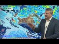
- Title
- Oz 8 Day: Wet weather coming for some dry regions, tropical cyclone risk for WA
- Runtime
- 10:22
- Date posted
- 7 months ago
- Description
- At the time of recording this video there was a moderate chance a tropical low could form into a tropical cyclone this weekend in WA, we track the low and potential rainfall going into next week. It's borderline and that makes it harder to do longer range outlooks - so keep up to date with the Bureau of Meteorology going into this weekend.
Thunderstorms and areas of rain and showers will move into central Australia then further into NSW, the A.C.T and now even parts of Vic may get some. There's also some tropical rain around Cairns in Qld, but large dry areas still remain over parts of that state.
Finally, we compare 3 different computer models with an 8 day expected rainfall map: GFS (America), ECMWF (Europe) and ACCESS-G (Australia) to get a general idea of which areas look driest, which look wettest, and those areas that are perhaps a bit more 50/50.
Due to Waitangi Day in NZ (NZ's national holiday) we have no video on Friday - catch you again ...

- Title
- NZ 8 day: High pressure, a couple of weak cold fronts, isolated downpours
- Runtime
- 6:28
- Date posted
- 7 months ago
- Description
- High pressure is the main feature for NZ for the next week ahead, but there will be showers in both main islands due to a little bit of local low pressure and a couple of cold fronts that brush the South Island. This means coastal areas in both islands are likely to have some temperature fluctuations as wind directions shift - but most places aren't too windy, but the Cook Strait area and parts of the Southern Alps may have some locally brisk winds.
Most places are dry, although a few downpours and isolated thunderstorms are in the forecast over the coming week.
By later next week we may finally see the high pressure zones moving away from NZ, we'll update you again on Monday about that possibility.
Have a great Waitangi Day and long weekend - catch you again on Monday.

- Title
- Oz: Tracking wet weather chances, esp WA, NT & NSW
- Runtime
- 10:13
- Date posted
- 7 months ago
- Description
- A large low is drifting into northern WA and connecting with other low pressure zones around it - this will help produce some pockets of rain and thunderstorms over the coming days as it tracks westwards and potentially southwards too. But high pressure remains south-west and south-east of Australia, keeping most southern parts of the nation dry.
As we go into the weekend and early next week we may have enough low pressure sinking southwards over the south-east corner of Australia to bring some heavier rain (and more widespread) into NSW in particular, but heavy showers and/or thunderstorms may also move into some parts of SA and Vic - but not for all.
There will be some temperature ups and downs between all the highs and lows - we show you where the heat and cooler airflows are most likely.
Finally a low pressure zone north-east of Queensland next week is worth keeping an eye on. For now it poses no threat to Australia - but it's been showing up...

- Title
- NZ: Waitangi Day (& long weekend) weather outlook
- Runtime
- 7:39
- Date posted
- 7 months ago
- Description
- High pressure is the dominating force in our weather but due to the placement of various high pressure centres it means varying wind directions, cloud cover and even a few showers.
Higher pressure usually brings lighter winds when it's centred over us, or very near us - and certainly reduces any severe weather risks. But the set up for the next several days may still mean cloudy conditions and some, especially coastal areas, may still have some cooler breezes.
We're also monitoring a low pressure zone next week in the tropics - for now it does not pose a threat to NZ, but it's been showing up for a few days now in longer range maps so thought it was worth simply pointing that out.

- Title
- Oz: Tropical showers expand, as stubborn southern dry holds on
- Runtime
- 8:46
- Date posted
- 7 months ago
- Description
- We're monitoring a tropical low over the NT today which is drifting eastwards towards northern WA, while high pressure continues the mostly dry weather in the south of the nation.
Between the northern low pressure and southern high pressure that easterly wind will continue, especially around southen WA.
Unfortunately, for those that really want/need rain in the south, the forecast continues to stay dry or mainly dry - we explain why it's this way for perhaps another couple of weeks.
But tropical showers will sink further southwards over the weekend and early next week, further into NSW and nothern parts of SA.
Qld also sees plenty of showers - but still in the mix are large dry areas.

- Title
- NZ: Low pressure to cross central NZ, then a noticeable uptick in high pressure
- Runtime
- 7:49
- Date posted
- 7 months ago
- Description
- Wet weather along with a windier, cooler, change is moving across NZ today and tonight, dropping the muggy humidity around the North Island and bring a drop in temperatures nationwide as we go into Wednesday.
By Thursday high pressure expands over the country, lingering into the weekend for most regions - we explain which places may still have a few showers and temperature changes, with southern parts of the South Island most exposed to some weak cold fronts.
Considering how unsettled NZ's weather has been over the past two months, and despite the low pressure zone crossing the country tonight, we do see a generally more settled weather pattern over the next week or two.

- Title
- ClimateWatch: FEBRUARY outlook as highs & lows mix up a bit
- Runtime
- 12:59
- Date posted
- 7 months ago
- Description
- The high pressure belt is a bit broken this month, as it was last month, meaning there will be further temperature ups and downs across New Zealand and southern/eastern Australia in particular.
When high pressure is continuous - ie, one anticyclone after the other - that can lead to drought, but when they are brokem up it can bring low pressure zones in between and temperature fluctations. There will be some parts of southern Australia that still has lower rainfall (when many want/need rain) and some parts of NZ may also enjoy some drier weather (following floods and landslides in January).
The tropics is still busy - with plenty of low pressure zones - and there is a possibility of a tropical cyclone somewhere north of NZ going into the middle of the month, athough that far out it cannot be confirmed. Phil explains how we're in the peak of the cyclone season now - and why a broken high pressure belt can make for chances of tropical low pressure to drop south...

- Title
- NZ: Low pressure crosses on Tuesday, high pressure for many this long weekend
- Runtime
- 6:04
- Date posted
- 7 months ago
- Description
- **Apologies for the visual problem in the first 5 seconds of the video**. Heat and humidity is increasing in northern NZ tonight, low pressure crosses the country on Tuesday and then a more refreshing southerly airflow will move in - all ahead of the next high pressure zone by Wednesday and Thursday.
Waitangi Day looks mostly settled around NZ, although some showers are likely in southern Westland, Fiordland and maybe Southland and Otago (although it won't be much for most).
This weekend looks similar, although rain moves up the West Coast and on Sunday a cooler southerly with showers comes into Southland and Otago, while high pressure brings light winds and dry skies to much of the North Island, perhaps just a little windy through Cook Strait at times.

- Title
- Oz: Large dry zones, some tropical showers drift south
- Runtime
- 7:14
- Date posted
- 7 months ago
- Description
- There are some large dry areas around Australia over the coming week, but a few heavy showers will come into the southern half of the nation - but many of them will be up in the tropics.
No especially nasty weather is on the way for most states and territories, although some of the isolated downpours could bring severe thunderstorms.
For those needing rain in Vic, SA and NSW there are a few pockets of wet weather, but still some large dry zones.





