WeatherWatchTV
ClimateWatch: SEPTEMBER Outlook and how SPRING is shaping up

- Title
- ClimateWatch: SEPTEMBER Outlook and how SPRING is shaping up
- Runtime
- 11:32
- Date posted
- 4 years ago
- Description
- NZ & Australia will see an uptick in high pressure this month, but rainmakers are still in the mix - along with a wintry blast for Southern NZ within the first week. However low pressure to the north and more mild airflows are also in the mix.
Over the coming weeks plenty of high pressure looks to exit Australia and move across NZ - but there are rainmakers too, so break down for you the highlights and lowlights of our emerging spring weather pattern.
We also update you on La Nina.

- Title
- Mild weather before southern cold blast from Sunday
- Runtime
- 5:56
- Date posted
- 4 years ago
- Description
- Weather conditions will be average to mild in a number of places in the days ahead but a wintry blast this Sunday to next Wednesday is heading towards southern NZ with snow on the hills and ranges and a biting wind chill for newborn lambs.
High pressure from Australia will help fuel the southerly in NZ - while helping keep conditions in Australia more settled, although more colder airflows will impact the southern states in the days ahead - it looks milder next week in Australia.

- Title
- Wintry change for southern NZ in 5 days time
- Runtime
- 3:56
- Date posted
- 4 years ago
- Description
- Both NZ and Australia have colder airflows moving in over the coming week but it’s NZ that is most exposed to a wintry change later on Sunday and for the start of next week. This is a developing situation so it’s more am early heads up about wintry weather.
In the north of NZ a windy, wet and milder set up is forecast later this weekend and early next week.
Australia has some rain through the desert interior (around Alice Springs) this week, with Thursday several degrees below normal there as a result of the set up.

- Title
- More snow for NZ's mountains, rain for VIC & Oz’s interior
- Runtime
- 5:00
- Date posted
- 4 years ago
- Description
- This week will see a lot of weather coming from our west and east across NZ and Australia - with a hint of spring in the air due to the lack of major southerlies.
It will be cooler for some areas though, especially this weekend in southern NZ with snow on the ranges.
But over the coming days much of NZ is settled, while Aussie has rainmakers in the south and through the central interior.
- Title
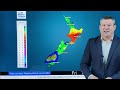
- High pressure increasing next 5 days
- Runtime
- 5:53
- Date posted
- 4 years ago
- Description
- The forecast isn’t perfectly settled but the rainmakers are taking more of a break over the weekend and for the first half of next week across a large portion of NZ and Australia.
NZ has a cool down this weekend as a fairly weak southerly flow moves in - while Oz goes the other way and sees a milder northerly returning (and both NZ and Aussie are sharing the same high pressure zone - southerlies in NZ on one side of the high, northerlies in Australia on the other).
Next week there are lot of westerlies, northerlies and easterlies in the forecast with a few showers - rainfall totals for most places are low, except the West Coast.

- Title
- Your forecast for the rest of August
- Runtime
- 6:42
- Date posted
- 4 years ago
- Description
- NZ - OZ - South Pacific — The weather pattern for the rest of the month is changeable in the NZ area and some parts of Australia - but high pressure looks to dominate more by the time we get to August 31 and into the start of September.
Two main features to focus on in today’s video.
1) The large low moving into NZ Thursday PM/Friday AM.
2) The large high south of Australia driving in a cooler southerly there - which is heading towards NZ this weekend.
We have rainfall maps and the latest on wind and temperatures across NZ, Australia and the South Pacific islands for the rest of August.

- Title
- Wind & rain but big high pressure rolls across Oz then NZ
- Runtime
- 5:59
- Date posted
- 4 years ago
- Description
- A low in the Tasman Sea will bring a burst of rain and snow to parts of NZ over the next 48 hours while a huge high pressure zone moves into Australia.
The high in Australia has a southerly flow from the Southern Ocean, northwards right across Australia and into Papua New Guinea! This colder southerly flow will reach NZ this weekend but before it does so, a low in the Tasman Sea will move over us.
Rainfall totals aren’t huge for most places - but following recent rain there may still be a few slips here and there. Snow on the Southern Alps may reach 50cm on the summit of the mountains.
Full details through to Monday…

- Title
- Another rainmaker for NZ on Thursday, then cooler air from Oz
- Runtime
- 7:29
- Date posted
- 4 years ago
- Description
- Australia has a colder change which is coming to NZ by this weekend - but another low/rainmakers arrives in NZ before then, on Thursday/Friday.
The colder change in Australia extends as far north as northern Queensland and will bring frosts across a large portion of the interior. This colder change loses it’s steam as it moves into NZ but will still drop our temperatures this Friday and weekend, before milder airflow returns next week.
The NZ Listener - Investigative piece:
Thank you so much for the amazing response to The Listener story this week. It’s in stores now and it took their reporter, Paul Gorman, 18 months to put together. It’s a detailed story covering 6 pages and encourage anyone that needs weather data to read it. We appreciate the feedback and incredible support you’re giving our small NZ business. Thank you!!

- Title
- Your forecast to Saturday + Investigative news story about NZ’s weather industry
- Runtime
- 5:58
- Date posted
- 4 years ago
- Description
- More rain is coming for the upper South Island this week but hopefully not at levels that will cause too many headaches - but still something locals and authorities should be aware of.
Most places in NZ have a changeable week this week as windier westerlies from Australia move in - and cooler and windier airflows push into the lower south eastern corner of Aussie in the days ahead.
We also take a look a the NZ Listener which has published an 18 month investigative story on NZ’s broken weather industry - how the Government is making life very difficult for the private weather sector and why NZ is the only modern country on earth to have two tax funded weather forecasters competing against each other. It’s on sale now in stores across NZ and we also hope to bring a digital version to you once this edition is no longer on sale.

- Title
- Heavy Rain finally eases this weekend - but next week looks messy
- Runtime
- 7:45
- Date posted
- 4 years ago
- Description
- More significant heavy rain will fall around the upper South Island/central NZ area across Friday and into Saturday - but this weekend the skies do finally dry up around the upper South Island and many parts of NZ.
Next week more wet weather will return - but totals won’t be high and there will be longer, drier, spells in between.
Australia has windy west to south west conditions blowing through bringing more wintry air to the entire southern coastline - and severe gales around VIC and TAS on Monday.
The tropics are fairly quiet at the moment with mostly easterlies and passing showers.
We also highlight this week (starting August 15) and compared 2022 with 2011…when it snowed in Auckland City.

- Title
- Detailed rain update for NZ, also Australia’s windy westerlies
- Runtime
- 8:25
- Date posted
- 4 years ago
- Description
- More heavy rain is coming to NZ with 150 to 200mm over the next 48 hours in the upper South Island and 100 to 150mm across parts of the North Island.
Rain is heavy enough to cause more widespread slips and flooding in the upper South Island but risks are easing on the West Coast slowly over the coming days. Some isolated flood and slip risks for the North Island now too.
Australia has a windy westerly change moving along the southern coastline with showers and patchy rain in VIC and TAS and perhaps just brushing ACT. By Monday a bigger and cooler south west change moves into WA, SA and VIC basically at the same time, as NZ sees weather conditions continue to ease.

- Title
- Rain Update for NZ + Cooler change for Aussie & NZ this weekend
- Runtime
- 8:19
- Date posted
- 4 years ago
- Description
- More heavy rain is still to fall across parts of NZ while Australia has windy westerlies right along the southern coastline turning cooler southerly in Melbourne and Hobart this weekend.
That cooler air will reach NZ slowly over the weekend and the start of next week - nothing major but a drop from the tropical airflows we have now.
Plenty more rain is on the way for Nelson and Takaka and Golden Bay area - also the West Coast, Mt Taranaki and Northland. We track the rain and where the highs and lows will be placed over the coming 5 days.

- Title
- Updated Rainfall totals as significant rain event affects parts of NZ
- Runtime
- 7:14
- Date posted
- 4 years ago
- Description
- We have latest rainfall totals which suggest 500 to 800mm is quite possible over the next five days in the north west corner of the South Island. These are significant totals and will likely lead to slips and flooding.
Gusty N to NE winds will also develop over the coming days in northern NZ with gusts to gale force and some heavy rain there too.
This weekend this wet set up moves through but then a showery westerly and southerly may also be in the mix.
In Australia not much is happening but a westerly change is moving in for the southern coastline and that turns colder southerly this weekend.

- Title
- Special Update: Half a metre of rain forecast for parts of NZ this week, flood & slip risk
- Runtime
- 7:51
- Date posted
- 4 years ago
- Description
- More than 500mm of rain is forecast for parts of the South Island this week and 100 to 150mm for the upper and western North Island as an atmospheric river or tropical rain arrives.
Stuck between powerful high pressure to the east and low pressure in the Tasman Sea, NZ has a windy week ahead with above normal temperatures and heavy rain in the north and north west of both main islands.
Australia finally sees low pressure clearing the south east this week - but only to be replaced by a very spring-like westerly change which - by Saturday - will extend from the Indian Ocean to WA, SA, VIC, TAS and eventually New Zealand by Saturday.

- Title
- Problematic position for high near NZ - Slips & flooding possible next week
- Runtime
- 6:11
- Date posted
- 4 years ago
- Description
- Low pressure is slowly exiting Australia in the days ahead but so too is high pressure and the two will impact NZ mid to late next week with the possibility of heavy rain and gales for New Zealand.
The high pressure zone next week will be far enough north to pull down moisture-rich air from the tropics and pull it down to NZ…but it will then block that rain from moving through, increasing localised slip and flooding risks for the upper side of both main islands, such as Nelson and Northland.
Australia’s weather looks quite changeable next week with a burst of westerlies developing and moving through from WA to VIC.

- Title
- Frosts next few nights, but flooding & gale risks next week
- Runtime
- 7:01
- Date posted
- 4 years ago
- Description
- Both high & low pressure are exiting Australia over the coming days bringing frosts nationwide to NZ (about as far north as the Bombay Hills) but then next week low pressure will work with the high to drive down sub-tropical rain and potential gales for parts of New Zealand.
Australia has patchy rain from low pressure in the south and south east, which will take until early next week to move into the Tasman Sea - and may help fuel more rain in the NZ area. Some rain will briefly make it as far north as QLD.
This is a developing situation for NZ and is not locked in yet - but today we cover the current modelling and likely forecast for next week.

- Title
- High pressure heads to NZ from OZ - but so too is low pressure next week
- Runtime
- 6:14
- Date posted
- 4 years ago
- Description
- A big high pressure zone is covering the south eastern corner of Australia and is heading to NZ this weekend. Sunday and Monday look especially settled over NZ following on from the colder, showery, week this week.
Temperatures across NZ will be down for the next several days - but will rebound early next week as a sub-tropical airflow from north of Fiji starts to move in - and could create a heavy rain event from NZ.
Australia has low pressure hugging the southern coastline and should exit Australia early next week.
- Title
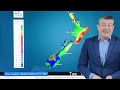
- Powerful highs across NZ & Australia - but flooding risks too
- Runtime
- 5:49
- Date posted
- 4 years ago
- Description
- We have some big high pressure zones - but flood potential in NZ not only today (Tuesday Aug 9) but also next week in the NZ area as a sub-tropical flow comes down.
Currently high pressure from Australia is moving into the lower South Island - major frosts tonight with -7 to -10C through the Southern Alps and down to Northern Southland.
Next week that big high will lie east of NZ and looks likely to encourage rain and mild Fiji air down over both main islands.

- Title
- Australia Update: Windy & wet along the southern coastline
- Runtime
- 5:09
- Date posted
- 4 years ago
- Description
- We have a special Aussie-only video for the week ahead due to so much weather to focus on in New Zealand. In this Australian weather update we track windy and wet weather for WA which will take this whole week to spread across southern SA and into parts of VIC and TAS - even ACT and NSW.
Sydney and coastal NSW have a cooler S to SE flow for today, making it similar to Auckland temperature-wise (so cooler!).
We have Australia’s forecast out to Saturday.

- Title
- NZ Update: Tracking the snow & rain this week
- Runtime
- 4:47
- Date posted
- 4 years ago
- Description
- New Zealand has wintry weather in the South Island with snow flurries, but milder and wetter in the North Island - for now. The colder southern change will spread into the North Island over the coming days bringing a few snow flurries to Central Plateau and a general temperature drop.
Later this week high pressure expands further south from the Southern Ocean.

- Title
- Wintry weather kicks in next week
- Runtime
- 5:57
- Date posted
- 4 years ago
- Description
- Mild weather for most regions is about to stop as a wintry south to south easterly flow kicks into both NZ & the eastern side of Australia.
Temperatures will drop - especially on Sunday and Monday in the South Island with Canterbury looking quite exposed to several bleak days and windchill below zero.
We cover the weather across NZ and Australia through until Wednesday.
Drill down deeper at WeatherWatch.co.nz and RuralWeather.co.nz

- Title
- Severe gales for Friday, low pressure for NZ & Aust next week
- Runtime
- 6:36
- Date posted
- 4 years ago
- Description
- Low pressure exiting Australia will bring severe gales to the South Island on Friday along with a colder, wintry, change this weekend in the South Island.
By next week low pressure will dominate NZ with a low over the North Island, driving in wet weather to eastern parts of both main islands too - important to note after the rain/flooding we just had in the east. Cold southern air will see snow flurries around the South Island too - above a couple hundred metres at this early stage.
Meanwhile yet another big low moves into southern parts of Australia next week - for SA, VIC and TAS

- Title
- Severe gales for southern NZ & Aust - Wintry change on Sunday for NZ
- Runtime
- 4:33
- Date posted
- 4 years ago
- Description
- Mild and windy will sum up the next few days in New Zealand but a wintry change is coming from this weekend onwards, with very low temperatures and some low level snow flurries in the forecast from Sunday to Tuesday in the South Island.
Australia has severe gales over the coming days from Western Australia to New Zealand’s South Island - spanning a distance of about 6000km.
We have your latest forecast to Sunday…

- Title
- Severe gales & rain for both NZ & Australia next few days
- Runtime
- 5:29
- Date posted
- 4 years ago
- Description
- Severe westerly gales will affect both NZ & Australia over the next few days as stormy weather in the Southern Ocean interacts with high pressure further north.
From Perth to Adelaide, to Melbourne to Hobart, to Wellington - these windy conditions will prevail until the weekend.
This Saturday a wintry change arrives in southern NZ and slides up the eastern side of the country on Sunday bringing a temperature drop following a milder than usual week ahead.
Heavy Rain:
Both NZ and Australia also have heavy rain over the next 48 to 72 hours - we have special maps for both nations showing the totals.

- Title
- ClimateWatch: AUGUST sees big highs & lows, + Spring outlook
- Runtime
- 10:53
- Date posted
- 4 years ago
- Description
- There’s no shortage of both large highs and large lows this August in NZ and Australia as La Nina continues to slowly look to return at some point.
The long range forecast for New Zealand leans warmer than average with rainfall carrying on across both main islands - especially northern NZ.
For full details and to see all the maps, please visit RuralWeather.co.nz

- Title
- Severe winds for south Australia brush NZ this week too
- Runtime
- 5:13
- Date posted
- 4 years ago
- Description
- A warmer than average week for many parts of NZ due to windy W to NW winds in most regions. Stormy weather south of Australia will see gales, even severe gales, from WA to SA and even into VIC and TAS. This windy westerly flow will also connect to NZ at times, especially later this week - ahead of a more wintry change for the Deep South on Sunday.

- Title
- Positive change to NZ’s weather pattern next week
- Runtime
- 5:48
- Date posted
- 4 years ago
- Description
- A big high is exiting eastern Australia this weekend and will track in to the upper North Island of NZ, creating a windier westerly flow for next week.
This set up will allow eastern and northern parts of NZ to dry out following recent heavy rain - while frosty weather briefly impacts eastern inland Australia tonight/Saturday morning, and possibly some parts of NZ on Sunday morning and again overnight Sunday/Monday.
Generally speaking, westerlies dominate much of the southern half of Australia and the NZ area for the next week ahead - although a brief southerly this weekend in NZ will drop temperatures before milder winds arrive next week.

- Title
- Classic winter weather for NZ & Australia next several days
- Runtime
- 5:45
- Date posted
- 4 years ago
- Description
- Cold fronts in NZ and frosts in parts of Australia’s eastern interior sum up the forecast for the weekend and early next week.
NZ has more wet weather in the days ahead , but it will increasingly be falling in western areas which can cope with it better than eastern areas have done recently. Some snow is also on the way for ski fields in both islands.
Aussie has a big high rolling eastwards bringing a cold Friday night in the east with frosts inland, but mild on the western side with northerlies - then windy westerlies next week.
NOTE: Thanks for the loyal support on YouTube - we just cracked 3 MILLION views in the past 365

- Title
- Windy westerlies return to NZ, big high crosses Aussie
- Runtime
- 5:10
- Date posted
- 4 years ago
- Description
- NZ’s weather will be unsettled for the rest of July as mid-winter weather takes hold. A powerful high from Australia will dominate in the days ahead, then drifts to northern NZ for Monday, August 1.
The high’s northern placement means more windy westerlies for NZ… which will help keep overnight lows up a little.
Aussie’s weather is fairly settled overall, but a windier, wetter and cooler change will move into the south eastern corner.

- Title
- Tracking NZ’s rain as Aussie sees more sun
- Runtime
- 4:26
- Date posted
- 4 years ago
- Description
- Low pressure is falling apart over NZ at the moment and later this week back come the windy west to south westerlies.
There’s no shortage of rainmakers for the NZ area over the coming week, but there will be some dry breaks for most regions that have been impacted by heavy rain recently.
Australia has most settled weather - although a few showers in the south western corner for VIC and TAS especially.
The tropical islands are mostly settled, but a few downpours linger around Vanuatu.

- Title
- Severe weather risks for NZ, Aussie more settled
- Runtime
- 5:55
- Date posted
- 4 years ago
- Description
- NZ has pockets of severe weather to kick off this week with heavy rain and slow moving gales spreading down the country from the north.
The low will fall apart in the NZ area over the coming 48 hours but brings plenty more rain.
Australia has a weak low brushing the SE corner then a mostly settled week ahead with high pressure over many states but windy westerlies brushing the southern coastline.
It’s these windier W to SW winds that will move into the NZ area later this week and into the coming weekend.
RuralWeather.co.nz and WeatherWatch.co.nz to drill down deeper.

- Title
- More Severe Weather for NZ next week
- Runtime
- 5:57
- Date posted
- 4 years ago
- Description
- A low deepening near Queensland will drift towards NZ by Sunday/Monday, bringing gales and rain to the upper North Island, then more rain into the South Island - including Canterbury which could see at least another 50mm next week, while upper North Island places like the western BoP and Northland may receive over 100mm.
This next low isn’t a storm - but it does work with a powerful high which will help slow it down and boost rainfall totals and wind speeds, making a "squash zone" of gales in the upper North Island for a time.
Speaking of that high - it will bring frosts and colder weather for Friday night and Saturday, especially the South Island.
Australia also has a cold night tonight in TAS, VIC, NSW and even parts of southern QLD…but further north that offshore low (which is moving to NZ) will bring gales for Friday night to coastal areas around Brisbane.
For more details, visit WeatherWatch.co.nz
THANK YOU YOUTU...

- Title
- NZ & Australia: Severe Weather risks next few days
- Runtime
- 7:16
- Date posted
- 4 years ago
- Description
- We’re tracking the severe weather risks across both NZ and Australia as we share the same weather pattern. A powerful high from Tasmania is heading to the South Island this weekend with frosts, while a rainmaker will develop near Queensland over the coming days and reach NZ’s North Island on Monday with gales and rain.
We have special maps for both NZ and Australia as we track the mid-winter weather.

- Title
- NZ & Aust: Big high + big low = sun, wind & rain
- Runtime
- 5:56
- Date posted
- 4 years ago
- Description
- As one big high departs NZ another one is waiting in the wings over TAS and will bring a fairly settled weekend to the NZ area.
However low pressure in the Coral Sea will drift into the northern Tasman Sea this weekend, bringing rain to the eastern side of Australia (especially coastal QLD). This rainmaker then moves into northern NZ early next week with possible gales in some exposed areas.
The tropics is fairly quiet with an East to SE airflow dominating and the usual showers here and there.

- Title
- Big high coming for NZ, large rainmaker for QLD
- Runtime
- 4:51
- Date posted
- 4 years ago
- Description
- A big high from Aussie is slowly drifting towards NZ later this week, bringing a frosty weekend to many. Before this happens a weak low crosses NZ bringing showers and a burst of southerlies on Thursday as it departs to our east.
As this powerful high moves in from TAS to the South Island a large but fairly weak low will form in the Coral Sea and drift into the north Tasman Sea - producing rain for QLD and some parts of NSW, and a developing easterly for northern NZ

- Title
- Tracking severe weather this week in NZ & Australia
- Runtime
- 6:44
- Date posted
- 4 years ago
- Description
- Severe gales, heavy rain & some snow for NZ while a new wet easterly forms for eastern Australia later this week.
Both NZ & Aussie share similar weather patterns this week with a windy change in TAS moving over to NZ today - and Tuesday as well.
Weak low pressure in the NZ area will see showers and southerlies continue mid week but a powerful high pressure zone from Aussie is on the way for NZ by the end of this week and coming weekend.

- Title
- Weekend Weather & outlook for next week
- Runtime
- 5:24
- Date posted
- 4 years ago
- Description
- NZ - Australia - South Pacific — We have your forecast as we head into the weekend with another burst of wintry weather for New Zealand. Heavy rain, heavy snow and severe gales are all possible from Sunday to Tuesday next week, then high pressure from Australia should move in and settle things down - starting in the lower South Island by Wednesday.
Australia has cold nights ahead and the same wintry blasts hitting NZ will also swipe VIC, TAS and parts of SA & NSW. But a big high is rolling through early next week and will be parked over TAS around Tue/Wed.
The tropics have easterlies next week, but heading into the weekend New Caledonia and Vanuatu have a slightly cooler southerly coming out of the Tasman Sea area.
For more detailed please visit WeatherWatch.co.nz or RuralWeather.co.nz

- Title
- More northern rain, then a nationwide southerly for Fri/Sat
- Runtime
- 5:54
- Date posted
- 4 years ago
- Description
- As rain spreads over the North Island today another cold southerly is on the way - but this time that cold southerly will go nationwide bringing a temperature drop to every part of the country.
There may even be a dusting of snow on Friday on the Desert Road.
By Sunday windy nor’westers return with a classic cold front coming into NZ.
Over in Australia frosts are coming - but so too is another wet and windy cold front for early next week for the south eastern corner of the nation.

- Title
- The next low from the Tasman Sea is headed to the NI
- Runtime
- 4:11
- Date posted
- 4 years ago
- Description
- The second low pressure system of the week will cross NZ in the next day or two, followed by a colder southerly that should go nationwide.
For those in the north the cooler air this weekend will stand out after the weeks of warmer than usual weather.

- Title
- Heavy rain, strong winds cross NZ - another burst Friday
- Runtime
- 5:53
- Date posted
- 4 years ago
- Description
- Low pressure is affecting much of NZ with strong winds heading southwards along with heavy rain. The rain is widespread across the country although not every region will have heavy rain.
Blustery winds with gales in exposed places continue - but in the very north of NZ conditions should start to ease across today.
We take a look at NZ’s forecast in detail to Sunday - and we briefly update Australia’s weather too.

- Title
- Two lows & plenty of rain for NZ this week
- Runtime
- 6:14
- Date posted
- 4 years ago
- Description
- An atmospheric river of rain will slide over the country for Monday and Tuesday as a large low move through, tapping into tropical airflows.
Mid-week this low will be parked near the lower South Island bringing wintry southerlies there and milder westerlies for the North Island.
Another low with rain moves through on Friday.
Australia has mostly settled weather but is colder in the southeastern corner. The Tropics area is also relatively quiet, with just the usual passing showers.

- Title
- 3 big rainmakers for NZ next 7 days
- Runtime
- 6:27
- Date posted
- 4 years ago
- Description
- A large low is bringing widespread rain to NZ for Friday with more on Monday as the next part of this system comes through bringing gales and heavy rain.
In between this weekend the South Island has a wintry change with snow flurries down to 200 or 300m for a time (light falls). Australia also has that colder southerly in their south east corner (and milder W to NW winds over in WA).
Next Monday and Tuesday sees wind and rain across NZ - then later next week the third low from the Tasman Sea may well move in across NZ bring more rain to the North Island in particular.

- Title
- Heavy rain coming for NZ next 7 days
- Runtime
- 5:53
- Date posted
- 4 years ago
- Description
- Low after low from the Tasman Sea will affect NZ in the week ahead, bringing over 100mm to a number of regions in both islands.
Almost every part of the country will get rain - although some in the east will have lower totals, most places will get a soaking at some point with northern and western sides of both main islands looking most exposed.
Strong winds will also be in the mix at times - from all directions basically.
Australia has a drier pattern compared to the past week - and a colder one in the south east with plenty of southerly winds coming up.

- Title
- Due to staff sick leave we have no video today , back tomorrow with your Friday and weekend outlook
- Runtime
- 0:13
- Date posted
- 4 years ago
- Description
- www.weatherwatch.co.nz

- Title
- A series of lows to cross NZ next 7 days, rain continues in eastern Aussie
- Runtime
- 5:20
- Date posted
- 4 years ago
- Description
- Several lows will impact NZ over the coming week or so, with more rain along eastern Australia but relief in NZ for remaining dry areas.
The unsettled weather pattern will bring real variety to NZ, along with a more set in wintry change for the lower South Island which peaks this weekend.
Next week - more lows in the Tasman Sea area.

- Title
- NZ: Low + wintry change late this week. Sydney: More rain.
- Runtime
- 4:17
- Date posted
- 4 years ago
- Description
- NZ and eastern Australia share the same weather this week with more rain for Sydney which will drift over to the North Island and upper South Island too.
By Friday a new low in the Tasman Sea will cross NZ bringing a burst of severe weather (gales, rain then snow).
Saturday looks wintry in parts of NZ with snow possible to lower levels of Southland and maybe into Canterbury too (above 200 or 300m at this early stage).
One positive on Saturday - Sydney should have more dry spells in the mix.

- Title
- ClimateWatch - How JULY is shaping up (+Aug & Sep)
- Runtime
- 9:01
- Date posted
- 4 years ago
- Description
- “Variety" is the key word summing up NZ’s weather over the coming month, which means it may be quite similar to June. We have a real mixture of large highs moving in at different lattitudes, and some big lows in the mix too. Some lows will reach NZ, others brush by us.
Either way the set up for the month ahead is one of variety with injections of cold and warm, sun and cloud, wet and dry.
We’re also in a “La Nina Watch” - which means La Nina may come back in full force later this year, but it’s still marginal.

- Title
- Fairly settled weekend for NZ - but not perfect
- Runtime
- 5:04
- Date posted
- 4 years ago
- Description
- NZ is on the edge of high pressure this weekend while Australia has a heavy rain and wind event - which will reach NZ next week and unravel.
For this weekend in NZ the south west flow continues on, bringing a few showers to western areas of both islands but nothing too major.
Meanwhile eastern parts of Aussie have 100 to 200mm coming over the next 5 days.
Next week that Aussie system reaches NZ and falls apart - then a more wintry southerly joins in around Wednesday.

- Title
- High pressure (sort of) for NZ, heavy rain for eastern Australia
- Runtime
- 2:55
- Date posted
- 4 years ago
- Description
- High pressure is trying to cross NZ over the coming week and to some degree it does so, generally bringing a SW flow into the NZ area.
Meanwhile Australia has an easterly flow in eastern states bringing 150 to 200mm of rain over the coming 5 days.
We have your forecast through to Tuesday.
- Title
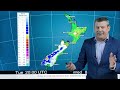
- Huge high pressure trying to reach NZ as rain returns to eastern Australia
- Runtime
- 4:03
- Date posted
- 4 years ago
- Description
- A sub-tropical low north of NZ is bringing rain into the upper North Island for Wednesday as a weak cold front comes into the lower South Island.
In Australia a huge area of high pressure is developing and will stretch 8000km west to east by early next week as it tries to cross NZ bringing fairly settled weather here.
Meanwhile eastern Australia is lining up for some very wet weather this coming weekend and into next week.
Visit WeatherWatch.co.nz for more details





