WeatherWatchTV
NZ: 7 day focus on snow, rain, sun & wind + Hurricane Lee forms

- Title
- NZ: 7 day focus on snow, rain, sun & wind + Hurricane Lee forms
- Runtime
- 4:47
- Date posted
- 3 years ago
- Description
- We take a closer look at New Zealand’s weather over the coming week as a mild weekend gives way to a colder week next week.
Sou’westers will dominate NZ next week bringing snow and rain showers to the south and west and drier weather to the east of both islands.
We track the wind flows, the wet weather and just how much snow is coming.
Meanwhile, a new hurricane has formed with a dramatic increase in power - going from a newly named Category 1 hurricane on Thursday to a major Category 4 hurricane by Friday…and a chance it may be Category 5 (the highest level) by the end of Friday NZT.

- Title
- Tracking a storm + new rain forecast for NZ & Australia
- Runtime
- 5:29
- Date posted
- 3 years ago
- Description
- We have the latest rain forecast for NZ and Australia as spring does it’s thing. Mixtures of warm and colder air will see thunderstorms and downpours - today across 5 inland states of Australia. There’s also a weak front moving into the North Island today - but being surrounded by high pressure means it will fall apart.
High pressure dominates a lot of NZ for the next day of two as the south-eastern corner of Australia turns stormy… then that windier and wetter weather will swipe parts of NZ around Sunday to Tuesday.
We have the latest New Zealand and Australia weather forecast through to Tuesday next week.

- Title
- Stormy weather for parts of NZ & Australia along with big highs
- Runtime
- 5:50
- Date posted
- 3 years ago
- Description
- Spring weather is truly underway with a mix of warm and cold sparking thunderstorms and large low pressure in the week ahead. The bulk of the severe weather looks to be in Australia’s south eastern corner and mostly the southern half of NZ - but windy westerlies are going to surge up and down across NZ in the coming week.
There’s also some large pressure around - giving NZ a calm, sunny and mostly dry patch of weather later this week.
We also take a closer look at Tasmania - and why New Zealanders share more than just the same weather pattern with them!
We have your detailed New Zealand and Australia forecast through to Monday.

- Title
- NZ milder with downpours + the Melbourne storm
- Runtime
- 5:24
- Date posted
- 3 years ago
- Description
- It’s quite an unsettled weather pattern from Perth to Adelaide, Melbourne to New Zealand as spring-like weather from the Southern Ocean pushes through active cold fronts and lows. With some large high pressure zones around too, it means a fair amount of variety for both NZ and Australia in the days ahead - while the tropics have a bit of a breather from recent rain - Fiji is mostly dry in the several days ahead.
NZ has generally mild weather coming in with northerlies and westerlies dominating - that will push some eastern places into the low 20s temperaturewise. Heaviest rain in NZ will be on the West Coast with up to 150mm possible in the 48 hours from 7pm tonight (Tuesday).
Australia is quite dry inland - but those towards the south coast have plenty of active weather with thunderstorms, squalls and gales over the next week. A deep low will form around Victoria later this week bringing some stormy weather to Melbourne and even Adelaide, Canberra, Sydney ...

- Title
- Spring westerlies for NZ, southerly blast for Aussie
- Runtime
- 4:25
- Date posted
- 3 years ago
- Description
- Classic September weather is kicking in across New Zealand this week with plenty of windy weather, swinging back around to westerlies over the next day or two as a low near Auckland falls apart.
High pressure is dominant across Australia but the placement of that high brings in a properly southerly blast this week to southern states.
We track the rain, showers, snow and gales over the coming week for NZ and Australia.

- Title
- ClimateWatch: SEPTEMBER & Spring outlook as El Niño conditions grow
- Runtime
- 10:29
- Date posted
- 3 years ago
- Description
- As we do each month we take a look at the general air pressure trends and climate drivers moving in and around the NZ, Australia, the South Pacific and Southern Ocean.
As we head through September New Zealanders should notice an uptick in high pressure and longer dry spells. Rainfall totals should be slightly lower for many places - although may still be close to normal for many too. Despite a drier trend emerging, we’re still seeing a number of cold fronts interacting with NZ bringing some chances of rain.
Temperatures look to lean warmer than average across NZ over September and Spring.
An El Niño “Alert” remains in place - meaning an El Nino announcement is looking more likely in the coming month.
ClimateWatch is not a weather forecast - it's about likely upcoming trends and climate drivers (like El Niño) to help growers, farmers and those who work outdoors better plan ahead.

- Title
- Low pressure affects northern NZ this weekend / early next week
- Runtime
- 5:10
- Date posted
- 3 years ago
- Description
- Milder weather is moving into New Zealand this weekend and next week with sub-tropical connections - but rain is also in the forecast, especially for the upper and north eastern North Island. East Cape and Western BoP look to have some of the heaviest rain - but generally speaking most rain is below warning thresholds.
Milder winds continue on into NZ next week with more of a westerly theme by mid-week.
Australia is quite dry over the coming week but a cold front does move into southern WA, then coastal SA, VIC and TAS - but rainfall is generally quite low.
We have your NZ and Australia forecast through to Wednesday next week.

- Title
- Low pressure for northern NZ, sub-tropical winds for many
- Runtime
- 4:33
- Date posted
- 3 years ago
- Description
- It’s a cold week for NZ this week but sub-tropical winds are moving in this Friday and weekend to a number of regions as low pressure forms around the North Island. Yes, some rain is on the way - but the rainfall totals aren’t huge for most places. Fiordland looks to be the wettest.
In Australia high pressure dominates but showers and cooler winds brush the southern and eastern coastlines.
**Programming Note: We have NO VIDEO on Thursday - but we have TWO VIDEOS on Friday with our regular weekend update and our next ClimateWatch update. See you again on Friday!

- Title
- Winter’s last week is a cold one for NZ
- Runtime
- 5:43
- Date posted
- 3 years ago
- Description
- The final week of winter on the meteorological calendar is a cold one for NZ - but milder, sub-tropical, airflows come in this weekend - with some pockets of rain and showers too.
Basically the last week of winter for NZ is dominated by high pressure and below average overnight lows - classic winter showing up at the very end of the season after a very mild beginning!
This weekend low pressure from the Tasman Sea moves closer to NZ as high pressure departs to our east.
Australia has a few showers in the east and the south this week from weak low pressure and a fairly weak cold front too.
We have your forecast through to Saturday.
**PROGRAMMING NOTE** We have no weather video this TUESDAY or THURSDAY this week due to travel and thanks to much quieter weather! Also, our next ClimateWatch update is out later this week.

- Title
- Winter’s last weekend & week is upon us
- Runtime
- 5:59
- Date posted
- 3 years ago
- Description
- A storm near Antarctica and a huge high pressure zone over Australia sum up our weather pattern for the last week of winter on the meteorological calendar.
A weak cold front brushes Tasmania today and will move up NZ this weekend - bringing a colder, showery, Sunday and Monday into a number of regions and another dusting of snow on the ranges of both main islands.
However next week in NZ is dominated by that high pressure zone out of Australia, with a spell of settled weather.
We have your weekend weather and the outlook for the last week of August across New Zealand and Australia.
**Programming Note**: Next week (last week of August) we have NO videos on either Tuesday 29th or Thursday 31st, due to travel reasons (but also timed with very quiet weather!). But please note next Friday we have TWO videos - our regular weather forecast plus our next edition of ClimateWatch, covering September and Spring.

- Title
- A showery southerly for NZ on Sunday/Monday
- Runtime
- 3:06
- Date posted
- 3 years ago
- Description
- High pressure is the main driver of our weather over the rest of August but we’ve still got some energy in the Southern Ocean to help send up some showers and southerlies later this coming weekend and to kick off next week/
The same high driving the southerly into NZ is also driving an easterly into eastern Australia with showers along the eastern coastline over the coming week.
We have your (brief) NZ forecast through to the middle of next week!

- Title
- Rest of August = more high pressure, NZ cold front Sunday
- Runtime
- 3:46
- Date posted
- 3 years ago
- Description
- A weak cold front is coming to NZ this weekend and next Monday but for the most part NZ is leaning drier than average for the remainder of August with a big uptick in high pressure.
There will still be coastal showers around both islands and by Sunday and Monday a colder change heads up with NZ with even a dusting of snow into the North Island on Monday.
Australia has plenty of coastal showers in the east - otherwise high pressure is dominating much of the continent for the rest of August.
September may see low pressure in the Tasman Sea - so we’re not getting too carried away just yet with this drier phase moving in.
We have your weekend outlook and forecast to Monday across New Zealand and Australia.
- Title
- NZ & Australia weather + Rain for B.C.’s wildfires
- Runtime
- 4:47
- Date posted
- 3 years ago
- Description
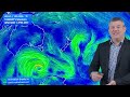
- We track high pressure and showers around NZ & Australia plus the latest on Canada’s wildfires as Hilary’s rain moves in.
For NZ and Australia high pressure is dominating more in the weeks ahead with fewer big rain events and low pressure. However around the edges of these constantly-moving high pressure zones there are plenty of showers for coastal parts of New Zealand and Australia - but generally speaking a drier trend is arriving.
We also track the rain from former Hurricane Hilary as it moves into the Pacific North’West of USA and then into the Rocky Mountains of Canada - in particular British Columbia which is being burnt by out of control wildfires. The rain will be very welcome

- Title
- High pressure is flirting with NZ this week
- Runtime
- 4:06
- Date posted
- 3 years ago
- Description
- Hail showers and gales in Auckland and other northern areas will ease today as high pressure Aussie moves in. The high will bring widespread inland frosts to the South Island tonight with lighter winds and clearer skies. Showers and southerlies continue in some eastern parts of the North Island due to a low pressure zone near the Chatham Islands.
Apart from a weak cold front brushing Adelaide to Melbourne, much of Australia is seeing a settled weather pattern due to high pressure.
Don’t forget we have a special video update out today on Tropical Storm Hilary.

- Title
- Tropical Storm Hilary moves into California, Los Angeles flash flood risks
- Runtime
- 6:56
- Date posted
- 3 years ago
- Description
- Hilary is now a Tropical Storm and while winds are easing the rain is not - with flash flooding and record challenging rainfall expected across Southern California and into Nevada tonight and Monday local time.
We show the track of Hilary for the next 72 hours, expected rainfall into California, Nevada and then on into Canada. We also talk about how Hilary’s rain could bring significant relief to the wildfires burning in Alberta and British Columbia, Canada - but may damage infrastructure in California first.
Please follow local official weather warnings in your state or country.

- Title
- Special update on historic Hurricane Hilary - USA & Mexico
- Runtime
- 7:04
- Date posted
- 3 years ago
- Description
- The first tropical storm warning for California in over 80 years is moving in and brings significant rain and flooding risks to desert parts of the south-western United States and western Mexico.
1 to 3 year’s worth of rain may fall in just the next 1 to 3 days, in an area that is usually a desert with dry riverbeds and dry lakes. The risk for catastrophic flooding and serious damage to infrastructure from this historic hurricane is very high between Los Angeles and Las Vegas, impacting 3 US states.
We take a look at the track of Hilary, the areas most exposed, and why this hurricane is so historic and unusual - even with the wind portion weakening.
We also compare why Los Angeles and Sydney are similar in that they tend to avoid tropical storms…and explain why countries like NZ and Canada - which are further from the tropics - usually are more exposed than New South Wales and California for tropical storms.
WeatherWatch.co.nz

- Title
- NZ’s wet weekend - But high pressure next week
- Runtime
- 5:31
- Date posted
- 3 years ago
- Description
- We have your NZ and Australia weekend weather plus the detailed forecast for next week as we come closer towards the end of winter 2023.
An active cold front will move into western NZ on Saturday with low pressure lingering around the North Island for Sunday and moving away on Monday. Next week high pressure flirts with NZ bringing a drier, calmer and sunnier week for many - although showers will still brush coastal areas of both main islands.
Australia has a lot of high pressure - but a colder southerly punches as far north as northern Queensland over the next few nights.

- Title
- Active cold front for NZ this weekend BUT high pressure next week
- Runtime
- 5:46
- Date posted
- 3 years ago
- Description
- A cold front will blast across south-eastern Australia over the coming 24 hours before reaching NZ on Saturday as an ‘active cold front’ - that means it’s got the chance of some thunderstorms and heavy downpours. By Sunday a low will deepen over northern NZ and by Monday it should hopefully be clearing away.
Next week NZ has a big uptick in high pressure from out of Australia - and this means a more settled weather pattern with longer dry spells, lighter winds and a better chance of sunshine.
Both NZ and Aussie see a more settled week next week following the unsettled sou-west change over the next few days ahead.

- Title
- Heavy rain for parts of NZ this weekend
- Runtime
- 5:01
- Date posted
- 3 years ago
- Description
- For many this may not be the news you want but an active cold front and low pressure zone will move into NZ this weekend after visiting the south-eastern corner of Aussie late this week.
It means 20 to 50mm of rain across the North Island with some ranges getting closer to 100mm. It’s a similar story for the upper South Island with Nelson region potentially most exposed to the highest rainfall totals over the coming several days.
The low is expected tol be centred over the North Island on Monday.
Meanwhile Australia has a lot of high pressure - except in that south eastern corner for the next few days. Highest rain in Aussie will be in western Tasmania.

- Title
- Active cold front + low this weekend for NZ
- Runtime
- 5:15
- Date posted
- 3 years ago
- Description
- NZ’s unsettled weather carries on into this weekend as a cold blast out of Aussie comes our way.
The cold front arrives in NZ on Saturday then a low forms on Sunday.
Before reaching NZ the cold change will bring a windy, wet and colder end to the working week for Australia.
However our last map for Sunday also shows a huge amount of high pressure and westerlies coming out of the Indian Ocean and across Australia - with a chance they could also reach NZ later in the month.

- Title
- Big low for NZ this week + cold front by Saturday
- Runtime
- 4:48
- Date posted
- 3 years ago
- Description
- Rain and showers will affect the western side of NZ this week and the southern and south-eastern coastlines of Australia.
A large low over NZ this week will fall apart late week giving way to more westerlies - then a cold front on Saturday may produce a few downpours and isolated thunderstorms.
Australia and NZ have plenty of active weather from the Southern Ocean this week.
We have your forecast through to Saturday…

- Title
- NZ: High pressure gives way to large lazy low next week
- Runtime
- 5:44
- Date posted
- 3 years ago
- Description
- High pressure fades this weekend and by next week a large low looms over New Zealand bringing rain to the western half of NZ and a drier, milder, set-up for many in the east.
Despite the low being large, it’s not looking especially stormy - and that may be due to a lot of high pressure surrounding it.
Australia has a lot of high pressure but airflows over the coming week will bring rain and showers into the southern coastal side of the nation and also into Sydney next week.
We have your NZ and Australia forecast for the weekend and through to Wednesday next week.

- Title
- Typical August weather as large low looms next week
- Runtime
- 5:04
- Date posted
- 3 years ago
- Description
- NZ is living on the edge of high pressure at the moment meaning it’s not too stormy but not overly dry and calm either. The showers and coastal winds will continue off and on for the coming days, all ahead of a large low pressure zone expected to engulf NZ for much of next week. While the low is large, there were no signs of it being too stormy at the time of this update - obviously we’ll be updating again on Friday to see how it’s shaping up.
But there is a lot of high pressure out there too nearby - giving Australia some calm weather but also shutting off southerlies into NZ for a time next week too.
We have your forecast to Tuesday next week…

- Title
- A number of cold fronts for NZ & Australia
- Runtime
- 5:03
- Date posted
- 3 years ago
- Description
- There are no major storms right now but still some wind, snow and rain in the forecast for both nations as winter weather patterns continue.
NZ has a number of southerlies over the coming week while Australia has several cold fronts, some of which make it to NZ too.
We have your forecast to the start of next week across New Zealand, the Tasman Sea and Australia…

- Title
- More snow & rain showers for NZ & Australia
- Runtime
- 4:50
- Date posted
- 3 years ago
- Description
- There’s a lot of high pressure around Australia with NZ on the edges of it - and low pressure zones nearby. It means, for New Zealand, an unsettled weather pattern for the next 10 days bringing classic mid-August weather with snow flurries for the mountains and ranges of both islands, more sou’westers - and some fairly weak low pressure zones in the mix.
It means rainfall for NZ is normal or even slightly below normal for some in the coming 10 days.
We have your NZ and Australia forecast to Sunday - and a brief mention of the tropics as easterlies and showers continue there.

- Title
- Weekend weather & outlook for next week: NZ & Australia
- Runtime
- 4:35
- Date posted
- 3 years ago
- Description
- High pressure covers a large portion of Australia and the Tasman Sea - and will cover NZ to some degree bringing frosts and/or a cold start again on Saturday morning. A slightly milder westerly arrives in the South Island on Sunday from Tasmania, then a cold front moves up the South Island early next week.
A few coastal showers for the North Island but generally leaning drier.
A large portion of Australia is drier at the moment although showers continue along the eastern coastline and rain and possibly even some snow into Tasmania and Vic mountains this weekend.
**Programming Note -- We have no weather video on Monday, back again Tuesday 🙂

- Title
- High pressure flirts with NZ, so too does another cold front
- Runtime
- 5:30
- Date posted
- 3 years ago
- Description
- High pressure over eastern Australia and storms in the Southern Ocean means NZ is on the edges of it all, bringing us perhaps a more settled weather pattern than the past few days, but still not as settled as some may want.
NZ has a fair amount of high pressure around in the coming days, meaning large dry and sunny areas, cold mornings with frosts inland (and as far north as north Waikato / south Auckland potentially). It also won’t be as windy.
However stormy conditions in southern Australia will pass near the lower South Island on Sunday and Monday - lifting temps with nor’westers, then yet another cold front to kick off next week.
Australia has a lot of high pressure but unsettled in the south with gales and showery in the coastal east.

- Title
- ClimateWatch: How AUGUST is shaping up as official El Niño announcement draws closer
- Runtime
- 10:34
- Date posted
- 3 years ago
- Description
- As we do every month we take a look at the climate drivers influencing our temperatures and rainfall. This is not a weather forecast but an outlook covering trends and the latest on what is happening with El Niño as it continues to develop.
============
VIEW 16 Maps in more detail from this video in our special ClimateWatch news story here: https://www.weatherwatch.co.nz/content/climatewatch-how-august-is-shaping-up-as-official-el-nino-announcement-draws-nearer-16-maps-video
============
As of the beginning of August El Niño was still not officially with us - but the latest update from the Bureau of Meteorology (BoM) continues to place our part of the world in an "El Niño Alert" - meaning it's arrival is imminent.
BoM's statement issued on August 1st says El Niño development is considered "likely in the coming weeks" - and this is despite the current lack of atmospheric response in our part of the world.
...

- Title
- Southerly blast eases Thursday with frosts coming
- Runtime
- 5:24
- Date posted
- 3 years ago
- Description
- Snow on the ranges, coastal gales and some heavy downpours make up the forecast for Wednesday, but by tomorrow a briefly milder change returns to the South Island.
High pressure moving in means frosts will be expected inland over both main islands on Thursday and Friday.
Some showers are forecast but most regions see a drier trend returning in the days ahead, although Fiordland, Southland and parts of Otago may still be exposed to a couple more cold fronts.
Australia has showers again in southern WA, VIC, western TAS and just south of Cairns - otherwise dry for most places thanks to a lot of high pressure.

- Title
- NZ: Severe gales, snow, hail, rain, frosts & sunshine
- Runtime
- 5:23
- Date posted
- 3 years ago
- Description
- Australia’s sending NZ their gale westerlies - and they ramp up today in the South Island and spread across the rest of the country on Wednesday before turning south to south-west.
Heavy snow for the Southern Alps, snow for the Central North Island and ranges, plus hail and thunder from the west - but for many in the east and north of each island the weather will likely be sunnier and drier.
Australia has more settled weather thanks to high pressure - and that high pressure zone will reach NZ as early as Thursday bringing frosts which will expand nationwide going into Friday/Saturday.
We have your NZ and Australia forecast through to Monday…

- Title
- Another Wintry blast for NZ this week, gales for TAS
- Runtime
- 5:23
- Date posted
- 3 years ago
- Description
- Gales, snow, hail and squally showers are in the forecast for NZ this week as gale westerlies from Australia move our way along with an associated cold front.
The cold front will go nationwide on Wednesday - reaching the Far North by lunchtime.
It fades out fast on Thursday and Friday though with showers mostly stuck in the eastern North Island and frosty weather returning over the South Island and part of the western North Island.
We have the NZ and Australia forecast through to Saturday….
**Programming Note: Our monthly ClimateWatch update is out this week - published on Wednesday afternoon NZST (August 2).

- Title
- A new westerly weather pattern is locking in for early August
- Runtime
- 5:03
- Date posted
- 3 years ago
- Description
- The weekend weather and outlook for next week is one of high pressure to the north, low pressure to the south and windy westerlies in between.
Tasmania and the South Island are most exposed to the windy westerlies, which will see heavy rain for western areas. The North Island of NZ and much of the rest of Australia looks drier - apart from a few coastal showers here and there.
A cold night in NZ tonight too, with a chance of inland frosts.
We have your Weekend weather and the forecast to the end of next week…

- Title
- Settled this weekend, but more classic cold fronts next week
- Runtime
- 3:57
- Date posted
- 3 years ago
- Description
- Both NZ and Australia are caught up in a westerly driven weather pattern at the moment, which is sending some wintry weather across NZ with snow on the mountains and coastal hail showers into Auckland and the upper North Island.
A weak cold front moves into the North Island today but high pressure from Aussie will try to bring a fairly calm and dry weekend to NZ - and to a large portion of Aussie.
But the windy weather in Australia’s southern states comes back into the lower South Island on Sunday lifting temperatures up ahead of westerly gales next week - and a classic cold front moving up NZ on Tues/Wed and another one moving into Perth and WA on Wednesday too.

- Title
- Gales & showers ease for NZ this weekend, high pressure for OZ
- Runtime
- 4:42
- Date posted
- 3 years ago
- Description
- Wednesday is a windy day for parts of NZ with Thursday quite similar - but conditions do ease heading in to the weekend for most places. With no high or low pressure this weekend there may be a few coastal showers in both islands, especially the western side.
Over in Australia high pressure is dominating but windy westerlies and wet weather continues to brush the southern states and a showery easterly brings some wet weather into Cairns and QLD.
We have your forecast through to Monday…

- Title
- NZ has gales, snow, showers, as Australia has high pressure
- Runtime
- 5:43
- Date posted
- 3 years ago
- Description
- A classic cold front is moving up NZ over the next 24 hours bringing a burst of S to SW gales to some areas and snow for the mountains and ranges - as far north as the Gisborne Ranges.
The cold blast is short lived - and in fact the airflow is not going to go much below normal for the South Island, but the North Island may notice it more.
Australia is smothered in high pressure - but showers in coastal areas will build up around QLD, VIC and WA.
We have your forecast to Sunday...

- Title
- A classic cold front for NZ = snow, southerlies & showers
- Runtime
- 5:11
- Date posted
- 3 years ago
- Description
- Another cold front for NZ this week means another dusting of snow on the mountains and ranges of both main islands - and some wet weather too. Thankfully most of it is falling in places that can cope with it (the south west corner of both main islands) - but some in the eastern North Island have more wet weather this week as that southerly kicks back in.
Australia has a HUGE area of high pressure - but it’s also encouraging wet weather for QLD and WA with 10 to 35mm expected.
We have your Big Picture forecast through to Saturday as we head towards the end of July…

- Title
- Low pressure affects NZ this weekend, cold change next Wednesday
- Runtime
- 4:22
- Date posted
- 3 years ago
- Description
- A large low is with NZ for the weekend bringing wind and rain to the middle and eastern parts of the country (lower North Island, upper South Island and along the eastern coastline from Gisborne down to Dunedin). This is where the wettest and windiest weather will be.
Elsewhere large dry areas will dominate.
Next week west to south-west winds kick back in with a cold front likely going nationwide on Wednesday.
In Australia high pressure is dominating for the most part, but a couple cold fronts will brush the southern coastal states and showers and patchy rain also affect coastal parts of northern NSW and across coastal QLD.
We have your forecast to the middle of next week - have a great weekend!

- Title
- Rain & gales for parts of NZ next few days
- Runtime
- 5:26
- Date posted
- 3 years ago
- Description
- Unsettled weather returns today and continues over the weekend as a low pressure zone moves around the North Island.
With nearby high pressure it will ramp up the easterly quarter winds from later today through until the start of next week for some. The wind and rain should slide southwards over the weekend with drier and calmer spells returning to the north.
Next week west to south-west winds return out of Australia, where high pressure is mostly dominating - but cold fronts continue to brush the coastal areas of southern states.

- Title
- Large low to bring more rain to saturated NZ regions
- Runtime
- 5:15
- Date posted
- 3 years ago
- Description
- A low pressure zone in the Tasman Sea will track north of NZ this weekend and then slide down the eastern side of the North Island - bringing a number of days with rain or showers in the eastern side of the country.
Rainfall totals aren’t huge for most places - but some areas around Gisborne and the Far North may have more than 50mm between now and Monday.
Australia has a series of cold fronts and westerlies along the southern coastline, otherwise high pressure is in charge.

- Title
- Snow for NZ’s ski fields, large low to follow
- Runtime
- 4:18
- Date posted
- 3 years ago
- Description
- There’s a fairly active weather pattern around NZ this week but despite the snow and incoming rain many regions will lean drier than average thanks to a lot of high pressure still in the area.
A cold front over the next day or so will bring snow to the ski fields of both main islands - but the front falls apart as it heads northwards and helps form a large low pressure zone that will bring in days of east to south east winds for the north.
Australia has plenty of high pressure zones but a few cold fronts will brush the south.
We have your detailed big picture forecast out to Sunday…

- Title
- NZ has a cold front, but drier weather is generally growing
- Runtime
- 4:27
- Date posted
- 3 years ago
- Description
- A cold front and a low developing north of NZ this week - but most regions will lean drier than average for mid-July as the westerly flow out of Australia continues on.
The bulk of the rain this week in NZ will be in Fiordland. For Australia it will be mostly around Cairns, Tasmania and southern WA.
We have your New Zealand and Australia weather forecast out to Saturday.

- Title
- New westerly weather pattern to dominate NZ rest of July
- Runtime
- 5:13
- Date posted
- 3 years ago
- Description
- Many have been asking for this for months - a change in New Zealand's weather pattern away from sub-tropical rain events and into a more westerly driven pattern. While this set-up means more showers for western and southern NZ, it will see a drier pattern emerge across most of eastern and northern NZ - regions that have been saturated this year so far.
The Southern Ocean is especially stormy this year too - which means our milder westerly flow will, once or twice each week, have a burst of colder southerly air and snow into the ranges and mountains, followed quickly by more westerlies (as we've seen in southern NZ over the past 24 hours!).
The long weekend in NZ will see a few showers along western regions (including as far north as Auckland) but plenty of long dry spells. Driest weather will be in the north and east of both islands.
A colder surge on Sunday will bring some snow and rain/showers to the South Island - but a bigger cold snap is e...

- Title
- NZ's long weekend forecast + a new pattern is forming
- Runtime
- 4:34
- Date posted
- 3 years ago
- Description
- The last long weekend until late October is upon us and the forecast isn't too bad considering the time of year we're in! The west to south west flow will continue on this weekend with gusty winds in some places (like Cook Strait and coastal areas to the west). There will be a few showers in the west too - but long dry spells. Eastern areas are mostly or even completely dry this long weekend.
This comes after a snowy change today for some in the South Island, but this eases on Thursday and fades quickly as westerlies return.
Australia is very settled with a lot of high pressure which will drift southwards, bringing lighter winds next week to the southern states.
While El Nino isn't yet officially with us, the weather pattern is sure starting to look like it now in our part of the world. Our location on earth means things can change quickly, but long term we're seeing more West to South-West winds for NZ and more high pressure for Australia and t...

- Title
- NZ is in a westerly sandwich!
- Runtime
- 6:12
- Date posted
- 3 years ago
- Description
- It may not be to everyone's taste but NZ is the 'filling' in a westerly sandwich over the coming week or two. It's created when high pressure dominates Australia and to our north, while low pressure storms dominate the Southern Ocean - this places New Zealand in the belt of windy westerlies.
This is helping push Tuesday's temperatures above normal - but a cold change on Wednesday will bring some snow and colder weather into the South Island and lower North Island.
But west to south west winds dominate NZ and the southern states of Australia for the coming days.
*Programming Note: Our small team are down staff due to the School Holidays - so our video doesn't have the extra audio and video editing. Thanks for your understanding and support 🙂

- Title
- A brief snowy change this week, followed by westerlies
- Runtime
- 4:18
- Date posted
- 3 years ago
- Description
- This week kicks off a little milder than usual in NZ but a cold, snowy, change moves in on Wednesday - then eases as early as Thursday as a new westerly flow kicks in over NZ.
The westerly airflow actually starts out over the western Indian Ocean near Madagascar - then tracks all the way to NZ south of Australia (but over Tasmania).
Eastern areas do have some wet weather this week - but most of it leans west and south west.
We have your forecast through to Saturday for NZ and Australia.
**We have staff away today, so our video an audio editing skills are reduced in today's video! 🙂

- Title
- Another cold change for NZ next week
- Runtime
- 4:37
- Date posted
- 3 years ago
- Description
- Downpours this weekend with fairly mild winds will give way later next week to another cold blast which starts on Wednesday and peaks on Thursday over the South Island in particular. It will likely bring a burst of snow to the ski fields of both main islands (yes, also the North Island!).
Between now and then many places may lean warmer than average for this time of year.
Plenty of low pressure for NZ means instability - some of you may see the thunderstorm icon in your local forecast. This doesn’t always mean thunder, but it does mean heavy downpours and instability are likely in the days ahead with hit and miss heavy falls from the Tasman Sea.
Australia has huge high pressure from west coast to east coast - but the southern coast is stormier with gales and rain/showers at times.

- Title
- Your Weekend outlook across NZ and Australia
- Runtime
- 3:41
- Date posted
- 3 years ago
- Description
- High pressure covers NZ today but low pressure is moving back in for the weekend with an unsettled westerly flow which will see more isolated downpours and possible thunder, and more rain for saturated parts of the North Island. While it is more wet weather one positive is that rainfall totals do look to be lower than in previous weeks.
Australia has gale force winds along the southern coastline and sliding up towards Sydney for a time, with rain hugging the southern coastal states and TAS.
We have your forecast to Monday

- Title
- Brief high pressure for NZ before next burst of wind & rain
- Runtime
- 5:46
- Date posted
- 3 years ago
- Description
- A high pressure zone will cross NZ over Thursday and Friday morning bringing a (very brief) pause in the windy conditions affecting some regions, and a break in most of the wet weather too. A few showers here and there but generally dry nationwide - up until the next rain band arrives on Friday in the western side of NZ.
Australia has a lot of high pressure but the southern coastline has severe gales from the west in the days ahead and more rain especially round VIC and TAS. Some of the windy south to south west weather will make it up to ACT and into NSW as well.

- Title
- JULY ClimateWatch - Order to the Chaos as El Niño conditions grow over New Zealand & Australia
- Runtime
- 13:02
- Date posted
- 3 years ago
- Description
- As we do each month we look at the main climate drivers influencing NZ and Australia's weather patterns. June was especially wet and warm in NZ with some locations receiving two or three times their usual rainfall, which means as we hit the halfway mark of 2023 a number of regions have now had more than one year’s worth of rain.
This extra wet first half of the year has many concerned about the second half - but it looks as though Mother Nature is going to try to do a balancing act with the increase in westerlies helping to dry out eastern areas.
But western areas (like Waikato) may still a few more weeks of wet weather before a drier trends starts to emerge.
Following the chaos of June’s weather pattern, July is shaping up to have more order and more westerly driven weather.
VIEW the Maps in this video via our websites: WeatherWatch.co.nz / RuralWeather.co.nz

- Title
- Gales kick off this week, then eases before weekend westerlies
- Runtime
- 5:31
- Date posted
- 3 years ago
- Description
- NZ kicks off July with a Southern Ocean storm but it is today moving away from us - bringing a final burst of gale W to SW winds as it does so, especially in coastal areas and the upper North Island / Auckland. These winds peak on Monday PM and ease back slowly on Tuesday.
As we go through this week NZ warms up a little and winds ease - although the nights may get colder with frosts here and there.
By late week westerlies return with showers this weekend.
Australia is unsettled this week with heavy rain through inland QLD and severe gales expected to develop along the southern coastline, especially for VIC.
*Programming Note: Apologies but we have NO VIDEO on Tuesday (July 4) due to other work commitments, but we do have our ClimateWatch JULY (and Aug/Sep) update out today, giving you extra detailed video content. Our usual week-day weather videos return Wednesday.





