WeatherWatchTV
NZ 7 Day RainWatch: Tracking any possible wet weather

- Title
- NZ 7 Day RainWatch: Tracking any possible wet weather
- Runtime
- 8:58
- Date posted
- 2 years ago
- Description
- High pressure is the most dominant weather force around NZ at the moment but that doesn’t mean it’s dry for everyone as we still have a couple southerlies bringing in some showers.
Winds are light in many places next week - we talk about how Autumn is the season for fertilising the gardening.
We also have your 7 day rainfall map and 7 day departure from normal rainfall.

- Title
- Cyclone Alfred (Friday) - Latest on gales, rain, tracking
- Runtime
- 12:56
- Date posted
- 2 years ago
- Description
- We have Friday’s latest maps and modelling on Tropical Cyclone Alfred as it moves into Queensland and NSW.
First we cover wave heights.
Then we cover wind gusts moving through over the next 48 hours and into next week.
Finally we wrap up with rain maps and total rainfall.
Our next update will be on Saturday morning - possibly earlier if things change.

- Title
- Australia 7 Day: Pockets of rain relief across the nation - who gets it, who misses out
- Runtime
- 9:43
- Date posted
- 2 years ago
- Description
- Cyclone Alfred will help bring some wet weather into parched parts of inland NSW and maybe even Victoria in the week ahead - but rainfall will be a bit hit and miss, especially as we head south into Victoria and Tasmania.
SA has some heavy showers in the forecast - but large dry areas remain over SA and a large portion of western Vic.
WA has widespread showers over the week ahead, although not all will be overly heavy. WA also has temperature fluctuations in the south.
NT has showers and thunderstorms which add up over a week - but may still be below what many might expect for the monsoon season - along with FNQ.
We have another video out about Cyclone Alfred on Thursday - please refer to that if you live in NE NSW and SE Qld.

- Title
- NZ: A few wet southerlies in the mix, otherwise dry
- Runtime
- 6:00
- Date posted
- 2 years ago
- Description
- We track any wet weather over the coming week as high pressure dominates our weather - but not 100%.
There are 3 weak southerlies coming in this week, the weekend and next week, mostly affecting the south and east of both main islands with western and northern areas likely the driest - especially in the North Island.
We have you NZ forecast through to the middle of next week.

- Title
- Cyclone Alfred (Thursday) - Gales, rain, huge seas - we have the latest forecast to Monday
- Runtime
- 9:04
- Date posted
- 2 years ago
- Description
- Cyclone Alfred remains a Category 2 tropical cyclone and is still expected move into Brisbane and surrounding regions tonight and through Friday. The cyclone has a bit of a messy path as it’s basically in an area that allows it to stall off and on - meaning it may move westwards, then stop, even move in a circle for a time.
We break down wind, rain and waves - plus how Alfred’s remnants may affect Sydney and other large parts of NSW going into the start of next week.
This is a messy cyclone to be precise about - we do our best to break it all down.
We have another Cyclone Alfred special update on Friday morning Queensland time

- Title
- NZ: Another weak cold front on Saturday, otherwise high pressure reigns
- Runtime
- 4:22
- Date posted
- 2 years ago
- Description
- More high pressure is moving into NZ and despite a weak cold front this weekend in some regions, many parts of the north of both main islands look drier than average.
High pressure looks especially dominant in the NZ area at the moment but we are still tracking Cyclone Alfred to see if his remnants will reach NZ in any shape or form (as a new system, not so much an ex-cyclone/storm).
We have your forecast to Monday next week and will drill down even deeper on Friday in our “RainWatch” update, brought to you by RESUPPLY.

- Title
- Cyclone Alfred (Wednesday) - Fine tuning the forecast: Brisbane, Qld & NSW
- Runtime
- 10:52
- Date posted
- 2 years ago
- Description
- We have the latest on Category 2 Tropical Cyclone Alfred as the storm moves westwards now towards land.
Cyclone Alfred looks to be making landfall on Friday morning near Brisbane - but severe weather will start as early as today and ramps up across Thursday.
Alfred is moving slowly - this increases the chance of flooding and coastal erosion and inundation.
We bring you the latest as we continue to fine tune the forecast for Alfred as it moves into SE Queensland, Brisbane itself and into a large part of NSW too.
Our next update is expected on Thursday afternoon.
Follow Australia’s Bureau of Meteorology for all official local warnings.

- Title
- NZ: More high pressure coming - we track showers & southerly changes
- Runtime
- 4:56
- Date posted
- 2 years ago
- Description
- A wet-ish southerly change is moving up the country with dry areas, light falls and heavier downpours. Most of the wet energy is sliding up the eastern side of NZ as high pressure moves into the Tasman Sea.
For the next week ahead - or even weeks ahead - we see more high pressure coming into NZ from the west.
We have the latest on any potential rain and temperature changes.

- Title
- Cyclone Alfred (Tuesday) - Brisbane & NSW in the firing line
- Runtime
- 9:39
- Date posted
- 2 years ago
- Description
- Cyclone Alfred continues to churn well offshore from Qld and NSW today but on Wednesday it should start to track more westwards directly towards Brisbane.
The zone for Landfall is narrowing and today it looks most likely to be between the Qld/NSW border and just north of Brisbane itself. This places Brisbane city directly in the path of some of the most severe weather.
Meanwhile very large and destructive waves will increase around Brisbane, the Gold Coast and a large portion of NSW in the coming days.
We also look at what Alfred’s rainy remnants may do to parched inland parts of NSW and Victoria in the week ahead.
Keep up to date with the Bureau of Meteorology for official local warnings in NSW and Qld in the next few days.
Our next update will be on Wednesday.

- Title
- Australia weather to Sunday: Will Alfred bring rain relief to dry parts of OZ?
- Runtime
- 8:19
- Date posted
- 2 years ago
- Description
- Cyclone Alfred is likely to drench parts of northern NSW and south-eastern Qld, but we track whether or not rain from Alfred will make it further southwards into Victoria or SA.
We also monitor the high pressure band controlling much of the current weather.
Many areas look dry still - but we do see some weekend rain relief for parched inland areas.
Our next Australia-only update will be on Thursday.
We have Cyclone Alfred special updates all this week.
- Title
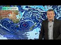
- NZ: Some wet weather Mon/Tue, but powerful high pressure returning
- Runtime
- 4:06
- Date posted
- 2 years ago
- Description
- We have a cooler, wetter change moving up the nation - especially over Tuesday before fading out to the east on Wednesday.
Then, apart from isolated showers, New Zealand has a powerful high pressure zone moving in. We bring you the latest on NZ’s weather through until this coming Sunday.

- Title
- Cyclone Alfred: (Monday) Brisbane, SE Qld, NE NSW prepare for direct hit
- Runtime
- 9:00
- Date posted
- 2 years ago
- Description
- Tropical Cyclone Alfred is still on track to make landfall in eastern Australia, with most guidance picking the south-east corner of Queensland to be most exposed.
We explain why Brisbane and parts of NSW are exposed and how much wind and rain there might be.
We also cover wave heights around the Tasman Sea and Coral Sea generated by Alfred.
Our next Cyclone Alfred update will be on Tuesday March 4.
- Title
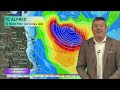
- Cyclone Alfred (Sunday): Qld, Brisbane & NSW most exposed
- Runtime
- 8:29
- Date posted
- 2 years ago
- Description
- In this special Sunday update we have the latest on the messy path of Tropical Cyclone Alfred which is looking increasingly likely to make landfall in the central eastern Australia coastline later this coming week. Those between about Bundaberg (Qld) and Grafton (NSW) should be tracking Alfred’s path closely in the days ahead.
The cyclone has weakened a little - and this week may weaken further before powering up again a little before potential landfall in south-east Qld (maybe even north-eastern NSW).
High pressure south of the cyclone is the main guiding force - we explain why this cyclone isn’t just moving in one line, and why landfall isn’t yet locked in due to a number of “moving parts".
We’ll have another update on Cyclone Alfred on Monday as we continue to fine tune the likely path.

- Title
- ClimateWatch: MARCH pattern remains “Neutral” - we track the dry & wet
- Runtime
- 13:06
- Date posted
- 2 years ago
- Description
- Due to Cyclone Alfred it’s a bit trickier than previous months to work out upcoming rain for NZ (and eastern Australia). The cyclone may well be around for a couple of weeks, cradled in place by strong and dry high pressure zones to the south of Australia, the southern Tasman Sea and New Zealand at times.
These high pressure belts steer tropical cyclones - and can often block their movement.
But as we go into March there are more gaps between the highs - which allows rainmakers to drop south from the tropics, develop locally, or move out of the Southern Ocean area.
We’re still in NEUTRAL - ie, no La Nina, no El Nino.
We do our best at locking down some details in what is shaping up to be hot and dry for a large portion of Australia, while New Zealand has some chances to ease the dry weather - but it’s not 100% locked in, as Philip Duncan explains

- Title
- NZ 7 Day: Some wet weather coming - but it’s messy
- Runtime
- 6:28
- Date posted
- 2 years ago
- Description
- The first week of March will kick off with some wet weather for New Zealand but it’s a bit of a messy set-up with so much high pressure around.
But there’s a break in the high pressure next week - perhaps enough for a weak low to create some pockets of rain and showers before the next high rolls in.
We also take a look at Severe Cyclone Alfred which remains to NZ’s north-west over the Coral Sea (east of Queensland).

- Title
- 7 Day Forecast for Cyclone Alfred "the pinball”
- Runtime
- 4:45
- Date posted
- 2 years ago
- Description
- Tropical Cyclone Alfred is a bit like a pinball stuck in a giant pinball machine as high pressure around Southern Australia, the Tasman Sea and the New Zealand area influence the future tracking of this cyclone.
We try to break down what is a fairly messy forecast as Alfred looks set to remain at sea for at least a week - but will brush Australia this week in a way that means those in Queensland should be closely monitoring in case it moves closer than is forecast.
If Alfred does as the models suggest, and remain at sea, it might linger there for over another week.
Today’s video is short and to the point with still so much uncertainty about the precise future path.

- Title
- Australia 7 Day: Severe Cyclone Alfred amongst the dry and heat
- Runtime
- 9:11
- Date posted
- 2 years ago
- Description
- We continue to track Severe Tropical Cyclone east of Queensland - and while the next days of tracking appear locked in, there remains great uncertainty about Alfred’s path going into next week. This is because of the huge high pressure zone over the Tasman Sea that guides the path of cyclones - and can stall them, weaken them or nudge them sideways. We compare global modelling so you can see where things get messier as far as locking in a forecast is concerned.
Elsewhere there isn’t much activity, but the eastern coastal side of Qld and NSW may both get thunderstorms, showers and rain next week - depending on how close Alfred can get. WA also has thunderstorms most days here and there.
But the majority of Australia leans drier than average over the next week as the tropical north isn’t as wet as it should be and those in the south have more dry winds in the mix.
Our Flight Sim place of the day this week is the very small town (village) of...

- Title
- NZ’s weekend weather, outlook for next week + update on Cyclone Seru
- Runtime
- 6:48
- Date posted
- 2 years ago
- Description
- High pressure is mostly dominating New Zealand in the week ahead but we do have some wet weather in the mix - but not a huge amount.
There will be a few isolated showers this weekend, potentially heavy, otherwise many are dry and warm to hot.
Next week a southerly change looks to bring a burst of wet weather, mainly to the eastern side of the country from Southland to East Cape. Western and northern parts of the North Island look driest.
But later next week or weekend we may be monitoring Cyclone Alfred which is currently a Severe Tropical Cyclone in the Coral Sea. It’s path beyond the next five days is unclear - but it’s worth monitoring. (See our Australia-only update today for full details on Alfred).

- Title
- Australasia: 4 named cyclones, Queensland still most exposed
- Runtime
- 5:56
- Date posted
- 2 years ago
- Description
- We’re tracking 3 tropical cyclones and 1 ex-tropical cyclone around Australia, New Zealand and the south Pacific over the coming days. New Zealand is not currently at risk of these storms.
Alfred - which is over the Coral Sea - perhaps poses the biggest threat to people with the tropical cyclone potentially affecting Queensland in the week ahead, although the tracking isn’t yet locked in.
This video is focusing on tropical storms - on Thursday we’ll have our usual NZ and Australia only videos and we’ll have more information about these tropical cyclones in those updates.
As always, keep up to date with official warnings from the Fiji Met Service and BoM.

- Title
- Tropical Update as 3 cyclones develop around Australasia
- Runtime
- 4:33
- Date posted
- 2 years ago
- Description
- Cyclone Rae, Cyclone Alfred and Cyclone Bianca are the focus of our special video today - plus a potentially new tropical cyclone that may form near Vanuatu.
We track each tropical storm and where they are likely to go - and who may be most impacted.
As always keep up to date with your local weather authority for official local weather warnings.
This is the big picture about all four of these tropical storms/lows and where the wind, rain and big seas will be.
We aim to have another cyclone update again on Wednesday.

- Title
- NZ RainWatch: Forget cyclones, it’s anticyclones here bringing more dry weather
- Runtime
- 6:38
- Date posted
- 2 years ago
- Description
- 7 Day Outlook --- For now New Zealand is truly in a dry run of weather as high pressure zones smother the country and keep tropical lows and most Southern Ocean storms well away from us.
Despite a few showers - and some locally may be heavy and bring relief this week - most places lean dry or drier than average. The only exception is the very south to south-west of the South Island which may get some brief late week rain.
Put short, if it’s dry where you are now then chances are it will be even drier in a week.
We take a close up look at New Zealand’s weather for the next 7 days ahead + a big picture 7 day rainfall map of Australasia to get your head around where the rain is falling - and where it is not.

- Title
- Australia: Queensland Cyclone threat otherwise a dry week for most
- Runtime
- 6:48
- Date posted
- 2 years ago
- Description
- We’re monitoring two tropical cyclones around Australia. Cyclone Bianca is west of Western Australia and poses no threat to land as of today.
Cyclone Alfred over the Coral Sea is likely to be the main one to watch as it grows over the Coral Sea this week - and might impact Queensland directly on Sunday or a week from today (next Monday).
High pressure to the south and over the Tasman Sea will guide Alfred’s future path - and these anticyclones will also make places that are dry now, likely even drier by one week from now.
- Title
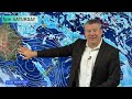
- NZ looks dry as 3 Tropical Cyclones develop in tropics
- Runtime
- 5:58
- Date posted
- 2 years ago
- Description
- High pressure is dominating NZ in the week ahead and while there are some showers most places that are dry today will be even drier one week from now.
These highs are also controlling the movement and path of two tropical cyclones directly north of NZ around the Coral Sea (Cyclone Alfred) and near Fiji and Tonga (Cyclone Rae).
A third tropical cyclone is west of Australia and poses no threat to land.
Despite all the tropical rain north of NZ, the weather here is looking drier than average for every region in the country except Fiordland.

- Title
- RainWatch: NZ 7 Day + South Pacific cyclone outlook
- Runtime
- 8:56
- Date posted
- 2 years ago
- Description
- We track the next week of rainfall chances in the NZ area, but also monitoring the tropics with a number of “areas of concern” as low pressure continues to try to spin up a tropical cyclone.
High pressure in the NZ area is actually the most dominant force - holding the tropical lows back from expanding properly and ensuring much of NZ and Australia remains drier than usual for the next week ahead.
We also cover the 7 Day Rainfall Map for NZ plus the latest on the Drought Index.
*A small thing to note - when talking about the Tropical Cyclone Outlook Philip accidentally references cyclones forming “within 24 hours” but meant to say “beyond 24 hours”, as per the screen key.
Have a good weekend!
- Title
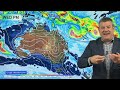
- Australia 7 Day: More heat, some thunderstorms, possible storm over the Coral Sea
- Runtime
- 9:19
- Date posted
- 2 years ago
- Description
- Despite thunderstorms possible over much of Australia in the coming week the hit and miss nature means a large portion of the continent is dry - and becoming hotter.
Tropical eastern Queensland and parts of the Kimberley look to have the highest chances of rain - but coastal NSW and even parts of VIC, TAS and the A.C.T may get some downpours and thunderstorms this weekend.
This week’s Flight Sim flyover is Griffith, NSW!

- Title
- High pressure returns to NZ as lows grow in the tropics
- Runtime
- 5:25
- Date posted
- 2 years ago
- Description
- A south to south-west change is moving into NZ over late Thursday and going into Friday - but don’t expect much rain if you live in northern NZ as high pressure comes on in for the weekend. High pressure dominates NZ into next week with a lot of dry weather.
Meanwhile the tropics continues to be very busy with several low pressure zones. There still remains a cyclone risk or two over the next week, but it’s not as straightforward if and when a tropical cyclone may form - we explain why it’s messy.
We cover New Zealand and the South Pacific island nations in our Thursday weather video.

- Title
- NZ & South Pacific weather as tropical cyclone may form near Tonga & Niue
- Runtime
- 5:46
- Date posted
- 2 years ago
- Description
- High pressure is returning to the NZ area as the tropical South Pacific is smothered in low pressure producing widespread rain and the chance of a tropical cyclone this week around Tonga and Niue.
We will have more details on Thursday about the cyclone risk - but Niue and Tonga look most exposed.
NZ has a cold front arriving in the south on Thursday, weakening on Friday as it moves northwards - and by this weekend and early next week NZ has high pressure over us bringing mostly dry weather.

- Title
- High pressure returning to NZ, but all eyes on the Tropics
- Runtime
- 6:38
- Date posted
- 2 years ago
- Description
- Low pressure covers NZ for the rest of Tuesday but clears away Wednesday as westerly quarter winds return to the country. Over Thursday and Friday many regions become drier again, but a cold front late Thursday and into Friday will move up the South Island dropping temperatures and bringing some wet weather.
High pressure from the west is likely to “bulldoze” that wet southerly east of the nation as we go into the weekend - which will keep more of the North Island drier.
High pressure crosses NZ this weekend and into next week.
At the same time two tropical lows north of NZ are worth monitoring. One likes near Tonga, just to the north. The other is yet to develop over the Coral Sea. Both are worth keeping an eye on in the week or two ahead. We’ll have more details on Wednesday

- Title
- Australia weather through to Sunday with a generally quieter week for many
- Runtime
- 7:17
- Date posted
- 2 years ago
- Description
- There isn’t as much “weather” to talk about this week with the remnants of Cyclone Zelia bringing showers and thunderstorms to inland parts of WA, as severe thunderstorms do their usual thing in the tropics.
Coastal and higher elevation parts of NSW also have the risk of some wet weather this week, particularly northwards around Grafton and surrounds.
A windier and hotter northerly quarter wind will also develop later this week through NSW, the A.C.T and into Victoria.
And sorry SA, not much rain coming for you - or for large parts of VIC.
Tasmania still has a cooler week - but ends warmer, especially this Saturday where 30 degrees is possible for some.

- Title
- Low pressure descends on NZ - where does it fall & how much?
- Runtime
- 5:53
- Date posted
- 2 years ago
- Description
- Two low pressure systems are moving into NZ over Monday and Tuesday and both are weakening as they do so. This brings the “Three D’s” to New Zealand: Drizzle, Downpours and Dry areas.
We break down where rain is most likely - and when the next high pressure system is coming.
As you may have noticed from the thumbnail in this video there is a LOT of low pressure in the tropics - we discuss the chances of a tropical cyclone (or two) developing over the next week or two to New Zealand’s north in the south and south-west Pacific

- Title
- NZ 7 Day RainWatch: Tracking drought & upcoming rain
- Runtime
- 7:55
- Date posted
- 2 years ago
- Description
- We have two low pressure zones coming to NZ from Sunday to Wednesday, one from the tropics and the other from the Tasman Sea.
Both bring patchy rain relief to dry and drought regions, but it may not be enough to really reverse conditions - especially with more high pressure coming next week.
It will become windier in the upper North Island (squash zone nor’easters) while heat will cover the lower South Island this weekend - ahead of a cold and Autumn-like change coming mid next week.
We have NZ’s 7 day rainfall outlook and latest drought index maps too.

- Title
- Australia: Severe Tropical Cyclone ZELIA to make landfall today in Pilbara
- Runtime
- 8:10
- Date posted
- 2 years ago
- Description
- This video was recorded on Friday morning and shows the final maps before Severe Tropical Cyclone Zelia makes landfall, which is expected later Friday and going into tonight as it tracks southwards.
Port Hedland and nearby communities looks most exposed to a direct hit.
Zelia has been stalled offshore overnight but this morning rain radar shows the cyclone moving south-eastwards towards Port Hedland. We bring you the latest on winds, rain and tracking.
This is our final update on Zelia - please keep up to date with the Bureau of Meteorology for all Western Australia cyclone warnings and advisories.
Our next Australia-wide update will be on Monday.

- Title
- Australia 7 Day: Southerly change drops temps, severe thunderstorms & Severe Cyclone Zelia
- Runtime
- 9:01
- Date posted
- 2 years ago
- Description
- It’s a busy weather video today as a cooler southerly moves in bringing Autumn weather to some this weekend while WA deals with Severe Tropical Zelia (please see our special video out today/Thursday specific to Cyclone Zelia).
The temperature drop in the south-east will spark severe thunderstorms and downpours as it moves through in the days ahead.
Tasmania in particular looks Autumn-like this weekend with windy southerlies blowing off the Southern Ocean.
In the tropics it’s not too busy, the usual severe thunderstorms and humidity.
We bring you the 7 day rainfall map and today’s Flight Sim place of the week is “Port Hedland” in WA where Severe Tropical Cyclone Zelia may make landfall later on Friday (although not yet locked in).

- Title
- NZ: Wet weather chances Sunday to Tuesday as drought kicks in for some
- Runtime
- 6:03
- Date posted
- 2 years ago
- Description
- High pressure is bringing a ‘cocoon of calm’ to much of the country today and tomorrow but that high slips east this weekend allowing a warmer, more humid, north to north-easterly flow to kick in. This will bring more cloud and showers to eastern parts of the upper North Island this weekend with perhaps some heavy falls in the north-east going into Monday.
By Tuesday a low from the Tasman Sea moves in and brings a burst of rain and/or showers from the west.
By mid-next week a westerly flow returns.
We talk about which regions are now in drought and how much rain is coming for them.

- Title
- WA: Worst Case Scenario - Cyclone Zelia may be Category 5 at landfall
- Runtime
- 7:51
- Date posted
- 2 years ago
- Description
- Forecasts today/Thursday have shifted the tracking of Severe Tropical Cyclone Zelia further down the Pilbara coastline, with Port Hedland potentially facing a direct hit from what is expected to be a Categoy 5 Tropical Cyclone - the highest on the level.
It’s a worst case scenario if this storm makes a direct hit with Port Hedland - we explain the variabilities and why the precise location of landfall may not be known until Friday morning.
Karratha to Port Hedland looks most exposed, as do parts of 80 Mile Beach.
The cyclone is then likely to track inland through central parts of WA as it falls apart and turns into a rain event.
Winds may reach 290km/h at landfall.
Rainfall may be 2 or 3 times the annual amount for Port Hedland and surrounds in just a couple of days - but depends on the speed of ZELIA as the cyclone moves over land.
We have the latest big picture forecast. Don’t forget the Bureau of Mete...

- Title
- Tropical low may brush NZ on Sun/Mon, then westerly change
- Runtime
- 5:53
- Date posted
- 2 years ago
- Description
- NZ’s dry weather is about to get drier - before the next wet weather chances from Sunday to Tuesday due to two different lows moving in.
The first low comes out of the tropics where it is a short lived unofficial tropical cyclone - the remnants of that come southwards on Sun/Mon but may mostly be offshore.
Then Mon/Tue a larger low in the Tasman Sea may move in, merging into one low pressure zone by Tuesday
Despite all the action, rainfall numbers still may not be high for everyone - we have the latest.

- Title
- WA Special Update: Tropical Cyclone ZELIA - Kimberley, Pilbara most at risk
- Runtime
- 7:22
- Date posted
- 2 years ago
- Description
- We show the latest tracking of Tropical Cyclone Zelia and which areas may be most affected by the wind and rain storm.
A large portion of Western Australia is at risk of rain, especially inland areas south of Port Hedland and Eighty Mile Beach.
We break down what BoM is saying and global modelling, to make sense of it all.
Next Update: In our usual Thursday Australian update out tomorrow.

- Title
- Australia: WA Cyclone risk, severe thunderstorms SE, temp changes in south
- Runtime
- 9:14
- Date posted
- 2 years ago
- Description
- There are a number of moving parts to the weather this week with the possibility of a tropical cyclone forming around the Kimberley or Pilbara bringing widespread rain, thunderstorms and potentially wind - we explain why the forecast isn’t locked in yet.
In the south-eastern corner of Australia the heat goes up this week bringing widespread showers and severe thunderstorms - especially for NSW. Later in the week temperatures drop as a refreshing southerly moves on through - check your local temperatures for timing where you are.
We also take a look at the rain risks around Qld following the flooding, with rain clouds breaking up - but still some pockets of heavy rain.
*Technical Issue: We apologise for the brightness/colour issues in some of the maps in today’s video, it was out of our control today.

- Title
- NZ: Downpours then dry this week - what happens next week though?
- Runtime
- 5:44
- Date posted
- 2 years ago
- Description
- This week kicks off with some showers, downpours and possibly severe thunderstorms here and there - but the long range forecast is a dry one is a big high pressure zone moves through this week.
The high departs this weekend and drags down a hotter, sub-tropical, northerly or nor-wester boosting the heat and fire risks across both main islands.
But next week might see a change with a chance of a rainmaker for dry areas - it’s not locked in this far out, but we give you a sneak peek into the possibilities of high pressure being replaced by wetter lower pressure.
*Technical Issue: We apologise for the brightness/colour issues in some of the maps in today’s video, it was out of our control today.
**Programming Note: We have no NZ video on Tuesday - see you again Wednesday!

- Title
- Australia: Excessive heat, flooding rains & large dry areas
- Runtime
- 8:26
- Date posted
- 2 years ago
- Description
- We’re tracking severe weather in all corners of Australia as heavy rain continues in tropical Queensland, severe thunderstorms and downpours move into NT, the Kimberley and the eastern side of NSW.
Excessive heat remains around WA with a brief relief this weekend in south-west.
SA, VIC are windy, hot and dry at times with a brief slightly cooler change for some this weekend - especially around coastal VIC and TAS.
And the A.C.T gets some wind and wet weather - but not as much as surrounding areas.
We have your forecast through to next Tuesday.
Our Flight Sim place of the week is Karumba in Queensland.

- Title
- NZ’s weather to Tuesday next week as downpours & dry dominate
- Runtime
- 4:36
- Date posted
- 2 years ago
- Description
- High pressure is mostly affecting the country in the week ahead but we see afternoon downpours in both main islands that may turn heavy and thundery.
Winds are light for many regions, with hottest weather in the north of the country and more temperature fluctuations further south.
We also monitor a busy tropical region with a number of lows at the moment.
Due to Waitangi Day and leave our next video update will be on Monday. Have a great Waitangi Day and weekend.

- Title
- Special 7 Day QUEENSLAND rain & flood update
- Runtime
- 8:12
- Date posted
- 2 years ago
- Description
- We take a closer look at how much more rain is coming for tropical Queensland and what is driving it all with at least another week of rain to come.
Rainfall totals are extreme in some places and may exceed half a metre, or even over 1000mm in some locations over the coming week.
This video helps explain what is happening and what is coming - but please keep up to date with the Bureau of Meteorology for all local official weather warnings and advice.

- Title
- Tropical low may brush northern NZ this weekend
- Runtime
- 6:05
- Date posted
- 2 years ago
- Description
- High pressure is mostly dominating the country but storms in the tropics are moving closer towards us and means it’s something northerners need to “keep an eye on”.
While modelling shows the low offshore, the close proximity to NZ on Sunday and Monday means easterlies and some wet weather may brush the upper North Island. Severe weather risks are rated as LOW for this event, but it’s worth monitoring closely and we explain why.
There are also a few thunderstorms and afternoon downpours around NZ as high pressure continues to mostly control things.
We have your forecast for Waitangi Day, the upcoming weekend and the start of next week.

- Title
- Australia 7 Day: Heavy Qld Rain, some heat relief in the south but mostly dry still
- Runtime
- 7:17
- Date posted
- 2 years ago
- Description
- Heavy tropical rain around Ingham and Townsville this week may total up to half a metre of rain in some locations as a very wet east to north-east flow continues (and may go into next week). This airflow will spark some severe thunderstorms into hilly and higher elevation parts of NSW with showers also possible around VIC and SA - but unfortunately won’t be much.
VIC may get some coastal rain in the next day or so as a more refreshing airflow comes in.
WA has an offshore tropical cyclone, more heat in Perth this week, thunderstorms and downpours inland near both Broome and Carnarvon *but less likely on the coast itself) and a refreshing change later this week in WA’s South West.
We also cover how much rain is likely beween Cairns and Mackay between now and Saturday.
Programming Note: Due to NZ’s national holiday for Waitangi Day this Thursday we’ll bring forward our next Australia-only weather video to Wednesday.

- Title
- Tracking the showers as NZ looks to have mostly dry weather this week
- Runtime
- 4:46
- Date posted
- 2 years ago
- Description
- There may be a few temperature fluctuations in the southern half of the South Island in particular but the further north you go up New Zealand this week the more consistent the temperatures will be.
We track the daily showers across both main islands and show all the lows forming in the tropics right now.
This video covers New Zealand’s forecast through until Sunday, including Waitangi Day this Thursday.
- Title
- ClimateWatch: FEBRUARY around NZ & Australia looks energetic, but still large dry areas
- Runtime
- 11:33
- Date posted
- 2 years ago
- Description
- High pressure is dominating NZ and south-eastern Australia but the tropics and the Southern Ocean areas remain active with numerous low pressure zones, some simmering away gently, others growing into large storms.
La Niña is not officially here - and we discuss why Australia’s Bureau of Meteorology no longer provides fortnightly updates on La Niña, as news outlets continue to headline it almost every week.
Put short, the forecast across Australasia is that of a very active tropical season creating more lows, thunderstorms and heavy rain in the tropics, while the Southern Ocean also remains very busy with storms tracking past. A “protective” layer of high pressure separates these rain and wind makers from NZ for now - and most of that high pressure is tracking south of Australia, over the south-east of Australia, the Tasman Sea and over NZ, keeping these areas drier than normal.
However, with so much energy north and south of these dry area...

- Title
- NZ’s weather for the first week of February
- Runtime
- 6:12
- Date posted
- 2 years ago
- Description
- High pressure dominates NZ but some showers and wind changes are expected.
Regions that are drier are likely to become drier over the next 7 days.
The tropics is very busy at the moment, so too is the Southern Ocean - but for now NZ remains under a “protective” layer of high pressure keeping most rain makers offshore.
We have your weekend weather and the outlook for the first week of February.

- Title
- Australia 7 Day: Tropical rain for Qld, showers & dry elsewhere
- Runtime
- 10:22
- Date posted
- 2 years ago
- Description
- Tropical low pressure is dominating northern parts of Australia with hotter weather sinking southwards in the days ahead. While showers are possible around VIC, NSW and SA, it will be coastal Queensland - in particular the Mackay/Whitsunday and North-East regions with flooding rains from off the Coral Sea.
An offshore tropical cyclone is also possible west of WA next week (not locked in).
We monitor the low pressure belt from Africa to Australia and beyond to Fiji and how this might impact Australia’s weather along with large high pressure zones brushing the southern coastline and more storms and southerlies off the Southern Ocean.
This is Australia’s Big Picture forecast with 7 day rainfall.
This week’s Flight Sim place is Bowen in the Whitsunday region as rain clouds already arrive!
- Title
- NZ: High pressure grows but showers are forecast for both main islands
- Runtime
- 4:50
- Date posted
- 2 years ago
- Description
- High pressure is dominating NZ as we end January and go into February, but it’s not without a few showers moving through both main islands.
Generally speaking NZ is entering a settled period of “classic” summer weather with lighter winds, drier skies and higher temperatures for many. But the tropics is much more active - we cover that, and we also show how lows in the Southern Ocean will still be sending up some cooler, showery, southerlies/easterlies into next week too.

- Title
- NZ: Dry weather increasing, we track the showers
- Runtime
- 5:38
- Date posted
- 2 years ago
- Description
- High pressure is dominating the NZ region for the end of January and the start of February, bringing drier than average weather to most of NZ and Australia too (over the next 7 days).
But it’s not entirely dry for NZ with some pockets of wet weather, which we track for you.
Big Picture and we see the tropics becoming more active but still no major storms to be concerned about - but it’s worth noting the lows growing around the tropics in the coming week could easily grow into something larger, but for now it’s no too stormy north of NZ, but certainly an increase in rain and low pressure around Fiji, Tonga and Vanuatu





