WeatherWatchTV
Severe weather risks for NZ Wed/Thu as low moves through, high pressure to follow

- Title
- Severe weather risks for NZ Wed/Thu as low moves through, high pressure to follow
- Runtime
- 7:50
- Date posted
- 1 year ago
- Description
- Heavy rain in the north-eastern South Island, and severe gales through central NZ and the top of the North Island will bring a messy end to April and start to May.
We break down where the rain will be heaviest, winds the strongest - and when the southerly change arrives, dropping temperatures.
Meanwhile, once the first weekend of May arrives a powerful high pressure zone is drifting our way - and will bring a mostly settled and dry first week to May.
*Programming Note: Our May ClimateWatch update for NZ/Australia will be out later on Thursday.
- Title
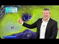
- Sub-tropical low to bring wind & rain before enormous high pressure zone
- Runtime
- 10:41
- Date posted
- 1 year ago
- Description
- Pockets of heavy rain, isolated thunderstorms and gale force winds will be spreading around parts of NZ for today, Wednesday and Thursday as low pressure drops down over the country from the sub-tropics. Interacting with high pressure departing - and then incoming new high pressure - we’ll see a burst of East to North-East winds today and tonight, followed by a surge of gale South to South-West winds on Thursday (strongest around the lower North Island).
Rain bands will be messy - meaning some of those downpours may be hit and miss for some.
Not all regions are affected - especially those in the lower third of the South Island, where a colder southerly flow is about to kick in.
But by Friday and this weekend in comes a high pressure zone as big as Australia - and that looks set to bring a settled first week of May to most, if not all, parts of New Zealand.
We have your forecast through to Monday of next week.

- Title
- Australia: Rain for coastal NSW and FNQ, large dry areas for many others
- Runtime
- 6:53
- Date posted
- 1 year ago
- Description
- High pressure is tracking along the south of Aussie this week, bringing rain into parts of VIC and NSW as it does so - and interacts with a large low in the NZ area.
Elsewhere very large areas of dry will continue on with southerlies this week for many places, turning more easterly - and then hotter northerly as we go into the weekend.
We have your Australia-only forecast through until Sunday.

- Title
- Low pressure sinks over NZ this week, before powerful weekend high
- Runtime
- 6:20
- Date posted
- 1 year ago
- Description
- Low pressure is dropping down over the country this week bringing wind and sub-tropical rain into the South Island too, along with calm spells and instability in the north.
The set up sees areas of heavy rain, mixed in with large dry and drizzly areas too. We have the latest on how this tracks through - and the latest on a very large high pressure zone likely coming into the country for the first weekend of May.

- Title
- Anzac Day + Long Weekend Weather
- Runtime
- 8:22
- Date posted
- 1 year ago
- Description
- A few showers may be around for dawn ceremonies on Anzac Day but it won’t be much with most of NZ dry underneath high pressure.
But some low pressure north of NZ is going to grow in the coming days (at this stage not into a storm) and this means a changeable forecast for NZ as this is a bit of a borderline set-up.
In saying that, rain is possible in northern parts of NZ from Northland to Auckland, Coromandel Peninsula to East Cape.
Elsewhere not too much is happening - with a big question mark remaining over that low pressure north of NZ. We explain the likely set-up.
Have a good Anzac Day and enjoy the long weekend - we’ll catch you again on Monday.

- Title
- Sub-tropical rain may return this weekend in the north
- Runtime
- 8:05
- Date posted
- 1 year ago
- Description
- It’s possible some area of heavy rain may brush the top of the North Island for the second long weekend in a row, as yet another big balloon of high pressure builds out to our east and encourages a sub-tropical airflow down.
But unlike Easter this one doesn’t have a storm attached to it - but an area of sub-tropical low pressure and Tasman Sea low pressure may help drag in some wet north-east weather. We’ll lock this in with more detail in our Thursday video update as the situation isn’t yet locked in.
Elsewhere cooler mornings, drier weather (a few showers here and there).
We have the full forecast for NZ through to Tuesday next week - plus the weekend rainfall map brought to you by Resupply.co.nz

- Title
- OZ: Showery in the south and south-east, weekend thunderstorms
- Runtime
- 7:58
- Date posted
- 1 year ago
- Description
- Many parts of Australia are dry this week, but those in the south-east will get a burst of wind, rain, showers and a drop in temperatures - along with the chance of severe thunderstorms across VIC, A.C.T and NSW around Friday and Saturday.
We try to break down which areas are more exposed to rain and which ones are not - on what is a fairly quiet week or so of weather ahead for many places. Saturday’s severe weather risks mostly affect NSW and Victoria at the time of recording this (Tuesday April 22).
Due to the short week (Easter and Anzac) this is our only Australia-only update this week - but we’re back on Monday and normal updates return.

- Title
- NZ: Cooler airflows, drier skies - rain may return Sun/Mon
- Runtime
- 5:32
- Date posted
- 1 year ago
- Description
- High pressure is expanding over NZ this week, ushering in a cooler/colder airflow and bringing a few showers - but much longer dry spells moving through.
High pressure covers the country until the long weekend with Sunday or Monday potentially seeing rain clouds building to the north and west of NZ along with a windier nor’east. (Not as bad as the one we just had based on modelling at the moment).
We have your forecast for the short week, Anzac Day and the next long weekend.
Our next update is on Wednesday April 23.

- Title
- Easter Weekend update: When it trains, it pours `
- Runtime
- 6:40
- Date posted
- 1 year ago
- Description
- “Training" is a meteorological term that refers to thunderstorms and intense downpours all tracking in a line one behind each other - like train carriages on a train track. Slightly east or west of that line it may be sunny and completely dry.
Set-ups like this are highly forecastable - as we warned days ago of the risk of intense thunderstorms and downpours like the one that hit Auckland and Hamilton and other North Island areas overnight/this morning But on the day itself their precise placement - or when they will suddenly trigger - is much harder. WeatherWatch has had the alerting capability to automatically warn of these events through our mobile App for the past three years - but sadly MetService’s commercial side has so far made it impossible for us to achieve these alerts in NZ due to their commercial side and no open data (open data is standard in the rest of the modern world).
But we can give you the big picture - and that’s what we do in this...

- Title
- Australia 7 Day: Wet weather around the edges + Cyclone Errol heads near Broome
- Runtime
- 10:08
- Date posted
- 1 year ago
- Description
- A severe tropical cyclone is off the coast of the Kimberly while downpours move from southern WA to SA before easing to a showery southerly that tracks to Adelaide where a new low starts to form, bringing more showers from Adelaide to Melbourne off the sea, then that weak low slides up the eastern side of Australia and towards Brisbane next week - this brings plenty of rain and showers along coastal NSW and parts of eastern Victoria, also the ACT.
Elsewhere not a lot is going on!
The Microsoft Flight Sim Place of the Day is this week Broome, WA.
Have a great Easter - our next video update will be on Tuesday of next week (Due to Monday being a public holiday in NZ where we record).

- Title
- NZ storm update as we go into the Easter long weekend
- Runtime
- 12:09
- Date posted
- 1 year ago
- Description
- Severe weather risks may increase today but are likely to become more isolated as we go through the long weekend.
We explain why rainfall forecasts will still change - and how much longer the gales will last.
We also take a look at 7 day rainfall - brought to you by Resupply.co.nz (and a big thanks to them for supporting us so we can provide even more content for farmers, growers and gardeners!).
There is NO VIDEO on Good Friday - but, we are back again on Saturday with a special Easter Weekend update due to the pockets of severe weather that may be lingering on..nz

- Title
- Subtropical storm to unravel around NZ for long weekend
- Runtime
- 13:50
- Date posted
- 1 year ago
- Description
- Severe gales, heavy rain and travel disruptions are forecast for NZ as a sub-tropical storm moves in.
The low was named Cyclone Tam on Tuesday by the Fiji MetService, and confirmed still this morning by NZ’s MetService - but it’s rocketing out of the tropics so will today lose that technical “tropical cyclone” status. The low will get larger though as it stalls over the Tasman Sea.
Between the large storm, and a very powerful high pressure zone to our south-east, we can expect damaging winds in the upper North Island. Rain will be slow moving due to the blocking high to our east… therefore rain may linger through until next week for some regions.
We have extensive details as we go into the long Easter Weekend with pockets of severe weather around New Zealand.

- Title
- NZ: Category 1 Cyclone Tam forms near Vanuatu, severe weather risks for parts of both main islands
- Runtime
- 12:18
- Date posted
- 1 year ago
- Description
- TEXT Updated 9pm Tuesday: Cyclone Tam has formed and is now a Category 1 storm with gale force winds around the centre. Category 1 is damaging, but it is also the lowest on the tropical cyclone scale (which goes up to five). In comparison, Cyclone Gabrielle had Category 3 strength when it reached New Zealand just over two years ago.
At the time of recording this video the cyclone was not officially named by the Fiji Met Service but it was anticipated – tonight the Fiji Met Service named the Tropical Cyclone “Tam”.
Ex-cyclones, even once winds have eased, can bring flooding if high pressure near New Zealand slows it down – or stalls the rain in one area for days. High pressure is likely to be in that position in the days ahead, which is why forecasters are tracking this low so closely.
Powerful high pressure to the east of NZ will create a “squash zone” (a line of windy nor’east weather) as the storm approaches NZ in the next two day...

- Title
- OZ: Showers, some heavy, for dry regions - otherwise calm
- Runtime
- 8:04
- Date posted
- 1 year ago
- Description
- We’re monitoring low pressure in the tropics and some showers for dry regions to the south as a fairly calm week of weather comes your way.
A tropical low (which has reached cyclone status according to JTWC) is yet to be named a tropical cyclone by BoM as we recorded this - but is likely in the next day.
In the south there are showers from west to east along the southern coastline over the coming week - but surrounded by large dry areas.
Those in the east of Australia have showers and east to south-east winds finally easing later this week. Inland areas are mainly hot and dry and calm with little change.
We have your forecast and rainfall outlook to Sunday
- Title
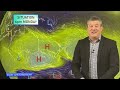
- NZ: Sub-tropical storm to bring severe gales, heavy rain Wed - Fri
- Runtime
- 9:28
- Date posted
- 1 year ago
- Description
- A tropical low is deepening near Vanuatu today and will power up in the sub-tropics as it drops southwards towards NZ - and then interacts with a powerful high pressure system to our east.
We call this windy area between the low and high a "Squash zone” and this creates stronger and stronger north-east winds and then slows down the sub-tropical rain - bringing a burst of severe wind and rain to northern parts of both main islands, but in particular the North Island.
We bring down winds, rain, waves and the nationwide set-up between now and covering the long weekend.

- Title
- 7 Day RainWatch: We explain the flip-flopping Easter forecast
- Runtime
- 9:41
- Date posted
- 1 year ago
- Description
- High pressure may be dominating NZ for now, but a large low pressure area is challenging this as we head into Easter.
Today we explain why there is some predictable “flip flopping” in the long range forecast and why we may need a few more days to lock in.
We also have a swell forecast for the weekend, 7 day departure from normal and some outdoor Autumn gardening and farm tips brought to you by Resupply.co.nz
- Title
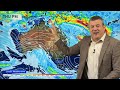
- Australia 7 Day: Tropical Cyclone risk increases + eastern showers & WA downpours
- Runtime
- 8:43
- Date posted
- 1 year ago
- Description
- Despite some very large, dry and calm areas in the week ahead we’re monitoring two areas in the tropics where tropical cyclones may form. For now there isn’t much threat to land - but they are close enough to monitor in the Top End, Kimberley and also FNQ.
Eastern coastal Queensland and coastal NSW have plenty of easterlies and showers over the coming week- but inland areas look dry. Much of VIC, TAS, SA and inland NSW looks dry.
We break it all down for you - and this week’s Flight Sim place is Port Pirie, in South Australia.

- Title
- NZ 9 Day Outlook with high pressure, southerlies and tropical life
- Runtime
- 6:15
- Date posted
- 1 year ago
- Description
- High pressure continues to dominate most of NZ’s weather with the next cold front arriving on Monday with another burst of wind, rain and alpine snow - but it looks to fade fast going into Tuesday as more high pressure arrives.
High pressure looks to control our weather going into the Easter weekend - but is not locked in yet. The tropical lows north of the country are still expected to develop - but whether they affect NZ or not is not locked in yet, due to the powerful high pressure belt still passing over the country.

- Title
- NZ’s extra long range outlook to Good Friday
- Runtime
- 7:35
- Date posted
- 1 year ago
- Description
- A lot of high pressure is coming in to NZ - but will it be gone by Good Friday as a sub-tropical low grows? We have the latest forecast and big picture modelling showing how settled NZ’s weather will be (for the most part) over the next 7 days - but as we go into Easter it looks more changeable.
We bring you our first taste of Easter weather-wise with this forecast through until Friday of next week.

- Title
- The build up to Easter - high pressure may not last until long weekend
- Runtime
- 7:31
- Date posted
- 1 year ago
- Description
- NZ has a cold change moving up the nation today with weather in the lower half of the South Island - but it is short lived.
On Wednesday, after a colder start (with some frosts through the South Island's interior), high pressure starts to return from the west and is likely to cover NZ through this coming weekend and into next week, but may move away by Easter Weekend.
We’re also monitoring low pressure in the tropics and the Southern Ocean which might impact our weather for the Easter Weekend. We have your forecast through to Tuesday next week - and we hope to bring you our first hint at potential Easter Weekend weather in our video tomorrow (Wednesday April 9).

- Title
- Australia: Tropical downpours as temps swing in south + Cyclone near Darwin
- Runtime
- 8:26
- Date posted
- 1 year ago
- Description
- A large southerly flow has dropped temperatures in a large part of Eastern Australia but hotter weather is expected by this weekend as northerlies return. It’s a dry forecast for the south-east but showers in the south-west and the eastern coastal side of the nation are forecast.
Heaviest rain will be FNQ coming in off the Coral Sea, while a tropical cyclone is expected north of Darwin this week and is likely to impact West Timor later this week - we have the latest for East & West Timor and possible tracking with Kupang looking exposed to a direct hit (but this may still change). The cyclone is likely to be west of the Kimberley this weekend and looks to be well offshore for now.

- Title
- Short lived wintry snap on Tuesday - then back to high pressure
- Runtime
- 7:08
- Date posted
- 1 year ago
- Description
- Snow on the ranges, gale force winds and squally showers are in the forecast for Tuesday as an Autumn blast comes through giving parts of the South Island a taste of winter.
The cold blast hit Tasmania over the weekend with some snow on the summits. This cold blast reaches NZ on Tuesday and clears away on Wednesday.
High pressure returns behind it - but some easterlies are in the weekend forecast bringing some northern showers.

- Title
- NZ 7 Day RainWatch: Rain, showers & more high pressure
- Runtime
- 8:02
- Date posted
- 1 year ago
- Description
- Autumnal weather continues on going into this weekend with another burst of windier, unsettled weather going into the start of next week.
But by the middle of next week high pressure returns to all of New Zealand bringing more calm, dry, weather. Good conditions for getting out in the garden or on the farm and doing some projects that perhaps you had to wait for some rain for first.
We bring you the latest Autumn Outdoor tips brought to you by Resupply.co.nz
Also, please pick up a copy of the NZ Listener - Journalist Paul Gorman has written an amazing piece about why NZ has two tax funded forecasters, how this mess happened and what comes next. Paul interviews Philip Duncan in the story too.
Have a great weekend - we’ll see you again on Monday.

- Title
- Aussie 7 Day: Dry expands, but helpful showers for WA, Autumn for Tassie!
- Runtime
- 7:37
- Date posted
- 1 year ago
- Description
- Autumn weather will be off and on for Tasmania and coastal parts of Victoria and SA in the coming days - but rainfall still is low in most populated places as high pressure continues to dominate much of the south.
Rainfall will be highest on the west coast of Tasmania, but good news for the south-west of Western Australia with some good widespread rain, thunderstorms and showers in the days ahead - but with very windy east to north-easterlies for a time.
Much of NSW is dry, as is central Australia.
Best chance for rain is from severe thunderstorms in the tropical areas - and central Queensland too (especially today and Friday).
We have your 7 day rainfall map plus the Flight Sim place of the day is Mareeba, Queensland.

- Title
- Rain & wind move into NZ, Autumn blast again early next week
- Runtime
- 5:47
- Date posted
- 1 year ago
- Description
- Heavy rain and strong winds are pushing across New Zealand today, tonight and over Friday - with weather easing on Saturday for many places.
By Sunday the next surge of westerlies and showers from the west kicks in - with Monday and Tuesday seeing a cold Autumn blast moving through, maybe even snow on the southern ranges.
But high pressure isn’t done with NZ yet - and the next big high arrives around Wednesday next week.
We have your forecast through to the middle of next week.

- Title
- Update on heavy rain, gales & storms around NZ next 7 days
- Runtime
- 8:49
- Date posted
- 1 year ago
- Description
- A storm near NZ will bring gales and pockets of heavy rain into both main islands for the rest of this week with the risk of slips and flooding in some places.
The north-west of the South Island and other parts of the northern and western North Island are most at risk from the heavy rain.
We also break down wind risks and temperature changes - plus track a huge storm south of NZ next week which may not hit us but is likely to help produce a new rain maker in the Tasman Sea.
For those that need rain this is a positive forecast - but in some locations there is a chance it may be too much of a good thing.

- Title
- ClimateWatch: APRIL sees more variety, but stubborn highs still in mix
- Runtime
- 10:27
- Date posted
- 1 year ago
- Description
- Two big lows in the Tasman Sea shape the start of April for NZ and some eastern parts of Australia as a more energetic Autumn weather pattern develops south of us.
But rainfall looks below normal for drought zones in Australia - while New Zealand should see some relief into the drought zones in the west of the upper North Island (Auckland and Northland) in the first half of April.
Heavy rain will be hit and miss in both main islands of NZ with temperatures fluctuating more - but still likely warmer than average.
As for those stubborn high pressure zones - they change shape this month, increasing the dry in Australia but giving NZ more windy westerlies…but by mid-month we may be back to settled/dry high pressure again.
We have the latest Big Picture trends for air pressure, rain/dry, sea temperatures and overall land temperatures across New Zealand and Australia.

- Title
- NZ: Rain & wind on the way - we break it all down
- Runtime
- 6:45
- Date posted
- 1 year ago
- Description
- A burst of windy and wet weather is coming into the country as we finally see a more official start to Autumn’s weather pattern on a nationwide level.
The next week ahead brings rain, wind and temperature fluctuations - but still dry areas too.
We let you know who gets relief and where the heaviest rain and strongest winds will be.

- Title
- OZ: Severe northern thunderstorms but increasing high pressure in south
- Runtime
- 7:10
- Date posted
- 1 year ago
- Description
- Autumn changes will be much more noticable in the south-eastern side of Australia this week, from Adelaide to Sydney down to Hobart and everyone in between. The main burst of Autumn weather (windier, wetter weather with a temperature drop) will be at the end of this week and going into Saturday, especially for Tas, Vic, the A.C.T and southern parts of NSW. SA is on the edge of this from a rain point of view - and will remain drier than usual, along with the western and northern sides of Vic.
Best chances for rain will be in Qld and NT this week.
We have your Australia foercast out to Sunday.
Programming Note: Our APRIL ClimateWatch update will be out on Tuesday afternoon, April 1st (tomorrow). While this is mainly a NZ based video we cover much of Australia in it too.

- Title
- NZ: Rain finally on way for dry/drought zones this week
- Runtime
- 7:02
- Date posted
- 1 year ago
- Description
- We have the latest on incoming wet weather for our driest regions as the first week of April kicks off Autumnal, with a burst of warm windy northerlies followed by west to south-west winds.
Wettest weather will be in the north-west of the South Island (the ranges between Nelson and Farewell Spit) but also other western parts of NZ - with eastern areas driest.
We cover the week ahead and likely rainfall going through to Sunday.
Programming Note: Our APRIL ClimateWatch update will be out on Tuesday afternoon, April 1st (tomorrow). While this is mainly a NZ based video we cover much of Australia in it too.

- Title
- NZ 10 Day Outlook: Autumn weather arrives for early April!
- Runtime
- 7:03
- Date posted
- 1 year ago
- Description
- A burst of wind and rain is coming next week to many regions as high pressure finally slips away for a time allowing low pressure, fronts and cooler air to get in the mix.
The Southern Ocean is stormier going into April, and high pressure breaks up later next week and going into April’s first week. More high pressure may return after that, but next week is definitely a change to NZ’s weather pattern.
We have a 10 day rainfall map, plus the forecast out to the end of Daylight Saving.

- Title
- Aussie 7 Day: Widespread rain & showers, but dry persists in south
- Runtime
- 11:30
- Date posted
- 1 year ago
- Description
- We are tracking extensive areas of rain and showers over the coming week, especially in Qld, NSW, NT and parts of WA. Vic is much more borderline, as is SA and Tas.
Low pressure off the Kimberley has a moderate chance of becoming a tropical cyclone on Friday - but would be short lived if it does. Otherwise it’s just a tropical low likely to bring some heavy rain over the deserts.
We bring you your 7 day rainfall outlook as well.
Today’s Flight Sim place of the day is Carnarvon in Western Australia!

- Title
- NZ: Rain clouds on the horizon? We have the latest
- Runtime
- 7:09
- Date posted
- 1 year ago
- Description
- A weak southerly for Thursday and Friday will bring a few showers up the country - and a few may linger over the weekend at the top of the North Island, otherwise many places are leaning drier than average.
Low pressure is growing over Australia, the tropics and the Southern Ocean though - and there are signs the high pressure belt may finally see some breaks as we go into April.
We show you where the best chances of rain are in this 7 day NZ Outlook.

- Title
- NZ’s high pressure vs Australia’s rain - we discuss if rain may reach NZ
- Runtime
- 7:16
- Date posted
- 1 year ago
- Description
- The driest parts of NZ are least likely to see wet weather for the rest of March, other than a few showers here and there over the coming days. While some isolated downpours may bring relief, the general forecast shows most wet weather in the south of NZ.
But Australia has suddenly seen a shift to widespread wet weather around the tropics, and out east over NSW too in the days ahead.
There are some chances this wet weather will drift to NZ later next week in the first few days of April - but for this to happen we need a really big area of high pressure to move away.
Full details in our New Zealand forecast out to Tuesday, April 1st
- Title
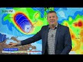
- OZ: Widespread tropical rain/downpours, WA Cyclone Risk, update on dry southern states
- Runtime
- 11:03
- Date posted
- 1 year ago
- Description
- Heavy rain & thunderstorms will balloon out across Qld, NT and parts of WA & NSW this week, brushing SA and Vic, but not soaking the south like it will the north.
Qld has the highest and most widespread chance of rain this week, with NT and NSW close behind - although it’s much more broken up in those places.
The Kimberley may have a tropical cyclone this weekend. Those from Broome to Port Hedland should be monitoring it - as should those in NT incase a new low forms elsewhere.
Tasmania is quiet again this week as high pressure dominates there - and is why coastal parts of SA and Vic (west of about Melbourne) are also looking dry/fairly dry.
We have your Australia only forecast to Monday and a 7 day rainfall map to make sense of it all.

- Title
- NZ: Southern southerly on Thursday, high pressure dominates otherwise
- Runtime
- 6:54
- Date posted
- 1 year ago
- Description
- High pressure is in control for the rest of March bringing drier and warmer than usual weather to many regions - but the southern half of the South Island has best chances of rain and temperature fluctuations, especially with a cold front arriving on Thursday which moves up the nation on Friday.
High pressure comes back in for the weekend - although there are showers here and there.
We discuss the big picture and what may be driving New Zealand’s weather going into April.

- Title
- NZ 7 Day RainWatch: Tracking the showers, southerlies & high pressure
- Runtime
- 9:13
- Date posted
- 1 year ago
- Description
- High pressure is dominating NZ for the next week - but there are some showers and cooler changes in the mix. Nothing too major on the horizon with a low chance of severe weather over the coming week.
Many regions will be drier than usual - and this weekend many may be warmer than average due to the west to north-west flow ahead of the southerly change for Sunday and Monday.
We also take a look at 7 Day Rainfall and 7 Day Wind (new feature) thanks to Resupply.co.nz (please support them as they are supporting us!)
Have a great weekend - we’ll catch you again on Monday!

- Title
- Aussie 7 Day: WA Cyclone risk, showers &/or dry elsewhere
- Runtime
- 8:43
- Date posted
- 1 year ago
- Description
- High pressure is still the main driving force but a possible tropical cyclone in WA could shake things up next week. It’s important to realise this potential cyclone isn’t yet locked in - but today’s modelling certainly shows it’s possible mid to late next week.
If you’re in need of rain elsewhere the rainfall is hit and miss - with large dry areas stubbornly remaining around parts of WA, SA, Vic and Tas.
We have your 7 day general “Big Picture” weather forecast across Australia.
The tropical cyclone risk for Australia is still a developing story - and we’ll have more details in our Monday Aussie video as to whether or not this tropical low will pose a threat to land, or end up at sea.
And today’s Flight Sim place of the day is Coffin Bay in SA.
A big THANK YOU to all of the generous comments we get on YouTube - we read them all, but can’t always reply or “like” them all - but we try to and appre...

- Title
- NZ: High pressure returns, still some showers - the outlook to next Wed.
- Runtime
- 5:58
- Date posted
- 1 year ago
- Description
- High pressure is moving back in - but we’re not done with the random showers here and there around the country.
We track the showers going into the weekend and a weak southerly on Sunday in the SI.
Next week there is more high pressure moving in - we take a look at the bigger picture driving our weather around Australasia.

- Title
- NZ: Low pressure creates instability today + temp changes in week ahead
- Runtime
- 9:10
- Date posted
- 1 year ago
- Description
- Low pressure is covering the North Island for Wednesday then departs slowly on Thursday to the east as high pressure returns to the country.
High pressure then moves in for the end of the week and into the weekend - with a warmer/hotter nor’west flow on Saturday, followed by a cooler southerly for some in the south on Sunday.
Next week kicks off with more high pressure - we look at what is going on in the tropics, Australia and Southern Ocean.
We also have a weekend surf forecast as we track some of the swells moving in thanks to PredictWind.

- Title
- Australia: Thunderstorms & downpours across the nation next 7 days
- Runtime
- 8:04
- Date posted
- 1 year ago
- Description
- We track wet weather chances again this week as thunderstorms and downpours are forecast to be more widespread than previous weeks and months.
Our forecast highlights the heaviest rain - and the areas most exposed to thunderstorms.
There’s also a low pressure zone near Port Hedland and Exmouth worth monitoring this week in WA - along with heavy rain between Townsville and Mackay in Qld.

- Title
- Tracking NZ’s wet weather - and who misses out
- Runtime
- 6:54
- Date posted
- 1 year ago
- Description
- An Autumn cold front and low pressure are moving in to NZ over the next few days - departing on Wednesday.
Wet weather moves into both main islands - but those in the east and top of the North Island look to have the lowest totals, with higher totals around the South Island - especially the West Coast.
We have your NZ forecast through until Sunday.
**Programming Note:
We have no video update on Tuesday - please use our hourly rain forecast plus the MetService rain radar to track the incoming wet weather.
Tracking NZ’s wet weather - and who misses out

- Title
- Classic Autumn blast coming, double digit temp drop for parts of SI
- Runtime
- 6:47
- Date posted
- 1 year ago
- Description
- Hotter and windier nor-west weather kicks in over NZ this weekend ahead of a classic Autumn cold front on Monday and Tuesday that looks to bring some severe weather.
Some rain relief is coming but for those in the north of the North Island it may not be much - but could still be helpful.
We track the rainmakers, pasture/lawn care and what happens after the cold front moves through

- Title
- Australia 7 Day: Cold front coming, but heat surges first
- Runtime
- 9:30
- Date posted
- 1 year ago
- Description
- A pulse of hotter weather is developing ahead of a classic gale cold front arriving this weekend. The cold front will cross Tasmania on Sunday bringing a burst of gales - possibly severe gale - then squally and heavy showers. This wet weather will push into Victoria and some parts of the south-east SA. Then into Monday it moves into the A.C.T and NSW although in a much weakened state - and may mostly just bring a reduction in temperatures following a burst of heat.
Elsewhere we track rain relief across WA, while the tropics has heavy rain between Cairns and Townsville for Qld, but for those in the wake of Cyclone Alfred the forecast leans drier rather than wetter - although a few heavy showers are still around.
The place of the day this week is Devonport, in Tasmania.

- Title
- NZ: Some wet weather coming Tuesday, hotter/windier before then
- Runtime
- 5:25
- Date posted
- 1 year ago
- Description
- A cold front from Tasmania will reach NZ early next week with a blast of hotter, drier, nor’westers on Monday followed by a cold front moving up the country on Tuesday and Wednesday.
We break down who has the best chances of rain - and who does not.
We have your New Zealand forecast for the upcoming weekend and outlook to Wednesday next week.

- Title
- NZ’s stuck in a pattern - we show you 14 days from now
- Runtime
- 7:00
- Date posted
- 1 year ago
- Description
- High pressure is dominating NZ although a windy, showery, southerly is moving northwards for today/Wednesday.
Next week more high pressure comes in, although a burst of windy and warmer/hotter nor’westers is expected around Sunday and Monday.
Two weeks from now more high pressure will be in the NZ area - we show you the Big Picture driving New Zealand’s weather for much of the month of March and what is helping across the Southern Hemisphere.

- Title
- 7 Day: Downpours across Australia - where will wet weather be most likely
- Runtime
- 9:47
- Date posted
- 1 year ago
- Description
- After Alfred we’re seeing plenty of showers in NSW and Qld - but drier weather is likely to expand later this week there. But elsewhere we see showers and thunderstorms increasing across all states and territories. Not everyone will get rain relief but this is one of the more positive forecasts for those that do.
For those needing more dry weather we track that too - along with some big temperature fluctuations.
We have your Australia-only Big Picture forecast through to the start of next week.

- Title
- NZ: Showers, large dry, plus Autumnal temp fluctuations
- Runtime
- 8:03
- Date posted
- 1 year ago
- Description
- NZ is starting to receive more and more southerly injections each week - but the summer-like heat is not done with us yet.
While there is a cooler southerly moving up the nation mid-this week, it will be book-ended by hotter and windier nor’west winds. This means we’re seeing more signs of Autumn arriving.
But the summer dry and above normal temperatures look to remain in many regions - despite a cold start with some South Island interior frosts possible on Thursday morning.
We have your NZ forecast through to Monday next week.

- Title
- Ex-Cyclone Alfred (Saturday) - Storm makes landfall, here’s what's next
- Runtime
- 8:04
- Date posted
- 2 years ago
- Description
- Alfred has made landfall on Moreton Island east of Brisbane and is currently situated near Caboolture as it continues to very slowly move and slowly weaken.
BoM has now downgraded Alfred to an ex-tropical cyclone - this happened moments after we recorded this video so please note the cyclone is no longer Category 1 (as Phil says would happen). This downgrading of the storm does not impact what we say in the video or the forecast (as it was expected to happen).
Destructive winds are expected to ease over Saturday but generally speaking gusty weather fans out across coastal Qld and NSW along with large portions of inland NSW over Sunday and Monday as the low falls apart but interacts with very powerful high pressure out over the Tasman Sea towards New Zealand.
Rain is going to become more of a main focus this weekend.
This is our final update on Ex-Cyclone Alfred.
Our normal Australia-only Monday video (and our usual NZ vi...

- Title
- #CycloneAlfred Philip just doing weather things 🤦 #justfactsnohype
- Runtime
- 0:10
- Date posted
- 2 years ago
- Description





