WeatherWatchTV
Australia: Quieter - but an east coast storm possible next week

- Title
- Australia: Quieter - but an east coast storm possible next week
- Runtime
- 8:31
- Date posted
- 1 year ago
- Description
- Drier weather is expected to increase around Australia this weekend, but next week a low may deepen into a storm over the Tasman Sea, feeding in severe gale south-easterlies and some heavy eastern rain. It’s too far out to be more precise, with a few more days needed to lock it in. As of today it looks as though a burst of gales and heavy rain is likely in eastern Australia next week.
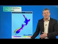
In our Thursday Big Picture video forecast we take a look at where the changing and how much rain is likely coming over the next 7 days.
This week’s Flight Sim flyover is Norsewood, WA!

- Title
- Severe weather for parts of NZ, ahead of more high pressure
- Runtime
- 6:47
- Date posted
- 1 year ago
- Description
- A large low in the Tasman Sea will bring further heavy rain and strong winds to western and southern parts of NZ, and maybe the upper North Island too over the next couple of days.
As we go into the weekend showers ease back, especially by Sunday, with colder/cooler air moving back in to the South Island.
Next week more high pressure - but a low (potential storm) may develop east of New South Wales next week and might reach New Zealand one week from today.

- Title
- NZ: Gales, heavy rain, sunshine & showers - your weather to Tuesday
- Runtime
- 8:20
- Date posted
- 1 year ago
- Description
- NZ has a burst of strong & mild winds, then rain/showers, followed by cooler/colder southerly quarter winds going through the weekend.
Severe weather is most likely between now and Friday PM, with the weekend cooler but less intense as high pressure tries to expand here.
We have your full forecast for the days ahead, the upcoming weekend - and how next week is kicking off.
+ We take a look at past 15 days rainfall, to see which regions are wetter or drier than usual for this time of year.

- Title
- NZ has a burst of wind, rain from the west - then a colder weekend
- Runtime
- 8:30
- Date posted
- 1 year ago
- Description
- Milder north to north-west winds, with subtropical connections for some, will ramp up on Wednesday and Thursday ahead of a cold front exiting Australia today (and reaching NZ for Thu/Fri).
The front will clear NZ by the weekend with a colder south to south-west flow returning - bringing polar air back into the South Island but mostly dry skies in the east of both main islands.
We break down wind, heavy rain, showers, thunderstorms and temperature movements through until Monday of next week - along with a look back at sunshine hours over the past couple of weeks which show a number of regions have been brighter/sunnier than usual this winter…we tell you where, and which regions have been gloomier.

- Title
- Oz: Winter blast for SA, VIC, Tas, ACT & NSW
- Runtime
- 7:58
- Date posted
- 1 year ago
- Description
- A burst of gales, rain/showers and colder polar air are in the mix for parts of coastal WA today - then heading into SA later today/tonight and into VIC and Tas in the coming days. There will be spillover into NSW and the A.C.T with snow on the mountains/high peaks and overnight lows dropping inland to near (or at) freezing as far north as Queensland and NT for a time. (check your local forecast for more detail).
We cover likely rainfall for dry southern states and when the next big anticyclone is on the way.

- Title
- NZ-wide burst of windy, wet, weather mid-late this week
- Runtime
- 5:11
- Date posted
- 1 year ago
- Description
- A blast of gale westerlies and a shot of colder air is coming into NZ mid to late this week - but before that we have brief high pressure then milder nor-west winds.
High pressure crosses NZ on Tuesday and by Wednesday and Thursday the wind and rain both ramp up from the west.
By this weekend polar air heads northwards for a time - bringing a colder weekend to the southern half of the South Island.
We have your forecast to Sunday - including expected rainfall.

- Title
- Australia 7 Day: Showers in the south and east, dry for most others
- Runtime
- 8:24
- Date posted
- 1 year ago
- Description
- Southern Ocean storms and lows will help fuel more windy/changeable weather for those on the southern edge of Australia, roughly from Perth to Sydney/Canberra. Showers are most likely the closer to the south coast you are.
Tasmania has some windy and wet weather next week - but before that WA’s southern half gets a wintry cold front.
We have your 7 day rain forecast too.
This week’s Flight Sim flyover is Mildura, Vic!
WeatherWatchTV also has officially reached 100,000 YouTube subscribers - we yesterday received the Silver plaque from YouTube. THANK YOU to all of you who have subscribed, or shared our YouTube channel with friends and family - we wouldn’t be here without your support!!
- Title
- WW hits 100K on YouTube + Your Long Weekend Weather
- Runtime
- 7:08
- Date posted
- 1 year ago
- Description
- We have your weather outlook for Matariki and the long weekend, plus the outlook for next week.
With many people stargazing we’ve got some cloud maps and graphs for you + the 7 day rainfall outlook.
NEW: We have new marine maps, you can view them here: https://www.weatherwatch.co.nz/maps-radars/marine/ripple We’d love your feedback on them!
WeatherWatchTV also has officially reached 100,000 YouTube subscribers - we yesterday received the Silver plaque from YouTube. THANK YOU to all of you who have subscribed, or shared our YouTube channel with friends and family - we wouldn’t be here without your support!!
Have a great long weekend!

- Title
- Matariki Long Weekend Weather
- Runtime
- 7:13
- Date posted
- 1 year ago
- Description
- It’s the shortest day of the year on Saturday, which also means we’re at the halfway point of the Solar Winter (the three months of the year with the lowest amounts of available sunlight). Phil covers the latest on the weather for Matariki on Friday. Don’t forget our FREE WeatherWatch NZ App and also RuralWeather.co.nz have “Cloud/Fog” forecasts under “Trends” for all hours of the day in all parts of NZ. It’s a helpful guide if you want to go stargazing.
The long weekend looks fairly ok for winter, with a few showers in the mix around the country and some temperature fluctuations - and some snow in alpine areas of the South Island.
We have your New Zealand forecast through until Tuesday next wee

- Title
- NZ to Monday: 2 highs and 2 cold fronts
- Runtime
- 6:21
- Date posted
- 1 year ago
- Description
- Colder air remains stuck over large parts of NZ over the next week with two cold fronts and two anticyclones bringing typical winter weather.
Showers will affect both islands with some West Coast rain in the mix.
The forecast brings variety - and some regions will see some warmer and sunnier moments as north to north-west winds form for a time, but the second cold front by Sunday/Monday brings another temperature drop to much of NZ.
We also take a look at soil moisture levels, with one part of each main island still drier than average for this time of year.

- Title
- Oz Big Picture weather to Sunday, cold fronts for WA and southern states
- Runtime
- 10:19
- Date posted
- 1 year ago
- Description
- High pressure is fairly dominant at the moment but the southern third of WA has several cold fronts in the week or two ahead, some of those will brush the southern coastlines of SA and Vic, with Tas also caught up in it.
NSW and the A.C.T have a few frosts inland and higher elevation areas, with a mainly dry week - a few showers will come through from the south and maybe off the Tasman Sea.
Qld has plenty of showers around Cairns to Townsville but hit and miss in other areas.
And the NT is very quiet this week, along with the Kimberley and Pilbara.

- Title
- NZ Weather forecast covering Matariki long weekend
- Runtime
- 7:00
- Date posted
- 1 year ago
- Description
- High pressure, frosts and a few showers kick this week off, but the week ends with a cold front and another southerly change. As we go into the long weekend high pressure returns with drier skies and lighter winds.
We have your NZ forecast for the week ahead and the upcoming long weekend.

- Title
- Oz: - Tracking the showers & a Coral Sea low
- Runtime
- 10:27
- Date posted
- 1 year ago
- Description
- Cold fronts continue to swipe the south of Australia from coast to coast bringing windy, showery weather to southern coastal areas - and temperature fluctuations between milder northerlies and cooler southeries.
A low in the Coral Sea next week is worth monitoring as this has the potential to bring rain or thunderstorms to FNQ and coastal parts of Qld - but it is a bit borderline.
We also have two 7 day rainfall maps, from two different models, due to the uncertainty of some of these systems.
There are many parts of Australia with no rain, or noticeable temperature changes due to high pressure.
This week’s Flight Sim flyover is the Gordon River Dam in Tasmania.
- Title
- NZ 7 Day - Next high pressure has a puncture
- Runtime
- 7:19
- Date posted
- 1 year ago
- Description
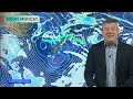
- Heavy showers are easing for most who had them but some showers will linger around the North Island in particular this weekend. Despite high pressure rolling in, it does have a “puncture” - by that we mean a small area of lower pressure still stuck around northern NZ that may see some showers lingering longer.
Frosts expand again over Saturday and Sunday although aren’t as widespread as they could be.
A cooler/colder southerly heads northwards next week, before north to north-west winds likely return as we go through later next week.
We have your 7 day rain forecast too.

- Title
- More thundery downpours, easing Friday, cooler air Sun/Mon
- Runtime
- 8:06
- Date posted
- 1 year ago
- Description
- Downpours, some with lightning and thunder, will continue across western parts of the North Island and some western/north-western parts of the South Island as a large low pressure zone in the Tasman Sea slowly drifts in - and then falls apart.
The thundery downpours will ease by the end of Friday, although a few isolated heavy showers may remain in the north and perhaps the east of the North Island going into the weekend. Many other places are drier this weekend as high pressure starts to expand - and that will send the colder air from the lower South Island up into the North Island for early next week - fuelled by sou-east winds in the North Island (and light winds over much of the South Island).
We have your forecast to Tuesday next week.
*Programming note - We have no video on Thursday due to travel, we’re back again Friday with two videos (NZ and Australia).
- Title
- Thundery downpours this week, high pressure increases next week
- Runtime
- 7:32
- Date posted
- 1 year ago
- Description
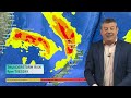
- A large low out over the Tasman Sea is set to bring areas of rain, downpours and some thunderstorms over the coming days as the low moves in - but then falls apart over the weekend.
Colder and drier air remains in the south - and that colder airflow moves up into the lower and eastern North Island going through the weekend and the start of next week.
Despite some showers lingering next week, high pressure out of Australia is expected to grow in the NZ area.
Thundery downpours this week, high pressure increases next week

- Title
- Oz - High pressure grows, but southern showers continue
- Runtime
- 6:47
- Date posted
- 1 year ago
- Description
- Wet weather will ease in Australia’s south-east but more wintry, showery, weather will linger for a time - mostly in coastal areas to the south and south-east of the continent.
NSW, the A.C.T, VIC and TAS all see heavy showers and some wintry air - with isolated thunderstorms and inland (and higher elevation) frosts.
WA has thunderstorms and downpours as a couple of cold fronts swipe the south-west.
Most other places have large dry areas thanks to higher air pressure.
*Programming Note: Our Thursday video is being delayed to Friday this week due to work travel by us.

- Title
- NZ - Large Tasman Sea low to bring downpours, thunderstorms
- Runtime
- 8:15
- Date posted
- 1 year ago
- Description
- High pressure briefly crosses NZ on Tuesday ahead of more downpours, isolated thunderstorms and wet weather thanks to a large low sitting in the Tasman Sea.
Due to all the high pressure surrounding this low it has a slow journey to NZ and lingers into the weekend as it morphs into a different system. There are large dry areas this week - especially in the east and south of NZ, but western and northern parts of both main islands have the risk of some heavy rain and thunderstorms (possibly severe).
We have your NZ forecast (+ 7 day rainfall) through until Sunday.

- Title
- NZ 7 Day: Polar air this weekend - sub-tropical next week for some
- Runtime
- 8:16
- Date posted
- 1 year ago
- Description
- Snow, frosts and downpours continue around NZ going into the weekend as the polar airflow carries on until the start of next week. Low level snow showers are expected in the eastern South Island for a time, and around the ranges and mountains of the North Island.
Wind chill will be below zero in southern and eastern areas at times - and overnight lows inland this weekend for the South Island’s interior may drop to -10 or lower. Ouch!
But next week high pressure moves in for Tuesday - then by Wednesday the next low move to NZ from the Tasman Sea with rain, showers - and milder sub-tropical northerlies. Southern NZ looks to remain the coldest - but may also be the driest down around Southland and Fiordland.
We also have your 7 Day New Zealand rainfall map.

- Title
- OZ - Large low dominates the South-East - who gets rain and who misses out
- Runtime
- 10:02
- Date posted
- 1 year ago
- Description
- Our 7 day rainfall video today is very much focused on the south-east side of Australia and the southern coastline as wintry weather moves through thanks to slow moving low pressure. Wet, windy and colder weather will go well through the weekend and next week - especially from South Australia to Victoria, with Victoria most in the firing line for rain. Tasmania is also caught up in it with rain fall across the island and snow on the peaks. Snow will also fall across the Alps and heavier rain and showers on the western sides of the Aussie Divide (including inland and outback parts of NSW).
Many other areas are dry with little change.
We have your 7 day forecast and 7 day rainfall map.
This week’s Fight Sim place of the day is Denham, Shark Bay - in Western Australia. (Australia’s westernmost publicly accessible town!)
- Title
- NZ - Cold air peaks on Saturday - snow, frost, showers & sunshine
- Runtime
- 7:41
- Date posted
- 1 year ago
- Description
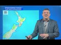
- Over Friday and Saturday the main pulse of wintry air moves over NZ with snow levels lowering to just 100 or 200 meters on Saturday - and the potential for isolated snow showers to go down to sea level for a time in the east (like around coastal Otago). If that does happen, it doesn’t look like it will amount to much based on the current data. Snow may be heavier further north in Canterbury around the ranges and mountains with that cold air moving into more moisture - the Canterbury Plains may see some flurries too. Overnight lows will be below zero (or near it) for many regions as we get to Sunday morning - with conditions easing further into Monday - and high pressure returning by Tuesday.
But by Wednesday of next week we’re back to sub-tropical northerlies, isolated thunderstorms/downpours (in the north and west of both main islands) as a large low exits Australia and heads towards NZ. This low looks to linger into next weekend bringing a mixture of weather.
...

- Title
- Full details on Winter weather moving into NZ
- Runtime
- 11:27
- Date posted
- 1 year ago
- Description
- Gales, heavy rain, snow, large waves and a big temperature drop - that’s the forecast for a number of regions in the days ahead as a wintry southerly flow kicks in.
We break down who gets the severe weather, which regions likely miss out, and when this is likely to ease and clear up.
Our forecast also takes a look at the start of next week ahead of Fieldays at Mystery Creek in Waikato.
Extra maps and full details in our extended forecast for New Zealand today.

- Title
- Oz: Wintry blast(s) bring frost, drought relief and sunshine too
- Runtime
- 9:02
- Date posted
- 1 year ago
- Description
- Winter is coming to the south-east with frosts as far north as Queensland’s higher elevation locations in the south as a southerly comes in following a wintry change this week.
A low in Western Australia is sparking thunderstorms and downpours over the next couple of days in the south-east and south.
This coming weekend that low may reform over in the south-east and bring more widespread wintry rain into Victoria and parts of SA, TAS, A.C.T and NSW with snow on the mountains. Squally showers at sea level from Adelaide to Melbourne and parts of Tassie may have thunder or hail.
Southerlies blow up the eastern side of Australia this week too.
As for inland areas further away from this - expect a lot of dry, sunny, weather.
We have your Australia only forecast through to Sunday + rainfall to then too.

- Title
- NZ: Here. Comes. Winter!
- Runtime
- 10:52
- Date posted
- 1 year ago
- Description
- *Correction: This was recorded on TUESDAY (not Thursday as Phil accidently says... blame the long weekend!) --- Snow to low levels, thundery downpours and a significant temperature drop is on the way for New Zealand later this week and coming weekend with some places inland through the South Island dropping to -10C with daytime highs barely in the positive single digits.
Snow to sea level is possible in Southland and Otago, but as of today it was more likely above 100 or 200m in those areas. Snow to sea level is often borderline in NZ unless we have an Antarctic blast off the ice shelf - this one is close, but not quite coming from that area.
All of NZ will be affected by this wintry change - but not everyone will have severe weather with our mountains and ranges splitting up the wet weather and windy weather.
We have your forecast through until Sunday.
- Title
- ClimateWatch: June sees big highs, but more breaks in between
- Runtime
- 11:48
- Date posted
- 1 year ago
- Description
- There’s still plenty of high pressure coming in to Australia and New Zealand over the next few weeks - but there are gaps between the highs allowing some rain makers to continue on, especially around New Zealand, Tasmania and Western Australia.
The highs will give decent stretches of dry or mainly dry weather - with lows adding wind and rain in between.
Storms south of NZ are getting larger - as you’d expect going into winter - and as the high pressure belt over NZ and Australia area breaks up a little more (and nudges further northwards) it will allow more wind westerlies to clip the south-east of Australia and across the Tasman Sea and into NZ, especially the lower North Island southwards.
There is variety in the forecast - but high pressure is, generally speaking, still the most dominant feature of the weather around Australasia.

- Title
- NZ 7 Day: King’s Bday weekend + Winter arrives!
- Runtime
- 7:50
- Date posted
- 1 year ago
- Description
- The long weekend is here and with it comes the official start of winter on the meteorological calendar.
The weather pattern is wintry today in the southern part of NZ as the main pulse of cold air moves in today, then gradually retreats back southwards over the long weekend, with milder westerlies returning to the south by Monday.
Western regions of both islands have windier weather off the Tasman Sea and that brings showers all along the western coastline this long weekend.
Driest and mildest weather will be at the very top and eastern sides of NZ.
Next week another large low may bring more rain, thunder and wind - followed by a wintry change end of next week (not yet locked in but showing up for days in long range models).

- Title
- Oz 7 Day - Lows in the mix for south with eastern & western downpours.
- Runtime
- 9:31
- Date posted
- 1 year ago
- Description
- A large high is moving through this week but low pressure is behind it, bringing widespread showers and some thunderstorms to WA, especially the western and southern sides.
On the opposite side of Oz, south to south-east winds drop temperatures for the east coast and bring in some wet weather, mostly showers. Inland thunderstorms are possible across NSW and QLD.
A wintry change returns to TAS along with VIC - but still may not be enough rain relief for those in SA and VIC over the coming week.
We have your 7 day rainfall map.
This week’s Flight Sim flyover is Surfers Paradise, Qld!
*Programming note: Due to King’s Birthday on Monday in NZ we have no video on Monday. We’re aiming to do it on Tuesday instead.

- Title
- NZ - Downpours, thunderstorms and Long Weekend Weather
- Runtime
- 7:39
- Date posted
- 1 year ago
- Description
- Thunderstorms and heavy downpours are crossing northern NZ on Thursday, clearing early Friday - then a cold change moves into the south while a windy sou’west flow develop nationwide.
The long weekend looks windy in exposed places with showers off the Tasman Sea for those along the western side of the nation, and around Southland too.
Driest and mildest weather will be at the top of NZ and the eastern side.
Next week another low may form - we show you the modelling for that.

- Title
- Heavy downpours/thunder, then windy SW flow for long weekend
- Runtime
- 8:47
- Date posted
- 1 year ago
- Description
- A large low in the Tasman Sea is moving into NZ with pockets of heavy rain, strong winds - and isolated thunderstorms and downpours.
Rain bands move in later today and again on Thursday as this very large low inches closer. Low pressure creates instability in the atmosphere which can make for sudden downpours that can break what is forecast to fall - so tracking on the rain radar is helpful over the next few days as some downpours may surprise people.
By Friday a colder and much windier South-West flow moves in over the country and will linger for the entire long weekend - bringing western and southern showers along NZ, and driest weather in the east of both main islands.
We have your full forecast through to Tuesday next week - and point out which regions don’t have severe weather risks.

- Title
- NZ: Expect the unexpected - Flash flood risk as large low approaches
- Runtime
- 10:31
- Date posted
- 1 year ago
- Description
- Large low pressure zones can produce sudden, unexpected, torrential downpours - as we saw in Nelson yesterday, ahead of this large low pressure zone moving in on Thursday.
Severe weather risks return again on Wednesday as the low moves in properly - but it’s Thursday/Friday AM that likely have the highest risk for sudden downpours, severe thunderstorms, and the potential for flash flooding that may not have been specifically forecast. This is because warm and cold air mixing, along with large low air pressure, are the perfect recipe for creating new and intense downpours as it interacts with New Zealand’s land (plus daytime heating).
We cover general risks - and New Zealand’s weather forecast out to King’s Birthday Monday. This forecast will still change a bit in the days ahead - as is always the nature with such a large sized low pressure zone. NZ’s mountains and ranges further complicate the precision of longer range forecasts (beyond a couple day...

- Title
- Oz outlook: Rain, snow, thunderstorms - and one lonesome high pressure zone
- Runtime
- 11:21
- Date posted
- 1 year ago
- Description
- A wintry outbreak continues today and Tuesday in Australia’s south-east thanks to a storm south of the nation moving towards the Tasman Sea and NZ. Snow is likely in the Australian Alps tonight for a time as this system moves through - bringing squally and heavy showers to parts of SA, VIC and TAS, especially coastal areas.
NSW and Qld get some downpours and thunderstorms - but large dry areas areas are also in the mix.
One of the main features this week will be some heavy downpours tracking from Broome to Queensland (from west to east) bringing daily rainfall totals of 80 to 100mm in some locations.
Meanwhile populated parts of WA have rain and shower chances in the week ahead as high pressure zones finally break apart allowing for low pressure to move in to more places.
We have your Australian outlook through until Sunday.
p.s It’s good to be back on screen! Thank you for all your support this month.

- Title
- NZ forecast to King’s Birthday as large low moves in this week
- Runtime
- 8:59
- Date posted
- 1 year ago
- Description
- Philip Duncan returns onscreen with your NZ forecast through to King's Birthday Monday --- Warmer winds will give way to colder air this week as a large low moves in with severe weather risks to both main islands in the form of some wind, rain, thunderstorms and maybe some snow around the southern Alpine Passes.
By Friday and going into King’s Birthday Weekend New Zealand will be mainly caught up in a classic Autumn-like sou-wester, bringing showers to the west and south, but mainly dry for those in the east. Winds may be a little brisk this long weekend.
We break down the severe weather risks this week - and the likely weather outlook for the long weekend coming up.
We have your NZ forecast through to King’s Birthday Monday.
p.s It’s good to be back on screen! Thank you for all your support this month.

- Title
- NZ 7 Day RainWatch - Severe weather risks next week
- Runtime
- 8:17
- Date posted
- 1 year ago
- Description
- A massive anticyclone moves over NZ this weekend, but next week Autumn roars back to life with thundery cold fronts, windy nor’westers and a colder end to the week.
We break down the highs and lows, the rain bands - and bring you the 7 Day NZ Rainfall map, brought to you by Resupply.co.nz
Have a great weekend - and Phil is looking forward to likely returning on screen next week (even though the “Green Hand” seems to be even more popular now!!).

- Title
- Australia 7 Day RainWatch: Rain relief + wintry change
- Runtime
- 11:54
- Date posted
- 1 year ago
- Description
- Rain and downpours are sliding south over NSW, the A.C.T and parts of VIC and TAS in the days ahead as low pressure drops south this week, and an Autumn southerly change kicks in this weekend. Many coastal southern parts of Australia will get rain and showers, with the south-west and south-east both getting wet weather - including inland parts of NSW today and Friday.
Next week WA and NT may see heavy rain and thunderstorms moving through - and a few more showers for QLD.
We bring you your Australian-only 7-day rainfall map, plus the Microsoft Flight Sim place of the day is today Nelson, Victoria - smack bang on the coastal border of SA

- Title
- NZ: Warmer, windier, weather coming - then cold front next week
- Runtime
- 7:14
- Date posted
- 1 year ago
- Description
- High pressure is crossing NZ, then exits next week with windy (and warmer) nor’westers - ahead of a cold change by mid week.
There are some severe weather risks next week for NZ as his Autumn change moves through - we break it all down for you

- Title
- Big Picture: Low pressure, Autumn changes coming
- Runtime
- 11:21
- Date posted
- 1 year ago
- Description
- Settled weather is dominating NZ but the next cold/wet/windy change is heading to Australia’s south-east and NZ next week.
Severe weather may be possible in NZ next week (it’s not yet locked in) and in parts of south-eastern Australia this weekend.
Before this weather arrives temperatures will lift above average, especially around NZ with nor’westers along with Australian and subtropical airflows all combining. This weekend and the start of next week look above average in NZ but the cold change in Australia’s south-east looks likely to reach NZ mid to late next week (remember Autumn’s weather is more changeable so it’s harder to lock in Southern Ocean storms too far in advance).

- Title
- Australia: Heavy eastern rain + southern showers
- Runtime
- 11:07
- Date posted
- 1 year ago
- Description
- High pressure is going to help encourage heavy rain to remain stuck along the eastern NSW coastline this week - then will be pushed into Queensland where it falls apart.
Showers will spread across a large portion of NSW, VIC and SA going into the weekend, along with the southern coastline of WA and the south-west corner.
Most other places are dry with little change in temperatures.
We have your rainfall forecast for the week ahead too, brought to you by IPF.

- Title
- NZ: High pressure is in charge all week for most
- Runtime
- 5:32
- Date posted
- 1 year ago
- Description
- A colder southerly flow will fade this week as high pressure grows and then crosses New Zealand.
Inland frosts, especially around the South Island, coupled with a few coastal showers are really the only main features - most places are drier than average this week.
We have your NZ forecast until Sunday.
*Programming note: We have no video update on Tuesday due to such quiet weather - our next update will be on Wednesday, May 21st.

- Title
- NZ 7 Day RainWatch: Weekend cold front, then some frosts & another high
- Runtime
- 8:04
- Date posted
- 1 year ago
- Description
- A cold front is moving up New Zealand this weekend and will affect most of NZ by Monday .
Wet weather will move up and cross NZ over the weekend with hit and miss heavier downpours, maybe a few isolated thunderstorms (or just heavy showers).
A southerly flow covers the county on Monday with frosts in the morning - mainly the South Island.
High pressure cross us next week, but by the end of next week sub-tropical winds return - and by next weekend we may have another low in the Tasman Sea moving our way.
We also have your 7 day rainfall map - brought to you by Resupply.co.nz

- Title
- Australia 7 Day: Rain in the east, wintry in the SE
- Runtime
- 11:27
- Date posted
- 1 year ago
- Description
- A wintry change is coming into the south-east corner of Australia while rain, showers and thunderstorms affect the east, including inland parts of both NSW and Qld.
Elsewhere easterlies dominate a lot with mainly dry weather.
We have your Big Picture Australian forecast for the next 7 days - and the 7 day rainfall Map.

- Title
- NZ: Cold front this weekend, next week another high
- Runtime
- 5:53
- Date posted
- 1 year ago
- Description
- NZ’s weather is about to warm up over Friday and Saturday ahead of a cold front that moves into the South Island on Saturday and goes nationwide by Sunday night.
Next week kicks off colder with a southerly flow for many - but that’s ahead of the next big high rolling in.
Behind that high there is another burst of warmer, windier and wetter weather - we have your NZ forecast to Wednesday of next week.

- Title
- Big Picture: Cold front for NZ this weekend, but high pressure dominates
- Runtime
- 9:18
- Date posted
- 1 year ago
- Description
- A windier, colder and wetter burst of weather is coming into NZ this weekend but there’s still a lot of high pressure moving through from west to east in the week or two ahead.
This weekend severe NW gales, some alpine snow and a chance of hit and miss thunderstorms are all possible as the colder southerly spreads up the nation on Sunday (after a warmer than average Friday and Saturday for many regions).
Next week high pressure returns - although some may have colder and windier weather lingering.
We have your NZ forecast through until Tuesday.

- Title
- Australia 7 Day: Rainfall is low for most, but NSW perhaps has best chances
- Runtime
- 11:13
- Date posted
- 1 year ago
- Description
- Dry weather is dominating much of Australia but showers/downpours and some thunderstorms will spread out across NSW in the week ahead, bringing some wet weather to dry areas - not just the coastal east.
The coastal south has showers - but the further inland you are the drier it will be.
A cold change this weekend and early next week swipes TAS, VIC, A.C.T and the south-east of NSW - with a likely light dusting of snow on the peaks, or close to it.
THANK YOU
For the hundreds of comments people posted with get well wishes, great humour, or just encouragement to get back to work as soon as possible - every single comment was read and appreciated. I look forward to being back on screen as soon as I can.
Philip Duncan.

- Title
- We’re (sort of) back! - A taste of winter coming for NZ
- Runtime
- 9:04
- Date posted
- 1 year ago
- Description
- High pressure is the main feature of NZ’s weather this week but there are some showery and windy surges
This weekend starts off warmer than average in most places - but ends colder as a southerly change arrives.
Next week is looking colder in the South Island and parts of the North Island - but there’s still a lot of high pressure around despite the rain, showers and windy patches.
THANK YOU
For the hundreds of comments people posted with get well wishes, great humour, or just encouragement to get back to work as soon as possible - every single comment was read and appreciated. I look forward to being back on screen as soon as I can.
Philip Duncan.

- Title
- NZ: Incoming high, but is that another sub-tropical low too?
- Runtime
- 6:50
- Date posted
- 1 year ago
- Description
- A cooler and drier weekend is on the way as high pressure moves in and lingers over the country through a large part of next week.
As this high slips away to our east mid to late next week it will encourage a sub-tropical airflow down over parts of the country, along with windier westerlies in the south.
But a new low pressure zone may well develop again in the subtropics, with a chance of some heavy rain and wind at the top of the North Island later next week and next weekend.
We have your 7 day rainfall forecast too, brought to you by Resupply.co.nz.
*NO VIDEOS MONDAY
Programming note - We are away on Monday due to other work commitments, but we’ll be back on Tuesday May 6th with both NZ and Australia weather video updates. Have a great weekend!

- Title
- ClimateWatch: MAY is neutral - here’s what that likely means for you
- Runtime
- 12:11
- Date posted
- 1 year ago
- Description
- Covering New Zealand, Australia and the south-west Pacific we track the high and low air pressure over the weeks ahead, where the rain will go and how temperatures may feel.
With NEUTRAL conditions remaining (ie, no El Nino or La Nina, and no positive or negative IOD) we don’t see anything significant changing the pattern we’ve had for the past few months.
However in the Tasman Sea/New Zealand area (and between NZ and the South Pacific tropical islands) we do see more lows and rain in between each high pressure system - this has helped end the NZ droughts and bring relief across both main islands - with more rain relief coming, mixed in with some solid dry spells too.
But the highs over the southern half of Australia remain more constant - meaning droughts there aren’t going to be getting any relief just yet. The silver lining is that usually winter sends more storms in from the south - but for some people that may be too late to help.

- Title
- Aust 7 Day: Huge high pressure brings eastern showers & increasing northerlies
- Runtime
- 7:29
- Date posted
- 1 year ago
- Description
- Much of Australia is dry over the next day with the most widespread wet/showery weather in the east, mainly from Sydney northwards, but gradually becoming more Queensland focused. Most places have below normal rainfall.
Windy northerlies or nor-westers are expected on the back edge of the high as it moves into New Zealand this weekend and next week - but yet another anticyclone from the Indian Ocean will zip in behind it and, sadly, keep much of the south dry.
We do see some chances of showers around SA and Vic - but it’s not much and is not likely have any impact on droughts.

- Title
- NZ: Storm continues to Friday, then eases as huge high pressure arrives
- Runtime
- 8:12
- Date posted
- 1 year ago
- Description
- Hurricane force winds (120km/h+) in central NZ, squalls around Auckland, heavy rain across Canterbury up to Wairarapa and a cold southerly bringing sub-zero temperatures and snow to the Southern Alps.
Talk about Autumn!!
We have the latest on the severe gales for today and Friday, the heavy rain - and when the high from Australia will reach NZ (and when it may depart).
This is the New Zealand forecast through until the middle of next week.

- Title
- Severe weather risks for NZ Wed/Thu as low moves through, high pressure to follow
- Runtime
- 7:50
- Date posted
- 1 year ago
- Description
- Heavy rain in the north-eastern South Island, and severe gales through central NZ and the top of the North Island will bring a messy end to April and start to May.
We break down where the rain will be heaviest, winds the strongest - and when the southerly change arrives, dropping temperatures.
Meanwhile, once the first weekend of May arrives a powerful high pressure zone is drifting our way - and will bring a mostly settled and dry first week to May.
*Programming Note: Our May ClimateWatch update for NZ/Australia will be out later on Thursday.

- Title
- Sub-tropical low to bring wind & rain before enormous high pressure zone
- Runtime
- 10:41
- Date posted
- 1 year ago
- Description
- Pockets of heavy rain, isolated thunderstorms and gale force winds will be spreading around parts of NZ for today, Wednesday and Thursday as low pressure drops down over the country from the sub-tropics. Interacting with high pressure departing - and then incoming new high pressure - we’ll see a burst of East to North-East winds today and tonight, followed by a surge of gale South to South-West winds on Thursday (strongest around the lower North Island).
Rain bands will be messy - meaning some of those downpours may be hit and miss for some.
Not all regions are affected - especially those in the lower third of the South Island, where a colder southerly flow is about to kick in.
But by Friday and this weekend in comes a high pressure zone as big as Australia - and that looks set to bring a settled first week of May to most, if not all, parts of New Zealand.
We have your forecast through to Monday of next week.





