WeatherWatchTV
Oz: NSW & Vic most in the firing line for t-storms/rain

- Title
- Oz: NSW & Vic most in the firing line for t-storms/rain
- Runtime
- 11:11
- Date posted
- 12 months ago
- Description
- A line of thunderstorms stretches off and on from the Top End down to NSW. In the days ahead a low (currently near southern WA) will move in to Vic/NSW and the A.C.T - and produces more rain, showers and thunderstorms. Rainfall totals vary locally.
There are showers in other parts of Australia, but not as widespread.
More polar air is briefly coming into parts of SA and Tas, while warmer air drops further southwards into Qld and NSW for a time too.
After this all? High pressure again in the south.
We have Australia's forecast out to Sunday.
*Please note, we have internet disruption to our studio this week, this may result in videos temporarily being lower quality (SD and not HD) due to slow upload times to YouTube. (Video quality today is 720p and not 4K).
- Title
- NZ: Windy westerlies to surge back, chance of thunderstorms this week
- Runtime
- 8:46
- Date posted
- 12 months ago
- Description
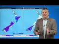
- High pressure covers much of the country today, but a windier burst of weather is coming back - with more polar air around the South Island in particular. It's not a major week of weather - but there are severe weather risks into both main islands.
Frosty weather is also possible this week, again mainly around the South Island but some risks into the North Island - especially tonight/Tuesday AM.
We have your NZ forecast through to Sunday and surges of windy westerlies move into the country.
*Please note, a broadband internet disruption is affecting our studio this week, some videos may be 720p instead of 1080 or 4K (in other words, video is standard definition not HD).

- Title
- Oz: NSW, Vic, WA, SA severe weather risks
- Runtime
- 11:10
- Date posted
- 12 months ago
- Description
- Gales, heavy rain, thunderstorms and the chance of some snow are all in the forecast for the next week ahead as spring weather sets in.
Severe weather risks spread from WA to SA, then new thunderstorms and low pressure will push severe weather risks into Vic and NSW - and to some degree some small parts of NT, Qld, Tas and the A.C.T.
Not everyone has severe weather risks - there are very large areas with dry, or mainly dry weather, and winds that aren't too problematic.
We bring you the ups and downs of Australia's weather for the upcoming weekend and the outlook for next week.

- Title
- NZ: Polar weekend, warmer westerly gales next week
- Runtime
- 8:46
- Date posted
- 12 months ago
- Description
- Temperatures drop this weekend nationwide as a polar change heads northwards, with Sunday the coldest of the days - ahead of more windy westerlies next week, lifting temperatures back up again.
In true spring-weather style we're getting cold fronts, windy westerlies and swings in temperatures.
We break down who gets what, and when - with your 7 day New Zealand RainWatch update.

- Title
- Australia: Storm conditions possible in the south-east next week
- Runtime
- 11:35
- Date posted
- 1 year ago
- Description
- Severe weather risks look to expand next week as inland thunderstorms, wintry southerlies and large low pressure all combine over the south-east corner of the nation, potentially bringing heavy rain, thunderstorms and strong winds into parts of NSW, SA, VIC, along with Qld, Tas, the A.C.T and NT all affected at some point (although not as widespread based on today's data).
WA has a number of windy cold fronts to come in - bringing more thunderstorms and squally conditions into the south-west, spreading inland for a time.
Despite all the changing weather, there are sunny/warm days in the mix too.... just depends on where you live and what day we're talking about!

- Title
- NZ: More gales & downpours, sunny areas too
- Runtime
- 8:27
- Date posted
- 1 year ago
- Description
- Another shot of polar air is coming for NZ, starting in the south on Friday and clearing the north by the end of Saturday, meaning Sunday will be cooler nationwide.
We break down the wind, rain and timing to make sense of it all.
Next week we may well go back into a milder phase, but that could be ahead of a large low moving into NZ one week from now with severe weather risks - too far out to lock in, but we show you the map.

- Title
- Oz: Stormy stuff on the way as spring wakes up
- Runtime
- 10:43
- Date posted
- 1 year ago
- Description
- Thunderstorms, gales and swings in temperatures are on the way for various parts of Australia despite high pressure still being in the mix.
It's a fairly classic spring set up with warm and windy days, followed by colder windier days - and bursts of thunderstorms and showers.
But this set up also favours some areas (like eastern NSW) being drier and milder.
We break down the severe weather risks - which affect all states at some poing.

- Title
- NZ: Milder ahead of wintry cold front, gales for Fri/Sat
- Runtime
- 8:58
- Date posted
- 1 year ago
- Description
- Large parts of NZ will enjoy drier and more settled weather today and Thursday, ahead of windier nor-westers followed by a cold front on Friday (South Island) and Saturday (North Island).
By Sunday polar air covers the country - but in spring style mild weather is in the mix, and likely to bounce back for some again next week.
We break down the incoming weather for the next week ahead.

- Title
- Oz: Spring gales, thunderstorms & rain on the way
- Runtime
- 8:20
- Date posted
- 1 year ago
- Description
- Despite high pressure around the nation at the moment storms south of the country will continue shoot cold fronts northwards, bringing burst of gales - possibly damaging - thunderstorms and some alpine / high elevation snow again.
There's also thunderstorms and downpours forming in the week ahead in a line from Dawin to Tasmania.
Large areas of high pressure will also contribute to the windy weather as they move in and out of the Australia region - bringing windy weather into central and northern parts of the continent too. In other words, changeable weather may not just be for southern coastal areas.

- Title
- NZ: Spring is doing its thing!
- Runtime
- 8:26
- Date posted
- 1 year ago
- Description
- High pressure will briefly bring some settled weather to the country for Wednesday and Thursday but the next cold front arrives Friday in the South Island and goes nationwide on Saturday - with polar air covering the entire nation.
Surges of windy weather and temperature changes are on the way over the coming week - with snow on the mountains and ranges, especially in the South Island and plenty of westerly driven rain (driest in the east).
There's also a low developing in the subtropics one week from now - the current modelling keeps it offshore, but it's large and close enough to monitor.
We have your detailed New Zealand forecast through to Tuesday next week.

- Title
- ClimateWatch - How SEPTEMBER 2025 is shaping up (NZ, Oz, South Pacific)
- Runtime
- 11:38
- Date posted
- 1 year ago
- Description
- Spring weather is setting in across New Zealand and the southern half of Australia with windier weather in both nations and more temperature fluctuations between mild/warm days and colder ones.
High pressure increases over Australia and northern NZ in the coming weeks - but spring chaos means storms are wild over the Southern Ocean and some low pressure is bubbling about Australia and the sub-tropics north of NZ in the first week or two.
We cover rainfall for the next 16 days, air pressure placement over the next 3 weeks and the latest on El Nino/La Nina and the Indian Ocean Dipole.

- Title
- Oz: Cold fronts continue in south, but high pressure ticks up nationwide
- Runtime
- 9:16
- Date posted
- 1 year ago
- Description
- September 1st is the first day of spring on the Meteorological calendar and there is more high pressure over Australia this week, but cold fronts as well thanks to storms in the Southern Ocean. These cold fronts will fuel more thunderstorms, downpours and cold airflows along some parts of the entire southern Coastline, from WA to Vic & Tas.
We break down the severe weather risks coming up - and where the cold fronts will most likely be, and when. There's also a chance of some downpours/thunderstorms through the outback of NSW and Qld.
Our Australia-only forecast goes out to this Sunday - but don't forget our ClimateWatch September Outlook is also out later today covering the Big Picture across Australasia over the upcoming month.

- Title
- Westerlies blast NZ off and on
- Runtime
- 8:24
- Date posted
- 1 year ago
- Description
- High pressure is mostly north of the country at the moment, bringing windy westerlies over the nation and they will continue off and on all week and going into the weekend.
Wednesday is perhaps one of the most settled days as high pressure briefly crosses northern NZ with lighter winds and drier skies.
But a cold front moves up the country late week and going into the weekend - bringing more rain, snow and wind to some parts of the county - along with large sunny/dry weather for many in the east.
We have your NZ forecast through to Sunday.

- Title
- Australia: Damaging winds in SE + Oz weather next week
- Runtime
- 9:43
- Date posted
- 1 year ago
- Description
- A burst of damaging winds with thunderstorms and squally showers is moving through SA and into Vic, Tas and parts of NSW and the A.C.T today/tonight and into Saturday - before finally easing on Sunday. This burst of active weather will bring snow into the ranges and mountains too, around the south-east.
Saturday will also have windy easterlies in the top half of Australia which may reach gale force in the outback.
Next week high pressure moves in from the Indian Ocean and brings more settled weather - however around Tas and parts of Vic the unsettled westerly weather may continue on.
We have your Australia forecast through until the end of next week.
Have a great weekend!

- Title
- NZ's severe weather risks as gales, thunder and polar air move in
- Runtime
- 9:54
- Date posted
- 1 year ago
- Description
- Surges of severe weather will push across NZ over the coming days with damaging winds, squally heavy showers (some with hail and thunder off the Tasman Sea) and two pulses of cold polar air.
The first cold change comes in today and tonight, before easing over the North Island on Saturday.
By Sunday and Sunday night the next push of polar air moves up the nation, up to about Auckland by later in the day and may also have damaging winds and squally showers.
Our forecast covers the next 7 days ahead and upcoming rainfall, plus a break down on where the windiest weather will be - and when that is likely.
Keep up to date with official MetService warnings and watches.

- Title
- Australia 7 Day: Severe weather risks as cold blasts move through
- Runtime
- 9:04
- Date posted
- 1 year ago
- Description
- Windy weather may cause power outages and cause damage in some areas as blasts of severe gales are expected in parts of the south and south-east.
Wet weather is in the mix - although for many it won't be a lot, there will be some parts of Vic, A.C.T, southern NSW and Tas which may get heavier falls.
Elsewhere thunderstorms and showers are isolated.
We cover the next bursts of severe weather + your 7 day rainfall outlook.
This week's Flight Sim flyover is Hawker, SA!

- Title
- NZ: Gales, isolated thunderstorms, some snow & sunshine too!
- Runtime
- 8:58
- Date posted
- 1 year ago
- Description
- Windy weather is about to be New Zealand's main weather feature over the weekend and next week. Damaging gales are possible in both main islands along with alpine snow (and maybe a few isolated lower flurries in the lower South Island).
Western wet weather off the Tasman Sea - some heavy falls with isolated thunderstorms too. Eastern areas look driest.
Squally conditions (a burst of wind with a downpour at the same time) are also expected off the Tasman Sea from time to time for western areas.
We have your NZ forecast out to Wednesday of next week, along with extra wind gust maps to make more sense of it all.

- Title
- Australia: Widespread gales, some rain & snow risks
- Runtime
- 10:33
- Date posted
- 1 year ago
- Description
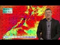
- **Apologies for the low quality of today's video - back to normal tomorrow!** Windy weather is going to surge across southern Australia and the south-east in particular with gale westerlies reaching severe gale (damaging) at times across a number of states and the A.C.T.
Meanwhile parts of northern WA will have gusty easterlies kicking in for a time as high pressure finally returns to southern parts of the state going into next week.
But most of the energy - gales, rain, thunderstorms and snow - lies in the south-east corner of Australia, very generally from Adelaide to Sydney to Hobart and everyone in between.
We cover the upcoming weather through until next week.
Keep up to date with BoM (Bureau of Meteorology) for all official Australia weather warnings over the days ahead.
- Title
- NZ: Severe weather risks over the days ahead
- Runtime
- 8:45
- Date posted
- 1 year ago
- Description
- Damaging gales, rain/showers, some snow and a couple bursts of polar air are all on the way for New Zealand over the coming days, weekend and early next week.
Windy weather - mostly westerly driven - will ramp up over the next few days with Sunday looking especially windy around the North Island and then on Monday more central parts of the country.
Snow may get down to 300 or 400m for a time in the lower half of the South Island and 800m for the North Island but most heavy snow will be in the Southern Alps at higher elevations and North Island mountains.
Rain, heavy at times, moves into the West Coast with rain and showers for the western NI. Driest areas are the east of both main islands and the very top of the North Island.
We have a detailed forecast through until Tuesday of next week.

- Title
- Oz: Blast of widespread strong winds + southern rain, alpine snow
- Runtime
- 10:55
- Date posted
- 1 year ago
- Description
- Strong winds will affect most states and territories at times in the days ahead along with snow at higher elevations and wet weather in the south of the nation.
Winds, which may reach damaging for a time in the south-east will turn more westerly, while northern parts of Australia have easterlies picking up in the week ahead.
Rain, showers, thunderstorms and snow are all in the mix too - we break down where and when.

- Title
- NZ: Westerly gales, polar air - but a touch of spring
- Runtime
- 8:02
- Date posted
- 1 year ago
- Description
- Temperatures will continue to rise in most places over the next couple of days ahead of two polar changes coming into the country.
The first polar change arrives on Friday, with some wind, rain and snow. The second larger polar shot of air looks to be on Sunday, along with damaging westerlies in some parts of the North Island in particular. Eastern areas look driest.
September kicks off windy with westerlies - but there are some signs of more high pressure returning after that. We give you the forecast for the end of August and the first day of September.

- Title
- Oz: Stormy south with gales, snow & thunderstorms
- Runtime
- 10:09
- Date posted
- 1 year ago
- Description
- Winds may approach damaging in parts of the southern third of Australia over the week ahead with areas of rain, thunderstorms and snow all in the mix too, thanks to stormy low pressure just south of the nation.
Warm Northerlies and cold Southerlies are forecast - but it's the windy Westerlies that may make some areas feel more spring-like in the east, with hopefully a boost in sunshine and dry weather for those that have recently been wet/gloomy along the eastern coast.
By Sunday, the weather looks to ease in many places, although Tasmania still has that windy westerly and western showers.
It's a busy weather week for many in the south with changeable conditions and colder air and some severe weather risks - we have your Australia forecast through to Sunday.

- Title
- NZ's last days of August turn windy westerly
- Runtime
- 7:52
- Date posted
- 1 year ago
- Description
- High pressure covers most of NZ to kick off August's last week, but a huge area of low pressure by this weekend will bring a surge of windy westerlies over the nation, lasting into next week too.
This will bring winter weather back to some regions with late week snow in the Southern Alps, coming into the North Island's Central Plateau this weekend.
Those in the eastern North Island will be exposed to the windy westerlies - which hopefully will also blow away cloud and showers which has been sticking around a lot lately.
We bring you the latest forecast - and why some weekend downpours weren't forecast accurately for everyone,
Have a great week ahead!

- Title
- Oz: Southern severe weather risks increase again next week
- Runtime
- 8:54
- Date posted
- 1 year ago
- Description
- Drier weather is returning to NSW & Qld, but more active cold fronts are coming back to the south with another wintry burst of weather from WA to Vic/NSW over the coming week.
We break down where the rain is easing (or returning), where the thunderstorms are, severe weather risks - and who gets the colder air, or warmer air, over the next several days.
Thanks for your support - if you love what we do please tell your friends and family about our YouTube channel!

- Title
- NZ 7 Day: Huge high, followed by even larger low
- Runtime
- 7:48
- Date posted
- 1 year ago
- Description
- Powerful high pressure is crossing the South Island today and tomorrow then will lie east of the country going into next week. This will bring dry weather and lighter winds, along with colder nights, into many regions.
However as the high moves through an easterly will develop at the top of the North Island, bringing some cloud and showers/isolated downpours. Windier northerlies will form through Cook Strait and a light westerly will develop in southern NZ this weekend (or early next week).
By Wednesday next week the high is moving away from NZ bringing milder northerlies.
But later next week a windy westerly is expected - as a very large pool of low pressure moves into our part of the world.
We also have your 7 Day NZ rainfall outlook.
Have a great weekend!

- Title
- Australia 7 Day Weather: Wintry blasts keep coming for the south
- Runtime
- 10:45
- Date posted
- 1 year ago
- Description
- Heavy rain and thunderstorms in NSW and Qld should ease, as will severe thunderstorms in WA - although another cold front is coming, and that will bring some areas of severe weather potential into WA then later on the south-east corner of Australia (yes again!).
We have the latest on the winter storms brushing the south - but also some signs of the tropical heat pushing further southwards over the nation.
Today also includes the 7 day rainfall map.
This week's Flight Simulator flyover is is Port Denison / Dongara in WA.

- Title
- NZ weather: Frosty high incoming, windy westerlies possible in a week
- Runtime
- 5:41
- Date posted
- 1 year ago
- Description
- Powerful high pressure is moving in and over the South Island this weekend bringing more frosty nights and cold mornings around the nation. Some cloud and showers continue in the east and south, along with a windier southerly flow.
Over the weekend and early next week easterlies may well develop at the top of the North Island bringing some showers.
But later next week we may be seeing what looks more like an early spring pattern with strong westerlies moving in. We'll have more details about that in our Friday update and obviously early next week too.

- Title
- Australia: Cold fronts, downpours & thunderstorms
- Runtime
- 6:47
- Date posted
- 1 year ago
- Description
- Heavy rain and thunderstorms are moving into NSW and parts of Qld, while out west an active cold front with Severe Thunderstorms move into WA.
For the most part much of the 'weather energy' around Australia over the coming week is focused around eastern NSW and south-western WA.
We track the cold fronts, wind changes and thunderstorm risk areas over the coming days and into the start of next week.

- Title
- NZ - Powerful high pressure arrives, cold nights kick back in
- Runtime
- 5:13
- Date posted
- 1 year ago
- Description
- Frosty conditions will affect both main islands going into the later part of this week and the upcoming weekend as high pressure dominates.
There are a few showers in the forecast, along with mainl dry weather for most of the nation.
We break down what is influencing NZ's weather between now and the earlier part of next week.

- Title
- Australia: Cold fronts, showers & thunderstorms
- Runtime
- 7:56
- Date posted
- 1 year ago
- Description
- Eastern wet weather, thunderstorms for NSQ, Qld & WA and more active cold fronts hitting WA and moving eastwards. It's a fairly busy forecast although some states do have long stretches without much happening over the days ahead.
We break down the temperature swings, the windy weather, the wet weather - and who's getting the cold fronts and when.

- Title
- NZ: Big (frosty) high pressure coming, but not all have sunshine
- Runtime
- 5:57
- Date posted
- 1 year ago
- Description
- It's a wintry day over New Zealand as polar heads covers the entire nation, with the coldest pulse of air moving up the nation today and tonight, followed by increasing high pressure.
Cold air will linger into the weekend, especially around the North Island, but frosty weather also expands in the South Island as high pressure comes in this weekend with lighter winds and clearer skies.
But parts of the eastern North Island have showers, cloud, and colder winds lingering longer - we break down New Zealand's weather forecast through until Sunday.

- Title
- Australia: Cold fronts WA, rain & thunderstorms NSW/Qld
- Runtime
- 8:28
- Date posted
- 1 year ago
- Description
- The weather pattern is still busy in some parts of Australia this week with active cold fronts pouncing on WA, and wet easterlies and some low pressure creating downpours and thunderstorms around NSW and Qld.
Low pressure and some wet weather also pushes past SA, Vic, the A.C.T and Tas, with a little more snow forecast in Tas.
NT looks very settled.
We also take a look at the 7 day rain forecast in the coastal east as heavy rain/thunderstorms/downpours brush NSW and Qld.

- Title
- NZ: Snow, rain showers and polar air - then frosty and dry
- Runtime
- 9:15
- Date posted
- 1 year ago
- Description
- A cold blast that is affecting Aussie is now moving into NZ overnight tonight and across Tuesday, bringing snow to low levels in the South Island and to just 300 or 400m into the North Island for a time too. In the South Island snow levels may get down to 100 or 200m, although heavy snow is mainly above 400m and clears away quite fast going into Wednesday.
Later this week huge high pressure out of Australia will move in - bringing drier weather for most places, but also colder nights again.
We have your New Zealand forecast out to Sunday.

- Title
- Cold blast SE Australia, frosts for Qld, cold fronts WA
- Runtime
- 9:32
- Date posted
- 1 year ago
- Description
- This weekend a polar airflow will spread as far north as southern Queensland bringing frosts, while snow to lower levels is expected across Tasmania, and the mountains going into Victoria. Snow is also likely on the peaks of the Great Dividing Range, although may not be a lot.
Meanwhile in WA more active cold fronts are coming, with thunderstorms risks.
Elsewhere - it's fairly quiet.
We have your Australia only forecast for this weekend and across next week.

- Title
- NZ's weekend weather & outlook for next week
- Runtime
- 9:59
- Date posted
- 1 year ago
- Description
- Milder weather is moving in this weekend, ahead of a wintry change that peaks around Monday to Wednesday across New Zealand, bringing some heavy mountain snow and the chance of some low lying snow flurries around the South Island.
Snow is also forecast for the Central North Island and eastern ranges of the North Island right up to Hawke's Bay Tairawhiti/Gisborne area (although won't be much that far north).
We track the weather over NZ for the next full week ahead - plus your 7 day rainfall.

- Title
- Australia: UPDATE on Cold fronts, snow in the south & south-east
- Runtime
- 10:16
- Date posted
- 1 year ago
- Description
- Apologies for the delayed publication today - we've changed editing studios! --- Cold fronts, polar air, thunderstorms, squalls and snow are all possible in southern and south-eastern parts of Australia over the coming week - while many northern areas remain dry.
We have your 7 Day Australia weather forecast, 7 day rainfall outlook and the latest on 7 day rainfall nationwide.
This week's Flight Sim place is Benambra, Victoria!
- Title
- NZ Weather: Milder northerlies this weekend, colder air next week again
- Runtime
- 7:58
- Date posted
- 1 year ago
- Description
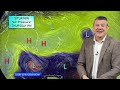
- A northerly flow will spread over a number of regions this weekend, nudging temperatures up for a time but also indicating high pressure will be leaving us during Sunday and Monday as low pressure returns.
At the same time as low pressure areas move in next week, another wintry southerly comes in. This will make for bleak conditions in the eastern South Island in particular, then into the lower half of the North Island with some snow about (ranges and mountains).
The forecast is a bit messy - but compared to what happened on this day in 2011 we have very settled weather at the moment! (14 years ago today/tomorrow that snow fell in Dunedin, Christchurch, Wellington and even parts of Auckland).
- Title
- Australia: Southern cold fronts, showers & snow
- Runtime
- 8:57
- Date posted
- 1 year ago
- Description
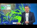
- A couple of cold fronts are moving through with some pockets of severe weather from WA to Australia's south-east.
The weekend and the start of next week look extra wintry with snow on the skifields and a dusting of snow in to the higher peaks of NSW (although not everywhere will get very much).
We have the latest Australia weather forecast for the next 7 days.

- Title
- NZ temperatures to (briefly) lift this weekend
- Runtime
- 9:31
- Date posted
- 1 year ago
- Description
- Milder airflows, some with subtropical connections, will spread across parts of NZ over Friday, Saturday and Sunday - ahead of low pressure, rain and some snow next week.
The forecast for next Tuesday still remains messy and still can't be locked in - we show you the flip flopping models and explain why this does happen in winter in our part of the world (and yes, it's frustrating!).
We cover the big changes between now and next Tuesday across New Zealand.

- Title
- Oz: Polar blast, snow, coming for SE
- Runtime
- 10:42
- Date posted
- 1 year ago
- Description
- The next active cold front is approaching Australia's SW, but it will be the SE of the country likely to see that polar air bringing snow and wintry weather conditions again into Tas, Vic, the A.C.T and NSW over the weekend and/or early next week.
We cover the cold front(s) in the south, how far north that cold air will go - and where the quiet/dry spots are.
Next update: Wednesday.
*With the snow/rain "Precip" maps - please ignore the rain key at the bottom of the page.

- Title
- Polar air lingers, snow and rain next week
- Runtime
- 7:40
- Date posted
- 1 year ago
- Description
- Cold polar air remains over NZ this week before a brief "warming up" this weekend as northerlies return - ahead of rain clouds and some wind on Monday, then a snowy/wet polar blast next week.
The cold(er) change next week will come with wet weather - either as snow, rain or hail - and this poses some difficulties for those already in lambing and calving.
We bring you NZ's weather ups and downs for the next 7 days.

- Title
- Australia: Weather for the week (and weekend) ahead
- Runtime
- 8:25
- Date posted
- 1 year ago
- Description
- In our Big Picture weather outlook this week we track a couple of active cold fronts in the south, brushing the southern states over the days ahead.
Showers continue - but then ease - in many eastern areas, but it's worth noting some wet weather is forming in the tropical north offshore (Coral Sea/Solomon Sea area) and this may brush FNQ.
We track the next pulse of cold polar air (and some mountain snow) and which areas get the dry warm winds over the week ahead.

- Title
- Polar air dominates NZ this week (and next)
- Runtime
- 8:19
- Date posted
- 1 year ago
- Description
- A cold pool of air lies over New Zealand for much of this week, ahead of a wintry burst next week - and perhaps some briefly milder northerlies in between.
High pressures moves over the South Island this week, bringing nationwide frosts - heaviest in the South Island and the Central Plateau of the North Island. A few showers are also in the mix.
Milder northerlies are likely late week or this weekend - but that's ahead of an even larger southerly change likely early next week. We bring you the latest forecast.
- Title
- Oz: Isolated thunderstorms as cold fronts brush the nation
- Runtime
- 9:18
- Date posted
- 1 year ago
- Description
- It’s not as stormy as it was, but cold air is still brushing Australia and that’s triggering thunderstorms here and there as southerly winds get in the mix surrounding some very powerful high pressure to the south.
We cover conditions when we recorded this video, showing a big range in temperatures, some windy areas and where the rain is falling.
Longer range we track any severe weather risks - which is fairly minimal overall - but we do have thundery downpours for a few states over the coming week.
Programming Notes:
1) Next week we are changing our editing studio and may create some delays publishing our videos - just a heads up incase they are published an hour or two later next week as we get settled.
2) Our Australian daily weather video trial is over - and you’ll be pleased to know it’s been a great success and we are now locking in daily (week day) Australian-only weather updates here at WeatherWatchTV on YouTube. Thank...
- Title
- NZ: Colder & drier air for a week, but some get showers for days
- Runtime
- 7:32
- Date posted
- 1 year ago
- Description
- High pressure is returning to NZ this weekend but some will have lingering showers through into next week as a wintry southerly flow sets in.
Friday and Saturday are the wettest (with snow higher up) and frosts then expand going into the weekend and into next week.
Polar air will linger over basically the entire country for the next week ahead - perhaps bringing the coldest week of the year so far from a nationwide point of view.
Programming Note:
Next week we are changing our editing studio and may create some delays publishing our videos - just a heads up incase they are published an hour or two later next week as we get settled.

- Title
- Oz: Eastern cloud/showers continue as cold fronts hit WA
- Runtime
- 8:45
- Date posted
- 1 year ago
- Description
- High pressure and showers is chugging along to the south while central thunderstorms around the NT drift eastwards into Qld and northern NSW in the days ahead. The main headline for the next week will be eastern coastal Australia having plenty of east to south-east winds (cooler) and cloud and showers. Rainfall isn’t huge but it adds up day after day - we have the 7 day rainfall map to make sense of that.
Meanwhile WA has a few cold fronts and thunderstorms in the south-west - and just a few showers for SA, Vic and Tas. The A.C.T and NT look mostly dry.
Today’s Flight Sim place of the week is Palmerston City, near Darwin, NT!

- Title
- NZ enters peak winter as cold air dominates next week or two
- Runtime
- 7:23
- Date posted
- 1 year ago
- Description
- Friday sees wet weather crossing NZ from the west ahead of a colder weekend - and a cold week next week for many places as frosts and high pressure return.
There may be some snow to 300 metres in the South Island and around the North Island’s Central Plateau on Friday/Saturday (including the Desert Road).
Next week high pressure moves into the South Island with widespread frosts and low temperatures - this affects the North Island too, but an easterly flow means eastern areas have more cloud and showers, western areas sunnier/drier - although northern NZ will be close (again) to a subtropical low which may feed more easterlies, cloud and showers in to the upper North Island.
HEADS UP
We also take a long range look 12 days away at a *potential* wintry/snowy outbreak for New Zealand - we show you the long range modelling for that.

- Title
- Oz: Eastern showers, inland thunderstorms & southern cold fronts
- Runtime
- 6:42
- Date posted
- 1 year ago
- Description
- High pressure is in the forecast more than it’s been recently - but there are still cold fronts, showers and thunderstorms in the mix.
Main highlights are more active cold fronts for the south-west of WA and around Tasmania, while much of eastern Australia has easterlies, cloud and showers setting back in again over the coming days and into next week.
Elsewhere, large dry areas and not much to talk about (yet!).

- Title
- NZ: Wintry weekend is coming, some snow and frosts
- Runtime
- 5:15
- Date posted
- 1 year ago
- Description
- Friday sees rain clouds moving through followed by a wintry southerly that will bring polar air as far north as Auckland and Coromandel Peninsula this weekend and into next week.
This will bring snow in the ranges, mountains and maybe some foothills of the South Island, and around Central Plateau (including the Desert Road) this Friday and Saturday.
By Sunday and Monday frosty weather expands as high pressure moves closer - but the southerly flow is still with us, keeping temperatures down.
We have your NZ forecast through to Tuesday of next week

- Title
- Oz: Severe thunderstorms for WA & Qld, showers or dry elsewhere
- Runtime
- 8:48
- Date posted
- 1 year ago
- Description
- Following a stormy past month the weather isn’t as severe over the next week, but some pockets of severe thunderstorms are possible, mostly in WA and Qld (but some other inland areas, including NSW, may also be brushed by them).
The main headlines today are showers returning to eastern Australia for a number of days (with easterly winds), while WA has more windy cold fronts coming in. Southern states have a few showers - but plenty of dry areas in the mix too.
And the tropics? As quiet as ever





