Bureau of Meteorology
Climate and Water Outlook, issued 15 April 2021

- Title
- Climate and Water Outlook, issued 15 April 2021
- Runtime
- 2:38
- Date posted
- 6 years ago
- Description
- The Climate and Water Outlook video provides a look at likely rainfall, streamflow and temperature for the months ahead. See http://ow.ly/gOoW50EoYX5 for more detail.

- Title
- A new radar for Mildura
- Runtime
- 0:34
- Date posted
- 6 years ago
- Description
- The new weather radar at Mildura is now operational, providing a boost for rural and regional communities across Victoria, New South Wales and South Australia.
With the latest Doppler and dual-pol technology, this radar provides real-time hail detection, rain intensity and wind velocity to assist with flood and severe weather warnings.
This is part of the Bureau of Meteorology's program to deliver the most significant uplift to Australia's radar and observation network in a generation.
View the radar on our website http://www.bom.gov.au/australia/radar/ or on the BOM Weather app via Google Play or the App Store.
To learn more about radars:
➡️ Read our blog "How does a weather radar work?" http://media.bom.gov.au/social/blog/1459/how-does-a-weather-radar-work/
➡️ Read frequently asked questions
http://www.bom.gov.au/australia/radar/about/radarfaq.shtml
➡️Watch our Radar Technician, Coby Mattinso...

- Title
- Severe Weather Update: Extreme fire danger & damaging winds for southeast Australia - 13 April 2021
- Runtime
- 1:45
- Date posted
- 6 years ago
- Description
- Severe Weather Update: Extreme fire danger and damaging winds for southeast Australia. Video current at 1:00pm AEST 13 April, 2021.
Strengthening northerly winds ahead a developing cold front across southeast Australia is creating severe to potentially extreme fire danger for highly populated areas of South Australia, including the Adelaide hills, with a fire weather warning and ban current for the remainder of today.
A severe weather warning is also current across central South Australia for locally damaging northerly winds, that are forecast to extend into elevated parts of Victoria this afternoon, potentially including the northern suburbs of Melbourne.
For the latest forecasts and warnings, go to our website: http://www.bom.gov.au/australia/warnings/index.shtml or the #BOMWeather app and follow the advice of emergency services.

- Title
- Severe Weather Update: Ex-Tropical Cyclone Seroja crossing inland WA. 10:00am AEST - 12 April, 2021
- Runtime
- 1:39
- Date posted
- 6 years ago
- Description
- Severe Weather Update: Ex-Tropical Cyclone Seroja crossing inland Western Australia. Video current at 10:00am AEST 12 April, 2021.
A severe weather warning for damaging winds and periods of heavy rainfall remains current as Ex-Tropical Cyclone Seroja continues to track through the Western Australian Wheat Belt and the South East Coastal District.
For the latest forecasts and warnings, go to our website: http://www.bom.gov.au/wa/ or the #BOMWeather app and follow the advice of emergency services.

- Title
- Weekly weather from the Bureau of Meteorology: Sunday 11 April, 2021
- Runtime
- 2:01
- Date posted
- 6 years ago
- Description
- Our meteorologist Sarah Scully presents this week's weather forecast as aired on ABC Landline on Sunday 11 April, 2021. Our forecasts update daily, please visit www.bom.gov.au for current information.

- Title
- Severe Weather Update: tropical cyclone Seroja rapidly approaching WA coast, 11 April, 2021
- Runtime
- 1:52
- Date posted
- 6 years ago
- Description
- Severe Weather Update: tropical cyclone Seroja rapidly approaching WA coast. Video current at 11am AWST Sunday 11 April, 2021.
For the latest tropical cyclone advice go to our website http://www.bom.gov.au/cyclone/ or the #BOMWeather app and follow the advice of emergency services.

- Title
- Severe Weather Update: Tropical Cyclone Watch continues for WA - 10 April, 2021
- Runtime
- 3:03
- Date posted
- 6 years ago
- Description
- Severe Weather Update: Tropical Cyclone Watch continues for WA. Video current at 10:30AM AWST 10 April, 2021.
For the latest tropical cyclone advice go to our website http://www.bom.gov.au/cyclone/ or the #BOMWeather app and follow the advice of emergency services.
- Title
- Severe Weather Update: Tropical Cyclone Watch for WA - 9 April, 2021
- Runtime
- 2:21
- Date posted
- 6 years ago
- Description
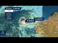
- Severe Weather Update: Tropical Cyclone Watch for WA. Video current at 11.30AM AWST 9 April, 2021.
Two tropical cyclones - Seroja and Odette – are now lying off Western Australia, and a cyclone watch has been issued for communities along the west coast, now is the time to prepare.
For the latest forecasts and warnings, go to our website: http://ow.ly/qia350Ekkm9 or the #BOMWeather app and follow the advice of emergency services - https://www.dfes.wa.gov.au/Pages/default.aspx
For more information about tropical cyclones, please go to our Tropical Cyclone Knowledge Centre - http://ow.ly/9g0M50Ekl5P

- Title
- Weather Update: Tropical cyclone Seroja to impact WA, 8 April 2021
- Runtime
- 1:46
- Date posted
- 6 years ago
- Description
- Weather Update: Tropical cyclone Seroja to impact WA. Video current 10.00am AWST, 8 April 2021.
Tropical cyclone Seroja is expected to approach the WA coast from Sunday, bringing destructive winds, heavy rain, flooding and dangerous tides, initially to the area between Geraldton and Carnarvon, moving south to Jurien Bay on Monday, and Perth could see heavy rain.
Know your weather. Know your risk. This is a rare event for the west coast of WA, and people should prepare for potentially dangerous conditions ahead. For the latest forecasts and warnings, go to www.bom.gov.au or the #BOMWeather app and follow the advice of emergency services.

- Title
- Severe Weather Update: Heavy rainfall for southeastern Qld - 4 April, 2021
- Runtime
- 1:40
- Date posted
- 6 years ago
- Description
- Severe Weather Update: Heavy rainfall for southeastern Qld. Video current at 11:30 AM AEST 4 April, 2021.
For the latest forecasts and warnings, go to our website: http://www.bom.gov.au/australia/warnings/ or the #BOMWeather app and follow the advice of emergency services.

- Title
- Weather Update: Potential rain event for eastern Qld and northern NSW, Thursday 1 April
- Runtime
- 1:46
- Date posted
- 6 years ago
- Description
- Weather Update: Potential rain event for eastern Qld and northern NSW. Video current at 12:30pm AEST, Thursday 1 April.
We're keeping a close watch on what could become a significant rain event for parts of central and southeast Queensland this Easter long weekend, and possibly northern New South Wales into next week.
If you're in south east Queensland or northern New South Wales this long weekend, be sure to stay up to date with Bureau forecasts and warnings.
For the latest forecasts and warnings, go to our website www.bom.gov.au or the #BOMWeather app.

- Title
- Climate and Water Outlook, issued 25 March 2021
- Runtime
- 3:20
- Date posted
- 6 years ago
- Description
- The Climate and Water Outlook video provides a look at likely rainfall, streamflow and temperature for the months ahead. See http://ow.ly/7ktW50DVM6A for more detail.

- Title
- Severe Weather Update: flooding for eastern NSW & Qld - 24 March, 2021
- Runtime
- 1:43
- Date posted
- 6 years ago
- Description
- Severe Weather Update: flooding for eastern NSW and Qld. Video current at 3.30pm AEDT 24 March, 2021.
For the latest forecasts and warnings, go to our website: http://www.bom.gov.au/australia/warnings/ or the #BOMWeather app and follow the advice of emergency services.

- Title
- Severe Weather Update: Heavy rain & flooding for eastern Vic & Tas, 24 March 2021
- Runtime
- 1:47
- Date posted
- 6 years ago
- Description
- Severe Weather Update: Heavy rain across eastern Victoria and eastern Tasmania has communities on flooding alert, with further falls and strong winds persisting into Thursday. Video current at 11.00am AEDT Wednesday 24 March, 2021.
Know your weather. Know your risk. For the latest forecasts and warnings, go to our website http://ow.ly/8fPc50E5NjI or the #BOMWeather app and follow the advice of emergency services.

- Title
- Severe Weather Update: heavy rain, flooding for eastern Australia - 23 Mar 2021
- Runtime
- 1:39
- Date posted
- 6 years ago
- Description
- Severe Weather Update: flooding for Sydney and Eastern NSW and heavy rainfall for eastern Vic and Tas. Video current at 2.00pm AEDT 23 March, 2021.
Know your weather. Know your risk. For the latest forecasts and warnings, go to our website www.bom.gov.au or the #BOMWeather app and follow the advice of emergency services.

- Title
- Severe Weather Update: Flooding for Sydney and Eastern NSW - 22 March 2021
- Runtime
- 1:26
- Date posted
- 6 years ago
- Description
- Severe Weather Update: Flooding for Sydney and Eastern NSW. Video current at 2.00pm AEDT 22 March, 2021.
Know your weather. Know your risk. For the latest forecasts and warnings, go to our website www.bom.gov.au or the #BOMWeather app and follow the advice of emergency services.

- Title
- Severe Weather Update: Flooding for Sydney and Eastern NSW - 21 March 2021
- Runtime
- 2:07
- Date posted
- 6 years ago
- Description
- Severe Weather Update: Flooding for Sydney and Eastern NSW.
Video current at 11.30am AEDT 21 March, 2021.
Know your weather. Know your risk. For the latest forecasts and warnings, go to our website www.bom.gov.au or the #BOMWeather app and follow the advice of emergency services.

- Title
- Severe Weather Update: Heavy rain and major flooding for eastern NSW - 20 March 2021
- Runtime
- 2:08
- Date posted
- 6 years ago
- Description
- Severe Weather Update: Heavy rain and major flooding for eastern NSW. Video current at 11.30am AEDT 20 March, 2021.
Know your weather. Know your risk. For the latest forecasts and warnings, go to our website www.bom.gov.au or the #BOMWeather app and follow the advice of emergency services.

- Title
- Severe Weather Update: Dangerous flash flooding eastern NSW, 19 Mar 2021
- Runtime
- 1:58
- Date posted
- 6 years ago
- Description
- Severe Weather Update: Dangerous flash flooding possible for eastern NSW. Video current at 3pm AEDT, Friday 19 March 2021.
A potentially dangerous flood situation is unfolding for parts of the Mid North Coast with intense rainfall leading to life threatening flash flooding possible.
Numerous flood warnings are also current for multiple rivers in the Mid North Coast and Hunter region.
Know your weather. Know your risk. For the latest forecasts and warnings, go to our website http://www.bom.gov.au/australia/warnings/index.shtml or the #BOMWeather app and follow the advice of emergency services.

- Title
- Severe Weather Update: heavy rain for parts of eastern Australia, 18 Mar 2021
- Runtime
- 1:20
- Date posted
- 6 years ago
- Description
- Severe Weather Update: heavy rainfall for parts of eastern Australia. Video current at 2.00pm AEDT, Thursday 18 March 2021.
Know your weather. Know your risk. For the latest forecasts and warnings, go to our website www.bom.gov.au or the #BOMWeather app and follow the advice of emergency services.
- Title
- Severe Weather Update: heavy rainfall for parts of eastern Australia, 17 March 2021
- Runtime
- 3:20
- Date posted
- 6 years ago
- Description
- Severe Weather Update: heavy rainfall for parts of eastern Australia. Video current at 3.00pm AEDT, Wednesday 17 March 2021.
Flood warnings and watches are current across central and southern Queensland, as well as northern and northeast NSW.
A severe weather warning has been issued for heavy rainfall which may lead to flash flooding about the Capricornia coastline late on Wednesday and into Thursday morning.
A severe weather warning has also been issued for heavy rain developing for the NSW Mid-North coast from Thursday morning that may lead to flash flooding.
Catchments across many parts of NSW and parts of southern Queensland are near saturated, so more rain on wet soils means increased risk of high runoff and flooding.
Know your weather. Know your risk. For the latest forecasts and warnings, go to our website www.bom.gov.au or the #BOMWeather app and follow the advice of emergency services.

- Title
- Weather Update: significant rain forecast for parts of Queensland and NSW, Monday 15 March.
- Runtime
- 2:29
- Date posted
- 6 years ago
- Description
- Weather Update: significant rain forecast for parts of Queensland and NSW. Video current at 3pm AEST, Monday 15 March.
There has been good news for many communities across areas of inland southeast Queensland, who are celebrating widespread totals of 40-70 mm over the past 24 hours, with a number of locations recording in excess of 100 mm.
Showers and thunderstorms are forecast to develop across parts of Queensland and New South Wales this week. There's potential for widespread accumulated totals of 50 -100 mm with isolated total up to 150 mm, with a focus about the southern Interior of Qld, inland NSW and also about the east coast and adjacent land areas of NSW.
Unfortunately, significant rainfall is likely to miss the region between Mackay and Wide Bay, where rainfall has been below average for some time—our thoughts go out to those communities.
For the latest forecasts and warnings, go to our website www.bom.gov.au or the #BO...

- Title
- Weekly weather from the Bureau of Meteorology: Sunday 14 March, 2021
- Runtime
- 1:58
- Date posted
- 6 years ago
- Description
- Our meteorologist Dean Narramore presents this week's weather forecast as aired on ABC Landline on Sunday 14 March, 2021. Our forecasts update daily, please visit www.bom.gov.au for current information.

- Title
- Severe Weather Update: Severe thunderstorms possible for eastern Australia, 11 March 2021.
- Runtime
- 1:05
- Date posted
- 6 years ago
- Description
- Severe Weather Update: Severe thunderstorms possible for eastern Australia. Video current at 1pm AEDT, Thursday 11 March 2021.
Severe Thunderstorms with large hail, damaging winds and heavy rainfall are likely over large parts of inland New South Wales, Southern Queensland and Northeast Victoria today which will likely continue into Friday.
Know your weather. Know your risk. For the latest forecasts and warnings, go to our website http://www.bom.gov.au/nsw/warnings/ for the #BOMWeather app.

- Title
- Climate and Water Outlook, issued 11 March 2021
- Runtime
- 2:52
- Date posted
- 6 years ago
- Description
- The Climate and Water Outlook video provides a look at likely rainfall, streamflow and temperature for the months ahead. See http://ow.ly/7ktW50DVM6A for more detail.
- Title
- Weekly weather from the Bureau of Meteorology: Sunday 7 March, 2021
- Runtime
- 2:01
- Date posted
- 6 years ago
- Description
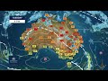
- Our meteorologist Sarah Scully presents this week's weather forecast as aired on ABC Landline on Sunday 7 March, 2021. Our forecasts update daily, please visit www.bom.gov.au for current information.

- Title
- Norfolk Island Tsunami Final Update. Video issued at 3:00pm, 5 March, 2021.
- Runtime
- 1:06
- Date posted
- 6 years ago
- Description
- The Tsunami Marine Warning for Norfolk Island has now been cancelled.
This marks the end of the Joint Australian Tsunami Warning Centre's (JATWC) response to this morning's 7.9 magnitude earthquake north east of New Zealand and the aftershocks thereafter.
Emergency services on Norfolk Island will advise if and when it is safe to return to normal activity.
Up to 64 centimetre tsunami waves were observed on the Island as well as much smaller tsunami waves being recorded in some areas of the east coast.
Be aware that although the main tsunami threat has passed, small unusual waves, currents and abnormal tides may still affect some beaches, harbours and coastal waterways for many hours or even days.
No further update will be provided unless situation changes.

- Title
- Tsunami Marine Warning Norfolk Island Update #2 - 5 March 2021
- Runtime
- 1:20
- Date posted
- 6 years ago
- Description
- Tsunami Marine Warning Norfolk Island Update 2 - Video current at 12.00pm AEDT 5 March 2021
A Tsunami Marine Warning remains in place for Norfolk Island following an 7.9 magnitude earthquake north east of New Zealand early this morning. A further aftershock of 6.6 magnitude was recorded at 1013 AEDT at the same location
The latest Media Statement issued at 12.45pm AEDT can be viewed at http://ow.ly/CRII50DQG2G
At this stage the public is advised to check the latest advice on the Bureau's twitter or at www.bom.gov.au/tsunami

- Title
- Tsunami Marine Warning has been issued for Norfolk Island, 5 March 2021
- Runtime
- 1:34
- Date posted
- 6 years ago
- Description
- A Tsunami Marine Warning has been issued for Norfolk Island following an 7.9 magnitude earthquake near the Kermadec Islands region, north east of New Zealand.
A marine warning means there is the possibility of dangerous rips, waves and strong ocean currents and some localised overflow into the immediate foreshore for Norfolk Island.
The potential impact for Norfolk Island may begin after 10am local time on the island (9am AEDT) and last for several hours.
Evacuations are not necessary for marine threat areas but Norfolk Island residents are strongly advised to get out of the water and move away from the immediate water's edge of beaches, marinas, coastal estuaries and rock platforms.
Police are urging residents not to go to the coast to watch the tsunami.
Boats in Norfolk Island harbours, estuaries or shallow coastal water should return to shore.
Vessels at sea should stay offshore in water at least 25m dee...

- Title
- Severe Weather Update: Tropical cyclone Niran off Northern Queensland - 4 March 2021
- Runtime
- 1:06
- Date posted
- 6 years ago
- Description
- Know your weather. Know your risk. For the latest tropical cyclone forecasts and warnings, go to our website bom.gov.au/cyclone or the #BOMWeather app. Make sure your cyclone kit is ready and your plans in place, and always listen to advice from emergency services.

- Title
- BOM Webinar: Autumn 2021 climate and water update
- Runtime
- 57:14
- Date posted
- 6 years ago
- Description
- Join our climate experts Dr Lynette Bettio and Catherine Ganter for an update on temperature, rainfall and other conditions to date, and an in depth look at the outlook for autumn 2021. Learn how the Bureau's climate and water information can help you make important decisions for the season ahead.
1-3 mins – Introduction and topics covered today: Summer Wrap Up, Climate Influences and Autumn Outlook
3-16 mins – Senior Climatologist Catherine Ganter takes us through the Summer Wrap Up
16-22 mins – Question and answer session 1
22-35 mins – Senior Climatologist Dr Lynette Bettio discusses Climate Influences and the Autumn outlook
35-54 mins - Question and answer session 2
54-56 mins – Summary and useful links
Thanks for watching! Click subscribe and the notification bell to see Bureau videos in your feed.
If you'd like information like this delivered to your inbox, sign up for our subscriber emails: https://e.bom.gov.au/subscrib...

- Title
- Severe Weather Update: tropical cyclone Niran off Northern Queensland - 3 March 2021
- Runtime
- 2:14
- Date posted
- 6 years ago
- Description
- Severe Weather Update: tropical cyclone Niran off Northern Queensland. Video current at 12.00pm AEST Wednesday 3 March, 2021.
Know your weather. Know your risk. For the latest forecasts and warnings, go to our website www.bom.gov.au or the #BOMWeather app and follow the advice of emergency services.

- Title
- Severe Weather Update: tropical cyclone Niran off Northern Qld - 2 March 2021
- Runtime
- 2:06
- Date posted
- 6 years ago
- Description
- Severe Weather Update: tropical cyclone Niran off Northern Queensland. Video current at 12.00pm AEST Tuesday 2 March, 2021.
Know your weather. Know your risk. For the latest forecasts and warnings, go to our website www.bom.gov.au or the #BOMWeather app and follow the advice of emergency services.

- Title
- Severe Weather Update: Developing tropical low for northern Queensland, 1 March, 2021.
- Runtime
- 2:05
- Date posted
- 6 years ago
- Description
- Severe Weather Update: Developing tropical low for northern Queensland. Video current at 1.30 pm AEST, Monday 1 March 2021.
A tropical low is approximately 175km east southeast of Cairns and is forecast to intensify into a tropical cyclone on Tuesday morning, which will be name "Niran".
The cyclone is expected to remain fairly slow moving at first, and although it's not forecast to make landfall, it is expected to bring hazardous conditions to coastal areas.
Heavy rainfall, flash flooding, damaging winds and abnormally high tides are all a risk and a cyclone Watch is current from Cape Flattery to Lucinda – it's important for people within the affected region to start activating their cyclone plans now.
The amount of rainfall and potential flooding is highly dependent to the movement and intensity of the system, however widespread daily totals of 50-100 mm are expected right along the northern Qld coast, with isolated daily totals...

- Title
- Severe Weather Update: Tropical low for northern Queensland, 28 February 2021
- Runtime
- 1:43
- Date posted
- 6 years ago
- Description
- Severe Weather Update: Tropical low for northern Queensland, 28 February 2021. Video current at 3pm AEST 28 February, 2021.
Know your weather. Know your risk. For the latest forecasts and warnings, go to our website www.bom.gov.au or the #BOMWeather app and follow the advice of emergency services.

- Title
- Weather Update: tropical low for northern Queensland, 26 February 2021
- Runtime
- 2:00
- Date posted
- 6 years ago
- Description
- Weather Update: tropical low for northern Queensland. Video current at 12.30 pm AEST, Friday 26 February 2021. A tropical low has developed in the Coral Sea to the northeast of Cairns and will bring heavy rain for coastal regions in far North Queensland over the coming days.
Conditions are favourable for it to develop into a tropical cyclone next week, but there is still uncertainty about its movement and development, and where we'll see the heaviest rain.
An Initial Flood Watch has already been issued for parts of the tropical north east coast in anticipation of heavy rain - this will likely be extended to include the Townsville area.
Daily totals more than 100 mm are possible across the Flood Watch area.
Catchments are saturated after a wet February so far – widespread 500-800 mm has already been recorded, and so some rivers will respond quickly.
Know your weather. Know your risk. For the latest forecasts and warning...

- Title
- Climate and Water Outlook for autumn 2021, issued 25 February 2021
- Runtime
- 3:57
- Date posted
- 6 years ago
- Description
- The Climate and Water Outlook video provides a look at likely rainfall, streamflow and temperature for the months ahead. See http://www.bom.gov.au/climate/outlooks/ for more detail.

- Title
- Developing tropical lows off WA and QLD: 2020-21 Tropical Cyclone Season Update
- Runtime
- 1:39
- Date posted
- 6 years ago
- Description
- We are currently monitoring 2 developing tropical lows off WA and QLD.
So far out of the 15 tropical lows in Australia's area of responsibility this season, only 4 have developed into tropical cyclones.
So why have we seen so few tropical cyclones?
Meteorologist Jackson Browne shares the science of why this is occurring.
Know your weather. Know your risk. For the latest forecasts and warnings, go to our website www.bom.gov.au or the #BOMWeather app. Make sure your cyclone kit is ready and your plans in place, and always listen to advice from emergency services.

- Title
- Weekly weather from the Bureau of Meteorology: Sunday 21 February, 2021
- Runtime
- 1:58
- Date posted
- 6 years ago
- Description
- Our meteorologist Jonathan How presents this week's weather forecast as aired on ABC Landline on Sunday 21 February, 2021. Our forecasts update daily, please visit www.bom.gov.au for current information.

- Title
- Weekly weather from the Bureau of Meteorology: Sunday 14 February, 2021
- Runtime
- 2:01
- Date posted
- 6 years ago
- Description
- Our meteorologist Dean Narramore presents this week's weather forecast as aired on ABC Landline on Sunday 14 February, 2021. Our forecasts update daily, please visit www.bom.gov.au for current information.

- Title
- Climate and Water Outlook, issued 11 February 2021
- Runtime
- 2:32
- Date posted
- 6 years ago
- Description
- The Climate and Water Outlook video provides a look at likely rainfall, streamflow and temperature for the months ahead. See http://ow.ly/waCG50Dxfxn for more detail.

- Title
- Severe Weather Update: Tropical low and bushfire weather update for WA, 5 February 2021
- Runtime
- 1:44
- Date posted
- 6 years ago
- Description
- Severe Weather Update: Tropical low and bushfire weather update for WA. Video current at 9.30 am AWST Friday 5 February, 2021.
The tropical low continues to bring squally rain to northwest Western Australia, while over Perth, gusty winds will make conditions challenging for the ongoing bushfire emergency.
Know your weather. Know your risk. For the latest forecasts and warnings, go to our website http://ow.ly/Mums50DrU8W or the #BOMWeather app and follow the advice of emergency services.

- Title
- Severe Weather Update: severe storms for SE Australia - 4 Feb 2021
- Runtime
- 2:12
- Date posted
- 6 years ago
- Description
- Severe Weather Update: severe thunderstorms, heavy rain and damaging winds for southeast Australia. Video current at 2.30pm AEDT Thursday 4 February, 2021.
Know your weather. Know your risk. For the latest forecasts and warnings, go to our website www.bom.gov.au or the #BOMWeather app and follow the advice of emergency services.

- Title
- Severe Weather Update: fires & tropical low impacting WA - 3 Feb 2021
- Runtime
- 2:21
- Date posted
- 6 years ago
- Description
- Severe Weather Update: fires and tropical low impacting Western Australia. Video current at 12.30pm AWST Wednesday 3 February, 2021.
Know your weather. Know your risk. For the latest forecasts and warnings, go to our website www.bom.gov.au or the #BOMWeather app and follow the advice of emergency services.

- Title
- Severe Weather Update: tropical low for northwestern WA - 1 Feb 2020
- Runtime
- 1:42
- Date posted
- 6 years ago
- Description
- Severe Weather Update: Tropical low with heavy rain and gales for northwestern Western Australia. Video current at 12:15pm AWST Monday, 1 February, 2021.
Latest forecasts and warnings: http://ow.ly/z9QV50DnntL or the #BOMWeather App and follow the advice of emergency services.

- Title
- Severe Weather Update: Deepening tropical low in WA , Jan 31
- Runtime
- 1:35
- Date posted
- 6 years ago
- Description
- Severe Weather Update: Deepening tropical low in WA. Video current at 10am AWST Sunday, 31 January 2021.
Know your weather. Know your risk. For the latest forecasts and warnings, go to our website www.bom.gov.au or the #BOMWeather App and follow the advice of emergency services.

- Title
- Climate and Water Outlook, issued 28 January 2021
- Runtime
- 3:32
- Date posted
- 6 years ago
- Description
- The Climate and Water Outlook video provides a look at likely rainfall, streamflow and temperature for the months ahead. See http://ow.ly/AGP050DkkfU for more detail.

- Title
- Severe Weather Update: tropical low brings heavy rain to Cape York, Qld, 27 January 2020
- Runtime
- 1:54
- Date posted
- 6 years ago
- Description
- Severe Weather Update: tropical low brings heavy rain to Cape York, Queensland. Video current at 2pm AEST Wednesday 27 January 2021.
The low moved over land on western Cape York Peninsula this morning and is no longer expected to be a tropical cyclone. Cyclone Watches and Warnings have all been cancelled.
However, a Severe Weather Warning is current for heavy rainfall across much of the Peninsula district, with falls up to 180 mm possible in just 6 hours. In the past 24 hours we have seen isolated falls greater than 200 mm in some locations.
Know your weather. Know your risk. For the latest forecasts and warnings, visit our website http://ow.ly/7v3T50DjhH3 or the BOM Weather App and follow the advice of emergency services.

- Title
- Severe Weather Update: Tropical low deepening in the Gulf of Carpentaria, Jan 26
- Runtime
- 2:06
- Date posted
- 6 years ago
- Description
- Severe Weather Update: Tropical low deepening in the Gulf of Carpentaria. Video current at 12pm AEST Tuesday, 26 January 2021.
Know your weather. Know your risk. For the latest forecasts and warnings, go to our website www.bom.gov.au or the #BOMWeather App and follow the advice of emergency services.

- Title
- Severe Weather Update: tropical low developing Gulf of Carpentaria, 25 Jan
- Runtime
- 1:18
- Date posted
- 6 years ago
- Description
- Severe Weather Update: tropical low developing in the Gulf of Carpentaria.Video current at 3pm AEST Monday, 25 January 2021.
Know your weather. Know your risk. For the latest forecasts and warnings, go to our website www.bom.gov.au or the #BOMWeather App and follow the advice of emergency services.





