WeatherWatchTV
ClimateWatch: May and the start of winter as El Nino builds

- Title
- ClimateWatch: May and the start of winter as El Nino builds
- Runtime
- 10:17
- Date posted
- 3 years ago
- Description
- We’re officially in an El Nino ‘Watch’ as conditions continue to build across the equatorial Pacific in favour of this climate driver. While La Nina brings humid nor’easters to NZ, El Nino tends to bring the opposite - cooler and drier sou’westers.
We’re currently in a “Neutral” phase (although it does still feel like La Nina in New Zealand due to the sub-tropical winds in the first week or so of May - and the last couple weeks of April).
Neutral means more chaos and no set pattern to drive our weather here in New Zealand. Over the months ahead it looks as though El Nino will build and this should start to slow down the number of sub-tropical rainmakers NZ gets. It is worth noting that NZ’s small size means one big low or high can upset the long range forecasts, but generally speaking May looks unsettled and chaotic still, but June and July may start to be a bit more westerly driven than April or early May.

- Title
- Warm, wet and windy - NZ’s next week ahead
- Runtime
- 6:06
- Date posted
- 3 years ago
- Description
- Sub-tropical winds, powerful high pressure and a Tasman Sea low are all combining over New Zealand this week bringing much warmer than average temperatures, heavy rain at times, and winds up to gale force.
The set-up remains in place from today until next Monday, May 8th. All of the country will be warmer than average this week with a month’s worth of rain (or more) falling in the north and west of both main islands.
Australia has more typical Autumn weather, mostly affected the south east.
We have your forecast out to Saturday - and don’t forget, our next ClimateWatch update is out later today!

- Title
- Raining cats and Dillon.
- Runtime
- 0:16
- Date posted
- 3 years ago
- Description
- When you're working from the home studio .

- Title
- NZ - A month’s worth of rain next week for many, strong winds, mild air
- Runtime
- 7:04
- Date posted
- 3 years ago
- Description
- NZ and NSW both have heavy rain coming up, but NZ has the highest totals with over 200mm forecast in some parts of the Upper North Island and the West Coast as a sub-tropical low drops southwards and interacts with a powerful high east of NZ. We often call this set-up a “squash zone” event due to the windy nor’easters we get for several days. It’s also known as an “atmospheric river” as it funnels moisture-rich sub-tropical air directly into us for days on end. The low itself will unravel over NZ next week.
We go through the rain risks for New Zealand - but also for New South Wales which also has a rain event with over 125mm on the way.
Today’s video covers the forecast right through until Friday of next week.

- Title
- Sub-tropical low pressure to boost NZ’s temperatures again
- Runtime
- 4:01
- Date posted
- 3 years ago
- Description
- Much of NZ had a warmer than average April and May looks to kick off on the warmer than average note thanks, once again, to sub-tropical low pressure to the north of NZ and powerful high pressure to our east. The set up encourages airflows from around the Cook Islands and Tonga to spread down over most of New Zealand next week, pushing overnight lows into double digits and again seeing daytime highs reach the 20+ degree mark in some places.
Australia is more unsettled with windier westerlies in the south, easterlies for Queensland, and NSW is stuck in the middle with some low pressure forming there next week following a weak cold front.
We have your NZ and Australia forecast out to Tuesday.

- Title
- Powerful high pressure crossing NZ but sub-tropical low coming
- Runtime
- 3:15
- Date posted
- 3 years ago
- Description
- There’s active weather across parts of Australia but NZ has high pressure moving through ahead of low pressure in the north by Sunday. The sub-tropical low will linger into next week bringing more days of windy nor’easters to the top half of the North Island, while the South Island stays more settled - but warmer.
Australia has a cold front (or a few of them) in the southern half of the country, brushing up to about Sydney by next week with windiest weather around Bass Strait.

- Title
- Cold changes this week, but sub-tropical warmth next week
- Runtime
- 5:18
- Date posted
- 3 years ago
- Description
- +Anzac Day weather for dawn ceremonies. A cold change is moving up NZ on Monday with a follow up on Wednesday - but by Sunday a warmer sub-tropical airflow will return to NZ boosting temperatures above normal for the start of next week.
Australia has some wet weather around the coastlines - we show you the 5 day rainfall map.
We also have the forecast for Anzac Day - both for dawn ceremonies in NZ and the forecast across the day for NZ and Australia.

- Title
- Cold blast for NZ on Monday, more unsettled weather next week
- Runtime
- 7:38
- Date posted
- 3 years ago
- Description
- Heavy rain for Friday and Saturday will cross through central NZ ahead of a nationwide cold blast on Monday. Temperatures will take a hit nationwide next week with another cold, windier, surge on Wednesday too. However NZ may not be finished just yet with sub-tropical weather… we may have another low forming north of NZ late next week worth keeping an eye on (not a storm or severe at this stage - but might bring more milder-than-usual weather to NZ if it does form and track southwards).
In Australia high pressure is the dominant force but plenty of showers in the east from Sydney to Brisbane to Cairns and northwards - this remains next week too. Perth has a colder, windier, southerly change next week.
The Tropics has low pressure from Samoa to the Cook Islands - but this low pressure zone will weaken in the days ahead.
Have a great weekend - see you again on Monday!

- Title
- Some rain, then a cold change on Monday
- Runtime
- 4:55
- Date posted
- 3 years ago
- Description
- Another big high pressure zone is heading to NZ next week before skirting southern Australia - and this will bring a cold change right over New Zealand on Monday and Tuesday. It’s fairly short lived but it will hack back temperatures by several degrees (for some by day, for others both day and night).
Australia is quite settled but showers and east to south east winds dominate from Sydney northwards along the eastern coastline, and a colder southerly for WA arrives on Monday.
The Tropics sees low pressure deepening and passing over the Cook Islands but clears away next couple days.

- Title
- Warmer than normal for NZ, but big colder change on Monday
- Runtime
- 6:59
- Date posted
- 3 years ago
- Description
- Sub-tropical airflows and northerlies are boosting NZ’s temperatures but following some rain through central NZ late this week, colder air will start to advance northwards.
By Monday a nationwide south to south west flow will move over New Zealand dropping temperatures. For some in the north this will be especially noticeable at nighttime with overnight lows in places like Auckland dropping from 18C to 11C, while daytime highs in the south will drop with places like Christchurch going from a high of 18C to 20C on Sunday to just 13C by Monday.
In Australia - high pressure is the main feature, bringing a few showers to the south and east, otherwise dry inland with light winds.
The tropics have some low pressure with Rarotonga most exposed to strong winds, heavy rain and bigger seas for a time over the coming several days.

- Title
- Heavy rain and high pressure for NZ
- Runtime
- 4:33
- Date posted
- 3 years ago
- Description
- High pressure is dominating much of NZ and Australia - but rain is trapped in central western parts of NZ with some heavy falls, and parts of south eastern Australia have a windier west to south west change for a time.
Eastern parts of Australia have showers and SE winds.
The powerful high east of NZ is working with low pressure in the tropics (and later the Tasman Sea) to help produce the mild airflows in NZ…. places like Auckland have overnight lows over +18C for the next four nights ahead, this is more like the middle of summer.
Full forecast to Sunday…

- Title
- High pressure dominates NZ & Australia - brings showers & wind though
- Runtime
- 5:31
- Date posted
- 3 years ago
- Description
- We have two powerful high pressure zones dominating both NZ and Australia this week - but the tropics and the Tasman Sea are full of low pressure which, to some degree, will impact New Zealand.
While much of the low pressure remains up in the tropics, bringing thunderstorms and higher humidity to Fiji, Tonga, Vanuatu, New Caledonia and later on the Cook Islands, the high pressure zone parked east of New Zealand (over the Chathams) will work with this tropical low pressure to bringing in some wet weather to the upper South Island and some other western areas. The tropical weather stays north of NZ but the warmer than average temperatures will cover a large portion of our country.
The next big high from the Indian Ocean moves into Australia and brings a slight temperature drop - and a few showers - to Adelaide, Melbourne, Hobart and Sydney this week.
We have your forecast through to Saturday for New Zealand, Australia and much of the South Pacific ...

- Title
- Powerful anticyclone to bring sub-tropical air to NZ next week
- Runtime
- 6:32
- Date posted
- 3 years ago
- Description
- Cyclone Ilsa made landfall in WA early Friday as a powerful recording breaking cyclone but NZ has a powerful anti-cyclone which will dominate our weather for the coming week ahead.
The anti-cyclone (or high pressure zone) will be parked to our east and will grow in size in the coming days. This, coupled with a low i the Tasman Sea and lows in the tropics, will help produce a warmer than average week next week for all of NZ. Northerly quarter winds will dominate for several days. Windy nor’easters will be the theme for some regions in the north of the country.
In Australia Ilsa was still a Severe Tropical Cyclone (Cat3) when we recorded this, but will likely lose its tropical cyclone status by late Friday or Saturday at the latest. It broke an Australian recorded for highest sustained 10 minute winds, which clocked in at 218km/h, breaking the 2007 record which was in the 190km/h range. Note this is SUSTAINED winds, not gusts - which were estimated to be clo...

- Title
- Severe CATEGORY 5 Cyclone ILSA in WA, as NZ has big temp changes coming
- Runtime
- 6:21
- Date posted
- 3 years ago
- Description
- #Breaking: ILSA is now a Severe Category *5* Tropical Cyclone --- A severe tropical cyclone will make landfall in Western Australia overnight tonight as NZ’s weather pattern remains the same with more downpours and isolated thunderstorms for at least another 24 hours, before finally easing.
See more at www.WeatherWatch.co.nz or via our Twitter page @WeatherWatchNZ.
NZ’s weather takes a change this weekend and next week with high pressure parked to our east and that encourages a week long northerly quarter airflow - this will keep NZ above normal temperature-wise. Make the most of it, as the last week of April looks colder!
In Australia TC Ilsa makes landfall tonight/overnight near Port Hedland and then tracks inland over Friday, reaching Alice Springs by Friday night/Saturday as a mostly rain event. Behind the cyclone a big cold southerly will blast into Perth - and this will reach NZ in the last week of April.
This video was re...

- Title
- NZ’s downpours continue, Cyclone Ilsa forms in Western Australia
- Runtime
- 7:27
- Date posted
- 3 years ago
- Description
- New Zealand has more downpours and isolated thunderstorms on Wednesday and potentially the next couple days ahead before an almost week-long northerly quarter airflow moves in, starting this weekend.
This weekend or next week places in the South Island that would normally be frosty by mid-April (like Alexandra) have daytime highs in the early 20s and overnight lows in the double digits thanks to the northerly flow.
In Australia Tropical Cyclone Ilsa has formed is expected to make landfall on Thursday PM north east of Pord Hedland. The severe cyclone will then churn across the desert, falling apart before Alice Springs and likely reaching Queensland next week as just a few showers.
The south east corner of Australia is especially Autumnal with windy, wet and colder changes in the mix.
Finally - next week north of NZ the tropics will be getting more interesting. No sign of any tropical cyclones yet, but low pressure may deepen enough a...

- Title
- Thunderstorms & tornadoes for NZ, severe cyclone for Western Australia
- Runtime
- 8:54
- Date posted
- 3 years ago
- Description
- Classic peak mid-Autumn weather across NZ and Australia this week with severe weather risks in both nations. A mixture of big lows and big highs means there are temperatures swings across Australia - but NZ is stuck in a mostly warmer than average set up, especially for the North Island and upper South Island.
More downpours with isolated thunderstorms and even tornadoes (or damaging localised winds) are possible (hit and miss) around New Zealand today - and again for the next few days ahead.
In Australia a tropical cyclone is forming in Western Australia and is expected to become a severe category 4 storm when it makes landfall this Thursday night between Broome and Port Hedland.
Finally, this weekend in NZ a “squash zone” is expected - this produces blustery winds from the same direction (nor’east this time) for days in a row.

- Title
- Your Easter Weekend forecast + outlook for next week
- Runtime
- 5:06
- Date posted
- 3 years ago
- Description
- A series of lows and highs will affect New Zealand this long weekend - and across next week too. Australia’s south east (from Adelaide to Sydney and down to Hobart) will also be affected by the incoming lows and highs, with a wintry southerly kicking in on Easter Sunday and into Monday too.
A large low next week from the Tasman Sea will bring mild but cloudy and sometimes wet and windy weather to NZ - especially western regions rain-wise.
The tropics are fairly quiet at the moment with large dry areas and no serious storms for now.

- Title
- Updated Easter Weekend forecast (Wed April 5)
- Runtime
- 5:30
- Date posted
- 3 years ago
- Description
- This long weekend it’s a battle of the air pressure systems for NZ and Australia as lows and highs all move through.
For NZ there will be a sub-tropical area of low pressure to keep an eye on, followed by a deepening Tasman Sea low by Sunday/Monday with Southern Ocean connections. In between these lows is high pressure - so, many regions will get some settled weather and some unsettled weather. Fairly standard Easter Weekend weather!
In Australia a wintry southerly will kick in over the south eastern corner of the country on Eastern Sunday and easing back over Monday.
As always, drill down deeper at RuralWeather.co.nz and WeatherWatch.co.nz - proud to be a small kiwi owned business and NZ’s most popular private forecaster.

- Title
- Easter Weekend forecast (Updated Tue April 4)
- Runtime
- 5:52
- Date posted
- 3 years ago
- Description
- We have the latest on Easter Weekend as high pressure crosses the country and low pressure from the sub-tropics brushes some North Island regions… and that’s ahead of the next Tasman Sea low pressure zone which is likely to move in on Easter Monday.
It’s not overly stormy - but certainly half of the weekend in NZ looks unsettled for many regions (central NZ looks most settled, especially those in the west).
Australia has a stormy, wintry, southerly blast for a time - which affects a large area from Adelaide to Melbourne to Hobart (and maybe as far north as Sydney for a time on Easter Sunday).
Full details to Monday in our video - and we’ll update this again on Wednesday.

- Title
- ClimateWatch - APRIL’s outlook brings the chaos factor
- Runtime
- 12:38
- Date posted
- 3 years ago
- Description
- Our monthly ClimateWatch update is back and we take a look at the likely rain and temperature trends over New Zealand for the month of April.
With La Nina now officially gone we’re in a NEUTRAL phase - and for NZ that means “Chaos”. A pattern that is changeable, but with a mixture of highs and lows it means we’ll likely all have a mixture of warm/dry/settled days and wetter/windier/colder days.
We take a detailed look at what is driving our weather now - and a look to the months ahead with more talk about El Nino coming in later this year.
As always, visit our websites for more details: WeatherWatch.co.nz and RuralWeather.co.nz

- Title
- Your Easter Weekend forecast (and outlook for this week!)
- Runtime
- 6:53
- Date posted
- 3 years ago
- Description
- Easter is almost here and we’ve got the forecast right through to Easter Monday as NZ sees more high pressure but lows nearby too.
Over in Australia it’s a similar pattern of highs and lows - with plenty of settled spells, just like NZ, but also some wet, windy and colder bursts in the mix too.
We take a detailed look at the forecast for the week ahead and for the four-day-weekend in New Zealand.
**Our TUESDAY WeatherWatch video will be a few hours later than usual - issued late afternoon tomorrow.

- Title
- Low pressure coming this weekend
- Runtime
- 4:18
- Date posted
- 3 years ago
- Description
- NZ has a colder southerly for Tuesday & Wednesday then a milder low pressure zone this weekend will bringing more rain but with north to north easterly winds. In between the southerly and the weekend low will be some high pressure - mostly for northern and western parts of NZ, before the next low this weekend comes in from the west.
Australia has ares of rain and downpours from Brisbane to Sydney to Melbourne and again over in WA. Another high from the Indian Ocean is heading towards Tasmania this weekend.
**PROGRAMMING NOTE** - Due to family bereavement we are still not back to our normal schedule and today is our final video for this week/March. We apologise for the inconvenience and can confirm that as of Monday next week (April 3) our usual daily videos will resume, along with our next instalment of ClimateWatch. Thank you again for all the incredible support and kind comments, they have been very much appreciated by us.
For mo...

- Title
- Cold change coming for NZ Tuesday/Wednesday
- Runtime
- 5:24
- Date posted
- 3 years ago
- Description
- A colder southerly will bring rain and showers into NZ this week with yet another low pressure zone and wet weather arriving this coming weekend. For those in northern NZ you will be least affected by the colder change and the wet weather over the coming week.
Australia has wet weather along the eastern side and out over inland parts of WA.
The next high rolls into Tasmania later this weekend but low pressure remains stuck around VIC and parts of NSW.
**PROGRAMMING NOTE** - Due to family bereavement we are still not back to our normal schedule and tomorrow (Tuesday) will be our final video for this week/March. We apologise for the inconvenience and can confirm that as of Monday next week (April 3) our usual daily videos will resume, along with our next instalment of ClimateWatch. Thank you again for all the incredible support and kind comments, they have been very much appreciated by us.
For more daily updates visit WeatherWa...

- Title
- Classic early Autumn weather for NZ and Australia
- Runtime
- 4:13
- Date posted
- 3 years ago
- Description
- Westerlies for lower NZ will give way to a cold change by early next week, especially Tuesday. It’s part of the encroaching Autumn weather pattern which will see more westerlies and more southerly changes over the weeks and months ahead - as we head towards winter.
Generally, many parts of NZ lean drier than average for the next week ahead with the bulk of the rain in Westland and Fiordland.
Some of this wet weather also connects with eastern Australia, mainly around Sydney and coastal NSW.
There’s a good mix of highs and lows over the rest of March for NZ and Australia.
The tropics are fairly quiet with one main area of low pressure expected next week to the south of Tonga - but nothing too serious at this stage and mostly out at sea.
**Our next video will be on Monday, March 27th.

- Title
- Weather update for Thur March 23rd
- Runtime
- 5:54
- Date posted
- 3 years ago
- Description
- Title: Weather update for Thur March 23rd
Our daily videos are gradually returning following a family tragedy, with our normal schedule returning by April. Thank you so much for the lovely support and messages you have sent us over the past week and a half, they have been very much appreciated.
WeatherWise:
High pressure is rolling into NZ with a classic Autumn weather pattern now kicking in - meaning those shots of colder air from the Southern Ocean will increase in frequency.
Still plenty of dry and settled weather to - especially northern NZ.
La Nina has officially gone now - so a neutral/classic pattern is developing for now.
**Programming Note**
- Due to family bereavement we have a limited schedule for the rest of March.
- Our next update is Friday March 24, with two more updates next week on Monday and Tuesday.
- The following week is April and - apart from the stat holidays that...

- Title
- Due to a family tragedy, our weather videos won't return until Thursday, March 23rd.
- Runtime
- 0:13
- Date posted
- 4 years ago
- Description
- STATEMENT:
Due to a family tragedy, our weather videos won't return until Thursday, March 23rd. We apologise for the inconvenience - and we thank you so much for all the lovely messages of support. Our normal schedule will return properly in April.

- Title
- We will be out of the studio until Monday, March 20th.
- Runtime
- 0:11
- Date posted
- 4 years ago
- Description
- "Due to a bereavement in our family,
We will be out of the studio
until Monday, March 20th.
Please keep up to date with the weather on our websites or other social channels "
Team @ WW

- Title
- Super stormy Southern Ocean, but highs still in the mix
- Runtime
- 3:47
- Date posted
- 4 years ago
- Description
- We’re tracking some significant storms in the Southern Ocean at the moment, but they are hugging Antarctica - meaning they encouraging windy westerlies at times into the NZ and southern Australia areas.
This weekend northern high pressure for NZ will see a warm Sunday, but by Monday a cold front from the Southern Ocean will drop temperatures by close to 10 degrees, before the next big high rolls in for mid week. The storms are well south of NZ but we’re on the edges of them so they are influencing our weather with more West Coast rain (especially in Fiordland) and stronger west to south west winds at times.
Low pressure remains near Queensland driving in 50 to 70mm around Brisbane and the ranges with coastal showers next week increasing around NSW.
The tropics look more settled but next week a series of weak lows to monitor for any potential tropical cyclone development.
Have a great weekend - we’ll see you again on Monday!

- Title
- Southern Ocean turns very stormy - how it will influence our weather
- Runtime
- 6:24
- Date posted
- 4 years ago
- Description
- There are some major storms well south of NZ in the Southern Ocean over the coming week or two, hugging Antarctica. These giant storms will extend up to Tasmania, Victoria and parts of New Zealand in the coming week bringing some bursts of weather - ie, windy westerlies, or thundery showers.
A cold front on Sunday night/Monday will drop temperatures for southerners on Monday and Tuesday, but by mid next week a large high covers basically all of NZ.
The tropics are quieter - but several low pressure zones are forming and worth keeping an eye on over the coming week or two.
As always, drill down deeper by visiting RuralWeather.co.nz or WeatherWatch.co.nz

- Title
- Autumn’s weather pattern about to surge over NZ
- Runtime
- 4:25
- Date posted
- 4 years ago
- Description
- Thunderstorms, downpours, windy westerlies and long dry spells too - that’s the basic forecast for NZ over the coming week, and for large parts of Australia as the classic Autumn weather pattern arrives.
At least three high pressure zones look to affect NZ over the coming several days bringing warm and cool surges, and some cold fronts in the mix too.
With more high pressure north of NZ it stops tropical storms from forming for a while - but we do still expect more energy from the tropics this month. For now though, many in the north and east of the North Island will be loving the drier rather than wetter phase we’re in at the moment.
We have your forecast through to Monday.

- Title
- Autumn Weather pattern for NZ + Tropical Update
- Runtime
- 5:24
- Date posted
- 4 years ago
- Description
- Both NZ and Australia have Autumn like weather, especially the further south you are based over the coming week. Storms in the Southern Ocean are now sending up weekly windy westerlies (a classic sign of Autumn weather patterns) and this means a weekly colder injection of air. However summer’s heat is still with us too, so expect plenty more settled and sunny days on the way too.
We track NZ’s cold front this Friday/Saturday - and what that means for storm and flood hit regions in the North Island.

- Title
- Tracking Severe Cyclone Kevin + NZ’s big weather pattern change
- Runtime
- 8:57
- Date posted
- 4 years ago
- Description
- There are two tropical cyclones north of NZ, we have the very latest tracking on them both.
NZ is about to feel a big southerly change this weekend - mainly in the lower half and eastern sides of the South Island, but some northern areas too.
After this cold front NZ’s weather pattern takes a big change - away from La Nina easterlies of the past several months, to a much more traditional windy westerly set up.
We have your New Zealand, Australia and South Pacific tropical update through to Wednesday next week.
*Programming note - we have no video on Monday, we’re back on Tuesday!*

- Title
- Double trouble in the tropics, southerly for NZ this weekend
- Runtime
- 5:46
- Date posted
- 4 years ago
- Description
- Severe Cyclone Judy will slowly move away from Vanuatu today but yet another tropical cyclone has developed behind it.
Our video was made shortly before the Fiji Met Service named the second storm "KEVIN".
For Vanuatu it means a repeat performance with another damaging storm coming in the days ahead.
For New Zealand it means no real change to our weather, with both of these tropical cyclones expected to remain well north of NZ, as we exclusively first reported last week. They may be just close enough to increase rips, currents and waves in some north eastern beaches of the North Island.
High pressure from Australia will help keep these storms north of NZ - this high pressure will also encourage a colder southerly into Southland and Otago this weekend with daytime highs tumbling about 10 degrees on where they are today and Friday.
This southerly then heads up into the North Island but looks to only deliver 5 to 15mm for ...

- Title
- ClimateWatch: March & Autumn outlook as La Nina leaves
- Runtime
- 12:19
- Date posted
- 4 years ago
- Description
- La Nina is likely near the end according to Australia’s Bureau of Meteorology (BoM) but tropical lows look likely to remain across the month of March and may still bring rain into northern NZ and Australia in the coming weeks. It is the peak of the cyclone season after all. However, the start of March is certainly kicking off drier in the North Island following two months of relentless storms, flooding and slips. The breather coming up will be noticeable and positive for many northern regions.
But long range, rain still looks to lean above average for the North Island and some parts of the South Island - as the lower South Island remains drier than usual.
We take a look at expected rainfall in March - and the trends for Autumn compared to the trends expected at the end of winter and start of Spring later this year… this is when a possible El Nino may develop, which typically encourages more west to south west winds over NZ and more high pressure over the T...

- Title
- Cyclone Judy tracks over Vanuatu as NZ sees high pressure
- Runtime
- 4:42
- Date posted
- 4 years ago
- Description
- The North Island is enjoying a settled break in the days ahead although a few showers this weekend will still affect the eastern North Island (Hawke’s Bay, Gisborne etc).
Severe Cat 3 Tropical Cyclone JUDY remains over Vanuatu, making a direct hit to the capital Port Vila on Wednesday. The storm is expected to remain offshore from NZ when it passes by early next week.
We take a look at the Southern Ocean too, with a storm down there sending up Autumn westerlies and a cooler change again for Tasmania and the lower South Island.

- Title
- Tracking Cyclone Judy + Dry weather for the North Island
- Runtime
- 6:28
- Date posted
- 4 years ago
- Description
- Tropical Cyclone Judy is going to directly affect Vanuatu over the next two days, with the Fiji Met Service expecting the storm to become a “severe” Category 3 cyclone over the top of the capital, Port Vila tonight/overnight/Wednesday.
The latest tracking for Judy still keeps it well to NZ’s north - but it is worth monitoring closely each day in case there is any change to this tracking.
More flooding and slips for Gisborne and Hawke’s Bay overnight - but we FINALLY have some good news for you, and for other flood hit regions of the North Island with drier weather - not wetter - dominating for the next week ahead.

- Title
- High pressure for NZ + Tropical lows developing
- Runtime
- 5:40
- Date posted
- 4 years ago
- Description
- Edit: 3:30pm NZDT Monday - Cyclone JUDY has now been named.
We’re tracking a big block of high pressure in the NZ area this week but some rain lingers around the eastern North Island where a rain warning is in force for Monday. (Gisborne area).
Thunderstorms and downpours will also develop today over the North Island.
We keep an eye on the tropics - with a new low forming there it’s one to keep an eye on, but for now modelling shows it tracking near NZ but mainly offshore. It could still change, so check back daily for tracking. As of 3:30pm the Fiji Met Service had named it - in the video there was uncertainty about when it would be named, but it's been named earlier than expected. This doesn't change any of the tracking or forecasts in the video.

- Title
- Weather forecast to March 1 + Tropics update
- Runtime
- 6:05
- Date posted
- 4 years ago
- Description
- Rain continues to fall over Hawke’s Bay and Gisborne regions but will ease this weekend to isolated showers. Other parts of the North Island and north eastern South Island have some wet weather through until about Saturday afternoon or Sunday when the risk becomes more broken up into showers.
Heavy rain is also expected in Auckland - this is not so much in our video today covering the rest of March (due to the timing of the rain being mostly today/Friday). Please track on rain radar and keep up to date with current warnings - with localised flash flooding possible in Auckland region on Friday. https://www.weatherwatch.co.nz/maps-radars/radar/rain-radar-realtime
High pressure over the South Island continues this weekend with high pressure over more parts of the country next week - along with a few heavy afternoon downpours inland.
Australia has coastal showers in the east, rain in the tropics and a cooler southerly coming into SA, TAS and VIC f...

- Title
- Heavy rain in Hawke’s Bay + NZ’s weekend weather
- Runtime
- 4:18
- Date posted
- 4 years ago
- Description
- A burst of rain will move into Hawke’s Bay, linger for Friday, then slide back southwards on Saturday. Keep up to date with MetService warnings and watches. Since we recorded this video MetService has issued an Orange Rain Warning for Hawke's Bay with 150 to 200mm now possible.
Elsewhere the forecast is a bit messy next few days due to this set up in eastern NZ which will spillover into some western areas, however as we progress through the weekend high pressure returns to most places.
We have your forecast for NZ, and highlights around Australia and the tropics to Tuesday next week.

- Title
- Rain for Hawke’s Bay + NZ’s weather to Monday
- Runtime
- 5:16
- Date posted
- 4 years ago
- Description
- A cold front is moving up NZ with rain and then a temperature drop behind it.
This wet weather will mostly slide up the eastern side of NZ, bringing a wet Thursday and Friday to Hawke’s Bay.
Elsewhere we see rain around Canterbury and Wairarapa too, also Gisborne. Showers are forecast in other regions.
The set up for NZ continues on across the Tasman with eastern Australia also getting plenty of E to SE winds along with showers/rain accumulating.
In the tropics, some low pressure near Fiji to monitor but for now poses no threat to either Fiji or NZ.

- Title
- A colder southerly + more rain returning to Hawke’s Bay
- Runtime
- 6:38
- Date posted
- 4 years ago
- Description
- A southerly will drop temperatures across a large part of NZ ahead of more rain (possibly heavy) for Hawke’s Bay this week.
The southerly arrives first in the lower South Island bringing some much needed rain - totals do vary so keep up to date with RuralWeather.co.nz if you live in Southland, Otago and South Canterbury and need rain.
Wet weather then slides up the east of NZ and, unfortunately, looks to linger long enough in Hawke’s Bay to produce rainfall totals of 40 to 90mm, mostly around Thursday and Friday.
We have NZ’s forecast and a quick look at Australia and the (much quieter) tropics - with the forecast through to Sunday.

- Title
- Final update on Gabrielle + NZ/Australia outlook to Tuesday
- Runtime
- 7:26
- Date posted
- 4 years ago
- Description
- We continue to track departing Cyclone Gabrielle which is weakening and falling apart int he coming days. High pressure is to the rescue with settled weather for many places from now until mid next week
Thursday: We do have a few downpours and thunderstorms in the eastern and upper North Island today (and maybe Friday - but much more isolated). We show you the risk areas and what that means for flood ravaged eastern areas.
The outlook to Tuesday is a mostly dry one for NZ with high pressure, but a cold front and some wet weather is coming in on Wednesday for Southland and then moves up the eastern side of NZ end of next week with a little bit of wet weather for Hawke’s Bay and eastern parts of the North Island (with a temperature drop too).
Finally, we have a tropical outlook as low pressure remains there.
**Programming Note** - We have no video tomorrow, Friday Feb 17th after such a long 10 days, as we focus on our websites and cli...

- Title
- Cyclone Gabrielle finally departs NZ next 24 hours
- Runtime
- 6:19
- Date posted
- 4 years ago
- Description
- Some lingering wind and rain for the souther and eastern sides of the North Island today and the north eastern side of the South Island - but the storm is slowly tracking away from the North Island and is weakening at the same time too.
A few heavy downpours and isolated thunderstorms will develop around the upper North Island in the coming days - but they don’t look overly widespread.
Australia is fairly settled although Cairns and other parts of Queensland look especially wet in the coming 5 days.
We take a look at where Gabrielle goes, where the next high pressure zone is - plus and update on the tropics with low pressure zones around Fiji and Tonga worth monitoring (but posing no threat to NZ at this stage).

- Title
- Tue Feb 14 update on Cyclone Gabrielle as it starts to slowly weaken
- Runtime
- 6:53
- Date posted
- 4 years ago
- Description
- After half a day stalled near Great Barrier Island the cyclone is today on the move again, tracking SE towards East Cape and then out over open waters away from New Zealand on Wednesday and Thursday.
As it pulls away today it’s going to drag in stronger wind gusts for Auckland - with more damaging gales until tonight. It finally eases properly over Wednesday and Wednesday night.
Rain and wind are sliding down NZ today - we track it all and give you the forecast to the weekend where, hopefully, we do get some high pressure finally coming back in nationwide.
Thank you for your incredible comments - we can’t reply to them all due to being so busy, but we see them all and really do appreciate them.
- WeatherWatch.co.nz for more ongoing coverage today.

- Title
- Monday FEB 13th: Centre of Cyclone Gabrielle approaches northern NZ tonight
- Runtime
- 10:41
- Date posted
- 4 years ago
- Description
- We go through the latest tracking for Cyclone Gabrielle and the (many) various moving parts to this system.
NZ’s mountains and ranges play a huge part in breaking up the rain and wind - make it more intense for some, and not so bad for others. As the cyclone moves in the wind angle will shift around - affecting other places and likely sheltering some others too.
It’s a big storm and a little complicated - but we hope we can make sense of it further for you.
As always, refer to RuralWeather.co.nz and WeatherWatch.co.nz for hourly forecasts at your location - and stay up to date with MetService weather warnings.
**This video was recorded on FEBRUARY 13th... Phil accidentally said January in the initial video... you can blame his lack of sleep!! 🙂 **
From everyone at WeatherWatch.co.nz - thank you for the incredibly supportive comments to our small Kiwi business. It means heaps! 🙂 Take care next 48 hours.
- WW

- Title
- Sunday update on Cyclone Gabrielle for NZ
- Runtime
- 9:54
- Date posted
- 4 years ago
- Description
- Cyclone Gabrielle is moving into the New Zealand area with severe gales and heavy rain.
There are many moving parts to this storm - so we try to break it all down for you, including explaining what it means to go from a Tropical Cyclone to an Extra Tropical Cyclone.
Gabrielle is expected to deepen again as it moves closer to Auckland and Coromandel Peninsula on Monday night and Tuesday morning - before weakening to some degree later on Tuesday and moving off the North Island to the east on Wednesday.
Our next video update will again be early afternoon on Monday - weather and electricity dependent. If for whatever reason we cannot record a video on Monday or Tuesday, we’ll be providing news updates on our website: www.WeatherWatch.co.nz and www.RuralWeather.co.nz instead.
Take care - and please follow the advice of MetService and your local Civil Defence.
MetService Warnings: https://www.weatherwatch.co.nz/maps-radars/wa...

- Title
- Sunday update on Cyclone Gabrielle
- Runtime
- 10:03
- Date posted
- 4 years ago
- Description
- Some people have had issues with audio-syncing in this video - We've published the video AGAIN here with audio fixed: https://www.youtube.com/watch?v=59o8z3rJ6Kg&t
Thank you for all the comments below!
WeatherWatch.co.nz / RuralWeather.co.nz
- Title
- Special Saturday update on Cyclone Gabrielle
- Runtime
- 6:29
- Date posted
- 4 years ago
- Description
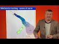
- Text Edit: 7pm NZDT Saturday -- Tropical Cyclone Gabrielle was still a severe category 3 storm at the time of this update – but is now a Category 2 cyclone, as it continues to track towards the northern side of the North Island.
There is little difference between a low end Category 3 cyclone and a high end Category 2. On Sunday Gabrielle will lose it’s tropical cyclone status, as it becomes extra-tropical. It is still expected to retain Category 2 equivalence strength near the centre as it passes by NZ on Monday night/Tuesday.
We have the latest tracking and outlook for NZ through until Thursday.
Please stay up to date with MetService warnings: https://www.weatherwatch.co.nz/maps-radars/warnings/metservice
And our websites RuralWeather.co.nz and WeatherWatch.co.nz
Our next video update will likely be early on Sunday afternoon.

- Title
- Friday’s update on Severe Cyclone Gabrielle
- Runtime
- 5:55
- Date posted
- 4 years ago
- Description
- Cyclone Gabrielle was upgraded to a severe Category 3 cyclone overnight but will weaken a little before it reaches New Zealand.
The storm is going to go through a big transition as it leaves the tropics and turns extra-tropical. This shifts the severe weather further out from the centre of the storm and makes the low lop-sided (with the bulk of the severe weather in the southern half of the storm).
This weekend we’ll have extra updates, with a video later on Saturday and another one on Sunday.

- Title
- Tropical Cyclone Gabrielle on track to directly hit NZ
- Runtime
- 7:37
- Date posted
- 4 years ago
- Description
- It’s an extremely concerning set-up, one that may see a few days of severe across New Zealand as Tropical Cyclone Gabrielle strengthens further today.
Global modeling suggests there is a high risk for New Zealand, especially the upper North Island which may well take a direct hit from the centre of the storm.
While confidence is high the cyclone will reach NZ, there still remains some uncertainty about the precise tracking of the centre. We explain what is driving the set-up next week and how high pressure could make it worse or better.
For Australia, the mainland is mostly unaffected weather-wise - but Norfolk Island may well get a direct hit on Saturday night from the eye of the cyclone.





