WeatherWatchTV
A weak low for NZ on Saturday, high pressure next week

- Title
- A weak low for NZ on Saturday, high pressure next week
- Runtime
- 5:22
- Date posted
- 2 years ago
- Description
- A low will move over the North Island on Saturday and fall apart - bringing patchy rain and showers across the island, in particular the central and top part of the North Island from the west. The South Island has a weak cold front on Friday bringing a little wet weather to the south.
Next week, however, kicks off with high pressure - but there’s something happening in Australia which may come our way next week (not yet locked in).

- Title
- Tracking the next low for NZ - who gets rain & when
- Runtime
- 7:12
- Date posted
- 2 years ago
- Description
- A cold front moves into NZ on Friday but it’s pretty weak - but it will help spark a new low for the North Island in particular on Saturday.
The low looks to be short lived for Friday and Saturday - and as it moves over the North Island on Saturday PM it should fall apart. Rainfall totals don’t look excessive in any regions, BUT - we do have to monitor it because there could be a sub-tropical element to it and with so much high pressure around this low it will be slow moving - in other words, it could trigger some localised downpours, otherwise the rain bands are patchy and broken.
We have your forecast for NZ through to Monday next week.

- Title
- NZ & South Pacific weather outlook
- Runtime
- 5:32
- Date posted
- 2 years ago
- Description
- High pressure is close to northern NZ and will be there for most of this week bringing a few showers to NZ, mostly the west and south. A weak cold front on Friday will move into the lower South Island while low pressure develops in the Tasman Sea and is likely to drift into the North Island on Saturday with mild winds in the north.
By Sunday it gets pushed away by the next incoming high.
We also take a look at the 7 day general outlook for the South Pacific + a 7 Day rainfall map for the South Pacific as we track a low forming around Vanuatu and likely tracking north of NZ and south of the Cook Islands (moving south east) later this weekend or early next week.
Thanks for supporting WeatherWatchTV on YouTube!

- Title
- Australia Weather: Your week ahead as eastern showers dominate
- Runtime
- 5:22
- Date posted
- 2 years ago
- Description
- Eastern Australia has lower temperatures, more cloud and a high risk of showers for the next full week ahead as the weather pattern around the nation somewhat stalls.
High pressure remains centred just to the south of WA and SA and over the coming week drifts eastwards to reach VIC, TAS and the ACT by the weekend.
However coastal NSW and QLD have a week of showers, some areas of rain and cloudier and cooler airflows.
By this Sunday a low in the Coral may be worth monitoring, especially for Queenslanders. No storm is forecast yet but any low in the Coral Sea is worthy of monitoring closely, especially as we’re still technically in the cyclone season for another two weeks.

- Title
- NZ’s outlook for the week ahead
- Runtime
- 4:47
- Date posted
- 2 years ago
- Description
- High pressure is nearby, but not perfectly over NZ this week which encourages a few showers about the nation. We have a couple of cold fronts this week but they aren’t very strong, mostly affecting the lower South Island on Tuesday and Friday.
We have your NZ forecast through to Sunday.

- Title
- RainWatch - The next 8 days around NZ
- Runtime
- 5:20
- Date posted
- 2 years ago
- Description
- Our latest RainWatch updates tracks the wet weather around the country this weekend - and what is happening next week.
Basically low pressure continues around NZ for Friday and Saturday then clears away. From Sunday through to the end of next week the country is more in a west to south west set-up which brings in showers to the south and west of New Zealand.
We break down where the rain will be - and won’t be - over the next 8 days.
Have a great weekend!

- Title
- Aust. 7 Day: Showery east, wetter FNQ + ex-cyclone Olga in WA
- Runtime
- 7:43
- Date posted
- 2 years ago
- Description
- High pressure south of Australia is dominating most of the weather over the next 7 days but drives in a very showery and cloudy flow to much of eastern Australia. A tropical depression in the Coral Sea area will fall apart but help fuel some wet weather from Townsville northwards starting from about Sunday and off and on next week.
Another low skirts by Darwin, likely out at sea.
Meanwhile today ex-cyclone Olga moves into Exmouth, WA as a weak rain maker. It will drive in wet weather as far south as Kalgoorlie but sorry Perth, you miss out at this stage.
We have your 7 Day Australia Rainfall Map + today’s Flight Sim “place of the day” is Trinity Beach in Queensland.

- Title
- NZ: Low pressure arrives with gales & rain, high pressure by Sunday
- Runtime
- 5:37
- Date posted
- 2 years ago
- Description
- A low is moving into NZ over the next 24 hours and with it a surge of gales and a burst of rain for both main islands. In fact it’s the upper North Island’s turn to get some rain, along with the upper South Island - two large areas that perhaps need the rain the most. Keep up to date with our local rainfall totals in our new alerting app so you get fewer nasty surprises.
By Saturday the low is in Cook Strait and weakening - but will bring a surge of windy westerlies to the upper western North Island (and warm nor’westers to the eastern North Island). At the same time a southerly change moves up the South Island.
On Sunday and into next week high pressure is nearby to NZ, bringing showers but a generally drier and more settled pattern.

- Title
- More rain & wind as low pressure moves into NZ
- Runtime
- 6:14
- Date posted
- 2 years ago
- Description
- A low in the Tasman Sea will reach NZ by Friday but before now and then more rain and wind will blow through, with temperatures well above normal for this time of year due to the sub-tropical component.
We go into detail about latest rainfall figures - and of course, as always, refer to rainfall data in our new app or websites for your local estimates.
The low falls apart by Saturday with a weak southerly change - but high pressure starts to return over Sunday and Monday from the west with a few showers and larger dry areas.
We have your detailed New Zealand forecast through to Monday.

- Title
- Detailed update on low moving into NZ + Pacific Islands update
- Runtime
- 7:13
- Date posted
- 2 years ago
- Description
- Westland is in for a deluge, so too possibly the surrounding areas including Nelson and Takaka. But for many other places the incoming wet weather will be welcome after a very dry start to 2024.
Sub-tropical or mild northerlies will continue to blow through - becoming windiest on Thursday.
By Friday the low moves into the West Coast and falls apart - with a west to south west change for NZ on Saturday, then high pressure on Sunday.
We break down the rain for Westland in as much detail as we can - and show a rainfall map for NZ through until this Sunday. Keep up to date with MetService official warnings and watches.
Finally, the last part of the video (as we do every Tuesday now) is dedicated to the South Pacific islands - a quick animation of the next 7 days ahead and a 7 day rainfall animation to make sense of all those messy daily showers.

- Title
- NEW: Australia: Your week ahead weatherwise
- Runtime
- 5:07
- Date posted
- 2 years ago
- Description
- In this NEW Monday feature we’re trialling in April a shorter video outlining the Big Picture for Australia.
We’ll cover the working week ahead and the weekend with a quick summary of what is driving the weather - and highlighting severe weather risks around the nation.
Thanks for your support as we look to extend our Australian coverage.

- Title
- Rain & gales for parts of NZ, we break it down for you
- Runtime
- 5:24
- Date posted
- 2 years ago
- Description
- A complicated system moves into NZ this week bringing pockets of severe weather thanks, in part, to two power high pressure zones in the mix too. They will all work together to produce some heavy rain in both main islands (but it’s broken up) along with windy northerlies which will become sub-tropical and milder over the next 48 hours.
We take a look at what is driving this weather, the areas most inline for heavy rain and wind and when it clears away.
We’ll update this again on Tuesday as we fine tune the data further.

- Title
- RainWatch: Your detailed 7 Day NZ rain forecast
- Runtime
- 6:40
- Date posted
- 2 years ago
- Description
- We track the isolated showers this weekend but more importantly a Tasman Sea low later next week which should bring areas of rain to both main islands.
Some regions are incredibly dry for this time of year and the wet weather will be very welcome - but it’s still not locked in. We give you the most detailed rain forecast in NZ - but also tell you what could “break” this rain forecast.
The 7 day forecast shows you how the tracking of the highs and lows - and the current best thinking for 7 day rainfall.
This weekend Daylight Saving ends in NZ - clocks fall back 1 hour on Sunday morning (making Sunday 25 hours long, woohoo!).
Don’t forget our rain forecast data updates HOURLY in our new app: https://www.weatherwatch.co.nz/mobile-app

- Title
- OZ 7 Day - Eastern drenching, then cooler + Darwin’s possible cyclone risk
- Runtime
- 9:04
- Date posted
- 2 years ago
- Description
- Thunderstorms and heavy downpours will affect NSW, parts of QLD and maybe even the ACT and Victoria in the coming days as a small area of low pressure lingers. Rainfall totals may exceed 100mm in some locations.
Next week, once this rain has moved through, a colder southerly comes in with a chance of snow on the mountains and ranges of Tasmania and then frosty weather through higher elevations as far north as northern NSW. It will be a significant temperature reset for some locations, and even spreading into central areas like Alice Springs.
But it remains hot in the west with some locations still in the mid to late 30s.
There are two tropical lows worth monitoring - an offshore one from Broome and then, potentially, a new tropical system north of Darwin. This is certainly not yet locked in, but has been showing up in modelling for a few days now. In the tropics lows can form and drift in any direction - so it’s very early days and, for now, the...

- Title
- NZ 7 Day - Rain possible next week
- Runtime
- 5:27
- Date posted
- 2 years ago
- Description
- Mr Blobby the high crosses over NZ this weekend but it departs slowly next week and may help to fuel a low in the Tasman Sea with a sub-tropical airflow. This low may then bring in more widespread rain than we’ve seen recently to parched parts of the country. It’s not locked in yet, but the modelling has been lining this up for a number of days now which is boosting our forecast confidence even more. In tomorrow’s RainWatch update we’ll try to confirm how likely rain is in our driest regions, but it may not be until early next week that we can be more sure of things.
Until then, a few showers move in but the main weather feature is high pressure from Friday to Tuesday crossing New Zealand from west to east.

- Title
- APRIL ’24 ClimateWatch: El Niño is fading
- Runtime
- 12:02
- Date posted
- 2 years ago
- Description
- We are coming to the end of El Niño but as we go through April there may not be any sudden changes as Autumn’s weather pattern is quite similar to a fading El Niño - ie, more westerly driven weather and high pressure zones still exiting Australia.
However the silver lining this month is that we expect more lows and cold fronts mixing into NZ’s weather. It may not bring the relief everyone needs but it will still likely bring some rain around both islands which, over the next 15 days, should bring some relief.
We discuss the set up of El Niño and how we’re transitioning to “Neutral” as we head into the next few months ahead.
Temperature-wise we expect a few cold mornings due to the highs rolling through - but the westerly lean to our weather may keep temperatures still leaning above normal for this time of year.
Here’s our April outlook…

- Title
- A weak front late week, big high this weekend
- Runtime
- 4:15
- Date posted
- 2 years ago
- Description
- A little wet weather is coming in for NZ with most of it in West Coast. The front falls apart entirely on Friday as it climbs northwards up the North Island.
This weekend kicks off with a cooler southerly flow as high pressure rolls back in - then that high departs next week with a warm northerly.
We have your weekend weather forecast and outlook to the start of next week.

- Title
- Anticyclonic gloom + 7 day South Pacific rainfall
- Runtime
- 6:15
- Date posted
- 2 years ago
- Description
- High pressure is crossing NZ and will move away in the next few days allowing a cold front to move up the nation. The front will weaken significantly on Thursday and Friday as it moves into the North Island - so if you need rain, don’t hold your breath for much.
The next high rolls in this week over NZ bringing more settled and mainly dry weather.
Our Pacific Videos have stopped for the year - but each Tuesday our NZ Video will end with two new animations: 1) A 7 day animation showing conditions in the South Pacific Tropical island nations. 2) A 7 day rainfall animation for NZ, the Tasman Sea and the South Pacific islands.

- Title
- Special Update: Easter Weekend Weather - tracking the offshore low
- Runtime
- 5:15
- Date posted
- 2 years ago
- Description
- In this special Good Friday update we track current showers caught up in the Friday southerly, we take a look at low pressure deepening off the North Island’s coast and check out that next big high rolling into NZ, starting with the South Island this weekend and spreading nationwide into next week (briefly).
We have your long weekend updated weather + the outlook to Wednesday next week across New Zealand.
Have a great, safe, weekend - and we’ll catch you back again on Tuesday.
- WeatherWatch.co.nz / RuralWeather.co.nz

- Title
- Australia 7 Day: Cooler airflows for many, SE areas have rain chances
- Runtime
- 6:21
- Date posted
- 2 years ago
- Description
- High pressure will finally clear away from southern Australia bringing in a southerly flow from WA to SA to Vic and even into NSW eventually.
Next week a low around Tasmania and Bass Strait will likely bring some much welcome rain to dry parts of the south east.
The cooler easterly flow carries on for eastern Australia but, of course, that heats up as it tracks westwards.
We have your 7 day forecast and 7 Day Rainfall Map.

- Title
- Easter Weekend: Fine line between good & bad weather
- Runtime
- 2:56
- Date posted
- 2 years ago
- Description
- The weather looks good for most, but a large area of low pressure near the eastern side of the North Island is one to keep an eye on this long weekend. Between this nearby low and a large high pressure zone near Australia it makes a fine line between good/settled weather and bad/stormier weather for those on holiday this long weekend/
For now, the forecast has improved from recent days - but because only a slight movement westwards of this low could make for windier and wetter weather we’re going to provide a special weather update on Good Friday.
After an unsettled Thursday, much of the South Island improves across the long weekend.

- Title
- Final Pacific-wide forecast of the season
- Runtime
- 4:03
- Date posted
- 2 years ago
- Description
- This is our last Pacific-focused forecast for this season, but don’t fret - we have more updates on the way. As of April we'll start including a South Pacific update at the end of NZ video each and every Monday (except Easter Monday). This is because at this time of year - and likely for the next several months - nothing much will be changing.
We’ll still create special videos for any cyclones in the Southern Hemisphere and active hurricanes affecting populated places in the Northern Hemisphere that pop up.
This week - we’re covering a flatter air pressure zone for the Pacific region and fewer stormy events.
We also have your 7 day rainfall map for the South Pacfic.

- Title
- Update on that North Island low for Easter Weekend
- Runtime
- 6:07
- Date posted
- 2 years ago
- Description
- We have another detailed video on how the days ahead are shaping up - and that Easter Weekend low pressure zone we first told you about in yesterday’s video.
The North Island still looks caught up in it with burst of island-wide winds (South to south-east at this stage) and some patches of light and heavier rain and showers, mostly in the east of the North Island but possibly into Canterbury too. We show you two of the world’s most trusted computer models side by side for Saturday’s forecast.
Meanwhile colder air this week is about to move into the South Island - but the South Island’s long weekend looks more settled.
PROGRAMMING NOTES:
- Our FINAL Pacific-wide weather update of the season is today (starting in April we’ll include a special 7 day South Pacific update in our MONDAY NZ Videos).
- We have NO VIDEO on WEDNESDAY sorry
- THURSDAY videos for NZ (and our Australia only video) will be both delayed and not publis...

- Title
- NZ's Easter Weekend weather looks messy for some, great for others
- Runtime
- 7:52
- Date posted
- 2 years ago
- Description
- Low pressure will dominate a lot of NZ’s weather this week and long weekend, but there is high pressure in the mix too - making for a bit of a messy forecast in the 7 days ahead.
This working week the main focus is low pressure in the Southern Ocean. This stormy weather will produce gale westerlies in the NZ area and heavy West Coast rain - followed by a colder change around Wednesday and Thursday. It’s this southerly flow later in the week that might then spin off a new low pressure zone in the upper North Island. It’s a slightly unusual system as this new low might produce some gales and eastern rain for the North Island - but other areas may be sunny and totally dry despite being near to the low (thanks to our mountains and ranges blocking things).
The South Island has an unsettled end to the week but high pressure looks to expand over the island for the Easter Weekend.
Most places look dry on Easter Monday - although a few showers might ...
- Title
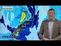
- RainWatch: A weak low moves in, then windier showers next week
- Runtime
- 6:59
- Date posted
- 2 years ago
- Description
- A weak low moves over the North Island this weekend bringing broken rain clouds and some hit and miss wet weather. Unfortunately for the upper South Island the latest precise tracking of this low takes it further away from you, and while not by very much, it’s enough to lower your rainfall chances sadly. There are some showers expected in the ranges and hopefully a few might spread elsewhere. Track on rain radar this weekend for more detail.
Next week a storm in the Southern Ocean is dominating our weather, bringing a surge of westerly gales to some regions and heavy rain for Fiordland and Westland.
Easter Weekend is too far out to lock in - but there may be low pressure clearing away ahead of high pressure - but we’ll lock that in on Monday for you.
We also have your 7 day rainfall map to make sense of all the talk!
Weather App:
Don’t forget if you live in NZ to download our new App! It’s free to use and also h...

- Title
- Australia 7 Day: Downpours for QLD & NSW, cooler for some
- Runtime
- 7:26
- Date posted
- 2 years ago
- Description
- An easterly flow right across Australia means eastern areas will be cloudier and cooler and western areas windier and warmer.
Ex-cyclone Megan is still dumping run in NT and northern parts of WA in the days ahead. Also, thunderstorms and daily downpours will form through parts of QLD and northern and western parts of NSW.
Victoria and ACT along with TAS are quite Autumn like. SA and southern parts of WA look to be driest.
We have your 7 day outlook.
Plus, this week’s Place of the Week is Tamworth, NSW.

- Title
- Southern Ocean storm brings wind to NZ next week
- Runtime
- 5:37
- Date posted
- 2 years ago
- Description
- Some wet weather crosses NZ over the next couple of days but it’s not widespread, nor is it heavy.
Next week a large storm well south of NZ will bring windy westerlies up the nation, lasting for a few days.
Behind it is more high pressure.

- Title
- Autumn’s windy westerlies are heading to NZ & TAS
- Runtime
- 6:09
- Date posted
- 2 years ago
- Description
- High pressure slides off NZ today and Thursday allowing a weak low to move in for Friday and Saturday. By Sunday windy westerlies develop in the south of NZ and spread nationwide into the start of next week, followed by a colder change on Tuesday in the south. Classic late March / early Autumn weather.
Tasmania, Bass Straight and coastal Victoria will also be on the edges of this windy weather and cooler change in the days ahead.
We have your NZ forecast (and the south-eastern corner of Australia) through to Tuesday next week.
Today is the Autumn Equinox at 4:06pm NZDT / 2:06pm AEDT.

- Title
- Pacific 7 Day: Low pressure dominates South Pacific
- Runtime
- 3:38
- Date posted
- 2 years ago
- Description
- More low pressure zones keep the showers and thunderstorms coming for many South Pacific nations this coming week, in particular Vanuatu, Fiji and maybe Tonga (Tonga is also close to some very dry weather - but for now Tonga is forecast to receive up to 200mm.
In the Northern Hemisphere Japan has another wintry storm this week, mostly deepening offshore to the east. It will then track up to Alaska. Rain makers continue for the western United States bringing more rain and snow into California.

- Title
- NZ & Australia: Tracking the rain makers
- Runtime
- 5:05
- Date posted
- 2 years ago
- Description
- Cold fronts and low pressure zones are impacting the weather across NZ and Australia, bringing some rain relief to dry regions - but probably not enough to reverse the drought or dry conditions some places have. Still, the wet weather will be welcome by many even if it’s only 10mm.
The Autumn Equinox is at 4:06pm Wednesday in mainland NZ (2:06pm in Sydney). In the weeks ahead the nights become longer than the days, which means there is less chance for the sun to evaporate the wet weather that falls. Another silver lining for those who want rain.
But overall we’re still seeing a lot of high pressure controlling our weather - but that may also bring in the Autumn westerlies to parts of NZ over the next 10 days, and to the south-eastern corner of Australia.

- Title
- Severe Cyclone Megan for Aussie + NZ’s big high pressure zones
- Runtime
- 6:20
- Date posted
- 2 years ago
- Description
- A severe cyclone is making landfall this morning in Australia’s Northern Territory (NT) in a fairly remote area, although at least 1000 people are in the path of wind and rain maker. We track the storm moving inland - and also another tropical low in Western Australia.
*Please Note: The timing of "landfall" may differ to the 10am displayed in the video - and may be several hours later. This is due to modelling not being sure of the precise timing of this slow moving system. It may be late morning local time, or later today. Either way, it makes little difference at this point with severe weather now setting in.
Then the focus shifts back to New Zealand with high pressure crossing the South Island - bringing showers along the eastern sides of both NZ and Australia.
A cold front late week comes into NZ but weakens significantly as it moves into North Island.
By the time the weekend arrives south west winds ease in NZ with another lar...

- Title
- Australia: Tropical Cyclone possible, as cooler showers affect the east coast.
- Runtime
- 8:33
- Date posted
- 3 years ago
- Description
- WA may face a Severe Tropical Cyclone next week and while modelling still isn’t 100% locked in we bring you the latest potential tracking and 7 day rainfall.
On the other side of Australia cooler airflows are expected to drop temperatures further in the days ahead with plenty of cloud and showery weather off the Tasman Sea. Inland some of these showers may be heavier but isolated.
Cooler air will be impacting Tasmania in the week ahead, although there are a couple brief hotter days in the mix - but tonight will be a cooler with lows inland and higher up getting closer to freezing.
We have your 7 Day Australia forecast every Thursday at WeatherWatchTV on YouTube.
- Title
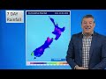
- NZ RainWatch: Scattered showers with a number of cold fronts
- Runtime
- 5:44
- Date posted
- 3 years ago
- Description
- We have no video this Friday so we’ve brought our 7 Day RainWatch update ahead one day. A number of cold fronts will be moving into NZ over the coming days and early next week, before high pressure once again takes over.
Patchy rain and showers are widespread across NZ but totals may not be massive, between a few mm and up to maybe 20 or 30 for some who get the heavier falls.
Next week high pressure returns with a few coastal showers.
We take a closer look at NZ’s rainfall chances over the next week, as we do each and every week (normally Fridays) as some regions deal with drought like conditions

- Title
- Cold fronts coming, but so too is another big high
- Runtime
- 6:15
- Date posted
- 3 years ago
- Description
- Cold fronts will move up NZ over Thursday and Friday bringing a cooler weekend with South Island frosts through the interior and high country and a dusting of snow on the ranges.
But it’s all ahead of the next enormous high pressure zone which will cross the South Island next week. This placement of the high encourages sou’easters into the North Island next week which will spread over to eastern Australia bringing showers. There’s also a cyclone risk brewing in Western Australia.
We have your NZ forecast (and some Aussie weather too) through to Tuesday next week.

- Title
- Pacific 7 Day: Loads of lows back in the forecast
- Runtime
- 4:49
- Date posted
- 3 years ago
- Description
- Right around the Pacific Ocean there are stormy lows developing. Japan has 3 in just a week, Fiji and the South Pacific nations have several lows over the coming week.
There are no tropical cyclones forecast as of this broadcast - but the lows in the South Pacific are still worth keeping a close eye on (as we’re in the peak of the cyclone season now, with sea surface temperatures at their highest).
We track the weather around both the Southern and Northern Hemispheres for the Pacific + we have 7 day rain maps for both the North & South Pacific, to make sense of it all.

- Title
- Classic Autumn cold front for NZ this Fri/Sat
- Runtime
- 5:15
- Date posted
- 3 years ago
- Description
- We have showers around the country over the next week, with some rain moving up the nation on Friday/Saturday as a cold front moves in. It will bring a burst of wind and rain, with temperatures dropping in most regions. But it’s short lived, with high pressure already expanding again by Sunday.
Many places will be cloudier this week too.
Driest regions will remain the driest - but there is the chance of a few welcome showers here and there, but sadly not enough to reverse the big dry/droughts that are now here.

- Title
- A couple of cold fronts this week, high pressure dominates though
- Runtime
- 6:24
- Date posted
- 3 years ago
- Description
- High pressure is covering thew Tasman Sea area for much of this week with NZ on the edges of it. This means more cloud in the west and a couple of cold fronts on the way. This early Autumn/El Nino weather pattern is quite normal - but sadly it limits how much wet weather can get into the driest regions.
Whilst the tropics are busy with more lows, none of these low pressure zones are forecast by WeatherWatch.co.nz to reach NZ this week, or come anywhere near us. This is due to controlling high air pressure in the NZ area - something we forecast would be the main feature this month in our recent March ClimateWatch video/update.
We have your forecast around NZ and parts of Australasia through until Sunday.

- Title
- 7 Day RainWatch: NZ looks very dry, so what about that tropical low?
- Runtime
- 6:46
- Date posted
- 3 years ago
- Description
- High pressure dominates NZ for the next week ahead, parked mostly in the Tasman Sea so allowing a few cold fronts to try to move in - but they won’t do much. The bulk of the rain is in Fiordland and south Westland, with a few showers elsewhere.
Some regions may get 0mm in the next 7 days.
There’s been news this week about a tropical deluge that might come to NZ - but as we explain, for it to get here it needs to contend with high pressure. We break down the possibilities of this rain system reaching NZ and, if so, what then?
RainWatch is a FREE Weekly Video made by WeatherWatch.co.nz to help farmers, growers, gardeners and those on limited rain water supply during these tougher, drier, El Nino times.

- Title
- Australia: Heat, wind, dry + a 7 day WA deluge
- Runtime
- 8:13
- Date posted
- 3 years ago
- Description
- The heat is coming back to the south-east, windy easterlies dominate a large portion of eastern Australia while Western Australia has a week long deluge thanks to thunderstorms.
There’s also the potential for a tropical low (or two) in northern WA by the end of next week. This far out it is not yet locked in.
But the high pressure belt elsewhere (mostly to the south and south-east) looks dominant - keeping many inland areas dry over the coming week, even if many coastal areas will be showery or cloudy in the east.
There’s also a potential for another tropical low east of the country - which may bring some windier weather and possible rain into Norfolk Island next week.
And our place of the day? Innamincka, in the Simpson Desert, just east of Alice Springs.

- Title
- Mostly dry for NZ, but a tropical low is worth monitoring
- Runtime
- 4:58
- Date posted
- 3 years ago
- Description
- High pressure is mostly dominating NZ but a couple cold fronts will try their best to move up the country, falling apart as they do so. The first one is today, Thursday, but a couple more weak ones are expected in the week ahead - mostly in the lower South Island or West Coast.
As high pressure dominates the Tasman Sea area, low pressure dominates to the north. There have been news stories from other outlets about this low, but modelling is still very conflicted about its path towards NZ. Earlier this week modelling showed a direct hit. Today it shows it out to the east and merging with a wet southerly for eastern areas. Put simply - it’s worth monitoring, but for now it may not bring the rain relief some people want. We’ll update you again on Friday in our next video instalment of “RainWatch”.

- Title
- NEW FORMAT: 7 Day Pacific-wide Weather
- Runtime
- 5:02
- Date posted
- 3 years ago
- Description
- We’ve sped up our Pacific Video to bring more detail to the Northern Hemisphere and have started animating days that are otherwise, well, a bit quiet and boring!
It’s a way to break through the normal tropical showers and find the real storms and lows impacting the lives and holidays of many.
This week we have a low forming near Vanuatu and New Caledonia worth keeping an eye on - it may bring welcome rain to Norfolk Island maybe even on to New Zealand later next week.
In the Northern Hemisphere Japan has 3 stormy lows over the next 7 days bringing plenty more wintry weather and snow to the mountains.
For North America and Hawaii the Pacific area isn’t too stormy but Northern California has heavy rain caught up in a wet westerly flow off the Pacific.
And finally our 7 day rainfall map will now be split into two: Southern Hemisphere and Northern Hemisphere, to bring more detail to our Northern Hemisphere viewers.
- Title
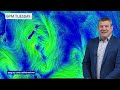
- NZ: Cooler nights, more high pressure & a sub-tropical low
- Runtime
- 4:49
- Date posted
- 3 years ago
- Description
- High pressure is moving into NZ over the next week ahead but will be challenged by wet weather from both the north and south. The next cold front comes in on Thursday then falls apart as it tries to head up NZ. This weekend high pressure dominates, but next week a sub-tropical low to our north may be worth monitoring. This far out it is not locked in, but as some of you are seeing in long range models it may affect the NZ area - but again, not locked in yet. We have more details on this low in our 7 Day Pacific Weather Update, out this afternoon.
Finally - tonight will be a cold one for inland parts of the South Island and up to the Central Plateau with frosts possible, especially around the Southern Alps.
*Programming Note: We have no weather video on Wednesday - back again Thursday!

- Title
- Storm crosses near NZ, high pressure by Wednesday
- Runtime
- 5:48
- Date posted
- 3 years ago
- Description
- In true Autumn style we have a storm to kick off this week but high pressure returning by mid-week to calm things down for most places.
Severe weather will be in pockets today, mostly associated with downpours bringing gales and thunderstorms. As we go into Tuesday the windiest weather moves to southern NZ and colder air then moves in.
By Wednesday there’s the risk of some frosts through the South Island’s interior, mostly around the Southern Alps. By warmer west to north west winds kick back in for a time. The next high will dominate NZ entirely, bringing us southerlies but mostly dry weather for the rest of the week.
More high pressure is expected after this too.

- Title
- NZ RainWatch (March 1) - Storm for Monday/Tuesday
- Runtime
- 5:02
- Date posted
- 3 years ago
- Description
- Rain and showers are coming this weekend for New Zealand but rainfall totals still won’t be enough to reverse the severely dry regions - but still, it’s good news for many going into the new month.
Stormiest weather will be on Monday and Tuesday and those in the north and east of both main islands will have the lowest rainfall totals, whilst central, inland and eastern areas will be windiest.
A cold change kicks in on Tuesday with snow on the ranges.
But high pressure is returning as we go through next week. We have your weekend and 7 day rainfall maps to help you plan ahead and have fewer nasty surprises.

- Title
- ClimateWatch: MARCH & AUTUMN are here, El Niño forecast to fade
- Runtime
- 9:22
- Date posted
- 3 years ago
- Description
- Despite a storm for NZ in the first week of March WeatherWatch.co.nz is expecting a drier than normal pattern to kick in for most regions as more high pressure continues to stream out of the Indian Ocean area, across southern Australia and over NZ.
El Niño + Autumn = a hat on a hat. In other words, it can make Autumn more Autumn-like, with windier westerlies,
warmer weather and more high pressure.
However, our longe range NZ data plus global data suggests that as El Niño fades, rainfall closer to normal will start to return into the NZ area.
In a nutshell – March continues the dry, often summer like, weather (despite that autumn storm around March 4th and 5th), then as we go later through Autumn NZ should see a return to more usual weather patterns and a heightened chance of rain makers returning.
Of course long range forecasting for a mountainous island nation as small as ours in the Roaring Forties can be difficult – but...

- Title
- Australia 7 Day: Autumn pattern in the south east, wetter WA
- Runtime
- 7:28
- Date posted
- 3 years ago
- Description
- It may be over 40 degrees for Thursday in south eastern inland parts of Australia but a cooler change moves in this weekend and next week - making it as far north as Queensland. At the same time Western Australia has more windy weather but also widespread showers and thunderstorms will dominate inland parts of the South Coast and the wheatbelt too.
For Victoria the weather stays mostly dry but some shower risks here and there - but another several dry days ahead for this through central and inland areas and towards SA.
We cover 7 day rainfall - and our place of the day this week is Dunkeld in Victoria.

- Title
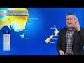
- Latest on the storm heading to NZ this Monday
- Runtime
- 5:14
- Date posted
- 3 years ago
- Description
- The weather is becoming more settled over New Zealand for 48 hours as high pressure rolls though, ahead of a stormy start to next week.
By Monday a storm near Southland will bring severe weather into both main islands, mostly from the west. This will be along with severe gales for central, inland and eastern areas.
The north of NZ looks least impacted - but may still get a burst of wind and rain next week.
We track the weather around New Zealand through until Wednesday next week.
- Title
- Big high before Monday’s storm
- Runtime
- 6:15
- Date posted
- 3 years ago
- Description
- A stormy low on Monday and Tuesday is expected to bring severe weather risks into both main islands of New Zealand - but before it arrives we have big high pressure zone moving in.
It will cross the South Island on Thursday, then moves into the North Tasman Sea for Friday and Saturday, then north to north east of NZ by Sunday and Monday,
Behind the high comes in cloud and patchy rain/showers - especially on Sunday.
By Monday a storm will be centred near the southern South Island and may well bring severe gales, heavy rain and some snow to the mountains too.
We have your full forecast to Tuesday next week

- Title
- 7 Day Pacific Weather: Lows fading in South Pacific, stormy in Japan
- Runtime
- 5:19
- Date posted
- 3 years ago
- Description
- (Recorded Feb 27 NZDT) — The South Pacific is looking much quieter in the week ahead. Last week there were several low pressure zones. By this weekend or early next week there may be none, for the first time in 2024. This means the traditional easterly flow will kick in with the usual showers.
In the Northern Hemisphere it’s more settled around Hawaii and North America, but a couple of storms track over Japan - with more settled weather returning there after.
We also have your 7 day Pacific-wide rainfall map to make sense of all the frequent showers in the tropics.
Our Tropical Updates go during the cyclone season, which ends on April 30th.

- Title
- Hotter weather returns to NZ ahead of Monday cold front
- Runtime
- 5:37
- Date posted
- 3 years ago
- Description
- High pressure from south-eastern Australia is drifting towards NZ this week and over the weekend it will slide out to our east, ushering in a hotter, windier, nor’wester that may see some regions return to the 30 degree mark, or above.
The nor’wester is ahead of a cold front and low pressure zone on Monday and Tuesday - which will bring a nationwide cool down, along with the chance of severe weather (gales, heavy rain and thunderstorm risks). There may even be snow along the ranges. The weather is being generated by a storm in the Southern Ocean. High pressure is expected to return next week after this.
We have your detailed forecast through to Monday for NZ and parts of Australia too.





