WeatherWatchTV
Two surges of cold air for Australia this week

- Title
- Two surges of cold air for Australia this week
- Runtime
- 4:42
- Date posted
- 2 years ago
- Description
- Australia has two main pulses of cold air this week. The first is for the start of the week in eastern Australia, in particular Sydney and coastal NSW. It eases as we go through this week.
The second comes in on Thursday to the south-western corner of WA, bringing another burst of heavy rain to Perth (and surrounds) and a windier, warmer, set-up for SA & VIC ahead of it.
This cold front will then brush across coastal parts of SA and then deeper into VIC and TAS on Fri, Sat and Sun with TAS most caught up in it on Sunday with winter weather conditions. It’s followed by high pressure.
Elsewhere there isn’t much to talk about, but the colder weather in QLD should ease as we go through this week.
Our next update is on Thursday and we’ll dive deeper into upcoming rainfall.

- Title
- Severe wintry weather for livestock & travel as airflows clash over NZ
- Runtime
- 7:42
- Date posted
- 2 years ago
- Description
- NZ: Subtropical airflows in the north meet subantarctic airflows in the south - this produces heavy snow at higher elevations, with miserable conditions for livestock (even at sea level due to the wet, cold, windy nature of the weather).
This is not a storm - but the combination of low pressure plus two highs and the two airmasses meeting in the depths of winter means there are severe weather risks in both main islands…especially the South Island.
At the other northern end of New Zealand temperatures will be up into the mid to possibly upper teens with a mixture of heavy rain, showers and large dry areas too in the milder northerly flow.
The much colder airflow works its way up the eastern side of the country this week, bringing colder, wetter and windier weather into the eastern North Island too (and a dusting of snow on the eastern ranges high up). But western parts of the North Island may not be so affected by the colder air.
Sno...

- Title
- NZ’s weather for the rest of July as large low looms again
- Runtime
- 4:22
- Date posted
- 2 years ago
- Description
- High pressure and warm nor’westers are the theme of July’s final weekend - and the final week looks to be dominated by a very large area of low pressure over the Tasman Sea and then covering NZ.
There is also a portion of very cold air coming in to the south of NZ - and this may turn rain to snow to lower levels (Sea level snow is not currently in our forecast).
We bring you the latest.
Don’t forget for news updates over the weekend check the newsfeed at WeatherWatch.co.nz, our new App, or at RuralWeather.co.nz

- Title
- OZ: Frosts return to Qld, snow, rain & gales in the south
- Runtime
- 10:10
- Date posted
- 2 years ago
- Description
- More winter weather is in the forecast with another big shot of winter air moving up the continent this weekend, going into Queensland on Sunday and into Monday with frosts at higher elevation.
The cold change will bring rain to Sydney and other eastern coastal parts of NSW, and another dusting of snow (possibly heavy for a time) further south in the mountains/ski fields.
Tasmania has a cold weekend with frosts and higher up snow flurries.
SA has wet weather as does the south-western corner of WA. In fact parts of WA may have over 100mm in the coming week as winter sets in properly with numerous cold fronts, thanks to large lows south of Australia.
We also have your 7 day rainfall map to make sense of it all.
Our FlightSim place of the day today is Longreach, Queensland.

- Title
- Latest on snow risks for NZ next week
- Runtime
- 6:16
- Date posted
- 2 years ago
- Description
- Temperatures over the coming days will be several degrees above average for late July as airflows from the interior and tropical parts of Australia move in.
But it’s what happens after this that is more newsworthy, with the potential for a wintry outbreak in NZ next week. It’s complicated though - and sub-tropical connections over the North Island and a large low that will also be in the mix means no forecaster can yet lock it in. Yes, some modelling has indicated snow to low levels - but other updates have backed off from this. At this early stage, with such a messy set up, it’s wise to be cautious - and we’re being fairly conservative still for our outlook next week.
Farmers - this is something to pay attention to with windchill and wet, cold, winds being a potential problem for any early newborn livestock.
We have your weekend forecast and the outlook to Tuesday next week.
- Title
- Northern fog Saturday, Southern wintry change next week
- Runtime
- 6:01
- Date posted
- 2 years ago
- Description
- High pressure will cross over the North Island on Friday and Saturday bringing foggy areas in the north of NZ, but encouraging milder nor’westers in the South Island.
By Monday that high is out east of NZ and a potential wintry change comes into the South Island - but as we said yesterday there are a lot of moving parts to this and it may not pan out as forecast. We explain today two different scenarios - neither of them are locked in.
Sometimes the chaos of the winter weather systems south of NZ and around NZ can make it very difficult to lock things in, in advance - the issue with this set up is uncertainty about the precise shape of the anticyclone over south-eastern Australia, and every change in the forecasts on the shape of this one high dramatically changes the outlook for NZ. We have the latest - and will continue to cover it in our videos on Thursday and Friday this week. Put short - next week looks messy in NZ weatherwise, especially compared to ...

- Title
- Winter blast possible next week, but warmer before then
- Runtime
- 7:22
- Date posted
- 2 years ago
- Description
- High pressure is on the way to NZ and temperatures are about to go up and well above normal (over 10 degrees above normal for some in the south of the South Island) as a warm nor’wester comes out of Australia.
The nor’wester is fuelled by high pressure crossing northern NZ on Friday/Saturday and fades away over the weekend and by early next week.
However, next week things turn colder - with a likely wintry blast on the way. There are a number of moving parts so it’s too early to lock anything in yet, this is because the shape of the high pressure zone matters a lot …and one slight change can turn a snowy sou-easter into a windy, drier and milder, sou-wester. But, a polar blast is possible for NZ next week - so we’re tracking the modelling and will keep you up to date over the coming week.

- Title
- OZ: Colder, windier, wetter in south - but settled elsewhere
- Runtime
- 5:29
- Date posted
- 2 years ago
- Description
- More stormy weather is coming for the southern side of Australia, from Perth to Adelaide, Melbourne to Hobart and everyone in between. It’s not a major system but severe weather warnings from BoM are possible as gales pick up. Colder air will move in this week to the mountains and south-eastern ski fields with some rain later in the week/weekend for NSW.
Queensland sees showers and easterlies in coastal areas, while hotter weather returns to the north and north-west. Frosts also ease this week in Queensland following a cold run for many.
We have your Australia-only forecast through until Sunday.

- Title
- Drier week for NZ, weak cold front this weekend
- Runtime
- 4:52
- Date posted
- 2 years ago
- Description
- Monday kicks off with showers but this week is looking drier for many places, although western parts of the North Island are likely to have small showers off and on this week - still drier than usual for this time of year though.
High pressure exits Australia this week and low pressure leaves NZ. It means milder winds will kick in later this week, ahead of a weak cold front this weekend that may bring a dusting of snow to the ski fields and mountains.

- Title
- Storm brushes NI on Sat + NZ’s 7 Day RainWatch outlook
- Runtime
- 3:40
- Date posted
- 2 years ago
- Description
- We’re tracking a storm that will rapidly form overnight Friday and into Saturday to the north of the country which is likely to brush the north-eastern corner of the North Island with a risk of some severe weather. The good news? It’s short lived and gone by Sunday for most people.
Next week kicks off with cooler/colder south to south-westerly winds and showers, then as the week wears on the skies mostly dry up.
We have your 7 day rainfall map and the outlook to next Friday.
Have a great weekend!

- Title
- OZ: More wintry blasts across the southern half
- Runtime
- 7:26
- Date posted
- 2 years ago
- Description
- More heavy snow is coming for the skifields and mountains around TAS, VIC and the ACT. Frosts head up to Queensland again this weekend and overnight lows tonight will also be down for Darwin and Cairns (as two examples of northern centres).
Most of the weather action is in the south-west of WA, the coastal side of SA and across the south-eastern corner of Australia with severe gales, heavy rain, snow and frosts all in the mix.
We have your 7 day forecast and 7 day rainfall map.
Our Flight Sim place of the day today is Bunbury in Western Australia!

- Title
- NZ: Storm to come close to North Island on Saturday
- Runtime
- 4:42
- Date posted
- 2 years ago
- Description
- An offshore storm will rapidly develop on Friday PM and by Saturday will be a storm. The low may technically reach the “weather bomb” status (bombogenesis) when the air pressure drops more than 24hPa in 24 hours.
But the good news is the storm - for now anyway - looks to mostly miss NZ, but may still drop some heavy rain in the north, and some windy weather on Saturday for a time. We have the latest maps.
We also take a look at how next week is kicking off.

- Title
- Potential storm for North Island on Saturday - will it or won’t it?
- Runtime
- 7:42
- Date posted
- 2 years ago
- Description
- Low pressure is going to dominate NZ’s weather for weeks ahead by the looks of it, with a storm potentially affecting the north-eastern North Island on Saturday.
The low has the potential to rapidly power up and even reach equivalent power and air pressure to a Category 1 or 2 tropical cyclone. But it’s going to be zipping past by the looks of it - and as we discuss in the video today, severe weather is not yet locked in for the eastern North Island.
Elsewhere more cloud, showers and rain - but large dry and calm areas too, so fog may still be an issue especially with higher humidity.
We have your detailed New Zealand forecast through to Tuesday next week.

- Title
- Fog, cloud, some wet weather as low pressure controls NZ’s weather
- Runtime
- 5:30
- Date posted
- 2 years ago
- Description
- More fog patches, cloudy areas and rain bands/showers are coming for NZ as low pressure dominates the weather pattern in our part of the world, just one week after the most powerful high pressure zone in our recorded history tracked over (breaking a 135 year old record).
The change from a large high to a large area(s) of low pressure means cloud and wet weather is more likely than last week - and frosts are less likely overall. Some places have sub-tropical winds.
Driest weather will be in the south of the South Island.
We track the low pressure zones - how long they linger for - and what likely happens once it all moves through.

- Title
- OZ: Wintry weather blasts southern half of Aussie
- Runtime
- 5:27
- Date posted
- 2 years ago
- Description
- Another wintry week of weather for those in the southern half of Australia this week, especially the south-eastern corner which has more bitter temperatures and heavy snow for the mountains, skifeilds and ranges.
Freezing air will make it as far north as Queensland at night.
Windy westerlies will also blast the southern coastline from Perth around to Adelaide, Melbourne and Hobart.
Sunday sees calming high pressure return for many - but those westerlies may still be blowing in the south.
We have your Australian forecast through to Sunday.

- Title
- “Messy” low to affect NZ for several days
- Runtime
- 4:51
- Date posted
- 2 years ago
- Description
- After last week’s recording breaking high pressure zone, this week we’re back to a large low in the Tasman Sea. Despite some storm aspects to this low pressure zone it’s generally quite a large and lazy low - bringing milder airflows for some, rain and cloud for others - but also some long dry spells.
Even if you’re seeing the rain or shower icon a lot this week, there is still plenty of good school holidays weather on the way.
We try to break down the rain and wind - and also if a stormy system will again affect the eastern North Island in about a week from now (definitely not locked in, but showing up in the modelling).

- Title
- Messy next week as Tasman Sea low tries to move in
- Runtime
- 7:52
- Date posted
- 2 years ago
- Description
- A powerful high pressure zone will continue to affect NZ’s weather well through next week, but NZ is a bit in limbo between the exiting high and a storm forming in the Tasman Sea, closer to Australia. The low is not yet forecast to hit NZ but it may still bring us wind and rain next week, in part due to the nearby high.
The high - which broke NZ’s 135 previous high air pressure record this week - will remain to our east for all of next week and may complicate the timing of rain, and where rain might fall.
Meanwhile Australia’s skifields have a number of days of natural snow coming - but NZ looks drier and milder for now.
We have a detailed forecast covering rain, snow, frosts, wind and temperatures - and a 7 day rainfall map for NZ.

- Title
- Aussie 7 Day: Wintry outbreak with southern snow & northern frosts
- Runtime
- 7:34
- Date posted
- 2 years ago
- Description
- Another cold southerly is about to blast into the southern and then eastern sides of Australia, dropping temperatures, bringing snow to the mountains, ranges and plateaus and frosty weather as far north as Queensland. Even Darwin will notice the slight cooler change next week.
The wintry southerly is thanks to a storm in the Southern Ocean followed by another very powerful high pressure zone.
Hot weather is still around - mostly in NT and the north-west of WA.
We have your 7 day forecast + 7 Day Rainfall map for farmers, growers and those relying on rain water.

- Title
- NZ: 3 Lows and a High
- Runtime
- 5:42
- Date posted
- 2 years ago
- Description
- A record challenging area of powerful high pressure is crossing NZ for Wednesday and Thursday before sliding off to our south east. Around this high three low pressure zones will form. The first east of the North Island this week, bringing some showers into the east from Gisborne to Wairarapa. This weekend and into next week two more lows form over the Tasman Sea.
This enormous high keeps most rain away (other than the eastern North Island as it slides off the country to our south).
Next week the rain clouds return - also with milder winds.

- Title
- High dominates - but lows return in a week
- Runtime
- 4:30
- Date posted
- 2 years ago
- Description
- As we keep saying a “huge high” is over the top of NZ this week, mostly the South Island - which allows cloud and a few isolated showers to sneak into the eastern and upper North Island.
Most of NZ is drier than average for the next week ahead.
However next week the second week of the school holidays may be different as the high slinks off to our east and a new low pressure zone(s) forms in the Tasman Sea. Next week may have milder weather but also rain returning too.
We have your forecast for the rest of this week, weekend and the start of next week.
PROGRAMMING NOTES:
*We have no videos on Thursday due to travel.
*Wednesday will have both our NZ forecast and our 7 Day Australia forecast (one day forward as usually on a Thursday).
*Friday has the usual 7 day ‘RainWatch’ update for NZ.

- Title
- Aussie: Tracking showers + next wintry change this weekend
- Runtime
- 5:15
- Date posted
- 2 years ago
- Description
- Downpours and showers are moving across Australia again this week, mostly in the southern side of the continent and along the eastern seaboard again.
That means some further rain relief for parched southern areas, including southern WA, SA and parts of VIC and NSW. TAS may also get some wet weather in the mix, along with QLD, although totals look generally lower or more broken up.
There’s another surge of wintry air going into the weekend - and that will bring frosts back as far north as Queensland and more snow on the Alps.

- Title
- NZ School hols weather: Settled, drier as high moves in
- Runtime
- 4:58
- Date posted
- 2 years ago
- Description
- Most of NZ is dry this week but showers are possible in the eastern North Island both start and end of the week - but it won’t be much. This weekend more showers are likely in the eastern North Island as the high pressure zone drops away to our south-east.
But this high pressure zone is enormous - and means more parts of NZ have drier, calmer, settled weather this week.
Once the high departs (in about a week) there may be a new change rolling in from the west with low pressure/rain bands.
We have your forecast across NZ for this week and the coming weekend.

- Title
- NZ 7 Day: Anticyclone moves in, then moves out
- Runtime
- 4:57
- Date posted
- 2 years ago
- Description
- Cold air will stay in place across most of NZ for the next several days but by the end of next week a warmer flow from the sub-tropics may be moving in - or about to.
The powerful high pressure zone (anticyclone) moving in now has great ‘reach’ - by that we mean it’s scooping up colder subantarctic air this week, locking that cold next week as the high passes over, then by the end of next week may well usher in warmer subtropical air.
Rainfall is low across NZ with all regions drier than average for this time of year over the next 7 days.
We have your forecast and rainfall map through to Friday next week. Have a great weekend!

- Title
- Australia 7 day: Downpours track eastwards, more rain relief
- Runtime
- 8:18
- Date posted
- 2 years ago
- Description
- Dry areas are in for more wet weather over the next 7 days as high pressure slowly leaves the south. The high is enormous and will take a number of days to move towards NZ, but should be east of Aussie by mid-next week, allowing for these hit and miss downpours to track eastwards from SA to VIC/NSW and TAS. Southern Qld is only brushed by it.
WA and eastern Australia have plenty of showers and patchy rain.
Sorry NT - not much to talk about up your way this week! Enjoy the drier warmth!
Our Flight Sim place of the day is near Alice Springs, but not in the township itself.

- Title
- NZ: Frosts ease back for showers/wind this weekend, frosts increase again next week
- Runtime
- 4:36
- Date posted
- 2 years ago
- Description
- Frosty weather is back again tonight and may go as far north as Auckland and Northland before retreating this weekend rapidly due to a windier change moving in.
Many daytime temperatures are down at the moment and overnight lows near zero or subzero. But the windier weather this weekend will see some places jump with their overnight temperatures.
Next week, as high pressure moves in and over the top of the country we can expect colder nights again and most frosts, especially in the lower three quarters of the nation.
- Title
- NZ’s colder airflow - turns windier again on Saturday
- Runtime
- 5:32
- Date posted
- 2 years ago
- Description
- The same big high pressure zone is controlling NZ’s weather for at least another week, and right now it’s bringing in colder air - but the winds are easing for many. This means frosts and lower overnight temperatures.
However on Saturday those winds ramp back up again with a blustery, fresh, south to south-west flow pushing more showers into NZ (and snow flurries into the skifields).
We track the ups and downs of the temperatures over the coming days.

- Title
- Hurricane Beryl barrels towards Jamaica as Cat 4 storm
- Runtime
- 3:21
- Date posted
- 2 years ago
- Description
- Hurricane Beryl, which was the Atlantic’s earliest Category 5 hurricane on record, is now a powerful Category 4 storm and is racing towards Jamaica.
The storm has weakened a little today over the Caribbean Sea, but winds are only down by a few kilometres an hour (or a couple miles per hour). There is very little difference between where it was as a Category 5 storm and where it is now.
We track Beryl’s destructive winds and heavy rain as it brushes Haiti and Dominican Republic right now, but aims more directly towards the southern side of Jamaica in particular tomorrow - within the next 24 hours.
Beyond that Beryl is likely to track near the Caymans, Mexico and potentially into Texas, USA next week.
*This video was recorded at 11am NZST Wednesday, or 7pm Tuesday Eastern Time in the United States.

- Title
- Cold air brings frosts, drier for many too
- Runtime
- 4:36
- Date posted
- 2 years ago
- Description
- A massive high pressure zone over Tasmania will influence NZ’s weather for at least the next week or two, bringing a drier than average airflow into NZ.
There will be some snow flurries on Tuesday in both main islands but over the week frosty weather is more likely as winds ease for a time.
But the windy weather looks to crank up again this coming weekend - and yes, it’s still coming from off the Southern Ocean.

- Title
- ClimateWatch: JULY starts colder, with a mountain of high pressure
- Runtime
- 10:45
- Date posted
- 2 years ago
- Description
- July might have big storms in the Southern Ocean but it may be high pressure near Tasmania and New Zealand that dominate the first half of the month. Despite July in NZ kicking off with an active cold front and low pressure, the high pressure zone near Aussie will influence NZ’s weather for well over a week.
Initially this set-up brings temperatures down across New Zealand to average or below average.
Despite rain and snow kicking off the month, the south-west lean (overall) to our airflows (even if you locally have other winds) means that most wet weather looks to be in the west to south-west of NZ. This is good news for the eastern North Island which wants a breather following the flooding in late June - but not great news for Canterbury which needs more rain.
We are still in a NEUTRAL season (ie no La Nina or El Nino) - and that is certainly showing up in the weather we’ve experienced these past two months.

- Title
- OZ: Cold SE, showery east coast + some outback rain coming
- Runtime
- 6:25
- Date posted
- 2 years ago
- Description
- July kicks off colder for many in the south and south-east of Australia thanks to an enormous area of high pressure south of Adelaide and near Tasmania. We had high pressure like this back in May and, just like back then, this new high brings plenty of easterly winds to the continent - meaning the eastern seaboard is showery and often cloudy. Some heavier rain is possible between Sydney and about Gladstone.
But as the week wears on heavy rain and downpours will bubble up through the interior, especially for inland parts of SA.
The downside is many dry parts of VIC, NSW and TAS miss out on rain this time around - or at least, don’t get a lot.
The silver lining is that our final weather map on Sunday shows a new westerly change returning to WA (normality).

- Title
- NZ: July kicks off cold, snow, showers, wind and sunshine
- Runtime
- 6:51
- Date posted
- 2 years ago
- Description
- Monday July 1st kicks off with a cold front crossing NZ, Tuesday has colder air moving in - then for about another week the nation will be under a mostly south-west airflow (although locally some places might have easterlies blowing for a time). The cold air is being dredged out of the Southern Ocean area by an enormous high pressure belt south of Adelaide and near Tasmania.
But NZ’s mountains and ranges mean not all regions in NZ will have cloud or wet weather - with sunshine in the forecast too (especially the West Coast).
We track the wind, rain, snow and showers - and how long this will linger for.

- Title
- NZ’s long weekend weather + July kicks off with a low
- Runtime
- 6:01
- Date posted
- 2 years ago
- Description
- A weak cold front moves up the South Island on Mataraki Friday, then falls apart over the western North Island as it heads north on Saturday.
Sunday is fairly settled across NZ with a west to north wester developing for some - ahead of a large low coming in to NZ over Monday and Tuesday of next week. It will be followed by wintry weather coming out from Australia and near Antarctica.
But an enormous high is coming in next week (around July 7).
We have your 7 day forecast for our part of the world.
Have a great long weekend - see you again on Monday.
*Programming Note:
Monday we have a NZ Video, an Australian weather update + our next ClimateWatch update looking at the weather trends for the month of July.

- Title
- Aussie: Snow! + 7 Day Rainfall as some rain relief continues
- Runtime
- 8:39
- Date posted
- 2 years ago
- Description
- Snowy and wet weather is in the forecast for the driest parts of southern & south-eastern Australia with some heavy falls here and there in Western Australia too - but again not everyone will get the relief they want. We break down the messy forecast for you - who gets rain, who misses out - and who has snow. Certainly the mountains of NSW,VIC and TAS have a chance of a dusting. The ski fields should get a good dump of snow.
*CORRECTION: Sounds silly, but Phil talks at the start about Aussie looking like it's driving "away" from NZ...but instead...it's driving TOWARDS NZ! We will clarify on Monday to those that care! 🙂 Also, this: https://x.com/WeatherWatchNZ/status/1805749036424794502
Temperatures vary with mid 30s in NT and single digit highs in TAS!
Our flight sim place of the day today is Adelaide!
*Programming Note: Due to a long weekend in New Zealand we have brought forward our Thursday Australia forecast by one day. Our next...

- Title
- North Island storm weakens + NZ’s long weekend weather
- Runtime
- 5:26
- Date posted
- 2 years ago
- Description
- The storm off the eastern North Island continues to very slowly east but heavy rain and strong winds do continue for another day or so - but clears on Friday. We have the latest on rainfall for Thursday and when the sun may finally return.
On Friday high pressure covers a fair amount of NZ but a cold front comes into the West Coast and on Saturday that moves up the North Island.
We have your forecast through to Monday next week.

- Title
- Special Update on offshore North Island storm
- Runtime
- 6:33
- Date posted
- 2 years ago
- Description
- Severe weather is expected over the eastern North Island over the next couple of days as the centre of a new low tracks by.
Heavy rain and Severe gales are likely in this part of NZ.
We track the life of this low affecting us, and what is coming in for Matariki long weekend.

- Title
- Aust: More rain relief for WA, SA, VIC, TAS
- Runtime
- 7:38
- Date posted
- 2 years ago
- Description
- Low pressure zones will again affect the southern states of Australia this week, but QLD will also get heavy rain in the form of easterlies.
The southern states have a few low pressure zones tracking by, the biggest one coming into WA this week, then tracking eastwards this weekend.
While not everyone will get the relief they so desperately need this is yet another significant silver lining with rainfall totals between 10 and 40mm for a number of places, and some may go above and beyond that too.
We try to break it all down for you.
Our next update will be on Thursday.

- Title
- NZ: Stormy low forms east of North Island + Matariki is coming!
- Runtime
- 6:28
- Date posted
- 2 years ago
- Description
- Low pressure has been affecting NZ for 11 days now and will continue on this week - but in an entirely new location, centred east of the North Island. This new low pressure centre will rapidly form tonight and into Tuesday bringing windier south to south-east winds for the North Island and driving in rain to northern Hawke’s Bay, Gisborne and East Cape. Rain and showers may spread as far south as the eastern South Island.
The low will take all of this week to finally move away and isn’t expected to do much beyond these regions. Strong winds will also clip Bay of Plenty, especially in the east.
Elsewhere a narrow area of high pressure comes in this week - and by Mataraki we have some high pressure over NZ but also a cold front moving into the West Coast and heading towards the North Island for Saturday.
We have your detailed forecast through to Sunday.

- Title
- Week long low finally to cross NZ this Sun/Mon
- Runtime
- 6:17
- Date posted
- 2 years ago
- Description
- Low pressure has affected NZ’s weather for over a week now and will be with us until the middle of next week - but it will cross NZ from west to east from this Sunday to Tuesday. Once it’s over the Pacific Ocean and no longer the Tasman Sea it may grow again, and that could see some colder air and showers pushing into eastern NZ.
However high pressure is on the way next week for a time bringing frosts, colder nights, and some sunnier weather. It may not linger too long though.
We have your forecast through to Wednesday next week, plus the 7 day Rainfall outlook.
Have a great weekend!

- Title
- Aust. 7 Day Weather: Rain, snow, frosts & showers
- Runtime
- 8:24
- Date posted
- 2 years ago
- Description
- A series of low pressure zones around the southern edge of Australia will bring rain, snow and showers to the south-eastern corner of the nation, along with rain into dry WA, SA, VIC, TAS and some parts of NSW.
The colder air goes all the way up to Queensland bringing frosts at higher elevations, including just near Brisbane inland (Toowoomba for eg).
We track the various lows and cold fronts over the coming 7 days - along with the 7 day Australia Rainfall Map.
Our Flight Sim place of the day today is Kalgoorlie in WA and the Super Pit mine.

- Title
- Low pressure returns to NZ this Sunday/Monday
- Runtime
- 4:08
- Date posted
- 2 years ago
- Description
- Wind and rain push across NZ later this weekend and into early next week as a low pressure zone that has now been with NZ for an entire week continues on. However this eastern movement of the low on Sunday and Monday will finally see it crossing the country and, all things going smoothly, it should finally depart our shores by Tuesday and Wednesday of next week, almost two full weeks since it first arrived.
We track the progress of this low - and the brief area of high pressure likely coming in behind it later next week.

- Title
- Low pressure to drift back into NZ by Sun/Mon
- Runtime
- 4:55
- Date posted
- 2 years ago
- Description
- A large low remains over the Tasman Sea but a nearby high pressure zone east of Dunedin is making for a windier set-up in some parts of NZ today, mostly from Auckland northwards, around central NZ and then down around coastal Otago. Most places don’t have major winds but some windy weather is likely in exposed places as we go through Wednesday and into Thursday.
Eastern areas, mostly from East Cape southwards, are coolest - and warmest air is to the north and west of the North Island - but a milder nor’wester kicks back into the South Island later this week and weekend.
By Sunday and Monday the low over the Tasman Sea will likely drift back into NZ with more rain and showers - and milder than usual weather (especially overnight temperatures) in many regions.
We have your forecast through to Monday.

- Title
- RainWatch: NZ’s 7 Day rain forecast as low pressure lingers
- Runtime
- 7:12
- Date posted
- 2 years ago
- Description
- NZ’s broken weather pattern continues for another week with low pressure in the area but high pressure driving in some colder air, especially for southerners and easterners (if “easterners” is even a thing!?).
Heavy downpours are likely in the north of both main islands over the next week. However, even with our 7 day rainfall map the instability caused by this low and nearby high means these totals may shift around a bit… and of course any shift in the forecast means NZ’s mountains and ranges will change things even further. But here’s the latest thinking as of today.
And our place of the day is - the wonderful southern city of Invercargill - we love you Invercargill!! 🙂 https://www.ruralweather.co.nz/forecasts/Invercargill,%20Southland
- Title
- Aussie - Some rain for dry SA, WA, VIC, colder NSW
- Runtime
- 6:02
- Date posted
- 2 years ago
- Description
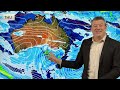
- A wintry southerly will drive down temperatures along the southern side of Aussie this week bringing welcome rain into dry parts of WA, SA and VIC in particular. In fact for SA this may be a much better chance to get rain than previous weeks.
As usual, not everyone will get the relief they need - but some will get a good boost.
While a high pressure zone does follow this southerly it’s short lived - so another cold front will move along the southern coastline this weekend too.
Meanwhile over the Tasman Sea a large low remains in place driving in more colder southerlies for eastern TAS, VIC, the ACT and NSW.
To the north QLD and NT look mostly settled and dry - a few isolated coastal showers are possible FNQ.
Our next update will be on Thursday.

- Title
- Low stuck in the NZ area all week & weekend (maybe next week too)
- Runtime
- 6:41
- Date posted
- 2 years ago
- Description
- A large low will remain over the Tasman Sea this week before moving back over New Zealand this coming weekend.
The low is expected to gradually weaken this week but may energise again on Saturday and Sunday as it moves back in.
Long range modelling suggests it may remain over the country (or near us) next week too.
We explain why the low is stuck here and what it means for rain, snow and sunshine in our country.

- Title
- NZ’s weekend weather + outlook for next week
- Runtime
- 4:58
- Date posted
- 2 years ago
- Description
- A large low will continue to affect NZ’s weather pattern across the weekend and into next week.
Please check your local forecasts to keep up to date with any changes this weekend.
The low itself is quite unpredictable, creating areas of instability (rain and showers).
Have a great weekend, catch you again in our Monday weather video.

- Title
- Aust 7 Day: Wintry in the SE, rain for dry SA, VIC, WA
- Runtime
- 6:59
- Date posted
- 2 years ago
- Description
- Rain and colder air is coming to Sydney over the next couple of days with coastal NSW receiving rain thanks to a large low in the Tasman Sea. The low will be stuck there for almost a week and will drive wintry weather conditions into TAS and some in the south-east of Australia.
Tasmania is looking especially cold with air from near Antarctica being dredged up. Hobart only just makes it into double digits at the warmest part of the day.
Meanwhile wet weather is forecast for the southern half of WA, the coastal and Adelaide parts of SA and into Victoria too.
Cold air at night will be noticeable in the ACT and Queensland.
And NT, right up in Darwin, overnight lows are now dropping into the late teens as some slightly cooler air heads right up into the tropical side.
We also have your 7 day rainfall map to make sense of it all.

- Title
- Large low engulfs NZ on Friday, then shifts over the weekend
- Runtime
- 5:16
- Date posted
- 2 years ago
- Description
- Low pressure will cover all of the country on Friday bringing drizzly areas, dry areas and heavier downpours. Rainy areas will be widespread across the country but the north and west of both islands appears to be more exposed to heavier falls.
Over the weekend low pressure shifts out to the Tasman Sea and makes for a changeable forecast - we break down what is happening over the next few days and into next week.

- Title
- Large low like lopsided washing machine
- Runtime
- 6:20
- Date posted
- 2 years ago
- Description
- A large low is developing around NZ this week and weekend - but it’s going to be spinning like a lopsided washing machine with a load making it spin off kilter. It means it’s a very messy forecast - one that will change further in the coming days as the centre of the low moves around a lot and changes shape. This shifts and even reduces severe risks for now.
Why so much uncertainty? Both the shape of the low and the precise location of the centre can't yet be locked in by usually reliable modelling. This is due to the precarious nature of the southerly and northerly feeds going into it - and the high pressure zone near Tasmania that could sneak in south of it all and then shut down the southerly feed.
The low may even start to push itself back towards Australia for a time - which significantly reduces severe weather risks in NZ…but then may well come back bringing another burst of rain or showers.
But the low pressure centre creates instab...

- Title
- Detailed update on incoming large low for NZ
- Runtime
- 7:03
- Date posted
- 2 years ago
- Description
- Today’s video has much more detail about a large low pressure system developing over the next couple of days and how it’s likely to linger over NZ well into next week. The low brings pockets of severe weather into both islands but also plenty of “normal” weather conditions for this time of year too.
Today we go into more detail about the likely tracking of this low and therefore the weather (and severe weather) it may produce.
We’ll have more details in the days ahead as this low develops and sets in.
Here’s the latest forecast for NZ up until Monday of next week.

- Title
- Australia: More rain for the SE & SW
- Runtime
- 5:09
- Date posted
- 2 years ago
- Description
- More wet weather is about to move through the south-west and south-east of Australia in particular from a number of systems moving through. Rainfall won’t be huge for most but Tasmania and Victoria (especially the hills and ranges) look to get some good and helpful wet weather. It’s not widespread for everyone though - and we try to break that down for you.
For those in the entire top half of the nation there isn’t much to talk about - cooler nights, sunnier days are on the way for many of you.
Our Monday update gives you the big picture for the week and weekend ahead. We’ll update in more detail rainwise in our Thursday PM update.
Thanks for your support of WeatherWatchTV on YouTube!





