USGS
Eyes on Earth Episode 76 – ECOSTRESS and Disease Risk

- Title
- Eyes on Earth Episode 76 – ECOSTRESS and Disease Risk
- Runtime
- 19:42
- Date posted
- 2 years ago
- Description
- Spaceborne sensors orbit hundreds of miles over our heads. Even the most advanced among them struggle to capture high-resolution imagery of individual human beings. Mosquitos, of course, are far smaller than we are. Clearly, sensors on a satellite or space station can’t see them. Even so, these sensors can gather a host of information that helps to understand the movements and behaviors of these pesky little disease vectors, which are responsible for at least a million deaths a year. Mosquitos are more active under certain environmental conditions, for example, and those conditions can be tracked at wide scales from above. Changes to the land’s surface can also make it easier for mosquitos to proliferate. On this episode of Eyes on Earth, we learn how a sensor onboard the International Space Station was used to calculate West Nile virus risk in California’s San Joaquin River Valley.

- Title
- Eyes on Earth Episode 77 – ECOSTRESS and Urban Heat
- Runtime
- 21:01
- Date posted
- 2 years ago
- Description
- We don't need a scientist to tell us that city streets catch and hold heat. Anyone who's walked barefoot from a parking lot to a beach can tell you that. What scientists can help us understand, particularly scientists who work with spaceborne, remotely sensed data, is just how big a difference there is between cities and the countryside. That gap is sometimes referred to as the urban heat island effect. At the height of summer, heat disparities can have a large impact on at risk human populations. On this episode of Eyes on Earth, we hear from a remote sensing scientist and a sustainability coordinator for the city of Los Angeles who teamed up to study the impact of cool pavement coating as an urban heat mitigation strategy.

- Title
- Eyes on Earth Episode 75 – Mapping Dust Sources Worldwide
- Runtime
- 18:52
- Date posted
- 2 years ago
- Description
- Clouds of dust kicked up in places like the Sahara can travel thousands of miles across the planet. We can see those clouds in satellite imagery, but we don’t typically know much about the composition of that dust. That’s a huge blind spot, because those unknown characteristics—such as the particles’ lightness or darkness—have an impact on what they do. The warming and cooling of the atmosphere, snow melt, ocean or rain forest fertilization, and even cloud formation can all be affected by dust cloud composition. Mapping those dust sources is the focus of the Earth Surface Mineral Dust Source Investigation, or EMIT, which will be supported by NASA’s Land Processes Distributed Active Archive Center (LP DAAC), which is located at the USGS EROS Center. On this episode of Eyes on Earth, we hear about the importance of the mission from three members of the EMIT Science Team.

- Title
- Eyes on Earth Episode 74 – A Satellite Cross Calibration Mission
- Runtime
- 19:24
- Date posted
- 2 years ago
- Description
- When the first Landsat satellite launched 50 years ago, it was the only game in town in terms of civilian land remote sensing. In the years that followed, a host of satellites have launched to serve similar purposes. But that data doesn't always play well together. Subtle differences between the measurements taken by satellites make it difficult to do apples-to-apples comparisons of land change. On this episode of Eyes on Earth, we hear from the USGS partners working with partners in Australia to launch a satellite cross calibration mission that will offer a common reference post and serve as a sort of “translation tool” to help remote sensing scientists to use datasets together to study changes to the Earth’s surface.

- Title
- Eyes on Earth Episode 78 - Landsat 50 Lookback
- Runtime
- 19:03
- Date posted
- 2 years ago
- Description
- Government officials and scientists had high hopes for Landsat when the first experimental satellite launched July 23, 1972. Those hopes were soon realized when imagery came back depicting features never before seen. Since then, an archive of imagery surpassing 10 million scenes has amassed at EROS, collected from eight different Landsat satellites. Agencies, scientists, researchers, and data analysts use Landsat in a variety of ways to learn more about our planet, preserve its resources, and benefit its people. On this episode of Eyes on Earth, we spotlight how several guests from past Eyes on Earth episodes value the Landsat imagery and archive, from forests and fires to lakes and cities.
- Title
- Eyes on Earth Episode 81 - Tour of the EROS Radome
- Runtime
- 20:18
- Date posted
- 2 years ago
- Description
- The Landsat satellites have been collecting Earth imagery for more than 50 years. A key piece of equipment that moves the data from the spacecraft to the archive so researchers can use it is the antenna at the EROS Center. The antenna and its radome have a fascinating history of their own that adds to the overall Landsat story. In this episode of Eyes on Earth, we go on location to learn about how the antenna works and how the ground station engineers at EROS make it possible to study land change with Landsat

- Title
- Eyes on Earth Episode 79 – Landsat Global Archive Consolidation
- Runtime
- 11:48
- Date posted
- 2 years ago
- Description
- The Landsat archive at EROS contains an unparalleled 50 years of Earth observation data. But with earlier technologies, some Landsat scenes were collected and stored only by international ground receiving stations rather than in the central archive at EROS. More than 10 years ago, to help make that far-flung data available to scientists interested in land change over time, the Landsat Global Archive Consolidation (LGAC) project began having the reels and tapes sent to EROS to digitize that information and deepen the archive.

- Title
- Eyes on Earth Episode 80 - ECOSTRESS and Carbon
- Runtime
- 17:22
- Date posted
- 2 years ago
- Description
- ECOSTRESS, which stands for the ECOsystem Spaceborne Thermal Radiometer Experiment on Space Station, collects land surface temperatures in an effort to answer questions about plants’ use of water. The NASA Land Processes Distributed Active Archive Center (LP DAAC) at EROS has provided storage and distribution of ECOSTRESS data for four years now and counting. In this episode of Eyes on Earth, we’ll take a look at how the ECOSTRESS temperature measurements can be useful in characterizing biological influences on the carbon dioxide exchange, specifically in the urban environment of Los Angeles and the non-urban environment surrounding the city.

- Title
- Peligros Costeros de Puerto Rico
- Runtime
- 4:58
- Date posted
- 4 years ago
- Description
- La isla de Puerto Rico está sujeta a numerosos peligros naturales, incluyendo huracanes y erosión costera. La información sobre cómo responden los entornos costeros de la isla a estos eventos es fundamental para reforzar la resiliencia costera. La Dra. Legna Torres-García, nacida en Puerto Rico, está liderando un esfuerzo para estudiar los peligros costeros y hacer que esta información sea más accesible para las comunidades de la isla. Esta información puede ayudar a los residentes del territorio a estar más preparados y resilientes a los peligros naturales.
Obtenga más información sobre la Investigación de Peligros Costeros de USGS en Puerto Rico: https://www.usgs.gov/mission-areas/natural-hazards/science/puerto-rico-natural-hazards-coastal-peligros-naturales-de
Escuche la versión de audio descrita.
YouTube: https://www.youtube.com/watch?v=TJF-cUQg6aA
USGS: https://www.usgs.gov/media/videos/peligros-costeros-de-puerto-rico-ad
<...

- Title
- Monthly update of activity at Yellowstone Volcano for October 1, 2022
- Runtime
- 7:30
- Date posted
- 4 years ago
- Description
- Mike Poland, scientist-in-charge of the Yellowstone Volcano Observatory, describes activity at Yellowstone in this monthly update for October 1, 2022.
The update comes to you from Artist Paintpots in Yellowstone National Park. The paintpots are acid sulfate springs, one of three different types of thermal features in Yellowstone.
The features start as snowmelt and rainwater percolate deep into the earth. The water is heated by the magma chamber that's cooling well beneath the surface. As the water starts to rise, it picks up gases emitted by the cooling magma body. As the water gets closer to the surface, it might begin to boil. The water will go off and form one of the neutral chloride features like Grand Prismatic Spring or Old Faithful. The gas separates from the water, and because it contains carbon dioxide, it will be slightly acidic. As is moves upward, the gas can start to dissolve some of the rock, turning it into a white, chalky clay. The clay mixes...
- Title
- Chesapeake Bay Status and Trends
- Runtime
- 3:10
- Date posted
- 4 years ago
- Description
- Chesapeake Bay is one of the United State’s great watersheds, and so monitoring and maintaining the Bay’s health is crucial. The USGS is monitoring the status and trends of sever key indicators of ecosystem health in the Chesapeake Bay. Check out this video and visit https://usgs.gov/CB-status-trend to learn more.
Non-AD version: https://www.usgs.gov/media/videos/chesapeake-bay-status-and-trends
AD version: https://www.usgs.gov/media/videos/chesapeake-bay-status-and-trends-ad

- Title
- September 27, 2022 — Continued endogenous growth of crater floor at Kīlauea summit
- Runtime
- 0:54
- Date posted
- 4 years ago
- Description
- This timelapse sequence shows one image per day since March from the B1cam webcam on the east rim of Halema‘uma‘u, at the summit of Kīlauea. The images show that the floor of Halema‘uma‘u has been growing endogenously. Lava is supplied beneath the solidified crust that forms the surface of the crater floor, lifting the surface in a manner similar to inflating an air mattress. In addition to endogenous growth, sporadic lava flows overplate the crust and also contribute to growth.

- Title
- September 29, 2022 — One year of eruption in Halema‘uma‘u, Kīlauea
- Runtime
- 3:01
- Date posted
- 4 years ago
- Description
- Kīlauea volcano's summit eruption, within Hawai‘i Volcanoes National Park, began one year ago—on September 29, 2021. This three-minute video, produced by the Hawaiian Volcano Observatory, features footage from the past year and summarizes the eruption (audio-described version in link below).
USGS video and AD version: https://www.usgs.gov/media/videos/september-29-2022-one-year-eruption-halemaumau-kilauea

- Title
- Hermits Peak-Calf Canyon debris flow
- Runtime
- 2:38
- Date posted
- 4 years ago
- Description
- Heavy rainfall on the afternoon of August 3, 2022 triggered a debris flow in the Hermits Peak-Calf Canyon burn area. A USGS monitoring station installed in the drainage basin captured video footage of the flow. This clip of the video shows the flow from 13:43:00 MDT to 13:45:32 MDT.
0:00 (13:43 MDT) Start of Video
0:08 (13:43:08 MDT) Trees falling from south bank of channel
0:12 (13:43:12 MDT) Trees continue falling from south bank of channel
0:25 (13:43:25 MDT) Large trees visible in channel
1:27 to 1:30 (13:44:27 to 13:44:30 MDT) Several large trees fall from south bank of channel
2:04 (13:45:04 MDT) Large tree visible in channel
2:32 (13:45:32 MDT) End of Video
- Title
- Hermits Peak Fire, HLS (2022)
- Runtime
- 0:37
- Date posted
- 4 years ago
- Description
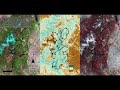
- This Harmonized Landsat Sentinel-2 (HLS) data animation shows the development of the Hermits Peak Fire which began on April 6, 2022, in the U.S. Forest Service Santa Fe National Forest. This video shows the fire as it spreads across the landscape from April 4, 2022, to August 2, 2022. The three views in the video demonstrate different methods of visualizing where the fire has burned using satellite imagery. The left image emphasizes fire hotspots as bright red-orange and burned areas in red using shortwave infrared (SWIR), near infrared (NIR), and red bands. The middle image uses Normalized Difference Vegetation Index (NDVI) values calculated using NIR and red bands to highlight vegetation health and where fire damage to vegetation occurred. Finally, the right image uses the NIR, red, and green bands to emphasize healthy, dense vegetation in red and areas where the fire has burned in black.
To learn more about Harmonized Landsat Sentinel-2 data please visit the NASA's Land...

- Title
- September 8, 2022 — Evening views of Halema‘uma‘u lava lake, Kīlauea
- Runtime
- 4:48
- Date posted
- 4 years ago
- Description
- Evening views of the eruption within Halema‘uma‘u crater on September 8, 2022. Solidified crust founders and sinks at the lava lake margin, and the lava lake sloshes. Lava spatters along the margin of the lake.
USGS video: https://www.usgs.gov/media/videos/september-8-2022-evening-views-halemaumau-lava-lake-kilauea

- Title
- September 12 overflight video of Kīlauea summit
- Runtime
- 1:04
- Date posted
- 4 years ago
- Description
- A routine helicopter overflight of the summit of Kīlauea provided airborne views of the lava within Halema‘uma‘u crater. The active lava lake is limited to the western portion of the crater floor, near the main source of white fume. The remainder of the crater floor consists of solidified lava flows.
USGS video at: https://www.usgs.gov/media/videos/september-12-overflight-video-kilauea-summit

- Title
- Rifts & Rumples in Antarctica (Image of the Week)
- Runtime
- 1:05
- Date posted
- 4 years ago
- Description
- Landsat satellites have watched the Brunt Ice Shelf for nearly five decades. And now, Landsat 9 has joined in observing the changing surface.
Major rifts have formed near a distinctive feature called the McDonald Ice Rumples. Ice rumples form when a rocky formation on the seabed impedes the flow of ice, causing pressure waves, crevasses, and rifts to form.
Through this Landsat time series, the feature that causes the rumples remains stationary, while the ice shelf and its rifts flow west.
In recent years, a prominent rift named Chasm 1 has approached close to the McDonald Ice Rumples. A large iceberg could form if it continues to lengthen.
Estimates suggest it would cover about 17 hundred square kilometers, a little bigger than the island of Oahu.
USGS video: https://www.usgs.gov/media/videos/image-week-rifts-rumples-antarctica

- Title
- USGS Woods Hole Coastal and Marine Science Center
- Runtime
- 2:54
- Date posted
- 4 years ago
- Description
- This video provides an overview of the science and products produced by the U.S. Geological Survey Woods Hole Coastal and Marine Science Center, as well as the use and value of the knowledge, data, and tools produced by the Center. It additionally highlights the Center’s location, where we conduct research, and collaborator/stakeholder types.
USGS video and AD version: https://www.usgs.gov/media/videos/usgs-woods-hole-coastal-and-marine-science-center

- Title
- Seafloor Erosion in the Florida Keys
- Runtime
- 5:12
- Date posted
- 4 years ago
- Description
- Coral reefs are important for supporting biodiversity, fisheries, tourism, and coastal protection, but are in decline worldwide, primarily due to extreme heat waves and subsequent coral bleaching, in addition to other stressors. By combining data and knowledge on seafloor elevation and coral reef carbonate budgets, USGS scientists are collaborating to better understand the current state, and predict the future of, the Florida Keys Reef Tract. The data being collected by USGS can also help inform partners working on coral reef restoration efforts such as the National Oceanic and Atmospheric Administration (NOAA).
Learn more about this research.
USGS video and AD versions at: https://www.usgs.gov/media/videos/seafloor-erosion-florida-keys

- Title
- Monthly update of activity at Yellowstone Volcano for September 1, 2022
- Runtime
- 6:08
- Date posted
- 4 years ago
- Description
- Mike Poland, scientist-in-charge of the Yellowstone Volcano Observatory, describes activity at Yellowstone volcano in this monthly update for September 1, 2022.
The update comes to you from beautiful Sapphire Pool in Yellowstone National Park’s Biscuit Basin. This and other features like Grand Prismatic Spring and Old Faithful, form from water, snow melt, and rainwater that circulates down in the earth and becomes heated by the cooling magma body beneath Yellowstone. The water picks up some of the gases from that magma body and because it's warm, it starts dissolving some of the rock beneath the surface that's very high in silica. The warm water buoyantly rises, moving through colder groundwater, and when it reaches the surface, it deposits a lot of the silica that it had dissolved from the rock below. This process is what creates the beautiful terrace features and also some of the cones that make up geysers like Old Faithful, Castle, and Giant.
These neutra...
- Title
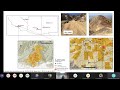
- Temporal changes in rainfall intensity-duration thresholds debris flows in recovering burned area
- Runtime
- 40:27
- Date posted
- 4 years ago
- Description
- Post-fire debris flows are often observed during the first rainy season following a wildfire, but it is unclear how long the elevated threat of debris flow persists. We constrained a hydrologic model using field and remotely sensed measurements of soil-infiltration capacity, vegetation cover, runoff, and debris-flow activity. We applied this model to estimate rainfall intensity-duration (ID) thresholds for debris-flow initiation within three burned areas in the southwestern United States over a post-fire recovery period of 3-4 years. Modeling suggests ID thresholds are lowest immediately following the fire (below a one-year recurrence interval storm) and increase with time, such that a 10- to 25-year recurrence interval storm would be required to generate a debris flow after three years of recovery. Results improve our ability to assess temporal changes in postfire debris-flow potential, highlight how site-specific factors may alter the persistence of postfire debris-flow hazards, and ...

- Title
- August 18, 2022 — Timelapse of lava lake motion in Halema‘uma‘u, Kīlauea
- Runtime
- 1:01
- Date posted
- 4 years ago
- Description
- This timelapse sequence is shown at 100x speed and shows the motion of the lava lake in Halema‘uma‘u, at the summit of Kīlauea. Lava enters the lake at the west end (bottom of image) and flow steadily towards the east end, where the crust is consumed along the lake margins.
USGS video: https://www.usgs.gov/media/videos/august-18-2022-timelapse-lava-lake-motion-halemaumau-kilauea

- Title
- Aridland Water Harvesting Study Animation
- Runtime
- 2:04
- Date posted
- 4 years ago
- Description
- Informative video portraying natural infrastructure in dryland streams (NIDS) in a watershed and descriptions of their documented climate-smart practices, graphic illustrated by Heartwood Visuals; animated by Hans J. Huth (Supplementary video 1; Norman et al. 2022). This animation portrays an illustration of a mountain with water flowing from the top down to a river with smaller rivers flowing off the sides. Multiple items appear along the various rivers including leaky weirs, one rock dams, log dams, gabions, check dams, trincheras, and earthen berms. Informational bubbles appear alongside these various items in the illustration.
Illustration Title: Aridlands Water Harvesting Study
Riparian detentions structures create soil-water sponges (like wetlands!)
This regenerative riparian management creates climate resilience!
Items: Leaky weirs; one rock dams; trincheras. Healthy vegetation (biomass) is supported up & downstream from st...

- Title
- ARkStorm
- Runtime
- 3:20
- Date posted
- 4 years ago
- Description
- The ARkStorm scenario led by the USGS and hundreds of scientists and experts from many disciplines details impacts of a scientifically plausible storm similar to the Great California Storm of 1862 in the modern day. The scenario led to several important scientific advancements and will be used by emergency and resource managers to improve partnerships and emergency preparedness. The ARkStorm Overview: http://pubs.usgs.gov/of/2010/1312/
USGS video and credits: https://www.usgs.gov/media/videos/arkstorm

- Title
- Understanding the Hunga Tonga-Hunga Ha'apai Event
- Runtime
- 2:16
- Date posted
- 4 years ago
- Description
- Between January 14-15, 2022, volcanic eruptions destroyed much of Hunga Tonga-Hunga Ha'apai, an uninhabited island in the Tonga archipelago in the southern Pacific Ocean. A plume of ash rising 36 miles into the atmosphere blanketed the neighboring Tongan islands. The eruption also displaced an enormous volume of water, sending waves estimated up to 49 feet tall toward nearby inhabited islands, causing major infrastructural damage and loss of life. The tsunami’s impact was powerful and deadly.
The Hunga Tonga-Hunga Ha'apai eruption and tsunami were immediate hazards to the island nation of Tonga, but their effects were felt on a much larger scale, unleashing sound and pressure waves that were detected around the world, generating multiple distinct tsunamis.
Video and AD at: https://www.usgs.gov/media/videos/understanding-hunga-tonga-hunga-haapai-event
- Title
- Timelapse showing rise of Halema‘uma‘u crater floor
- Runtime
- 0:52
- Date posted
- 4 years ago
- Description
- This timelapse sequence shows activity in Halema‘uma‘u, at the summit of Kīlauea, from March to August. The video shows the rise of the crater floor due to lava supplied beneath the surface crust, lifting the crater floor in an "endogenous" process. In addition, lava flows erupt sporadically and resurface portions of the crater floor.
USGS video: https://www.usgs.gov/media/videos/timelapse-showing-rise-halemaumau-crater-floor

- Title
- Monthly update of activity at Yellowstone Volcano for August 1, 2022 from Mammoth Hot Springs
- Runtime
- 7:15
- Date posted
- 4 years ago
- Description
- Mike Poland, scientist-in-charge of the Yellowstone Volcano Observatory, describes activity at Yellowstone in this monthly update for August 1, 2022.
The August 1 update comes to you from beautiful Mammoth Hot Springs in Yellowstone National Park. Tens of millions of years ago, this area was a shallow inland sea. The bedrock geology includes sandstones and slates, and even limestones composed of the shells of small marine organisms that accumulated over time. This area is also a zone of persistent hydrothermal activity and faulting, so hot fluids from the Yellowstone caldera migrate upward, interact with marine sediments, and pick up calcium carbonate. When the fluids get to the surface, the calcium carbonate is deposited, creating beautiful terraces. Mammoth is considered a travertine hot spring, which is different from the neutral chloride hot springs observed around Old Faithful, and the acid sulfate hot springs typified by Mud Volcano. These hot springs will be explor...

- Title
- Reducción de los riesgos de inundación mediante la restauración de los arrecifes de coral
- Runtime
- 2:11
- Date posted
- 4 years ago
- Description
- El aumento de riesgos por inundaciones a lo largo de nuestras costas está causado por el cambio climático, el desarrollo urbano y la pérdida de hábitat.
Poderosos huracanes impulsados por el clima como los fueron los huracanes Irma y María en 2017, causaron daños significativos a comunidades costeras en Florida y Puerto Rico, no solo a la infraestructura, sino también a las barreras naturales como los arrecifes de coral, que ayudan a disipar la energía de las olas antes de que éstas inunden las costas.
Tres nuevos informes del Servicio Geológico de los Estados Unidos, la Universidad de California y la Administración Nacional Oceanográfica y Atmosférica evalúan cuantitativamente cómo los arrecifes de coral afectados por esos huracanes aumentaron significativamente el riesgo de inundación, a un valor de cientos de millones de dólares.
Los informes también evalúan cómo, en la ausencia de restauración, los arrecifes de coral en Fl...

- Title
- Reducción de los riesgos de inundación mediante la restauración de los arrecifes de coral (con AD)
- Runtime
- 3:17
- Date posted
- 4 years ago
- Description
- El aumento de riesgos por inundaciones a lo largo de nuestras costas está causado por el cambio climático, el desarrollo urbano y la pérdida de hábitat.
Poderosos huracanes impulsados por el clima como los fueron los huracanes Irma y María en 2017, causaron daños significativos a comunidades costeras en Florida y Puerto Rico, no solo a la infraestructura, sino también a las barreras naturales como los arrecifes de coral, que ayudan a disipar la energía de las olas antes de que éstas inunden las costas.
Tres nuevos informes del Servicio Geológico de los Estados Unidos, la Universidad de California y la Administración Nacional Oceanográfica y Atmosférica evalúan cuantitativamente cómo los arrecifes de coral afectados por esos huracanes aumentaron significativamente el riesgo de inundación, a un valor de cientos de millones de dólares.
Los informes también evalúan cómo, en la ausencia de restauración, los arrecifes de coral en Fl...

- Title
- Gulf of Mexico Groundwater Wells
- Runtime
- 1:35
- Date posted
- 4 years ago
- Description
- A team from the USGS St. Petersburg Coastal and Marine Science Center heads out into the Gulf of Mexico to check on a set of recently installed groundwater wells. These types of wells allow scientists to monitor submarine groundwater through time and quantify the flux of groundwater from Florida’s aquifer into the coastal waters of the west Florida Shelf. The groundwater could carry nutrients that could potentially influence algal blooms in the Gulf of Mexico.
Dr. Christopher G. Smith pumps water from the well through tubing to the R/V Halimeda to ensure the wells are working properly and producing groundwater. USGS Summer Intern Sam Randall from Eckerd College is on board to assist.
Divers splash in to check the second set of wells closer to shore. Water from the well has lower salinity than the overlying surface water, confirming that groundwater is pumping through the wells.
The team is one step closer to sampling the groundwater from this s...
- Title
- Monthly update of activity at Yellowstone Volcano for July 2022
- Runtime
- 6:28
- Date posted
- 4 years ago
- Description
- Mike Poland, scientist-in-charge of the Yellowstone Volcano Observatory, describes activity at Yellowstone volcano in this monthly update for July 1, 2022.
The Yellowstone region saw record flooding owing to heavy rainfall and snowmelt during June 10–13. Several roads and bridges were washed out, and many small landslides and rockfalls occurred, especially in the northern part of Yellowstone National Park. Although severe, the flooding is not expected to have any significant impact on seismic or hydrothermal activity in the Yellowstone region. The only potential impact would be on geyser activity, because some geysers tend to erupt slightly more frequently during high-precipitation years compared to drier years. The timing shift is subtle but statistically significant.
There were 149 located earthquakes in June (maximum magnitude M2.4) and several small swarms. There was continued caldera subsidence and slight subsidence at Norris. Steamboat Geyser had...

- Title
- Bon Voyage, Rafael
- Runtime
- 1:23
- Date posted
- 4 years ago
- Description
- Over the last few weeks, Woods Hole scientists have been mapping the seafloor of Nantucket Sound as part of a long-term partnership with the State of Massachusetts. Using the research vessel “Rafael,” the bathymetric and stratigraphic surveys completed by the crew will be useful for finding different shoals to nourish various beaches that have been scoured and eroded.
On a bittersweet note, after 20+ years of service, this will be Rafael’s last season. We thought it would be fun to pay our respects to our ol’ friend with a video tribute. Hope you enjoy!
Video and AD: https://www.usgs.gov/media/videos/bon-voyage-rafael

- Title
- June 15 — Small collapse into lava lake at Kīlauea summit
- Runtime
- 1:13
- Date posted
- 4 years ago
- Description
- The lava lake in Halema‘uma‘u, at the summit of Kīlauea, remains active. On Wednesday, June 15, a small collapse of a portion of the lake rim created a dusty plume and lake agitation, including waves that traveled across the lake surface.
Video: https://www.usgs.gov/media/videos/june-15-small-collapse-lava-lake-kilauea-summit

- Title
- Landsat: Celebrating 50 Years (Extended Edition)
- Runtime
- 20:04
- Date posted
- 4 years ago
- Description
- 50 years of teamwork. 50 years of innovation. 50 years of resilience. In 1966, Secretary of the Interior Stewart Udall announced his vision to create a program aimed at gathering facts about the natural resources of the Earth from Earth orbiting satellites. It was a bold proclamation. It was also an idea that worked and continues to work 50 years on.
Video and AD: https://www.usgs.gov/media/videos/landsat-celebrating-50-years-extended-edition

- Title
- Can rock dams reverse climate change?
- Runtime
- 9:30
- Date posted
- 4 years ago
- Description
- Re-greening a Dryland Watershed
The installation of thousands of rock detention structures in the Turkey Pen Watershed, of the Chiricahua Mountains in SE Arizona, provided a 30-year case study to consider low tech and low-cost Natural Infrastructure in dryland watersheds. The USGS systematic study, through observation and experiment, offers verifiable data that documents their efficacy as a Nature-based Solution, that can provide climate adaptation and mitigation benefits here in the Chiricahua Mountains and beyond.
The rainfall-runoff response of a watershed is a complex and complicated process that is governed by large number of known and unknown physiographic factors, that vary both in space and time. Results reported in these case studies are snapshots in time at this location, using limited available inputs, with large uncertainty and potential error.
Learn More at the Aridland Water Harvesting Study: https://www.usgs.gov/centers/western-geographic-...

- Title
- June 13, 2022 — Thermal camera timelapse of Kīlauea summit lava lake growth
- Runtime
- 0:37
- Date posted
- 4 years ago
- Description
- This timelapse sequence shows the evolution of the lava lake and rise of the crater floor in Halema‘uma‘u, at the summit of Kīlauea Volcano, since the eruption start in September 2021. Much of the the crater floor rise is driven by lava supplied beneath the surface crust. The camera is located on the west rim of the summit caldera, looking east. The sequence is shown three times.
Video: https://www.usgs.gov/media/videos/june-13-2022-thermal-camera-timelapse-kilauea-summit-lava-lake-growth

- Title
- Catfish Ponds in Mississippi (Image of the Week)
- Runtime
- 0:45
- Date posted
- 4 years ago
- Description
- Mississippi leads the U.S. in catfish production. The blue tinted shapes in these Landsat images mark ponds where catfish are raised.
Ponds are build above ground with levees. The ponds are 4 to 6 feet deep. Catfish pond acreage dropped by more than half from 2003 to 2013. Many ponds returned to cropland. Some were left unused. Others transitioned to woody wetlands.
Music used with permission:
"Like An Angel", Strength To Last, Soundstripe, MTNZUNU5PXVC1KGH
Video: https://www.usgs.gov/media/videos/image-week-catfish-ponds-mississippi

- Title
- YVO monthly update of activity at Yellowstone Volcano for June 2022
- Runtime
- 5:18
- Date posted
- 4 years ago
- Description
- This monthly video update of activity at Yellowstone Volcano comes to you from Mammoth Hot Springs, in Yellowstone National Park, where the Yellowstone Volcano Observatory consortium had its first face-to-face meeting in four years.
During the meeting, YVO talked about science, the latest research, and plans for the future. YVO scientists also discussed revisions to the YVO response plan, which provides a guide for the scientific and hazards response to any geological event or unrest in the region.
As described in the video from Mike Poland, scientist-in-charge of the Yellowstone Volcano Observatory, activity at Yellowstone is at background levels. There were 87 located earthquakes (maximum magnitude M4.2) and two small swarms. There was continued caldera subsidence and no deformation of Norris. Steamboat Geyser had two major water eruptions, bringing the total number of eruptions this year to six.
YVO is a consortium of institutions, which includ...

- Title
- Rise of the Halema‘uma‘u crater floor
- Runtime
- 0:48
- Date posted
- 4 years ago
- Description
- This timelapse sequence shows one image per day over the past two months from the B1cam webcam on the east rim of Halema‘uma‘u, at the summit of Kīlauea. The images show that the floor of Halema‘uma‘u has been growing endogenously. Lava is supplied beneath the solidified crust that forms the surface of the crater floor, lifting the surface in a manner similar to inflating an air mattress. In addition to endogenous growth, sporadic lava flows overplate the crust and also contribute to growth.
Video: https://www.usgs.gov/media/videos/rise-halemaumau-crater-floor
- Title
- Coastal Wetlands
- Runtime
- 2:18
- Date posted
- 4 years ago
- Description
- Coastal wetlands are among the most productive and valuable ecosystems in the world—comparable to even rainforests and coral reefs. They are often referred to as natural sponges or nature’s kidneys because they slow the flow of water across the watershed, filter out pollutants and excess nutrients, and even absorb and store large quantities of the greenhouse gas carbon dioxide. These capabilities help protect coastal communities from storms and flooding, prevent erosion, improve water quality, and decrease the effects of climate change. Coastal wetlands also provide essential food, refuge, and nursery habitat for important species, as well as opportunities for recreation, like boating, hiking, and bird watching. Everyone benefits from the numerous critical services these ecosystems provide.
At the U.S. Geological Survey, we conduct a wide variety of research in coastal wetlands to ensure Federal, State, regional, and local organizations have the information they need t...

- Title
- May 26, 2022 — Kīlauea — Lava lake activity continues at the summit
- Runtime
- 0:53
- Date posted
- 4 years ago
- Description
- Lava lake activity continues in Halema‘uma‘u, at the summit of Kīlauea Volcano. A small stream of lava was pouring into a small pond northwest of the main lava lake, near the west vent.
Video: https://www.usgs.gov/media/videos/may-26-2022-kilauea-lava-lake-activity-continues-summit

- Title
- The USGS Library
- Runtime
- 5:14
- Date posted
- 4 years ago
- Description
- To build and organize a collection of scientific materials focused on the earth sciences. Preserving historical collections for future scientists.
Video: https://www.usgs.gov/media/videos/usgs-library

- Title
- I Am A...Natural Resource Economist
- Runtime
- 1:04
- Date posted
- 4 years ago
- Description
- Welcome to the “I Am A..." series, a whiteboard animation video series highlighting USGS careers. The concept is to show "what society (or my parents) thinks I do" compared with "what I really do." One image captures a more whimsical representation of a "scientist" in a particular field and the second demonstrates a more accurate representation of what that professional really “looks” like at work.
This video is about a natural resource economist (i.e. someone who studies the value of features in the natural world).
Economist:
eco- = “house”
-nomos = “account”
-ist = “person”
(i.e. “house manager”)
Thank you for watching, we appreciate your support. Please like, share, and subscribe. If you are a teacher, please feel free to use this video (or coloring page below) in your science class.
Project-Related Links:
• Coloring page for Natural Resource Economist: https://www.usgs.gov/medi...

- Title
- LGSOWG 50th Anniversary
- Runtime
- 2:57
- Date posted
- 4 years ago
- Description
- The Landsat Ground Station Operators Working Group (LGSOWG) just held its 50th meeting in Petoria, South Africa. LGSOWG meetings have taken place in over 15 countries and participants from over 38 countries have attended, helping strengthen the Landsat mission through the exchange of ideas and strategic collaboration.
Video: https://www.usgs.gov/media/videos/lgsowg-50th-anniversary

- Title
- Calwood Fire, Heil Ranch post-fire debris-flow monitoring station, July 31, 2021
- Runtime
- 6:14
- Date posted
- 4 years ago
- Description
- Calwood burn area, Heil Ranch post-fire debris-flow monitoring station video footage from rainstorm on July 31, 2021 from 14:07 MDT to 14:13:11 MDT.
0:00 (14:07 PM) – Start of Video
0:32 (14:07:32 PM) – Start of flow in the channel
1:13 (14:08:13 PM) – Increasing rainfall intensity
4:04 (14:11:04 PM) – Start of sediment-laden flow
6:11 (14:13:11 PM) – Video Ends
Video: https://www.usgs.gov/media/videos/calwood-fire-heil-ranch-post-fire-debris-flow-monitoring-station-july-31-2021

- Title
- Calwood Fire, Calwood post-fire debris-flow monitoring station, July 31, 2021
- Runtime
- 7:12
- Date posted
- 4 years ago
- Description
- Calwood burn area, Calwood post-fire debris-flow monitoring station video footage from rainstorm on July 31, 2021 from 14:06 MDT to 14:13:05 MDT.
0:00 Video begins on July 31st, 14:06 PM
0:20 (14:06:20 PM) – Flow begins in channel
1:15 (14:07:15 PM) – Increased flow in the channel
1:15 – 7:00:05 (14:13:05 PM) – Increased flow in the channel continues
7:00:05 (14:13:05 PM) – video ends
Video: https://www.usgs.gov/media/images/calwood-fire-calwood-post-fire-debris-flow-monitoring-station

- Title
- Kīlauea summit overflight video – May 10, 2022
- Runtime
- 3:11
- Date posted
- 4 years ago
- Description
- An overflight at approximately 10 a.m. on May 10, 2022, provided aerial views of the eruption within Halema‘uma‘u crater. Lava continues to erupt from the west vent area, supplying an active lava pond in the western portion of Halema‘uma‘u within Kīlauea summit caldera. This video, shown at 2x speed, contains footage from three flights along the east margin of Halema‘uma‘u crater floor at different elevations.
Video: https://www.usgs.gov/media/videos/kilauea-summit-overflight-video-may-10-2022

- Title
- Landsat: Celebrating 50 Years
- Runtime
- 5:03
- Date posted
- 4 years ago
- Description
- The Landsat program conceived of in the 1960s, has been running longer than any remote sensing program. The idea was simple: position a satellite in a nearly polar orbit fixed to the solar angle so that each daytime pass would cross the equator at roughly the same local time.
Data representing bands of the spectrum are captured and processed into grayscale recordings, which can be combined to create natural looking views like this or false color views like this. Nine Landsat satellites have been launched in partnership with NASA's since 1972.
Expectations were high when Landsat 1 carried two sensors into orbit. This view of Dallas, Texas, was the first cloudless image received. Landsat 1 data led to immediate and fundamental changes to practices of the cartographic and geographic communities. Country borders were redrawn and entire islands were discovered.
Imagery was received and processed at the new USGS EROS Center in South Dakota, which would ...

- Title
- YVO monthly update of activity at Yellowstone Volcano, May 1, 2022
- Runtime
- 5:50
- Date posted
- 4 years ago
- Description
- Mike Poland, scientist-in-charge of the Yellowstone Volcano Observatory, talks about Yellowstone’s recent earthquakes, trends in ground deformation, and Steamboat Geyser activity in this video update of May 1, 2022.
Mike is reporting from the Cascades Volcano Observatory in Vancouver, Washington. CVO is one of five observatories operated by the USGS. The others are in Hawaii, Alaska, and California. Unlike the other four, Yellowstone is a virtual observatory. It has no physical location. Instead, scientists from the California and Cascades Observatories, and from state geological surveys, universities, and research agencies located in the western U.S. work together to research, monitor, and understand Yellowstone.
Since YVO is a virtual observatory, data and updates are available online. Newly available is the YVO Annual Report for 2021. This report summarizes seismic activity, ground deformation, and research activities like geologic mapping and studies of ...





