USGS
Eyes on Earth Episode 67 - ECOSTRESS and Water Use

- Title
- Eyes on Earth Episode 67 - ECOSTRESS and Water Use
- Runtime
- 13:18
- Date posted
- 2 years ago
- Description
- If you want to know how much rain fell yesterday, you can catch it and measure it. Water vapor? That's not so easy. Which is a problem if you want to know how quickly that rate is returning to the atmosphere. Water vapor is the single largest part of the water budget, but without space-based observations, it would be all but impossible to measure at wide scale. On this episode of Eyes on Earth, we learn how a sensor called ECOSTRESS helps improve the space-based measurement of evapotranspiration, or ET, which is the combined rate of evaporation from the Earth's surface and transpiration from plants.

- Title
- Eyes on Earth Episode 68 - Tracking Mangroves by Satellite
- Runtime
- 17:39
- Date posted
- 2 years ago
- Description
- The sturdy root systems of mangrove forests act as buffer zones along the coastlines of some of the planet’s most vulnerable communities, protecting lives, ecosystems and property from the rigors of hurricanes and tsunamis. The dual stressors of climate change and man-made changes to the environment such as offshore aquaculture have damaged these critical buffer zones in recent years. Remote sensing scientists are using satellite data to understand the impact those changes will have on the communities they protect as temperatures continue to warm worldwide and extreme weather events become more frequent. On this episode of Eyes on Earth, we talk to one of those scientists, Dr. Lola Fatoyinbo.

- Title
- Eyes on Earth Episode 69 - Thirty Years of Land Change in the U.S.
- Runtime
- 18:45
- Date posted
- 2 years ago
- Description
- Land change is a constant. Even land areas that see little major change can see disruptions from storms, heat waves, wildfires, or invasive species. But major changes aren't uncommon, either. Each year in the U.S., farm fields become tracts of suburban homes, wetlands become more permanent bodies of water, and shrublands burn to be replaced with grasslands. A team of researchers with the USGS Land Change Monitoring, Assessment, and Projection initiative (LCMAP) recently released a study documenting land cover class change from 1985-2016. On this episode of Eyes on Earth, we talk to the study’s lead author about what they learned about land change, and about how land change ties in to policy, economic trends, weather patterns and more.

- Title
- Eyes on Earth Episode 70 - ECOSTRESS and Aquatic Ecosystems
- Runtime
- 22:00
- Date posted
- 2 years ago
- Description
- Summary: The Earth observation data archived here have plenty of value to the study of aquatic ecosystems. Landsat satellites can capture harmful algal blooms, for example. Spaceborne sensors can also record land surface temperatures, and that includes water surfaces. On this episode of Eyes on Earth, we hear about how a sensor called ECOSTRESS can be used to measure water temperatures at different times of day, and how those measurements could be useful in the monitoring and management of the endangered Delta smelt. ECOSTRESS data are available through the NASA Land Processes Distributed Active Archive Center (LP DAAC), located in the USGS EROS Center.

- Title
- Eyes on Earth Episode 71 – Blue Oak Forests of California
- Runtime
- 14:36
- Date posted
- 2 years ago
- Description
- In this episode of Eyes on Earth, we zero in on the use of USGS Land Change Monitoring, Assessment, and Projection (LCMAP) products to examine the effects of drought on California’s Blue Oaks. LCMAP datasets are built from Landsat data and reveal the land cover and change of every pixel in the conterminous United States, dating back to 1985. In this case, LCMAP helped identify areas of declines and losses of the Blue Oak trees that are native to California and found in the foothills surrounding the central valley and along the coast.

- Title
- Eyes on Earth Episode 73 – Global Water Use
- Runtime
- 14:31
- Date posted
- 2 years ago
- Description
- Some plants are simply better at making use of their water supply than others. More efficient plants can capture more carbon with less water, which has implications for carbon sequestration and ultimately for climate change modeling. In other words, the more we understand about water use efficiency, the more reliable our climate change models can be. And the only way to measure efficiency at the global scale is from space. On this episode of Eyes on Earth, we hear from a scientist who studied global water use using a sensor called ECOSTRESS, whose data are housed at the USGS EROS Center, in NASA’s Land Processes Distributed Active Archive Center (LP DAAC).

- Title
- Eyes on Earth Episode 72 – Northward Shift of the Boreal Forest
- Runtime
- 19:37
- Date posted
- 2 years ago
- Description
- The boreal forest, or taiga, stretches across nearly 5.7 million square miles in the northern latitudes. That’s nearly a quarter of all forested lands in the world. This sprawling biome also happens to be one of the most rapidly shifting in the face of climate change. Many studies have suggested that the taiga tree line is moving northward as temperatures warm worldwide, edging itself into the colder tundra. On this episode of Eyes On Earth, we hear from Professor Logan Berner, part of team at Northern Arizona University’s Global Earth Observation and Dynamics of Ecosystems (GEODE) Lab that used USGS Landsat satellite data to track and quantify the northward shift of the boreal tree line.

- Title
- Mount Rainier Lahars: Hazards for the Puyallup and Nisqually River Drainages
- Runtime
- 6:20
- Date posted
- 4 years ago
- Description
- Large lahars (volcanic mudflows) pose substantial threats to people and property downstream from Mount Rainier, Washington. Lahars can occur during an eruption, as happened at Mount St. Helens on May 18, 1980. Lahars can also begin as large landslides that occur without warning, traveling down river channels to densely populated areas downstream.
To inform potentially affected communities, assist school districts with implementing state mandatory lahar drills, and help emergency management officials prepare for the possibility of a large lahar, the USGS prepared state-of-the-art numerical simulations (D-Claw) of hypothetical lahars that originate as landslides high on Mount Rainier’s western flank and descend the Puyallup and Nisqually River valleys.
The simulations focused on the Sunset Amphitheater and Tahoma Glacier Headwall, areas identified as the most landslide-prone part of the volcano. Two different volumes were modeled: 260 million cubic meters, the...

- Title
- Lava lake at Kīlauea summit on April 26, 2022
- Runtime
- 1:03
- Date posted
- 4 years ago
- Description
- This video was recorded by a webcam on the northwest rim of Kīlauea caldera, and shows the active lava lake in Halema‘uma‘u. The lava flows from west to east (right to left in this image) and plunges down a cascade into a smaller pit, where the lava is highly agitated. USGS video by M. Patrick.
Video: https://www.usgs.gov/media/videos/lava-lake-kilauea-summit-april-26-2022

- Title
- Climate Science Champions, Season 1: Steve Matsuoka, Research Wildlife Biologist
- Runtime
- 2:01
- Date posted
- 4 years ago
- Description
- Research Wildlife Biologist Steve Matsuoka explores how climate change affects the reproductive success of Alaska’s diverse bird communities, which include more than 100 species that migrate to Alaska each year world to breed.
In Alaska’s boreal forest, where more than 100 species of birds arrive each summer from around the world to breed, climate change brings warmer, drier summers, increased frequency of wildfire, and declines in suitable nesting habitat—all of which can be hurdles to reproductive success. Additionally, many species face other climate-induced challenges along every stop of their migrations. Birds are considered indicators of ecosystem health; USGS researchers studying migratory birds can get a better understanding of changing environmental conditions across the diverse habitats birds use.
Learn more about Steve Matsuoka’s work: https://www.usgs.gov/centers/alaska-science-center/science/landbird-research-alaska
Standard...

- Title
- Climate Science Champions, Season 2: Ann Gibbs, Geologist
- Runtime
- 1:46
- Date posted
- 4 years ago
- Description
- Geologist Ann Gibbs studies the vulnerability of the rapidly-warming Alaska coast to climate change effects like sea level rise and permafrost thawing.
The Beaufort Sea coast along the northern edge of Alaska is a place of extremes. Home to the northernmost year-round settlements in the United States, this region sees round-the-clock daylight during the three-month Arctic summer and is shrouded in darkness and ice for much of the rest of the year. As climate change brings rising sea levels, warmer surface water and air temperatures, and powerful storms to coastal areas across the country, it is Alaska’s Arctic coast that may see the most extreme effects: The region is warming faster than anywhere else in the country. USGS researchers studying these rapid changes are helping Arctic Alaska’s coastal communities plan for a climate-altered future.
Learn more about Ann Gibbs’s work: https://www.usgs.gov/centers/pcmsc/science/climate-impacts-arctic-coasts

- Title
- Climate Science Champions, Season 1: Vanessa von Biela, Research Fish Biologist
- Runtime
- 2:08
- Date posted
- 4 years ago
- Description
- Research Fish Biologist Vanessa von Biela investigates how heatwaves and other climate-driven stressors may affect Alaska’s spawning Pacific salmon in the future.
Salmon forms the lifeblood for many in Alaska. The state hosts all five Pacific salmon species; Alaskan salmon hold cultural, economic and ecological significance. One of the major climate factors affecting salmon in Alaska is the increasing occurrence of extreme heat events. A record-breaking heatwave and drought in 2019 caused stress and unprecedented mortality in Alaskan salmon, affecting adults on their way to spawning grounds. USGS researchers are trying to understand how heatwaves and other climate-driven stressors will affect Alaska’s spawning Pacific salmon into the future. While an event like the 2019 heatwave was devastating—fish that die before spawning don’t contribute to future generations—salmon in Alaska are resilient.
Learn more about Vanessa von Biela’s work: https://www...
- Title
- Climate Science Champions, Season 1: Vijay Patil, Wildlife Biologist
- Runtime
- 2:01
- Date posted
- 4 years ago
- Description
- Wildlife Biologist Vijay Patil explores the effects of climate change and shifting seasons on Arctic-nesting waterfowl.
The Arctic is warming twice as rapidly as the rest of the planet. This can create a seasonal mismatch for migratory bird species that nest there. Birds arriving to breeding grounds after the snow has melted may find that they missed out on resources their chicks need to survive. USGS researchers are studying the effects of these changes on Arctic-nesting waterfowl, which are an important food resource for northern Alaskan communities. One species in particular, the snow goose, appears to be profiting from less snow in the Arctic in the short-term: Earlier-than-average spring thaw is allowing snow goose populations to increase dramatically in Arctic Alaska. This creates the potential for indirect effects of warming on Arctic ecosystems, such as increased grazing pressure and competition between snow geese and other Arctic-nesting species.
Lea...
- Title
- Climate Science Champions, Episode 4: Ferdinand Oberle, Research Oceanographer/Geologist
- Runtime
- 2:15
- Date posted
- 4 years ago
- Description
- Healthy coral reefs are more than just hotspots of marine biodiversity and the source of livelihood for coastal communities—they’re also invaluable to long-term resilience against storms and sea-level rise. Reefs serve as natural breakwaters, helping to dissipate wave energy before they crash ashore and flood coastlines. Along reef-lined shores of the Caribbean and Pacific Islands, USGS researchers study how stressors such as warming surface waters, nutrient runoff, and increasingly powerful storms impact the growth and health of reefs. Their work adds to a growing shift toward nature-based climate solutions: By working with nature and restoring degraded reefs, humans can reduce present and future risks to coastal communities and save coral reef ecosystems at the same time.
Learn more about Ferdinand Oberle’s work here:
https://www.usgs.gov/centers/pcmsc/science/coral-reef-project
Music: “Satsuma Beach” by Giants’ Nest, “Jakartaâ€...

- Title
- Climate Science Champions, Season 1: Heather Johnson, Research Wildlife Biologist
- Runtime
- 1:52
- Date posted
- 4 years ago
- Description
- USGS Wildlife Research Biologist Heather Johnson uses collar-mounted video cameras to peer into the lives of climate-threatened caribou.
Caribou are an iconic species of Alaska’s Arctic landscapes. On the treeless tundra, herds of caribou numbering in the thousands are a dominant ecological presence, as well as an important source of food for Indigenous and rural communities in the Arctic. Migrating vast distances between their seasonal ranges, caribou are one of many Arctic species forced to adapt to climate-driven shifts in temperature, habitat, and food resources. A major hurdle to studying these animals is logistical: caribou range over vast, remote landscapes, making tracking them costly and even dangerous. In Alaska, USGS researchers are exploring a new tool to study the habits and movements of caribou: collar-mounted video cameras.
Learn more about Heather Johnson’s work here:
https://www.usgs.gov/centers/alaska-science-center/sc...

- Title
- Climate Science Champions, Season 1: Mike Carey, Research Fish Ecologist
- Runtime
- 1:58
- Date posted
- 4 years ago
- Description
- Fish Ecologist Mike Carey studies the impacts beavers have on warming Alaskan permafrost landscapes.
As subarctic summers grow warmer and drier and winters less severe, Alaska’s tundra landscape is transforming. Plants and animals historically absent from the tundra are arriving and multiplying. One of these newcomers is the beaver, which is expanding its range north and west out of the boreal forest. Beavers’ ability to build dams and create wetlands is well-known in temperate regions. What USGS researchers want to understand is the impact beavers have on landscapes underlain by permafrost—the frozen ground that contains methane, carbon dioxide, and other greenhouse gases that contribute to global warming.
Learn more about Mike Carey’s work: https://www.usgs.gov/centers/alaska-science-center/science/beavers-impacting-tundra-ecosystems-bite
Standard version: https://cms.usgs.gov/media/videos/climate-science-champions-season-1-mike-carey-...

- Title
- Climate Science Champions, Season 2: Kira Mizell, Research Oceanographer
- Runtime
- 1:53
- Date posted
- 4 years ago
- Description
- Research Oceanographer Kira Mizell studies change in ocean chemistry by collecting marine minerals, looking for insights into past climate conditions and geologic history.
The world’s oceans are in constant flux, influencing—and being influenced by—Earth’s climate. One way USGS researchers study changes in ocean chemistry over geologic time is by collecting marine minerals known as ferromanganese crusts. These minerals grow slowly on the seafloor over millions of years, building layers and accumulating metals as they precipitate from seawater. The study of ferromanganese crusts provides insights into past climatic conditions and geologic history. For example, ferromanganese crusts record the intensity of erosion on land by rivers and along the coast, as well as changes to ocean circulation and biological activity levels in ocean surface waters.
Learn more about Kira Mizell’s work: https://www.usgs.gov/centers/pcmsc/science/global-marine-mineral-reso...

- Title
- I Am An...Inventor
- Runtime
- 1:03
- Date posted
- 4 years ago
- Description
- Welcome to the “I Am A..." series, a whiteboard animation video series highlighting USGS careers. The concept is to show "what society (or my parents) thinks I do" compared with "what I really do." One image captures a more whimsical representation of a "scientist" in a particular field and the second demonstrates a more accurate representation of what that professional really “looks” like at work.
This video is about an inventor (i.e. someone who creates new tools or techniques).
Inventor:
Invenire = “to come upon; devise, discover”
-or = “person”
(i.e. “person who finds out”)
Thank you for watching, we appreciate your support. If you are a teacher, please feel free to use this video (or coloring page below) in your science class.
Project-Related Links:
• Coloring page for Inventor: https://www.usgs.gov/media/images/volcanologist-coloring-page
• YouTube Playlist for “I Am A…” ...

- Title
- Monthly update of activity at Yellowstone Volcano (April 1, 2022)
- Runtime
- 8:23
- Date posted
- 4 years ago
- Description
- Yellowstone Volcano Observatory Scientist-in-Charge Mike Poland talks about a recent earthquake swarm in Yellowstone National Park, trends in ground deformation, and water eruptions at Steamboat Geyser, in this video update of recent activity (April 1, 2022).
Seismic swarms are nothing new in Yellowstone. In fact, about 50% of all earthquakes in Yellowstone are part of swarms. The recent swarm that began on March 28, 2022 occurred in an area where earthquakes are common. There are at least three reasons why this area is so active: (1) Yellowstone sits right on the eastern edge of the Basin and Range extensional province so there are many faults in the area; (2) a lot of snow and rain moves into the subsurface to interact with those faults, generating small earthquakes; and (3) the 1959 Hebgen Lake earthquake (the largest earthquake ever recorded in the Intermountain West Region of the U.S.) altered the stress field in the rock to make small earthquakes more likely. That is...

- Title
- Continued lava lake activity at Kīlauea summit on March 29, 2022
- Runtime
- 1:19
- Date posted
- 4 years ago
- Description
- Activity continues in Halema‘uma‘u crater, at the summit of Kīlauea. Today, spattering was present at the margin of the active lava lake, along with lava pouring from a small cone in the northeast portion of the crater floor. The video ends with crustal foundering in an area of ponded lava in the central portion of the crater floor. USGS video by M. Patrick.
Video: https://www.usgs.gov/media/videos/continued-lava-lake-activity-kilauea-summit-march-29-2022

- Title
- 29 March 2022– Kīlauea volcano, spattering within Halema‘uma‘u crater
- Runtime
- 1:01
- Date posted
- 4 years ago
- Description
- This video, captured by a webcam on the northwest rim of Kīlauea caldera of March 29, 2022, shows spattering from a cone that has developed on the crater surface in the eastern part of Halema‘uma‘u. The presence of these features demonstrates that molten material is present beneath the solidified surface of the crater floor.
Video: https://www.usgs.gov/media/videos/29-march-2022-kilauea-volcano-spattering-within-halemaumau-crater

- Title
- March 25, 2022 — Kīlauea summit continued lava lake activity
- Runtime
- 0:57
- Date posted
- 4 years ago
- Description
- The summit eruption in Halema‘uma‘u crater, at the summit of Kīlauea, continues with lava lake activity. This video, taken on March 24, 2022, shows lava from the main lake pouring into a smaller lake in the western portion of the crater. USGS video by M. Patrick.
Video: https://www.usgs.gov/media/videos/march-25-2022-kilauea-summit-continued-lava-lake-activity

- Title
- What is a seismic survey?
- Runtime
- 0:45
- Date posted
- 4 years ago
- Description
- What is a seismic survey? This video gives a very brief overview of the what goes into conducting a seismic survey in an urban area. The survey depicted in this video was done in San Carlos, California.

- Title
- March 17, 2022 — Kīlauea summit eruption overflight video
- Runtime
- 1:27
- Date posted
- 5 years ago
- Description
- A routine helicopter overflight on March 17, 2022, provided airborne views of the summit eruption in Halema‘uma‘u crater, at the summit of Kīlauea. At the start of the video, the helicopter flies over the edge of the large collapse depression formed during the 2018 eruption. The black lava filling the deepest portion of the crater has been erupted during the current eruption which began in September 2021. USGS video by M. Patrick.
Video: https://www.usgs.gov/media/videos/march-17-2022-kilauea-summit-eruption-overflight-video

- Title
- Flooding in Tweed Heads, Australia (Image of the Week)
- Runtime
- 0:46
- Date posted
- 5 years ago
- Description
- Europe's Copernicus Sentinel-2 satellites revealed flooding at Tweed Heads, New South Wales. Heavy rain that persisted for days in late February 2022 caused widespread flooding on Australia's east coast.
The Harmonized Landsat and Sentinel-2 (HLS) project combines the two satellite programs to enable global observations of the land every 2–3 days at 30-meter resolution. As they flooded, the Tweed River and Terranora Creek carried runoff sediment into the ocean,
shown with the lighter blue shade in the Sentinel images.
The USGS distributes Sentinel data through its EarthExplorer portal.
Video: https://www.usgs.gov/media/videos/image-week-flooding-tweed-heads-australia
- Title
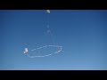
- Southern Wisconsin Airborne Electromagnetic Survey 2022
- Runtime
- 4:26
- Date posted
- 5 years ago
- Description
- Low-flying helicopter with geophysical equipment loop deployed below it via slingload. In March 2022, a helicopter carried an airborne electromagnetic induction sensor over parts of southeast and southwest Wisconsin as part of a USGS study to map the aquifers in the region. The data will be used to inform models of water availability and quality in the region that can be used by resource managers and policy makers.
The survey is in partnership with Wisconsin Geological and Natural History Survey (WGNHS), Natural Resources Conservation Service (NRCS) and Wisconsin Department of Agriculture, Trade and Consumer Protection (DATCP).
Video: https://www.usgs.gov/media/videos/southern-wisconsin-airborne-electromagnetic-survey-2022

- Title
- I Am A...Climate Modeler
- Runtime
- 1:03
- Date posted
- 5 years ago
- Description
- Welcome to the “I Am A..." series, a whiteboard animation video series highlighting USGS careers. The concept is to show "what my parents think I do" compared with "what I really do." One image captures a more whimsical representation of a "scientist" in a particular field and the second demonstrates a more accurate representation of what that professional really “looks” like at work.
This video is about a climate modeler (i.e. someone who forecasts future climate scenarios).
Climate Modeler:
klima- = “slope, zone”
modulus- = “measure, scale”
-er = “person”
(i.e. “maker of small mountains”)
Thank you for watching, we appreciate your support. If you are a teacher, please feel free to use this video (or coloring page below) in your science class.
Project-Related Links:
• Coloring page for Climate Modeler: https://www.usgs.gov/media/images/i-am-aclimate-modeler-coloring-page
•...

- Title
- I Am A...Wetland Ecologist
- Runtime
- 1:03
- Date posted
- 5 years ago
- Description
- Video: https://www.usgs.gov/media/videos/i-am-awetland-ecologist
Welcome to the “I Am A..." series, a whiteboard animation video series highlighting USGS careers. The concept is to show "what society (or my mom) thinks I do" compared with "what I really do." One image captures a more whimsical representation of a "scientist" in a particular field and the second demonstrates a more accurate representation of what that professional really “looks” like at work.
This video is about a wetland ecologist (i.e. someone who studies wetland plants and animals).
Wetland Ecologist:
wetland = land with water at the surface for all or part of the year
eco- = “home”
-ology = “study of”
-ist = “person”
(i.e. “studier of perennially wet or saturated habitats”)
Thank you for watching, we appreciate your support. Please like, share, and subscribe. If you are a teacher, please feel free to use this vide...

- Title
- March 2, 2022 — Kīlauea summit overflight
- Runtime
- 4:29
- Date posted
- 5 years ago
- Description
- A morning overflight of Kīlauea summit on March 2, 2022, provided aerial views of the eruption within Halema‘uma‘u. Lava erupts from the west vent area and pours into the active lava lake area.
Video: https://www.usgs.gov/media/videos/march-2-2022-kilauea-summit-overflight

- Title
- Monthly update of activity at Yellowstone Volcano for March 2022
- Runtime
- 6:56
- Date posted
- 5 years ago
- Description
- Happy 150th birthday to Yellowstone National Park! The Park is truly a wonderland, and a place of continuous inspiration and learning. Listen, as Yellowstone Volcano Observatory Scientist-in-Charge Mike Poland recounts some of its unique history and provides an update of recent earthquakes, ground deformation, and geyser activity.
Did you know, that a thermophilic bacterium from a Yellowstone hot spring is helping the fight against the COVID-19 pandemic?
In 1966, Professor Thomas Brock of Indiana University and undergraduate student Hudson Freeze collected microbial mat samples from Mushroom Springs (located in Yellowstone’s Lower Geyser Basin). In the lab, Freeze and technician Sally Murphy worked to isolate the bacterium Thermus aquaticus strain YT-1, that was thriving at 71.5°C (160 °F).
From this sample, the bacterium was studied through the 1970s and 1980s, with the basis of the patent for Polymerase Chain Reaction (PCR) founded on the th...

- Title
- The Sky Island Restoration Collaborative
- Runtime
- 19:31
- Date posted
- 5 years ago
- Description
- Scientists at the USGS Aridland Water Harvesting Study are partnering with others to build resilience in the United States-Mexico border. Representatives from various backgrounds are joining together across the administrative boundaries of the Madrean Archipelago Ecoregion of North America. This video introduces some of the partners, places, and restoration structures we are using, along with our associated scientific research.
We describe the development of the Sky Island Restoration Collaborative (SIRC) and our integration of science and practice. SIRC partners are working together to sustain biodiversity, improve resilience to a changing climate, and re-establish an ecologically healthy relationship between nature and culture in the borderlands, where economies focused on restoration and stewardship benefit everyone.
Video: https://www.usgs.gov/media/videos/sky-island-restoration-collaborative

- Title
- 2022 Polar Bear Research Masterplan
- Runtime
- 1:09
- Date posted
- 5 years ago
- Description
- Scientists continue to study how a warming Arctic will affect polar bear populations. The new 2022 Polar Bear Research Council Masterplan identifies how polar bears in zoos can help fill knowledge gaps that benefit wild populations. By studying the physiology, behavior, and reproduction of bears in zoos, researchers are getting a better idea of understanding changes to the health and welfare of polar bears in the wild.
To read the 2022 Polar Bear Research Council Masterplan: https://polarbearsinternational.org/news-media/articles/polar-bear-research-council-purple-fur-zoo-coalition
For more on USGS Polar Bear Research: https://www.usgs.gov/centers/alaska-science-center/science/polar-bear-research
Read about a new study on polar bear diets in zoos: https://www.usgs.gov/publications/new-insights-dietary-management-polar-bears-ursus-maritimus-and-brown-bears-u-arctos
To learn more about Polar Bears International: https://polarbearsinternational.org/

- Title
- North Pacific Marine Heatwave
- Runtime
- 4:00
- Date posted
- 5 years ago
- Description
- In the winter of 2015, the public noticed thousands of dead seabirds washing ashore across the western coast of the United States and Canada. The USGS linked this massive seabird die-off to the North Pacific Marine Heatwave. A marine heatwave occurs when sea surface temperatures are above normal for an extended period of time. This marine heatwave caused north Pacific Ocean temperatures to increase far above normal from 2013-2016, making it the longest marine heatwave on record for the region.
For more information on the North Pacific Marine Heatwave visit:
Marine and Coastal Resources Continue to Feel the Effects of the Marine Heatwave (NPS)
https://www.nps.gov/orgs/1349/marineheatwaveimpacts.htm
Heatwave-induced synchrony within forage fish portfolio disrupts energy flow to top pelagic predators (Wiley Online Library)
https://onlinelibrary.wiley.com/doi/10.1111/gcb.15556
Extreme mortality and reproductive failure of c...

- Title
- February 17, 2022 — Typical activity at the west vent in Halema‘uma‘u, Kīlauea
- Runtime
- 0:53
- Date posted
- 5 years ago
- Description
- This video clip shows typical activity at the west vent, in Halema‘uma‘u crater at the summit of Kīlauea. Lava upwells in a small pond and then flows into the main lake via a narrow channel. USGS video by M. Patrick.
Video: https://www.usgs.gov/media/videos/february-17-2022-typical-activity-west-vent-halemaumau-kilauea

- Title
- Coastal Change in Arctic Alaska
- Runtime
- 2:42
- Date posted
- 5 years ago
- Description
- The Arctic region is warming faster than anywhere else in the nation. Understanding the rates and causes of coastal change in Alaska is needed to identify and mitigate hazards that might affect people and animals that call Alaska home.
Video and AD versions: https://www.usgs.gov/media/videos/coastal-change-arctic-alaska

- Title
- February 7– 10, 2022 – Kīlauea summit eruption thermal timelapse video
- Runtime
- 1:25
- Date posted
- 5 years ago
- Description
- Eruptive activity at the summit of Kīlauea, within Halema‘uma‘u crater, has recently been characterized by the eruption waxing and waning over timescales of days. This video, captured from February 7–10, 2022, by the F1cam, a thermal camera located on the west rim of the caldera and looking east, shows the eruption pass through a pause cycle. Other eruption monitoring data streams also track this fluctuating activity, with ground deflation and decreased volcanic sulfur dioxide emissions coinciding with decreased and paused eruption activity.
Video: https://www.usgs.gov/media/videos/february-7-10-2022-kilauea-summit-eruption-thermal-timelapse-video

- Title
- Lava lake in Halema‘uma‘u remains active
- Runtime
- 1:18
- Date posted
- 5 years ago
- Description
- This video, taken on February 10, 2022, shows lava upwelling at the western vent, in Halema‘uma‘u crater at the summit of Kīlauea, before flowing into the lava lake to the east via a narrow channel. USGS video by M. Patrick.
Video: https://www.usgs.gov/media/videos/lava-lake-halemaumau-remains-active

- Title
- Olympic Skiing in Beijing (Image of the Week)
- Runtime
- 1:01
- Date posted
- 5 years ago
- Description
- A satellite image of the mountains that will host Olympic skiing events should display a snowy landscape, right? But the National Alpine Ski Centre and Sliding Centre 45 miles northwest of Beijing, China doesn't get much snowfall. Instead, the steep slopes are lined with manmade snow. Water used in snowmaking is pumped from reservoirs which makes it possible to reuse snowmelt and rainwater.
Landsat 8 imagery acquired in the years before the venue's opening shows a forested mountain range. In February 2022, Landsat shows the artificially snow-covered ski runs ready for competition. In summer the ski runs carved out of the mountainside stand out against a green forested landscape.
Video: https://www.usgs.gov/media/videos/image-week-olympic-skiing-beijing

- Title
- January 28, 2022 — Kīlauea summit UAS missions
- Runtime
- 6:10
- Date posted
- 5 years ago
- Description
- On January 28, the USGS-Hawaiian Volcano Observatory conducted Unoccupied Aerial Systems (UAS) missions at the summit of Kīlauea, within Hawai‘i Volcanoes National Park.
USGS has special use permits from the National Park Service to conduct official UAS missions as part of HVO’s mission to monitor active volcanoes in Hawaii, assess their hazards, issue warnings, and advance scientific understanding to reduce impacts of volcanic eruptions.
Video: https://www.usgs.gov/media/videos/january-28-2022-kilauea-summit-uas-missions

- Title
- Northeast Wisconsin Airborne Electromagnetic Survey 2021 - Helicopter and survey equipment takeoff 2
- Runtime
- 2:23
- Date posted
- 5 years ago
- Description
- Helicopter with geophysical equipment loop deployed below it via slingload taking off for survey flight. In January 2021 a helicopter carried an airborne electromagnetic induction sensor over parts of northeastern Wisconsin as part of a USGS study to map the aquifers in the region. The data will be used to inform models of water availability and quality in the region that can be used by resource managers and policy makers. This video shows the equipment being deployed from a low-flying helicopter operated by specially trained pilots. In addition to the usual field safety procedures, USGS personnel are practicing COVID-19 safety measures including distancing and wearing face coverings during current field work. The project is a collaboration by the USGS Upper Midwest Water Science Center and Water Availability and Use Science Program with Wisconsin Department of Agricultural, Trade and Consumer Protection (DATCP); Wisconsin Department of Natural Resources (DNR); and Wisconsin Geological...

- Title
- Northeast Wisconsin Airborne Electromagnetic Survey 2021 - Helicopter and survey equipment takeoff
- Runtime
- 2:15
- Date posted
- 5 years ago
- Description
- Helicopter with geophysical equipment loop deployed below it via slingload taking off for survey flight. In January 2021 a helicopter carried an airborne electromagnetic induction sensor over parts of northeastern Wisconsin as part of a USGS study to map the aquifers in the region. The data will be used to inform models of water availability and quality in the region that can be used by resource managers and policy makers. This video shows the equipment being deployed from a low-flying helicopter operated by specially trained pilots. In addition to the usual field safety procedures, USGS personnel are practicing COVID-19 safety measures including distancing and wearing face coverings during current field work. The project is a collaboration by the USGS Upper Midwest Water Science Center and Water Availability and Use Science Program with Wisconsin Department of Agricultural, Trade and Consumer Protection (DATCP); Wisconsin Department of Natural Resources (DNR); and Wisconsin Geological...

- Title
- Northeast Wisconsin Airborne Electromagnetic Survey 2021 - Panoramic view of equipment on ground 2
- Runtime
- 0:20
- Date posted
- 5 years ago
- Description
- Geophysical equipment loop for electromagnetic survey on ground prior to liftoff by helicopter. In January 2021 a helicopter carried an airborne electromagnetic induction sensor over parts of northeastern Wisconsin as part of a USGS study to map the aquifers in the region. The data will be used to inform models of water availability and quality in the region that can be used by resource managers and policy makers. The equipment is deployed from a low-flying helicopter operated by specially trained pilots. In addition to the usual field safety procedures, USGS personnel are practicing COVID-19 safety measures including distancing and wearing face coverings during current field work. The project is a collaboration by the USGS Upper Midwest Water Science Center and Water Availability and Use Science Program with Wisconsin Department of Agricultural, Trade and Consumer Protection (DATCP); Wisconsin Department of Natural Resources (DNR); and Wisconsin Geological and Natural History Survey (...

- Title
- Northeast Wisconsin Airborne Electromagnetic Survey 2021 - Panoramic view of equipment on ground
- Runtime
- 0:16
- Date posted
- 5 years ago
- Description
- Geophysical equipment loop for electromagnetic survey on ground prior to liftoff by helicopter. In January 2021 a helicopter carried an airborne electromagnetic induction sensor over parts of northeastern Wisconsin as part of a USGS study to map the aquifers in the region. The data will be used to inform models of water availability and quality in the region that can be used by resource managers and policy makers. The equipment is deployed from a low-flying helicopter operated by specially trained pilots. In addition to the usual field safety procedures, USGS personnel are practicing COVID-19 safety measures including distancing and wearing face coverings during current field work. The project is a collaboration by the USGS Upper Midwest Water Science Center and Water Availability and Use Science Program with Wisconsin Department of Agricultural, Trade and Consumer Protection (DATCP); Wisconsin Department of Natural Resources (DNR); and Wisconsin Geological and Natural History Survey (...
- Title
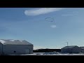
- Northeast Wisconsin Airborne Electromagnetic Survey 2021 - Arriving to Land
- Runtime
- 0:24
- Date posted
- 5 years ago
- Description
- Helicopter with geophysical equipment loop deployed below it via slingload arriving to land. In January 2021 a helicopter carried an airborne electromagnetic induction sensor over parts of northeastern Wisconsin as part of a USGS study to map the aquifers in the region. The data will be used to inform models of water availability and quality in the region that can be used by resource managers and policy makers. This video shows the equipment being deployed from a low-flying helicopter operated by specially trained pilots. In addition to the usual field safety procedures, USGS personnel are practicing COVID-19 safety measures including distancing and wearing face coverings during current field work. The project is a collaboration by the USGS Upper Midwest Water Science Center and Water Availability and Use Science Program with Wisconsin Department of Agricultural, Trade and Consumer Protection (DATCP); Wisconsin Department of Natural Resources (DNR); and Wisconsin Geological and Natural...

- Title
- February 4, 2022 — Kīlauea summit eruption observations
- Runtime
- 3:18
- Date posted
- 5 years ago
- Description
- A Kīlauea summit eruption monitoring shift on February 4, 2022, provided views of the eruption within Halema‘ma‘u crater. Lava flows from a pond north of the west vent into the lava lake, which exhibits areas of spattering. The audio is mostly wind noise, though some gas-jetting sounds from the west vent and spatter features on the surface of the east portion of the lava lake can also be heard. USGS video by K. Mulliken.
Video: https://www.usgs.gov/media/videos/february-4-2022-kilauea-summit-eruption-observations

- Title
- Landsat's 10 Millionth Scene (Image of the Week)
- Runtime
- 1:05
- Date posted
- 5 years ago
- Description
- Landsat 7 had the honor of acquiring the satellite program’s 10 millionth scene in November 2021.
The scene captures changes to the Dead Sea, located in Southwest Asia. The Dead Sea is mainly fed by the Jordan River, which enters from the north. However, the water level of the Dead Sea has been falling due to irrigation projects and water use upstream.
The Dead Sea has no outlet, so the only way water exits is by evaporation. When the water evaporates, it leaves behind dissolved minerals, making the water even saltier.
This series of images of the Dead Sea reveals one of Landsat’s biggest strengths—its nearly 50-year record of continuous data.
Landsats 8 and 9 together will acquire around 1,500 satellite scenes per day, a pace higher than at any other time in Landsat’s history.
Read more about the Dead Sea on the USGS Earthshots website.
All 10 million+ Landsat scenes are available for free download a...

- Title
- Recent activity at Kīlauea summit - February 1, 2022
- Runtime
- 1:11
- Date posted
- 5 years ago
- Description
- These video clips show recent activity at the lava lake in Halema‘uma‘u crater, at the summit of Kīlauea. Lava upwelling at the western vent flows into the lake, where bubbling is commonly present. In the eastern portion of the crater, a steep spatter cone has produced vigorous spattering and small lava flows. USGS video by M. Patrick.
Video: https://www.usgs.gov/media/videos/recent-activity-kilauea-summit-february-1-2022

- Title
- Monthly update of activity at Yellowstone Volcano for Jan 2022
- Runtime
- 6:04
- Date posted
- 5 years ago
- Description
- This monthly update from the Yellowstone Volcano Observatory begins with a story.
Many would enjoy the adventure of a bicycle expedition to Yellowstone National Park. But imagine doing this before pavement, lightweight cycles, and modern camping equipment. In 1896, the Buffalo Soldiers, who made up the volunteer Bicycle Corps of the 25th Infantry Regiment, were up to the challenge.
Stationed in Missoula, Montana, the Bicycle Corps began their expedition on August 15 to Yellowstone National Park and Fort Yellowstone, a journey of over 300 miles that took just over 8 days. After two days of rest and reprovisioning at Fort Yellowstone, the Corps set out on a tour of the Park on August 25, stopping at Lower Geyser Basin, Upper Geyser Basin (where they observed Old Faithful, Giantess, and Castle Geysers all erupting at the same time), West Thumb, and the Grand Canyon of the Yellowstone and its waterfalls, returning to Mammoth Hot Springs on August 29. After two day...

- Title
- What is Bathymetry?
- Runtime
- 4:18
- Date posted
- 5 years ago
- Description
- Bathymetry is the science of measuring the depth of water in ocean, river and lake environments. Learn how USGS measures bathymetry in this video by the St. Petersburg Coastal and Marine Science Center, originally created for the 2021 virtual St. Petersburg Science Festival.
View video and AD version at: https://www.usgs.gov/media/videos/what-bathymetry

- Title
- Secrets of the Sediment on Barrier Islands
- Runtime
- 7:30
- Date posted
- 5 years ago
- Description
- Join the USGS St. Petersburg Coastal and Marine Science Center as they uncover the secrets of the sediment on barrier islands in Pinellas County, Florida. This video was originally created for use at the 2021 virtual St. Petersburg Science Festival.
Video and AD version at https://www.usgs.gov/media/videos/secrets-sediment-barrier-islands





