USGS
A Year at Zion National Park #timelapse

- Title
- A Year at Zion National Park #timelapse
- Runtime
- 0:31
- Date posted
- 11 hours ago
- Description
- A year at Zion National Park, one frame at a time. 🏞️
This time-lapse captures the North Fork Virgin River with Zion’s iconic Watchman formation in the background, showing how the river and surrounding landscape change over the seasons.
USGS Hydrologic Imagery Visualization and Information System (HIVIS) cameras at this and other water monitoring sites across the country help the USGS remotely track current conditions, identify technical issues, verify remote measurements, and provide a visual record of conditions.
Want to see the latest view of the river? Check out the camera 👉 https://apps.usgs.gov/hivis/camera/UT_North_Fork_Virgin_River_near_Springdale
#NationalParkWeek
🔔 Subscribe to @usgs for more science content! 🔔
- Title
- Kīlauea (Hawaiʻi) Episode 54 lava fountaining summary (August 25, 2026) #kilauea #volcano #shorts
- Runtime
- 1:01
- Date posted
- 2 days ago
- Description
- Episode 54 of lava fountaining at Kīlauea (Hawaiʻi) is in the books! Here’s a recap of the activity:
▶️ The episode began at 10:30 a.m. HST on August 25 and ended at 7:33 p.m. HST, lasting over 9 hours.
▶️ Fountains occurred from the North Vent only.
▶️ Maximum fountain height was 500 feet (150 meters)
▶️ Eruptive plume rose to an altitude of 17,000 feet (5,200 meters).
▶️ Winds out of the northeast carried gas and fine ash/Peleʻs hair toward the southwest.
▶️ Lava flows covered about 30% of the Halemaʻumaʻu crater floor
▶️ Total erupted volume was 5.2 million cubic yards (4 million cubic meters), and the highest instantaneous effusion rate was 290 cubic yards (220 cubic meters) per second at about noon HST.
▶️ The abrupt switch from summit deflation to inflation at the end of episode 54 indicates that another lava fountaining episode is likely in the coming weeks.
Latest Kīlaue...
![[V2cam] Kīlauea volcano, Hawaii (east Halemaʻumaʻu crater)](https://i.ytimg.com/vi/f9-oSpYpubg/1_live.jpg)
- Title
- [V2cam] Kīlauea volcano, Hawaii (east Halemaʻumaʻu crater)
- Runtime
- 0:00
- Date posted
- 3 days ago
- Description
- Live view from Halemaʻumaʻu crater from the eastern rim of the caldera [V2cam]. This camera is a pan-tilt-zoom model and the view may change depending on activity. If your view of the livestream appears blurry, please try refreshing your browser.
Other livestream views of eruption:
[V1cam] Kīlauea volcano, Hawaii (west Halemaʻumaʻu crater): https://www.youtube.com/watch?v=HggWKlZv9yk
[V3cam] Kīlauea volcano, Hawaii (south Halemaʻumaʻu crater): https://www.youtube.com/watch?v=gXKuUyKt8mc
=====
Current Kīlauea Eruption FAQs (seen from the live stream): https://www.usgs.gov/observatories/hvo/frequently-asked-questions-about-kilaueas-summit-eruption?utm_source=kilauea-live&utm_medium=youtube&utm_campaign=nh-volcanoes-fy23
Videos: https://www.usgs.gov/volcanoes/kilauea/multimedia?utm_source=kilauea-live&utm_medium=youtube&utm_campaign=nh-volcanoes-fy23
Kīlauea FAQs: https://www.usgs.gov/volc...

- Title
- Kīlauea (Hawaiʻi) Episode 53 lava fountaining summary (August 12-13, 2026) #kilauea #volcano #shorts
- Runtime
- 1:08
- Date posted
- 15 days ago
- Description
- Episode 53 of lava fountaining at Kīlauea (Hawaiʻi) is in the books! Here’s a recap of the activity:
▶️ The episode began at 3:45 p.m. HST on August 12 and ended at 1:23 a.m. HST on August 13, lasting over 9.5 hours.
▶️ Fountains occurred from the North Vent only.
▶️ Precursory overflows and flames, occurred from the South Vent and West Vent (formerly called “the crack” or “the collapse pit”)
▶️ Maximum fountain height was 500 feet (150 meters)
▶️ Eruptive plume rose to an altitude of 18,000 feet (5,500 meters).
▶️ Low-level winds out of the northeast carried gas and fine ash/Peleʻs hair toward the southwest, while upper-level winds were more easterly and transported gas and fine tephra westward toward the summit of Mauna Loa.
▶️ Lava flows covered 40–50% of the Halemaʻumaʻu crater floor
▶️ Total erupted volume was 6 million cubic yards (4.6 million cubic meters), and the highest in...

- Title
- Volcano sampling ASMR #kilauea
- Runtime
- 1:00
- Date posted
- 24 days ago
- Description
- Join three USGS Hawaiian Volcano Observatory scientists as they embarked on a helicopter mission to the northwestern wall of Halema‘uma‘u at Kīlauea’s summit on July 2, 2026.
Their goal was to sample tephra deposits from the crater wall, which had been inaccessible before now. As lava flows have filled in Halemaʻumaʻu, the floor of the crater has risen but the deposits, records of past explosive eruptions in Kīlauea’s history, could be covered by lava flows in the future.
These samples were collected with permission from Hawai’i Volcanoes National Park and will help us better understand eruption behavior, magma storage, and volcanic hazards.
🎥 This behind-the-scenes glimpse highlighting the sampling mission in Halema’uma’u was filmed on July 2, 2026.
🔊 Turn up the sound and experience the mission through the rotor blades, footsteps, rock sampling, and volcanic landscape.
🔔 Subscribe to @usgs for...
- Title
- Is Yellowstone's north caldera rim rising? (Yellowstone Monthly Update - July 2026)
- Runtime
- 3:35
- Date posted
- 25 days ago
- Description
- Over the past few decades, an area on the north rim of Yellowstone Caldera has risen and fallen. Just last year a new period of uplift in this area began!
**Yellowstone Volcano Observatory monthly video update – August 1, 2026**
The Norris Uplift Anomaly is an area along the north rim of Yellowstone Caldera, just south of Norris Geyser Basin and in the vicinity of Gibbon Falls. In the late 1990s to early 2000s, it was found to be uplifting at a rate of a couple of inches per year. After that, it subsided slightly. Subsequent periods of minor uplift occurred in the mid 2010s and early 2020s. Most recently, a new period of uplift began suddenly in June/July 2025. The uplift was detected by continuous GPS stations, semipermanent GPS station (which are installed for a few months every summer to densify the ground deformation monitoring network), and satellite radar measurements.
In January 2026, the uplift stopped just as suddenly as it began....

- Title
- POV: You're a geology teacher teaching kids about minerals
- Runtime
- 0:51
- Date posted
- 25 days ago
- Description
- We’re here to make educators’ lives a little easier (and tastier). 🧁
As teachers head back to the classroom, the USGS has free resources for every grade level to help bring the earth sciences to life. From lesson plans, activities, and maps for elementary and high school students to coloring pages and word puzzles for younger learners, these activities will help students visualize complex processes and provide a memorable learning experience.
Who says learning science can’t be fun?
🔗Explore the lesson plans and activities: https://www.usgs.gov/educational-resources/middle-and-high-school-geology
🎥A person prepares cupcakes by following the steps from a USGS mineral lesson plan.
#TeacherResources #ScienceEducation #STEMactivities
====================
🔔 Subscribe to @usgs for more science content! 🔔

- Title
- Kīlauea (Hawaiʻi) Episode 52 lava fountaining summary July 28-29, 2026) #kilauea #volcano #shorts
- Runtime
- 1:05
- Date posted
- 28 days ago
- Description
- A lava fountain and a full moon - Kīlauea eruption episode 52 summary (July 28-29, 2026)
Episode 52 of lava fountaining began at 7:10 p.m. HST on July 28, 2026, after low dome fountains and lava flows from the north vent throughout most of that day. The episode ended after about 7.5 hours, with the lava fountain from the north vent reaching a maximum height of about 500 feet (150 meters) at around 9 p.m. An estimated 6.1 million cubic yards (4.7 million cubic meters) of lava erupted in total.
The eruption plume reached about 19,000 feet (5,800 meters) above sea level. Winds were out of the northeast for the most energetic of the eruption, causing the plume to move to the south. Most tephra fell in the closed area of Hawaiʻi Volcanoes National Park.
The USGS kept the Kīlauea alert level/aviation color code at WATCH/ORANGE throughout the episode because there were limited hazards associated with Episode 52. After the episode ended, USGS lowered K...

- Title
- Salt Lake City - Annual National Land Cover Database
- Runtime
- 0:17
- Date posted
- 1 month ago
- Description
- What can four decades of land cover data reveal? A changing landscape.
The latest release of the Annual National Land Cover Database (NLCD) extends annual mapping through 2025, providing a longer view of how landscapes across the United States have changed over time.
One example is the Great Salt Lake in Utah. In the mid-1980s, the lake’s water levels reached historic highs. Since then, water levels have fluctuated over the years but have declined overall.
Built from Landsat imagery, Annual NLCD maps land cover across the United States each year, helping researchers, government agencies, businesses, and communities better understand how landscapes are changing.
Learn more about the latest Annual NLCD release, including how to access and download the data: 👉https://ow.ly/CWM850ZqMSE
🎥: Animation showing Annual NLCD maps of the Great Salt Lake area in Utah (1985 to 2025). Darker blue represents open water, wh...

- Title
- Aerial tour of Mount St. Helens Crater #science #shorts #mountsthelens #helicopter
- Runtime
- 1:34
- Date posted
- 2 months ago
- Description
- Join us for an aerial tour of Mount St. Helens! We start by cruising up the west arm of Crater Glacier, viewing the lava dome that was erupted in 1980-1986 directly in front of us. As we pass that dome, looking at it on the left side of the frame, the overlapping and taller 2004-2008 lava dome comes into view. We circle around the back of the crater, with a view of the jagged crater walls and the glacial ice below. As the view swings around to the north and we look out over the lava domes, we can see that the 2004-2008 dome is still steaming in places! Beyond the crater we can see Spirit Lake (where logs from 1980 still float on the water), Johnston, Ridge, and Mount Rainier looming in the distance.
Video by Marco Bagnardi, USGS, June 24, 2026
====================
====================
🔔 Subscribe to @usgs for more science content! 🔔
📊 Watch @USGSPresentations for presentations.
🔨 Watch @USGSTraining...

- Title
- Another hydrothermal explosion at Biscuit Basin (Yellowstone Monthly Update - June 2026)
- Runtime
- 5:46
- Date posted
- 2 months ago
- Description
- On June 13, 2026, Yellowstone National Park’s newest geophysical monitoring sites captured a small hydrothermal explosion in Biscuit Basin! That story is the subject of this month’s video update.
*Yellowstone Volcano Observatory monthly video update – July 1, 2026*
On July 23, 2024, Biscuit Basin was the site of a significant hydrothermal explosion. Just before 10 am that day, an explosive event from Black Diamond Pool sent rocks flying, destroying a nearby boardwalk but fortunately not causing any injuries. The explosion was caused by pressure changes in the hot water plumbing system just beneath the surface, with hot water flashing to steam and driving the activity. To monitor the area, the Yellowstone Volcano Observatory installed several new sensors after the explosion. On June 13, 2026, that monitoring equipment detected significant seismic and acoustic energy, with video observations catching a jet of steam coming from new features that opened s...

- Title
- Small hydrothermal explosion in Yellowstone on June 13, 2026 #yellowstone #science #shorts
- Runtime
- 1:23
- Date posted
- 2 months ago
- Description
- At 5:09 a.m. MDT on June 13, 2026, a small hydrothermal explosion occurred at Biscuit Basin in Yellowstone National Park, in a location just north of Black Diamond Pool (that pool was the site of a larger hydrothermal explosion on July 23, 2024). The activity was recorded by a camera and other monitoring equipment and resulted in major changes to the landscape, including a 18.5-meter (61--foot) fissure full of boiling water. Rocks were thrown a short distance from the vents.
About 2 or 3 days later, a circular collapse feature with a pool of near-boiling water formed in the area of the explosion. That pool was observed to spout water to heights of 6-9 meters (20-30 feet) intermittently on June 18.
🎥: Video showcasing the June 13, 2026, hydrothermal explosion at Biscuit Basin and its consequences.
Following the explosion, Yellowstone Volcano Observatory scientists deployed new monitoring equipment in the basin to track the evolving nature of the...

- Title
- Top visitor questions about Yellowstone's thermal areas (Yellowstone Monthly Update - June 2026)
- Runtime
- 4:13
- Date posted
- 3 months ago
- Description
- Summer is here, and millions of people will be visiting Yellowstone National Park. People with questions. What is this scat I’m seeing? How does a geyser erupt? What makes Yellowstone so special?
Where’s the bathroom?
We asked Yellowstone interpretive rangers to tell us the most common questions they are asked every summer. Those questions and their answers are part of this month's video update!
**Yellowstone Volcano Observatory monthly video update – June 1, 2026**
Some of the most common questions are about the temperature of the water. Geysers are all boiling, but the temperature of hot springs can vary from lukewarm to almost boiling. Mammoth Hot Springs has no boiling water because the water takes a very long journey from the heat source beneath the caldera. So there are no geysers in Mammoth Hot Springs because there's no boiling water.
Acidity also varies by thermal area. Mud Volcano is more acidic than fe...

- Title
- Planetary Defense
- Runtime
- 2:55
- Date posted
- 4 months ago
- Description
- May the 4th Be with You!
It's not just science fiction, Planetary Defense at USGS is an active body of research, and protecting life and property is a core part of our mission at the Department of the Interior.
USGS Astrogeology has been researching hazards from space since the 1960s, and although we're not battling Star Destroyers, we'll do our best to inform you of rocky space invaders!
🎥: USGS Physical Scientist Dr. Lori Pigue explains past asteroid impacts and how the USGS is working to better understand potential hazards.
#PlanetaryDefense #StarWarsDay #PlanetaryDefenders
====================
🔔 Subscribe to @usgs for more science content! 🔔

- Title
- Roaring Mountain (Yellowstone Monthly Update - May 2026)
- Runtime
- 3:48
- Date posted
- 4 months ago
- Description
- Did you hear that??? Well, Roaring Mountain isn’t quite as loud as it used to be, but it’s still one of the hottest thermal areas in all of Yellowstone National Park!
**Yellowstone Volcano Observatory monthly video update – May 1, 2026**
Roaring Mountain is located along the highway between Mammoth Hot Springs and Norris Geyser Basin. In the late 1800s, the sounds of gas escaping could be heard for miles, but that diminished by the beginning of the 1900s. Then, in 1902, there was a thermal event that brought the sound back once again! Heat emissions increased, and trees died off over a broad part of the thermal region.
Now, Roaring Mountain sort of hisses away, but that sound can be clearly heard when traffic and winds are light.
In addition to being the site of present-day thermal activity, the area near Roaring Mountain hosts a few hydrothermal explosion craters, including Semi-Centennial—a feature that erupted explosi...
![[V1cam] Kīlauea volcano, Hawaii (west Halemaʻumaʻu crater)](https://i.ytimg.com/vi/HggWKlZv9yk/3_live.jpg)
- Title
- [V1cam] Kīlauea volcano, Hawaii (west Halemaʻumaʻu crater)
- Runtime
- 0:00
- Date posted
- 4 months ago
- Description
- Live view of the eruption in Halemaʻumaʻu, from the northwest rim of the caldera [V1cam]. This camera is a pan-tilt-zoom model and the view may change depending on activity. The V1cam is an autofocusing pan-tilt-zoom model. The camera automatically focuses its view, and USGS Hawaiian Volcano Observatory staff may change the view angle or zoom amount depending on eruptive activity. If your view of the livestream appears blurry, please try refreshing your browser.
Other livestream views of eruption:
[V2cam] Kīlauea volcano, Hawaii (east Halemaʻumaʻu crater): https://www.youtube.com/watch?v=f9-oSpYpubg
[V3cam] Kīlauea volcano, Hawaii (south Halemaʻumaʻu crater): hhttps://www.youtube.com/watch?v=gXKuUyKt8mc
=====
Current Kīlauea Eruption FAQs (seen from the live stream): https://www.usgs.gov/observatories/hvo/frequently-asked-questions-about-kilaueas-summit-eruption?utm_source=kilauea-live&utm_medium=youtube&utm_camp...

- Title
- Lone Star Geyser (Yellowstone Monthly Update - April 2026)
- Runtime
- 3:12
- Date posted
- 5 months ago
- Description
- What do Yellowstone National Park and your father's brother's nephew's cousin's former roommate have in common? LONE STAR!!!!!
**Yellowstone Volcano Observatory monthly video update – April 1, 2026**
Lone Star is not just an iconic movie hero of the 1980s (and also next year!). It’s an iconic Yellowstone geyser as well!
Lone Star Geyser is a classic cone-type geyser. The cone is made of silica sinter. Silica is dissolved in the hot water that moves beneath the surface, and as the water rises and erupts the sinter is deposited to form a cone. Lone Star erupts about every three hours on average—a pattern that has been consistent since at least the 1880s. That’s more consistent than Old Faithful!
Lone Star Geyser eruptions start with minor activity before sending a plume of water and steam up nearly 50 feet for as long as tens of minutes. A steam phase follows—that’s what you're seeing in this video.
So if ...

- Title
- Avalanche forecasting - Glacier National Park
- Runtime
- 2:27
- Date posted
- 6 months ago
- Description
- Each year, reopening Going-to-the-Sun Road in Glacier National Park depends on daily avalanche forecasting and a decades-long partnership between the U.S. Geological Survey and the @NationalParkService.
The 50-mile engineering marvel crosses the Continental Divide, connecting the east and west sides of the park.
Since 2003, USGS avalanche scientists have worked side-by-side with the NPS to deliver daily avalanche forecasts that guide “go/no-go” decisions for crews clearing snow and avalanche debris from the road.
Spring conditions in Glacier can change quickly, with sudden snowstorms and avalanches threatening crew safety and slowing progress.
This USGS–NPS partnership ensures road crews have the information they need to work safely and efficiently, saving time and resources while helping the park prepare for the busy season ahead.
The Going-to-the-Sun Road typically opens in late June or early July each year. Visit...
- Title
- The New Norris Hot Spring (Yellowstone Monthly Update - March 2026)
- Runtime
- 5:03
- Date posted
- 6 months ago
- Description
- YVO Monthly Video Update
March 2, 2026
KABOOM! That’s what Yellowstone is famous for – huge explosive volcanic eruptions. There’s really nothing brewing right now, the magma chamber is mostly solid, but there have been quite a few hydrothermal eruptions and small explosions in both Biscuit Basin and Norris Geyser Basin as water in the hydrothermal system flashes to steam.
A curious new blue water pool formed in Norris Geyser Basin in late 2024 to early 2025 via a series of small explosions that threw out rock and excavated a small crater. This sort of activity is nothing new, as thermal features are commonly activating and going quiet across Yellowstone National Park. But it’s a great reminder about how dynamic the system is, and also how important it is to have monitoring instruments in place.
During the month of February 2026, the University of Utah Seismograph Stations, which monitors and operates the Yellowstone seismic...
- Title
- Measuring Moving Mountains (Yellowstone monthly update - February 2026)
- Runtime
- 3:59
- Date posted
- 7 months ago
- Description
- Meet a friend of ours. This friend has been monitoring changes of the ground surface in Yellowstone for decades and is so good that it can detect movement of just a few millimeters in magnitude (just a fraction of an inch). The friend? A continuous GPS station!
There are dozens of continuous GPS stations throughout the Yellowstone region, and they show us that the ground in Yellowstone is always changing, sometimes going up and sometimes going down, typically at a rate of about an inch (about 2-3 centimeters) per year. Since 2015, the caldera has been going down by about an inch or so per year. Prior to that, for a few years the ground was going up. For a few years before that, the ground was going down. It’s almost like Yellowstone is breathing. If you're interested in seeing data from the continuous GPS sites, check out the monitoring map on the Yellowstone Volcano Observatory website.
During the month of January 2026, the University of Utah Seismograph St...
- Title
- Top 5 Yellowstone geologic stories of 2025 (Yellowstone monthly update - January 2026)
- Runtime
- 5:49
- Date posted
- 8 months ago
- Description
- Happy New Year! Let's go back and take a look at the top five geologic stories for Yellowstone in 2025.
5️⃣ RUMORS: No, animals are not fleeing Yellowstone National Park!
4️⃣ HYDROTHERMAL ACTIVITY: Yellowstone was its usual dynamic self, with several new thermal features forming.
3️⃣ EARTHQUAKES AND DEFORMATION: Earthquake activity was on the low side of average for the year, but some interesting deformation began occurring in 2025!
2️⃣ STEAMBOAT GEYSER: Just three eruptions, as the tallest geyser in the world slowly goes back to sleep.
1️⃣BLACK DIAMOND POOL: Sporadic eruptions throughout the year captured by new monitoring equipment!
Watch the video to learn more.
🌋 Read Caldera Chronicles 🌋 https://www.usgs.gov/volcanoes/yellowstone/caldera-chronicles
🌋 Visit the Yellowstone Volcano Observatory website 🌋 https://www.usgs.gov/observatories/yvo
...
![[V3cam] Kīlauea volcano, Hawaii (south Halemaʻumaʻu crater)](https://i.ytimg.com/vi/gXKuUyKt8mc/1_live.jpg)
- Title
- [V3cam] Kīlauea volcano, Hawaii (south Halemaʻumaʻu crater)
- Runtime
- 0:00
- Date posted
- 8 months ago
- Description
- Live view from Halemaʻumaʻu crater from the southern rim of the caldera [V3cam]. This camera replaces the view of the original V3 livestreaming camera that was destroyed by lava fountaining during episode 38 on December 6, 2025; the view is permanently offset to the east of the original V3 view. This camera is a pan-tilt-zoom model and the view may change depending on activity. If your view of the livestream appears blurry, please try refreshing your browser.
Other livestream views of eruption:
[V1cam] Kīlauea volcano, Hawaii (west Halemaʻumaʻu crater): https://www.youtube.com/watch?v=HggWKlZv9yk
[V2cam] Kīlauea volcano, Hawaii (east Halemaʻumaʻu crater): https://www.youtube.com/watch?v=f9-oSpYpubg
=====
❓ FAQs about Kīlauea eruptions: ❓
https://www.usgs.gov/observatories/hvo/frequently-asked-questions-and-answers-hawaiian-volcanoes-and-hazards?utm_source=youtube&utm_medium=usgs-main&utm_campaign=nh-volcanoes-...

- Title
- Lava fountain engulfs USGS HVO V3cam - December 6, 2025
- Runtime
- 2:01
- Date posted
- 9 months ago
- Description
- In case you ever wondered what it would be liked to be engulfed in a lava fountain...
This video was recorded by the V3 camera, located on the south rim of Halema‘uma‘u crater at the summit of Kīlauea volcano on the Island of Hawai‘i. The camera, located in a hazardous closed area of Hawai‘i Volcanoes National Park, was buried by tephra from an inclined lava fountain between 9:55 and 9:57 am HST on December 6, during episode 38 of the Kīlauea summit eruption that began on December 23, 2024.
====================
====================
🔔 Subscribe to @usgs for more science content! 🔔

- Title
- Kīlauea lava fountaining episode 38 - December 6, 2025
- Runtime
- 1:10
- Date posted
- 9 months ago
- Description
- Views of Kīlauea summit eruption lava fountaining episode 38 in Halema‘uma‘u crater on the Island of Hawai‘i. Episode 38 of the Kīlauea summit eruption lasted for just over 12 hours on December 6, 2025, in Hawai‘i Volcanoes National Park. The eruption was monitored by the USGS Hawaiian Volcano Observatory.
📋✏️Summary of episode 38:
- Lava fountains from the south vent reached over 1,000 feet (300 meters) high
- Both vents (north and south) in Halema‘uma‘u crater erupted, but the south vent erupted higher fountains and for longer
- Lava flows were contained to Halema‘uma‘u crater in the summit caldera of Kīlauea caldera
- Fallout from the lava fountain covered one of the three USGS livestream cameras that monitor this area (the camera was located in a hazardous area closed to the public)
- Ashfall was reported in Pāhala, a community about 20 miles (32 km) downwind
- Eruptive plume reached more than 20,00...

- Title
- Eyes on Earth Episode 137 – Landsat Takes Yellowstone’s Temperature
- Runtime
- 26:10
- Date posted
- 9 months ago
- Description
- The Yellowstone National Park area has more than 10,000 thermal features. And while Old Faithful is a pretty predictable geyser, some thermal features can change quite a bit. New ones can even pop up! Remote sensing provides a tool for monitoring them—especially the thermal infrared sensors (TIRS) on Landsat 8 and Landsat 9 satellites.
In this episode of Eyes on Earth, R. Greg Vaughan, the remote sensing lead for the Yellowstone Volcano Observatory, describes what causes the thermal features and how he uses Landsat and other remote sensing data to track their locations and estimate their temperatures. Then Terry Sohl, the Integrated Science and Applications Branch chief at USGS EROS, describes a couple of other important uses of Landsat thermal data.

- Title
- Hawaii versus Yellowstone (Yellowstone monthly update - December 2025)
- Runtime
- 4:25
- Date posted
- 9 months ago
- Description
- Just last week, Kīlauea put on another dramatic display of lava fountaining and flows within the caldera, during its 37th episode of this most recent eruption. It doesn't seem like Hawaii and Yellowstone have a lot in common, but actually, those two magmatic systems have a common cause.
They are both hotspots. A hotspot is an area of anomalous melting that's tens of miles deep. It's fed by a plume of hot material that originates deep within the earth.
Watch the video to learn more.
🌋 Read Caldera Chronicles 🌋 https://www.usgs.gov/volcanoes/yellowstone/caldera-chronicles
🌋 Visit the Yellowstone Volcano Observatory website 🌋 https://www.usgs.gov/observatories/yvo
====================
====================
🔔 Subscribe to @usgs for more science content! 🔔

- Title
- Emergency Fix at a Yellowstone Monitoring Site (Yellowstone Monthly Update - October 2025)
- Runtime
- 4:28
- Date posted
- 11 months ago
- Description
- The White Lake GPS station is in a remote area of the park. It is on the Sour Creek resurgent dome within Yellowstone Caldera. This is a raised area of the caldera floor that formed shortly after the last massive explosive eruption, when the ground was pushed upward by magma accumulating beneath the surface. Since 2015, the dome has been subsiding (sinking).
During the summer of 2024, the White Lake station went offline. The larger network of dozens of GPS stations in the region, including others on the Sour Creek dome, continued to collect data, but repairing the White Lake station was important as it has a very long history and is located near the core of the dome.
Watch the video to learn more.
🌋 Read Caldera Chronicles 🌋 https://usgs.gov/volcanoes/yellowston...
🌋 Visit the Yellowstone Volcano Observatory website 🌋 https://www.usgs.gov/volcanoes/yellow...
====================
====================

- Title
- M8.8 Kamchatka Peninsula Earthquake Animation
- Runtime
- 0:30
- Date posted
- 11 months ago
- Description
- On July 29, a magnitude 8.8 earthquake struck off Russia’s Kamchatka Peninsula, tying for the sixth-largest earthquake ever recorded by modern seismic instruments.
This visualization shows the model we created of the earthquake’s rupture, illustrating how the ground moved and how far the shaking spread across the region.
Studying events like this helps scientists better understand past earthquakes and prepare scenarios for potential future ones.
📹: Shakemovie animation showing seismic waves emanating from the magnitude 8.8 Kamchatka Peninsula earthquake.
====================
🔔 Subscribe to @usgs for more science content! 🔔

- Title
- Unique Phenomenon at Kīlauea Volcano
- Runtime
- 0:31
- Date posted
- 12 months ago
- Description
- "Volnado", "Lavanado", or "Lava whirlwind"? Call it what you will...it’s cool and fire! 💨🔥
They may not be scientific terms, but they are fun to say.
On September 2, one of USGS' Kīlauea live cams captured a whirlwind whipping up loose ash and spatter along the active fountain and lava flow within Halemaʻumaʻu crater.
These whirlwinds have been observed during several eruptive episodes and are caused by the chaotic mixing of hot and cold air.
🎥 Keep an eye on all three Kilauea livestream cameras and you may catch the next "volnado."
[V1cam] Kīlauea volcano, Hawaii (west Halemaʻumaʻu crater): https://www.youtube.com/watch?v=tk0tfYDxrUA
[V2cam] Kīlauea volcano, Hawaii (east Halemaʻumaʻu crater): https://www.youtube.com/watch?v=fiyttmA7YkA
[V3cam] Kīlauea volcano, Hawaii (south Halemaʻumaʻu crater): https://www.youtube.com/watch?v=BqmpkUdMtyA

- Title
- Lava flows in Yellowstone (Yellowstone Monthly Update - September 2025)
- Runtime
- 4:09
- Date posted
- 12 months ago
- Description
- Picture a Yellowstone eruption. What comes to mind? It’s a huge explosion, right? Like the one that formed the caldera about 631,000 years ago. But the most common form of eruption in Yellowstone isn’t a huge explosion, it’s a lava flow.
Watch the video to learn more.
🌋 Read Caldera Chronicles 🌋 https://usgs.gov/volcanoes/yellowstone/caldera-chronicles?utm_source=youtube&utm_medium=usgs-main&utm_campaign=nh-volcanoes-fy25
🌋 Visit the Yellowstone Volcano Observatory website 🌋 https://www.usgs.gov/volcanoes/yellowstone?utm_source=youtube&utm_medium=usgs-main&utm_campaign=nh-volcanoes-fy25
====================
====================
🔔 Subscribe to @usgs for more science content! 🔔
- Title
- Mine Waste
- Runtime
- 1:03
- Date posted
- 1 year ago
- Description
- 💰Gold in the trash? Not quite. But we are rethinking mine waste as a resource.
Across the U.S., legacy mining sites have left behind open pits, shafts, and extensive tailings piles. Historically considered waste, these materials might contain critical minerals and other minerals.
These minerals are essential to modern technologies—powering everything from smartphones and electric vehicles to medical devices and defense systems. Many occur alongside commodities like gold, zinc, and coal.
USGS scientists are using advanced geochemical and geophysical methods to characterize mine waste and assess its potential as a secondary source of critical minerals.
It’s part of a broader effort to reduce reliance on imported materials and support a more secure, domestic mineral supply chain.
Learn more: https://ow.ly/lUPN50WuLNx
📹Video Description: The video shows historical and modern mining scenes, with aerial v...

- Title
- 5 Largest Earthquakes
- Runtime
- 1:35
- Date posted
- 1 year ago
- Description
- Earthquakes can be devastating and strike all over the world. In the last 120+ years, many have been extremely large. These are the 5 biggest quakes ever recorded (or at least as recorded since 1900).
5️⃣ MAGNITUDE 9.0, Russia, 1952 – The was the world's first recorded magnitude 9 earthquake. It triggered a large tsunami that struck Hawaii causing over $1 million in damages.
4️⃣ MAGNITUDE 9.1, Japan, 2011 – This earthquake sent a devastating tsunami along coastal Japan, triggered the Fukushima nuclear disaster, and led to more than $220 billion in damage.
3️⃣ MAGNITUDE 9.1, Sumatra, 2004 – Amazingly, this earthquake shook for at least 5 minutes and produced a massive tsunami that killed more than 280,000 people, while displacing 1.1 million more.
2️⃣ MAGNITUDE 9.2, Alaska, 1964 – Known as the Great Alaska Quake, this earthquake was largest in US history and spurred new insights and better understanding of subdu...

- Title
- A Year Since the Biscuit Basin Hydrothermal Explosion (Yellowstone Monthly Update - August 2025)
- Runtime
- 5:18
- Date posted
- 1 year ago
- Description
- Just over one year ago, early morning visitors to Yellowstone’s Black Diamond Pool suddenly found themselves filming a spectacular event. The July 23, 2024 hydrothermal explosion threw material hundreds of feet high, including rocks that were a foot or more across. Fortunately, most of the rocks were directed away from the visitors on the boardwalk and no one was injured. But the boardwalk was heavily damaged, and the area remains closed.
Watch the video to learn more.
🌋 Read Caldera Chronicles 🌋 https://usgs.gov/volcanoes/yellowstone/caldera-chronicles?utm_source=youtube&utm_medium=usgs-main&utm_campaign=nh-volcanoes-fy25
🌋 Visit the Yellowstone Volcano Observatory website 🌋 https://www.usgs.gov/volcanoes/yellowstone?utm_source=youtube&utm_medium=usgs-main&utm_campaign=nh-volcanoes-fy25
====================
====================
🔔 Subscribe to @usgs for more science content! 🔔

- Title
- Critical Minerals - Fireworks
- Runtime
- 1:17
- Date posted
- 1 year ago
- Description
- Boom! 💥 Critical minerals power your phone, satellites in space—and yes, even the fireworks on the 4th.
Strontium makes red. Barium brings the green. Copper gives you blue. Those dazzling 4th of July displays? They’re chemistry in the sky.
But these minerals aren’t just for celebration. They’re essential to our economy and national security, and they aren't always easy to get.
That’s why USGS leads the science behind the U.S. List of Critical Minerals.
@USInterior
====================
🔔 Subscribe to @usgs for more science content! 🔔

- Title
- Grand Prismatic Spring: Boiling, colorful & full of bacteria (Yellowstone Monthly Update, July 2025)
- Runtime
- 4:43
- Date posted
- 1 year ago
- Description
- Grand Prismatic Spring is the largest hot spring in the US, and one of the largest in the world. The boiling lake was named for the spectacular array of colors along its rim. This month's Yellowstone Volcano Observatory update talks about what creates the colors, along with earthquakes, ground deformation, and hydrothermal activity that occurred in the area of Yellowstone National Park during June 2025.
Watch the full video to learn more!
Yellowstone Volcano remains at normal, background levels of activity.
For questions, email yvowebteam@usgs.gov
🌋Read Caldera Chronicles 🌋https://ow.ly/p1qu50VLFm6
🌋 Visit the Yellowstone Volcano Observatory website 🌋
https://ow.ly/BjN950VLFm5
#YVO #Yellowstone #YellowstoneVolcanoObseratory
====================
🔔 Subscribe to @usgs for more science content! 🔔

- Title
- GeoKids: Dorien
- Runtime
- 2:52
- Date posted
- 1 year ago
- Description
- In this episode, meet Dorien Gilchrist and his mom, Donya. Donya is a research oceanographer at the St. Petersburg Coastal and Marine Science Center in Florida. Donya speaks about her work building computer simulations of how beaches and coastlines change during calm days and under storm conditions. In this series, we feature kids who have special ties to USGS employees: a parent, relative, mentor, or friend, and see science through their eyes. Each episode features one USGS employee, their work, and what a kid thinks about what they do.
Learn more about what the St. Petersburg Coastal and Marine Science Center does here: https://www.usgs.gov/st-petersburg-coastal-and-marine-science-center
====================
🔔 Subscribe to @usgs for more science content! 🔔

- Title
- Record-Breaking Flooding in Australia (Image of the Week)
- Runtime
- 2:12
- Date posted
- 1 year ago
- Description
- In May 2025, record rainfall in Australia's New South Wales created major flooding along the coast. In Taree, a mid-North Coast city, the Manning River reached a height of 6.4m on May 21st. The previous record of six meters was set back in 1929. The torrential rains have left almost 800 properties and counting uninhabitable in New South Wales.
South Australia was hit in late March through early April 2025. Extensive rainfall in Queensland in March sent floodwaters down the Kinipapa (or Cooper Creek) into the South’s outback township of Innamincka. Landsat images show the area before and during the flooding. Pasturelands, settlements, and protected national areas became inundated with floodwater, prompting massive road and park closures. The water levels peaked around 14.5m, a little over 47ft, near the Innamincka Causeway, surpassing the previous flood record set in 1974.
Thanks to Landsat’s decades long satellite archive, scientists and emergency managers...

- Title
- Topographic Map of Mercury
- Runtime
- 0:30
- Date posted
- 1 year ago
- Description
- USGS maps don’t stop at Earth. We’ve charted Mercury, volcanoes and all! 🌋🪐
In 2016, USGS collaborated with NASA, Arizona State University, Carnegie Institution for Science, and the Johns Hopkins University Applied Physics Laboratory to produce the first high-resolution topographic map of Mercury. The map captures the planet’s craters, volcanoes, and tectonic features in remarkable detail.
To make this possible, USGS scientists developed advanced software and innovative techniques to process massive amounts of spacecraft imagery. Using more than 100,000 images from NASA’s MESSENGER mission, they identified Mercury’s landforms and precisely aligned the images to create a seamless digital map of the entire planet.
By mapping planetary landscapes, we learn more about planetary evolution, tectonics, and even Earth’s own geologic past.
Download the full map and legend 👉https://ow.ly/fZbM50W8B63
📹 This a...

- Title
- Eyes on Earth Episode 136 – The EROS Test Site
- Runtime
- 27:38
- Date posted
- 1 year ago
- Description
- Landsat has been accurate and reliable for over 50 years because of the diligent calibration and validation work done by the team at EROS. One of the ways the team validates what they have so carefully calibrated is to take measurements on the ground while Landsat passes by overhead. For this Eyes on Earth podcast episode, we go out to the EROS test site during a Landsat pass to get a sense of what that work is like. Learn about the instruments used for this work and why it’s important to keeping Landsat as the gold standard for Earth observations.

- Title
- World Ocean Day
- Runtime
- 0:44
- Date posted
- 1 year ago
- Description
- 🌊 Happy #WorldOceanDay!
USGS science doesn’t stop at the shoreline. From coastal hazards to deep-sea mysteries, our work helps reveal the interconnected systems shaping Earth’s oceans.
Dive into our ocean science: https://ow.ly/AgAZ50ScmON
📹 Description: An animation shows the Earth from space, with much of its surface covered by the ocean, followed by aerial footage of coastlines threatened by flooding and coastal erosion. Footage shows USGS scientists at work in coastal and marine settings, mapping and studying nearshore environments, coastal erosion, offshore seismic hazards, coral reefs, seabed minerals, and more.
====================
🔔 Subscribe to @usgs for more science content! 🔔
- Title
- 2024 DOI Remote Sensing Activities Report
- Runtime
- 1:31
- Date posted
- 1 year ago
- Description
- How do we track wildfires, find illegal mining sites, or count nesting birds on tiny islands? 🔥🔨🦅
Remote sensing has the answers.
Across the @USInterior, scientists are using satellites, drones, and other tech to monitor the planet and tackle big questions about land use, natural hazards, and more.
The new 2024 DOI Remote Sensing Activities Report highlights many of these innovative efforts.
Explore how science from above is shaping decisions on the ground 👉https://ow.ly/2yNt50W5bSy
📹 Description: Video opens with an animation showing a satellite in space above earth and an uncrewed aircraft, or drone, launching from a wetland, piloted by scientists. Following scenes show examples of how DOI scientists use remote sensing in their work, including: using satellites to monitor coastal storm impacts and shifting habitat conditions, map wildfires and vegetation phenology; using drones to create 3D models ...

- Title
- Yellowstone's Magma Chamber - A Hot Mess! (Yellowstone Monthly Update - June 2025)
- Runtime
- 3:41
- Date posted
- 1 year ago
- Description
- There’s a lot of hot water in Yellowstone. What’s it heated by? The magma chamber beneath the surface, of course! This month's Yellowstone Volcano Observatory update discusses what we know about that magma system and how we know it, while also covering earthquakes, ground deformation, and hydrothermal activity (including a small eruption at Black Diamond Pool on May 31!) that occurred in the area of Yellowstone National Park during May 2025.
Watch the full video to learn more!
Yellowstone Volcano remains at normal, background levels of activity.
For questions, email yvowebteam@usgs.gov
🌋 Read Caldera Chronicles 🌋 https://ow.ly/p1qu50VLFm6
🌋 Visit the Yellowstone Volcano Observatory website 🌋https://ow.ly/BjN950VLFm5
#YVO #Yellowstone #YellowstoneVolcanoObseratory
====================
🔔 Subscribe to @usgs for more science content! 🔔

- Title
- Eyes on Earth Episode 135 – Exotic Annual Grasses and Sheep Grazing
- Runtime
- 30:40
- Date posted
- 1 year ago
- Description
- Exotic annual grasses, or EAGs, are invasive species. They outcompete native grasses. They are extremely flammable. And they are expanding into higher elevations. Targeted sheep grazing is one way to combat these invasive grasses, manage fire risk, and help restore native sagebrush in western states.
The EROS team releases weekly EAG maps during the peak green-up in late April to early June, along with annual phenology maps to show the seasonal timing of the green-up. Dr. Kelly Hopping at Boise State University is using these maps to see whether targeted sheep grazing can help manage EAGs. The maps help researchers work with sheep producers to know when is the best time to move the sheep into those areas so their grazing can do the most good. The sheep then, as a part of the team solving the problem of invasive grasses, get to eat in the field when they might not otherwise have grazing available. Learn more in this episode of Eyes on Earth.

- Title
- 4 Ways Wildfires Change Landscapes
- Runtime
- 0:57
- Date posted
- 1 year ago
- Description
- 🔥 Wildfires do more than burn trees—they change entire landscapes!
Here's how:
🧪Streams become polluted. USGS tests water for contamination, informing water treatment plants so they can adjust filtration.
💧Burned soil becomes water-repellent. USGS maps burn scars to predict where postfire flooding & debris flows will happen.
🪨Slopes become unstable. USGS maps landslide-prone areas and works with the National Weather Service to issue early warning alerts for communities.
🪴Invasive plants can grow. USGS studies how different environments recover & provides guidance on reforestation efforts.
Now that you know how wildfire changes landscapes, visit this link to learn more about what USGS is doing about it 👉https://ow.ly/UnoE50VV8zi
#WildfireAwarenessMonth #WildlandFireScience #wildfire #FiredUpForScience #flooding #invasives #landslides #pollution
============...

- Title
- 45th anniversary of the 1980 eruption of Mount St. Helens
- Runtime
- 0:13
- Date posted
- 1 year ago
- Description
- 🌋Today marks the 45th anniversary of one of the most dramatic geologic events in American history - the May 18, 1980 eruption of Mount St. Helens.
After lying dormant for over a century, signs of unrest for the eruption begin in March of that year when a swarm of earthquakes shook inside the mountain. With each tremor a new pathway was opened for the magma and volcanic gases to rise upwards.
As the weeks passed, pressure built within the volcano causing the north flank to bulge ominously.
Then, on the morning of May 18, the slope gave way in a massive landslide—followed instantly by a devastating lateral blast.
Traveling at over 650 mph, the eruptive blast flattened 230 square miles of pristine Pacific Northwest wilderness. Volcanic mudflows, known as lahars, surged through valleys, carrying debris all the way to the Columbia River. Ash from the eruption rose high into the atmosphere and drifted east, eventually reaching as far a...

- Title
- Great Lakes Shipping Season Begins (Image of the Week)
- Runtime
- 1:12
- Date posted
- 1 year ago
- Description
- The St. Marys River between Michigan and Ontario is typically frozen January through March. The US Army Corp of Engineers performs maintenance on regulated access channels (the Soo Locks) during the coldest months.
The Soo Locks enable ships to travel between Lake Superior and the lower Great Lakes. The 2025 shipping season opened March 21st with the help of US Coast Guard ice-breaking ships. Landsat imagery captures the freeze-thaw cycle of the river and access for ships.
Shipping routes across Lake Superior are critical for the transportation of goods and resources.
Landsat imagery is available at no cost to scientists and communities around the world.
⬇️ USGS Video ⬇️
https://www.usgs.gov/media/videos/great-lakes-shipping-season-begins-image-week?utm_source=youtube&utm_medium=usgs&utm_campaign=css-landsat-fy25
🔔 Subscribe to @usgs for more science content! 🔔
📊 Watch @USGSPresentatio...
- Title
- Finding Lava Flows in Yellowstone (Yellowstone Monthly Update - May 2025)
- Runtime
- 3:14
- Date posted
- 1 year ago
- Description
- If you want to find a lava flow in Yellowstone, look to the trees! The vegetation is telling us more than you might think...
YVO Scientist-in-Charge Mike Poland reveals how vegetation can be used to map geology in this month's update from the Yellowstone Volcano Observatory.
During the month of April 2025, the University of Utah Seismograph Stations, which monitors and operates the Yellowstone seismic network, located 46 earthquakes; the largest was a magnitude 1.8. Deformation trends (subsidence) continue without significant changes. Steamboat Geyser erupted on April 14 -- its second major water eruption of 2025.
Watch the full video to learn more!
Yellowstone Volcano remains at normal, background levels of activity.
For questions, email yvowebteam@usgs.gov
🌋 Read Caldera Chronicles 🌋
https://ow.ly/p1qu50VLFm6
🌋 Visit the Yellowstone Volcano Observatory website 🌋https://ow.ly/B...
- Title
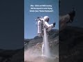
- Rocket Man
- Runtime
- 0:26
- Date posted
- 1 year ago
- Description
- From Apollo to Artemis: USGS Supports NASA’s Return to the Moon 🌍🌕✨
This #NationalSpaceDay, we’re proud to celebrate our ongoing partnership with @NASA preparing astronauts for a new era of lunar exploration through the Artemis program. This "rocket backpack" was one of the bold ideas being tested in 1966 by USGS and NASA for personal propulsion to expand astronaut mobility.
At the USGS Astrogeology Science Center in Flagstaff, Arizona, our scientists are working closely with NASA to train astronauts, test equipment, and refine field science techniques for use on the Moon, and maybe even someday Mars! By using terrestrial analog sites, Earth locations with geology similar to the lunar surface, astronauts gain valuable experience in field observation, sampling, and mapping. These exercises also provide critical opportunities to test mission tools (maybe not rocket backpacks anymore) and exploration strategies, ensuring the missions are safe, ef...
- Title
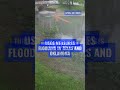
- Flooding in Oklahoma and Texas
- Runtime
- 0:15
- Date posted
- 1 year ago
- Description
- RISING WATERS ALERT: Our silent guardians are on watch!
While you were sleeping, USGS streamgages captured dramatic floodwaters surging across Oklahoma and Texas. This video from Turtle Creek in Dallas shows water levels rising more than 6 feet in just 2 hours!
These 24/7 sentinels don't just collect data—they're the backbone of flood warnings that save lives. Emergency managers rely on this real-time information to make critical decisions about evacuations, bridge closures and keeping communities safe.
For over a century, USGS streamgages have stood watch through America's most devastating floods. Today, they continue their vigilant service as floodwaters threaten the region. When floodwaters rise, USGS measurements inform decisions that can save lives.
#FloodManagement #WaterRising #WaterScience
📹: Time-lapse video showing Turtle Creek in Dallas transforming from normal water levels to flood conditions as water ris...

- Title
- Seafloor Minerals
- Runtime
- 1:10
- Date posted
- 1 year ago
- Description
- All of modern society depends on minerals. ⛏️💎🔋
From the technology we use to the energy that powers our world, minerals are at the core of everything. While we often think of mining minerals from the land, did you know we can also find minerals underwater?
In fact, the U.S. has more land area under the ocean than on land. Beneath the waters of the U.S. Exclusive Economic Zone (EEZ)—an area that extends up to 200 miles off the coast—the ocean floor is home to vast, unexplored features like abyssal plains, seamounts, and submarine canyons, as well as valuable seabed minerals.
The EEZ gives the U.S. special rights to explore and manage marine resources, including minerals, within that 200-mile range.
The USGS is leading efforts to map these underwater mineral resources, which are critical for powering the U.S. economy and ensuring national security. Our research not only focuses on mineral resources but also on the ecosyst...





