USGS
Eyes on Earth Episode 83 - ECOSTRESS and Burn Severity

- Title
- Eyes on Earth Episode 83 - ECOSTRESS and Burn Severity
- Runtime
- 21:17
- Date posted
- 2 years ago
- Description
- ECOSTRESS, or ECOsystem Spaceborne Thermal Radiometer Experiment on Space Station, data provides variables related to plant water stress, including evapotranspiration, evaporative stress index and water use efficiency. The NASA Land Processes Distributed Active Archive Center (LP DAAC) at EROS provides storage and distribution of ECOSTRESS data. In this episode of Eyes on Earth, we take a look at how these variables were useful for research that looked at predictors for spatial patterns of burn severity in recent California wildfires in the Sierra Nevada and the Southern California Mountains.

- Title
- Eyes on Earth Episode 84 - Hurricane Disturbance Mapping
- Runtime
- 18:09
- Date posted
- 2 years ago
- Description
- When disaster strikes, near-real-time images of its effects can be invaluable. In this episode of Eyes on Earth, we learn about how a newly developed system using the Harmonized Landsat Sentinel-2 dataset and artificial intelligence was put to the test when Hurricane Ian tore through Florida in late September 2022. By comparing pre-storm and post-storm imagery, the system quickly flagged anomalies statewide such as brightness, which could indicate exposed sand or bare land after a hurricane. Harmonized Landsat Sentinel-2 data is available through the Land Processes Distributed Active Archive Center, or LP DAAC for short, located at EROS, which is also home to the entire Landsat archive.

- Title
- Eyes on Earth Episode 82 - Introduction to GEDI
- Runtime
- 16:34
- Date posted
- 2 years ago
- Description
- The Global Ecosystem Dynamics Investigation, or GEDI, instrument on the International Space Station acquires lidar waveforms to observe the Earth’s surface in 3D. The GEDI lidar measures the height and density of objects, so it provides information such as surface elevation and tree canopy height and cover. The NASA Land Processes Distributed Active Archive Center (LP DAAC) at EROS provides storage and distribution of GEDI data. In this episode of Eyes on Earth, we’ll take a look at the purpose of the GEDI mission, how the instrument works, and how GEDI data are being used to understand things like carbon dynamics in forests.
- Title
- Eyes on Earth Episode 86 - Tours at EROS
- Runtime
- 13:52
- Date posted
- 2 years ago
- Description
- The USGS EROS Center is the home of the Landsat satellite archive. This data center and science center located on a former farm near Sioux Falls, SD, is one of the largest civilian archives of land imaging in the world. In this episode of Eyes on Earth, we discuss what visitors to EROS will learn on a tour, including examples of land change seen by Landsat and why EROS is located where it is. Find out how to contact the EROS Outreach Coordinator to schedule a tour, group visit, or school or civic presentation.
- Title
- Eyes on Earth Episode 85 - Landsat 7 Extended Science Mission
- Runtime
- 19:25
- Date posted
- 2 years ago
- Description
- Landsat 7’s nominal science mission ended in April 2022 after nearly 23 years of acquiring Earth imagery from 705 kilometers above the Earth. Landsat 7 is now in an extended science mission after having its orbit lowered by about 8 kilometers to make way for Landsat 9. In this episode of Eyes on Earth, we discuss why Landsat 7 continues to collect imagery, the quality of the extended science mission imagery, and the advantages of having three Landsats operating at the same time.

- Title
- Monitoring Suspended Sediment and Flow along the Mississippi River: Episode 2
- Runtime
- 41:34
- Date posted
- 4 years ago
- Description
- In this video segment, the U.S. Geological Survey (USGS), Lower Mississippi Gulf Water Science Center (LMGWSC) scientists give a detailed description of how the USGS uses Acoustic Doppler Current Profilers, (ADCP) to measure flow along the lower Mississippi River. In-depth methods are explained on how the USGS deploys ADCPs, their specific mounts, initial setups, calibrations, offsets, and computer software programs used to view and record the digital data. Quality assurance methods and software are also discussed. Furthermore, the USGS staff explain how they utilize the flow data to establish sampling global positioning system (GPS) points across the channel to collect water samples at specific areas across the river channel using depth-integrating water samplers.
Created as part of the Memorandum of Understanding between the USGS and the National Water Agency and Geological Survey of Brazil to support sediment and flow monitoring practices in Brazil.
USGS vi...
- Title
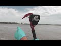
- Monitoring Suspended Sediment and Flow along the Mississippi River: Episode 1
- Runtime
- 14:50
- Date posted
- 4 years ago
- Description
- In this video segment, Physical Scientists from the U.S. Geological Survey (USGS) Lower Mississippi Gulf Water Science Center (LMGWSC) give an overview of USGS monitoring efforts along the Lower Mississippi River. General sampling logistics and monitoring frequencies are also shown. Summaries are given of data collection efforts on the lower Mississippi River and how the USGS utilizes large river work boats to collect data using heavy water samplers. Best practices for large riverboat sampling safety are also explained in detail during this episode.
Created as part of the Memorandum of Understanding between the USGS and the National Water Agency and Geological Survey of Brazil to support sediment and flow monitoring practices in Brazil.
USGS video: https://www.usgs.gov/media/videos/monitoring-suspended-sediment-and-flow-along-mississippi-river-episode-1

- Title
- Landsat and Our Tilted Planet (Image of the Week)
- Runtime
- 1:16
- Date posted
- 4 years ago
- Description
- We wouldn't have seasons here on Earth if not for the planet's 23.5 degree axial tilt. Axial tilt is also known as obliquity. Earth's obliquity and its relationship with the sun give us two solstice points and two equinox points. As we orbit through each solstice and equinox, the amount and angle of daylight change. A 12 month sequence of Landsat imagery shows how much each month can differ, especially away from the equator. In extreme northern latitudes, sunlight during the winter solstice is so limited that daytime Landsat imagery is not available, while Antarctica receives long hours of daylight in the extreme southern latitudes. This multi-path swath of Landsat imagery in the Western Hemisphere shows the big picture. It contains only cloudy Landsat images, which are brighter and help show the change from north to south as the seasonal angle of the sun changes.
USGS Video: https://www.usgs.gov/media/videos/image-week-landsat-and-our-tilted-planet
Music trac...

- Title
- World Cup in Qatar, 2022 (Image of the Week)
- Runtime
- 0:56
- Date posted
- 4 years ago
- Description
- While the best soccer players in the world show off their footwork skills, the best Earth observation satellite program in the world displays its skill at detecting change over time. Landsat images show the rapidly growing city of Doha in Qatar. It's the country's capital and the location of the 2022 men's World Cup.
It grew from around 500,000 people in the late 1990s to 1.5 million in 2011. The city's 2022 estimated population is nearly 1.9 million. Lusail is the largest stadium hosting the World Cup with a seating capacity of 80,000, it will host the final on December 18th. Credits and sources appear on screen. USGS. Science for a changing world.
USGS Video: https://www.usgs.gov/media/videos/image-week-world-cup-qatar-2022
Music track licensed via SoundStripe:
"Like an Angel" by Strength to Last
https://app.soundstripe.com/songs/5769
- Title
- Mauna Loa Eruption, HI - USGS live stream
- Runtime
- 1:13:48
- Date posted
- 4 years ago
- Description
- NOTE that this camera is experiencing connectivity issues and is intermittently transmitting live video. When the connection is dropped, the livestream is saved as a static youtube video. Please check the timestamp in the upper right (displayed in Hawaii Standard Time) to determine if the video is truly live or a recording.
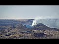
[M8cam] Mauna Loa - Northeast Rift Zone Fissure 3 Eruption Live View
Live video of fissure 3 erupting on the Northeast Rift Zone of Mauna Loa volcano. The camera is located roughly 1 mi (1.6 km) East of fissure 3 and looks west.
Disclaimer: The webcams are operational 24/7 and faithfully record the dark of night if there are no sources of incandescence or other lights. Thermal webcams record heat rather than light and get better views through volcanic gas. At times, clouds and rain obscure visibility. The cameras are subject to sporadic breakdown, and may not be repaired immediately. Some cameras are observing an area that is ...

- Title
- Mauna Loa Eruption, HI - USGS live stream
- Runtime
- 1:54:46
- Date posted
- 4 years ago
- Description
- NOTE that this camera is experiencing connectivity issues and is intermittently transmitting live video. When the connection is dropped, the livestream is saved as a static youtube video. Please check the timestamp in the upper right (displayed in Hawaii Standard Time) to determine if the video is truly live or a recording.
[M8cam] Mauna Loa - Northeast Rift Zone Fissure 3 Eruption Live View
Live video of fissure 3 erupting on the Northeast Rift Zone of Mauna Loa volcano. The camera is located roughly 1 mi (1.6 km) East of fissure 3 and looks west.
Disclaimer: The webcams are operational 24/7 and faithfully record the dark of night if there are no sources of incandescence or other lights. Thermal webcams record heat rather than light and get better views through volcanic gas. At times, clouds and rain obscure visibility. The cameras are subject to sporadic breakdown, and may not be repaired immediately. Some cameras are observing an area that is ...
- Title
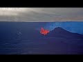
- Mauna Loa Eruption, HI - USGS live stream
- Runtime
- 11:54:56
- Date posted
- 4 years ago
- Description
- NOTE that this camera is experiencing connectivity issues and is intermittently transmitting live video. When the connection is dropped, the livestream is saved as a static youtube video. Please check the timestamp in the upper right (displayed in Hawaii Standard Time) to determine if the video is truly live or a recording.
[M8cam] Mauna Loa - Northeast Rift Zone Fissure 3 Eruption Live View
Live video of fissure 3 erupting on the Northeast Rift Zone of Mauna Loa volcano. The camera is located roughly 1 mi (1.6 km) East of fissure 3 and looks west.
Disclaimer: The webcams are operational 24/7 and faithfully record the dark of night if there are no sources of incandescence or other lights. Thermal webcams record heat rather than light and get better views through volcanic gas. At times, clouds and rain obscure visibility. The cameras are subject to sporadic breakdown, and may not be repaired immediately. Some cameras are observing an area that is ...

- Title
- Mauna Loa Eruption, HI - USGS live stream
- Runtime
- 12:59
- Date posted
- 4 years ago
- Description
- NOTE that this camera is experiencing connectivity issues and is intermittently transmitting live video. When the connection is dropped, the livestream is saved as a static youtube video. Please check the timestamp in the upper right (displayed in Hawaii Standard Time) to determine if the video is truly live or a recording.
[M8cam] Mauna Loa - Northeast Rift Zone Fissure 3 Eruption Live View
Live video of fissure 3 erupting on the Northeast Rift Zone of Mauna Loa volcano. The camera is located roughly 1 mi (1.6 km) East of fissure 3 and looks west.
Disclaimer: The webcams are operational 24/7 and faithfully record the dark of night if there are no sources of incandescence or other lights. Thermal webcams record heat rather than light and get better views through volcanic gas. At times, clouds and rain obscure visibility. The cameras are subject to sporadic breakdown, and may not be repaired immediately. Some cameras are observing an area that is ...

- Title
- Mauna Loa Eruption, HI - USGS live stream
- Runtime
- 28:27
- Date posted
- 4 years ago
- Description
- NOTE that this camera is experiencing connectivity issues and is intermittently transmitting live video. When the connection is dropped, the livestream is saved as a static youtube video. Please check the timestamp in the upper right (displayed in Hawaii Standard Time) to determine if the video is truly live or a recording.
[M8cam] Mauna Loa - Northeast Rift Zone Fissure 3 Eruption Live View
Live video of fissure 3 erupting on the Northeast Rift Zone of Mauna Loa volcano. The camera is located roughly 1 mi (1.6 km) East of fissure 3 and looks west.
Disclaimer: The webcams are operational 24/7 and faithfully record the dark of night if there are no sources of incandescence or other lights. Thermal webcams record heat rather than light and get better views through volcanic gas. At times, clouds and rain obscure visibility. The cameras are subject to sporadic breakdown, and may not be repaired immediately. Some cameras are observing an area that is ...
- Title
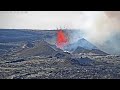
- Mauna Loa Eruption, HI - USGS live stream
- Runtime
- 39:53
- Date posted
- 4 years ago
- Description
- NOTE that this camera is experiencing connectivity issues and is intermittently transmitting live video. When the connection is dropped, the livestream is saved as a static youtube video. Please check the timestamp in the upper right (displayed in Hawaii Standard Time) to determine if the video is truly live or a recording.
[M8cam] Mauna Loa - Northeast Rift Zone Fissure 3 Eruption Live View
Live video of fissure 3 erupting on the Northeast Rift Zone of Mauna Loa volcano. The camera is located roughly 1 mi (1.6 km) East of fissure 3 and looks west.
Disclaimer: The webcams are operational 24/7 and faithfully record the dark of night if there are no sources of incandescence or other lights. Thermal webcams record heat rather than light and get better views through volcanic gas. At times, clouds and rain obscure visibility. The cameras are subject to sporadic breakdown, and may not be repaired immediately. Some cameras are observing an area that is ...

- Title
- Mauna Loa Eruption, HI - USGS live stream
- Runtime
- 10:42
- Date posted
- 4 years ago
- Description
- NOTE that this camera is experiencing connectivity issues and is intermittently transmitting live video. When the connection is dropped, the livestream is saved as a static youtube video. Please check the timestamp in the upper right (displayed in Hawaii Standard Time) to determine if the video is truly live or a recording.
[M8cam] Mauna Loa - Northeast Rift Zone Fissure 3 Eruption Live View
Live video of fissure 3 erupting on the Northeast Rift Zone of Mauna Loa volcano. The camera is located roughly 1 mi (1.6 km) East of fissure 3 and looks west.
Disclaimer: The webcams are operational 24/7 and faithfully record the dark of night if there are no sources of incandescence or other lights. Thermal webcams record heat rather than light and get better views through volcanic gas. At times, clouds and rain obscure visibility. The cameras are subject to sporadic breakdown, and may not be repaired immediately. Some cameras are observing an area that is ...

- Title
- Mauna Loa Eruption, HI - USGS live stream
- Runtime
- 16:11
- Date posted
- 4 years ago
- Description
- NOTE that this camera is experiencing connectivity issues and is intermittently transmitting live video. When the connection is dropped, the livestream is saved as a static youtube video. Please check the timestamp in the upper right (displayed in Hawaii Standard Time) to determine if the video is truly live or a recording.
[M8cam] Mauna Loa - Northeast Rift Zone Fissure 3 Eruption Live View
Live video of fissure 3 erupting on the Northeast Rift Zone of Mauna Loa volcano. The camera is located roughly 1 mi (1.6 km) East of fissure 3 and looks west.
Disclaimer: The webcams are operational 24/7 and faithfully record the dark of night if there are no sources of incandescence or other lights. Thermal webcams record heat rather than light and get better views through volcanic gas. At times, clouds and rain obscure visibility. The cameras are subject to sporadic breakdown, and may not be repaired immediately. Some cameras are observing an area that is ...

- Title
- Mauna Loa Eruption, HI - USGS live stream
- Runtime
- 17:13
- Date posted
- 4 years ago
- Description
- NOTE that this camera is experiencing connectivity issues and is intermittently transmitting live video. When the connection is dropped, the livestream is saved as a static youtube video. Please check the timestamp in the upper right (displayed in Hawaii Standard Time) to determine if the video is truly live or a recording.
[M8cam] Mauna Loa - Northeast Rift Zone Fissure 3 Eruption Live View
Live video of fissure 3 erupting on the Northeast Rift Zone of Mauna Loa volcano. The camera is located roughly 1 mi (1.6 km) East of fissure 3 and looks west.
Disclaimer: The webcams are operational 24/7 and faithfully record the dark of night if there are no sources of incandescence or other lights. Thermal webcams record heat rather than light and get better views through volcanic gas. At times, clouds and rain obscure visibility. The cameras are subject to sporadic breakdown, and may not be repaired immediately. Some cameras are observing an area that is ...
- Title
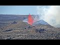
- Mauna Loa Eruption, HI - USGS live stream
- Runtime
- 18:28
- Date posted
- 4 years ago
- Description
- NOTE that this camera is experiencing connectivity issues and is intermittently transmitting live video. When the connection is dropped, the livestream is saved as a static youtube video. Please check the timestamp in the upper right (displayed in Hawaii Standard Time) to determine if the video is truly live or a recording.
[M8cam] Mauna Loa - Northeast Rift Zone Fissure 3 Eruption Live View
Live video of fissure 3 erupting on the Northeast Rift Zone of Mauna Loa volcano. The camera is located roughly 1 mi (1.6 km) East of fissure 3 and looks west.
Disclaimer: The webcams are operational 24/7 and faithfully record the dark of night if there are no sources of incandescence or other lights. Thermal webcams record heat rather than light and get better views through volcanic gas. At times, clouds and rain obscure visibility. The cameras are subject to sporadic breakdown, and may not be repaired immediately. Some cameras are observing an area that is ...

- Title
- Mauna Loa Eruption, HI - USGS live stream
- Runtime
- 10:10
- Date posted
- 4 years ago
- Description
- NOTE that this camera is experiencing connectivity issues and is intermittently transmitting live video. When the connection is dropped, the livestream is saved as a static youtube video. Please check the timestamp in the upper right (displayed in Hawaii Standard Time) to determine if the video is truly live or a recording.
[M8cam] Mauna Loa - Northeast Rift Zone Fissure 3 Eruption Live View
Live video of fissure 3 erupting on the Northeast Rift Zone of Mauna Loa volcano. The camera is located roughly 1 mi (1.6 km) East of fissure 3 and looks west.
Disclaimer: The webcams are operational 24/7 and faithfully record the dark of night if there are no sources of incandescence or other lights. Thermal webcams record heat rather than light and get better views through volcanic gas. At times, clouds and rain obscure visibility. The cameras are subject to sporadic breakdown, and may not be repaired immediately. Some cameras are observing an area that is ...

- Title
- Mauna Loa Eruption, HI - USGS live stream
- Runtime
- 12:53
- Date posted
- 4 years ago
- Description
- NOTE that this camera is experiencing connectivity issues and is intermittently transmitting live video. When the connection is dropped, the livestream is saved as a static youtube video. Please check the timestamp in the upper right (displayed in Hawaii Standard Time) to determine if the video is truly live or a recording.
[M8cam] Mauna Loa - Northeast Rift Zone Fissure 3 Eruption Live View
Live video of fissure 3 erupting on the Northeast Rift Zone of Mauna Loa volcano. The camera is located roughly 1 mi (1.6 km) East of fissure 3 and looks west.
Disclaimer: The webcams are operational 24/7 and faithfully record the dark of night if there are no sources of incandescence or other lights. Thermal webcams record heat rather than light and get better views through volcanic gas. At times, clouds and rain obscure visibility. The cameras are subject to sporadic breakdown, and may not be repaired immediately. Some cameras are observing an area that is ...

- Title
- December 4, 2022 — Aerial Views of Mauna Loa Fissure 3 Erupting
- Runtime
- 0:12
- Date posted
- 4 years ago
- Description
- Aerial view of fissure 3 erupting on the Northeast Rift Zone of Mauna Loa the morning of December 4, 2022.
USGS Video:: https://www.usgs.gov/media/videos/december-4-2022-aerial-views-mauna-loa-fissure-3-erupting

- Title
- Lake Powell and the Megadrought (Image of the Week)
- Runtime
- 0:46
- Date posted
- 4 years ago
- Description
- Two decades of drought are contributing to low water levels in reservoirs along the Colorado River, including Lake Powell.
Lake Powell’s highest recorded water level was in 1983. In this 1984 Landsat 5 image, the lake’s elevation was 3,702 feet above sea level.
Landsat 8 shows the lake near its historic low level. In April 2022, Lake Powell was 3,529 feet above sea level, its lowest level since the lake began filling behind the Glen Canyon Dam in the 1960s.
USGS video: https://www.usgs.gov/media/videos/image-week-lake-powell-and-megadrought

- Title
- December 1, 2022 - Mauna Loa Eruption #6
- Runtime
- 0:16
- Date posted
- 4 years ago
- Description
- Footage of a channelized section of the Northeast Rift Zone eruption of Mauna Loa, captured the morning of December 1, 2022.
USGS Video: https://www.usgs.gov/media/videos/december-1-2022-mauna-loa-eruption-4

- Title
- December 1, 2022 - Mauna Loa Eruption #5
- Runtime
- 0:17
- Date posted
- 4 years ago
- Description
- Aerial footage of the Northeast Rift Zone eruption of Mauna Loa captured the morning of December 1, 2022.
USGS Video: https://www.usgs.gov/media/videos/december-1-2022-mauna-loa-eruption-3

- Title
- December 1, 2022 - Mauna Loa Eruption #4
- Runtime
- 0:14
- Date posted
- 4 years ago
- Description
- Footage of a geologist taking a sample of the Northeast Rift Zone eruption of Mauna Loa the morning of December 1, 2022.
USGS Video: https://www.usgs.gov/media/videos/december-1-2022-mauna-loa-eruption-2

- Title
- December 1, 2022 - Mauna Loa Eruption #3
- Runtime
- 0:12
- Date posted
- 4 years ago
- Description
- Aerial footage of the Northeast Rift Zone eruption of Mauna Loa captured the morning of December 1, 2022.
USGS Video: https://www.usgs.gov/media/videos/december-1-2022-mauna-loa-eruption-1
- Title
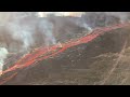
- December 1, 2022 - Mauna Loa Eruption #2
- Runtime
- 0:08
- Date posted
- 4 years ago
- Description
- Aerial footage of the Northeast Rift Zone eruption of Mauna Loa captured the morning of December 1, 2022.
USGS Video: https://www.usgs.gov/media/videos/december-1-2022-mauna-loa-eruption-0

- Title
- December 1, 2022 - Mauna Loa Eruption #1
- Runtime
- 0:08
- Date posted
- 4 years ago
- Description
- Aerial footage of the Northeast Rift Zone eruption of Mauna Loa captured the morning of December 1, 2022.
USGS Video: https://www.usgs.gov/media/videos/december-1-2022-mauna-loa-eruption

- Title
- Monthly update of activity at Yellowstone Volcano (December 1, 2022)
- Runtime
- 6:31
- Date posted
- 4 years ago
- Description
- Just a few days ago, Mauna Loa, the tallest active volcano on the planet, started erupting for the first time in 38 years. Mike Poland, the scientist-in-charge of the Yellowstone Volcano Observatory, talks about the parallels and differences between Hawaiian and Yellowstone volcanism and describes recent activity at Yellowstone in this monthly update for December 1, 2022.
What’s similar? Both Yellowstone and Hawaiian volcanoes occur in the middle of tectonic plates, far from plate boundaries. Both are “powered” by what we call hotspots, anomalous areas of melting sourced deep within the earth. As it rises up, it burns its way through the tectonic plate and lava erupts onto the surface to form a volcano. As the tectonic plate moves, the volcano is carried away from the hotspot source, and the hotspot punches through again to create a new volcano. So for hotspots, you can follow a trail of volcanoes that gets older and older the farther you get from the hotspot. In Ha...

- Title
- November 30, 2022 — Fissure 3 on Mauna Loa's Northeast Rift Zone continues
- Runtime
- 0:48
- Date posted
- 4 years ago
- Description
- The eruption on the Northeast Rift Zone of Mauna Loa continues. This video shows the dominant fissure 3 remains active and is supplying lava to the flow advancing north. Taken on November 30, 2022.
USGS Video: https://www.usgs.gov/media/videos/november-30-2022-fissure-3-mauna-loas-northeast-rift-zone-continues
- Title
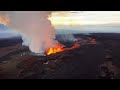
- Mauna Loa (Fissure 3) - November 30, 2022
- Runtime
- 0:25
- Date posted
- 4 years ago
- Description
- This video, taken during an early morning overflight on 30 November 2022, shows fissure 3, the dominant source of activity. The lava fountains are 20-25 meters in height (65-82 feet) and are feeding a lava flow that is moving to the northeast at ~130 meters per hour (0.08 miles per hour).
USGS Video: https://www.usgs.gov/media/videos/mauna-loa-fissure-3-november-30-2022

- Title
- Lava fountaining on Mauna Loa on November 29, 2022
- Runtime
- 0:17
- Date posted
- 4 years ago
- Description
- This video was taken by HVO field crews on the morning of November 29, 2022, and shows lava fountaining from a fissure vent high on Mauna Loa's northeast rift zone. Fissure heights of 20-25 meters (65-82 feet) were recorded at the time of the video.
USGS Video: https://www.usgs.gov/media/videos/lava-fountaining-mauna-loa-november-29-2022

- Title
- Morning overflight video of eruption on Northeast Rift Zone taken on November 29, 2022
- Runtime
- 1:01
- Date posted
- 4 years ago
- Description
- The eruption on the Northeast Rift Zone of Mauna Loa Volcano continues. Today, the dominant fountain at fissure 3 was supplying lava to a flow advancing north of the rift zone.
USGS Video: https://www.usgs.gov/media/videos/morning-overflight-video-eruption-northeast-rift-zone-taken-november-29-2022

- Title
- Mauna Loa Northeast Rift Zone Lava Fountains - November 29, 2022
- Runtime
- 0:11
- Date posted
- 4 years ago
- Description
- This video shows one of the fissures active on the Northeast Rift Zone of Mauna Loa. At approximately 11 a.m. on November 29, 2022, the fountains at this location were at measured 35-40 meters (115-148 ft) in height.
USGS Video: https://www.usgs.gov/media/videos/mauna-loa-northeast-rift-zone-lava-fountains-november-29-2022
- Title
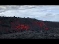
- Mauna Loa Northeast Rift Zone Lava Flow - November 29, 2022
- Runtime
- 0:26
- Date posted
- 4 years ago
- Description
- An ‘a‘ā lava flow on the northeast flank of Mauna Loa. This lava flow is several meters thick and moving to the northeast. 'A'ā flows have a rough rubbly surface composed of broken lava blocks called clinkers. The clinkery surface covers a massive dense core, which is the most active part of the flow. As pasty lava in the core travels downslope, the clinkers are carried along at the surface. At the leading edge of an ‘a‘ā flow, however, these cooled fragments tumble down the steep front and are buried by the advancing flow. This produces a layer of lava fragments both at the bottom and top of an ‘a‘ā flow.
USGS Video: https://www.usgs.gov/media/videos/mauna-loa-northeast-rift-zone-lava-flow-november-29-2022

- Title
- Mauna Loa Northeast Rift Zone Eruption - November 29, 2022 #2
- Runtime
- 0:16
- Date posted
- 4 years ago
- Description
- Video showing fissures erupting on the Northeast Rift Zone of Mauna Loa the morning of November 29, 2022. Fountains at this area (fissure 3) were measured up to 25 m (82 ft) in height.
USGS Video: https://www.usgs.gov/media/videos/mauna-loa-northeast-rift-zone-eruption-november-29-2022

- Title
- Mauna Loa Northeast Rift Zone Eruption - November 29, 2022 #1
- Runtime
- 0:21
- Date posted
- 4 years ago
- Description
- Video showing fissures erupting on the Northeast Rift Zone of Mauna Loa the morning of November 29, 2022. Fountains at this area (fissure 3) were measured up to 25 m (82 ft) in height.
USGS Video: https://www.usgs.gov/media/videos/mauna-loa-northeast-rift-zone-eruption-november-29-2022-0

- Title
- Monitoring Suspended Sediment and Flow along the Mississippi River: Bonus Episode
- Runtime
- 5:40
- Date posted
- 4 years ago
- Description
- In this video segment, the U.S. Geological Survey (USGS), Lower Mississippi Gulf Water Science Center (LMGWSC) scientists give a preview of how the USGS is currently working to design a new generation large river sampler. This new sampler will incorporate all functions of previously developed USGS depth and point samplers. The USGS is working to incorporate within this sampler suspended sediment surrogate recording devices like acoustic backscatter and or turbidity. This new technologically advanced sampler will be made using 3-D printers.
Created as part of the Memorandum of Understanding between the USGS and the National Water Agency and Geological Survey of Brazil to support sediment and flow monitoring practices in Brazil.
USGS video: https://www.usgs.gov/media/videos/monitoring-suspended-sediment-and-flow-along-mississippi-river-bonus-episode
- Title
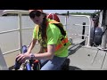
- Monitoring Suspended Sediment and Flow along the Mississippi River: Episode 2
- Runtime
- 41:34
- Date posted
- 4 years ago
- Description
- In this video segment, the U.S. Geological Survey (USGS), Lower Mississippi Gulf Water Science Center (LMGWSC) scientists give a detailed description of how the USGS uses Acoustic Doppler Current Profilers, (ADCP) to measure flow along the lower Mississippi River. In-depth methods are explained on how the USGS deploys ADCPs, their specific mounts, initial setups, calibrations, offsets, and computer software programs used to view and record the digital data. Quality assurance methods and software are also discussed. Furthermore, the USGS staff explain how they utilize the flow data to establish sampling global positioning system (GPS) points across the channel to collect water samples at specific areas across the river channel using depth-integrating water samplers.
Created as part of the Memorandum of Understanding between the USGS and the National Water Agency and Geological Survey of Brazil to support sediment and flow monitoring practices in Brazil.
USGS Vi...

- Title
- Lake Mead and the Megadrought (Image of the Week)
- Runtime
- 0:46
- Date posted
- 4 years ago
- Description
- Lake Mead and the Mega Drought.
Image of the Week.
Drought over the past 20 years in the Colorado River Basin, and a growing demand for water, have brought Lake Mead to historically low levels.
In 1972, the year Landsat 1 captured its first images, Lake Mead’s elevation was 1,155 above sea level.
50 years later, Landsat 9 shows its water level at 1,041, as low as it’s been since Hoover Dam was completed in the 1930s.
The lake level reduction is even more extreme than shown by Landsat because of the steep topography.
USGS Video: https://www.usgs.gov/media/videos/image-week-lake-mead-and-megadrought
Music track licensed via SoundStripe:
"Like an Angel" by Strength to Last
https://app.soundstripe.com/songs/5769
- Title
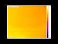
- Mauna Loa Eruption 2022 - Thermal Imagery
- Runtime
- 0:26
- Date posted
- 4 years ago
- Description
- Video showing thermal imagery from the 2022 Mauna Loa eruption which began around 11:30pm HST.
USGS Video: https://www.usgs.gov/media/videos/mauna-loa-eruption-2022-thermal-imagery

- Title
- Monitoring Suspended Sediment and Flow along the Mississippi River: Episode 1
- Runtime
- 14:50
- Date posted
- 4 years ago
- Description
- In this video segment, Physical Scientists from the U.S. Geological Survey (USGS), Lower Mississippi Gulf Water Science Center (LMGWSC) give an overview of USGS monitoring efforts along the Lower Mississippi River. General sampling logistics and monitoring frequencies are also shown. Summaries are given of data collection efforts on the lower Mississippi River and how the USGS utilize large river work boats to collect data using heavy water samplers. Best practices for large river boat sampling safety are also explained in detail during this episode.
Created as part of the Memorandum of Understanding between the USGS and the National Water Agency and Geological Survey of Brazil to support sediment and flow monitoring practices in Brazil.
USGS Video: https://www.usgs.gov/media/videos/monitoring-suspended-sediment-and-flow-along-mississippi-river-episode-1

- Title
- Kīlauea summit gas team fieldwork – October 22, 2022
- Runtime
- 6:31
- Date posted
- 4 years ago
- Description
- HVO volcanic gas specialists make sulfur dioxide (SO~2~) emission rate measurements downwind of the eruption within Halema‘uma‘u crater, Kīlauea summit. This video shows the typical fieldwork involved with measuring SO2 emission rates, during which HVO scientists drive traverses beneath the plume in the closed area of Hawai‘i Volcanoes National Park. As they drive, an ultraviolet spectrometer looks up at the plume to make the measurements. Access to the hazardous area is by permission from, and in coordination with, Hawai‘i Volcanoes National Park. Wind noise is audible in many clips.
USGS Video: https://www.usgs.gov/media/videos/kilauea-summit-gas-team-fieldwork-october-22-2022
- Title
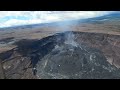
- October 28, 2022 — Kīlauea Summit Overflight
- Runtime
- 3:02
- Date posted
- 4 years ago
- Description
- An overflight, at approximately 10 a.m., on October 28, 2022, provided aerial views of the eruption within Halema‘uma‘u crater. Lava continues to erupt from the west vent area, supplying the lava pond in the western portion of Halema‘uma‘u. This video contains footage from two flights: one along the margin of Halema‘uma‘u crater, and one from farther away above Kīlauea caldera floor. USGS video.
USGS Video: https://www.usgs.gov/media/images/october-28-2022-kilauea-summit-aerial-observations-1
- Title
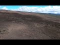
- October 28, 2022 — Mauna Loa Overflight
- Runtime
- 10:12
- Date posted
- 4 years ago
- Description
- An overflight at approximately 8:30 a.m. on October 28, 2022, provided aerial views of Mauna Loa Volcano, which is not erupting. This video contains several clips from the overflight, shown at 2X speed. The video includes (in this order) views of the south flank, the Southwest Rift Zone, the summit caldera (Moku‘āweoweo), the Northeast Rift Zone, and the south flank.
USGS Video: https://www.usgs.gov/media/videos/october-28-2022-mauna-loa-overflight

- Title
- Monthly update of activity at Yellowstone Volcano for November 1 2022
- Runtime
- 5:34
- Date posted
- 4 years ago
- Description
- November is Native American Heritage Month. Mike Poland, scientist-in-charge of the Yellowstone Volcano Observatory, talks about Indigenous peoples in the Yellowstone region and describes Yellowstone’s recent seismic, deformation, and geyser activity in this November 1, 2022 monthly update.
The update comes to you from Nez Perce Creek in Yellowstone National Park. The creek was named after a Nez Perce band fighting a running battle with the U.S. Army in the late 1870s. The band crossed Yellowstone in an attempt to escape to Canada.
One of the myths about Yellowstone is that people weren’t in the area until recently. This is not true. Archeological evidence shows that people were in the park for at least the past 11,000 years. They were using resources like obsidian to make arrowheads and other artifacts that have been found as far away as the Ohio River valley.
Another myth is that Indigenous people were afraid of Yellowstone. This is not true...

- Title
- Puerto Rico Coastal Hazards (AD)
- Runtime
- 7:05
- Date posted
- 4 years ago
- Description
- The island of Puerto Rico is subject to numerous natural hazards including hurricanes and coastal erosion. Information on how the island’s coastal environments respond to these events is critical for bolstering coastal resilience. Dr. Legna Torres-Garcia, who was born in raised in Puerto Rico, is leading an effort to study coastal hazards and make this information more accessible to communities on the island. This information can help residents of the territory to be more prepared for, and resilient to, natural hazards.
Learn more about USGS coastal hazards research in Puerto Rico: https://www.usgs.gov/mission-areas/natural-hazards/science/puerto-rico-natural-hazards-coastal-peligros-naturales-de
Watch the non-audio-described version:
YouTube: https://www.youtube.com/watch?v=i-eL6Yv9BPM
USGS: https://www.usgs.gov/media/videos/puerto-rico-coastal-hazards
Vea el video en español:
YouTube: https://www.youtube.com/watch?v=gLEa32m...
- Title
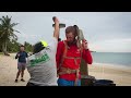
- Puerto Rico Coastal Hazards
- Runtime
- 3:26
- Date posted
- 4 years ago
- Description
- The island of Puerto Rico is subject to numerous natural hazards including hurricanes and coastal erosion. Information on how the island’s coastal environments respond to these events is critical for bolstering coastal resilience. Dr. Legna Torres-Garcia, who was born in raised in Puerto Rico, is leading an effort to study coastal hazards and make this information more accessible to communities on the island. This information can help residents of the territory to be more prepared for, and resilient to, natural hazards.
Learn more about USGS coastal hazards research in Puerto Rico: https://www.usgs.gov/mission-areas/natural-hazards/science/puerto-rico-natural-hazards-coastal-peligros-naturales-de
Listen to the audio-described version:
YouTube: https://www.youtube.com/watch?v=gLEa32mh890
USGS: https://www.usgs.gov/media/videos/puerto-rico-coastal-hazards-ad
Vea el video en español:
YouTube: https://www.youtube.com/watch?v=38v7...

- Title
- Peligros Costeros de Puerto Rico (AD)
- Runtime
- 10:14
- Date posted
- 4 years ago
- Description
- La isla de Puerto Rico está sujeta a numerosos peligros naturales, incluyendo huracanes y erosión costera. La información sobre cómo responden los entornos costeros de la isla a estos eventos es fundamental para reforzar la resiliencia costera. La Dra. Legna Torres-García, nacida en Puerto Rico, está liderando un esfuerzo para estudiar los peligros costeros y hacer que esta información sea más accesible para las comunidades de la isla. Esta información puede ayudar a los residentes del territorio a estar más preparados y resilientes a los peligros naturales.
Obtenga más información sobre la Investigación de Peligros Costeros de USGS en Puerto Rico: https://www.usgs.gov/mission-areas/natural-hazards/science/puerto-rico-natural-hazards-coastal-peligros-naturales-de
Vea la versión no audiodescrita:
YouTube: https://www.youtube.com/watch?v=38v7YIb4ja8
USGS: https://www.usgs.gov/media/videos/peligros-costeros-de-puerto-rico
Wa...





