USGS
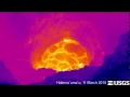
Thermal View of Lava Surface Deep within Halema`uma`u

- Title
- Thermal View of Lava Surface Deep within Halema`uma`u
- Runtime
- 0:34
- Date posted
- 16 years ago
- Description
- This movie shows the lava surface deep within the Halema`uma`u vent cavity, captured with a thermal camera that can see through the thick fume. The lava surface is about 70 meters (230 ft) wide, and remains about 200 meters (660 ft) below the cavity rim. The surface is mostly crusted, with a slow migration from north to south. Small spattering sources occasionally break through the thin crust. Just a few minutes after this video was taken, violent degassing and spattering ensued, disrupting the entire lava surface, and the lava level dropped about 20 meters (66 ft).
Learn more about this volcano and other Hawaiian volcanic activity at the USGS Hawaiian Volcano Observatory website. (http://hvo.wr.usgs.gov)
- Title
- Thermal View of Active Lava Pond in Halema`uma`u Vent
- Runtime
- 0:48
- Date posted
- 16 years ago
- Description
- This movie shows the active lava pond deep within the Halema`uma`u vent cavity. The lava is upwelling at the northern margin of the pond (the upper margin in this view), and slowly migrating south towards the bottom of the image, where it sinks out of view. The pond is about 50 m wide. Small spattering sources appear and disappear occasionally. This video was taken with a thermal camera (white is hot, dark blue is cold), which is able to see through the thick fume. No views were possible with the naked eye today due to the fume, and only loud gas roaring sounds could be heard.
Learn more about this volcano and other Hawaiian volcanic activity at the USGS Hawaiian Volcano Observatory website. (http://hvo.wr.usgs.gov)
- Title
- Thermal View of Halema`uma`u Floor
- Runtime
- 0:57
- Date posted
- 16 years ago
- Description
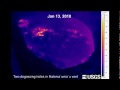
- This movie shows video collected with a thermal camera during two helicopter overflights of the Halema`uma`u vent. The high vantage point allowed a view of the entire floor of the vent cavity, which is not possible from the ground. Also, the thermal camera can "see" through the thick fume that normally obscures the vent to the naked eye. The first half of the video shows observations on January 7, when a dome fountain on the floor of the vent cavity was feeding a wide, vigorously flowing lava stream towards the north. The second half of the video shows observations on January 13, at which point the lava stream had disappeared and two degassing holes were active. The northern hole (on the right) appears to have lava just below the rim.
Learn more about this volcano and other Hawaiian volcanic activity at the USGS Hawaiian Volcano Observatory website. (http://hvo.wr.usgs.gov)

- Title
- Draining in Lava Pond within Halema`uma`u Vent
- Runtime
- 1:28
- Date posted
- 16 years ago
- Description
- This movie shows a draining event in the lava pond within the Halema`uma`u vent cavity. The lava column exhibited cycles of filling and draining of the vent cavity, with each cycle lasting a few minutes. As the pond drains, lava cascades into a small hole on the east side (right) of the cavity floor. Also, lava that was covering a large bench to the west of the main pond drains back, with large plates of crust sliding over the edge.
Learn more about this volcano and other Hawaiian volcanic activity at the USGS Hawaiian Volcano Observatory website. (http://hvo.wr.usgs.gov)

- Title
- Halema`uma`u Filling and Draining Cycle
- Runtime
- 1:16
- Date posted
- 16 years ago
- Description
- Lava within the vent cavity in Halema`uma`u crater continues to be active, and occasionally displays remarkable filling and draining cycles. This Quicktime movie shows the draining portion of one of these cycles, captured in "nightshot" mode in order to see through the thick fume. The video begins with a wide surface of chaotic, agitated lava, with vigorous upwelling and spattering. The lava surface is about 30 m wide. Eventually, the lava begins to drain into a hole on the floor of the vent cavity, as spattering continues. Each filling and draining cycle lasted about 5 minutes.
Learn more about this volcano and other Hawaiian volcanic activity at the USGS Hawaiian Volcano Observatory website (http://hvo.wr.usgs.gov)

- Title
- Small Explosive Event in Halema`uma`u
- Runtime
- 0:26
- Date posted
- 16 years ago
- Description
- This movie (at x2 speed) shows a small explosive event in the Halema`uma`u vent at 9:20am. The explosion was immediately preceded by a portion of the vent rim collapsing into the vent cavity. The brown plume rises rapidly from the vent, and in the full resolution video large particles can be seen ejected in front of the plume. In the video shown here, it is possible to see some of these particles impact the crater wall—look for several small white puffs to appear on the crater wall just ahead of the rising brown plume (about 7-9 seconds into the video clip). No ejecta was found at the Halema`uma`u Overlook, indicating that few, if any particles, reached the crater rim.
Learn more about this volcano and other Hawaiian volcanic activity at the USGS Hawaiian Volcano Observatory website (http://hvo.wr.usgs.gov)
- Title
- Lava Within Halema`uma`u Vent Cavity
- Runtime
- 1:01
- Date posted
- 16 years ago
- Description
- This movie shows lava within the Halema`uma`u vent cavity, at a depth of about 200 m below the vent rim. The lava surface, which is about 20 m wide, is extremely vigorous, with constant roiling and semi-continuous spattering. Spatter deposited on the walls around the lava surface creates a hot, unstable surface, which can be seen to disintegrate as large blocks break off and fall into the lava.
Learn more about this volcano and other Hawaiian volcanic activity at the USGS Hawaiian Volcano Observatory website (http://hvo.wr.usgs.gov)

- Title
- Why Some Public-Supply Wells are More Vulnerable to Contamination Than Others
- Runtime
- 12:22
- Date posted
- 16 years ago
- Description
- Visit: http://www.usgs.gov/corecast/details.asp?ep=120 for full transcript and more information.
This video discusses how scientists have tracked what, when, and how contaminants may reach public-supply wells in four aquifers in California, Connecticut, Nebraska, and Florida.

- Title
- Mount St. Helens: May 18, 1980
- Runtime
- 7:31
- Date posted
- 17 years ago
- Description
- USGS scientists recount their experiences before, during and after the May 18, 1980 eruption of Mount St. Helens. Loss of their colleague David A. Johnston and 56 others in the eruption cast a pall over one of the most dramatic geologic moments in American history.
🔔 Subscribe for more volcano content 🔔
https://youtube.com/@usgs?sub_confirmation=1
🕙 Video Chapters 🕙
0:00 Mount St. Helens Erupts!
0:55 How was the volcano monitored?
2:58 Surveying the Eruption
4:08 How did the eruption happen?
5:00 Learning from the eruption
=================================
🌋 Mount St. Helens website 🌋
https://www.usgs.gov/volcanoes/mount-st.-helens?utm_source=youtube&utm_medium=usgs-main&utm_campaign=nh-volcanoes-fy25
📣 Mount St. Helens volcano information updates 📣
https://www.usgs.gov/volcanoes/mount-st.-helens/volcano-updates?utm_source=youtube&utm_medium=...

- Title
- Mount St. Helens: A Catalyst for Change
- Runtime
- 6:47
- Date posted
- 17 years ago
- Description
- For more information visit: http://gallery.usgs.gov/videos/235
The May 18, 1980 eruption of Mount St. Helens triggered a growth in volcano science and volcano monitoring. Five USGS volcano observatories have been established since the eruption. With new technologies and improved awareness of volcanic hazards USGS scientists are helping save lives and property across the planet.
- Title
- Constrictor Snakes
- Runtime
- 5:05
- Date posted
- 17 years ago
- Description
- Video footage (B-roll) of Everglades National Park biologists hunting and capturing a Burmese Python in Florida.

- Title
- Summer Fieldwork in Everglades National Park
- Runtime
- 7:18
- Date posted
- 17 years ago
- Description
- Visit: http://gallery.usgs.gov/videos/222 for downloads, details, and transcript.
In this audio slideshow scientists cruise through tidal creeks, sample mangrove sites, pull sediment cores, and avoid swarms of mosquitoes while conducting studies and monitoring the largest subtropical wilderness in the United States, the Everglades.

- Title
- African Dust, Coral Reefs and Human Health
- Runtime
- 9:53
- Date posted
- 17 years ago
- Description
- Visit http://gallery.usgs.gov/videos/223 for downloads, transcript, and more.
This documentary presents how recent changes in the composition and quantities of African dust transported to the Caribbean and the Americas might provide clues to why Caribbean coral reef ecosystems are deteriorating and human health may be impacted.
Additional information can be found at: http://coastal.er.usgs.gov/african_dust/

- Title
- The Heat is On: Desert Tortoises & Survival (Part 3 of 4)
- Runtime
- 7:02
- Date posted
- 17 years ago
- Description
- Other formats and full transcript can be found at: http://gallery.usgs.gov/videos/197, http://gallery.usgs.gov/videos/198, http://gallery.usgs.gov/videos/199, and http://gallery.usgs.gov/videos/200
Part 3 of 4:
A thirty minute television program exploring the world of the Mojave Desert Tortoise. Witness a newborn tortoise hatching from its shell and male tortoises engaging in territorial battle. Follow scientists as they track tortoises across the desert. Learn about the many threats to tortoise survival. Watch as scientists use new technologies such as GPS and habitat modeling to sort out the factors causing tortoise decline and to help guide the effort to recover the species.
Tortoises have lived across this southwest landscape for thousand's of years. Their adaptation to its extreme harsh environment is amazing: surviving ground temperatures greater than 130 degress Fahrenheit and able to live a year, or even two, without water. But now, the dese...

- Title
- The Heat is On: Desert Tortoises & Survival (Part 4 of 4)
- Runtime
- 6:30
- Date posted
- 17 years ago
- Description
- Other formats and full transcript can be found at: http://gallery.usgs.gov/videos/197, http://gallery.usgs.gov/videos/198, http://gallery.usgs.gov/videos/199, and http://gallery.usgs.gov/videos/200
Part 4 of 4:
A thirty minute television program exploring the world of the Mojave Desert Tortoise. Witness a newborn tortoise hatching from its shell and male tortoises engaging in territorial battle. Follow scientists as they track tortoises across the desert. Learn about the many threats to tortoise survival. Watch as scientists use new technologies such as GPS and habitat modeling to sort out the factors causing tortoise decline and to help guide the effort to recover the species.
Tortoises have lived across this southwest landscape for thousand's of years. Their adaptation to its extreme harsh environment is amazing: surviving ground temperatures greater than 130 degress Fahrenheit and able to live a year, or even two, without water. But now, the desert t...

- Title
- The Heat is On: Desert Tortoises & Survival (Part 1 of 4)
- Runtime
- 10:00
- Date posted
- 17 years ago
- Description
- Other formats and full transcript can be found at: http://gallery.usgs.gov/videos/197, http://gallery.usgs.gov/videos/198, http://gallery.usgs.gov/videos/199, and http://gallery.usgs.gov/videos/200
Part 1 of 4:
A thirty minute television program exploring the world of the Mojave Desert Tortoise. Witness a newborn tortoise hatching from its shell and male tortoises engaging in territorial battle. Follow scientists as they track tortoises across the desert. Learn about the many threats to tortoise survival. Watch as scientists use new technologies such as GPS and habitat modeling to sort out the factors causing tortoise decline and to help guide the effort to recover the species.
Tortoises have lived across this southwest landscape for thousand's of years. Their adaptation to its extreme harsh environment is amazing: surviving ground temperatures greater than 130 degress Fahrenheit and able to live a year, or even two, without water. But now, the des...

- Title
- The Heat is On: Desert Tortoises & Survival (Part 2 of 4)
- Runtime
- 7:23
- Date posted
- 17 years ago
- Description
- Other formats and full transcript can be found at: http://gallery.usgs.gov/videos/197, http://gallery.usgs.gov/videos/198, http://gallery.usgs.gov/videos/199, and http://gallery.usgs.gov/videos/200
Part 2 of 4:
A thirty minute television program exploring the world of the Mojave Desert Tortoise. Witness a newborn tortoise hatching from its shell and male tortoises engaging in territorial battle. Follow scientists as they track tortoises across the desert. Learn about the many threats to tortoise survival. Watch as scientists use new technologies such as GPS and habitat modeling to sort out the factors causing tortoise decline and to help guide the effort to recover the species.
Tortoises have lived across this southwest landscape for thousand's of years. Their adaptation to its extreme harsh environment is amazing: surviving ground temperatures greater than 130 degress Fahrenheit and able to live a year, or even two, without water. But now, the desert t...
- Title
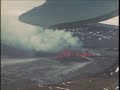
- Mauna Loa Volcano Hawaii -- 1930's Eruption
- Runtime
- 2:55
- Date posted
- 17 years ago
- Description
- Remarkable silent film, 16mm Kodachrome movie film, YouTube of it's day. Probably the first color film ever made of a volcanic eruption. Mokuaweoweo Crater eruption filmed probably in late 1935 by Harold T. Stearns, a USGS Hydrologist-Volcanologist. The lava fountains are hundreds of feet high, the erupting fissure inside the crater is about two thousand feet long. The crater floor is at an elevation of 13,100' ASL. Stearns is flying in an open cockpit at an altitude of around 15,000' ASL. View the entire film (1 hour, 6 min) at: mms://video.wr.usgs.gov/movies/early_hawaiian_volcanoes.wmv

- Title
- USGS Measurement, Salt River (January 2010 )
- Runtime
- 4:07
- Date posted
- 17 years ago
- Description
- USGS streamgagers, Mike Sanders and Henry Sanger are servicing the, Salt River near Roosevelt , Arizona streamflow gaging station and making a streamflow measurement on January 22, 2010. Flow was measured to be 44,500 cubic feet per second (CFS) on the 22th but peaked earlier on the 22nd at an estimated 88,000 cfs. The measurement was made from the cableway just downstream of the gaging station. Transcript available soon.

- Title
- Streamflow Measurement, Rillito Creek AZ (Jan 2010)
- Runtime
- 1:48
- Date posted
- 17 years ago
- Description
- USGS employees, John Hoffmann, Corey Salmond, Robert Fritzinger, and Chris Smith are being interviewed by Naomi Pescovitz from KVOA on January 22, 2010. Robert Fritzinger and Corey Salmond are making a streamflow measurement at Rillito Creek at La Cholla BLVD near Tucson streamflow gaging station. The updated peak was 1,360 cubic feet per second (CFS) on January 22, 2010. Flow was measured to be 633 cfs on the 22th. The measurement allowed the USGS to revise their initial peak of 3,400 cfs to a verified peak of 1,360 cfs. Transcript available soon.

- Title
- Streamflow Measurement (2008)
- Runtime
- 5:12
- Date posted
- 17 years ago
- Description
- USGS streamgagers make a discharge measurement in southwest Arizona. Transcript available soon.

- Title
- Streamflow Measurement, Pinto Creek, AZ (Jan 2010)
- Runtime
- 2:20
- Date posted
- 17 years ago
- Description
- USGS streamgagers, Mike Sanders, Arthur Rees, and Mike Schilling, are servicing the Pinto Creek near Miami, Arizona streamflow gaging station and making a streamflow measurement on January 28, 2010. Flow was measured to be 207 cubic feet per second (CFS) on the 28th but peaked earlier on the 22nd at an estimated 7,400 cfs. Debris from the flood flow can be seen in trees and on the over bank areas. Transcript available soon.
- Title
- Streamflow Measurement (San Pedro River - 2008)
- Runtime
- 4:47
- Date posted
- 17 years ago
- Description
- USGS streamgagers make a low flow measurement on the San Pedro River at Charleston. Transcript available soon.

- Title
- Measuring Low Flow in San Pedro River
- Runtime
- 2:47
- Date posted
- 17 years ago
- Description
- Measuring low flow in the San Pedro River with flume. Transcript available soon.

- Title
- Hydroacoustics for Collecting Streamflow Data
- Runtime
- 10:28
- Date posted
- 17 years ago
- Description
- The USGS Yuma Field Office demonstrates how hydroacoustics are helping them collect accurate streamflow data. Transcript available soon.

- Title
- Flood Measurement in Tucson, AZ (2008)
- Runtime
- 2:29
- Date posted
- 17 years ago
- Description
- Footage of USGS streamgagers taking measurements on the Santa Cruz River in Arizona. Transcript available soon.

- Title
- Explaining Flood Measurements
- Runtime
- 1:31
- Date posted
- 17 years ago
- Description
- Explaning why USGS streamgagers make discharge measurements. Transcript available soon.
- Title
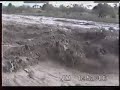
- Flood Measurement on Santa Cruz River (1993 and 2005)
- Runtime
- 4:09
- Date posted
- 17 years ago
- Description
- Two historic flood measurements are made on the Santa Cruz River in Tucson, Arizona for the 1993 and 2005 floods. Transcript available soon.

- Title
- Havasu Creek Flood Damge (2008)
- Runtime
- 6:44
- Date posted
- 17 years ago
- Description
- USGS staff evaluates flood damage caused by the recent Havasu Creek Flood, August 2008. Transcript available soon.

- Title
- Flooding in Tucson, AZ (2006)
- Runtime
- 8:43
- Date posted
- 17 years ago
- Description
- Measuring floods in Tucson, AZ 2006.
Transcript available soon.

- Title
- Flood Measurement on Rillito River (2006)
- Runtime
- 1:00
- Date posted
- 17 years ago
- Description
- USGS employees measuring flood flows on Rillito River in Tucson, Arizona.
Transcript available soon.

- Title
- Upper Midwest Environmental Sciences Center Open House 2009 and 50th Anniversary
- Runtime
- 5:30
- Date posted
- 17 years ago
- Description
- Caption file and other formats available at: http://gallery.usgs.gov/videos/195
Highlights of UMESC's open house September 2009. Commentary from the Center Director, Outreach Coordinator and Center Scientists.

- Title
- Introduction to the The National Map
- Runtime
- 6:09
- Date posted
- 17 years ago
- Description
- Visit http://gallery.usgs.gov/videos/187 for additional formats.
Maps are a foundation of geographic knowledge. As part of the Department of the Interior, the United States Geological Survey has led the way in mapping the nation.
This video introduces history mapping at the USGS and The National Map born from the digital revolution. Testimonials from National Geographic Society, Environmental Protection Agency, ESRI, and the USGS Director share how The National Map is used to help us navigate the world, explore, protect and sustain our resources, save lives, and preserve these lands for our children.
To learn more about The National Map and how to become a valuable partner go to nationalmap.gov

- Title
- Jan 9, 2010 Eureka, CA Earthquake
- Runtime
- 0:12
- Date posted
- 17 years ago
- Description
- The Fernbridge, CA USGS webcam located at the USGS streamgage station Eel River at Fernbridge(http://ca.water.usgs.gov/webcams/fernbridge/) captured live video of the Jan 9, 2010 6.5M earthquake (http://earthquake.usgs.gov/earthquakes/recenteqsus/Quakes/nc71338066.php#details) which struck near Eureka, CA and Ferndale, CA at 4:27 PM (Pacific).
A power outage cut off the video feed shortly after the earthquake started.

- Title
- Streamgages: The Silent Superhero
- Runtime
- 5:05
- Date posted
- 17 years ago
- Description
- Transcript and multiple formats will be available at: http://gallery.usgs.gov/videos/170
Whether you drink water from your tap, use electricity or canoe down your local river, chances are you benefit from USGS streamgage information. So what is a streamgage and what does it do for you? This CoreCast episode gives you the inside scoop on your silent superhero.

- Title
- Hatching of a Mojave Desert Tortoise
- Runtime
- 4:51
- Date posted
- 17 years ago
- Description
- Visit the USGS Multimedia Gallery (http://gallery.usgs.gov/videos/131) for this video and others.
This four minute short movie depicts the hatching of a Mojave Desert Tortoise. This is the continuation of a sixty million year process for this threatened species. One of the surprising moments in the movie is when the hatchling tumbles from its shell and is propped up by its yolk. This is an evolutionary adaptation where the young absorb the yolk over several hours and they then use that nutrition to sustain themselves during the first few months of their lives. This is an especially handy adaptation as the young tortoises hatch in late summer when temperatures can exceed 110 degrees making the search for food especially difficult.
The images shown here are part of a larger movie expected to be released by the USGS in November, 2009. That program will depict the USGS research program on the Desert Tortoise and the role of that research in managing desert...

- Title
- The Role of Hydrography in The National Map
- Runtime
- 6:34
- Date posted
- 17 years ago
- Description
- Visit http://gallery.usgs.gov/videos/124 (for captioned version and other formats)
Water is vital to our Nation and the U.S. Geological Survey plays an important role in the tracking and mapping our water resources. The National Hydrography Dataset component of The National Map supports this mission and is widely used in the study of hydrology, natural resources, and pollution control. Users of USGS geospatial data discuss the role of the National Hydrography Dataset in water rights management in California, fisheries management in Michigan, and drinking water threat analysis nationwide.

- Title
- USGS Open House, May 2009 (Menlo Park, CA)
- Runtime
- 4:24
- Date posted
- 17 years ago
- Description
- (More USGS video at: http://gallery.usgs.gov)
This short movie provides event coverage of the May 15, 16 & 17, 2009 USGS Open House in Menlo Park, California. The movie is a peppy and fun presentation highlighting how USGS scientists shared their work with an eager public and tons of school kids. USGS employees Christy Ryan, Leslie Gordon, Liz Colvard and Dina Venezky describe the scope and significance of the event.

- Title
- As the Lava Churns
- Runtime
- 1:17
- Date posted
- 17 years ago
- Description
- On June 4, 2009, conditions provided a rare view of active lava churning within Kīlauea Volcanos summit vent located in Halemaumau Crater. This video (actual speed) shows the surface of the circulating lava, which is about 100 meters (300 feet) below the crater floor, or 180 meters (590 feet) below the camera. As lava gushes across the opening, its surface is disrupted by waves, splashes, bursting gas bubbles, and spatters of molten rock. It is not known how long these conditions will continue. The lava surface could soon crust over or drop to a lower level—or it could keep going, as shown here, for days, weeks, or months.
For safety reasons, Hawaii Volcanoes National Park has closed access to the summit vent, which has erupted explosively numerous times since it opened in March 2008. However, the public can see spectacular views the vent—especially the orange glow it emits after dark—from an overlook at Jaggar Museum or via HVO Webcams (http://hvo.wr.usgs.gov...

- Title
- As the Lava Churns
- Runtime
- 1:13
- Date posted
- 17 years ago
- Description
- On June 3, 2009, conditions provided a rare view of active lava churning within Kīlauea Volcanos summit vent located in Halemaumau Crater. This video (actual speed) shows the surface of the circulating lava, which is about 100 meters (300 feet) below the crater floor, or 180 meters (590 feet) below the camera. As lava gushes across the opening, its surface is disrupted by waves, splashes, bursting gas bubbles, and spatters of molten rock. It is not known how long these conditions will continue. The lava surface could soon crust over or drop to a lower level—or it could keep going, as shown here, for days, weeks, or months.
For safety reasons, Hawaii Volcanoes National Park has closed access to the summit vent, which has erupted explosively numerous times since it opened in March 2008. However, the public can see spectacular views the vent—especially the orange glow it emits after dark—from an overlook at Jaggar Museum or via HVO Webcams (http://hvo.wr.usgs.gov...

- Title
- Yes! Yellowstone is a Volcano (Part 1 of 3)
- Runtime
- 7:36
- Date posted
- 18 years ago
- Description
- http://gallery.usgs.gov/videos/112 (for accessible version)
USGS Scientist-in-Charge of Yellowstone Volcano Observatory, Jake Lowenstern, answers
the following questions to explain volcanic features at Yellowstone: "How do we know Yellowstone is a
volcano?", "What is a Supervolcano?", "What is a Caldera?","Why are there geysers at Yellowstone?",
and "What are the other geologic hazards in Yellowstone?"

- Title
- Yellowstone Volcano Observatory (Part 2 of 3)
- Runtime
- 7:21
- Date posted
- 18 years ago
- Description
- http://gallery.usgs.gov/videos/113 (for accessible version)
USGS Scientist-in-Charge of Yellowstone Volcano Observatory, Jake Lowenstern, answers
the following questions to provide a tour of the Yellowstone Volcano Observatory: "What is YVO?", "How
do you monitor volcanic activity at Yellowstone?", "How are satellites used to study deformation?", "Do
you monitor geysers or any other aspect of the Park?", "Are earthquakes and ground deformation
common at Yellowstone?", "Why is YVO a relatively small group?", and "Where can I get more
information?"

- Title
- Yellowstone Eruptions (Part 3 of 3)
- Runtime
- 6:52
- Date posted
- 18 years ago
- Description
- http://gallery.usgs.gov/videos/114 (for accessible version)
USGS Scientist-in-Charge of Yellowstone Volcano Observatory, Jake Lowenstern, answers
the following questions to explain volcanic eruptions at Yellowstone: When was the last supereruption at Yellowstone?", "Have any eruptions occurred since the last supereruption?", "Is Yellowstone overdue for an eruption?", "What does the magma below indicate about a possible eruption?", "What else is possible?", and "Why didn't you think the Yellowstone Lake earthquake swarm would lead to an
eruption?"

- Title
- USGS CoreCast: USGS Crews Measure Historic Flooding in Fargo, ND
- Runtime
- 2:16
- Date posted
- 18 years ago
- Description
- CoreCast: http://www.usgs.gov/corecast/details.asp?ep=91
Additional 2009 Flooding available at: http://www.usgs.gov/homepage/science_features/flooding_march09.asp
USGS scientists continue to monitor streamflow during the historic flooding taking place in Fargo, ND. This information provides critical information used to estimate flood dangers and helps protect lives and property.
- Title
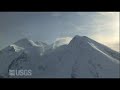
- Redoubt Volcano: Aerial B-roll
- Runtime
- 3:48
- Date posted
- 18 years ago
- Description
- http://gallery.usgs.gov/videos/102
Aerial footage take over Redoubt volcano in Alaska on Feb 7, 2009 showing the volcano, plume, and vents.
- Title
- Preparedness Now
- Runtime
- 4:33
- Date posted
- 18 years ago
- Description
- http://www.usgs.gov/shakeout/
This film depicts the realistic outcome of a hypothetical, but plausible, magnitude 7.8 earthquake on the San Andreas fault in Southern CA.
From the Creator:
http://www.youtube.com/watch?v=clQpk4it_Tk
Up-and-coming film director, motion graphics designer and Art Center College of Design alumnus, Theo Alexopoulos, takes you on a visceral journey through the USGS ShakeOut Earthquake Scenario. The film was created by the USGS Multi-Hazards Demonstration Project in cooperation with the Designmatters program at Art Center to depict the physical, social, and economic consequences of the most comprehensive earthquake scenario ever created. The film gives the viewers a sense of what will be happening and inspires them to prepare and mitigate for a faster recovery. The premise underlying the film is that design is a powerful catalyst that can bridge the divide between scientific understanding about damaging quakes...

- Title
- The Great ShakeOut: Mariana Amatullo Interview (Part 1)
- Runtime
- 8:01
- Date posted
- 18 years ago
- Description
- http://www.usgs.gov/shakeout
Interview with Mariana Amatullo
Vice President, International Initiatives
Art Center College of Design
Director, Designmatters

- Title
- The Great ShakeOut: Mariana Amatullo Interview (Part 2)
- Runtime
- 6:18
- Date posted
- 18 years ago
- Description
- http://www.usgs.gov/shakeout
Interview with Mariana Amatullo
Vice President, International Initiatives
Art Center College of Design
Director, Designmatters

- Title
- The Great ShakeOut: Gary Sturdivan Interview
- Runtime
- 5:03
- Date posted
- 18 years ago
- Description
- http://www.usgs.gov/shakeout
Interview with Gary Sturdivan
Manager
East Valley Water District
Security and Emergency

- Title
- The Great ShakeOut: Dennis Mileti Interview
- Runtime
- 6:24
- Date posted
- 18 years ago
- Description
- http://www.usgs.gov/shakeout
Interview with Dennis Mileti
Professor Emeritus
University of Colorado, Boulder
Natural Hazards Center





