USGS
Bayesian Modeling, Fly Fishing, and Effects of Urbanization on Stream Ecology

- Title
- Bayesian Modeling, Fly Fishing, and Effects of Urbanization on Stream Ecology
- Runtime
- 14:18
- Date posted
- 15 years ago
- Description
- http://gallery.usgs.gov/videos/475
Tom Cuffney and Song Qian describe their U.S. Geological Survey research on the effects of urbanization on stream ecology, while fly fishing.

- Title
- Ecosystem restoration in the Chesapeake Bay headwaters
- Runtime
- 10:53
- Date posted
- 15 years ago
- Description
- http://gallery.usgs.gov/videos/474
Faith Fitzpatrick (U.S. Geological Survey), Hala Flores (Anne Arundel County Department of Public Works), Ronald Bowen (Anne Arundel County Department of Public Works), and Keith Underwood (Underwood and Assoc.) talk about stream restoration projects associated with Anne Arundel County's new office complex. A 0.5- mile long series of sand seepage berms and bog wetlands were constructed instead of traditional stormwater ponds. This unique site had a degraded and eroded outfall system and ephemeral gully that was rehabilitated into a perennial stream and floodplain system starting with enhanced infiltration in the headwaters. Pollutant load reductions also are met through stormwater redevelopment using sand bedded systems.
- Title
- Watershed Action Teams Connect People with Their Urban Streams
- Runtime
- 4:50
- Date posted
- 15 years ago
- Description
- http://gallery.usgs.gov/videos/473
Faith Fitzpatrick (U.S. Geological Survey) and Theresa Caven (City of Brookfield) talk about how the City of Brookfield near Milwaukee, Wisconsin actively participates in the highly successful Menomonee River Action Plan team.

- Title
- Making Watershed Action Teams Successful
- Runtime
- 7:09
- Date posted
- 15 years ago
- Description
- http://gallery.usgs.gov/videos/472
Faith Fitzpatrick (U.S. Geological Survey) and Paul Lohmiller (GRAEF-USA, Inc.) talk about the communities and groups that make up the successful Menomonee River Action team in Milwaukee, Wis.

- Title
- Creating Watershed Action Teams
- Runtime
- 4:27
- Date posted
- 15 years ago
- Description
- http://gallery.usgs.gov/videos/471
Faith Fitzpatrick (U.S. Geological Survey) and Gail Epping Overholt (University of Wisconsin-Extension Basin Educator) talk about bringing people together to improve the Menomonee River watershed through the Menomonee River Action Plan.

- Title
- Simulated groundwater declines in Central Arkansas
- Runtime
- 0:22
- Date posted
- 15 years ago
- Description
- A groundwater-flow model of the Mississippi embayment was used to evaluate changes in water-level altitudes after the addition of wells that simulate potential future pumping from the Sparta aquifer in the Bayou Meto-Grand Prairie area of eastern Arkansas (shown within the black outline) for the 30-year period from 2007 through 2037. The animation portrays the time-lapse development of a cone of depression with a maximum water-level decline of approximately 102 feet, and a lesser cone of depression to the east. Selected wells are shown as grey vertical pipes. Water-level altitude declines range from 40 to 50 feet over most of the remainder of the Bayou Meto-Grand Prairie area.

- Title
- What Lies Beneath: Using Mangrove Peat to Study Ancient Coastal Environments and Sea-Level Rise
- Runtime
- 9:21
- Date posted
- 15 years ago
- Description
- http://gallery.usgs.gov/videos/468
This video describes how scientists study past changes in sea-level and coastal environments by analyzing mangrove peat. Mangrove islands located off the coast of Belize are underlain by deep deposits of peat (organic soil), which retain a record of past sea level, vegetation, and climate. By studying past changes in sea level and how intertidal ecosystems, such as mangroves, have responded to these changes, we can better predict what will happen in the future as sea levels increase. The information generated by such research is critical to geophysical modeling efforts as well as to management and conservation of coastal ecosystems.

- Title
- Congressional Briefing on SPARROW Model
- Runtime
- 55:19
- Date posted
- 15 years ago
- Description
- http://gallery.usgs.gov/videos/462
In this briefing USGS demonstrated a new and innovative online decision support system used to identify sources of nutrients to downstream waters, such as the Gulf of Mexico, Long Island Sound and others. The decision support system provides access to six newly-developed regional models that describe how rivers receive and transport nutrients to sensitive waters. This decision support system saves time and resources by giving water managers access to sophisticated water-quality models that relate nutrient sources, such as atmospheric deposition, agriculture, waste water treatment plants, and others, to stream water-quality conditions. Managers can easily map and track predictions of nutrient conditions, sources, and quantities transported to downstream waters, and evaluate alternative nutrient reduction scenarios.

- Title
- Climate Connections: Questions from Puerto Rico
- Runtime
- 5:29
- Date posted
- 15 years ago
- Description
- http://gallery.usgs.gov/videos/469
America has questions about climate change, and the USGS has real answers. In this episode of Climate Connections, USGS scientists answer questions gathered from Puerto Rico. Questions include:
- Why has the rainy season been so long in Puerto Rico?
- How is global warming impacting the island of Puerto Rico?
- What are solar storms and are they related to climate change?
- Will we see polar bears on the island of Puerto Rico?

- Title
- A Study in Stream Ecology
- Runtime
- 6:57
- Date posted
- 15 years ago
- Description
- http://gallery.usgs.gov/videos/449
In this episode we explore how scientists for the USGS National Water Quality Assessment Program investigate the ecological health of rivers and streams across the United States. Focusing on a recent sampling effort along the Minam River in northeast Oregon, this video highlights USGS sampling methods for fish, macroinvertebrates (bugs), algae, and habitat. Join us, as we show biometric data can be used to assess the health of streams, only in this episode of the USGS CoreCast.

- Title
- Understanding NHD Data
- Runtime
- 4:57
- Date posted
- 15 years ago
- Description
- http://gallery.usgs.gov/videos/458
Displays and describes in detail the various features that make up the National Hydrography Dataset.

- Title
- Overview of the National Hydrography Dataset and The National Map -- Part II
- Runtime
- 14:59
- Date posted
- 15 years ago
- Description
- http://gallery.usgs.gov/videos/456
Provides an overview of the National Hydrography Dataset and of the National Map. Addresses topics such as the various applications of the NHD, watershed delineation, hydrologic units, ReachCodes, and the different features that make up the NHD.
- Title
- Overview of the National Hydrography Dataset and The National Map -- Part I
- Runtime
- 13:50
- Date posted
- 15 years ago
- Description
- http://gallery.usgs.gov/videos/455
Provides an overview of the National Hydrography Dataset and of the National Map. Addresses topics such as the various applications of the NHD, watershed delineation, hydrologic units, ReachCodes, and the different features that make up the NHD.

- Title
- Navigating the NHD Network
- Runtime
- 14:24
- Date posted
- 15 years ago
- Description
- http://gallery.usgs.gov/videos/451
Describes the NHD Network; how it is built, attributed, and used for analysis and modeling.

- Title
- Maintenance of the NHD
- Runtime
- 4:15
- Date posted
- 15 years ago
- Description
- http://gallery.usgs.gov/videos/452
Describes the way the National Hydrography Dataset (NHD) maintains the millions of features within the dataset. Talks about the roles of Points of Contacts (POCs) and of NHD Stewards, be them state, federal or local agencies.
- Title
- Linear Referencing in the NHD
- Runtime
- 4:22
- Date posted
- 15 years ago
- Description
- http://gallery.usgs.gov/videos/450
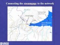
Describes how linear referencing is used within the National Hydrography Dataset (NHD) to associate information with the dataset by attaching it to the network.

- Title
- Hydrography Event Management Tools (HEM)
- Runtime
- 3:44
- Date posted
- 15 years ago
- Description
- http://gallery.usgs.gov/videos/453
Describes the Hydrography Event Management Tools (HEM); what types of data the tool creates and how one can use them to attach information to the National Hydrography Dataset (NHD).
- Title
- Finding Events on the NHD Network
- Runtime
- 3:25
- Date posted
- 15 years ago
- Description
- http://gallery.usgs.gov/videos/454
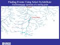
Description of how to find events on the National Hydrography Dataset (NHD) network for analysis and modeling purposes.

- Title
- Understanding Drainage Systems
- Runtime
- 3:45
- Date posted
- 15 years ago
- Description
- http://gallery.usgs.gov/videos/448
Understanding drainage systems also known as Hydrologic Units or HUCs in the National Hydrography Dataset.

- Title
- Time Lapse Photography of Tropical Storm Lee Flooding (downstream of W&OD Trail)
- Runtime
- 2:21
- Date posted
- 15 years ago
- Description
- http://gallery.usgs.gov/videos/447
The camera was set up to frequently take pictures of the stream during Hurricane Lee. This photography is part of a larger project by the USGS National Research Program, the Virginia Water Science Center and the Maryland Water Science Center examining sediment flow.

- Title
- Time Lapse Photography of Tropical Storm Lee Flooding (near streamgage 1645704)
- Runtime
- 3:04
- Date posted
- 15 years ago
- Description
- http://gallery.usgs.gov/videos/446
The camera was set up to frequently take pictures of the stream during Hurricane Lee. This photography is part of a larger project by the USGS National Research Program, the Virginia Water Science Center and the Maryland Water Science Center examining sediment flow.

- Title
- Paul Hsieh and The Deepwater Horizon Oil Spill
- Runtime
- 9:45
- Date posted
- 15 years ago
- Description
- http://gallery.usgs.gov/videos/444
In April of 2010, Paul Hsieh, a research scientist, readily stepped up to an opportunity to provide a service to the public that pulled him away from his work, that pulled him out of his environment. This was not something that's in his job description, but it was a way for him to make a tangible contribution, and as it turned out, he made a significant difference. Paul's activities in the oil spill reflect well on him personally, as well as the National Research Program, and as well, public servants in general. This video describes Paul's use of quick and creative thinking to solve a difficult and pressing issue.

- Title
- USGS Science: Walrus Haul-Out 2011
- Runtime
- 3:33
- Date posted
- 15 years ago
- Description
- Female Pacific walruses and their calves traditionally spend summers far from shore, diving for benthic invertebrates over the shallow continental shelf waters of the Chukchi Sea. These female walruses and their calves prefer to rest between forage bouts on sea ice drifting above their feeding grounds. However, in recent years loss of summer sea ice over the continental shelf has forced many walruses to travel to the northwest coast of Alaska where they haul-out on shore to rest. This large herd of walruses hauled out near Pt. Lay Alaska in August of 2011.

- Title
- Delta Science: Excerpt from "Delta Revival"
- Runtime
- 6:30
- Date posted
- 15 years ago
- Description
- http://gallery.usgs.gov/videos/443
"Delta Science" is an excerpt from the USGS produced television program "Delta Revival: Restoring a California Ecosystem". A link to the complete program follows this description. The segment shows how USGS scientists are working to guide the restoration of the Sacramento-San Joaquin Delta through studies of ecosystem responses to toxic contaminants, invasive species and water diversions. The program aired on KPIX CBS 5 San Francisco and its affiliate channel in the spring of 2004. The program received the 2004 first place Telly Award in documentary and the first place Gold Screen Award in documentary from the National Association of Government Communicators.

- Title
- An Idea That Worked
- Runtime
- 11:46
- Date posted
- 15 years ago
- Description
- http://gallery.usgs.gov/videos/442
On September 21, 1966, Secretary of the Interior Stewart Udall issued a press statement stating his belief that "the time is now right and urgent to apply space technology towards the solution of many pressing natural resources problems being compounded by population and industrial growth." This video provides a sense of America's long-term commitment to conservation, illustrating the depth of the USGS EROS archive and the contributions of Secretary Stewart Udall.

- Title
- 2011: Interior Thanks USGS for Flood Efforts
- Runtime
- 4:38
- Date posted
- 15 years ago
- Description
- http://gallery.usgs.gov/videos/440
Devastating floods across much of the U.S. were severe and unrelenting during the spring and summer of 2011. Countless USGS crews responded to the floods. Often working in dangerous conditions, USGS scientists measured streamflow and river levels, repaired and installed streamgages, measured water quality, and documented river changes. This science is critical for flood preparations and response. In this video, Anne Castle, Department of the Interior Assistant Secretary for Water and Science, thanks USGS for its effort.

- Title
- 2011: The Year of the Flood
- Runtime
- 7:28
- Date posted
- 15 years ago
- Description
- http://gallery.usgs.gov/videos/439
Devastating floods across much of the U.S. were severe and unrelenting during the spring and summer of 2011. When floods happen, USGS crews are among the first-responders. Often working in dangerous conditions, USGS scientists measure streamflow and river levels, repair and install streamgages, measure water quality and changes in sediment flow, and assess river changes. From flood forecasts to difficult decisions about flood management, science is critical for flood preparations and response.

- Title
- Forecast Mekong: Visualizing Shared Waters
- Runtime
- 5:25
- Date posted
- 15 years ago
- Description
- Forecast Mekong: Visualizing Shared Waters
Audio Script -- July 2011
The Mekong is one of the world's great rivers cascading through six Asian countries from the Tibetan Plateau to the South China Sea, connecting China, Myanmar, Laos, Thailand, Cambodia and Vietnam.
How one country uses or changes the waters of the Mekong upstream can have important implications for the health of the river and people downstream.
Increasing demands for hydropower and irrigation have prompted several countries to plan the construction of large dams on the Mekong River and its tributaries. The cumulative effects of such dams can be quantified through the use of hydrologic data and computer models. Visualization tools can help people develop a shared understanding of river resources and provide a science basis for critical decisions about regional development and sustainability.
In 1995, the nations of the Lower Mekong basin established the Me...

- Title
- Earthquakes - Shock Waves
- Runtime
- 4:56
- Date posted
- 15 years ago
- Description
- http://gallery.usgs.gov/videos/438
This short excerpt is from a USGS/Bay Area Earthquake Alliance produced television program "Shock Waves: 100 Years After the 1906 Earthquake". This specific segment describes some of the history behind our modern understanding of the earthquake process. The program received numerous industry awards and was nominated for a regional Emmy Award in the Bay area. It aired twice on KPIX CBS5 and its affiliate station around the time of the April 18, 2006, 100 year anniversary of the Great San Francisco Earthquake. The full program is streamed at the link: http://earthquake.usgs.gov/regional/nca/1906/shockwaves/

- Title
- USGS Activities During Missouri River Flooding 2011
- Runtime
- 7:02
- Date posted
- 15 years ago
- Description
- http://gallery.usgs.gov/videos/436
USGS Nebraska Water Science Center Associate Director Richard "Rick" Wilson describes the reasons for and extent of the flooding on the Missouri River in 2011, the risks associated with the flooding, and the work the USGS is doing on the river to characterize the amount of scour and other potential damage resulting from the flood waters
- Title
- Land Area Change in Coastal Louisiana (1932 to 2010)
- Runtime
- 5:15
- Date posted
- 15 years ago
- Description
- http://gallery.usgs.gov/videos/433
Coastal Louisiana wetlands make up the seventh largest delta on Earth, contain about 37 percent of the estuarine herbaceous marshes in the conterminous United States, and support the largest commercial fishery in the lower 48 States. These wetlands are in peril because Louisiana currently undergoes about 90 percent of the total coastal wetland loss in the continental United States. Documenting and understanding the occurrence and rates of wetland loss are necessary for effective planning, protection, and restoration activities.
USGS land change analyses show that coastal Louisiana has undergone a net change in land area of about -1,883 square miles (mi2) from 1932 to 2010, or an area equivalent to the size the State of Delaware. This net change in land area amounts to a decrease of about 25 percent of the 1932 land area. Trend analyses from 1985 to 2010 show a wetland loss rate of 16.57 mi2 per year. If this loss were to...

- Title
- Bobcat Movement Patterns in Urban Southern California
- Runtime
- 2:29
- Date posted
- 15 years ago
- Description
- http://gallery.usgs.gov/videos/435
USGS biologists are using GPS technology to track carnivores as they cross the highways of urban Southern California. USGS Western Ecological Research Center biologists Erin Boydston and Lisa Lyren attached GPS tracking collars to wild bobcats to shed light on how these carnivores are using highway under-crossings to travel between habitats, and whether urban development in Los Angeles and Orange County landscapes is shifting wildlife behavior. GIS specialist Bill Perry explains in this Google Earth animation.

- Title
- Post-fire Flash Flood in Coronado National Memorial, Arizona
- Runtime
- 2:33
- Date posted
- 15 years ago
- Description
- http://gallery.usgs.gov/videos/437
Video footage begins with dry streambed, and within the first 10 seconds a very dark, roiling, flow comes downstream toward the viewer. The rest of the video is footage of the flow going past, and into a culvert under a bridge. The video was recorded at the U.S. Geological Survey streamgage site near the Coronado National Memorial visitor center, in southern Arizona. The flow event was the result of rain higher up in the basin, which includes the Montezuma Pass overlook area. The video includes the sound of rushing water as the flow event sweeps downstream.

- Title
- Lake of the Sky: USGS Tahoe Basin Science
- Runtime
- 12:10
- Date posted
- 15 years ago
- Description
- http://gallery.usgs.gov/videos/431
A documentary film highlighting recent and past USGS research in the Lake Tahoe Basin. The program was produced for screening and release at the 2011 Lake Tahoe Summit. It features USGS science activities conducted by hydrologists, geologists, geographers, computer modelers, and biologists, among others. The story is told through the use of narration, expert interviews, graphics, animations, incredible video imagery and time-lapse video. USGS science detailed in the story includes water quality monitoring, streamgaging, Lake Tahoe bathymetry, aerial LiDAR, historic use of aerial photography, and the Tahoe Land Use Simulation Model. This wide range of consistent, reliable, long-term data and maps are crucial for evaluating and maintaining the lake and basin. The films concluding message is: "USGS researchers are working to rapidly deliver the best science possible in the on-going effort to protect, preserve and restore the spectacular Nati...

- Title
- Ocean Acidification: Research on Top of the World
- Runtime
- 2:22
- Date posted
- 15 years ago
- Description
- http://gallery.usgs.gov/videos/430
The Arctic Ocean is one of the most unique bodies of water on the planet. It houses large charismatic predators like polar bears, whales, and seals; critical species like shell fish and phytoplankton; and an array of organisms found nowhere else on Earth. The Arctic Ocean is also the most inaccessible and least explored ocean. Its remoteness has kept it ecologically pristine. But the Arctic is where climate change impacts are strongest and where global changes are underway.

- Title
- Climate Connections: Questions from North and South Carolina
- Runtime
- 5:29
- Date posted
- 15 years ago
- Description
- Subscribe to the USGS CoreCast: http://usgs.gov/corecast
America has questions about climate change, and the USGS has real answers. In this episode of Climate Connections, USGS scientists answer questions gathered from North and South Carolina.
- Title
- USGS CoreCast: Episode 161 -- Emerging Contaminants
- Runtime
- 9:32
- Date posted
- 15 years ago
- Description
- http://gallery.usgs.gov/videos/427
Today on the USGS CoreCast we explore what impact emerging contaminants have on the health and development of aquatic wildlife. We traveled to the Pacific Northwest to talk with a multidisciplinary research team of USGS scientists about an ongoing study that characterizes the contaminants and habitats for a number of aquatic species along the lower Columbia River.

- Title
- Halema'uma'u Northwest Rim Collapse
- Runtime
- 1:18
- Date posted
- 15 years ago
- Description
- Full details at: http://gallery.usgs.gov/videos/418
There was a series of vent wall and rim collapses on March 3, much like those that occurred in January and February. This video, compiled from the Webcam on the rim of Halema'uma'u above the vent, is one of the larger collapses, and shows the northwest rim of the vent falling into the lava lake.

- Title
- Halema'uma'u North Rim Collapse
- Runtime
- 0:40
- Date posted
- 15 years ago
- Description
- Full details at: http://gallery.usgs.gov/videos/419
This video, compiled from the Webcam on the rim of Halema'uma'u, shows the north rim of the vent collapsing.

- Title
- Collapse of the Pu'u 'O 'o Crater Floor on March 5, 2011
- Runtime
- 0:23
- Date posted
- 15 years ago
- Description
- Full details at: http://gallery.usgs.gov/videos/426
Video showing the collapse of the Pu'u 'O 'o crater floor on March 5. The video starts at 4 am and ends at 11 pm. The floor of the crater dropped about 115 meters (377 ft) in just a few hours.

- Title
- Lava Fountaining from a Dominant Vent
- Runtime
- 0:19
- Date posted
- 15 years ago
- Description
- Full details at: http://gallery.usgs.gov/videos/425
Video showing low fountaining from the dominant vent, near the southwest end of the fissure system adjacent to Napau Crater, active during the day on March 7.
- Title
- Lava Spattering from a Persistent Vent
- Runtime
- 0:23
- Date posted
- 15 years ago
- Description
- Full details at: http://gallery.usgs.gov/videos/424
Video showing spattering from the most persistent vent of the day just west of the base of Pu'u 'O 'o near the northeastern end of the fissure system.

- Title
- Lava Flowing Into a Seemingly Bottomless Crack
- Runtime
- 0:16
- Date posted
- 15 years ago
- Description
- Full details at: http://gallery.usgs.gov/videos/423
This video shows lava pouring from the fissure into a seemingly bottomless crack. Napau Crater in the background. Helicopter for scale.

- Title
- Spattering Near Propagating Fissure
- Runtime
- 0:29
- Date posted
- 15 years ago
- Description
- Full details at: http://gallery.usgs.gov/videos/422
Spattering near the front of the propagating fissure.

- Title
- Fissure Eruption Between Pu'u 'O 'o and Napau Crater
- Runtime
- 0:16
- Date posted
- 15 years ago
- Description
- Full details at: http://gallery.usgs.gov/videos/420
Video clip shot from the air looking SW at the fissure eruption between Pu'u 'O 'o and Napau Crater. The fissure segment in the tephra in the foreground opened seconds earlier, and only about 10 minutes after the eruption as a whole started. The cracks through the tephra are in the process of opening, though this can't be picked out at this distance.

- Title
- Propagating Fissure
- Runtime
- 0:25
- Date posted
- 15 years ago
- Description
- Full details at: http://gallery.usgs.gov/videos/421
Video clip shot in front of the propagating fissure, showing low spattering that started moments earlier. Thick white steam from the crack in the foreground indicates that lava is about to reach the surface, and is seen doing so seconds later.

- Title
- Thunder Sounds from the Vent in Halema'uma'u
- Runtime
- 0:31
- Date posted
- 15 years ago
- Description
- Full details at: http://gallery.usgs.gov/videos/415
Booming sounds from the vent in Halema'uma'u have been audible around the summit area of Kilauea for the past several days. Some of these sounds are caused by rocks striking the surface of the lava lake, but most are actually the sound of the vent walls cracking due to heating and expansion of rock. This video, from February 25, illustrates what this sounds like. Occasionally, these sharp reports and booms can be visually correlated to rocks exploding off the vent wall and showering fragments down onto the surface of the lava lake.

- Title
- Spattering in Halema'uma'u
- Runtime
- 0:32
- Date posted
- 15 years ago
- Description
- Full details at: http://gallery.usgs.gov/videos/417
As spattering intensifies, the walls of the vent heat even more, causing the cracking of the rocks through thermal expansion to speed up, creating the cacophony of popping noises apparent in this video.
- Title
- Rockfall in Halema'uma'u
- Runtime
- 0:36
- Date posted
- 15 years ago
- Description
- Full details at: http://gallery.usgs.gov/videos/416
The level of the lava lake sometimes changes abruptly. These cycles of rise and fall, which amount to a vertical change of around 15 m (about 50 ft), are occasionally triggered by rockfalls. Here, a small collapse from the vent wall triggers degassing and a drop in the lava level.

- Title
- Halema'uma'u West Rim Collapse
- Runtime
- 1:11
- Date posted
- 15 years ago
- Description
- Full details at: http://gallery.usgs.gov/videos/414
This clip, captured by a video camera on the rim of Halema'uma'u to the southwest of the vent, shows a small slice of the western rim of the vent collapsing into the lava lake.





