NWS Louisville
National Weather Service Louisville 150 Anniversary: Relationship with Our Media Partners Part 1

- Title
- National Weather Service Louisville 150 Anniversary: Relationship with Our Media Partners Part 1
- Runtime
- 5:11
- Date posted
- 5 years ago
- Description
- The mission of the National Weather Service is to protect life and property. This mission could not be achieved without the strong relation we have with our local media partners. Most life saving weather information might go unseen if not for that information being broadcast by local television and radio. Hear, in their own words, what this partnership means to them and their job as broadcast meteorologists.
---------------------------------
National Weather Service
Weather Forecast Office
Louisville, KY

- Title
- The National Weather Service in Louisville, KY Celebrates 150 Years of Service
- Runtime
- 4:50
- Date posted
- 5 years ago
- Description
- On September 11, 2021 the National Weather Service office in Louisville, KY celebrates its 150 anniversary serving the Louisville Area as well as central Kentucky and southern Indiana. We take you through brief history of our office and how it corresponds with the National Weather Service as a whole over those 150 years.
---------------------------------
National Weather Service
Weather Forecast Office
Louisville, KY

- Title
- Why have our sunrise/sunsets looked reddish-orange?
- Runtime
- 1:28
- Date posted
- 5 years ago
- Description
- Smoke is the reason we've seen a vivid reddish-orange sun at sunrise and sunset. We explain what gives the sun that color.
---------------------------------
National Weather Service
Weather Forecast Office
Louisville, KY
- Title
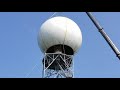
- NWS Louisville KLVX Service Life Extension Program 2021
- Runtime
- 4:06
- Date posted
- 5 years ago
- Description
- The Service Life Extension Program (SLEP) consists of 4 independent projects executed over the past 8 years. SLEP is meant to keep our weather radars functional beyond 2030 and involved replacing and refurbishing major components of weather radars.
KLVX radar, which serves the central Kentucky and southern IN region, underwent a new pedestal installment on July 15, 2021.
---------------------------------
National Weather Service
Weather Forecast Office
Louisville, KY

- Title
- F4 tornado strikes Bullitt County, KY, May 28, 1996
- Runtime
- 2:26
- Date posted
- 5 years ago
- Description
- A powerful tornado struck just south of Louisville, Kentucky. Bullitt County was hardest hit.
---------------------------------
National Weather Service
Weather Forecast Office
Louisville, KY
- Title
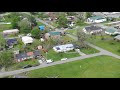
- EF-1 Tornado Damage in Tompkinsville, KY (5/3/21)
- Runtime
- 0:33
- Date posted
- 5 years ago
- Description
- Aerial views of tornado damage in Tompkinsville, KY, from an EF-1 tornado that struck the morning of May 3, 2021.
---------------------------------
National Weather Service
Weather Forecast Office
Louisville, KY
- Title
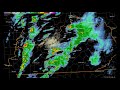
- March 25, 2021 Damaging Winds, Hail, and Tornadoes
- Runtime
- 0:25
- Date posted
- 5 years ago
- Description
- Radar animation showing the storms that produced hail, damaging winds, and three tornadoes across central Kentucky on March 25, 2021.
---------------------------------
National Weather Service
Weather Forecast Office
Louisville, KY
- Title
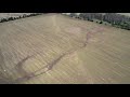
- Ground Swirls Left By EF-0 Tornado
- Runtime
- 0:30
- Date posted
- 6 years ago
- Description
- On the evening of March 25, 2021 an EF-0 tornado left these marks in an open field east of Clarkson, Kentucky.
---------------------------------
National Weather Service
Weather Forecast Office
Louisville, KY

- Title
- Ohio River Drone Survey in Louisville, Kentucky, on March 5, 2021
- Runtime
- 1:29
- Date posted
- 6 years ago
- Description
- Aerial video collected from a drone survey team as part of the National Weather Service in Louisville, Kentucky. Video was taken near the Ohio River which was in flood stage.
---------------------------------
National Weather Service
Weather Forecast Office
Louisville, KY

- Title
- Kentucky River Flooding at High Bridge
- Runtime
- 0:27
- Date posted
- 6 years ago
- Description
- Torrential rain on February 28, 2021 resulted in significant flooding across central Kentucky during the following days.
---------------------------------
National Weather Service
Weather Forecast Office
Louisville, KY

- Title
- Kentucky River Flooding in Frankfort
- Runtime
- 0:21
- Date posted
- 6 years ago
- Description
- Torrential rains on February 28 led to significant flooding across central Kentucky in the following days.
---------------------------------
National Weather Service
Weather Forecast Office
Louisville, KY

- Title
- How to Measure Snow
- Runtime
- 2:49
- Date posted
- 6 years ago
- Description
- For a quick reminder on how to properly measure snow and report snowfall totals, watch this short video!
---------------------------------
National Weather Service
Weather Forecast Office
Louisville, KY

- Title
- Development and decay of tall cumulus clouds
- Runtime
- 0:23
- Date posted
- 6 years ago
- Description
- Updrafts create tall cumulus clouds that billow upwards, collapse, and are followed by new development on new updrafts. Video taken by Tyler Voelker. Permission granted for NWS use only.
---------------------------------
National Weather Service
Weather Forecast Office
Louisville, KY

- Title
- Weather Wednesday Spotter Training: NWS Louisville & Wave 3 Weather Team - 4/29/2020
- Runtime
- 1:15:01
- Date posted
- 6 years ago
- Description
- NWS Louisvile Meteorologist and the Wave 3 Weather Team conduct a shortened version of Skywarn Spotter training on Weather Wednesday 4/29/2020
National Weather Service
Weather Forecast Office
Louisville, KY
- Title
- Mud Creek in Russell County, Kentucky, May 2, 2010
- Runtime
- 0:35
- Date posted
- 6 years ago
- Description
- Mike Bunch shared this video of Mud Creek in Russell County flowing swiftly after the heavy rains of May 1-2, 2010.
---------------------------------
National Weather Service
Weather Forecast Office
Louisville, KY

- Title
- CoCoRaHS Overview
- Runtime
- 20:09
- Date posted
- 7 years ago
- Description
- Volunteers send in daily rain and snow reports using their own rain gauge right in their back yard! Join today at cocorahs.org
---------------------------------
National Weather Service
Weather Forecast Office
Louisville, KY

- Title
- Radar loop from January 11, 2020
- Runtime
- 0:50
- Date posted
- 7 years ago
- Description
- Radar loop showing a squall line crossing the region during the late morning and early afternoon of January 11, 2020.
---------------------------------
National Weather Service
Weather Forecast Office
Louisville, KY

- Title
- Historical Odds of a White Christmas Kentucky & Southern Indiana
- Runtime
- 2:23
- Date posted
- 7 years ago
- Description
- When it comes to Christmas weather, most tend to dream of a White Christmas. But what are the historical odds of seeing snow on the ground Christmas Day across Southern Indiana and Kentucky?
---------------------------------
National Weather Service
Weather Forecast Office
Louisville, KY

- Title
- August 4, 2009 Flash Flood Emergency
- Runtime
- 0:11
- Date posted
- 7 years ago
- Description
- Radar reflectivity loop of storms that caused a flash flood emergency in Louisville, Kentucky, on August 4, 2009.
---------------------------------
National Weather Service
Weather Forecast Office
Louisville, KY

- Title
- Tornado History of Southern Indiana and Central Kentucky
- Runtime
- 45:10
- Date posted
- 7 years ago
- Description
- A look at tornadoes past and present in the middle Ohio Valley. Also, advice on how to increase your chances of surviving nature's most violent windstorms.
---------------------------------
National Weather Service
Weather Forecast Office
Louisville, KY

- Title
- Ohio Valley Weather Hazards
- Runtime
- 54:22
- Date posted
- 8 years ago
- Description
- A webinar originally presented on October 18, 2018 for our Weather Ready Nation (WRN) Ambassadors.
---------------------------------
National Weather Service
Weather Forecast Office
Louisville, KY
- Title
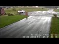
- Security camera footage of Harrison County, Indiana tornado
- Runtime
- 1:01
- Date posted
- 8 years ago
- Description
- July 20, 2018. Courtesy Patrick Koch.
---------------------------------
National Weather Service
Weather Forecast Office
Louisville, KY
- Title
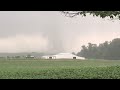
- New Middletown, Indiana tornado
- Runtime
- 0:29
- Date posted
- 8 years ago
- Description
- EF-1 tornado in Harrison County, Indiana on July 20, 2018. Video shared with NWS by August Veron.
---------------------------------
National Weather Service
Weather Forecast Office
Louisville, KY

- Title
- Harrison County EF-1 Tornado
- Runtime
- 2:12
- Date posted
- 8 years ago
- Description
- Harrison County EF-1 Tornado near Corydon, IN 7/20/18. Video by Gregory Linker.
---------------------------------
National Weather Service
Weather Forecast Office
Louisville, KY

- Title
- EF0 Tornado near Nolin River Lake June 25, 2018. Video courtesy of Steven Roberts.
- Runtime
- 1:31
- Date posted
- 8 years ago
- Description
- ---------------------------------
National Weather Service
Weather Forecast Office
Louisville, KY

- Title
- Drone Footage of Boyle County
- Runtime
- 1:46
- Date posted
- 9 years ago
- Description
- Drone footage of Boyle County after April 3, 2018 squall line. Courtesy Garrard County SKYWARN.
---------------------------------
National Weather Service
Weather Forecast Office
Louisville, KY
- Title
- Drone Footage of Boyle County
- Runtime
- 2:50
- Date posted
- 9 years ago
- Description
- Drone footage after April 3, 2018 squall line. Courtesy Garrard County SKYWARN.
---------------------------------
National Weather Service
Weather Forecast Office
Louisville, KY

- Title
- Security camera video from the Beaver Dam Kentucky EF-1 tornado on 11/18/2017
- Runtime
- 0:22
- Date posted
- 9 years ago
- Description
- Security camera video showing winds downing a tree in the Beaver Kentucky EF-1 tornado on 11/18/2017. Video courtesy Rebekah Poston-Mielke.
---------------------------------
National Weather Service
Weather Forecast Office
Louisville, KY

- Title
- Drone footage showing the start of an EF-1 tornado in Taylor County
- Runtime
- 1:50
- Date posted
- 9 years ago
- Description
- Drone footage of EF-1 tornado damage from November 18, 2017 in northern Taylor County, Kentucky. Video courtesy John Humphress. More information on this tornado available at http://www.weather.gov/lmk/11182017_Severe_Weather
---------------------------------
National Weather Service
Weather Forecast Office
Louisville, KY

- Title
- Winter Precipitation Types
- Runtime
- 1:45
- Date posted
- 11 years ago
- Description
- A brief explanation of how precipitation ends up falling as snow, sleet, or freezing rain.
---------------------------------
National Weather Service
Weather Forecast Office
Louisville, KY

- Title
- Winter Weather -Knowing the DIfference
- Runtime
- 2:15
- Date posted
- 11 years ago
- Description
- A brief overview of the differences between a Winter Storm Watch or Warning and a Winter Weather Advisory,
---------------------------------
National Weather Service
Weather Forecast Office
Louisville, KY

- Title
- EF-1 Tornado in Eastern Lincoln County, KY April 10, 2009
- Runtime
- 1:38
- Date posted
- 12 years ago
- Description
- This EF-1 tornado touched down on the west side of Eubank and moved NNE for 6.5 miles. It was 100 yards wide.
---------------------------------
National Weather Service
Weather Forecast Office
Louisville, KY

- Title
- Evolution of a Winter Storm in a Forecast Computer Model
- Runtime
- 0:21
- Date posted
- 12 years ago
- Description
- See how computer model forecasts change, sometimes drastically, from one run to the next.
---------------------------------
National Weather Service
Weather Forecast Office
Louisville, KY
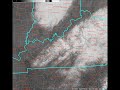
- Title
- Melting Snow
- Runtime
- 0:30
- Date posted
- 12 years ago
- Description
- Visible satellite images show quickly melting snow as temperatures climb above freezing January 24, 2015. Four to six inches of snow fell the previous evening, with the deepest snow melting the least in this animation.
---------------------------------
National Weather Service
Weather Forecast Office
Louisville, KY

- Title
- Downburst between Lyndon and Graymoor-Devondale (Louisville) KY
- Runtime
- 0:34
- Date posted
- 12 years ago
- Description
- This downburst felled trees near the intersection of Herr and Westport on July 7, 2014. It was taken by Tim Hargis and shared with us by Brian Goode of WAVE.
National Weather Service
Weather Forecast Office
Louisville, KY

- Title
- NWS Louisville - Online Skywarn - Module 3 (Storm Spotting)
- Runtime
- 16:51
- Date posted
- 12 years ago
- Description
- This is the 3rd of 4 modules in our Online Skywarn training. Quizzes and additional modules will be linked from our Skywarn webpage as they become available.

- Title
- NWS Louisville - Online Skywarn - Module 4 (Information Exchange)
- Runtime
- 20:39
- Date posted
- 12 years ago
- Description
- This is the 4th of 4 modules in our Online Skywarn training. If you don't see all 4, the other modules and quiz materials are coming soon, and will be linked from our Skywarn page. Voice: T.G. Shuck, former Chief Meteorologist, WKYT-TV (Lexington)

- Title
- NWS Louisville - Online Skywarn - Module 2 (How The Weather Works)
- Runtime
- 31:45
- Date posted
- 12 years ago
- Description
- This is the 2nd of 4 modules in our Online Skywarn training. Quizzes and additional modules will be linked from our Skywarn page as they become available.

- Title
- NWS Louisville - Online Skywarn - Module 1 (Intro)
- Runtime
- 22:35
- Date posted
- 13 years ago
- Description
- This is the 1st of 4 modules in our Online Skywarn training. Additional modules and quizzes will be linked from our Skywarn page once they become available. Voice: Ken Schulz, former Chief Meteorologist, WHAS-TV (Louisville)

- Title
- Wall cloud near Churchill Downs June 22, 2011
- Runtime
- 0:55
- Date posted
- 13 years ago
- Description
- Amazing circulation overhead! This storm did produce an EF2 tornado.
---------------------------------
National Weather Service
Weather Forecast Office
Louisville, KY
- Title
- Cold Outbreak Science Fun
- Runtime
- 0:07
- Date posted
- 13 years ago
- Description
- Due to the very cold airmass that had settled into the Ohio Valley on Monday, January 6th, we were able to see the effects of throwing a cup of hot water into the near zero degree air. Try it at home (but please wear layers of warm clothing)!
---------------------------------
National Weather Service
Weather Forecast Office
Louisville, KY

- Title
- Madison Indiana Ohio River Bridge Explosion
- Runtime
- 1:10
- Date posted
- 13 years ago
- Description
- The demolition of the bridge to Madison, IN. Weather support was provided for this event the morning of 23 July 2013.
---------------------------------
National Weather Service
Weather Forecast Office
Louisville, KY

- Title
- Logan County Tornado shot on Schochoh Road, Adairville, KY
- Runtime
- 0:55
- Date posted
- 13 years ago
- Description
- Courtesy of John Orndorff.
---------------------------------
National Weather Service
Weather Forecast Office
Louisville, KY

- Title
- Logan County Tornado near Robey Farm
- Runtime
- 0:12
- Date posted
- 13 years ago
- Description
- Courtesy of and shared with permission by Chad Jackson.
---------------------------------
National Weather Service
Weather Forecast Office
Louisville, KY
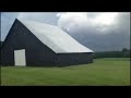
- Title
- Simpson County Tornado (near Franklin)
- Runtime
- 0:10
- Date posted
- 13 years ago
- Description
- Courtesy of and shared with permission by Chad Jackson.
---------------------------------
National Weather Service
Weather Forecast Office
Louisville, KY

- Title
- Logan County Tornado near Conn Road
- Runtime
- 0:17
- Date posted
- 13 years ago
- Description
- Courtesy of and shared with permission by Chad Jackson.
---------------------------------
National Weather Service
Weather Forecast Office
Louisville, KY
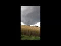
- Title
- Logan County Tornado
- Runtime
- 0:30
- Date posted
- 13 years ago
- Description
- Courtesy of and shared with permission by Chad Jackson.
---------------------------------
National Weather Service
Weather Forecast Office
Louisville, KY
- Title
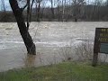
- Swift-flowing Blue River at Milltown, Indiana on March 18, 2013
- Runtime
- 0:29
- Date posted
- 14 years ago
- Description
- Sent to us by intrepid weather watcher Wade Bell.
---------------------------------
National Weather Service
Weather Forecast Office
Louisville, KY

- Title
- 2013 Severe Weather Awareness Public Service Announcement - 60 sec.
- Runtime
- 0:58
- Date posted
- 14 years ago
- Description
- Senator Dan Coats of Indiana provides life-saving information on staying safe during severe weather.
---------------------------------
National Weather Service
Weather Forecast Office
Louisville, KY

- Title
- 2013 Severe Weather Awareness Public Service Announcement
- Runtime
- 0:34
- Date posted
- 14 years ago
- Description
- Senator Dan Coats Severe Weather Awareness PSA
---------------------------------
National Weather Service
Weather Forecast Office
Louisville, KY





