NWS LaCrosse WI
Dangerous Cold Tonight-Wednesday Morning
- Title
- Dangerous Cold Tonight-Wednesday Morning
- Runtime
- 2:21
- Date posted
- 12 years ago
- Description
- An Arctic Front will sweep through the region this afternoon into tonight bringing dangerously cold wind chills to the area. Periods of bitter to dangerous cold expected the rest of the week.
---------------------------------
National Weather Service
Weather Forecast Office
La Crosse, WI

- Title
- Accumulating Snow This Evening
- Runtime
- 3:48
- Date posted
- 12 years ago
- Description
- Snow will moving quickly across the area this evening. The heaviest snow will fall across northeast Iowa and southwest Wisconsin where snow totals will range from 3 to 6". Hourly snow rates across northeast Iowa could approach an inch per hour.

- Title
- Winter Storm-Dangerous Cold: Noon UPDATE Jan 5 2015
- Runtime
- 2:38
- Date posted
- 12 years ago
- Description
- Noon update on expected winter storm-heavy snow, followed by bitter to dangerous cold through the upcoming weekend.
---------------------------------
National Weather Service
Weather Forecast Office
La Crosse, WI

- Title
- Snow this afternoon and evening followed by bitter to dangerous cold.
- Runtime
- 3:34
- Date posted
- 12 years ago
- Description
- Snow, possibly heavy at times, will impact the evening commute. Periods of bitter to dangerous cold expected late tonight through Saturday.
---------------------------------
National Weather Service
Weather Forecast Office
La Crosse, WI

- Title
- Jan 4 2015: Winter Briefing
- Runtime
- 2:37
- Date posted
- 12 years ago
- Description
- Updated on the impending winter storm and 6 plus inches of snowfall, along with the expected bitter/dangerous cold through the week.
---------------------------------
National Weather Service
Weather Forecast Office
La Crosse, WI

- Title
- Bitter To Dangerous Cold Moving In Today, Heavy Snow Possible Late Monday
- Runtime
- 3:36
- Date posted
- 12 years ago
- Description
- Multiple bouts of bitter to dangerous cold are expected this week, the first of which is moving in today. Additionally, heavy snow is possible late Monday, especially south of Interstate 90.
---------------------------------
National Weather Service
Weather Forecast Office
La Crosse, WI

- Title
- Video Briefing: January 3 2015 4pm
- Runtime
- 4:46
- Date posted
- 12 years ago
- Description
- Bitterly cold air and accumulating snow are in the forecast this week. Be prepared!

- Title
- Slippery Travel Tonight, Followed By Bitterly Cold Air
- Runtime
- 4:03
- Date posted
- 12 years ago
- Description
- Slippery Travel Expected Tonight, Bitterly Cold Air moves in for Sunday and lasts through much of next week, and a period of accumulating snow Monday night.
---------------------------------
National Weather Service
Weather Forecast Office
La Crosse, WI

- Title
- Bitterly Cold Wind Chills Tonight-Noon Tuesday.
- Runtime
- 1:57
- Date posted
- 12 years ago
- Description
- Bitterly cold wind chills are expected tonight into Tuesday with more bitter cold possible Tuesday night into Wednesday.
---------------------------------
National Weather Service
Weather Forecast Office
La Crosse, WI

- Title
- Video Briefing: 4 pm Update, December 26 2014
- Runtime
- 2:15
- Date posted
- 12 years ago
- Description
- Accumulating snow is expected to move in tonight and last through Saturday morning.

- Title
- Video Briefing for December 26, 2014
- Runtime
- 2:09
- Date posted
- 12 years ago
- Description
- Two to four inches of snow are expected across the Upper Mississippi River Valley tonight through Saturday.
---------------------------------
National Weather Service
Weather Forecast Office
La Crosse, WI

- Title
- Winter Weather Update - December 23rd - 900 a.m.
- Runtime
- 2:43
- Date posted
- 12 years ago
- Description
- Here's an update on the winter weather hitting the area this morning.
---------------------------------
National Weather Service
Weather Forecast Office
La Crosse, WI

- Title
- Snow covered roads causing slick conditions today.
- Runtime
- 3:02
- Date posted
- 12 years ago
- Description
- 3 to 5 inches of snow is expected to fall across portions of north central Iowa, southeast Minnesota on into north central Wisconsin today. This wet, packy snow will cause roads to become snow covered and slippery today, particularly this morning when most of the snow falls.
---------------------------------
National Weather Service
Weather Forecast Office
La Crosse, WI
- Title
- Slippery road conditions Tonight-Tuesday: North Central Wisconsin
- Runtime
- 2:53
- Date posted
- 12 years ago
- Description
- Snow accumulations of 3 to 5 inches are expected to fall across north central Wisconsin tonight into Tuesday which will cause some slippery road conditions. The heaviest snow is expected to fall on Tuesday morning. These slippery road conditions will make travel difficult for any commuters or holiday travelers the next few days.
---------------------------------
National Weather Service
Weather Forecast Office
La Crosse, WI

- Title
- Video Briefing for November 24. 2014
- Runtime
- 2:58
- Date posted
- 12 years ago
- Description
- Snow and wind impacting the area today into tonight
---------------------------------
National Weather Service
Weather Forecast Office
La Crosse, WI

- Title
- Video Briefing on Fog, Snow And Windy Conditions Through Monday
- Runtime
- 2:32
- Date posted
- 12 years ago
- Description
- Dense fog dissipates over northern Wisconsin this evening, followed by windy conditions and some snow to make for slippery conditions for Monday.
---------------------------------
National Weather Service
Weather Forecast Office
Aberdeen, SD

- Title
- Video Briefing for November 23, 2014
- Runtime
- 2:36
- Date posted
- 12 years ago
- Description
- A strong low pressure system will impact the Upper Mississippi River Valley today and Monday. Rain today will change over to snow overnight and continue through Monday as a strong cold front sweeps across the region. Accumulating rainfall and snowfall is expected with this system.
---------------------------------
National Weather Service
Weather Forecast Office
La Crosse, WI
- Title
- Freezing Rain/Drizzle To Produce Slippery Roads Tonight
- Runtime
- 2:55
- Date posted
- 12 years ago
- Description
- Slippery roads are likely tonight into Saturday morning from northeast Iowa into southwest and central Wisconsin, all due to freezing rain and drizzle moving through.
---------------------------------
National Weather Service
Weather Forecast Office
La Crosse, WI

- Title
- Winter Weather Briefing for November 15, 2014
- Runtime
- 2:52
- Date posted
- 12 years ago
- Description
- 2 to 4 inches of snow in southeast Minnesota and northeast Iowa from late this morning through midnight tonight. There may be some localized up to 5 inches. Meanwhile 1 to 3 inches of snow is expected from this afternoon through tonight in western Wisconsin. The highest snow totals in Wisconsin will be south of Interstate 94. This snow will produce slippery roads and may briefly lower visibilities to less than a mile at times.

- Title
- Winter Weather Briefing. Slippery Morning Commute Expected
- Runtime
- 2:00
- Date posted
- 12 years ago
- Description
- A quick 1-2 inches of snowfall along with a thin layer of ice will lead to slick travel on untreated roads this morning. First taste of winter driving for many.
---------------------------------
National Weather Service
Weather Forecast Office
La Crosse, WI

- Title
- NWS La Crosse Winter Weather Update - Monday afternoon Nov.10
- Runtime
- 2:20
- Date posted
- 12 years ago
- Description
- Late afternoon update covering progress of the winter storm that is moving through central Minnesota and northern Wisconsin.
---------------------------------
National Weather Service
Weather Forecast Office
La Crosse, WI

- Title
- NWS La Crosse Winter Weather Update - Midday November 10th
- Runtime
- 2:44
- Date posted
- 12 years ago
- Description
- Here is an update from NWS La Crosse concerning the on-going heavy snow event across central Minnesota into northern Wisconsin.
---------------------------------
National Weather Service
Weather Forecast Office
La Crosse, WI

- Title
- Winter Storm Update - Mid morning Monday Nov.10th
- Runtime
- 3:04
- Date posted
- 12 years ago
- Description
- Here is an update on the on-going winter storm across parts of Minnesota and Wisconsin.
---------------------------------
National Weather Service
Weather Forecast Office
La Crosse, WI

- Title
- Winter Weather Briefing November 10, 2014
- Runtime
- 4:13
- Date posted
- 12 years ago
- Description
- A strong storm system will bring heavy snow and a wintry mix to parts of the area today through Tuesday.
---------------------------------
National Weather Service
Weather Forecast Office
La Crosse, WI

- Title
- Winter Storm Update for Nov.10-11 - updated Sunday afternoon
- Runtime
- 3:42
- Date posted
- 12 years ago
- Description
- Here is a video update to the heavy snow that is forecast over the next couple days.
---------------------------------
National Weather Service
Weather Forecast Office
La Crosse, WI

- Title
- Winter Storm Briefing - Updated Sunday Morning 945 AM
- Runtime
- 2:56
- Date posted
- 12 years ago
- Description
- A quick update for the winter weather that will hit parts of the region on Monday and Tuesday, Nov.10-11th.
---------------------------------
National Weather Service
Weather Forecast Office
La Crosse, WI

- Title
- Winter Storm on Monday/Tuesday
- Runtime
- 6:04
- Date posted
- 12 years ago
- Description
- A winter storm will move into the area Monday and last through Tuesday with heavy snow falling across northern Wisconsin. 8 to 15 inches is currently forecast across this region with lesser amounts expected to the south.
---------------------------------
National Weather Service
Weather Forecast Office
Aberdeen, SD

- Title
- Briefing for Nov.10-11th Snowfall
- Runtime
- 3:24
- Date posted
- 12 years ago
- Description
- Latest forecast information for first heavy snow forecast of the season, expected Monday and Tuesday.
---------------------------------
National Weather Service
Weather Forecast Office
La Crosse, WI

- Title
- Heavy Snow Possible Monday/Tuesday...trending northward.
- Runtime
- 4:01
- Date posted
- 12 years ago
- Description
- A band of heavy snow is expected to develop Monday into Monday night with over 6" of snow likely to fall. Confidence remains high that this snow will fall, but confidence is low in where it will fall as the forecast models continue to shift it north. Here's the latest forecast thinking.
---------------------------------
National Weather Service
Weather Forecast Office
Aberdeen, SD

- Title
- Winter Storm Possible Monday Nov 10, 2014
- Runtime
- 2:34
- Date posted
- 12 years ago
- Description
- A winter storm may affect the region beginning late Sunday night and lasting into Monday night. Total snowfall amounts and location are still uncertain at this time.
---------------------------------
National Weather Service
Weather Forecast Office
Aberdeen, SD
- Title
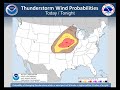
- Sept.9 Briefing on Severe Weather Potential - Update
- Runtime
- 4:03
- Date posted
- 12 years ago
- Description
- Updated weather briefing on severe weather potential for tonight - Tues. Sept.9th.
---------------------------------
National Weather Service
Weather Forecast Office
La Crosse, WI

- Title
- Severe Weather Briefing - September 9, 2014
- Runtime
- 5:25
- Date posted
- 12 years ago
- Description
- Flash flooding, damaging winds, and large hail are all possible tonight into tomorrow morning as a strong storm system enters the region.
---------------------------------
National Weather Service
Weather Forecast Office
La Crosse, WI
- Title
- Heavy rain/Severe Weather Briefing-September 8th, 2014
- Runtime
- 4:29
- Date posted
- 12 years ago
- Description
- Heavy rainfall, flash flooding, large hail, and damaging winds will be possible from thunderstorms Tuesday night into Wednesday morning.
---------------------------------
National Weather Service
Weather Forecast Office
La Crosse, WI

- Title
- Severe Weather Briefing for September 3, 2014 - Updated 12:30 PM
- Runtime
- 4:42
- Date posted
- 12 years ago
- Description
- A severe weather multimedia briefing concerning the severe weather threat for September 3, 2014.
---------------------------------
National Weather Service
Weather Forecast Office
La Crosse, WI
- Title
- Severe Weather Video Briefing Sep. 3, 2014
- Runtime
- 6:32
- Date posted
- 12 years ago
- Description
- Severe weather possible Sep. 3, 2014 during the evening and overnight hours.
---------------------------------
National Weather Service
Weather Forecast Office
La Crosse, WI

- Title
- Labor Day Weekend Weather Update: Friday@2pm
- Runtime
- 6:11
- Date posted
- 12 years ago
- Description
- An update on the weekend weather threats for southeastern Minnesota, northeast Iowa, and western and central WIsconsin.

- Title
- Heavy Rain - August 28-30, 2014
- Runtime
- 4:54
- Date posted
- 12 years ago
- Description
- Two bouts of heavy rain will move through the area from late this morning through Saturday. Rainfall amounts during this time period could total 2 to 3 inches with locally higher amounts possible. This could result in flooding in flood-prone areas and within bank rises on area water ways.
If the heavy rain falls repeatedly over the same locations, the threat for flash flooding and river flooding will increase.
- Title
- Periodic Heavy Rain Expected Thursday through Saturday
- Runtime
- 3:10
- Date posted
- 12 years ago
- Description
- Several bouts of heavy rain will move through the area from Thursday through Saturday. Rainfall amounts during this time period could range from 2 to 4 inches with locally higher amounts possible. This could result in flooding in flood-prone areas and within bank rises on area water ways.
If the heavy rain falls repeatedly over the same locations, the threat for flash flooding and river flooding will increase.

- Title
- July 7 2014 (Monday): Possible Severe Storms
- Runtime
- 5:03
- Date posted
- 12 years ago
- Description

- Title
- UPDATED: Severe Weather Briefing for Sunday, July 6, 2014
- Runtime
- 3:11
- Date posted
- 12 years ago
- Description
- This is an UPDATED video briefing regarding the possibility for Severe Weather during the afternoon and evening hours of Sunday, July 6, 2014.
---------------------------------
National Weather Service
Weather Forecast Office
Aberdeen, SD

- Title
- Severe Weather Briefing For Sunday July 6, 2014
- Runtime
- 1:59
- Date posted
- 12 years ago
- Description
- A quick briefing on the potential for scattered strong to severe thunderstorms Sunday afternoon and evening
---------------------------------
National Weather Service
Weather Forecast Office
La Crosse, WI
- Title
- June 30, 2014 Severe Weather Briefing 10:30 AM Update
- Runtime
- 5:43
- Date posted
- 12 years ago
- Description
- June 30, 2014 Severe Weather Briefing
---------------------------------
National Weather Service
Weather Forecast Office
La Crosse, WI

- Title
- June 30, 2014 Severe Weather Briefing
- Runtime
- 4:49
- Date posted
- 12 years ago
- Description
- Through 7 PM today, several rounds of severe weather will be possible south of Interstate 94. The greatest severe weather threat will be across northeast Iowa and southwest Wisconsin where damaging winds, flash flooding, large hail, and some tornadoes are possible.

- Title
- Sunday morning June 29 severe weather briefing
- Runtime
- 3:50
- Date posted
- 12 years ago
- Description
- Mid morning update on severe weather potential next few days - June 29, 2014.
---------------------------------
National Weather Service
Weather Forecast Office
La Crosse, WI

- Title
- NWS La Crosse Briefing: Severe Weather Potential June 29th, 2014
- Runtime
- 5:32
- Date posted
- 12 years ago
- Description
- Severe weather is a possibility today and Monday. Large hail, damaging winds, heavy rain and isolated tornadoes are all possible.
---------------------------------
National Weather Service
Weather Forecast Office
Aberdeen, SD
- Title
- NWS La Crosse Severe Weather Briefing: Saturday, June 28th, 2014
- Runtime
- 6:31
- Date posted
- 12 years ago
- Description
- Multiple rounds of severe weather are possible today through Monday. Damaging winds, large hail, tornadoes, and heavy rainfall leading to localized flash flooding are all possible.
---------------------------------
National Weather Service
Weather Forecast Office
Aberdeen, SD

- Title
- NWS La Crosse: Severe weather possible this weekend
- Runtime
- 4:19
- Date posted
- 12 years ago
- Description
- Two main rounds of storms are possible this weekend, the first coming on Saturday night and another round on Sunday night. Damaging winds, large hail, heavy rainfall are the main hazards though there is a chance of a tornado or two occurring on Sunday night.
---------------------------------
National Weather Service
Weather Forecast Office
Aberdeen, SD

- Title
- Severe Weather Briefing for June 22, 2014
- Runtime
- 3:51
- Date posted
- 12 years ago
- Description
- Strong to severe storms possible this afternoon through Monday. Flash Flooding the primary hazard.
---------------------------------
National Weather Service
Weather Forecast Office
La Crosse, WI

- Title
- NWS La Crosse Severe Weather Briefing: Saturday, June 21st, 2014
- Runtime
- 3:02
- Date posted
- 12 years ago
- Description
- Severe weather is possible Sunday into Sunday night with large hail, damaging winds and heavy rainfall the main hazards.
---------------------------------
National Weather Service
Weather Forecast Office
La Crosse, WI

- Title
- Severe Weather Briefing for Thursday June 19th, 2014 (6 am)
- Runtime
- 7:08
- Date posted
- 12 years ago
- Description
- Flooding and damaging winds are the main threats through Friday morning.





