NWS LaCrosse WI
June 22 2016: Strong to severe thunderstorms late tonight-Wed
- Title
- June 22 2016: Strong to severe thunderstorms late tonight-Wed
- Runtime
- 2:26
- Date posted
- 10 years ago
- Description
- Two rounds of strong to severe thunderstorms possible: 1) late tonight into Wed morning, 2) Wed late afternoon - evening. Hail, heavy rain and damaging winds all possible.
---------------------------------
National Weather Service
Weather Forecast Office
La Crosse, WI
- Title
- Severe Weather Update - June 14, 2016 (Early Afternoon)
- Runtime
- 2:31
- Date posted
- 10 years ago
- Description
- Here is a quick update on the severe weather risk for June 14th - later this afternoon and tonight.
---------------------------------
National Weather Service
Weather Forecast Office
La Crosse, WI
- Title
- Heavy Rain & Damaging Winds Possible Late This Afternoon and Evening
- Runtime
- 2:15
- Date posted
- 10 years ago
- Description
- Strong to severe storms could impact the area late this afternoon and evening with the potential for heavy rain and damaging winds.
---------------------------------
National Weather Service
Weather Forecast Office
La Crosse, WI
- Title
- June 10 2016: Severe Storm Threat
- Runtime
- 1:55
- Date posted
- 10 years ago
- Description
- Strong to severe storms possible this afternoon/evening, highest in the I-94 corridor highlighted by a damaging wind threat. Large hail and heavy downpours also possible. In addition, very warm and humid with heat indicies from 90 to 100.
---------------------------------
National Weather Service
Weather Forecast Office
Aberdeen, SD
- Title
- Very Warm and Humid. Severe Storms Possible Late Afternoon and Evening.
- Runtime
- 2:32
- Date posted
- 10 years ago
- Description
- A very warm and humid day is expected across the area today. Severe thunderstorms could impact parts of the region late this afternoon into this evening.
---------------------------------
National Weather Service
Weather Forecast Office
La Crosse, WI
- Title
- Controlled Burn at Hixon Forest (Next to the NWS La Crosse Weather Office) on May 3rd, 2016
- Runtime
- 5:26
- Date posted
- 10 years ago
- Description
- A controlled burn of grasses was done next to the NWS La Crosse Weather Office on May 3rd, 2016. A drone was used to film the burn.
---------------------------------
National Weather Service
Weather Forecast Office
Aberdeen, SD
- Title
- Winter Storm Update - Wednesday 4pm
- Runtime
- 2:49
- Date posted
- 11 years ago
- Description
- Here is an update on the winter storm that is expected to bring heavy snow to parts of the region tonight (March 23-24th).
---------------------------------
National Weather Service
Weather Forecast Office
La Crosse, WI
- Title
- Winter Storm Update - March 23rd at Noon
- Runtime
- 2:59
- Date posted
- 11 years ago
- Description
- Update on the expected winter weather weather that will impact the area today into Thursday.
---------------------------------
National Weather Service
Weather Forecast Office
La Crosse, WI
- Title
- Winter Storm March 23-24: 6 AM Wednesday Update
- Runtime
- 2:16
- Date posted
- 11 years ago
- Description
- Updated weather briefing for a significant winter storm impacting the region today into tonight.
- Title
- Winter Storm March 23-24 2016: Update
- Runtime
- 2:42
- Date posted
- 11 years ago
- Description
- Update on the storm heading our way.
- Title
- March 23 Winter Storm Briefing - 6 AM
- Runtime
- 1:53
- Date posted
- 11 years ago
- Description
- Latest weather briefing for a possible winter storm on March 23rd
- Title
- Wind and Snow Mar 16-17, 2016
- Runtime
- 2:17
- Date posted
- 11 years ago
- Description
- Its March! High winds and snow return for the 16th and 17th. High wind warnings and advisories in effect - gusts up to 55 mph. Snow falls in northern Wisconsin - 3 to 6 inches there.
---------------------------------
National Weather Service
Weather Forecast Office
Aberdeen, SD
- Title
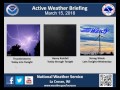
- March 15 Active Weather Briefing
- Runtime
- 2:47
- Date posted
- 11 years ago
- Description
- Active weather setting up across the area today through Wednesday including possible severe thunderstorms, heavy rain, and strong winds.
---------------------------------
National Weather Service
Weather Forecast Office
La Crosse, WI
- Title
- Winter Weather Briefing for Tonight & Tuesday Morning - 3 PM Update
- Runtime
- 2:45
- Date posted
- 11 years ago
- Description
- Accumulating snow will fall mainly south of Interstate 90 from late this evening through Tuesday morning. Snow totals will range from 3 to 6 inches. There may be even a few higher totals in Grant County in southwest Wisconsin.
- Title
- Snow to impact travel tonight into Tuesday morning.
- Runtime
- 2:30
- Date posted
- 11 years ago
- Description
- Slippery to difficult travel develops across northeast Iowa and far southern Wisconsin tonight. Snow will overspread these areas tonight and continue into the Tuesday morning commute. 1 to locally 6 inches of accumulation is expected.
---------------------------------
National Weather Service
Weather Forecast Office
La Crosse, WI
- Title
- Video Briefing for February 7, 2016
- Runtime
- 2:11
- Date posted
- 11 years ago
- Description
- Potential blizzard conditions for portions of southeast Minnesota and northeast Iowa during the night of February 7th into the 8th.
---------------------------------
National Weather Service
Weather Forecast Office
La Crosse, WI
- Title
- 4 pm Weather Briefing for Possible Blizzard Conditions Sunday into Monday
- Runtime
- 2:48
- Date posted
- 11 years ago
- Description
- Blizzard conditions are possible for areas mainly west of U.S. Highway 63 in northeast Iowa and southeast Minnesota Sunday afternoon into Monday.
- Title
- February 2, 2016 Winter Storm Update - 4pm
- Runtime
- 3:22
- Date posted
- 11 years ago
- Description
- Here is an update to the winter weather that is impacting the area today.
---------------------------------
National Weather Service
Weather Forecast Office
La Crosse, WI
- Title
- Groundhog Day Winter Storm Afternoon Update
- Runtime
- 3:00
- Date posted
- 11 years ago
- Description
- Winter storm producing hazardous travel through this evening.
---------------------------------
National Weather Service
Weather Forecast Office
La Crosse, WI
- Title
- Groundhog Day Winter Storm Update
- Runtime
- 3:27
- Date posted
- 11 years ago
- Description
- Dangerous travel conditions continue as a strong winter storm impacts the region.
---------------------------------
National Weather Service
Weather Forecast Office
La Crosse, WI
- Title
- Groundhogs Day Winter Storm: 6 am morning update
- Runtime
- 3:07
- Date posted
- 11 years ago
- Description
- Update on the Groundhogs Day winter storm. Heavy snow, wind, blowing and drifting, and even a wintry mix for some. Significant impacts to travel. 8 to 12" in main snow band
---------------------------------
National Weather Service
Weather Forecast Office
La Crosse, WI
- Title
- Winter Storm Update
- Runtime
- 4:03
- Date posted
- 11 years ago
- Description
- A winter storm will create dangerous travel Tuesday into Tuesday night.
---------------------------------
National Weather Service
Weather Forecast Office
La Crosse, WI
- Title
- Groundhogs Day Winter Storm 2016
- Runtime
- 3:43
- Date posted
- 11 years ago
- Description
- Significant winter storm to bring heavy snow, strong winds, blowing and drifting snow to the region. 8 to 10" likely. Blizzard-like conditions for parts of southeast MN and northeast IA
---------------------------------
National Weather Service
Weather Forecast Office
Aberdeen, SD
- Title
- Potential Winter Storm February 2-3, 2016
- Runtime
- 3:12
- Date posted
- 11 years ago
- Description
- It continues to look like a potential winter storm will impact the area beginning late Monday night and continue through Tuesday night. Since this system is still moving into southern California, there is still some uncertainty on the track of this system and this will greatly affect snow amounts with this system. In addition, there could be some mixed precipitation if it tracks further north. Hourly snow rates will be up to 2 inches per hour in some locations. In addition, blizzard conditions could potentially develop in parts of northeast Iowa and southeast Minnesota on Tuesday afternoon and night. If you have travel plans during this time frame, continue to monitor future forecasts for potential warnings and updated snowfall amounts.
- Title
- Groundhog Day: Significant Winter Storm
- Runtime
- 1:42
- Date posted
- 11 years ago
- Description
- Strong winter storm to bring heavy snow, strong winds, blowing and drifting, and potentially blizzard conditions. Significant impacts.
---------------------------------
National Weather Service
Weather Forecast Office
La Crosse, WI
- Title
- 11 am Update: Winter Storm Dec 28 2015
- Runtime
- 3:22
- Date posted
- 11 years ago
- Description
- The latest as of 11 am
- Title
- Update: Monday Storm: December 28 2015
- Runtime
- 2:30
- Date posted
- 11 years ago
- Description
- Summary of the winter storm moving in today and tonight.
- Title
- Significant Winter Storm - Heavy Snow December 28th, 2015
- Runtime
- 2:30
- Date posted
- 11 years ago
- Description
- Heavy snow with 6 to 10 inches expected as a winter storm roars through the region. Icing possible farther southeast and east. Strong winds could blow and drift some of the snow. 1-2" per hour snowfall rates will quickly turn slippery travel to dangerous.
---------------------------------
National Weather Service
Weather Forecast Office
La Crosse, WI
- Title
- Update: Monday December 28th 2015 Storm
- Runtime
- 3:59
- Date posted
- 11 years ago
- Description
- A Winter Storm Warning is in effect. See the impacts here!
- Title
- Dec 29th Winter Storm - Heavy Snow
- Runtime
- 3:41
- Date posted
- 11 years ago
- Description
- A winter storms will bring snow to the region December 29th. Accumulations of 4 to 8 inches expected, with some wintry mix across the south.
---------------------------------
National Weather Service
Weather Forecast Office
La Crosse, SD
- Title
- Updated winter weather briefing, 11/30/2015, 5 AM.
- Runtime
- 3:53
- Date posted
- 11 years ago
- Description
- Here is an updated video for the mix of precipitation expected in the area Monday and Tuesday, Nov.30/Dec.1st, recorded at 5 am, 11/30/2015.
---------------------------------
National Weather Service
Weather Forecast Office
La Crosse, WI
- Title
- Updated Briefing for Wintry Weather Nov.30/Dec1st
- Runtime
- 2:51
- Date posted
- 11 years ago
- Description
- Here is an updated video for the mix of precipitation expected in the area Monday and Tuesday, Nov.30/Dec.1st.
---------------------------------
National Weather Service
Weather Forecast Office
La Crosse, WI
- Title
- Video Update for Wintry Weather - Nov.30/Dec.1
- Runtime
- 2:31
- Date posted
- 11 years ago
- Description
- Here is an update on the wintry weather expected for the new work week - recorded at mid morning on Sunday, Nov.29th.
---------------------------------
National Weather Service
Weather Forecast Office
La Crosse, WI
- Title
- Potential Winter Storm - November 30-December 1 2015
- Runtime
- 3:30
- Date posted
- 11 years ago
- Description
- A winter storm may bring some accumulating snow from late tonight through Tuesday night. Heaviest totals (2 to 6 inches) will be near Interstate 35 in northeast Iowa and southeast Minnesota and in north-central Wisconsin. However there are some indication that warm air surging ahead of this system may reduce these totals some.
- Title
- Wintry Mix For Thanksgiving - Travel Impacts?
- Runtime
- 3:32
- Date posted
- 11 years ago
- Description
- Rain, snow, perhaps some sleet and even chances for freezing drizzle this Thanksgiving through tonight. 1-3 inches of snow for parts of southeast MN into north-central WI expected, lesser amounts elsewhere. There could be travel impacts, especially for holiday shoppers later tonight.
---------------------------------
National Weather Service
Weather Forecast Office
La Crosse, WI
- Title
- Thanksgiving Outlook: 11 am Wed Nov 25 Update
- Runtime
- 2:10
- Date posted
- 11 years ago
- Description
- A wintery mix will affect the area later Thursday and Thursday night. It looks to cause some slick travel.
- Title
- Thanksgiving outlook: wintry mix - snow - potential for ice
- Runtime
- 2:11
- Date posted
- 11 years ago
- Description
- Rain and drizzle will transition to a wintry mix and snow from west to east late on Thanksgiving, with a wintry mix/snow persisting through the night. Some of that could come in form of freezing and sleet, and thus there is an icing threat. Expect impacts to travel
---------------------------------
National Weather Service
Weather Forecast Office
La Crosse, WI
- Title
- Thanksgiving Weather
- Runtime
- 2:18
- Date posted
- 11 years ago
- Description
- The Thanksgiving holiday will bring drizzle, rain and some snow the region. Some snow accumulations look likely, which could result in impacts to travel and holiday shoppers Thanksgiving night.
---------------------------------
National Weather Service
Weather Forecast Office
La Crosse, WI
- Title
- Heavy Snow For Some Into Overnight - 3 pm Update Nov 20 2015
- Runtime
- 3:11
- Date posted
- 11 years ago
- Description
- An update on the winter storm is provided.
- Title
- Heavy Snow Moving In - Update: Nov 20-21 2015
- Runtime
- 3:11
- Date posted
- 11 years ago
- Description
- An update on the snow forecast for this afternoon and tonight.
- Title
- Heavy snow to impact the area this afternoon into Saturday morning
- Runtime
- 3:32
- Date posted
- 11 years ago
- Description
- Storm system to bring heavy snow to portions of northeast Iowa into southern Wisconsin
---------------------------------
National Weather Service
Weather Forecast Office
La Crosse, WI
- Title
- Update on Winter Storm Potential for Nov.20-21
- Runtime
- 3:07
- Date posted
- 11 years ago
- Description
- Brief summary of weather forecast for potential winter storm and heavy snow over mainly Iowa and southwest Wisconsin.
---------------------------------
National Weather Service
Weather Forecast Office
La Crosse, WI
- Title
- Briefing on Expected Snowfall Friday Night/Saturday - Nov.20-21
- Runtime
- 2:21
- Date posted
- 11 years ago
- Description
- Here is a briefing on the snowfall potential that will start Friday afternoon (Nov.20, 2015) and end Saturday morning.
---------------------------------
National Weather Service
Weather Forecast Office
La Crosse, WI
- Title
- Heavy Snow Possible Late Friday Afternoon through Saturday Morning.
- Runtime
- 4:20
- Date posted
- 11 years ago
- Description
- A strong storm system could bring significant snow to parts of the region. The exact storm track is uncertain at this time. Monitor
---------------------------------
National Weather Service
Weather Forecast Office
La Crosse, WI
- Title
- How To Use The (Experimental) Probability of Snowfall Graphic
- Runtime
- 3:48
- Date posted
- 11 years ago
- Description
- This short video describes the probability of snowfall graphic produced by the NWS La Crosse for 6 and 12 hour time periods, out to 72 hours.
- Title
- Strong to Severe Thunderstorms this Evening - Afternoon Briefing Update
- Runtime
- 2:35
- Date posted
- 11 years ago
- Description
- A strong cold front will sweep across the Upper Mississippi River Valley this evening and overnight. Some thunderstorms may become strong to severe across portions of west-central Wisconsin, southeast Minnesota, and northeast Iowa. The primary threats will be damaging wind and frequent lightning.
---------------------------------
National Weather Service
Weather Forecast Office
La Crosse, WI
- Title
- Strong To Severe Storms Possible Tonight: August 22 2015
- Runtime
- 3:19
- Date posted
- 11 years ago
- Description
- Here is a brief video discussing the potential for any severe weather for Saturday, August 22, 2015.
- Title
- Severe Weather Potential for August 22 2015
- Runtime
- 2:58
- Date posted
- 11 years ago
- Description
- Here is a brief video discussing the potential for any severe weather for Saturday, August 22, 2015. Recorded by meteorologist Todd Shea.
---------------------------------
National Weather Service
Weather Forecast Office
La Crosse, WI
- Title
- Severe storms expected this evening into the overnight hours.
- Runtime
- 3:47
- Date posted
- 11 years ago
- Description
- Severe thunderstorms look to impact the area this evening into the overnight hours with the potential for widespread damaging winds.
---------------------------------
National Weather Service
Weather Forecast Office
La Crosse, WI
- Title
- Severe Weather Briefing For Sunday, July 12, 2015
- Runtime
- 3:29
- Date posted
- 11 years ago
- Description
- Severe storms possible this evening into the overnight hours with damaging winds and locally heavy rains the main threats.
---------------------------------
National Weather Service
Weather Forecast Office
La Crosse. WI