NWS LaCrosse WI
Winter Storm Video Briefing January 21, 2019

- Title
- Winter Storm Video Briefing January 21, 2019
- Runtime
- 2:15
- Date posted
- 8 years ago
- Description
- Winter storm to bring accumulating snow for Tuesday, January 22, 2019.
---------------------------------
National Weather Service
Weather Forecast Office
La Crosse, WI

- Title
- Jan 21, 2019: Briefing for Tue/Tue Night Winter Storm
- Runtime
- 2:37
- Date posted
- 8 years ago
- Description
- Another winter storm is poised to move across the area late tonight into Tuesday night. Here are some timing and impact details for the snow expected to spread across the area.
---------------------------------
National Weather Service
Weather Forecast Office
La Crosse, WI

- Title
- 5 AM 1/18/19 Briefing for Snowfall Today/Tonight
- Runtime
- 2:50
- Date posted
- 8 years ago
- Description
- 5 am briefing on the expected moderate to heavy snowfall for parts of the area today and tonight, January 18, 2019.
---------------------------------
National Weather Service
Weather Forecast Office
La Crosse, WI

- Title
- 3 pm Update: Heavy Snow Friday and Friday Night Jan 18 2019
- Runtime
- 2:20
- Date posted
- 8 years ago
- Description
- NWS La Crosse

- Title
- Dec 1, 2018 Morning Winter Storm Briefing
- Runtime
- 2:37
- Date posted
- 8 years ago
- Description
- A winter storm will impact the region this weekend with a wintry mix of precipitation including heavy snowfall and light icing. Difficult travel is expected.

- Title
- Nov 30 Morning Update - Winter Storm Expected This Weekend
- Runtime
- 3:28
- Date posted
- 8 years ago
- Description
- A winter storm is expected to bring a messy wintry mix of precipitation to the region this weekend with difficult travel expected.

- Title
- Updated Severe Weather Briefing - Oct.3 PM
- Runtime
- 2:54
- Date posted
- 8 years ago
- Description
- Here is an updated weather briefing for Wednesday, October 3rd, including the severe weather risk today and potential for more heavy rain over the next 7-10 days.
---------------------------------
National Weather Service
Weather Forecast Office
La Crosse, WI

- Title
- Severe storms possible this afternoon and evening.
- Runtime
- 2:46
- Date posted
- 8 years ago
- Description
- Severe thunderstorms are possible this afternoon and early evening. Conditional threat based on cloud cover and potential for hindered storm development due to the clouds. If storms develop they could be severe with damaging winds, isolated tornadoes, some hail, and brief heavy rainfall.
---------------------------------
National Weather Service
Weather Forecast Office
La Crosse, WI

- Title
- Severe Weather Expected Later Today - Sept.20, 2018
- Runtime
- 2:25
- Date posted
- 8 years ago
- Description
- Here is a brief video detailing the threat for severe weather later today, including the possibility of damaging wind and tornadoes.
---------------------------------
National Weather Service
Weather Forecast Office
La Crosse, WI

- Title
- Dangerous Flooding Expected Overnight: 3 pm Update Tue Sept 4 2018
- Runtime
- 3:41
- Date posted
- 8 years ago
- Description
- Flash flooding is expected tonight and it could be quite dangerous.

- Title
- Flooding, Severe Weather Briefing - 7 am Sep 4, 2018
- Runtime
- 3:05
- Date posted
- 8 years ago
- Description
- Briefing on the flooding and severe weather risks for this afternoon into Wednesday morning. Heavy rain likely, with a high risk for flooding. In addition, some threat for winds and isolated tornadoes.
---------------------------------
National Weather Service
Weather Forecast Office
La Crosse, WI

- Title
- Outdoor Event Weather Planning - Decision Support
- Runtime
- 15:14
- Date posted
- 9 years ago
- Description
- This is a recording of a webinar given on May 8, 2018 to ensure those planning outdoor events develop an action plan, take advantage of decision support, and have weather situational awareness.
---------------------------------
National Weather Service
Weather Forecast Office
La Crosse, WI

- Title
- Another Wintry Storm to Impact the Area Today!
- Runtime
- 3:07
- Date posted
- 9 years ago
- Description
- One more late season wintry storm system is set to bring a round of accumulating snow to much of the area today into this evening.
---------------------------------
National Weather Service
Weather Forecast Office
La Crosse, WI

- Title
- Winter Storm to Affect Area from Wed Morning into Evening
- Runtime
- 3:41
- Date posted
- 9 years ago
- Description
- Another winter storm will impact the area with snow (potentially brief period of a wintry mix) Wednesday and Wednesday night. 4 to 8" in northeast Iowa & southeast Minnesota and 3 to 6" in southwest, west-central, and central Wisconsin. Hourly snow rates of 1 to 2 inches along & south of Interstate 90 from mid-morning through early afternoon.
There are still uncertainties on the storm track which would dictate precipitation types/amounts, so pay close attention to the later forecasts for updates.

- Title
- Another Strong Spring Storm to Bring Snow to the Area Wednesday!
- Runtime
- 2:52
- Date posted
- 9 years ago
- Description
- Another Round of Accumulating Snow is Expected across Much of SE Minnesota, NE Iowa and the south 1/2 of Wisconsin on Wednesday.
---------------------------------
National Weather Service
Weather Forecast Office
La Crosse, WI

- Title
- Strong Spring Storm to Impact the Region This Weekend
- Runtime
- 3:26
- Date posted
- 9 years ago
- Description
- A strong spring storm will bring wintry precipitation and heavy snow to much of the Upper Midwest this weekend.
---------------------------------
National Weather Service
Weather Forecast Office
La Crosse, WI

- Title
- Afternoon Video Briefing: Powerful late winter/early spring storm
- Runtime
- 3:53
- Date posted
- 9 years ago
- Description
- A powerful late winter/early spring storm will impact the region through the weekend with significant impacts.
---------------------------------
National Weather Service
Weather Forecast Office
La Crosse, WI

- Title
- Video briefing for April 13-15, 2018.
- Runtime
- 3:08
- Date posted
- 9 years ago
- Description
- Information concerning yet another round of impending wintry weather and potential the impacts.
---------------------------------
National Weather Service
Weather Forecast Office
La Crosse, WI

- Title
- Significant Snowfall and Hazardous Travel Today
- Runtime
- 2:45
- Date posted
- 9 years ago
- Description
- Significant snowfall today will result in hazardous travel conditions across the region. Snowfall will be highest (6-10") across southeast Minnesota into central Wisconsin with lesser amounts to the south. Snowfall rates of 1 to 2 inches per hour are possible, resulting in rapid accumulations and snow covered, slick roads.
---------------------------------
National Weather Service
Weather Forecast Office
La Crosse, WI

- Title
- Heavy Snow to Create Hazardous Travel Tonight Through Tuesday
- Runtime
- 2:25
- Date posted
- 9 years ago
- Description
- Heavy snow and light freezing drizzle will create hazardous travel across the region. The worst conditions will be from 7 AM to 5 PM Tuesday.
---------------------------------
National Weather Service
Weather Forecast Office
La Crosse, WI
- Title
- 4/2/18 AM Update: Heavy Snow/Light Icing Possible Tonight-Tuesday
- Runtime
- 3:09
- Date posted
- 9 years ago
- Description
- A winter storm will impact the region late tonight through Tuesday with the potential for heavy snow and light icing. Hazardous may travel as roads become snow-covered and slippery.

- Title
- Heavy Snow Expected Tonight West of the Mississippi
- Runtime
- 3:37
- Date posted
- 9 years ago
- Description
- Heavy snow moves in to the area this evening, continuing into Saturday morning for parts of northeast Iowa and Southeast Minnesota.

- Title
- Heavy, Wet Snow Tonight into Saturday Morning for Parts of the Area
- Runtime
- 2:57
- Date posted
- 9 years ago
- Description
- Here are the changes from overnight...
The heaviest snow band axis was shifted to the southwest. At this time, the heaviest snow (4 to 8"...locally up to 10") looks to be south of Dodge Center, MN to Dubuque, IA line.
The Winter Storm Watch across southeast Minnesota, northeast Iowa, and far southwest Wisconsin was replaced with either a Winter Storm Warning or Winter Weather Advisory. Those in the Winter Storm Warning can expect 4 to 8" of snow with local totals up to 10". Those in the Winter Weather Advisory can expect 2 to 4" of snow with local totals up to 6".

- Title
- Winter Storm Briefing: March 23-24 2018 Storm
- Runtime
- 2:34
- Date posted
- 9 years ago
- Description

- Title
- Winter Storm Expected Friday Night-Saturday
- Runtime
- 2:21
- Date posted
- 9 years ago
- Description
- Accumulations of 4 to 8" possible generally along and west of the Mississippi River Friday night into Saturday morning.
---------------------------------
National Weather Service
Weather Forecast Office
La Crosse, WI

- Title
- Heavy Snow Threat Monday March 5th - Update
- Runtime
- 4:30
- Date posted
- 9 years ago
- Description
- Late morning update on expected heavy snow that will move in later today and tonight.
---------------------------------
National Weather Service
Weather Forecast Office
La Crosse, WI

- Title
- Winter Storm Today & Tonight - Slippery Conditions Continue into Tuesday
- Runtime
- 3:45
- Date posted
- 9 years ago
- Description
- For this Morning, a light snow or a wintry mix will move into locations generally west of the Mississippi River. Snow totals will be up to 2".
From this afternoon into the evening, this precipitation will then spread into western Wisconsin during the late morning and afternoon and it will transition to all snow. Hourly snow rates will be up to 1 inch per hour at times. During this time period, snow amounts will range from 4 to 6" west of the Mississippi River and 1 to 4" in western Wisconsin. Strong winds will likely result in drifting and blowing in wind prone areas.
From overnight tonight through Tuesday, additional light snow will persist across the area. Additional snow totals will be up to 2".
Total snow accumulations will range from 4 to 8", with the heaviest snow falling during the afternoon and evening hours today.
Winter Storm Warnings and Advisories are in effect for the area.
- Title
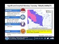
- Winter storm Monday into Tuesday
- Runtime
- 2:45
- Date posted
- 9 years ago
- Description
- Snow and a wintry mix are expected for Monday into Tuesday, with the bulk of the snow coming Monday afternoon and evening. 4 to 8 inches are currently expected, with some drifting and blowing possible in wind prone areas. There will be travel impacts - so prepare now.
---------------------------------
National Weather Service
Weather Forecast Office
La Crosse, WI

- Title
- Snow to Impact Travel Monday-Tuesday
- Runtime
- 3:38
- Date posted
- 9 years ago
- Description
- A wintry mix is expected to develop across the area on Monday morning and then transition to snow by late Monday afternoon and evening. Snow accumulations from 4 to 8 inches are possible in the Winter Storm Watch area of southeast Minnesota, northeast Iowa, and western Wisconsin. These snowfall totals may change based on shifts in the storm track.
The snow may be heavy at times on Monday afternoon and evening. Hourly snow rates may be in excess of 1" per hour.
Prepare now for likely impacts to travel, including the Monday afternoon and evening commute. In addition, anticipated snowfall amounts could change based on any fluctuation in the storm track - so keep up-to-date on the latest forecast.
- Title
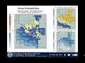
- Snow, Wintry Mix March 5-6, 2018
- Runtime
- 2:00
- Date posted
- 9 years ago
- Description
- Winter returns for Monday and Tuesday (March 5-6) with, to a wintry mix to rain. Snow accumulations up to 6 inches for some. Be ready for slippery to hazardous travel, including the Monday evening commute.
---------------------------------
National Weather Service
Weather Forecast Office
La Crosse, WI

- Title
- Updated: Spring 2018 Flood Outlook
- Runtime
- 5:42
- Date posted
- 9 years ago
- Description
- Updated March 1, 2018. The flood risk has increased slightly for the mainstem Mississippi River over the coming 3 months, while remaining near normal for most of the tributaries.

- Title
- Sat AM Update: Snow to Bring Difficult Travel This Afternoon/Tonight i
- Runtime
- 2:37
- Date posted
- 9 years ago
- Description
- Difficult travel conditions will develop this afternoon and tonight over parts of the area as snow develops, with some light icing possible as well. Stay up to date with the latest forecast if traveling later today and tonight.
- Title
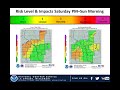
- Difficult Travel Expected Saturday Afternoon Into Early Sunday Morning
- Runtime
- 3:51
- Date posted
- 9 years ago
- Description
- Snow and light freezing rain will impact travel late Saturday afternoon through early Sunday morning.
---------------------------------
National Weather Service
Weather Forecast Office
La Crosse, WI

- Title
- Friday AM Update: Winter Storm Possible Saturday/Saturday Night
- Runtime
- 2:26
- Date posted
- 9 years ago
- Description
- A winter storm may bring heavy snow or light icing to parts of the region Saturday afternoon through Saturday night, with hazardous travel possible.
- Title
- Slippery Tonight Into The Friday Morning Commute. More Travel Impacts This Weekend?
- Runtime
- 3:42
- Date posted
- 9 years ago
- Description
- Snow, sleet, and light freezing rain will impact travel tonight into the Friday morning commute. Another storm system could bring snow and light freezing rain to the region Saturday into Sunday.
---------------------------------
National Weather Service
Weather Forecast Office
La Crosse, WI

- Title
- February 19, 2018: Daytime Radar Loop
- Runtime
- 0:26
- Date posted
- 9 years ago
- Description
- Title
- February 19-20, 2018: Overnight Radar Loop
- Runtime
- 0:35
- Date posted
- 9 years ago
- Description
- NWS La Crosse

- Title
- Additional Freezing Rain To Lead to Hazardous Travel Tuesday AM
- Runtime
- 2:17
- Date posted
- 9 years ago
- Description
- Another round of freezing rain and wintry precipitation will move through the area Tuesday morning. This will result in hazardous travel, particularly for the morning commute on Tuesday.

- Title
- 3 AM Update: Freezing Rain Today into Tuesday
- Runtime
- 3:07
- Date posted
- 9 years ago
- Description
- Messy travel is expected to develop across the area today into tonight and Tuesday morning as rain and freezing rain transition to mainly freezing rain with colder temperatures arriving.

- Title
- Freezing Rain To Create Hazardous Travel Monday Into Tuesday.
- Runtime
- 2:57
- Date posted
- 9 years ago
- Description
- A storms system will bring periods of freezing rain to the area Monday into Tuesday. Travel will be impacted. Untreated roads will become icy.
---------------------------------
National Weather Service
Weather Forecast Office
La Crosse, WI

- Title
- Hazardous/Icy Travel Expected Feb. 19-20, 2018
- Runtime
- 2:26
- Date posted
- 9 years ago
- Description
- A prolonged period of light freezing rain will create hazardous travel conditions February 19-20, 2018.
---------------------------------
National Weather Service
Weather Forecast Office
La Crosse, WI

- Title
- 2018 Spring Flood Outlook as of February 15, 2018
- Runtime
- 5:57
- Date posted
- 9 years ago
- Description
- Overall, the risk for spring flooding is near to below normal this year due to a lack of significant snow on the ground and low snowpack water content. Watch the video for our thoughts regarding the potential for spring flooding this year.

- Title
- Snow To Create Hazardous Travel - Feb. 8-9, 2018
- Runtime
- 2:26
- Date posted
- 9 years ago
- Description
- A Winter Storm will create hazardous travel conditions along and south of Interstate 90 from late afternoon Feb. 8 to the morning of Feb. 9, 2018.
---------------------------------
National Weather Service
Weather Forecast Office
La Crosse, WI

- Title
- Hazardous Roads Tonight & Friday Morning
- Runtime
- 3:11
- Date posted
- 9 years ago
- Description
- Snow will move into southeast Minnesota and northeast Iowa during the late afternoon and then spread into Interstate 90 corridor this evening and end late tonight. Much of accumulating snow will occur tonight. Snow totals of 2 to 3" are expected along Interstate 90 and 3 to 6" with locally higher amounts across northeast Iowa and southwest Wisconsin. Roads will be hazardous tonight and the Friday morning commute will be impacted.

- Title
- Slippery Travel Expected
- Runtime
- 2:48
- Date posted
- 9 years ago
- Description
- Accumulating snow will fall mainly along and south of Interstate 90 from late this morning through this evening. The highest snow totals (3 to 5") will be found across northeast Iowa and southwest Wisconsin. A Winter Weather Advisory is in effect for these areas. The bulk of the snows will fall during the afternoon. Travel will become slippery this afternoon for many, including the evening commute.

- Title
- Winter Storm Update: Hazardous Travel Continues For Some Areas.
- Runtime
- 2:52
- Date posted
- 9 years ago
- Description
- Heavy snow continues to impact portions of, northern Iowa, southern, Minnesota through north-central Wisconsin. Travel has become hazardous in these areas.
---------------------------------
National Weather Service
Weather Forecast Office
La Crosse, WI

- Title
- Winter Storm Video Briefing Update: January 22, 2018
- Runtime
- 3:19
- Date posted
- 9 years ago
- Description
- A complex winter storm will impact the region through tonight, bringing periods of heavy snow and mixed precipitation. The heaviest snow is expected across portions of southeast Minnesota into north central Wisconsin with light icing possible across much of the area. Travel will be impacted.
---------------------------------
National Weather Service
Weather Forecast Office
Aberdeen, SD

- Title
- Winter Storm Briefing: Jan 21, 2018 Afternoon Update
- Runtime
- 2:52
- Date posted
- 9 years ago
- Description
- A winter storm will impact the area tonight through Monday night, with significant snowfall likely and hazardous to dangerous travel expected over parts of southeast Minnesota into north-central Wisconsin.

- Title
- January 21-22, 2018 Winter Storm Video Briefing
- Runtime
- 3:04
- Date posted
- 9 years ago
- Description
- A winter storm will impact the area late this evening through Monday. Heavy snow will lead to significant snow accumulations across southeast Minnesota into north central Wisconsin. A wintry mix is also expected and could lead to some light icing for some areas. Travel will become difficult to hazardous.
---------------------------------
National Weather Service
Weather Forecast Office
Aberdeen, SD

- Title
- Heavy Snow & Wintry Mix To Impact Travel Late Sunday Night Through Monday.
- Runtime
- 4:26
- Date posted
- 9 years ago
- Description
- Heavy snow and a wintry mix is expected impact travel conditions late Sunday night through Monday. The Monday morning commute will likely be impacted and possibly the evening commute for some areas.
---------------------------------
National Weather Service
Weather Forecast Office
La Crosse, WI