NWS LaCrosse WI
Hazardous Weather Briefing for December 17-18 2016

- Title
- Hazardous Weather Briefing for December 17-18 2016
- Runtime
- 2:34
- Date posted
- 10 years ago
- Description
- Hazardous travel today then dangerously cold wind chills late tonight into Sunday
---------------------------------
National Weather Service
Weather Forecast Office
La Crosse, WI

- Title
- December 16, 2016 Afternoon Winter Storm Update
- Runtime
- 3:58
- Date posted
- 10 years ago
- Description
- A winter storm will impact the region late today through Saturday, with snow late this afternoon into Saturday, followed by dangerously cold temperatures for Saturday night into Sunday morning.
---------------------------------
National Weather Service
Weather Forecast Office
La Crosse, WI

- Title
- December 16th, 2016 Late Morning Winter Storm Update
- Runtime
- 2:53
- Date posted
- 10 years ago
- Description
- A winter storm will bring snow to the area this afternoon into Saturday, with very cold air arriving into Sunday.
---------------------------------
National Weather Service
Weather Forecast Office
La Crosse, WI

- Title
- Significant Snow through Saturday then Dangerously Cold Saturday Night Through Sunday
- Runtime
- 3:24
- Date posted
- 10 years ago
- Description
- A winter storm is still on track to impact the area this afternoon into Saturday, with very cold air arriving into Sunday.
---------------------------------
National Weather Service
Weather Forecast Office
La Crosse, WI

- Title
- December 15th Afternoon Winter Storm Update
- Runtime
- 3:39
- Date posted
- 10 years ago
- Description
- A winter storm is still on track to impact the area Friday into Saturday, with very cold air arriving into Sunday.

- Title
- Latest Winter Weather Hazards Briefing - December 15, 2016 - 5 AM
- Runtime
- 2:34
- Date posted
- 10 years ago
- Description
- We are looking at multiple winter weather hazards from this morning through Monday morning. These include: 1) Winter Storm for 5-10" from Friday into Saturday, 2) Dangerous Wind Chills - This morning and Sunday (coldest December wind chills since December 21, 2008) & Monday mornings, 3) Blowing & drifting snow Saturday afternoon.

- Title
- Dangerous Cold Tonight-Thursday Morning. Snow to create hazardous travel Friday-Saturday
- Runtime
- 2:50
- Date posted
- 10 years ago
- Description
- Dangerous wind chills of -20 to -30 tonight into Thursday morning. Winter storm watch for 5-9 inches of snow Friday-Saturday.
---------------------------------
National Weather Service
Weather Forecast Office
La Crosse, WI

- Title
- Multiple Winter Hazards from Today through Early Next Week
- Runtime
- 2:46
- Date posted
- 10 years ago
- Description
- We are looking for multiple winter hazards from today through early next week. These include: 1) Dangerous wind chills – Tonight (-15 to -30F - frostbite possible within 30 minutes) & Saturday night (-20 to -40F), 2) 5-8” snow possible Friday into Saturday - There is currently low to medium confidence on the location of heaviest band and amounts; and 3) Maybe some blowing & drifting snow - Today & Saturday

- Title
- Accumulating Snow from This Afternoon into Sunday Afternoon/Evening
- Runtime
- 2:19
- Date posted
- 10 years ago
- Description
- Accumulating snow will spread across the area this afternoon and evening and then continue into Sunday afternoon/evening. A total of 6 to 8 inches of snow is expected across southeast Minnesota, northeast Iowa, and the southern half of Wisconsin; and 4 to 8 inches across the northern half of Wisconsin. This snow will cause 1) snow covered and slippery roads, 2) may reduce visibilities to a 1/2 mile or less at times, and 3) maybe some minor blowing and drifting snow in the open areas of southeast Minnesota and northeast Iowa.

- Title
- Winter Weather Briefing for December 10 & 11, 2016
- Runtime
- 2:41
- Date posted
- 10 years ago
- Description
- Accumulating snow will occur Saturday, Dec. 10th into Sunday, Dec 11th. Amounts south of Interstate 94 will be in the 5 to 8 inch range with locally higher amounts possible.
---------------------------------
National Weather Service
Weather Forecast Office
La Crosse, WI

- Title
- Winter Weather Briefing - December 10-11, 2016
- Runtime
- 2:57
- Date posted
- 10 years ago
- Description
- Accumulating snow will fall across the area from the afternoon of Saturday, December 10th through Sunday, December 11th. While there is high confidence that accumulating snow (2-7") will fall across the area during this time frame, the confidence in axis of the heaviest snow (south of I-90) and the amounts of snow in this band are not as high (moderate confidence at best), and both of these could still change as we approach this time period. The main hazards from this snow will be: 1) slick & snow covered roads, 2) visibilities 1/2 mile or less due to falling snow at times, and 3) may see some minor blowing & drifting in the open areas of northeast Iowa & southeast Minnesota.

- Title
- Severe Weather Possible This Afternoon & Evening
- Runtime
- 1:06
- Date posted
- 10 years ago
- Description
- Scattered thunderstorms are expected to develop near the Interstate 90 corridor between 3 PM and 4 PM and then move north as a warm front moves north through the region. A few of these storms may become severe between 4 PM and 8 PM. The main threats will large hail, damaging winds, and isolated tornadoes. The tornado threat will be highly dependent upon whether temperatures can climb to near 80 degrees.

- Title
- Flooding & Severe Weather Potential Briefing for September 22nd
- Runtime
- 3:15
- Date posted
- 10 years ago
- Description
- Flooding is ongoing across much of the area this morning and moderate to major river flooding is expected to continue into next week. Up to 2 inches of additional rain is expected across northeast Iowa this morning. Elsewhere additional rainfall totals will be less than an inch.
Isolated strong to severe storms may form this afternoon across southeast Minnesota, northeast Iowa, and along the Mississippi River in western Wisconsin.

- Title
- Weather Update: Additional Heavy Rain Expected Tonight
- Runtime
- 3:31
- Date posted
- 10 years ago
- Description
- Additional showers and thunderstorms with heavy rain are expected tonight, with flooding likely. Remain aware of the weather overnight!

- Title
- Latest on the Severe Weather & Flooding Possibility through Thursday
- Runtime
- 2:12
- Date posted
- 10 years ago
- Description
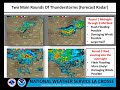
- Periodic heavy rain will fall across the area through Thursday. The heaviest rain looks to be tonight. Additional rainfall from today through Thursday will likely range from 1 to 4 inches with the heaviest rain likely falling from southeast Minnesota east into central Wisconsin. A few locations could see a 2-day rainfall total in the excess of 7 inches. As a result, we are looking for the possibility of flash flooding, river flooding, and mud slides.
In addition to the flooding, there could be a possibility of large hail and damaging winds this afternoon and evening.
- Title
- Updated Briefing: Heavy Rain Expected with Possible Flash Flooding Tonight into Thursday Evening
- Runtime
- 3:52
- Date posted
- 10 years ago
- Description
- Several rounds of showers and thunderstorms are expected tonight through Thursday evening, with heavy rainfall and flooding possible.
- Title
- A Couple of Rounds of Heavy Rain & Potential Severe Weather Expected through Thursday
- Runtime
- 2:43
- Date posted
- 10 years ago
- Description
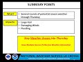
- There will be a couple of rounds of strong to severe thunderstorms possible across the region from tonight through Thursday. The first round will be tonight and the second round looks to be from Wednesday afternoon into Wednesday night. The main threats will be flooding, large hail, and damaging winds.

- Title
- Periodic Severe Weather through Thursday
- Runtime
- 1:52
- Date posted
- 10 years ago
- Description
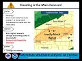
- There will be the potential of severe thunderstorms between 4 PM and 9 PM today across eastern Iowa, southern Wisconsin, and northern Illinois. The main threats with these storms will large hail, damaging winds, and maybe a brief tornado.
Additional periodic severe weather is possible from Tuesday night into Thursday. This severe weather would include large hail, damaging winds, and flooding.
- Title
- Heavy Rainfall and Flooding - Sep. 7, 2016
- Runtime
- 2:05
- Date posted
- 10 years ago
- Description
- Storms with heavy rain will move across the area through this evening. Flooding expected from this heavy rain.
---------------------------------
National Weather Service
Weather Forecast Office
La Crosse, WI

- Title
- Flooding & Severe Weather Possible Through Wednesday Evening
- Runtime
- 2:29
- Date posted
- 10 years ago
- Description
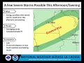
- Thunderstorms will become numerous late this afternoon and continue into tonight. These storms will be capable of producing flooding, damaging winds, and maybe an isolated tornado. All of these threats look to be the greatest along and south of Interstate 90. There could be the potential for a significant flooding event across parts of northeast Iowa and southwest Wisconsin.
On Wednesday, the threat for flooding and damaging winds shift south.
- Title
- Video Briefing For Sep. 6, 2016
- Runtime
- 2:29
- Date posted
- 10 years ago
- Description
- Heavy rain expected with flooding possible. Strong to severe storms could also occur.
---------------------------------
National Weather Service
Weather Forecast Office
La Crosse, WI

- Title
- 9-5-2016 Weather Briefing for Heavy Rain
- Runtime
- 3:00
- Date posted
- 10 years ago
- Description
- Heavy rainfall is expected across the area tonight (9/5) through Wednesday night. Hear our latest thoughts on the potential for flooding.

- Title
- Severe Weather Briefing, Thursday, August 18, 2016
- Runtime
- 2:32
- Date posted
- 10 years ago
- Description
- Two rounds of potentially strong to severe thunderstorms are expected to end the week. The first is expected this evening and overnight mainly north of Interstate 90. The second is expected Friday afternoon and evening mainly south of Interstate 90. The primary threats with these storms include damaging winds, hail, and locally heavy rainfall. Chances for rain will continue into the weekend with 1 to 2 inches of rain possible through Saturday region wide.
---------------------------------
National Weather Service
Weather Forecast Office
La Crosse, WI

- Title
- 5 pm Update: Flooding/Damaging Winds August 11th
- Runtime
- 2:12
- Date posted
- 10 years ago
- Description
- Looking like the main threat will be northeast IA and southwest WI.

- Title
- 12pm Update: Flooding/Damaging Winds August 11th
- Runtime
- 2:50
- Date posted
- 10 years ago
- Description
- The latest weather forecast for later today and tonight.

- Title
- Flooding/Damaging Winds August 11th
- Runtime
- 3:30
- Date posted
- 10 years ago
- Description
- A couple of rounds of storms today could bring flooding and damaging winds. Storms this morning could produce 2-4 inches of rainfall, leading to flooding. Another round in the late-afternoon and evening hours could again produce heavy rainfall with another 1-3 inches, along with the possibility of damaging winds.
---------------------------------
National Weather Service
Weather Forecast Office
La Crosse, WI

- Title
- Severe Storms Possible This Afternoon and Evening.
- Runtime
- 2:37
- Date posted
- 10 years ago
- Description
- Severe storms could move across much of the area late this afternoon and evening.
---------------------------------
National Weather Service
Weather Forecast Office
La Crosse, WI

- Title
- Severe Storms Possible Late Thursday Afternoon and Evening.
- Runtime
- 2:54
- Date posted
- 10 years ago
- Description
- Severe storms could impact parts of the area late Thursday afternoon into Thursday evening. Uncertainty exists so be sure to monitor forecasts closely.
---------------------------------
National Weather Service
Weather Forecast Office
La Crosse, WI
- Title
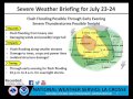
- Afternoon Video Briefing for July 23, 2016
- Runtime
- 2:25
- Date posted
- 10 years ago
- Description
- Flash flooding, heavy rains, damaging winds and possibly large hail possible through tonight.
---------------------------------
National Weather Service
Weather Forecast Office
La Crosse, WI
- Title
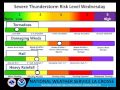
- Severe Weather Possible Tonight
- Runtime
- 2:44
- Date posted
- 10 years ago
- Description
- Two rounds of storms are expected through tonight. The first round of storms will produce heavy rain and small hail through 2 PM this afternoon. The second round will be a line of storms which will move through the area between 8 PM and 2 AM tonight. This line will be capable of producing damaging winds, large hail, heavy rainfall, and isolated tornadoes. Highs temperatures will be around 90 today with heat indices from 90 to 105. Stay hydrated and use caution with extended periods of outdoor activity.
- Title
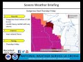
- Short-Lived Heatwave - Update July 20, 2016
- Runtime
- 1:30
- Date posted
- 10 years ago
- Description
- Brief video discussing the relatively high heat index values expected the next couple days.
---------------------------------
National Weather Service
Weather Forecast Office
La Crosse, WI

- Title
- Dangerous heat Thursday into Friday. Strong storms possible today.
- Runtime
- 2:32
- Date posted
- 10 years ago
- Description
- Hot and humid conditions could lead to heat related illness Thursday into Friday if precautions are not taken. Stronger storms today could produce brief heavy rainfall.
---------------------------------
National Weather Service
Weather Forecast Office
La Crosse, WI
- Title
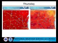
- Hazardous Weather Briefing - July 19th Afternoon
- Runtime
- 3:07
- Date posted
- 10 years ago
- Description
- A video update discussing the conditional risk of heavy rain and flash flooding tonight into Wednesday morning, as well as the heat expected later in the week.
---------------------------------
National Weather Service
Weather Forecast Office
La Crosse, WI

- Title
- Flash Flooding Possible Tonight. Dangerous Heat Thursday into Friday.
- Runtime
- 2:47
- Date posted
- 10 years ago
- Description
- Thunderstorms could produce heavy rainfall tonight across southeast Minnesota, northeast Iowa, and western Wisconsin. Dangerous heat index values of 100 to 115 are expected during the afternoon and early evenings hours of Thursday and Friday.
---------------------------------
National Weather Service
Weather Forecast Office
La Crosse, WI

- Title
- 10 AM Severe Weather Briefing for July 13, 2016
- Runtime
- 2:26
- Date posted
- 10 years ago
- Description
- There will be a potential of severe weather from 11 AM to 7 PM today. Damaging winds and hail still look to be the main threats. In addition, there will be a possibility of isolated tornadoes and flooding. The greatest threat looks to be from 11 AM to 3 PM and mainly south of Interstate 90. While the greatest threat looks to be before 3 PM, we cannot rule an isolated threat continuing through 7 PM this evening.

- Title
- Severe Weather Risks July 13, 2016
- Runtime
- 2:31
- Date posted
- 10 years ago
- Description
- Here is a brief video discussing the severe weather risk and possibilities for July 13, 2016. Severe thunderstorms are possible late this morning into the early evening across portions of the Upper Mississippi River Valley.
---------------------------------
National Weather Service
Weather Forecast Office
Aberdeen, SD

- Title
- Updated Briefing for Severe Thunderstorm Potential for Wednesday July 13th
- Runtime
- 1:58
- Date posted
- 10 years ago
- Description
- Severe thunderstorms remain possible across much of the area for Wednesday July 13th.

- Title
- Severe Weather Risks July 12-13
- Runtime
- 2:17
- Date posted
- 10 years ago
- Description
- Here is a brief video discussing the severe weather risk and possibilities for July 12-13, 2016. A few strong storms are possible late this afternoon and evening across eastern Iowa into southwest Wisconsin. However, the greater severe weather threat will be Wednesday afternoon and evening mainly along and south of Interstate 90.
---------------------------------
National Weather Service
Weather Forecast Office
La Crosse, WI

- Title
- Severe Weather Risks July 11-13
- Runtime
- 2:57
- Date posted
- 10 years ago
- Description
- Here is a brief video discussing the severe weather risk and possibilities for July 11-13, 2016
---------------------------------
National Weather Service
Weather Forecast Office
La Crosse, WI
- Title
- Severe Weather Expected This Evening & Overnight
- Runtime
- 3:42
- Date posted
- 10 years ago
- Description
- Thunderstorms over central and southwest Minnesota will evolve into a line of storms which will move through southeast Minnesota, northeast Iowa, and western Wisconsin between 7 PM and 2 AM tonight. The main threat will be damaging winds. However a few storms may produce large hail this evening. In addition to the wind and hail, there will be a smaller risk for flooding and isolated tornadoes.

- Title
- Updated Severe Weather Briefing for This Evening July 5th, 2016
- Runtime
- 2:46
- Date posted
- 10 years ago
- Description
- Severe thunderstorms appear increasingly likely across the area this evening. Hear our latest thoughts.
- Title
- Severe Weather Briefing for Tuesday Evening, July 5, 2016
- Runtime
- 2:29
- Date posted
- 10 years ago
- Description
- Severe thunderstorms are possible Tuesday evening across the Upper Mississippi River Valley. Primary threats include damaging wind, large hail, heavy rain, and perhaps an isolated tornado.
---------------------------------
National Weather Service
Weather Forecast Office
Aberdeen, SD

- Title
- Update: Storms Tonight: June 25 2016
- Runtime
- 3:24
- Date posted
- 10 years ago
- Description
- The latest on the threat of storms across the area tonight.

- Title
- Severe Weather Possible Tonight
- Runtime
- 3:09
- Date posted
- 10 years ago
- Description
- A line of strong to severe storms will move through the area tonight. The main threat will be damaging winds. In addition, there will be the possibility of hail up to the size of quarters and isolated tornadoes. The timing of this severe weather looks to be from 6 PM to 2 AM. Here is the latest web briefing on this severe weather threat.
- Title
- Thunderstorms could produce damaging winds across the area Saturday Evening.
- Runtime
- 2:43
- Date posted
- 10 years ago
- Description
- Severe thunderstorms are possible Saturday evening across much of the area. Main threat is damaging winds. An isolated tornado cannot be ruled out across northwest into north-central Wisconsin.
---------------------------------
National Weather Service
Weather Forecast Office
La Crosse, WI

- Title
- Severe Weather Possible - Saturday June 25, 2016
- Runtime
- 2:03
- Date posted
- 10 years ago
- Description
- There will be the potential for severe weather between 5 PM and 10 PM on Saturday, June 25th as one or several lines of storms move through the area. The main threat will be damaging winds and maybe some large hail.

- Title
- Update on the severe weather risk - June 22nd
- Runtime
- 3:54
- Date posted
- 10 years ago
- Description
- Update on the severe weather risk for later today/tonight, but confidence is not high on how this possible event will play out.
---------------------------------
National Weather Service
Weather Forecast Office
La Crosse, WI

- Title
- Wed June 22 2016: Potential for Severe Thunderstorms Later this afternoon
- Runtime
- 2:29
- Date posted
- 10 years ago
- Description
- Thunderstorms will redevelop later this afternoon, likely over parts of northeast Iowa into northern Illinois. Storms would quickly become severe with a large hail, damaging wind and tornado threat. Its not certain where the storms will blossom though, and the severe threat could shift east of the local area. The highest risk looks to be northern Illinois.
---------------------------------
National Weather Service
Weather Forecast Office
La Crosse, WI

- Title
- Two Rounds of Thunderstorms For Wednesday, June 22, 2016
- Runtime
- 2:29
- Date posted
- 10 years ago
- Description
- Two rounds of thunderstorms are expected Wednesday. The first mainly across northeast Iowa into far southwest Wisconsin tonight into Wednesday morning where large hail and heavy rain are possible. The second mainly across southwest Wisconsin late Wednesday afternoon and evening where large hail, damaging winds, and even an isolated tornado are possible.
---------------------------------
National Weather Service
Weather Forecast Office
La Crosse, WI

- Title
- June 22 2016: Strong to severe thunderstorms late tonight-Wed (update)
- Runtime
- 3:21
- Date posted
- 10 years ago
- Description
- Two rounds of strong to severe thunderstorms possible: 1) late tonight into Wed morning, 2) Wed late afternoon - evening. Hail, heavy rain and damaging winds all possible.
---------------------------------
National Weather Service
Weather Forecast Office
La Crosse, WI





