NWS LaCrosse WI
January 20, 2018 Morning Video Briefing

- Title
- January 20, 2018 Morning Video Briefing
- Runtime
- 2:53
- Date posted
- 9 years ago
- Description
- A winter storm will impact the region Sunday evening through Monday evening. Significant snow accumulations and light icing are possible, making travel difficult.
---------------------------------
National Weather Service
Weather Forecast Office
La Crosse, WI

- Title
- Snow and a wintry mix could create travel problems late Sunday through Monday.
- Runtime
- 3:21
- Date posted
- 9 years ago
- Description
- A storm system will bring snow, possibly heavy, and a wintry mix to the region. Travel impacts are looking more likely with difficult to hazardous travel possible.
---------------------------------
National Weather Service
Weather Forecast Office
La Crosse, WI

- Title
- Weather Briefing for Thursday, January 11
- Runtime
- 3:10
- Date posted
- 9 years ago
- Description
- A Winter Storm will create hazardous travel conditions Thursday.

- Title
- Slippery Travel Expected Thursday Into Friday
- Runtime
- 3:32
- Date posted
- 9 years ago
- Description
- Light snow and possibly freezing drizzle will create slippery travel Thursday through Friday. Plan ahead for slick travel. Allow for extra travel time. Bitter cold expected this weekend into the middle of next week.
---------------------------------
National Weather Service
Weather Forecast Office
La Crosse, WI

- Title
- Enhanced Hazardous Weather Outlook Now Available
- Runtime
- 2:15
- Date posted
- 9 years ago
- Description
- A new service from the National Weather Service office in La Crosse, WI - the Enhanced Hazardous Weather Outlook.
- Title
- Hourly Forecast Information
- Runtime
- 2:56
- Date posted
- 9 years ago
- Description
- Ever wanted to know hourly forecast information for your planning purposes? We have it available on our web site.

- Title
- Probabilistic Snowfall Graphics from the National Weather Service
- Runtime
- 5:29
- Date posted
- 9 years ago
- Description
- This video is intended to provide an overview of probabilistic snowfall forecasts issued by the National Weather Service.

- Title
- NWS La Crosse, WI Winter Monitor Overview
- Runtime
- 3:50
- Date posted
- 9 years ago
- Description
- A quick "how to" guide for using our new Winter Monitor page.

- Title
- 2017-18 CPC Winter Outlook - October 19, 2017
- Runtime
- 5:50
- Date posted
- 9 years ago
- Description
- NOAA's Climate Prediction Center (CPC) is forecasting for the upcoming winter months of December-February in northeast Iowa, southeast Minnesota, and western Wisconsin:
Temperatures: Equal chances of warmer-than-normal, near-normal, and colder-than-normal. This is due to a lack of a climate signal and no clear temperature signal in the climate models.
Precipitation: Wetter-than-normal is slightly favored. This does not imply that this winter will be snowier-than-normal.
- Title
- Updated: Severe Weather Briefing for July 21, 2017
- Runtime
- 2:12
- Date posted
- 9 years ago
- Description
- Update on the severe weather expectations through tonight. There has been a shift south into mainly northeast Iowa and southwest Wisconsin.

- Title
- More Severe Weather Possible through Tonight
- Runtime
- 1:18
- Date posted
- 9 years ago
- Description
- Through tonight, several rounds of storms capable of producing severe weather and flash flooding will move through the region. A Flash Flood Watch is in effect for much of the area from this afternoon through Saturday morning. In addition, there will also be a threat for damaging winds, large hail, and isolated tornadoes. Those with outdoor activities should be weather aware.

- Title
- Weather Briefing for Heavy Rain/Severe Threat Friday & Friday Night
- Runtime
- 3:02
- Date posted
- 9 years ago
- Description
- Another round of heavy rain and severe storms are possible across much of the area Friday afternoon and night.

- Title
- UPDATED! Severe Weather Briefing For Wednesday, July 19, 1017
- Runtime
- 3:57
- Date posted
- 9 years ago
- Description
- Update on the severe weather expectations through Thursday morning

- Title
- Severe Weather Briefing For Wednesday, July 19, 1017
- Runtime
- 2:20
- Date posted
- 9 years ago
- Description
- Severe storms expected tonight with the potential for widespread damaging winds. Heavy rains could produce some localized flooding.
---------------------------------
National Weather Service
Weather Forecast Office
La Crosse, WI

- Title
- Heavy rain, severe thunderstorm potential tonight - July 11, 2017
- Runtime
- 1:39
- Date posted
- 9 years ago
- Description
- Thunderstorms will track across much of the area late tonight, bringing heavy and the potential for hail and damaging winds. Localized flooding could occur, with rises on rivers and streams.
---------------------------------
National Weather Service
Weather Forecast Office
La Crosse, WI

- Title
- July 9, 2017 1 PM Severe Weather Briefing Update
- Runtime
- 1:42
- Date posted
- 9 years ago
- Description
- Severe storms are possible this evening and tonight, with damaging winds, large hail, and heavy rain possible.

- Title
- July 9,2017: Strong-Severe Storms Possible
- Runtime
- 1:42
- Date posted
- 9 years ago
- Description
- Strong to severe thunderstorms are possible this evening (July 9, 2017) with a heavy rain, hail and damaging wind threat.
---------------------------------
National Weather Service
Weather Forecast Office
La Crosse, WI

- Title
- Severe Storms Possible This Afternoon & Evening. Large Hail Threat.
- Runtime
- 3:43
- Date posted
- 9 years ago
- Description
- Severe thunderstorms could develop across the area this afternoon into this evening. If the storms develop, threats include large hail, damaging winds, and locally heavy rainfall.
---------------------------------
National Weather Service
Weather Forecast Office
La Crosse, WI

- Title
- Severe T-Storms Possible into Sunday
- Runtime
- 3:06
- Date posted
- 9 years ago
- Description
- A few rounds of severe thunderstorms and heavy rainfall are possible across the area from late this afternoon (Saturday, June 10th) through Sunday afternoon.

- Title
- Late Morning Update - June 3, 2017: Strong to Potentially Severe Storms This Afternoon/Evening
- Runtime
- 1:12
- Date posted
- 9 years ago
- Description
- A line of strong to severe storms is expected to move through the area between 3 p.m. and 8 p.m. While thunderstorms are expected to impact the entire area, the greatest threat for severe weather looks to be along and north of Interstate 94.
---------------------------------
National Weather Service
Weather Forecast Office
La Crosse, WI

- Title
- June 3 2017: Strong to Potentially Severe Storms This Afternoon-Evening
- Runtime
- 1:19
- Date posted
- 9 years ago
- Description
- A line of strong to potentially severe storms will track across the region from mid afternoon into the evening hours. Threats include large hail, damaging wind gusts, and heavy downpours.
---------------------------------
National Weather Service
Weather Forecast Office
La Crosse, WI

- Title
- 4:30 AM Briefing: Severe Thunderstorms Possible This Afternoon
- Runtime
- 2:15
- Date posted
- 9 years ago
- Description
- Severe thunderstorms are possible this afternoon, mainly between 3 and 8 pm, with a risk for isolated tornadoes, large hail, and damaging winds.
- Title
- Severe Weather Briefing 11 AM May 15, 2017
- Runtime
- 2:27
- Date posted
- 9 years ago
- Description
- Severe storms are expected this afternoon, especially south of I-90 with damaging winds and large hail possible.

- Title
- Severe Weather Briefing for April 19, 2017
- Runtime
- 3:42
- Date posted
- 10 years ago
- Description
- Strong to severe thunderstorms and locally heavy rain are possible late this afternoon and evening as a warm front lifts northward across the region. Large hail and damaging wind are the primary threats mainly south of Interstate 90, although an isolated tornado cannot be ruled out for areas south of U.S. Highway 18 across northeast IA and far southwest WI. Most areas will see 0.75 to 1.25 inches of rain, although some spots could see up to 3 inches. The area of heaviest rain remains somewhat uncertain, but river flooding and localized flash flooding are possible for those areas that see repeat thunderstorms.
---------------------------------
National Weather Service
Weather Forecast Office
La Crosse, WI

- Title
- April 15, 2017 Severe Weather Briefing
- Runtime
- 2:26
- Date posted
- 10 years ago
- Description
- Severe thunderstorms are possible this afternoon and evening, capable of producing large hail, damaging wind, and locally heavy rainfall. The highest threat area is across eastern Iowa into southwest Wisconsin from 2-10 pm.
---------------------------------
National Weather Service
Weather Forecast Office
La Crosse, WI

- Title
- Winter Storm Impacting Travel Through Monday
- Runtime
- 3:44
- Date posted
- 10 years ago
- Description
- Snow will overspread the area through tonight leading to snow covered and slippery roads. Travel could be difficult for the Monday morning commute especially across southeast Minnesota, northeast Iowa, and southwest into central Wisconsin.
---------------------------------
National Weather Service
Weather Forecast Office
La Crosse, WI

- Title
- Winter storm will impact the area this afternoon through Monday
- Runtime
- 2:52
- Date posted
- 10 years ago
- Description
- A winter storms will impact the area with snow and difficult to hazardous travel this afternoon through Monday
---------------------------------
National Weather Service
Weather Forecast Office
La Crosse, WI

- Title
- Snow to impact travel late Sunday through Monday.
- Runtime
- 3:24
- Date posted
- 10 years ago
- Description
- 3 to 8 inches of snow looks to impact travel starting late Sunday and continuing through Monday. The Monday morning commute will be impacted.
---------------------------------
National Weather Service
Weather Forecast Office
La Crosse, WI

- Title
- Significant Snow Expected Sunday Afternoon through Monday
- Runtime
- 2:09
- Date posted
- 10 years ago
- Description
- EDIT: Winter storm expected to impact the area Sunday afternoon through Monday.
---------------------------------
National Weather Service
Weather Forecast Office
La Crosse, WI

- Title
- A Few Severe Storms Possible This Evening; Strong Winds Tonight through Tuesday
- Runtime
- 3:12
- Date posted
- 10 years ago
- Description
- A few severe storms possible this evening; strong winds tonight through Tuesday.
---------------------------------
National Weather Service
Weather Forecast Office
La Crosse, WI

- Title
- Severe Weather Possible Late This Afternoon & Evening - March 6, 2017
- Runtime
- 2:58
- Date posted
- 10 years ago
- Description
- A strong cold front will produce a line of showers and storms as it moves east across the area between 5 PM and 11 PM. Some of these storms could potentially produce damaging winds. The highest threat will across southeast Minnesota and much of Iowa. In addition to the wind threat, there may be isolated tornadoes and hail up to 1 inch in diameter. Behind the cold front, it will remain very windy into Tuesday. Sustained winds will range from 25 to 35 mph with wind gust of 35 to 55 mph.

- Title
- Second 2017 Spring Flood Outlook - March 2, 2017
- Runtime
- 5:46
- Date posted
- 10 years ago
- Description
- This is our 2nd spring flood outlook briefing issued March 2, 2017.
---------------------------------
National Weather Service
Weather Forecast Office
La Crosse, WI

- Title
- 4 AM Winter Storm Update - February 24, 2017
- Runtime
- 4:19
- Date posted
- 10 years ago
- Description
- A significant winter storm will continue to impact the region today and tonight bringing heavy snow and wind to parts of the area, including blizzard conditions in open areas of southeast Minnesota and portions of northeast Iowa.
---------------------------------
National Weather Service
Weather Forecast Office
Aberdeen, SD

- Title
- 3 PM Update: Significant Winter Storm on Track to Impact the Region
- Runtime
- 4:13
- Date posted
- 10 years ago
- Description
- A major winter storm will bring heavy snow, wind, and some rain to the area tonight through Friday night, with significant accumulation expected in some areas. Blizzard conditions are also likely across portions of northeast Iowa into southeast Minnesota. Travel will be dangerous at times.

- Title
- Strong Winter Storm - Significant Impacts To Travel
- Runtime
- 3:17
- Date posted
- 10 years ago
- Description
- Snow, rain, and wind (possibly freezing rain) will accompany a winter storm for tonight through Friday night. Some locations could get a foot. Significant travel hazards.
---------------------------------
National Weather Service
Weather Forecast Office
La Crosse, WI

- Title
- Briefing for Potential Winter Storm Feb.23-24
- Runtime
- 2:40
- Date posted
- 10 years ago
- Description
- Here is a short briefing for the potential winter storm expected later this week.
---------------------------------
National Weather Service
Weather Forecast Office
La Crosse, WI
- Title
- Winter Storm Thursday Night-Friday Night
- Runtime
- 3:14
- Date posted
- 10 years ago
- Description
- Accumulating snow, rain and wind will accompany a winter storm for Thursday night through Friday night. Heaviest snow looks to fall from southern MN into northwest WI. Up to 10" possible. Storm track could change though and shift where this heavy snow falls.
---------------------------------
National Weather Service
Weather Forecast Office
La Crosse, WI

- Title
- First 2017 Spring Flood Outlook - February 16, 2017
- Runtime
- 7:03
- Date posted
- 10 years ago
- Description
- Here is an overview of the first spring snow melt flood outlook for the 2017 season.
---------------------------------
National Weather Service
Weather Forecast Office
La Crosse, WI

- Title
- Icy travel for the Tuesday morning commute, especially north of Interstate 90.
- Runtime
- 3:32
- Date posted
- 10 years ago
- Description
- Areas of drizzle, freezing drizzle and fog could create travel issues at times late tonight through Tuesday morning. The icing will mainly be on cold, untreated surfaces.
---------------------------------
National Weather Service
Weather Forecast Office
La Crosse, WI
- Title
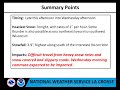
- Winter Weather Briefing - January 24-25, 2017
- Runtime
- 2:22
- Date posted
- 10 years ago
- Description
- 3 to 9" of wet snow will fall across the region from tonight through Wednesday. The heaviest snow will fall mainly south of Interstate 94 from tonight through Wednesday morning.

- Title
- Winter Weather Briefing, Tuesday, January 24, 2017.
- Runtime
- 2:41
- Date posted
- 10 years ago
- Description
- A winter storm will hit the area from late this afternoon through Wednesday. Accumulations of 3 to 9" expected across the area.
---------------------------------
National Weather Service
Weather Forecast Office
La Crosse, WI
- Title
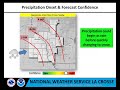
- Updated: Winter Storm Impacting the Area Tuesday - Wednesday
- Runtime
- 1:55
- Date posted
- 10 years ago
- Description
- A winter storm will impact the region with significant snowfall Tuesday into Wednesday, January 24-25th, 2017.

- Title
- Winter Storm Briefing for Jan. 23, 2017.
- Runtime
- 2:09
- Date posted
- 10 years ago
- Description
- A winter storm is expected to bring 4 to 7" of snow to the area from Tuesday afternoon into Wednesday afternoon.
---------------------------------
National Weather Service
Weather Forecast Office
La Crosse, WI

- Title
- Video Briefing for Jan 16, 2017
- Runtime
- 2:56
- Date posted
- 10 years ago
- Description
- Messy wintry mix to impact the area into Tuesday
---------------------------------
National Weather Service
Weather Forecast Office
La Crosse, WI

- Title
- Slippery Roads from Late This Afternoon into Tuesday
- Runtime
- 2:03
- Date posted
- 10 years ago
- Description
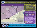
- Another round of snow moves into the area this afternoon. This snow will then transition to a wintry mix of snow, sleet, and freezing rain late tonight and continue into Tuesday. The highest snow totals (2-4”) will be north of the I-94 corridor. Much of the area could see up to a tenth of an inch of ice from late tonight into Tuesday. Anticipate travel hazards.
- Title
- Winter Weather Briefing for Monday, January 2, 2017
- Runtime
- 2:12
- Date posted
- 10 years ago
- Description
- A light wintry mix of precipitation, including light snow and light freezing rain, will lead to slippery roads today and tonight across parts of northeast Iowa, southeast Minnesota through central Wisconsin.
---------------------------------
National Weather Service
Weather Forecast Office
Aberdeen, SD

- Title
- Video Briefing for December 24, 2016: Afternoon Update
- Runtime
- 2:28
- Date posted
- 10 years ago
- Description
- Slick travel likely for some areas of southeast Minnesota, northeast Iowa, and central Wisconsin Christmas morning due to freezing rain. Then, rising rivers, ice jams, and localized street flooding are all possible later in the day as precipitation changes to all rain with even some thunderstorms. Windy conditions are expected late Sunday night into Monday with gusts from 40 to 50 mph.
---------------------------------
National Weather Service
Weather Forecast Office
Aberdeen, SD

- Title
- Freezing Rain Expected in Some Areas Christmas Morning
- Runtime
- 2:04
- Date posted
- 10 years ago
- Description
- Messy travel conditions are possible Christmas morning and early afternoon with freezing rain. Rising temperatures will end the risk for icing into the afternoon and evening, with gusty west winds up to 40-50 mph Sunday night into Monday.

- Title
- Morning Update: Accumulating Snow Expected Today, December 23rd
- Runtime
- 2:33
- Date posted
- 10 years ago
- Description
- Snow will overspread the area today, with 2-4" of accumulation expected. Look for snow-covered and slick roads through the afternoon and early evening hours.

- Title
- Winter Weather Briefing December 22, 2016
- Runtime
- 1:41
- Date posted
- 10 years ago
- Description
- A Winter Weather Advisory is in effect for Friday from 6 AM to 9 PM for 2 to 4 inches of snow. Difficult travel is expected.
---------------------------------
National Weather Service
Weather Forecast Office
La Crosse, WI





