Mr. Weatherman
Hurricane Lee becomes a Category 5 with 200 mph Wind Gusts...

- Title
- Hurricane Lee becomes a Category 5 with 200 mph Wind Gusts...
- Runtime
- 15:19
- Date posted
- 3 years ago
- Description
- Hurricane Lee is a powerful Category 5 hurricane, with winds of 165 mph/265 km/h. The wind gusts in Lee are around 200 mph or 320 km/h. Hurricane Lee will move to the north of Puerto Rico, The USVI & BVI, and Anguilla this weekend. All the hurricane and tropical storm conditions stay well to the north. Extremely dangerous seas will get only worse.
Hurricane Lee will slow next week to the west of The Bahamas and Turks & Caicos. It will then get caught up in a front/trough and lift north. Bermuda could have tropical storm or hurricane impacts on Thursday of next week.
LONGER TERM: The European Model keeps most of Lee just offshore of Nova Scotia and Newfoundland. The American Model brings Lee into Nova Scotia and Newfoundland, with tropical storm impacts for parts of New England.
Behind Lee, Tropical Storm Margot will stay out to see. The American Model continues to hint at another strong system approach the Caribbean in about a week or two. That i...

- Title
- Hurricane Lee shifts north as it approaches Land...
- Runtime
- 17:30
- Date posted
- 3 years ago
- Description
- Hurricane Lee took two significant shifts north. This is good news for the Northeast Caribbean. The track is holding, and even a little more to the north now.
Hurricane Lee will become a Major Hurricane tonight, with winds around 120 mph/190 km/h. In a few days, winds could be around 160 mph/260 km/h with gusts to 200 mph/320 km/h.
It will slow or stall north of Puerto Rico early next week. It should be just to the east of the Southern Bahamas and Turks and Caicos at that time.
After that, a front should draw Hurricane Lee to the north. The wind field will expand in Lee, which means significant winds will be possible for Bermuda. All interests in Bermuda, the Northeast United States, and the Atlantic Region of Canada should be on high alert in case this comes in that direction. Lee will be near Bermuda on Thursday of next week.
Lee will be so powerful and large that it will generate life-threatening surf and rip currents. Major eros...

- Title
- Lee will become a Hurricane today as it gets Closer to Land...
- Runtime
- 17:54
- Date posted
- 3 years ago
- Description
- Tropical Storm Lee will become Hurricane Lee today, as it marches closer to the Caribbean. In the short-term, the forecast remains locked in. Major Hurricane Lee will be just to the north of the Caribbean this weekend. Winds in Lee could exceed 150 mph, but if the track holds, the hurricane-force winds stay offshore. Hurricane Lee will be due north of Puerto Rico on Sunday and Monday. If anything changes with that (if there is any shift at all!) I'll let you know right away!
After that, I expect Lee to slow down or even stall to the east of the Bahamas and Turks & Caicos. Steering conditions become weak. Eventually, a front from the United States will help draw Hurricane Lee more to the north. When it makes its northerly turn will dictate where it goes.
An earlier turn would mean Lee could go right into Bermuda. A later turn means there could be a threat anywhere from the Carolinas, up through New England, into the Atlantic Region of Canada. The entire East C...

- Title
- Developing Hurricane will make a close approach to the Northeast Caribbean...
- Runtime
- 14:25
- Date posted
- 3 years ago
- Description
- This developing system, which will become a hurricane, will make a close approach to the Caribbean on Friday and Saturday. AS IT STANDS NOW: The center would be just to the north of Anguilla and north of Puerto Rico (and surrounding areas). That would be good news. It would keep hurricane conditions away from the islands.
HOWEVER, any shift south could bring in tropical storm or hurricane conditions. That is exactly what I'll be watching for you. My promise to you is that I will watch for any little change with this system. As it gets stronger and closer, I'll let you know if the track has changed and if we need to prepare for any impacts.
The main thing with this right now is AWARENESS. While we hope it stays north, we need to let others know there is a developing system. Thank you for sharing this video to get the correct information out. That is what this weather community is all about. Thank you for your trust! - Brian

- Title
- Caribbean on Alert for New Hurricane or Tropical Storm...
- Runtime
- 14:48
- Date posted
- 3 years ago
- Description
- The Caribbean is on alert for a hurricane of tropical storm approaching later this week. It is not definite that a major system moves in, but it is highly likely a significant system will be at least nearby late week.
With that, if you are in and around these locations, please be on high alert:
Dominican Republic, Puerto Rico, USVI, BVI, Saba, Station, St. Martin/Maarten, Antigua and Barbuda, St. Barts, Montserrat, St. Kitts & Nevis, Anguilla, Guadeloupe, Dominica, and Martinique.
Depending on the track, we could have tropical storm or hurricane impacts in these areas later this week. Again, this is NOT locked in. It is still early in the forecast, but I am giving the EARLY heads up for safety sake.
The European Model has this as a Category 2 or 3 hurricane, just north of the Northeast Caribbean (I expect changes in this). The American Model has this as a tropical storm, moving through the Northeast Caribbean (again, there will be changes...

- Title
- A Strong Hurricane will approach the Caribbean...
- Runtime
- 10:51
- Date posted
- 3 years ago
- Description
- A strong hurricane will approach the Caribbean this week. When it gets close to the Northeast Caribbean, it will start to curve. How quickly will that curve happen? It is too early to tell if it will miss the Caribbean or impact some of our islands. Please spread the video to get the word out that a system will be close by on Friday and Saturday.
Will it hit land? Almost all models take this VERY close to the Northeast Caribbean. That does not mean it will hit our islands, but at this point we need to spread awareness about the possibility. The European Model shows a curve away from the Caribbean, while the American Model takes it into some islands.
This new area will become a tropical depression and then a tropical storm by mid-week. Late week, it will become a hurricane (Hurricane Lee). I will monitor very close if this impacts the islands. Let's hope this stays away. I am watching this SUPER closely! Thank you! - Brian

- Title
- New Hurricane forms Next Week...
- Runtime
- 13:58
- Date posted
- 3 years ago
- Description
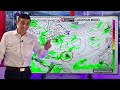
- A new hurricane will form next week as it approaches the Caribbean. All major models (European, American, Canadian, German) are showing this become a strong hurricane.
Right now, a strong tropical wave is coming off the coast of Africa. It will become a tropical depression, then a tropical storm by the middle of next week. Quickly after that, it will strengthen into a hurricane as it near the Caribbean late next week and next week.
Does it go into the Caribbean? That is exactly what I will track for you. Being about a week away, it is VERY hard to tell if it will curve before reaching the Eastern Caribbean. Please know that I am watching this non-stop. Where it goes will depend on the area of high pressure to the north and fronts coming off the coast of the United States.
No one needs to worry about this at this point, but we need to pay close attention to it.
I'll keep you updated. Thank you for building this weather community. Al...
- Title
- Long-Track Hurricane could develop Next Week...
- Runtime
- 13:44
- Date posted
- 3 years ago
- Description
- A long-track hurricane could develop next week and approach the Caribbean. Both the American Model and European Model see the potential of development from a strong tropical wave that will come off the coast of Africa.
The European Model is aggressive with this and turns the tropical wave into a strong hurricane. It shows a hurricane approaching the Eastern Caribbean late next week and next week. This is over a week away so there is no telling if this will curve and miss the Caribbean or move in. But it has my attention. This is the time of year long-track systems are likely. I fully expect development from this area and we should pay close attention to it.
Tropical Storm Idalia continues to spread rain across North Carolina and Virginia. Idalia could bring tropical storm conditions to Bermuda Sunday and Monday. Meanwhile, Hurricane Franklin will stay south of Canada, and Tropical Storm Jose will safely stay out to see.
It is super busy!

- Title
- Powerful Hurricane Idalia makes Landfall in Florida...
- Runtime
- 11:28
- Date posted
- 3 years ago
- Description
- Powerful and major Hurricane Idalia made landfall in Florida with a devastating storm surge and intense winds. Hurricane Idalia made landfall this morning near Keaton Beach, Florida, as a Category 3 hurricane with winds of 125 mph.
We are thinking of those impacted by this beast of a system. The storm surge in the Big Bend area of Florida will be historic. It will stay rather strong as it enter Georgia and even South Carolina. Power outages will be widespread. Tree damage will be extensive. Please, please be safe.
Hurricane Franklin will curl around Bermuda and stay south of Nova Scotia and Newfoundland. It will finally fall apart in the North Atlantic.
Tropical Depression 11 could become Tropical Storm Jose, but it will stay out to sea -- where we like them to stay!
The tropical wave in the Caribbean will continue to bring periods of rain for Barbados, St. Lucia, St. Vincent and the Grenadines, Grenada, and Trinidad and Tobago. It i...

- Title
- Two Major Hurricanes: Idalia to Florida & Franklin in the Atlantic…
- Runtime
- 15:50
- Date posted
- 3 years ago
- Description
- Two major hurricanes will be in the Atlantic Basin at the same time. This is the first time this has happened in August since 2010, with Hurricane Danielle and Hurricane Earl.
Idalia, which will become a major hurricane, will move into Florida late today and early Wednesday. A life-threatening storm surge will impact Tampa and points north through the Big Bend. Landfall could be anywhere from Apalachicola, down through Tampa. We've seen a history of storms sneaking into the West Coast of Florida early: Hurricane Charley, Hurricane Irma, Hurricane Ian. If you are in a Hurricane Warned location, please have the preparations finished by early afternoon. For Idalia info in Florida, check out: wftv.com
Major Hurricane Franklin will curl around Bermuda, but stay south of Nova Scotia and Newfoundland. Life-threatening rip currents will occur along the East Coast of the United States and Atlantic Region of Canada.
A strong tropical wave will bring period...

- Title
- Major Hurricane Impacts are Imminent...
- Runtime
- 13:33
- Date posted
- 3 years ago
- Description
- Major hurricane impacts are imminent for Florida. A life-threatening storm surge will accompany soon-to-be Hurricane Idalia. Idalia is now a strengthening tropical storm. It will cause flooding and landslides in Western Cuba before moving into the Gulf of Mexico tonight.
From there, Hurricane Idalia will head toward the Big Bend/West Coast area of Florida. It could make landfall near Tampa or up to Cedar Key on Wednesday morning. It will be a major hurricane at that point. Preps are ongoing!
RESOURCES:
wftv.com for livestreaming
North Florida:
Mike Buresh https://www.facebook.com/MikeFirstAlert/
Central Florida:
Tom Terry https://www.facebook.com/TomTerryWFTV/
Kassandra Crimi https://www.facebook.com/KassandraCrimiWFTV/
George Waldenberger https://www.facebook.com/GeorgeWaldenbergerWFTV/
Southwest Florida:
Matt Devitt https://www.facebook.com/MattDevittWeather/
Hurricane Fr...

- Title
- Hurricane Impacts ahead...
- Runtime
- 22:04
- Date posted
- 3 years ago
- Description
- Hurricane impacts are likely for parts of Florida. This tropical depression will become Tropical Storm Idalia today or tomorrow, then Hurricane Idalia on Tuesday. The major concern is how much this will strengthen when it hits the super warm water of the Gulf of Mexico.
Florida hurricane preparation details are all in the video. Mississippi and Alabama should monitor the progress of Idalia very closely too. The track could shift once the data from the Hurricane Hunters comes in later today.
Hurricane Franklin will make a close approach to Bermuda, then stay south of Nova Scotia and Newfoundland.
A strong tropical wave will move into the Southeastern Caribbean this week. The flood potential gets higher on Tuesday for: Trinidad & Tobago, St. Lucia, Barbados, Grenada, and St. Vincent & The Grenadines.
Now through October is the busiest time of the Hurricane Season. Please stay aware & I'll keep you posted!

- Title
- Hurricane Alert as new system Idalia forms...
- Runtime
- 18:35
- Date posted
- 3 years ago
- Description
- The Gulf of Mexico, Florida in particular, is on alert for hurricane conditions this upcoming weekend. A new system named Idalia is forming, and it's now bringing flooding rain to Jamaica, Belize, Mexico, The Cayman Islands, Cuba, and Honduras.
It will lift north on Monday and strengthen into a hurricane on Tuesday. Then it will take aim at Florida. The most likely landfall location is anywhere from Tampa/Central Florida, up through the Big Bend of Florida. Mississippi and Alabama should monitor closely for any shifts to the west.
Hurricane Hunter aircraft will be inside this developing system non-stop, and that data will make the computer models more and more accurate.
Please stay alert throughout Florida, and in the Northwest Caribbean.
Those in Florida & interest in Florida: For safety information and live-streaming, be sure to check out wftv.com.
Thank you for taking the time to share this channel with your friend...

- Title
- Tropical Storm forming this Weekend....
- Runtime
- 15:20
- Date posted
- 3 years ago
- Description
- A tropical storm will form this weekend, and it could develop into a hurricane as it approaches Florida. Heavy rain and storms near Mexico, Belize, and Cuba will organize. This area will lift north near the Cayman Islands and Cuba, and enter the Gulf of Mexico. On Monday, it should spin up into a name system, then move into Florida late Tuesday and Wednesday.
How much it intensifies and exactly where it moves in are questions that remain. That makes sense — it is still early, and it hasn't even formed at all yet. The water temperatures being so warm remain a big concern.
Tropical Storm Franklin will become a hurricane, and move to the west of Bermuda. It will lift close to the Atlantic Region of Canada later next week.
The remnants of Gert are bringing rain and storms to Barbados.
It's busy for sure! The peak of the Hurricane Season is September 10th.

- Title
- A Hurricane could form in the Gulf soon...
- Runtime
- 14:58
- Date posted
- 3 years ago
- Description
- A hurricane or tropical storm could form in the Gulf of Mexico soon. Here is the concern: This is close-to-home (not way out in the Atlantic Ocean). If something spins up, it would give us less time to prepare.
The Set-Up: An area of rain and storms near Honduras, Guatamala, El Salvador, and Nicaragua will lift north. This area of rain will be near Jamaica, The Cayman Islands, Cuba, and Belize this weekend. At this point, it could start to develop...
Chances of Development: The water is very warm. It always is in August, but it is running way above average. The wind shear could relax just enough to allow this to spin-up into a named system. If it does, it could intensify quickly because the water is so warm. I am not sure if it will develop, but at the least, there will be a large area of rain/storms to monitor.
Models: The models go back and forth. The European Model has been insisting on a tropical storm or Hurricane getting close to Florida. ...

- Title
- Franklin will Strengthen into the next Hurricane...
- Runtime
- 16:33
- Date posted
- 3 years ago
- Description
- Franklin will become the next hurricane of the season, Right now, tropical storm Franklin is bringing extreme flooding and mudslides to parts of the Dominican Republic and a few areas in Haiti. The heaviest weather is staying west of Puerto Rico. We are thinking of those dealing with the flooding. Know you are in our thoughts!
Franklin will become a hurricane to the east of the Turks and Caicos. It will be a category 1 or category 2 hurricane near Bermuda on Monday. Then, it will be close to Eastern Canada on Wednesday and Thursday of next week.
A new tropical system will try to form near Belize and Jamaica. If this develops, it could lift toward the Gulf of Mexico. I will monitor closely for Texas, Louisiana, Mississippi, Alabama, and Florida.

- Title
- Life-Threatening Impacts for parts of The Caribbean as Franklin Arrives...
- Runtime
- 17:10
- Date posted
- 3 years ago
- Description
- Life-Threatening flooding and mudslides arrives late today through tomorrow in parts of the Caribbean, as Tropical Storm Franklin moves in. This is an EXTREME FLOOD event. Please avoid rushing and rising rivers, avoid river crossings when the storm hits, and beware of mudslides and rock slides.
The worst weather will move into the south coast of Haiti and The Dominican Republic late today. The heaviest rain will be overnight, with devastating flooding in spots. Rain bands will also filter into Puerto Rico, and the flood threat gets higher tomorrow in the Turks and Caicos. Aruba has been dealing with the rain bands this morning. Franklin will make a close approach to Bermuda as a hurricane late weekend, and then the Atlantic Region of Canada.
Please spread the word about this system in the Dominican Republic and Haiti. NOTE: Not all locations in Haiti will get the heavy weather. There will be a sharp divide between dry weather and extreme flooding.

- Title
- Franklin Getting Stronger with Devastating Impacts Ahead...
- Runtime
- 24:24
- Date posted
- 3 years ago
- Description
- Tropical Storm Franklin is getting stronger, and it will bring devastating flood impacts to the Dominican Republic. Any shift in the track of Franklin will mean higher impacts for Haiti and Puerto Rico. Franklin could become a hurricane before hitting the Dominican Republic and Haiti. After that, it could bring hurricane conditions to Bermuda and the Atlantic Region of Canada.
DOMINICAN REPUBLIC: Finish preparations now. The rain with this system will bring extreme and catastrophic flooding. Over 350 mm of rain is possible, and that is over 12 inches! Anything and anyone near swollen rivers will be washed away. River crossing will be impassable. Mudslides are highly likely. The WORST WEATHER moves in late Tuesday and for Tuesday night, into early Wednesday.
HAITI: Make the preparations now for the possibility of intense flooding. When you watch this video, you will see that there is a sharp divide between flooding rain and no rain. It will be a very close ca...

- Title
- Caribbean System Coming this Weekend
- Runtime
- 21:03
- Date posted
- 3 years ago
- Description
- A new system approaching the Caribbean is on the way this weekend, and it could spin-up into a tropical storm. Regardless, there is a HIGH potential of flooding, mudslides and gusty winds.
The American Model brings heavy rain to St. Lucia, Barbados, Guadeloupe, Dominica, and Martinique, before lifting this toward Puerto Rico and the US and British Virgin Islands.
The European Model brings this more west, with additional rain for Trinidad & Tobago, Grenada, and St. Vincent and the Grenadines. Then it brings this system closer to Jamaica, Haiti, and the Dominican Republic.
It'll probably be a combination of the two. It is hard to know the exact track because this system is just now developing. It could intensify with the very, very warm water temperatures in the Caribbean and Atlantic.
Hurricane Hilary will bring life-threatening flooding to parts of Mexico, California, Nevada, and Arizona. This is historic — rainfall amounts will cau...

- Title
- Gulf, Caribbean, and California on Watch for Tropical System...
- Runtime
- 16:44
- Date posted
- 3 years ago
- Description
- The Gulf of Mexico, Caribbean, and California are watching tropical systems that could threaten.
An area of rain and storms near The Bahamas, will move toward Florida and then into the Gulf of Mexico. This could develop this weekend and next week, as it moves into parts of Texas, Louisiana, or Mexico.
In the Caribbean, rain continues to bring flooding to parts of Trinidad and Tobago and Grenada. By next weekend, a tropical system could spin up near Jamaica, and then lift toward Cuba, Florida, and The Bahamas.
Hurricane Hilary will bring tropical storm and hurricane conditions to Baja California. Life-threatening flooding will extend from Western Mexico, into California, Arizona, and Nevada. Gusty winds and heavy tropical rain will bring an extreme threat of flash floods for the Southwest United States.
Two strong tropical waves continue to march across the Atlantic Ocean. I'm monitoring both closely.
The next name on t...

- Title
- Storm Threat Increases for the Gulf of Mexico and Caribbean...
- Runtime
- 17:31
- Date posted
- 3 years ago
- Description
- The storm threat increase for the Gulf of Mexico and the Caribbean, where a tropical storm or even a hurricane could develop. Flooding rain near Trinidad and Tobago and Grenada, will move toward The Bahamas, Florida, Cuba, and Jamaica. With the super warm water, a tropical system could spin up next week.
The Gulf States should watch this area closely, in particular Texas and Louisiana. If something develops, it could move toward parts of Texas, Louisiana, and even parts of Mexico.
Most of this rain and storms stays south away from Puerto Rico, The Virgin Islands, Haiti, and The Dominican Republic, although we'll see a better chance of thunderstorms this weekend.
In the Eastern Pacific, a developing system will become Hurricane Hilary. This will bring tropical storm to hurricane impacts for parts of Western Mexico, including Baja California, Cabo San Lucas, and the Gulf of California. Eventually, Hilary could bring flooding rain and gust winds to ...

- Title
- The Start of the Active Period in the Hurricane Season...
- Runtime
- 14:04
- Date posted
- 3 years ago
- Description
- This is the start of the most active part of the Hurricane Season. A very strong tropical wave is coming off the coast of Africa, and it is likely to develop. If it does develop, it will most likely stay out to sea. However, more and more tropical waves like this will continue to move into the Atlantic, with the chance of developing.
Closer to home, I am concerned about a build up of moisture in the Caribbean and Gulf of Mexico next week. All the computer models are showing more rain and storms in the Gulf and Western Caribbean. Some of the models are showing this area spinning up into a tropical system. It is too early to know for sure, but this is an area to watch next week.
In the short-term, the rain chance picks up in Trinidad and Tobago, Grenada, and Guyana. Isolated flooding will be possible over the next 3 days.

- Title
- European & American Models show new Tropical Storm possibilities...
- Runtime
- 13:53
- Date posted
- 3 years ago
- Description
- The European, America, Canadian, and German tropical models all show development over the next week and a half. Large tropical waves are about to come off of Africa, and one or two of them is likely to develop.
Of more concern will be a weaker tropical wave getting into the Caribbean this weekend. The water temperatures are so warm in the Caribbean and Gulf of Mexico. This weak tropical wave might spin-up into a tropical depression or tropical storm early next week. It could feed off of the very warm water.
There are no threats at this time, but this is a sign of the up-swing in tropical activity for later this month.

- Title
- Hurricane Season pattern change Coming...
- Runtime
- 11:05
- Date posted
- 3 years ago
- Description
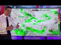
- A Hurricane Season pattern change is on the way! The dry air is winning right now (that's good!), but more moisture will build soon, and that means tropical storm and hurricanes are more likely to form.
Later this week, a weak tropical wave will move into the Caribbean, however, it could spin-up into a system while it is in the Caribbean. The American Model is showing a tropical storm forming in the Caribbean next weekend and the following week.
Late month, the European model is showing the possibility of development from multiple systems. Some may have a window to escape out to sea, but others may track toward the Caribbean, Gulf of Mexico, and the East Coast of the United States.
Tropical Storm Fernanda will move away from Central America, but a new system that could become Hurricane Greg, may threaten Mexico and Southern California. More on that on @WeathermanEurope
- Title
- Tropical Storm Chances get even Higher...
- Runtime
- 12:59
- Date posted
- 3 years ago
- Description
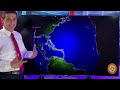
- The chance of a tropical storm (or multiple tropical storms) forming is getting higher and higher. All major models are latching onto the development of tropical storm and hurricane development later this month. We will see signs of this as soon as next week.
TIMING:
Next week, strong tropical waves emerge from Africa. As they get closer to the Caribbean, conditions are more conducive for development.
MODELS:
European: Tropical storm development
GFS: Tropical storm and hurricane development
ICON: Tropical storm development
CMC: Multiple tropical storms/hurricane development
It isn't all about models. Why are the models latching onto development? The atmosphere will not be as dry. Atmospheric conditions are key.
So is the water! The water temperatures are at record highs. If something develops, it could feed off the record warm water, and gain strength quickly.
Monitoring closely. We will se...
- Title
- European Model seeing Development....
- Runtime
- 11:26
- Date posted
- 3 years ago
- Description
- The European Model is hinting at the possibility of 3 strong tropical waves developing. Next week, a series of strong tropical waves will emerge from the coast of Africa. Conditions will be more conducive for a tropical storm to develop.
EUROPEAN MODEL: Tropical Depression (at least) forming
AMERICAN MODEL: Strong Tropical Wave
ICON: Tropical Depression or Tropical Storm forming
CANADIAN: Multiple Tropical Storms
The pattern this Hurricane Season will change the next few weeks. It is super dry now, but that may break a little. Extra moisture in the atmosphere could pave the way for tropical storms and hurricanes to develop and feed off the record warm water temperatures.

- Title
- Models hinting at development of a Tropical Storm or Hurricane...
- Runtime
- 9:24
- Date posted
- 3 years ago
- Description
- All the major models are hinting at some development next week, near the coast of Africa. The American Model, European Model, Canadian Model, and the ICON/German Model, show a strong tropical wave trying to spin-up.
This area could eventually be the next tropical storm or hurricane.
The next name on the hurricane list is Emily.
Monitoring closely!

- Title
- Caribbean Tropical Disturbance dumps rain and brings Landslide threat...
- Runtime
- 9:38
- Date posted
- 3 years ago
- Description
- The strong tropical disturbance is moving through Dominica, St. Lucia, Barbados, Grenada, St. Vincent and the Grenadines, and Trinidad and Tobago. Isolated flooding is possible. Please be safe!
To the north, heavy tropical rain will bring a flood and mudslide threat for Haiti, The Dominican Republic, and Puerto Rico. Flood Warnings may be issued in parts of Puerto Rico this afternoon.
A strong tropical wave is about to come off the coast of Africa. The European Model shows some slow development. I will monitor it closely!

- Title
- Disturbance Moves into the Caribbean...
- Runtime
- 12:27
- Date posted
- 3 years ago
- Description
- The tropical disturbance is moving into the Caribbean, and the rain, and flood threat is going up. We have been so dry and hot, but now, gusty winds and tropical downpours will bring the possibility of flash floods and landslides.
Heavy thunderstorms in parts of Haiti, The Dominican Republic, and Puerto Rico will also lead to isolated areas of flash flooding. Use caution at the river crossings, especially in Haiti, where the runoff will be more intense.
Gusty winds will come through Barbados, St. Lucia, and Dominica. The flood threat includes Grenada, St. Vincent and the Grenadines, and Trinidad and Tobago.
Please be safe!

- Title
- Tropical Disturbance brings a Major Flood Threat to the Caribbean...
- Runtime
- 10:46
- Date posted
- 3 years ago
- Description
- A tropical disturbance headed to the Caribbean will bring the possibility of major flooding. Areas of heavy rain and gusty winds will move into the Eastern Caribbean Wednesday night into Thursday. The highest rain threat will be from Dominica, south, through St. Lucia and Barbados. Isolated flooding is possibly in Trinidad and Tobago (especially southern Trinidad).
This tropical weather will move toward Jamaica and Belize late week and into the weekend.
Another strong tropical wave behind it will be monitored for development.

- Title
- The Hurricane Season is about to Wake Up...
- Runtime
- 11:00
- Date posted
- 3 years ago
- Description
- The hurricane season is about to wake up, with a much more active finish to the month of August.
The steering conditions are alarming. High pressure around Bermuda may prevent tropical storms and hurricanes from just going out to sea.
The highest threat areas will be the Southeast United States, including Florida, down through the Bahamas, and through the northern Caribbean.
I'll monitor the long-term trends very carefully. Thank you for your trust as we go throughout the hurricane season!

- Title
- Caribbean Flood Threat will get much higher...
- Runtime
- 13:10
- Date posted
- 3 years ago
- Description
- The threat of flooding in the Caribbean will get much higher next week. There are several strong tropical waves that will move right through the Caribbean. The train of tropical rain will produce significant flooding.
The first tropical wave arrives Monday. Then, another bigger tropical disturbance moves in by the middle of the week.
Late in the week, there could be some development either near the Gulf of Mexico or in the Western Caribbean. Conditions are more conducive for development as these waves near the Caribbean. Water temperatures are super warm as well!
As the month goes on, hurricane season will get more and more active.

- Title
- Caribbean & The Bahamas watching a Strong Tropical Wave approaching...
- Runtime
- 14:24
- Date posted
- 3 years ago
- Description
- A strong tropical wave will approach the Caribbean and Bahamas next week. If it survives the dry air around it, the tropical wave could spin up into a tropical storm.
The overall pattern is shifting. We are clearly getting deeper into the Hurricane Season. For example, the Gulf of Mexico is about to get more active. This strong tropical wave has a chance to track right through parts of the Caribbean and Bahamas, and then end up in the Gulf of Mexico.
The water temperatures are the warmest they've been in decades. All tropical waves should be monitored for quick development as they get closer to the Caribbean, Gulf of Mexico, and the United States.

- Title
- This is an area to watch for a Tropical Storm to form...
- Runtime
- 13:06
- Date posted
- 3 years ago
- Description
- There is a new area to watch for a tropical storm to form. In the Eastern Atlantic, a strong tropical wave is marching across, and another tropical wave is about to come off the coast of Africa.
There is a lot of dry air around them, but the first wave is holding its own. As it gets closer to the Caribbean next week, conditions could become conducive for some development.
The next name on the list this hurricane season is "Emily".
Monitoring closely...

- Title
- Hurricanes Coming from Here...
- Runtime
- 12:49
- Date posted
- 3 years ago
- Description
- A train of stronger tropical waves will move off the coast of Africa. We could see some development out of a strong wave emerging from the coast of Africa as soon as next week.
This tropical train will help breed hurricanes. With the extremely warm water, the pattern will get much more active later this month!
Today in Puerto Rico, the Dominican Republic, Haiti, Jamaica, and Cuba, isolated flooding will be possible with scattered storms that will develop.
I'll be monitoring the tropical storm and hurricane potential closely, especially as we get deeper and deeper into the Hurricane Season.

- Title
- Hurricane Forecast for August: Very Active Period Coming...
- Runtime
- 15:01
- Date posted
- 3 years ago
- Description
- The most active part of Hurricane Season is ahead! The next 3 months is historically when the most tropical storms and hurricanes develop. Early this month, it will be a slow, with dry air taking hold. But that will change when more moisture pumps into the atmosphere.
A major concern will be the rapid intensification of hurricanes this season. Not only is the water well above average, but the warm water extends below the surface. This can lead to tropical storms or hurricanes getting stronger, and in a very quick way.
The Pacific side is currently active, with Tropical Storm Dora. It will intensify into Hurricane Dora, and then it could get close to Hawaii next week. Hawaii should monitor the progress of Dora very carefully.

- Title
- Tropical Wave in the Caribbean...Two Atlantic Systems...
- Runtime
- 11:57
- Date posted
- 3 years ago
- Description
- A tropical wave continues to bring the flood threat for the Eastern Caribbean. Isolated flooding is possible the next two days, from Puerto Rico through Trinidad and Tobago. By the middle of the week, this tropical wave will help increase the chance of rain for Belize and Jamaica.
One area that moved off the coast of the United States is getting tied into a front. It is not tropical in nature. This will miss Bermuda and Canada. Another area could become Tropical Storm Emily. This will stay to the east of Bermuda.

- Title
- Extreme Flooding hits the Caribbean...
- Runtime
- 10:19
- Date posted
- 3 years ago
- Description
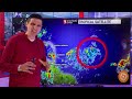
- Extreme flooding is hitting parts of the Caribbean right now. Homes in businesses in Trinidad and Tobago have taken on water. Heavy rain and storms move through Barbados last night. And, it is still active! More rain and storms are on the way and that will lead to additional flooding.
One foot of moving water can sweep away a vehicle. Please be safe! Use extra caution at river crossings.
The tropical system in the Atlantic will stay east of Bermuda, but it could enhance the chance of rain in Eastern Canada later this week.
The pattern is getting busy! Thank you for sharing this channel with others. Be safe!
- Title
- 4 Areas to Watch...Emily & Dora forming...
- Runtime
- 12:15
- Date posted
- 3 years ago
- Description
- There are 4 areas to watch, with the high chance of Tropical Storm Emily and Tropical Storm Dora forming over the next few days.
The strong tropical wave approaching the Caribbean will gradually develop as it turns up toward Bermuda. It will be just to the east of Bermuda early in the week.
A spin that moved into Florida and Georgia yesterday, will move off the coast of South Carolina and North Carolina later today. That could briefly develop into a tropical system as it moves away from the United States.
The other strong tropical wave that rolled through the Caribbean, is brining heavy rain to Belize, Guatemala, and El Salvador this morning. This area will spin up into Tropical Storm Dora, as it moves away from Mexico.
More tropical waves are coming off the coast of Africa. There is still lots of dry air out there, but some models, like the Canadian Model, are hinting at development.

- Title
- A Tropical Storm will form in the Atlantic
- Runtime
- 11:21
- Date posted
- 3 years ago
- Description
- Tropical Storm Emily will form in the Atlantic as soon as this weekend or early next week. This tropical system will approach the Caribbean the next two days, then lift more to the northwest. High pressure slides to the east, and this gives the tropical system a window to make that curve.
Next week, Tropical Storm Emily will be close to Bermuda. Early indications show it staying just east of Bermuda, but I'll monitor the steering conditions closely. By the middle of the week, this system will be close to the Atlantic Region of Canada.

- Title
- Next Tropical Storm Forming
- Runtime
- 11:40
- Date posted
- 3 years ago
- Description
- A tropical storm will try to develop in the Atlantic Ocean, and it will be near the Caribbean this weekend. A strong tropical wave is fighting off dry air, and will move into an area where it could spin up into a tropical depression or tropical storm. It will be close to the Northeast Caribbean this weekend, hopefully staying off in the Atlantic. It could then get close to Bermuda next week.
A front near the coast of the United States will be key. Whatever tries to develop, will look to ride up on the west side of the Bermuda-Azores High Pressure, and a front/trough to the near the United States. The timing and strength of the front will be critical in how close this tropical system gets to land.
The next storm that develops will be Tropical Storm Emily.

- Title
- Tropical Storm Development Possible
- Runtime
- 11:00
- Date posted
- 3 years ago
- Description
- A tropical storm could develop out of a tropical wave that is near the coast of Africa. It will battle the dry air and Saharan Dust. That may prevent it from spinning up. However, if it can fight off the dry air, conditions are favorable for development down the road.
All the major models are latching onto this tropical wave. Not all develop it, but they see this as a strong wave that needs to be paid attention to. The European models keeps it as a strong tropical wave, while the American and Canadian Models give it a sold chance of becoming at least a tropical storm.
Whatever it is, will be close to the Caribbean late weekend into next week. Monitoring closely!

- Title
- Hurricane Season is getting active....
- Runtime
- 12:13
- Date posted
- 3 years ago
- Description
- Hurricane Season is getting more and more active. A strong tropical wave is brining flooding and landslides to parts of the Caribbean today. From Puerto Rico, through Trinidad and Tobago, the flood threat will be higher the next three days.
An areas of thunderstorms to the east of the United States and Bahamas could develop slowly. This area of rain will slowly move toward the Northern Bahamas and Southeast United States.
Two more strong tropical waves are near the coast of Africa. Both could develop some. There is still lots of dry air around. The models go back-and-forth on developing them. There is the potential for at least one to become a tropical storm or hurricane down the road.

- Title
- Extreme Flooding in the Caribbean...
- Runtime
- 11:39
- Date posted
- 3 years ago
- Description
- Extreme flooding is possible in parts of the Caribbean. This strong tropical wave will bring over 100 mm of rain, or 4 inches, to several locations. The highest threat for flooding and mudslides is: St. Lucia, Barbados, Trinidad and Tobago, Grenada, St. Vincent and The Grenadines, Dominica, and Martinique.
Trinidad already as rain and more will be pumping in through at least Wednesday. The south side could see more intense areas of flooding. We could also get landslides in Grenada, St. Vincent & The Grenadines, and St. Lucia.
Rivers will continue to rise all week, even after the rain stops. Please use extra caution at river crossings!
- Title
- Tropical Disturbance headed for the Caribbean...
- Runtime
- 14:29
- Date posted
- 3 years ago
- Description
- A strong tropical disturbance is headed to the Caribbean. It will bring a chance of isolated flooding and some gusty winds. Flooding will be possible in parts of: Dominica, Martinique, St. Lucia, Barbados, St. Vincent & The Grenadines, Grenada, and Trinidad and tobago.
There are no signs that this will develop further at this point. However, I will monitor this as it moves through the Caribbean. It will eventually increase the chance of rain for Puerto Rico, Haiti, The Dominican Republic, The ABC Islands, Jamaica, and Belize.
Thank you for being part of this weather community and sharing it with others!

- Title
- Caribbean on Alert as Strong Disturbance gets closer...
- Runtime
- 12:36
- Date posted
- 3 years ago
- Description
- The Caribbean is on alert as a strong tropical disturbance moves closer. Development is NOT a guarantee, but at the least, this will bring areas of heavy rain, flooding, and gusty winds.
The rain and gusty wind threat picks up Monday night into Tuesday. This tropical disturbance will move through: Dominica, Martinique, St. Lucia, Barbados, Grenada, St. Vincent and the Grenadines, and Trinidad & Tobago.
It will have a small window to spin up into a tropical storm. As it moves through the Caribbean, it could eventually bring rain to Puerto Rico, Haiti, The Dominican Republic, and Jamaica.
Thank you for sharing this channel with your friends and family. This channel is done for safety reason. No hype. Just weather. Every island matters, no matter how big or how small.

- Title
- Tropical Storm Possible...
- Runtime
- 10:42
- Date posted
- 3 years ago
- Description
- A Tropical Storm could be close to the Caribbean next week. This strong tropical wave will move into an area that is more conducive for development. It could spin up into a tropical storm as it approaches the Caribbean, or as it moves through the Caribbean, next week.
Even if this does not become a named system, it is more and more likely to bring heavy rain to parts of the Eastern Caribbean. Flooding and gusty winds will be a concern.
Another tropical wave back behind this one, could become a tropical storm or hurricane. It is getting more and more active. As expected, it is a busy end of July!
Thank you for taking the time to subscribe and share this channel with others!

- Title
- Caribbean watching Strong Tropical Wave...
- Runtime
- 8:47
- Date posted
- 3 years ago
- Description
- A strong tropical wave is moving to the Caribbean, and eventually it could develop. In the short-term, lots of dry air will prevent development. By next week, once the tropical wave gets to the Eastern Caribbean, conditions could become conducive for development.
Wind shear may relax next week, and the water temperatures are very, very warm. This may allow for development as the tropical wave moves through the Caribbean.
I'll be tracking it for you every step of the way!

- Title
- Can this become a Tropical Storm or Hurricane....
- Runtime
- 12:01
- Date posted
- 3 years ago
- Description
- This strong tropical wave off of the coast of Africa will continue to move across the Atlantic toward the Caribbean. By next early next week, it will be near the Eastern Caribbean and it could bring areas of heavy rain.
Over the next few days, it will continue to battle dry air, Saharan Dust, and even some wind shear. That's a good thing! That will prevent this thing from spinning up quickly into a hurricane, like the American Model was showing a few days ago.
In the North Atlantic, Tropical Storm Don will spin over the open waters. Early next week, it will lose tropical characteristics, and weaken in cooler water.
We are about to get into the busiest 3 months of the Hurricane Season.

- Title
- Strong Tropical Wave marching toward the Caribbean...
- Runtime
- 11:38
- Date posted
- 3 years ago
- Description
- A strong tropical wave will move toward the Caribbean over the next week. It could develop into a tropical storm, however, it is fighting with dry air. That is good news!
The dry air will prevent any big development the next few days. This is reflected by the European Model. The European Model does not develop this into a tropical storm over the next 7 days. It shows this area as a rain-maker for the Caribbean next week, but not a tropical storm or hurricane.
The American Model (GFS) continues to show this becoming a stronger system. This scenario is less likely at this time.
Details and timing in the video!