Carolina Weather Group
The moment the clocks changed!

- Title
- The moment the clocks changed!
- Runtime
- 0:55
- Date posted
- 4 years ago
- Description

- Title
- S.S. Sally Ride, Northrop Grumman CRS-18 Cygnus pre-launch news conference
- Runtime
- 54:24
- Date posted
- 4 years ago
- Description
- #nasa #science #space
Northrop Grumman CRS-18 Cygnus pre-launch news conference.
The next resupply mission to the International Space Station from commercial cargo provider Northrop Grumman and SS Sally Ride is preparing for launch during a window that opens 5:50 a.m. EST Sunday, Nov. 6, at NASA’s Wallops Flight Facility on the Eastern Shore of Virginia.
The Carolina Weather Group will have live launch coverage beginning at 5:30 a.m. EST. Weather permitting, the launch will be visible in the eastern sky across much of the Carolinas and eastern seaboard.
Loaded with more than 8,200 pounds of research, crew supplies, and hardware, Northrop Grumman’s Cygnus cargo spacecraft will launch on the company’s Antares rocket from Virginia Space’s Mid-Atlantic Regional Spaceport’s Pad 0A on Wallops Island.
This Cygnus spacecraft is named S.S. Sally Ride, in honor of the first American woman in space.
<...

- Title
- NASA rolls out Artemis I to launch pad
- Runtime
- 11:55:00
- Date posted
- 4 years ago
- Description
- #nasa #artemis #space
Teams are on track to roll the Space Launch System rocket and Orion spacecraft from the Vehicle Assembly Building (VAB) to Launch Pad 39B no earlier than Friday, Nov. 4 with first motion targeted for 12:01 a.m. EDT.
Minor repairs identified through detailed inspections are mostly completed. Preparations are underway to ready the mobile launcher and VAB for rollout by configuring the mobile launcher arms and umbilicals and continuing to retract the access platforms surrounding SLS and Orion as work is completed.
Testing of the reaction control system on the twin solid rocket booters, as well as the installation of the flight batteries, is complete and those components are ready for flight. Engineers also have replaced the batteries on the interim cryogenic propulsion stage (ICPS), which was powered up for a series of tests to ensure the stage is functioning properly. Teams successfully completed final confidence checks for the I...

- Title
- NASA updates Artemis moon mission launch preps
- Runtime
- 38:57
- Date posted
- 4 years ago
- Description
- #nasa #artemis #space
Briefing participants include:
Jim Free, associate administrator, Exploration Systems Development Mission Directorate, NASA Headquarters
Cliff Lanham, senior vehicle operations manager, Exploration Ground Systems Program, Kennedy
Teams are on track to roll the Space Launch System rocket and Orion spacecraft from the Vehicle Assembly Building (VAB) to Launch Pad 39B no earlier than Friday, Nov. 4 with first motion targeted for 12:01 a.m. EDT.
Minor repairs identified through detailed inspections are mostly completed. Preparations are underway to ready the mobile launcher and VAB for rollout by configuring the mobile launcher arms and umbilicals and continuing to retract the access platforms surrounding SLS and Orion as work is completed.
Testing of the reaction control system on the twin solid rocket booters, as well as the installation of the flight batteries, is complete and those components ...

- Title
- We're spending our Patreon money 🙂
- Runtime
- 3:05
- Date posted
- 4 years ago
- Description
- This week, James Brierton provides a brief update on happenings behind the scenes at the Carolina Weather Group. Thanks to our new and existing supporters at https://patreon.com/carolinaweathergroup for allowing us to grow and continue to serve you. For just a $1, you can unlock episode extras and help pay our CWG bills.
We're back next Wednesday with an all new episode -- and live coverage this Sunday morning at 5:30 a.m. of a rocket launch from NASA Wallops that will be visible (weather permitting) across much of the Carolinas!

- Title
- JPSS-2 prelaunch news conference
- Runtime
- 39:52
- Date posted
- 4 years ago
- Description
- JPSS represents significant technological and scientific advancements in observations used for severe weather prediction and environmental monitoring. These data are critical to the timeliness and accuracy of forecasts three to seven days in advance of a severe weather event. It will scan Earth as it orbits from the North Pole to the South Pole, crossing the equator 14 times a day to provide full global coverage twice a day.
NASA and NOAA partner in the development, launch, testing, and operation of all satellites in the JPSS series.
Launching with JPSS-2 is NASA’s Low-Earth Orbit Flight Test of an Inflatable Decelerator (LOFTID) technology demonstration. After JPSS-2 safely reaches orbit, LOFTID will follow a re-entry trajectory from low-Earth orbit to demonstrate the inflatable heat shield’s ability to slow down and survive re-entry. LOFTID is a partnership with ULA and is dedicated to the memory of Bernard Kutter, one of the company’s engineers wh...
![Inside NOAA's weather model supercomputer [Ep. 429]](https://i.ytimg.com/vi/zfl86Et_dJk/3.jpg)
- Title
- Inside NOAA's weather model supercomputer [Ep. 429]
- Runtime
- 26:14
- Date posted
- 4 years ago
- Description
- #weather #technology #computer
NOAA's new supercomputers, first announced in February 2020 with a contract award to General Dynamics Information Technology (GDIT), provide a significant upgrade to computing capacity, storage space and interconnect speed of the nation’s Weather and Climate Operational Supercomputing System.
“Accurate weather and climate predictions are critical to informing public safety, supporting local economies, and addressing the threat of climate change,” said U.S. Secretary of Commerce Gina M. Raimondo. “Through strategic and sustained investments, the U.S. is reclaiming a global top spot in high-performance computing to provide more accurate and timely climate forecasts to the public.”
“More computing power will enable NOAA to provide the public with more detailed weather forecasts further in advance,” said NOAA Administrator, Rick Spinrad, Ph.D. “Today’s supercomputer implementation is the culmination of ...
![Let's Talk: Record cold temperatures, earthquakes in the Carolinas, and Twister movie! [Ep. 428]](https://i.ytimg.com/vi/IQ4cvpogVfM/2.jpg)
- Title
- Let's Talk: Record cold temperatures, earthquakes in the Carolinas, and Twister movie! [Ep. 428]
- Runtime
- 32:28
- Date posted
- 4 years ago
- Description
- The Carolina Weather Group is live talking with you about record-breaking cold temperatures, the science behind earthquakes in the Carolinas, and the much-anticipated sequel to the Twister! movie.
Join the conversation chatting live!
LEAVE A TIP: https://streamelements.com/carolinawxgroup/tip
SUBSCRIBE TO OUR PODCAST: https://anchor.fm/carolinaweather
SUPPORT US ON PATREON: https://patreon.com/carolinaweathergroup
VISIT OUR WEBSITE: https://carolinaweathergroup.com
The Carolina Weather Group operates a weekly talk show of the same name. Broadcasting each week from the Carolinas, the show is dedicated to covering weather, science, technology, and more with newsmakers from the field of atmospheric science. With co-hosts across both North Carolina and South Carolina, the show may closely feature both NC weather and SC weather, but the topics are universally enjoyable for any weather fan. Join us as we talk about weather, the environ...
![How the U.S. calculates "billion dollar" weather disasters [Ep. 427]](https://i.ytimg.com/vi/lhZlfvm_eX4/2.jpg)
- Title
- How the U.S. calculates "billion dollar" weather disasters [Ep. 427]
- Runtime
- 18:48
- Date posted
- 4 years ago
- Description
- The U.S. has sustained 332 weather and climate disasters since 1980 where overall damages/costs reached or exceeded $1 billion (including CPI adjustment to 2022). The total cost of these 332 events exceeds $2.275 trillion.
In 2022 (as of July 11), there have been 9 weather/climate disaster events with losses exceeding $1 billion each to affect the United States. These events included 1 drought event and 8 severe storm events. Overall, these events resulted in the deaths of 8 people and had significant economic effects on the areas impacted. The 1980–2021 annual average is 7.7 events (CPI-adjusted); the annual average for the most recent 5 years (2017–2021) is 17.8 events (CPI-adjusted).
This week we chat with Adam Smith, an NOAA applied climatologist based in Asheville, NC.
Learn more: https://www.ncei.noaa.gov/access/billions/
This episode was available early to supporters on Patreon. Join now for as little as $1/month to unlock ...
- Title
- Hurricane Ian aftermath: How to Help
- Runtime
- 2:18
- Date posted
- 4 years ago
- Description
- Our thoughts continue to be with everyone dealing with the aftermath of Hurricane Ian. Here's a few ways to help.
https://www.wcnc.com/article/weather/hurricane/hurricane-ian-how-to-help/507-547056b4-8409-47a9-9401-0ba231f6374c

- Title
- Tracking Ian: Live weather coverage for the Carolinas
- Runtime
- 4:06:10
- Date posted
- 4 years ago
- Description
- #ian #northcarolina #southcarolina #weaher
Ian is bringing heavy rain, storm surge, flooding, and an isolated risk of tornadoes to both North Carolina and South Carolina.
The Carolina Weather Group provides the latest forecast and live severe weather coverage of Ian.
LEAVE A TIP: https://streamelements.com/carolinawxgroup/tip
SUBSCRIBE TO OUR PODCAST: https://anchor.fm/carolinaweather
SUPPORT US ON PATREON: https://patreon.com/carolinaweathergroup
VISIT OUR WEBSITE: https://carolinaweathergroup.com
The Carolina Weather Net is a broadcast of the Carolina Weather Group, which operates a weekly talk show of the same name. Broadcasting each week from the Carolinas, the show is dedicated to covering weather, science, technology, and more with newsmakers from the field of atmospheric science. With co-hosts across both North Carolina and South Carolina, the show may closely feature both NC weather and SC weather,...

- Title
- Hurricane Ian heads toward the Carolinas | Sept. 29, 2022
- Runtime
- 32:16
- Date posted
- 4 years ago
- Description
- #ian #hurricane #southcarolina #northcarolina
Ian has restrengthened into a hurricane and is forecast to make landfall in South Carolina Friday.
Ian caused catastrophic damage to Florida as a Category 4 hurricane Wednesday.
Ian is expected to bring heavy rain, storm surge, flooding, and an isolated risk of tornadoes to both North Carolina and South Carolina.
The Carolina Weather Group provides the latest forecast for Hurricane Ian.
LEAVE A TIP: https://streamelements.com/carolinawxgroup/tip
SUBSCRIBE TO OUR PODCAST: https://anchor.fm/carolinaweather
SUPPORT US ON PATREON: https://patreon.com/carolinaweathergroup
VISIT OUR WEBSITE: https://carolinaweathergroup.com
The Carolina Weather Net is a broadcast of the Carolina Weather Group, which operates a weekly talk show of the same name. Broadcasting each week from the Carolinas, the show is dedicated to covering weather, science...
- Title
- South Carolina prepares for #Ian: Thursday briefing
- Runtime
- 26:17
- Date posted
- 4 years ago
- Description
- #northcarolina #southcarolina #weather #ncwx #scwx
South Carolina Governor Henry McMaster and other state officials hold a briefing to discuss preparations for Hurricane Ian.
LEAVE A TIP: https://streamelements.com/carolinawxgroup/tip
SUBSCRIBE TO OUR PODCAST: https://anchor.fm/carolinaweather
SUPPORT US ON PATREON: https://patreon.com/carolinaweathergroup
VISIT OUR WEBSITE: https://carolinaweathergroup.com
The Carolina Weather Group operates a weekly talk show of the same name. Broadcasting each week from the Carolinas, the show is dedicated to covering weather, science, technology, and more with newsmakers from the field of atmospheric science. With co-hosts across both North Carolina and South Carolina, the show may closely feature both NC weather and SC weather, but the topics are universally enjoyable for any weather fan. Join us as we talk about weather, environment, the atmosphere, space travel, and all the technology that makes...

- Title
- Charlotte prepares for #Ian: Thursday briefing
- Runtime
- 20:50
- Date posted
- 4 years ago
- Description
- #northcarolina #charlotte #weather #ncwx #scwx
LEAVE A TIP: https://streamelements.com/carolinawxgroup/tip
SUBSCRIBE TO OUR PODCAST: https://anchor.fm/carolinaweather
SUPPORT US ON PATREON: https://patreon.com/carolinaweathergroup
VISIT OUR WEBSITE: https://carolinaweathergroup.com
The Carolina Weather Group operates a weekly talk show of the same name. Broadcasting each week from the Carolinas, the show is dedicated to covering weather, science, technology, and more with newsmakers from the field of atmospheric science. With co-hosts across both North Carolina and South Carolina, the show may closely feature both NC weather and SC weather, but the topics are universally enjoyable for any weather fan. Join us as we talk about weather, environment, the atmosphere, space travel, and all the technology that makes it possible.

- Title
- What Wilmington can expect from #ian
- Runtime
- 6:11
- Date posted
- 4 years ago
- Description
- #northcarolina #southcarolina #weather #ncwx #scwx #ian
Eric Davis from WECT in Wilmington, NC explains the forecast impacts from Ian in his area.
Hurricane Ian made landfall Wednesday in Florida as a strong Category 4 hurricane with 150 mph winds.
By Thursday night, Ian is expected to reemerge over the East Coast and the Atlantic Ocean as a tropical storm. The storm will move to the north and is expected to make landfall Friday along the Georgia or South Carolina coast.
Tropical Storm Warnings have been posted along the Georgia, South Carolina, and portions of the North Carolina coast. Tropical Storm Watches extend inland through Columbia and towards Charlotte.
This week, a special extended edition of the Carolina Weather Group forecasting the impacts of Ian on the Carolinas: The storm is expected to produce storm surge at the coast upward of five feet, produce upwards of eight inches of rain, and wind gusts up to 50 mp...

- Title
- What Charleston can expect from #ian
- Runtime
- 10:18
- Date posted
- 4 years ago
- Description
- #ian #charleston #southcarolina #weather #chswx #hurricane
Rob Fowler from WCBD in Charleston, South Carolina talks to the Carolina Weather Group about his forecast for Ian in the Charleston area Friday and Saturday.
Hurricane Ian made landfall Wednesday in Florida as a strong Category 4 hurricane with 150 mph winds.
By Thursday night, Ian is expected to reemerge over the East Coast and the Atlantic Ocean as a tropical storm. The storm will move to the north and is expected to make landfall Friday along the Georgia or South Carolina coast.
Tropical Storm Warnings have been posted along the Georgia, South Carolina, and portions of the North Carolina coast. Tropical Storm Watches extend inland through Columbia and towards Charlotte.
This week, a special extended edition of the Carolina Weather Group forecasting the impacts of Ian on the Carolinas: The storm is expected to produce storm surge at the coast upward of five feet, prod...
- Title
- #Ian forecast for Greenville, Spartanburg, Asheville, and Clemson
- Runtime
- 7:39
- Date posted
- 4 years ago
- Description
- #northcarolina #southcarolina #weather #ncwx #scwx
Chrissy Kohler from WHNS in Greenville-Spartanburg, South Carolina explains the impacts of Ian in upstate South Carolina and western North Carolina.
Hurricane Ian made landfall Wednesday in Florida as a strong Category 4 hurricane with 150 mph winds.
By Thursday night, Ian is expected to reemerge over the East Coast and the Atlantic Ocean as a tropical storm. The storm will move to the north and is expected to make landfall Friday along the Georgia or South Carolina coast.
Tropical Storm Warnings have been posted along the Georgia, South Carolina, and portions of the North Carolina coast. Tropical Storm Watches extend inland through Columbia and towards Charlotte.
This week, a special extended edition of the Carolina Weather Group forecasting the impacts of Ian on the Carolinas: The storm is expected to produce storm surge at the coast upward of five feet, produce upwards of eig...

- Title
- What Charlotte & Columbia can expect from #Ian
- Runtime
- 24:45
- Date posted
- 4 years ago
- Description
- #ian #charlotte #columbia #northcarolina #southcarolina #weather
WCNC Charlotte Chief Meteorologist Brad Panovich, and the Carolina Weather Group's Frank Strait, provide their insight and analysis on Ian's forecast to explain what the storm could bring to Charlotte, North Carolina and Columbia, South Carolina. Other cities in this area also include Boone, Blowing Rock, Hickory, Statesville, Monroe, Rock Hill, Fort Mill, and Lancaster.
Hurricane Ian made landfall Wednesday in Florida as a strong Category 4 hurricane with 150 mph winds.
By Thursday night, Ian is expected to reemerge over the East Coast and the Atlantic Ocean as a tropical storm. The storm will move to the north and is expected to make landfall Friday along the Georgia or South Carolina coast.
Tropical Storm Warnings have been posted along the Georgia, South Carolina, and portions of the North Carolina coast. Tropical Storm Watches extend inland through Columbia and towa...

- Title
- Answering your #Ian questions
- Runtime
- 13:06
- Date posted
- 4 years ago
- Description
- #ian #hurricane #weather
The Carolina Weather Group answers your questions about Ian's forecast impact on North Carolina and South Carolina.
Hurricane Ian made landfall Wednesday in Florida as a strong Category 4 hurricane with 150 mph winds.
By Thursday night, Ian is expected to reemerge over the East Coast and the Atlantic Ocean as a tropical storm. The storm will move to the north and is expected to make landfall Friday along the Georgia or South Carolina coast.
Tropical Storm Warnings have been posted along the Georgia, South Carolina, and portions of the North Carolina coast. Tropical Storm Watches extend inland through Columbia and towards Charlotte.
This week, a special extended edition of the Carolina Weather Group forecasting the impacts of Ian on the Carolinas: The storm is expected to produce storm surge at the coast upward of five feet, produce upwards of eight inches of rain, and wind gusts up to 50 mph. The bigges...
![Ian's forecast impacts on the Carolinas [Ep. 426]](https://i.ytimg.com/vi/rTU2l3P7kRQ/3.jpg)
- Title
- Ian's forecast impacts on the Carolinas [Ep. 426]
- Runtime
- 1:05:29
- Date posted
- 4 years ago
- Description
- #ian #weather #hurricane #northcarolina #southcarolina
Hurricane Ian made landfall Wednesday in Florida as a strong Category 4 hurricane with 150 mph winds.
By Thursday night, Ian is expected to reemerge over the East Coast and the Atlantic Ocean as a tropical storm. The storm will move to the north and is expected to make landfall Friday along the Georgia or South Carolina coast.
Tropical Storm Warnings have been posted along the Georgia, South Carolina, and portions of the North Carolina coast. Tropical Storm Watches extend inland through Columbia and towards Charlotte.
This week, a special extended edition of the Carolina Weather Group forecasting the impacts of Ian on the Carolinas: The storm is expected to produce storm surge at the coast upward of five feet, produce upwards of eight inches of rain, and wind gusts up to 50 mph. The biggest threat from the storm will be heavy rain and flooding, but an isolated tornado or two are ...

- Title
- Charlotte prepares for #Ian: Wednesday briefing
- Runtime
- 23:16
- Date posted
- 4 years ago
- Description
- #ian #florida #hurricane
Hurricane Ian will make landfall in Florida Wednesday.
Widespread catastrophic flash, urban, and river flooding is expected across central Florida. Widespread considerable flash, urban, and river flooding is expected across portions of southern Florida through Wednesday and northeast Florida, southeastern Georgia, and coastal South Carolina later this week through the weekend. Limited flash, urban, and river flooding is possible over portions of the Southeast and southern Mid-Atlantic later this week through the weekend.
The Carolina Weather Group is tracking live hurricane conditions using live cameras, radar, National Weather Service severe weather alerts, and more. Landfall coverage begins at 4 p.m. et with the student meteorologists of Florida State University. The Carolina Weather Group panelists will host live coverage of the landfall, and to provide insight analysis into Ian's forecast impacts in both North Carolin...

- Title
- South Carolina officials prepare for #Ian: Wednesday briefing
- Runtime
- 24:46
- Date posted
- 4 years ago
- Description
- #ian #florida #hurricane
Hurricane Ian will make landfall in Florida Wednesday.
Widespread catastrophic flash, urban, and river flooding is expected across central Florida. Widespread considerable flash, urban, and river flooding is expected across portions of southern Florida through Wednesday and northeast Florida, southeastern Georgia, and coastal South Carolina later this week through the weekend. Limited flash, urban, and river flooding is possible over portions of the Southeast and southern Mid-Atlantic later this week through the weekend.
The Carolina Weather Group is tracking live hurricane conditions using live cameras, radar, National Weather Service severe weather alerts, and more. Landfall coverage begins at 4 p.m. et with the student meteorologists of Florida State University. The Carolina Weather Group panelists will host live coverage of the landfall, and to provide insight analysis into Ian's forecast impacts in both North Carolin...

- Title
- Hurricane Ian: Wed. AM forecast track
- Runtime
- 3:55
- Date posted
- 4 years ago
- Description
- #ian #weather #southcarolina #florida #georgia #northcarolina
Hurricane Ian is making landfall Wednesday in Florida before continuing across the state. The storm will reemerge into the Atlantic Ocean waters off the East Coast.
This will allow Ian, then expected to be a tropical storm, to make a second landfall somewhere along the Georgia or South Carolina coast Friday.
The biggest threat from Ian in the Carolinas will be flooding, with rainfall amounts between 6 and 8 inches and storm surge upward of 3 feet along the coast.
The storm could also produce an isolated number of tornadoes.
Following a potential second landfall Friday, the storm will push inland where it will weaken into a tropical depression. Impacts from the storm are still expected across all of North Carolina and South Carolina from the remnants of this storm. Localized flash flooding is the greatest threat for many Carolinians.
LEAVE A TIP: h...
![OUTBRK, virtual storm chasing video game [Ep. 425]](https://i.ytimg.com/vi/4Kimoao5xDg/1.jpg)
- Title
- OUTBRK, virtual storm chasing video game [Ep. 425]
- Runtime
- 30:32
- Date posted
- 4 years ago
- Description
- This week on a special episode of the Carolina Weather Group, an inside look at the development of Outbrk, multiplayer open-world storm chasing simulation PC game based on real weather data.We're joined by the development team of David and Marc, who are using their real world knowledge of weather to create a safe and entertaining way to chase with your friends virtually.Never before seen, they give us an inside look at how they model the virtual tornadoes that will make the game so realistic for chasers and enthusiasts alike.The game remains in early development.
To learn more and to add the game to your Steam wishlist: https://store.steampowered.com/app/1107320/OUTBRK/. You can also follow their ongoing development tasks on Trello: https://trello.com/b/nsBmMfIa/outbrk-game.
00:00 Programming Note
00:26 Episode start
06:50 The OUTBRK world
08:02 How to play OUTBRK
09:19 Radar and weather tools of OUTBRK
16:11 Point scoring in OUT...

- Title
- South Carolina Gov. McMaster on Ian preparations
- Runtime
- 30:11
- Date posted
- 4 years ago
- Description
- A Tropical Storm Watch and Storm Surge Watch have been issued for portions of the South Carolina coast ahead of impacts from Ian.
Ian is currently a Category 3 hurricane headed for landfall near Tampa, Florida.
South Carolina Governor Henry McMaster is joined by the National Weather Service, South Carolina Emergency Management, and others to discuss ongoing preparations for Ian.
LEAVE A TIP: https://streamelements.com/carolinawxgroup/tip
SUBSCRIBE TO OUR PODCAST: https://anchor.fm/carolinaweather
SUPPORT US ON PATREON: https://patreon.com/carolinaweathergroup
VISIT OUR WEBSITE: https://carolinaweathergroup.com
The Carolina Weather Group operates a weekly talk show of the same name. Broadcasting each week from the Carolinas, the show is dedicated to covering weather, science, technology, and more with newsmakers from the field of atmospheric science. With co-hosts across both North Carolina and South Caroli...

- Title
- Hurricane Ian prompts rollback for NASA's Artemis
- Runtime
- 42:02
- Date posted
- 4 years ago
- Description
- NASA will host a media teleconference at 2 p.m. EDT Tuesday, Sept. 27, to discuss the agency's decision to roll the Artemis I Space Launch System rocket and Orion spacecraft back to the Vehicle Assembly Building (VAB) at NASA’s Kennedy Space Center in Florida. Artemis I is a flight test to launch SLS and send Orion beyond the Moon and back to Earth before future missions with crew.
As Hurricane Ian moves toward Florida, the agency began to roll back its rocket and spacecraft at 11 p.m. Monday, Sept. 26, providing enough time for employees to prioritize safety of their families, as well as protect the Artemis I hardware before the hurricane makes landfall.
Briefing participants include:
Janet Petro, center director, Kennedy
Jim Free, associate administrator, Exploration Systems Development Mission Directorate, NASA Headquarters
NASA used the latest information provided by the National Oceanic and Atmospheric Administra...

- Title
- NASA's Artemis rolls back due to #Ian
- Runtime
- 11:35:56
- Date posted
- 4 years ago
- Description
- #nasa #space #artemis
NASA will roll the Artemis I Space Launch System rocket and Orion spacecraft back to the Vehicle Assembly Building.
Managers met Monday morning and made the decision based on the latest weather predictions associated with Hurricane Ian, after additional data gathered overnight did not show improving expected conditions for the Kennedy Space Center area. The decision allows time for employees to address the needs of their families and protect the integrated rocket and spacecraft system. The time of first motion also is based on the best predicted conditions for rollback to meet weather criteria for the move.
NASA has continued to rely on the most up to date information from the National Oceanic and Atmospheric Administration, U.S. Space Force, and the National Hurricane Center throughout its evaluations and continues to closely monitor conditions for the Kennedy area.
For updates, follow along on NASA’s Artemis...

- Title
- Hurricane #Ian: Monday evening update
- Runtime
- 4:15
- Date posted
- 4 years ago
- Description
- #weather #hurricane #ian #northcarolina #southcarolina
Hurricane Ian is growing in strength ahead of landfall in Florida later this week.
There is still uncertainty in the forecast for Ian. As the storm's track progresses, there will be a better certainty of where and when the storm makes landfall. This data will allow forecasters to better and more accurately predict what happens to Ian as it approaches Georgia, South Carolina, and North Carolina.
Both the NAM and a European weather forecast model envision a landfall near Tampa with the storm passing over Orlando and the space coast before returning to the Atlantic Ocean. This would put the storm closer to cities like Savannah, Hilton Head, Charleston, Myrtle Beach, and Wilmington. This scenario would bring more beach erosion and heavier surf to the Carolina coast.
The GFS model wants to take the storm further west and further inland following landfall in Florida's panhandle. If Ia...

- Title
- Tracking #Ian: Saturday storm update
- Runtime
- 21:30
- Date posted
- 4 years ago
- Description
- #ian #weather #hurricane
At 500 PM EDT (2100 UTC), the center of Tropical Storm Ian was
located near latitude 14.3 North, longitude 77.0 West. Ian is moving
toward the west near 16 mph (26 km/h), and this general motion is
expected to continue through early Sunday. A turn toward the
northwest and north-northwest is forecast on Sunday and Monday,
followed by a northward motion on Tuesday. On the forecast track,
the center of Ian is forecast to pass well southwest of Jamaica on
Sunday, and pass near or west of the Cayman Islands Sunday night and
early Monday. Ian will then move near or over western Cuba late
Monday and emerge over the southeastern Gulf of Mexico on Tuesday.
Data from an Air Force Reserve Hurricane Hunter aircraft indicate
that maximum sustained winds remain near 45 mph (75 km/h) with
higher gusts. Significant strengthening is forecast during the next
few days. Ian i...

- Title
- What you missed on NASA Artemis teleconference Friday
- Runtime
- 1:03:20
- Date posted
- 4 years ago
- Description
- #nasa #artemis #space
NASA is foregoing a launch opportunity Tuesday, Sept. 27, and preparing for rollback, while continuing to watch the weather forecast associated with Tropical Storm Ian. During a meeting Saturday morning, teams decided to stand down on preparing for the Tuesday launch date to allow them to configure systems for rolling back the Space Launch System rocket and Orion spacecraft to the Vehicle Assembly Building. Engineers deferred a final decision about the roll to Sunday, Sept. 25, to allow for additional data gathering and analysis. If Artemis I managers elect to roll back, it would begin late Sunday night or early Monday morning. Earlier in the week, crews conducted a fuel tanking test to ensure a fuel leak, which scrubbed the first two launch attempts, had been resolved. On Friday, officials talked with reporters about the testing data. That teleconference audio is in this podcast. The new cryogenic loading procedures and ground automation were designed ...

- Title
- What NASA Artemis flight director said about fuel tanking test
- Runtime
- 10:02
- Date posted
- 4 years ago
- Description
- #space #artemis #nasa
Charlie Blackwell-Thompson is optimistic about a possible launch of NASA's Artemis after a fuel tanking test Wednesday.
The launch director has confirmed all objectives have been met for the cryogenic demonstration test, and teams are now proceeding with critical safing activities and preparations for draining the rocket’s tanks. After encountering a hydrogen leak early in the loading process, engineers were able to troubleshoot the issue and proceed with the planned activities.
The four main objectives for the demonstration included assessing the repair to address the hydrogen leak identified on the previous launch attempt, loading propellants into the rocket’s tanks using new procedures, conducting the kick-start bleed, and performing a pre-pressurization test. The new cryogenic loading procedures and ground automation were designed to transition temperature and pressures slowly during tanking to reduce the likelihood of le...

- Title
- Hurricane Hugo anniversary special (Encore)
- Runtime
- 46:13
- Date posted
- 4 years ago
- Description
- #northcarolina #southcarolina #weather #history #hugo
It's been 33 years since Hurricane Hugo arrived in the Carolinas. The infamous storm, which impacted coastal and inland Carolina alike, is still ingrained in us over three decades later. This week, we're revisiting our 30th anniversary special from 2019.
Learn more: https://www.weather.gov/ilm/hurricanehugo
SUBSCRIBE TO OUR PODCAST: https://anchor.fm/carolinaweather
SUPPORT US ON PATREON: https://patreon.com/carolinaweathergroup
VISIT OUR WEBSITE: https://carolinaweathergroup.com

- Title
- NASA's Artemis fuel tanking test
- Runtime
- 11:54:56
- Date posted
- 4 years ago
- Description
- #nasa #space #artemis
NASA remains on track for an Artemis I cryogenic demonstration test on Wednesday, Sept. 21. In the days since the previous launch attempt, teams have analyzed the seals that were replaced on an interface for the liquid hydrogen fuel line between the Space Launch System (SLS) rocket and the mobile launcher and adjusted procedures for loading cryogenic, or supercold, propellants into the rocket. Engineers identified a small indentation found on the eight-inch-diameter liquid hydrogen seal that may have been a contributing factor to the leak on the previous launch attempt.
With new seals, updated cryogenic procedures, and additional ground software automation, teams are now preparing to demonstrate the updates under the same cryogenic conditions the rocket will experience on launch day. During the demonstration, the four main objectives include assessing the repair to address the hydrogen leak, loading propellants into the rocket’s tanks us...

- Title
- Understanding Artemis I cryogenic demonstration test
- Runtime
- 1:22:26
- Date posted
- 4 years ago
- Description
- #nasa #space #artemis
NASA is holding an audio-only teleconferenc with news reporters to preview the Artemis I cryogenic demonstration test scheduled for Wednesday.
The demonstration test will allow teams to confirm the repair to a hydrogen leak seen during an early September Artemis I launch attempt, evaluate updated propellant loading procedures, and conduct additional evaluations. The demonstration will conclude when the objectives for the test have been met.
The Artemis I mission to launch the Space Launch System (SLS) rocket and Orion spacecraft from the agency’s Kennedy Space Center in Florida.
Artemis I is an uncrewed flight test. It is the first in a series of increasingly complex missions to provide a foundation for human exploration in deep space and demonstrate our commitment and capability to extend human existence to the Moon and beyond.
Participants include:
Tom Whitmeyer, deputy associa...

- Title
- Look back: Hurricane Florence in the Carolinas
- Runtime
- 6:33
- Date posted
- 4 years ago
- Description
- #weather #northcarolina #southcarolina
Hurricane Florence, a large and slow moving category one hurricane, made landfall during the morning of September 14, 2018. After the eye crossed Wrightsville Beach, NC at 7:15 a.m. the storm spent the next two days producing record-breaking rainfall across eastern North Carolina and a portion of northeastern South Carolina. Over 30 inches of rain were measured in a few North Carolina locations, exceeding the highest single-storm rainfall amounts ever seen in this portion of the state. A station in Loris, SC recorded 23.63 inches rain, setting a new state tropical cyclone rainfall record for the state of South Carolina.
Record river flooding developed over the next several days along the Cape Fear, Northeast Cape Fear, Lumberton, and Waccamaw Rivers, destroying roads and damaging thousands of homes and businesses. A USGS report indicated nine river gauges reported floods exceeding their 1-in-500 year expected return ...

- Title
- REPLAY: Tornado Warning for Pender County, North Carolina
- Runtime
- 38:30
- Date posted
- 4 years ago
- Description
- The National Weather Service has issued a tornado warning for Pender County in North Carolina.
LEAVE A TIP: https://streamelements.com/carolinawxgroup/tip
SUBSCRIBE TO OUR PODCAST: https://anchor.fm/carolinaweather
SUPPORT US ON PATREON: https://patreon.com/carolinaweathergroup
VISIT OUR WEBSITE: https://carolinaweathergroup.com
The Carolina Weather Group operates a weekly talk show of the same name. Broadcasting each week from the Carolinas, the show is dedicated to covering weather, science, technology, and more with newsmakers from the field of atmospheric science. With co-hosts across both North Carolina and South Carolina, the show may closely feature both NC weather and SC weather, but the topics are universally enjoyable for any weather fan. Join us as we talk about weather, the environment, the atmosphere, space travel, and all the technology that makes it possible.

- Title
- REPLAY: Tornado Warning for Horry, Williamsburg, Florence, Marion Counties in South Carolina
- Runtime
- 14:33
- Date posted
- 4 years ago
- Description
- Tornado Warning for Horry, Williamsburg, Florence, Marion Counties in South Carolina
LEAVE A TIP: https://streamelements.com/carolinawxgroup/tip
SUBSCRIBE TO OUR PODCAST: https://anchor.fm/carolinaweather
SUPPORT US ON PATREON: https://patreon.com/carolinaweathergroup
VISIT OUR WEBSITE: https://carolinaweathergroup.com
The Carolina Weather Group operates a weekly talk show of the same name. Broadcasting each week from the Carolinas, the show is dedicated to covering weather, science, technology, and more with newsmakers from the field of atmospheric science. With co-hosts across both North Carolina and South Carolina, the show may closely feature both NC weather and SC weather, but the topics are universally enjoyable for any weather fan. Join us as we talk about weather, the environment, the atmosphere, space travel, and all the technology that makes it possible.

- Title
- REPLAY: Tornado Warning for Brunswick County, North Carolina and Horry County, South Carolina
- Runtime
- 33:38
- Date posted
- 4 years ago
- Description
- Tornado Warning for Brunswick County, North Carolina and Horry County, South Carolina
LEAVE A TIP: https://streamelements.com/carolinawxgroup/tip
SUBSCRIBE TO OUR PODCAST: https://anchor.fm/carolinaweather
SUPPORT US ON PATREON: https://patreon.com/carolinaweathergroup
VISIT OUR WEBSITE: https://carolinaweathergroup.com
The Carolina Weather Group operates a weekly talk show of the same name. Broadcasting each week from the Carolinas, the show is dedicated to covering weather, science, technology, and more with newsmakers from the field of atmospheric science. With co-hosts across both North Carolina and South Carolina, the show may closely feature both NC weather and SC weather, but the topics are universally enjoyable for any weather fan. Join us as we talk about weather, the environment, the atmosphere, space travel, and all the technology that makes it possible.

- Title
- REPLAY: Tornado Warning for Seabrook Island, SC
- Runtime
- 30:39
- Date posted
- 4 years ago
- Description
- Live tornado warning coverage for Seabrook Island, SC.
LEAVE A TIP: https://streamelements.com/carolinawxgroup/tip
SUBSCRIBE TO OUR PODCAST: https://anchor.fm/carolinaweather
SUPPORT US ON PATREON: https://patreon.com/carolinaweathergroup
VISIT OUR WEBSITE: https://carolinaweathergroup.com
The Carolina Weather Group operates a weekly talk show of the same name. Broadcasting each week from the Carolinas, the show is dedicated to covering weather, science, technology, and more with newsmakers from the field of atmospheric science. With co-hosts across both North Carolina and South Carolina, the show may closely feature both NC weather and SC weather, but the topics are universally enjoyable for any weather fan. Join us as we talk about weather, the environment, the atmosphere, space travel, and all the technology that makes it possible.
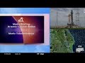
- Title
- NASA's Artemis: Status update Sept. 8, 2022
- Runtime
- 1:03:21
- Date posted
- 4 years ago
- Description
- #nasa #space #artemis
NASA will hold a media teleconference at 11 a.m. EDT Thursday, Sept. 8, to discuss next steps for the Artemis I mission to launch the Space Launch System (SLS) rocket and Orion spacecraft from the agency’s Kennedy Space Center in Florida.
Artemis I is an uncrewed flight test. It is the first in a series of increasingly complex missions to provide a foundation for human exploration in deep space and demonstrate our commitment and capability to extend human existence to the Moon and beyond.
Teleconference participants include:
Jim Free, associate administrator, Exploration Systems Development Mission Directorate, NASA Headquarters
Mike Bolger, Exploration Ground Systems program manager, Kennedy
John Blevins, SLS chief engineer, NASA’s Marshall Space Flight Center
After standing down on the Sept. 3 launch attempt due to a hydrogen leak, teams have decided to replace the seal on an i...
![Real weather impacts to your fantasy football [Ep. 337]](https://i.ytimg.com/vi/q2qB64u8lek/1.jpg)
- Title
- Real weather impacts to your fantasy football [Ep. 337]
- Runtime
- 21:38
- Date posted
- 4 years ago
- Description
- The real-life weather can have a huge impact on your fantasy football success. The next time you're crunching the stats, don't forget the real-world atmospheric science that could put a wrinkle in that next NFL game.
Which players perform best in rain? Who gets tripped up in the wind? Where might snow or storms delay a game? Those are all the things the Fantasy Football Weather Guys are forecasting, predicting, and monitoring.
This week on the Carolina Weather Group, we're revisiting our 2020 conversation with FFWG. These guys provide their own updates on which games could be impacted by weather and what that might mean for some of the expert-generated fantasy football player rosters.
Find FFWG on Twitter: https://twitter.com/ffweatherguys
LEAVE A TIP: https://streamelements.com/carolinawxgroup/tip
SUBSCRIBE TO OUR PODCAST: https://anchor.fm/carolinaweather
SUPPORT US ON PATREON: https://patreon.com/carolinaweathergroup
VIS...

- Title
- Why NASA is not launching Artemis yet
- Runtime
- 58:44
- Date posted
- 4 years ago
- Description
- #space #nasa #artemis
After standing down on today’s Artemis I launch attempt when engineers could not overcome a hydrogen leak in a quick disconnect, an interface between the liquid hydrogen fuel feed line and the Space Launch System (SLS) rocket, mission managers met and decided they will forego additional launch attempts in early September.
Over the next several days, teams will establish access to the area of the leak at Launch Pad 39B, and in parallel conduct a schedule assessment to provide additional data that will inform a decision on whether to perform work to replace a seal either at the pad, where it can be tested under cryogenic conditions, or inside the Vehicle Assembly Building.
To meet the requirement by the Eastern Range for the certification on the flight termination system, currently set at 25 days, NASA will need to roll the rocket and spacecraft back to the VAB before the next launch attempt to reset the system’s batteries. The f...

- Title
- Monitoring NASA's Artemis and ISS space walk
- Runtime
- 10:10:30
- Date posted
- 4 years ago
- Description
- #nasa #space #artemis
NASA will target Saturday, Sept. 3 at 2:17 p.m. EDT, the beginning of a two-hour window, for the launch of Artemis I, the first integrated test of NASA’s Orion spacecraft, Space Launch System (SLS) rocket, and the ground systems at the agency’s Kennedy Space Center in Florida.
Mission managers met Tuesday to discuss data and develop a forward plan to address issues that arose during an Aug. 29 launch attempt for the flight test. During that launch attempt, teams were not able to chill down the four RS-25 engines to approximately minus 420 degrees F, with engine 3 showing higher temperatures than the other engines. Teams also saw a hydrogen leak on a component of the tail service mast umbilical quick disconnect, called the purge can, and managed the leak by manually adjusting propellant flow rates.
In the coming days, teams will modify and practice propellant loading procedures to follow a procedure similar to what ...

- Title
- Artemis I pre-launch briefing Sept. 2, 2022
- Runtime
- 26:36
- Date posted
- 4 years ago
- Description
- #nasa #space #artemis
NASA will target Saturday, Sept. 3 at 2:17 p.m. EDT, the beginning of a two-hour window, for the launch of Artemis I, the first integrated test of NASA’s Orion spacecraft, Space Launch System (SLS) rocket, and the ground systems at the agency’s Kennedy Space Center in Florida.
Mission managers met Tuesday to discuss data and develop a forward plan to address issues that arose during an Aug. 29 launch attempt for the flight test. During that launch attempt, teams were not able to chill down the four RS-25 engines to approximately minus 420 degrees F, with engine 3 showing higher temperatures than the other engines. Teams also saw a hydrogen leak on a component of the tail service mast umbilical quick disconnect, called the purge can, and managed the leak by manually adjusting propellant flow rates.
In the coming days, teams will modify and practice propellant loading procedures to follow a procedure similar to what was su...
![Let's Talk: Artemis-1, tropics, and autumn weather [Ep. 424]](https://i.ytimg.com/vi/IJLg86uafbg/1.jpg)
- Title
- Let's Talk: Artemis-1, tropics, and autumn weather [Ep. 424]
- Runtime
- 35:20
- Date posted
- 4 years ago
- Description
- NASA hopes to launch Artemis-1 on Saturday following a scrub of Monday's first launch attempt.
Plus, the peak of hurricane season is nearly upon us. The National Hurricane Center is monitoring several areas of potential tropical areas of interest in the Atlantic Ocean.
And finally: It's the end of summer, at least meteorologically. We recap the summer and look ahead to the fall.
LEAVE A TIP: https://streamelements.com/carolinawxgroup/tip
SUBSCRIBE TO OUR PODCAST: https://anchor.fm/carolinaweather
SUPPORT US ON PATREON: https://patreon.com/carolinaweathergroup
VISIT OUR WEBSITE: https://carolinaweathergroup.com
The Carolina Weather Group operates a weekly talk show of the same name. Broadcasting each week from the Carolinas, the show is dedicated to covering weather, science, technology, and more with newsmakers from the field of atmospheric science. With co-hosts across both North Carolina and South Caroli...

- Title
- NASA targets Saturday for second Artemis launch attempt
- Runtime
- 52:09
- Date posted
- 4 years ago
- Description
- #nasa #artemis #space
NASA is now targeting Saturday, Sept. 3 for the launch of the #Artemis I flight test around the Moon. The two-hour launch window opens at 2:17 p.m. ET
On Tuesday, NASA officials held a teleconference to discuss what they learned during Monday's launch attempt - and what they're looking for on Saturday.
LEAVE A TIP: https://streamelements.com/carolinawxgroup/tip
SUBSCRIBE TO OUR PODCAST: https://anchor.fm/carolinaweather
SUPPORT US ON PATREON: https://patreon.com/carolinaweathergroup
VISIT OUR WEBSITE: https://carolinaweathergroup.com
The Carolina Weather Group operates a weekly talk show of the same name. Broadcasting each week from the Carolinas, the show is dedicated to covering weather, science, technology, and more with newsmakers from the field of atmospheric science. With co-hosts across both North Carolina and South Carolina, the show may closely feature both NC weather and SC weather, but the ...

- Title
- Artemis-1: Scrubbed launch news conference
- Runtime
- 42:41
- Date posted
- 4 years ago
- Description
- #space #nasa #artemis
Artemis I is a flight test to launch NASA’s Space Launch System rocket and an uncrewed Orion spacecraft around the Moon before the Artemis II mission with astronauts aboard.
The approximately two-day countdown for launch began Saturday, Aug. 27, and was waved off Monday after encountering an issue getting one of the four RS-25 engines on the bottom of the rocket’s core stage to the proper temperature range for liftoff.
NASA Administrator Bill Nelson provided brief remarks shortly after the scrub was announced. He also will join the upcoming news conference.
The following individuals also are confirmed to participate at this time:
Jim Free, associate administrator for Exploration Systems Development Mission Directorate, NASA Headquarters
Mike Sarafin, Artemis mission manager, NASA Headquarters
https://www.nasa.gov/specials/artemis/
LEAVE A TIP: https://streamelements...

- Title
- Artemis-1 prelaunch media briefing
- Runtime
- 48:43
- Date posted
- 4 years ago
- Description
- #nasa #space #artemis
NASA will hold a prelaunch media briefing following the mission management team meeting with the following participants:
Jeff Spaulding, Artemis I senior NASA test director
Melody Lovin, weather officer, Space Launch Delta 45
The SLS rocket is targeted to launch during a two-hour window that opens at 8:33 a.m. EDT Monday, Aug. 29, from Launch Pad 39B at Kennedy.
The rocket and spacecraft arrived at its launch pad Wednesday after the nearly 10-hour, four-mile trek from the Vehicle Assembly Building.
With Artemis missions, NASA will land the first woman and first person of color on the Moon, using innovative technologies to explore more of the lunar surface than ever before. We will collaborate with commercial and international partners and establish the first long-term presence on the Moon. Then, we will use what we learn on and around the Moon to take the next giant leap: sending the first astronauts...

- Title
- Artemis-1 prelaunch briefing
- Runtime
- 1:31:01
- Date posted
- 4 years ago
- Description
- #nasa #space #artemis
NASA will hold a prelaunch media briefing on the agency’s Moon to Mars exploration plans with the following participants:
Bill Nelson, NASA administrator
Bhavya Lal, NASA associate administrator for technology, policy, and strategy
Jim Free, NASA associate administrator, Exploration Systems Development Mission Directorate
Kathy Lueders, NASA associate administrator, Space Operations Mission Directorate
Thomas Zurbuchen, NASA associate administrator, Science Mission Directorate
Prasun Desai, NASA deputy associate administrator, Space Technology Mission Directorate
Randy Bresnik, NASA astronaut
The SLS rocket is targeted to launch during a two-hour window that opens at 8:33 a.m. EDT Monday, Aug. 29, from Launch Pad 39B at Kennedy.
The rocket and spacecraft arrived at its launch pad Wednesday after the nearly 10-hour, four-mile trek from the Vehicle Assembly Building...

- Title
- Artemis-1 prelaunch media briefing
- Runtime
- 1:11:48
- Date posted
- 4 years ago
- Description
- #nasa #space #artemis
NASA will hold a prelaunch media briefing following the mission management team meeting with the following participants:
Mike Sarafin, Artemis mission manager, NASA Headquarters
Charlie Blackwell-Thompson, Artemis launch director, Exploration Ground Systems Program, Kennedy
Judd Frieling, ascent and entry flight director, Johnson
Rick LaBrode, lead flight director, Johnson
Melissa Jones, recovery director, Exploration Ground Systems Program, Kennedy
Melody Lovin, weather officer, Space Launch Delta 45
Jacob Bleacher, chief exploration scientist, Exploration Systems Development Mission Directorate, NASA Headquarters
The SLS rocket is targeted to launch during a two-hour window that opens at 8:33 a.m. EDT Monday, Aug. 29, from Launch Pad 39B at Kennedy.
The rocket and spacecraft arrived at its launch pad Wednesday after the nearly 10-hour, four-mile trek from the Vehicle...





