USGS
Sea-level Rise Scenario for San Francisco Bay Estuary - Fagan Marsh

- Title
- Sea-level Rise Scenario for San Francisco Bay Estuary - Fagan Marsh
- Runtime
- 0:38
- Date posted
- 14 years ago
- Description
- http://gallery.usgs.gov/videos/584
How will sea level rise impact coastal ecosystems like salt marshes? Will plant species change and shift available habitat for local wildlife? Or will the marsh be completely inundated? USGS scientists are conducting extensive elevation and habitat surveys along the U.S. Pacific Coast, and using the data to model sea level rise impact for the next 100 years. This research will help coastal planners visualize the threats to marsh habitat under current conditions, and work towards long-term management strategies. Learn more at the San Francisco Bay Sea Level Rise Project website.
This animation depicts projected sea-level rise at Fagan Slough Marsh. Dark blue represents mean high water level, light blue is mean sea level. The marsh platform is accreting a constant 1.9 mm/yr, sea level rises 0.4 m by 2050 and 1.0 meter by 2100.

- Title
- Sea-level Rise Scenario for San Francisco Bay Estuary - San Pablo Bay Strip Marsh
- Runtime
- 0:38
- Date posted
- 14 years ago
- Description
- http://gallery.usgs.gov/videos/583
How will sea level rise impact coastal ecosystems like salt marshes? Will plant species change and shift available habitat for local wildlife? Or will the marsh be completely inundated? USGS scientists are conducting extensive elevation and habitat surveys along the U.S. Pacific Coast, and using the data to model sea level rise impact for the next 100 years. This research will help coastal planners visualize the threats to marsh habitat under current conditions, and work towards long-term management strategies. Learn more at the San Francisco Bay Sea Level Rise Project website.
This animation depicts projected sea-level rise at the San Pablo Bay Strip (East) Marsh. Dark blue represents mean high water level, light blue is mean sea level. The marsh platform is accreting a constant 1.9 mm/yr, sea level rises 0.4 m by 2050 and 1.0 meter by 2100.

- Title
- Sea-level Rise Scenario for San Francisco Bay Estuary - Petaluma Marsh
- Runtime
- 0:38
- Date posted
- 14 years ago
- Description
- http://gallery.usgs.gov/videos/582
How will sea level rise impact coastal ecosystems like salt marshes? Will plant species change and shift available habitat for local wildlife? Or will the marsh be completely inundated? USGS scientists are conducting extensive elevation and habitat surveys along the U.S. Pacific Coast, and using the data to model sea level rise impact for the next 100 years. This research will help coastal planners visualize the threats to marsh habitat under current conditions, and work towards long-term management strategies. Learn more at the San Francisco Bay Sea Level Rise Project website.
This animation depicts projected sea-level rise at Petaluma Marsh. Dark blue represents mean high water level, light blue is mean sea level. The marsh platform is accreting a constant 1.9 mm/yr, sea level rises 0.4 m by 2050 and 1.0 meter by 2100.

- Title
- Sea-level Rise Scenario for San Francisco Bay Estuary - West San Pablo Bay Marsh
- Runtime
- 0:38
- Date posted
- 14 years ago
- Description
- http://gallery.usgs.gov/videos/581
How will sea level rise impact coastal ecosystems like salt marshes? Will plant species change and shift available habitat for local wildlife? Or will the marsh be completely inundated? USGS scientists are conducting extensive elevation and habitat surveys along the U.S. Pacific Coast, and using the data to model sea level rise impact for the next 100 years. This research will help coastal planners visualize the threats to marsh habitat under current conditions, and work towards long-term management strategies. Learn more at the San Francisco Bay Sea Level Rise Project website.
This animation depicts projected sea-level rise at the West San Pablo Bay Marsh. Dark blue represents mean high water level, light blue is mean sea level. The marsh platform is accreting a constant 1.9 mm/yr, sea level rises 0.4 m by 2050 and 1.0 meter by 2100.

- Title
- Sea-level Rise Scenario for San Francisco Bay Estuary - Coon Island
- Runtime
- 0:38
- Date posted
- 14 years ago
- Description
- http://gallery.usgs.gov/videos/578
How will sea level rise impact coastal ecosystems like salt marshes? Will plant species change and shift available habitat for local wildlife? Or will the marsh be completely inundated? USGS scientists are conducting extensive elevation and habitat surveys along the U.S. Pacific Coast, and using the data to model sea level rise impact for the next 100 years. This research will help coastal planners visualize the threats to marsh habitat under current conditions, and work towards long-term management strategies. Learn more at the San Francisco Bay Sea Level Rise Project website
This animation depicts projected sea-level rise at Coon Island Marsh. Dark blue represents mean high water level, light blue is mean sea level. The marsh platform is accreting a constant 1.9 mm/yr, sea level rises 0.4 m by 2050 and 1.0 meter by 2100.
- Title
- Sea-level Rise Scenario for San Francisco Bay Estuary - Cogswell Marsh
- Runtime
- 0:38
- Date posted
- 14 years ago
- Description
- http://gallery.usgs.gov/videos/577
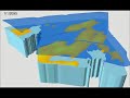
How will sea level rise impact coastal ecosystems like salt marshes? Will plant species change and shift available habitat for local wildlife? Or will the marsh be completely inundated? USGS scientists are conducting extensive elevation and habitat surveys along the U.S. Pacific Coast, and using the data to model sea level rise impact for the next 100 years. This research will help coastal planners visualize the threats to marsh habitat under current conditions, and work towards long-term management strategies. Learn more at the San Francisco Bay Sea Level Rise Project website
This animation depicts projected sea-level rise at Cogswell Marsh. Dark blue represents mean high water level, light blue is mean sea level. The marsh platform is accreting a constant 1.9 mm/yr, sea level rises 0.4 m by 2050 and 1.0 meter by 2100.

- Title
- Sea-level Rise Scenario for San Francisco Bay Estuary - China Camp State Park
- Runtime
- 0:38
- Date posted
- 14 years ago
- Description
- http://gallery.usgs.gov/videos/576
How will sea level rise impact coastal ecosystems like salt marshes? Will plant species change and shift available habitat for local wildlife? Or will the marsh be completely inundated? USGS scientists are conducting extensive elevation and habitat surveys along the U.S. Pacific Coast, and using the data to model sea level rise impact for the next 100 years. This research will help coastal planners visualize the threats to marsh habitat under current conditions, and work towards long-term management strategies. Learn more at the San Francisco Bay Sea Level Rise Project
This animation depicts projected sea-level rise at China Camp State Park. Dark blue represents mean high water level, light blue is mean sea level. The marsh platform is accreting a constant 1.9 mm/yr, sea level rises 0.4 m by 2050 and 1.0 meter by 2100.

- Title
- Sea-level Rise Scenario for San Francisco Bay Estuary - China Camp Tides
- Runtime
- 0:52
- Date posted
- 14 years ago
- Description
- http://gallery.usgs.gov/videos/575
This time-lapse video shows the dramatic natural tidal cycles of a salt marsh in San Francisco Bay -- daily rhythms to which animals take refuge in high ground, and the marsh receives sediment and nutrients from the estuary. But what will happen to these marsh ecosystems under sea level rise scenarios? Will we see shifts in vegetation and animal species, or lose some marsh ecosystems altogether? USGS scientists are surveying Pacific Coast marshes to model sea level rise scenarios for the next 100 years -- helping coastal planners visualize the threats to marsh habitat under current conditions, and work towards long-term management strategies. Learn more at the San Francisco Bay Sea Level Rise Project website (http://www.werc.usgs.gov/SFBaySLR).

- Title
- Sea-level Rise Scenario for San Francisco Bay Estuary - BlackJohn Marsh
- Runtime
- 0:38
- Date posted
- 14 years ago
- Description
- http://gallery.usgs.gov/videos/580
How will sea level rise impact coastal ecosystems like salt marshes? Will plant species change and shift available habitat for local wildlife? Or will the marsh be completely inundated? USGS scientists are conducting extensive elevation and habitat surveys along the U.S. Pacific Coast, and using the data to model sea level rise impact for the next 100 years. This research will help coastal planners visualize the threats to marsh habitat under current conditions, and work towards long-term management strategies. Learn more at the San Francisco Bay Sea Level Rise Project
This animation depicts projected sea-level rise at BlackJohn Marsh. Dark blue represents mean high water level, light blue is mean sea level. The marsh platform is accreting a constant 1.9 mm/yr, sea level rises 0.4 m by 2050 and 1.0 meter by 2100.

- Title
- Sea-level Rise Scenario for San Francisco Bay Estuary - Arrowhead Marsh
- Runtime
- 0:38
- Date posted
- 14 years ago
- Description
- http://gallery.usgs.gov/videos/579
How will sea level rise impact coastal ecosystems like salt marshes? Will plant species change and shift available habitat for local wildlife? Or will the marsh be completely inundated? USGS scientists are conducting extensive elevation and habitat surveys along the U.S. Pacific Coast, and using the data to model sea level rise impact for the next 100 years. This research will help coastal planners visualize the threats to marsh habitat under current conditions, and work towards long-term management strategies. Learn more at the San Francisco Bay Sea Level Rise Project

- Title
- Platte River at Platte River State Park Tower Northwest
- Runtime
- 11:05
- Date posted
- 14 years ago
- Description
- http://gallery.usgs.gov/videos/572
Time-lapse photos taken from the northwest side of the Platte River State Park Tower. Photos taken every hour from April 4, 2011 to April 29, 2012

- Title
- Time-Lapse Video of the Platte River at Two Rivers State Park
- Runtime
- 2:29
- Date posted
- 14 years ago
- Description
- http://gallery.usgs.gov/videos/574
Time-lapse photos taken from the a camera on the upstream side of abandoned concrete bridge piers facing north toward State Highway 92 from June 1 to Aug. 6, 2012.

- Title
- Organic Carbon and the World around Us
- Runtime
- 7:12
- Date posted
- 14 years ago
- Description
- http://gallery.usgs.gov/videos/571
In this episode, we talk about organic carbon. The benefit of studying carbon extends to many issues, including tracing mercury contamination or investigating disinfection by-products in drinking water treatment. It is amazing what can be discovered by monitoring the volume and flux of carbon through the environment. Learn about the biogeochemistry of carbon from USGS research chemists George Aiken and Brian Bergamaschi, only in this episode of the USGS Oregon Science Podcast.
- Title
- USGS Collects Storm Surge Sensors Following Hurricane Isaac
- Runtime
- 0:32
- Date posted
- 14 years ago
- Description
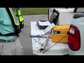
- Prior to Hurricane Isaac's landfall, USGS deployed more than 170 storm surge sensors throughout Louisiana, Mississippi, and Alabama in order to measure the height and duration of Hurricane Isaac's storm surge. Following Isaac's landfall, USGS scientists went out to collect the sensors and process their information. In this video, USGS scientist Ben McGee, who helped pioneer these sensors, explains how the sensors are mounted and protected.
Videographer: Alex Demas, USGS

- Title
- USGS Scans Percy Quin State Park Dam in Mississippi with LiDAR
- Runtime
- 0:27
- Date posted
- 14 years ago
- Description
- The U.S. Geological Survey is using LiDAR technology in select areas of Louisiana, Mississippi and Alabama to map areas impacted by Hurricane Isaac. Here, USGS scientist Toby Minear explains how USGS is helping the U.S. Army Corps of Engineers survey the impacts of high rainfall on Lake Tangipahoa at Percy Quin State Park in McComb, Mississippi, using LiDAR.
Videographer: Alex Demas, USGS

- Title
- Aaron Cupp: Daily Activities in Aquaculture
- Runtime
- 1:32
- Date posted
- 14 years ago
- Description
- http://gallery.usgs.gov/videos/573
Aaron Cupp is a student who has worked with the USGS for four years in La Crosse at the Upper Midwest Environmental Sciences Center. As a graduate student through UW Stevens Point, he has worked in Aquaculture Drug Research under Mark Gaikowski. His daily activities include water quality parameter measurements on studied fish, daily care and maintenance, feeding, cleaning and ensuring that fish are healthy so that they can be supplied for various research needs.

- Title
- US Topo
- Runtime
- 5:53
- Date posted
- 14 years ago
- Description
- http://gallery.usgs.gov/videos/568
US Topo is the next generation of topo¬graphic maps from the U.S. Geological Survey (USGS). Arranged in the familiar 7.5-minute quadrangle format, digital US Topo maps are designed to look and feel (and perform) like the traditional paper topographic maps for which the USGS is so well known. In contrast to paper-based maps, US Topo maps provide modern technical advantages that support faster, wider public distribution and enable basic, on-screen geographic analysis for all users.
US Topo maps are available free on the Web. Each map quadrangle is con¬structed in GeoPDF® format from key layers of geographic data (orthoimagery, roads, geographic names, topographic con¬tours, and hydrographic features) found in The National Map.
US Topo quadrangles can be printed from personal computers or plotters as complete, full-sized, maps or in custom¬ized sections, in a user-desired specific format. Paper copies o...

- Title
- Living Near the Epicenter of the M5.8 Mineral, Virginia, Earthquake
- Runtime
- 5:13
- Date posted
- 14 years ago
- Description
- http://gallery.usgs.gov/videos/566
Watch video interviews with four people discussing their experiences near the epicenter of the magnitude 5.8 earthquake in central Virginia on August 23, 2011. Tens of millions of people in the eastern U.S. and southeastern Canada were startled by sudden ground shaking from this earthquake, which was among the largest to occur in this region in the last century.

- Title
- Elevation
- Runtime
- 5:21
- Date posted
- 14 years ago
- Description
- http://gallery.usgs.gov/videos/567
The National Elevation Dataset (NED) is the primary elevation data product produced and distributed by the USGS National 3D Elevation Program (3DEP). The NED provides seamless raster elevation data of the conterminous United States, Alaska, Hawaii, and the island territories. The NED is derived from diverse source data sets that are processed to a specification with a consistent resolution, coordinate system, elevation units, and horizontal and vertical datums. The NED is the logical result of the maturation of the long-standing USGS elevation program, which for many years concentrated on production of topographic map quadrangle-based digital elevation models. The NED serves as the elevation layer of The National Map, and provides basic elevation information for earth science studies and mapping applications in the United States.
The NED is a multi-resolution dataset that is updated bimonthly to integrate newly available,...

- Title
- Puget Sound Groundwater Sampling Time Lapse
- Runtime
- 1:11
- Date posted
- 14 years ago
- Description
- http://gallery.usgs.gov/videos/569
This time-lapse is shot on the Hood Canal Wa., over the course of a typical groundwater sampling field day. We were investigating the impacts of a macrotidal tide range on the geochemistry of submarine groundwater discharge.

- Title
- Time-Lapse Video of the Platte River at Hwy 64 Bridge
- Runtime
- 2:34
- Date posted
- 14 years ago
- Description
- http://gallery.usgs.gov/videos/565
Time-lapse photos taken from from the Hwy 64 Bridge on the Platte River near streamflow-gaging station 06796500. Photos taken every hour from June 1, 2012 to Aug. 6, 2012.

- Title
- Time-Lapse Video of the Platte River at South Bend (Lied Bridge NE)
- Runtime
- 11:14
- Date posted
- 14 years ago
- Description
- http://gallery.usgs.gov/videos/564
Time-lapse photos taken from the northeast side of the Lied Bridge on the Platte River at South Bend near streamflow-gaging station 06805500. Photos taken every hour from April 14, 2011 to Aug. 6, 2012.

- Title
- Return of the Gentle Giants: Huron-Erie Corridor Fish Habitat Restoration
- Runtime
- 6:28
- Date posted
- 14 years ago
- Description
- http://gallery.usgs.gov/videos/570
The St. Clair River, Lake St. Clair and the Detroit River, also known as the Huron-Erie Corridor, are the international waters that connect Lake Huron to Lake Erie. Environmental changes in the Corridor over time have resulted in a loss of habitat for fish and other organisms. This video is focusing on the successful St. Clair River fish habitat restoration project and the science and collaboration that made it a success!
The Huron-Erie Corridor is the epicenter of fish populations and fish habitat restoration in the Central Great Lakes. The fish spawning habitat restoration successes in these connecting channels can have positive impacts on Lakes Erie and Huron as well as the entire Great Lakes basin.
The Huron-Erie Corridor Initiative partners will continue to work together to manage, restore, enhance, and protect the living resources and their habitats in these connecting waterways.
Vi...

- Title
- Climate Connections: Questions from Washington, DC
- Runtime
- 6:04
- Date posted
- 14 years ago
- Description
- http://gallery.usgs.gov/videos/563
America has questions about climate change, and the USGS has real answers. In this episode of Climate Connections, USGS scientists answer questions gathered from students at H.D. Woodson High School in Washington, DC. Questions include:
• If you could tell the public one thing about climate change, what would it be?
• Does climate change impact humans or animals more?
• How will climate change affect DC?
• When did climate change begin?

- Title
- Record-Breaking Burmese Python (17 feet, 7 inches, 87 eggs)
- Runtime
- 2:30
- Date posted
- 14 years ago
- Description
- http://gallery.usgs.gov/videos/562
Sound starts at: 0:53
Big Ol' Gal
This female Burmese python broke the records for her length -- 17 feet, 7 inches -- and the number of eggs she contained: 87. She was first captured in Everglades National Park by USGS researchers in the spring of 2012, when they followed a "Judas snake" -- a male python with a transmitter -- and found her nearby in the bushes. USGS scientists then outfitted her with two radio transmitters, a GPS device, and a motion-sensing device before releasing her back into the wild. The second radio transmitter was a failsafe, ensuring she wouldn't "go wild" again. The snake remained in the wild for 38 days and then was removed and euthanized. The information from this snake's every move -- each pitch, roll, and yawl -- was recorded by the motion detector, allowing biologists to piece together her behaviors, including her kills. Biologists plan to use detailed information about the snake's biology a...

- Title
- Teresa Ramos: Pushing the Envelope
- Runtime
- 4:15
- Date posted
- 14 years ago
- Description
- http://gallery.usgs.gov/videos/553
Teresa Ramos reflects on her internship with the USGS & applying for the Gates Millennium Scholarship. Teresa applied for an internship at the California Water Science Center for the Summer of 2011.

- Title
- Alaska Roundtable
- Runtime
- 4:48
- Date posted
- 14 years ago
- Description
- http://gallery.usgs.gov/videos/560
Aviation safety, energy development, resource assessments, flood plain management, and a long list of other Federal and State government activities depend on access to accurate, up-to-date topographic maps and data. Remarkably, modern mapping information does not exist over the majority of land in Alaska, where significant resource, safety and national security interests intersect.
To address this issue, the Department of the Interior (DOI) and the State of Alaska co-hosted the Alaska Mapping Roundtable meeting of senior Federal and State executives to raise awareness of status and plans and to explore alternatives for a joint funding strategy for completing topographic mapping in Alaska. The Roundtable was held in Washington, DC on June 28, 2012 and more than 20 Federal departments and bureaus participated because of their mission critical needs for this information. Alaska participants included representatives from the...

- Title
- Pacific Nearshore Project: Catching Sea Otters in the Wild
- Runtime
- 3:54
- Date posted
- 14 years ago
- Description
- http://gallery.usgs.gov/videos/559
How do you catch a sea otter? Very carefully. Researchers must use high-tech equipment and teamwork in order to safely capture these marine mammals and collect blood samples and conduct health exams as part of the Pacific Nearshore Project. The Pacific Nearshore Project is a multinational, multiagency project investigating sea otters as health indicators of coastal waters and marine resources from California north through Canada and Alaska. The project being conducted by researchers from an integrated partnership of world-class research institutions led by USGS. Learn more at http://on.doi.gov/nearshore.

- Title
- Pacific Nearshore Project: Dry Suits
- Runtime
- 3:58
- Date posted
- 14 years ago
- Description
- http://gallery.usgs.gov/videos/558
In order to study sea otters in the wild, research divers on the Pacific Nearshore Project must brave frigid waters from Alaska to California. Here's an explanation of how this special equipment works. The Pacific Nearshore Project is a multinational, multiagency project investigating sea otters as health indicators of coastal waters and marine resources from California north through Canada and Alaska. The project being conducted by researchers from an integrated partnership of world-class research institutions led by USGS. Learn more at http://on.doi.gov/nearshore.

- Title
- Volcano Hazards
- Runtime
- 6:02
- Date posted
- 14 years ago
- Description
- http://gallery.usgs.gov/videos/557
The United States has 169 active volcanoes. More than half of them could erupt explosively, sending ash up to 20,000 or 30,000 feet where commercial air traffic flies. USGS scientists are working to improve our understanding of volcano hazards to help protect communities and reduce the risks.
Video Sections:
-Volcanoes: Monitoring Volcanoes
-Volcanoes: National Volcano Early Warning System
-Volcanoes: Science for Public Safety
- Title
- Scuba Divers Catalogue Aquatic Life
- Runtime
- 3:39
- Date posted
- 14 years ago
- Description
- http://gallery.usgs.gov/videos/556
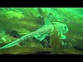
Scuba-diver scientists from the U.S. Geological Survey explore and catalogue the effect of released sediment on marine life following the nation's largest dam removal effort.
- Title
- Positional Accuracy of the National Hydrography Dataset- Part II
- Runtime
- 10:31
- Date posted
- 14 years ago
- Description
- http://gallery.usgs.gov/videos/555
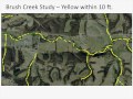
Presents the findings of a study on the positional accuracy of the NHD.

- Title
- Positional Accuracy of the National Hydrography Dataset - Part I
- Runtime
- 7:18
- Date posted
- 14 years ago
- Description
- http://gallery.usgs.gov/videos/554
Presents the findings of a study on the positional accuracy of the NHD.

- Title
- Forecast Mekong: Virtual River of Life
- Runtime
- 5:43
- Date posted
- 14 years ago
- Description
- http://gallery.usgs.gov/videos/551
The Mekong is one of the world's longest rivers connecting six Asian countries, China, Myanmar, Laos, Thailand, Cambodia, and Vietnam. People and fish, as well as many other species in this biologically rich region, are directly connected to the river, so that what impacts the river also impacts them. A river of life and livelihood, the Mekong provides for navigation, agriculture, and for the rich, naturally-produced fishery that is the primary protein source for more than 50 million people. Computer models and visualization tools can help people develop an integrated view of river life and provide a scientific basis for critical decisions about regional development and sustainability. The video is a form of science diplomacy requested by the U.S. Department of State to educate policy-makers and citizens in Southeast Asia about the vital importance of the Mekong River and delta in maintaining food security and livelihoods in the regi...

- Title
- Fly Over the Seafloor: Central California -- Bolinas to Pescadero
- Runtime
- 3:05
- Date posted
- 14 years ago
- Description
- http://gallery.usgs.gov/videos/550
Virtual fly-through over the seafloor of Central California near San Francisco as if the water was drained from the ocean. The movie flies out of San Francisco Bay pausing over a field of large sand waves west of the Golden Gate, and then up to the Bolinas area revealing folded and fractured bedrock. The movie then turns south flying down the coast past Pacifica and towards Half Moon Bay again revealing folded and fractured bedrock beneath the Maverick's surf break. The movie finishes by flying over very complex seafloor of folded bedrock, fault scarps, and ripple scour depressions south of Half Moon Bay and offshore San Gregorio State Beach. The seafloor is colored for depth with reds and oranges representing shallower regions and dark blues and purples representing deeper regions.

- Title
- Cold Water Survival
- Runtime
- 4:51
- Date posted
- 14 years ago
- Description
- http://gallery.usgs.gov/videos/548
In preparation for marine work in the cold waters off Alaska professionals from academia, industry and government must, every few years, take an offshore survival class to increase their chances of survival in the event of a seafaring mishap. This short video is a brief look at the non-classroom portion of an offshore cold water survival class taught by Learn to Return Survival Systems, Inc. of Anchorage, Alaska. USGS video producer Stephen M. Wessells recorded the footage while attending the class. Time Lapse video is used to compress much of the action into quicker segments that illustrate some of the strategies used for signaling and survival. Description disclaimer: Any use of trade, firm, or product names is for descriptive purposes only and does not imply endorsement by the U.S. Government.

- Title
- Kati Bednar: Diving Into the World of Water
- Runtime
- 0:54
- Date posted
- 14 years ago
- Description
- http://gallery.usgs.gov/videos/549
Hi, my name is Kaitlyn Bednar but everyone calls me Kati. I am currently a Student Trainee Hydrologist with the California Water Science Center (CAWSC) in Sacramento. I am also a full-time geology and geography student at California State University of Sacramento, and a part-time student at American River College within their G.I.S. certificate program. It may seem like a lot, but I enjoy keeping busy and learning new things.
- Title
- Emerging Contaminants
- Runtime
- 9:32
- Date posted
- 14 years ago
- Description
- http://gallery.usgs.gov/videos/427
Today on the USGS CoreCast we explore what impact emerging contaminants have on the health and development of aquatic wildlife. We traveled to the Pacific Northwest to talk with a multidisciplinary research team of USGS scientists about an ongoing study that characterizes the contaminants and habitats for a number of aquatic species along the lower Columbia River.

- Title
- Chasing the Mud: The Mississippi River Flood of 2011
- Runtime
- 12:33
- Date posted
- 14 years ago
- Description
- http://gallery.usgs.gov/videos/545
The 2011 Mississippi River flood was among the largest and most damaging to occur along this waterway in the past century. This major flood event dramatically increased the flow of water and sediment down the main channel of the Mississippi River and its tributary, the Atchafalaya River. To alleviate pressure on the levee system and control structures, water and sediment were diverted from the river into swamps and marshes in the Atchafalaya basin and Lake Pontchartrain. In contrast to negative impacts to human communities, the flood potentially delivered nourishing sediment to wetlands in the Mississippi River delta plain. This video follows one group of scientists as they investigate sediment deposition in the wetlands of the Mississippi River delta plain. The results of this investigation will lead to a better understanding of how extreme flood events influence sedimentation in wetlands and also will inform efforts to restore the det...

- Title
- Landslide Hazards
- Runtime
- 6:13
- Date posted
- 14 years ago
- Description
- Landslides occur in all 50 states and U.S. territories, and cause $1-2 billion in damages and more than 25 fatalities on average each year. USGS scientists aim to improve our understanding of landslide hazards to help protect communities and reduce associated losses.
Video Sections:
• Types of Landslides
• USGS Science
• Did You See It?
• Debris Flow Early Warning System (NOAA Partnership)
• Tips for Homeowners
• Conclusion
Video Producer/Videographer: Don Becker, U.S. Geological Survey

- Title
- USGS Gas Hydrates Lab
- Runtime
- 6:45
- Date posted
- 14 years ago
- Description
- Gas hydrates are a significant potential energy source occurring in ocean-floor sediments at water depths greater than 500 meters and beneath Arctic permafrost. The USGS operates a gas hydrates laboratory on its Menlo Park campus. This video features USGS geophysicists Laura Stern and Steve Kirby who relate details on how they study and create gas hydrates in their super-cooled lab. Work in the lab is funded by the U.S. Department of Energy and by the USGS Gas Hydrates Project.
USGS video: https://www.usgs.gov/media/videos/usgs-gas-hydrates-lab

- Title
- USGS spawning habitat restoration for the State threatened lake sturgeon in the St. Clair River
- Runtime
- 6:17
- Date posted
- 14 years ago
- Description
- http://gallery.usgs.gov/videos/543
On May 25, 2012, the USGS Great Lakes Science Center Dive Team documented first ever egg deposition by State- and Provincially-threatened lake sturgeon on a man-made spawning reef constructed in the Middle Channel of the St. Clair River Area of Concern, while the reef was still being constructed.
The Middle Channel reef project is supported by grants from the National Oceanic and Atmospheric Administration and the U.S. Fish and Wildlife Service through the U.S. Environmental Protection Agency's Great Lakes Restoration Initiative. Led by Michigan Sea Grant, this project is part of a long-term collaboration among federal, state and private groups interested in restoring valuable native fish populations in the Huron-Erie Corridor. USGS water flow velocity and depth models were used to determine ideal reef placement within the river. Further, USGS is leading the pre-/post- reef construction egg and larval fish assessme...

- Title
- Student/Youth: Marnelli Tassin
- Runtime
- 1:47
- Date posted
- 14 years ago
- Description
- Marnelli talks about how she started with the USGS in Hawaii and is continually growing her knowledge about science.

- Title
- New Dual-View Downhole Video Technology at the USGS
- Runtime
- 1:34
- Date posted
- 14 years ago
- Description
- http://gallery.usgs.gov/videos/531
Underwater video showing horizontal and vertical views from new video camera technology. The high-definition video output will help drillers complete the wells and will help hydrologist understand the aquifer system.
- Title
- Nutrient Impacts on Wetlands: Field Studies New Zealand
- Runtime
- 9:55
- Date posted
- 14 years ago
- Description
- http://gallery.usgs.gov/videos/540
This video describes how scientists are studying freshwater wetlands on the North Island of New Zealand and how nutrients from pasture runoff may alter the vegetation and peat formation in these important ecosystems. Much of what is known about wetlands comes from research conducted in the Northern Hemisphere. In contrast, much less is known about wetland ecosystems in the Southern Hemisphere. Because New Zealand has been geographically isolated, it has unique species of plants and animals found nowhere else. Scientists from the U.S. Geological Survey are collaborating with counterparts in New Zealand to study nutrient effects on plant production and decomposition processes. The peat-forming plants in freshwater wetlands are identified and methods used to study effects of nutrients on peat formation are illustrated. By studying how nutrients affect wetlands in New Zealand, scientists will gain a much broader understanding of how eutr...

- Title
- Using bare-earth LiDAR imagery to reveal the Tahoe
- Runtime
- 1:10
- Date posted
- 14 years ago
- Description
- http://gallery.usgs.gov/videos/541
This video provides a visual example of how airborne LiDAR (Light D
etection And Ranging) imagery penetrates dense forest cover to reveal
an active fault line not detectable with conventional aerial
photography. The video shows an aerial perspective of the range front
Mt. Tallac fault, which is one of five active faults that traverse
the base of the steep mountains west of Lake Tahoe, California. The
USGS has recently published a report in the Bulletin of the
Geological Society of America that details the seismic hazards of the
Tahoe -Sierra frontal fault zone mapped with the new technology.

- Title
- USGS Menlo Park Open House, May 19 - 20th.
- Runtime
- 0:31
- Date posted
- 15 years ago
- Description
- http://gallery.usgs.gov/videos/537
Got Science?
Come to the U.S. Geological Survey, Menlo Park Open House on Saturday and Sunday May 19 and 20.
Speak with scientists, pan for gold, make a quake!
Eat learn and have fun.
It's free! So bring the whole family!

- Title
- Fly Over the Seafloor of San Francisco Bay
- Runtime
- 4:05
- Date posted
- 15 years ago
- Description
- http://gallery.usgs.gov/videos/536
Virtual fly-through of San Francisco Bay revealing the seafloor as if the water was drained from the Bay. The movie flies through the south and central Bay, pausing over prominent seafloor features including, large sand waves, rock pinnacles, current scour pits, as well as many human impacts on the seafloor.

- Title
- USGS Student Employment, Get Your Foot In The Door
- Runtime
- 1:39
- Date posted
- 15 years ago
- Description
- http://gallery.usgs.gov/videos/535
Travis explains how he began his career as a hydrologic technician with the USGS through the USGS Student Career Employment Program.

- Title
- Vibracoring: Reconstructing the past from Earth sediments
- Runtime
- 6:49
- Date posted
- 15 years ago
- Description
- http://gallery.usgs.gov/videos/534
Geologists rely on information from deep beneath the Earth's surface to reconstruct the past. As sediments accumulate over time, they create records geologists use to understand Earth history and to predict future processes and trends. The most common way to get this information is to drill a hole in the Earth where sediments have been deposited over time. The type of drilling tool used for cores depends on how deep and how hard the sediments are. Vibracoring is one of the tools used in shallow coastal areas where sediments consist of soft sand and mud. This video podcast describes how cores are collected in shallow water from the deck of a research vessel using vibracoring. The sediments drilled are recovered in the form of a core that will contain an intact record of the past. Core samples are used to assess the geologic history of an area, such as its geomorphology; coastal, marine, and terrestrial processes; and changes in environment...





