Mr. Weatherman
Caribbean Flooding & Where a Tropical Storm Could Form...

- Title
- Caribbean Flooding & Where a Tropical Storm Could Form...
- Runtime
- 6:47
- Date posted
- 3 years ago
- Description
- There is a high chance of flooding this week for parts of Jamaica, Cuba, Haiti, and the Dominican Republic. Rain and thunderstorms will lift from the south and some areas could get over 100 mm of rain (or 4 inches). Isolated flooding is a concern by rivers and streams, and river crossings. Please be safe.
Near the Bahamas, and area of low pressure (storm system) will form late this week. It could become a tropical storm or subtropical storm. If it does, it would get the name Arlene. Monitoring closely.

- Title
- Heads UP: Jamaica, Cayman Islands, Belize... Tropical Wave Arrives
- Runtime
- 5:54
- Date posted
- 3 years ago
- Description
- A tropical wave is moving through the Eastern Caribbean, increasing the rain for Trinidad and Tobago, Guyana, and Suriname. As it moves into the Central Caribbean, the rain chance will get much higher for Jamaica, The Cayman Islands, and Cuba. The rain chance will even bump up in Belize and Honduras.
Isolated flooding will be possible in parts of Jamaica on Tuesday. Please stay alert.

- Title
- Tracking 4 Tropical Waves in the Atlantic...
- Runtime
- 8:17
- Date posted
- 3 years ago
- Description
- There are 4 tropical waves in the Atlantic, and the first one is moving into the Caribbean right now. The rain chance will go up for Trinidad and Tobago, Guyana, Suriname, St. Lucia, Barbados, Grenada, and St. Vincent and The Grenadines.
The blob of rain we've been tracking together off the coast of Florida, is now bringing heavy rain to North and South Carolina.
A weak storm system may develop next week in the Western Caribbean. This could increase the chance of rain for Belize, The Cayman Islands, and Jamaica...monitoring!

- Title
- The First Tropical Waves Enters the Caribbean...
- Runtime
- 8:08
- Date posted
- 3 years ago
- Description
- The first tropical wave of the year moves into the Caribbean this weekend. It will bring a better chance of rain, but it will not develop. There are now 4 tropical waves in total in the Atlantic, which is a sign that the hurricane season is about to crank up. The rain chance will be higher in Trinidad and Tobago, Guyana, and Surinmae. Afternoon storms continue for Jamaica and Puerto Rico.
One area that may still develop into a subtropical storm, is the area off the coast of Florida and Georgia. It is brining plenty of rain to The Bahamas. Regardless of how it develops, rain will move into South Carolina and North Carolina this weekend.
Hurricane season starts June 1st and activity is picking up.

- Title
- 3 Tropical Waves Crossing the Atlantic Ocean...
- Runtime
- 7:48
- Date posted
- 3 years ago
- Description
- Three tropical waves are crossing the Atlantic, and they will change the weather pattern! The first tropical wave of the season is close to Guyana and Suriname, and that will bring a better chance of rain to Trinidad and Tobago by late weekend.
A system off the coast of Florida could develop into a subtropical storm as it moves into Georgia, South Carolina, and North Carolina. If it gets a name, the first name on the list this Hurricane Season is Arlene.

- Title
- Tropical Wave moves toward the Caribbean...
- Runtime
- 9:33
- Date posted
- 3 years ago
- Description
- The first tropical wave of the season is getting close to the Caribbean. It is the first sign of a big pattern change, and more rain! This tropical wave will not develop into a tropical storm or hurricane, but it will bring a higher chance of rain to parts of the Caribbean.
Near Florida, an area of rain may spin up into a brief tropical depression or tropical storm. This area will move into Georgia, South Carolina, and North Carolina Friday and Saturday.

- Title
- Two Tropical Waves & One Area that Could Develop...
- Runtime
- 7:34
- Date posted
- 3 years ago
- Description
- Two tropical waves march across the Atlantic, and there is an area off the coast of the United States that could develop tropically later this week.
The two tropical waves are good news. They won't develop and are a sign that we are headed to the wet season.
An old front could help spin up a brief tropical depression or tropical storm near South Carolina and North Carolina. This could happen Thursday or Friday.
Meanwhile, El Popocatépetl in Mexico is erupting. El Popo is one of the most dangerous volcanoes on Earth. A major eruption would have global impacts to the weather.
- Title
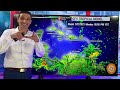
- Rain moving In and 2 areas to watch for development...
- Runtime
- 8:59
- Date posted
- 4 years ago
- Description
- The rain is coming down, plus there are two spins to watch for topical development. The first spin is bringing rain to Puerto Rico, but also helping enhance the rain around Trinidad and Tobago, Grenada, St. Lucia, and Barbadoes. Isolated flooding is possible in Guyana and Suriname.
A second area to watch will come off the coast of Florida. It could spin up, as it lifts along the coast of the United States, especially near North Carolina and South Carolina.
The weather pattern is getting more and more active!

- Title
- Do You Need Rain?
- Runtime
- 8:20
- Date posted
- 4 years ago
- Description
- It's about time! There is rain FINALLY on the way! Please be careful with isolated flooding. Next week, I'll keep an eye near Florida for the chance of a tropical storm developing.
AREAS WHERE THE RAIN INCEASES THE NEXT 3 DAYS:
Jamaica, Hait, Dominican Republic, Puerto Rico, British Virgin Islands, US Virgin Islands, Montserrat, Anguilla, Antigua and Barbuda, St. Kitts and Nevus, Guadeloupe, Dominica, Martinique, St. Lucia, Barbadoes, Grenada, St. Vincent and the Grenadines, Trinidad and Tobago, Guyana, Suriname, Aruba, Panama, Colombia, and Venezuela.

- Title
- Caribbean Flood Alert Right Now!
- Runtime
- 9:30
- Date posted
- 4 years ago
- Description
- Flooding is likely across parts of the Caribbean this weekend. Life-threatening flooding is a risk at river crossings. Quick rises are possible! Please use caution!
Haiti, Dominican Republic, Puerto Rico: Isolated downpours will lead to sharp rises of rivers and streams. Even if it is not raining where you are, rain from another nearby storm could quickly cause a river to rise. Over 100 mm (4 inches) of rain is possible in siolated areas.
Costa Rica, Panama, Colombia, Venezuela: An area of low pressure will bring downpours. Isolated flooding likely from the southern end of Costa Rica, stretching back into Venezuela.
Looking ahead: The rain will increase for Trinidad and Tobago on Sunday. Also, an area of low pressure may develop into a tropical or subtropical storm next week, off the coast of Florida and the Carolinas... more rain for Berumda and The Bahamas!
Please be safe! Thank you. - Brian

- Title
- Flooding Likely this Weekend!
- Runtime
- 7:19
- Date posted
- 4 years ago
- Description
- Flooding is likely this weekend...
HAITI: Some spots will receive 100 mm (4 inches) of rain or more. Runoff from the hillsides can lead to rock slides and a quick rise in rivers. Please use caution at crossings! Fast moving water can sweep a motorcycle away easily.
DOMINICAN REPUBLIC: Up to 100 mm (4 inches) of rain is also possible. It won't be for everyone, but where it falls, we could have a quick rise of rivers. Please stay away from fast moving water.
PUERTO RICO: Isolated flooding is possible from downpours, especially on Sunday. 75 mm (3 inches) or more of rain will be in some places (not all).
Please be safe!

- Title
- Two Areas to Watch before the Hurricane Season Begins...
- Runtime
- 10:20
- Date posted
- 4 years ago
- Description
- There are two areas of interest even before the Hurricane Season begins. A couple fronts in the United States will leave a batch of rain and storms near Florida and The Bahamas. Next week, conditions could allow one of these areas to spin up into a pre-season tropical storm.
The Hurricane Season offically starts on June 1st. The first name on the list is Arlene.

- Title
- This Area Could Develop by Next Week...
- Runtime
- 6:58
- Date posted
- 4 years ago
- Description
- A front will help bring rain and storms near the Southeast United States, off the coast of Florida and near the Bahamas... and it could develop into a tropical system by next week. Conditions are somewhat favorable for development, and the main spot to watch would be from The Bahamas, to Florida, and out to Bermuda.
Also, the models are hinting at a surge of moisture of parts of the Eastern Caribbean. The pattern may turn wetter for Trinidad and Tobago soon.
Monitoring...as always!
- Title
- The Beginning: The First Tropical Wave Comes off the Coast of Africa
- Runtime
- 8:06
- Date posted
- 4 years ago
- Description
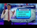
- The first tropical wave of the season just came off the coast of Africa. It is a sign the Hurricane Season is right around the corner. Throughout the course of the season, there will be about 60 tropical waves, and some could develop into our long-track tropical storms and hurricanes.
This tropical wave will not develop, but I am keeping an eye on an area near the Bahamas. There is an upper level spin there now, plus a new front may leave another batch of rain and storms. Early in the hurricane season, we look close to home for development, so I'll monitor this area carefully for you.

- Title
- Disturbance Brings Rain & Storms!
- Runtime
- 6:00
- Date posted
- 4 years ago
- Description
- A disturbance sliding through the Caribbean is changing the pattern, finally brining rain and storms! This is not for all of us, but at least it is a solid sign of a pattern change. We are getting closer to the true wet season.
The best chance of rain and thunderstorms will be for: Belize, Mexico, Colombia, Panama, Cayman Islands, Jamaica, Cuba, Haiti, and the Dominican Republic. Guyana and Suriname also stay active with more areas of showers.

- Title
- We had the First Storm of the Hurricane Season...
- Runtime
- 6:53
- Date posted
- 4 years ago
- Description
- We already had the first storm of the Hurricane Season in January! The National Hurricane Center just classified a storm system that formed in January as a Subtropical Storm. Since they did not name it at the time, the next tropical storm will still be called Arlene.
This developed January 16th, and then quickly moved inland into Eastern Canada. Sable Island had wind gusts of 100 km/h or 60 mph.
Today, the rain chance increase for Belize and Jamaica!

- Title
- Super El Niño this Hurricane Season?
- Runtime
- 9:20
- Date posted
- 4 years ago
- Description
- Will there be a Super El Niño this hurricane season? There are signs pointing that way! But regardless, El Niño is coming, and that has a direct impact on the upcoming Hurricane Season.
With an El Niño, the Atlantic Basin usually has a lower amount of tropical storms and hurricanes. However, record warm sea surface temperatures may balance that out! The extremely warm Caribbean, Gulf of Mexico, and Atlantic Ocean may help to fire up more hurricanes, and even produce stronger ones.
Regardless of the number of storms that develop, rapid intensification of hurricanes this season will be a very real threat.

- Title
- Ash Combines with Smoke & Dust
- Runtime
- 5:22
- Date posted
- 4 years ago
- Description
- Ash from the eruption of the Fuego Volcano, plus wildfire smoke, and Saharan dust, are making for very hazardous breathing conditions. The lowest air quality is in Guatemala, Mexico, Belize, Honduras, El Salvador, and Nicaragua.
The dust is locked in! From Trinidad and Tobago, Puerto Rico, Jamaica, and up to the Bahamas, we are all dealing with some of it. Plus, the rain chance stays way too low. Water shortages are ongoing. I'll monitor closely.
I'm thinking of all those in Guatemala impacted by the Fuego Volcano.

- Title
- Afternoon Storms Pop-Up....
- Runtime
- 4:58
- Date posted
- 4 years ago
- Description
- Afternoon storms, courtesy the daytime heating, remain our best chance of getting rain. There is no widespread rain event, which means the drought conditions worsen.
Hurricane season is a couple weeks away, and all is quiet in the Atlantic Basin. However, Cyclone Mocha is strengthening on the other side of the world and will impact parts of Indian, Bangladesh, and Myanmar.

- Title
- Drought & Dust...Looking for Relief....
- Runtime
- 4:18
- Date posted
- 4 years ago
- Description
- The drought continues, along with widespread wildfires and a surge of Saharan Dust. The next few days will only provide a few passing showers and storms.
Fortunately, the dust relaxes some early next week. In the meantime, please use extra caution if you have any difficulty breathing.
The overall pattern should become wetter in a week or two. I'll monitor for any signs of rain. Until then, the water restrictions and water shortages roll on.
- Title
- Tracking These Two Spots...
- Runtime
- 6:15
- Date posted
- 4 years ago
- Description
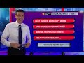
- I'm tracking two areas that could develop, all prior to the start of Hurricane Season. One front will leave leftover moisture near The Bahamas, and another front will leave an area of rain and storms in the Gulf of Mexico or Caribbean. Both could develop later this month.
Also, we'll get a pattern change as we approach the rainy season. The rain chance will get much higher for Trinidad and Tobago, Guyana, St. Vincent and The Grenadines, Guyana, and Suriname.
We stay way too dry in Belize, Mexico, and Honduras. Hopefully, some tropical moisture will break that pattern in a couple weeks!

- Title
- First Area to Watch this Hurricane Season...
- Runtime
- 6:17
- Date posted
- 4 years ago
- Description
- Hurricane Season officially starts in a few weeks, but there is an area to watch later this month. A significant front across the United States may leave a lot of moisture (rain/storms) in the Gulf of Mexico and Caribbean. Conditions could be favorable for some development at that time. It's too early to tell what may develop, if anything at all, but at the least, the rain chance will be on the increase!

- Title
- AIR ALERT: Closures, Restrictions, and More Fires....
- Runtime
- 6:50
- Date posted
- 4 years ago
- Description
- Low Air Quality is hitting hard, with fires, smoke, dust, and ongoing water shortages. There are air quality alerts in place, along with water restrictions for many. Day-to-day operations are suffering, with transportation delays and airport closures.
It may not be a hurricane, but many are getting hit hard right now. Please know I am thinking of you. I'll do my best to keep you updated!

- Title
- Biggest Surge of Dust so far this Year...
- Runtime
- 4:48
- Date posted
- 4 years ago
- Description
- The biggest surge of dust is plowing into the Caribbean this week into this weekend. This is a sign of what's to come as we approach the hurricane season. The dust is reaching as far west as Belize, Mexico, Jamaica, and Cuba.
By this weekend, it will get even thicker. Moderate dust will impact Puerto Rico, down through Dominica, St. Lucia, Barbadoes, and Trinidad and Tobago.
We are close to the start of hurricane season, so the pattern is starting to change!

- Title
- Hurricane in May?
- Runtime
- 7:24
- Date posted
- 4 years ago
- Description
- Four hurricanes formed in the month of May, including Hurricane Alma, right near Jamaica and the Cayman Islands. Tropical activity picks up mid to late may, with the official start of the Hurricane Season being June 1st.
The Pacific Hurricane Season kicks off May 15th. It could be very active on the Pacific side as El Nino takes hold!
I'm monitoring the tropics very closely!

- Title
- First Tropical Wave of the Season Coming Soon...
- Runtime
- 7:25
- Date posted
- 4 years ago
- Description
- The first tropical wave of the 2023 Hurricane Season will come off the coast of Africa within the next two weeks. However, we look close to home for tropical development in the month of May, especially in the Caribbean. Old fonts can spin up a pre-season tropical storm. I'll monitor the pattern carefully!

- Title
- Another Round Coming In!
- Runtime
- 5:18
- Date posted
- 4 years ago
- Description
- Another round of flooding rain is coming in, just where we don't need it. Trinidad & Tobago, St. Lucia, Guyana, and Suriname could all see addition flooding.
Elsewhere, it is way too dry! Critical drought levels remain in Mexico and Belize.
We are about one month away from hurricane season. We should see our first tropical wave emerge off the coast of Africa soon!

- Title
- Flood Threat Gets Higher...
- Runtime
- 5:35
- Date posted
- 4 years ago
- Description
- The flood threat gets higher today in parts of the Caribbean. The chance of rain goes up for Trinidad and Tobago, Guyana, and Suriname. Scattered showers will be possible across Grenada, St. Vincent and the Grenadines, St. Lucia, and Barbados.
In Colombia, the Nevado del Ruiz is about to erupt. This is the deadliest volcano in the Western Hemisphere, after its 1985 eruption killed 23,000 people. Evacuations are underway!

- Title
- Flooding hits the Caribbean...
- Runtime
- 5:25
- Date posted
- 4 years ago
- Description
- Flooding hit parts of the Caribbean this weekend, and the rain continues! The highest chance of flooding is Guyana and Suriname. Isolated flooding is possible in Trinidad and Tobago and St. Lucia. Another storm system is rolling through the Gulf of Mexico, but most of the rain stays away from Belize and the Yucatan of Mexico. Spotty showers continue for parts of Jamaica, Puerto Rico, and The Bahamas.
Please keep me posted you your drought, wildfire, and flood conditions. Thank you so much!

- Title
- Rain Surge Coming!
- Runtime
- 7:01
- Date posted
- 4 years ago
- Description
- A surge of rain is on the way! Puerto Rico, Jamaica, Haiti, and the Dominican Republic will continue with scattered showers and storms.
The spin near the Bahamas and Turks and Caicos will enhance the chance of rain (finally!) for Trinidad and Tobago, Guyana, Suriname, Grenada, St Vincent and the Grenadines, St. Lucia, and Barbardos.
Next week, the weather patter gets very busy. Multiple fronts will roll into the Gulf of Mexico. Monitoring!

- Title
- Tracking Two Disturbances in the Atlantic...
- Runtime
- 5:43
- Date posted
- 4 years ago
- Description
- Two disturbances will spin in rain and storms for the next few days for parts of Jamaica through Puerto Rico. I'll monitor for any signs of tropical development in these areas.
Also, the rain chance goes up for Trinidad and Tobago this weekend. This is a critical area to watch because last year we had a busy start to the Hurricane Season here, with major flooding. Guyana and Suriname will also be very active the next several days with more wet weather on the way!

- Title
- Spin in the Bahamas...
- Runtime
- 6:16
- Date posted
- 4 years ago
- Description
- A new spin near the Bahamas is exactly the spot where things can develop before the Hurricane Season actually starts. Every few years, things spin up along the fronts, and develop tropically in April. I'll watch this area closely. Plus, there is another front moving into the Gulf.
The rain chance stays elevated today for Jamaica, The Bahamas, Cuba, Puerto Rico, Haiti, Dominican Republic, Trinidad and Tobago, Guyana, and Suriname.
It's getting busy!

- Title
- Storm Tracking & Earthquake Potential
- Runtime
- 5:28
- Date posted
- 4 years ago
- Description
- An old front will spin up a batch of rain near The Bahamas. The best chance of rain today remains for Jamaica, Cuba, Haiti, Dominican Republic, Puerto Rico, The Bahamas, and Turks & Caicos. The rain chance drops for Belize and Mexico.
A hole was discovered in the Pacific Ocean. That is a sign that there could be a mega-thrust earthquake in that region, hopefully not anytime soon. That would cause a tsunami. I have information on that for you in the link in the comments.

- Title
- New Earthquakes in The Caribbean...
- Runtime
- 5:51
- Date posted
- 4 years ago
- Description
- Things were shaking this weekend in the Caribbean. Three earthquakes were felt in Jamaica, Anguilla, and Antigua & Barbuda. Fortunately, they were not super strong, but I am monitoring all earthquake activity closely for you.
Scattered shower and storms are around in Belize, The Cayman, Islands, Cuba, Jamaica, Haiti, the Dominican Republic, and Puerto Rico. Guyana and Suriname will also be wet at times. Some showers could spill into Trinidad and Tobago.
We are now about 7 weeks away from the start of the Hurricane Season. The first name on the list is Arlene. I'm watching the tropical patterns carefully!

- Title
- It's On the Way!
- Runtime
- 7:01
- Date posted
- 4 years ago
- Description
- Rain is on the way and it is critical we get some with the wildfires, dust, and overall water shortages. One front will help bring scattered showers to Jaimaica, Haiti, the Dominican Republic, and Puerto Rico. Then, next week another front scrapes by Belize and Mexico... with at least a better chance of relief from this incredible drought!

- Title
- It's Finally Going Up!
- Runtime
- 6:01
- Date posted
- 4 years ago
- Description
- Finally, a return of the rain! The chance of rain goes up for Jamaica the next few days, then for Belize, Mexico, Guatemala, El Salvador, and Honduras next week!
A wicked rain event continues to hit Florida. For Lauderdale had 26 inches of rain yesterday, causing massive flooding! The Bahamas saw rain and storms, but the rain chance will go down today.

- Title
- Tropical Downpours Could Cause Flooding...
- Runtime
- 4:48
- Date posted
- 4 years ago
- Description
- Tropical rain in the Gulf of Mexico will bring an isolated flood threat to parts of Louisiana, Mississippi, Alabama, Florida, and the Bahamas. There is a better chance of rain next week for Belize and Jamaica. The weather pattern stays active.
Take a look at these SEAWEED WAVES: youtube.com/@UCIq_FIJJtgt3W446i0jCvFQ

- Title
- Tropical Storm Forming in the Gulf of Mexico?
- Runtime
- 6:52
- Date posted
- 4 years ago
- Description
- If a tropical storm formed in the Gulf of Mexico, it would be the first on record for April! The chances of this happening remain low, but a lot of rain will build near parts of Texas, Louisiana, Mississippi, Alabama, and Florida.
An old front continues to bring rain to the Bahamas, with spotty showers for Jamaica, Cuba, Haiti, Dominican Republic, Puerto Rico, and the US & British Virgin Islands.
It's getting busy!

- Title
- Gulf Spin-Up Possible...
- Runtime
- 6:11
- Date posted
- 4 years ago
- Description
- A spin in the Gulf is possible this weekend or early next week. The pattern continues to show old fronts dropping through the Gulf of Mexico, Bay of Campeche, and in the Atlantic, near the Bahamas. It is possible a sub-tropical system tries to develop.
Either way, it is more likely that rain will move into parts of the Yucatan of Mexico, Belize, and approach Jamaica and The Cayman Islands next week.
We have a very active pattern ahead!

- Title
- Tropical Development In April?
- Runtime
- 10:02
- Date posted
- 4 years ago
- Description
- There are signs that something tropical is trying to spin up. Models hint that an area of low pressure could develop along an along front, either in the Gulf of Mexico or Atlantic (near the Bahamas). As of now, heavy rain continues to hit parts of Puerto Rico, the British Virgin Islands, US Virgin Islands, Anguilla, and St. Kitts & Nevis. I'll track things closely this weekend!
El Nino: youtube.com/@UCIq_FIJJtgt3W446i0jCvFQ

- Title
- Flash Flood Threat!
- Runtime
- 9:54
- Date posted
- 4 years ago
- Description
- El Niño update here! YouTube.com/@earthqc
Flash Flooding is a threat for parts of the Caribbean late week into the weekend. Downpours could lead to a quick stream rise in parts of: Puerto Rico, Haiti, Dominican Republic, British Virgin Islands, and the US Virgin Islands.
Anguilla, St. Kitts & Nevis, Montserrat, and Antigua & Barbuda will be right on the edge of the rain. Eventually, this area will develop further near the Bahamas.
Please be safe in areas of heavy rain. Move to higher ground if necessary!
- Title
- Spin in the Atlantic…
- Runtime
- 10:03
- Date posted
- 4 years ago
- Description
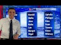
- An April spin in the Atlantic will bring the potential of flooding rain for some of us. Over 125 mm of rain, or 5 inches, is likely in some areas late this week and this weekend. I’m tracking this closely!

- Title
- System Coming Later this Week...
- Runtime
- 5:36
- Date posted
- 4 years ago
- Description
- A system will come toward the Caribbean later this week and bring a much higher chance of rain for some of us! It is not tropical in nature, but a rather large area of rain and storms will make its way toward the Eastern Caribbean and Bahamas Thursday into Friday. Lots to track this week!

- Title
- Hurricanes in April...
- Runtime
- 7:59
- Date posted
- 4 years ago
- Description
- Tropical Storms and Tropical Depressions have formed in the month of April, as we get closer to the start of Hurricane Season. However, there is no record of a hurricane developing. This time of year, old fronts can produce spins in the Atlantic, that could develop tropically (or sub-tropical). Activity ramps up in May. Last year, our first Tropical Wave came off the coast of Africa in early May. We are two months away from the start of Hurricane Season.

- Title
- RAIN! A Blob of Rain Returns!
- Runtime
- 5:08
- Date posted
- 4 years ago
- Description
- A blob of rain is coming in, as soon as tonight. This is VERY welcome weather news! We need the rain. Not all areas get it, but the best chance will be: Trinidad and Tobago, Grenada, Northern Venezuela, Guyana, and Suriname. St. Vincent and the Grenadines, St. Lucia, and Barbados will be on the edge of it.
SEAWEED! Check out the largest bloom on record for March: https://www.youtube.com/@EarthQC

- Title
- Fire & Smoke on the Move!
- Runtime
- 7:24
- Date posted
- 4 years ago
- Description
- Fire and smoke is on the move in the Caribbean and Gulf of Mexico. Mexico and Belize have many wildfires, along with Jamaica, Puerto Rico, and Trinidad and Tobago. Air quality is getting worse.
Meanwhile, we are locked into a drought! The Hurricane Season doesn't start for two more months, but sometimes a tropical storm develops in May. We aren't far away!
Please be safe! Keep me posted on your wildfire and air quality issues! Thank you!

- Title
- Windy in the Caribbean....
- Runtime
- 4:58
- Date posted
- 4 years ago
- Description
- The extra windy weather in the Caribbean will last the next two days. The "wind machine" set-up is in place, with an area of high pressure to the north. This also means higher seas.
*** Wildfire Threat *** With the gusty winds, wildfires could spread quickly. I'll be monitoring!

- Title
- April Rain Outook...
- Runtime
- 7:22
- Date posted
- 4 years ago
- Description
- The April Rain Outlook is so important since we have been so dry. The wildfire threat is increasing, and water restrictions and water shortages are becoming more widespread. We will start the month extremely dry, with some signs of more activity by the second week of April. Hurricane Season starts June 1st, and we may need to wait until then for a bigger break in the pattern!

- Title
- Asteroid Passes Between the Earth and Moon this Weekend!
- Runtime
- 4:38
- Date posted
- 4 years ago
- Description
- Asteroid Info Here: https://www.youtube.com/@EarthQC
A giant asteroid will be close to Earth on Saturday evening! The asteroid, called Asteroid 2023 DZ2, will pass right between the Earth and the Moon.
It will fly by at 28,000 km/h or 17,000 mph. The Asteroid is as long as an American football field and will pass over 170,000 km or over 100,000 miles away.
Meanwhile, the drought continues and the wildfire threat increases in the Caribbean. A few areas will see spotty showers this weekend!
More info on the Asteroid at Earth QC: https://www.youtube.com/@EarthQC

- Title
- Extreme Drought Hits the Caribbean...
- Runtime
- 7:40
- Date posted
- 4 years ago
- Description
- Extreme levels of droughts are now impacting: Belize, Cuba, Jamaica, Haiti, The Dominican Republic, and Puerto Rico. Other locations are being impacted too!
Severe levels of droughts are causing water shortages. The Vegetation Growth Index is alarming poor. Not only is it hard to grow, but we could lose current crops.
Please keep me updated on what you are dealing with. I'll be sure to provide updates!