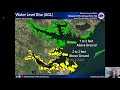
This is a recorded training we did for a basic weather spotters class on the evening of Wednesday March 19th, 2020. If you have questions email Erik at erik.heden@noaa.gov
This video is the GOES 16 satellite high resolution 1 minute data, that shows the melting snow over Eastern NC on the afternoon of February 22nd, 2020. Visit weather.gov/newport
This video was recorded around 4 PM on the 20th of February and details how much snow is expected in Eastern North Carolina. We also talk about the potential for high winds, coastal flooding, and a re freeze Friday evening.
This video was recorded on the afternoon of the 20th of February and covers the expected snow for Eastern NC, high winds, and coastal flood threat. This video was given to local officials to prepare for the upcoming storm.
This video was recorded on the morning of Feb 20th 2020 and covers how much snow Eastern NC will see, and who will see the highest amounts. We also talk about high winds and coastal flooding.
This video was recorded on the morning of February 19th and covers how much snow is expected for eastern NC, when the snow will fall and the uncertainties of the forecast.
This video covers the severe weather threat for Eastern NC, including strong winds and rain for everyone, and the severe potential later today and tonight.
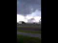
This video is from October 23rd 2019. A storm survey was conducted northeast of Vanceboro, NC to determine if a tornado hit the evening of Tuesday October 22nd just after 730 PM. Visit weather.gov/Newport or https://nwschat.weather.gov/p.php?pid=201910231928-KMHX-NOUS42-PNSMHX
This video was taken on the morning of Friday September 6th 2019 when severe storm surge impacted the sound side of the Outer Banks. This video is from Ocracoke, NC
This video, courtesy of Andrea Powers, was taken on the morning of September 6th, 2019 on Ocracoke Island during severe storm surge flooding from Hurriane Dorian. www.weather.gov/newport
This video was recorded just after 115 PM on the afternoon of Thursday September 5h, 2019. We want to emphasize ALL of the threats with Dorian including storm surge, heavy rain, wind, and tornadoes! visit weather.gov/newport for more
This video was recorded around 6 PM Wednesday Evening, September 4th, 2019. Our confidence continues to increase that we will see life threatening impacts of storm surge, heavy rain, and wind from Hurricane Dorian.
This video was recorded around 1 PM on Wednesday afternoon, September 4th, 2019. Our confidence has increased that we will see life threatening impacts of storm surge, heavy rain, and wind from Hurricane Dorian
This video was a recorded webinar we did with our partners on the morning of Tuesday September 3rd, 2019. We cover the increasing threat of Dorian to Eastern North Carolina. #hurricane #dorian #northcarolina
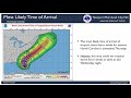
This video will go over forecast updates on Hurricane Dorian as of 6 PM Monday, September 2nd. We discuss possible impacts of Dorian on our area and what you should be doing now to prepare.
This was recorded Monday morning during a Facebook Live we did along with WCTI NewsChannel 12. This video covers what you can do to prepare for Dorian, how you shouldn't focus on just the category of the storm, but all of the impacts such as storm surge, rain, and wind.
This video highlights possible impacts from Hurricane Dorian for Eastern North Carolina. This video was made on the evening of Sunday September 1st, 2019.
In this video we will give the latest on Dorian but also go over what you should do to prepare. We will also cover what the hurricane cone means, why you shouldn't focus on just the category of the storm, and possible impacts on our area.
These two videos are from the afternoon and evening of Friday May 31st, 2019 when numerous severe thunderstorms impacted Eastern North Carolina. One thunderstorm whipped up a duststorm in Belhaven and another churned up a waterspout in Buxton! In total we issued 28 severe thunderstorm warnings and 2 tornado warnings!
Video from the afternoon of May 13th, 2019 in Bayview, NC. Golf ball size hail was reported across most of the path of this storm as it tracked across Eastern North Carolina for almost 2 hours!
We invite you to attend one of our upcoming hurricane community forums to learn more about hurricane preparedness. Remember it only takes one storm to make an impact on our lives. To learn more visit www.weather.gov/mhx
This was recorded on the evening of April 16th, 2019. This weather spotter class was given in an online format. If you want to become a spotter email Erik at erik.heden@noaa.gov
This briefing was recorded on the afternoon of December 8th, 2018 and goes over the potential for snow, high winds, and coastal flooding in Eastern North Carolina December 8th - 10th 2018.
Incredible before/after imagery courtesy of NOAA showing the impacts of #Florence. As of Wednesday afternoon you can view all of the NC beaches by going here: https://storms.ngs.noaa.gov/storms/florence/index.html#11/34.7340/-76.8727
You can also see other images here: https://oceanservice.noaa.gov/news/sep18/florence-storm-imagery.html #ncwx #nws
www.weather.gov/mhx
This video was shot on the afternoon of Friday September 15th, 2018 in the community of Bogue Watch, which is on the Bogue Sound, just south of Highway 24 and across from Emerald Isle on the sound side.
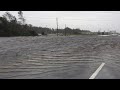
The video was shot on the afternoon of Friday September 14th, 2018 along highway 24 near Ocean and Bogue, NC. Surge of at least 3 feet was occurring from Goose Creek, which is off of Bogue Sound.