NWS Kansas City
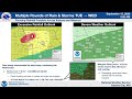
15 September 2026 - 06:29 AM CDT - HEAVY RAINFALL VIDEO BRIEFING
- Title
- 15 September 2026 - 06:29 AM CDT - HEAVY RAINFALL VIDEO BRIEFING
- Runtime
- 4:09
- Date posted
- 6 days ago
- Description
- Video briefing regarding the heavy rainfall and potential flooding possible from 9/15 to 9/16.
---------------------------------
National Weather Service
Weather Forecast Office
Kansas City, MO

- Title
- 2 JULY 2026 - 330 PM CDT - SEVERE AND HEAT VIDEO BRIEFING
- Runtime
- 4:26
- Date posted
- 3 months ago
- Description
- Hot and humid conditions are expected to continue through the weekend. Showers and storms will be possible Friday evening and Saturday. A few storms may become strong to severe with the main hazards being gusty to damaging winds and hail. For more information, visit our website at https://www.weather.gov/eax/ or find us on social media @nwskansascity.
---------------------------------
National Weather Service
Weather Forecast Office
Kansas City, MO

- Title
- 20 JUNE 2026 - 245 PM CDT - SEVERE/FLOOD VIDEO BRIEFING
- Runtime
- 4:35
- Date posted
- 3 months ago
- Description
- Video briefing covering the flood and severe weather threat for the evening of June 20, 2026 into the morning of June 21, 2026. Additional storm development is possible in the afternoon/evening of June 21.
---------------------------------
National Weather Service
Weather Forecast Office
Kansas City, MO

- Title
- 20 JUNE 2026 - 430 AM CDT - FLOODING AND SEVERE WEATHER VIDEO BRIEFING
- Runtime
- 4:45
- Date posted
- 3 months ago
- Description
- Multiple rounds of storms are possible through the weekend of Saturday June 20 and Sunday June 21, 2026 leading to concerns about flooding and severe weather. More information is available on our website: https://www.weather.gov/eax and on social media @NWSKansasCity
---------------------------------
National Weather Service
Weather Forecast Office
Kansas City, MO

- Title
- 19 JUNE 2026 - 145 PM CDT - FLOOD/SEVERE VIDEO BRIEFING
- Runtime
- 4:48
- Date posted
- 3 months ago
- Description
- Video briefing covering the severe weather and heavy rain/flood threats on Saturday, June 20 and Sunday, June 21.
---------------------------------
National Weather Service
Weather Forecast Office
Kansas City, MO

- Title
- 17 JUNE 2026 - 4:30 AM CDT - SEVERE VIDEO BRIEFING
- Runtime
- 4:41
- Date posted
- 3 months ago
- Description
- This video provides an update regarding the forecast for today, as well as a look ahead towards the weekend.
Expecting a blustery start to the morning, with a Wind Advisory out areawide through the afternoon beginning at 7 AM. Expecting sustained winds around 15-25 mph, with gusts as high as 50 mph. Later, expecting widespread thunderstorms to initiate along a cold front as early as 3 PM. Initial storm modes would be discrete, before gradually congealing into a line of thunderstorms pushing southeast through the late afternoon/evening. All severe hazards remain possible with storms, as well as a flash flooding risk due to excessive rainfall.
Looking ahead to the weekend, there is a signal for an active period of weather, with multiple rounds of storms creating conditions favorable for excessive rainfall/flash flooding as well as a severe threat. Stay up to date with the forecast in the coming days as the forecast evolves and specific details become clearer.<...

- Title
- 16 JUNE 2026 - 330 PM CDT - SEVERE WEATHER VIDEO BRIEFING
- Runtime
- 4:02
- Date posted
- 3 months ago
- Description
- This video briefing covers the forecasted severe weather expected on Wednesday 6/17/26.
---------------------------------
National Weather Service
Weather Forecast Office
Kansas City, MO

- Title
- 16 JUNE 2026 - 4:15 AM CDT - SEVERE VIDEO BRIEFING
- Runtime
- 4:43
- Date posted
- 3 months ago
- Description
- Video provides an update to the forecast for expected severe weather on Wednesday (6/17). Much of the CWA remains under an Enhanced Risk (Level 3 out of 5) for severe weather during the afternoon/evening, where widespread thunderstorms become likely (60-80%). Initial storms that are able to develop in the afternoon will have the potential to be supercellular in nature, presenting all severe hazards. These storms are expected to congeal into a line by the late afternoon/evening and progress southeastward along a cold frontal boundary, with damaging wind/embedded tornadoes becoming the primary threat. Some risk of excessive rainfall exists with storms, with an associated hazard of flash flooding in areas that see excessive rainfall over a short period of time. Uncertainty remains in the exact evolution of storms, so stay up to date with the forecast for the latest information regarding severe hazards.
---------------------------------
National Weather Service
W...
- Title
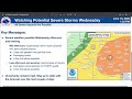
- 15 JUNE 2026 - 300 PM CDT - SEVERE VIDEO BRIEFING
- Runtime
- 3:09
- Date posted
- 3 months ago
- Description
- Video briefing on the severe weather potential arriving Wednesday, June 17.
---------------------------------
National Weather Service
Weather Forecast Office
Kansas City, MO
- Title
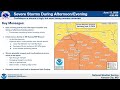
- 13 JUNE 2026 - 4:30 AM CDT - SEVERE VIDEO BRIEFING
- Runtime
- 4:53
- Date posted
- 3 months ago
- Description
- Today, expecting severe weather to develop during the afternoon/evening, with all hazards possible. Some uncertainty still remains in timing/coverage of storms. Flash flood/flood concerns remain with current morning activity and later storms.
Facebook: https://www.facebook.com/NWSKansasCity
X: https://x.com/NWSKansasCity
Website: https://www.weather.gov/eax/
---------------------------------
National Weather Service
Weather Forecast Office
Kansas City, MO

- Title
- 12 JUNE 2026 - 615 CDT - SEVERE VIDEO BRIEFING
- Runtime
- 4:21
- Date posted
- 3 months ago
- Description
- Video briefing on upcoming severe weather threats.
---------------------------------
National Weather Service
Weather Forecast Office
Kansas City, MO

- Title
- 8 JUNE 2026 - 230 PM CDT - SEVERE VIDEO BRIEFING
- Runtime
- 4:36
- Date posted
- 3 months ago
- Description
- Video briefing produced ahead of a severe weather threat overnight from Monday, June 8 through Tuesday, June 9. The primary hazards are heavy rainfall that could lead to flooding and damaging winds.
---------------------------------
National Weather Service
Weather Forecast Office
Kansas City, MO

- Title
- 19 May 2026 - 10:45 AM CDT Severe and Flooding Briefing
- Runtime
- 4:57
- Date posted
- 4 months ago
- Description
- Update on the severe storm and flooding concerns for Monday May 19, 2026.
---------------------------------
National Weather Service
Weather Forecast Office
Kansas City, MO

- Title
- 17 May 2026 - 1:30 PM CDT - May 17 and May 18 Severe Weather Briefing
- Runtime
- 4:56
- Date posted
- 4 months ago
- Description
- Video briefing for upcoming severe weather events on May 17 and May 18.
---------------------------------
National Weather Service
Weather Forecast Office
Kansas City, MO

- Title
- 26 April 2026 - 5:00 AM CDT - SEVERE VIDEO BRIEFING
- Runtime
- 4:29
- Date posted
- 5 months ago
- Description
- This is an update on the potential for severe weather tonight and tomorrow (4/27), with expectations on severe hazards and discussion of flooding concerns/issuance of a Flood Watch.
For more details on the forecast, please visit the following sites:
Website: weather.gov/kansascity
Facebook: facebook.com/NWSKansasCity/
X: x.com/NWSKansasCity
---------------------------------
National Weather Service
Weather Forecast Office
Kansas City, MO

- Title
- 17 April 2026 - 5:00 AM CDT - SEVERE VIDEO BRIEFING
- Runtime
- 4:37
- Date posted
- 5 months ago
- Description
- Severe weather continues to be expected this afternoon and evening in far eastern Kansas and northern and western Missouri. Widespread strong to severe storms are expected to develop early this afternoon (1-3 pm), spreading eastward across the region through the evening hours, with the threat winding down after 9 pm. All severe hazards are possible with the storms, with large hail being the primary threat early on while storms remain discrete. However, damaging winds are expected to become the primary threat as storms grow into lines or clusters. Isolated tornadoes are possible, especially if storms maintain a discrete mode for longer. Flash flooding is also possible, particularly south of I-70, in a region more favored for training storms with heavy rainfall this evening.
The most up to date forecast briefing packet can always be found at https://www.weather.gov/media/eax/DssPacket.pdf
You can also access our webpage at any time: https://www.weather.gov...

- Title
- 16 APRIL 2026 - 2:30 PM CDT/CST - SEVERE WEATHER VIDEO BRIEFING
- Runtime
- 4:48
- Date posted
- 5 months ago
- Description
- Widespread strong/severe storms are expected tomorrow afternoon and evening (Friday April 17, 2026). All hazards are possible, however, damaging winds are the primary threat as storms develop into a linear mode.
For more information visit our website: https://www.weather.gov/eax/
Or find us on social media: @NWSKansasCity
---------------------------------
National Weather Service
Weather Forecast Office
Kansas City, MO

- Title
- 13 APRIL 2026 - 145 CDT - SEVERE VIDEO BRIEFING
- Runtime
- 3:08
- Date posted
- 5 months ago
- Description
- Video briefing for the severe weather potential on Tuesday, April 14 and Wednesday, April 15, 2026.
---------------------------------
National Weather Service
Weather Forecast Office
Kansas City, MO

- Title
- 2 APRIL 2026 - 215 CDT - SEVERE VIDEO BRIEFING
- Runtime
- 3:58
- Date posted
- 6 months ago
- Description
- Video briefing for the severe weather potential on Thursday, April 2 and Friday, April 3, 2026.
---------------------------------
National Weather Service
Weather Forecast Office
Kansas City, MO
- Title
- 15 March 2026 - 4:15 AM CDT- Strong Spring Storm System
- Runtime
- 4:57
- Date posted
- 6 months ago
- Description
- A strong spring storm system is expected to impact the region today. Strong northwest winds could gust near 60 mph late this afternoon into the evening. A high wind warning is in effect for northern Missouri. Snow squalls possible late this afternoon into the early evening hours. More information can be found at www.weather.gov/KC
---------------------------------
National Weather Service
Weather Forecast Office
Kansas City, MO

- Title
- 14 March 2026 - 3pm CDT - Strong Spring Storm System Video Briefing
- Runtime
- 4:56
- Date posted
- 6 months ago
- Description
- A very strong spring storm system remains on track to affect the region, bringing with it the kitchen sink when it comes to weather. For the immediate area, very strong winds, a few showers and thunderstorms, snow (possible blizzard-like conditions or snow squalls), and much colder temperatures. More information can always be found at weather.gov/kansascity
---------------------------------
National Weather Service
Weather Forecast Office
Kansas City, MO

- Title
- 14 March 2026- 5:15 AM CDT - Strong Storm System Sunday March 15
- Runtime
- 4:54
- Date posted
- 6 months ago
- Description
- A strong storm system is expected to impact the region Sunday into Monday. Showers and thunderstorms are possible in the vicinity of a strong cold front moving through through the region. Behind the cold front, strong northwest winds will usher much cooler air into the region transitioning rain to snow. While the precipitation is expected to end Sunday evening, strong winds will continue into Monday creating sub zero wind chills Monday morning. More information can be found at www.weather.gov/kc
---------------------------------
National Weather Service
Weather Forecast Office
Kansas City, MO

- Title
- 13 March 2026 - 3:15 PM CDT - Strong storm system Sunday 3/15
- Runtime
- 4:19
- Date posted
- 6 months ago
- Description
- Video update on hazards and concerns with a strong storm system on Sunday 3/15.
---------------------------------
National Weather Service
Weather Forecast Office
Kansas City, MO

- Title
- 10 MAR 2026 - 400 AM CDT SEVERE VIDEO BRIEFING
- Runtime
- 5:01
- Date posted
- 7 months ago
- Description
- Video briefing regarding severe weather and flooding potential on Tuesday March 10th 2026
---------------------------------
National Weather Service
Weather Forecast Office
Kansas City, MO

- Title
- 06 MAR 2026 - 315 CST - SEVERE VIDEO BRIEFING
- Runtime
- 5:00
- Date posted
- 7 months ago
- Description
- Video Briefing For Friday March 6th 2026. This briefing create around 315am on Friday March 6th 2026.
---------------------------------
National Weather Service
Weather Forecast Office
Kansas City, MO

- Title
- 5 March 2026 - 2:30 PM CST - SEVERE WEATHER VIDEO BRIEFING
- Runtime
- 4:48
- Date posted
- 7 months ago
- Description
- Multiple rounds of strong to severe storms are expected Thursday 3/5 through Friday 3/6. For more information visit our website: weather.gov/KansasCity
or find us on social media: @NWSKansasCity
---------------------------------
National Weather Service
Weather Forecast Office
Kansas City, MO

- Title
- 1 March 2026 - 5 AM CST - WINTER VIDEO BRIEFING
- Runtime
- 4:57
- Date posted
- 7 months ago
- Description
- This video provides an update on winter weather expected Sunday afternoon through Monday morning for the Kansas City/Pleasant Hill CWA. For more information regarding the forecast, you can visit the following sites:
Website: https://www.weather.gov/eax
Facebook: https://www.facebook.com/NWSKansasCity/
X: https://x.com/NWSKansasCity
---------------------------------
National Weather Service
Weather Forecast Office
Kansas City, MO

- Title
- 28 February 2026 - 3 PM CST - WINTER VIDEO BRIEFING
- Runtime
- 4:58
- Date posted
- 7 months ago
- Description
- This video briefing discusses the winter weather event that is expected to impact the region Sunday afternoon into Monday morning. For more information, please see: https://www.weather.gov/KC
---------------------------------
National Weather Service
Weather Forecast Office
Kansas City, MO
- Title
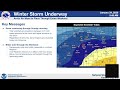
- 24 January 2026 - 6 AM CST - WINTER VIDEO BRIEFING
- Runtime
- 3:56
- Date posted
- 8 months ago
- Description
- Snow is expected to continue to expand eastward across the region today and continue into tonight before gradually decreasing from northwest to southeast on Sunday morning. Heaviest snow totals remain across central Missouri with 6-8" expected along and south of a line from Clinton- Columbia. Lesser amounts are expected further north, with 4-6" along the I-70 corridor, and 2-4" along the highway 36 corridor. The frigid cold is expected to remain across the region through the weekend into next week, with the coldest temperatures on Monday morning. For more information, please see: https://www.weather.gov/KC
---------------------------------
National Weather Service
Weather Forecast Office
Kansas City, MO

- Title
- 23 January 2026 - 2:06 pm CST - WINTER VIDEO BRIEFING
- Runtime
- 4:12
- Date posted
- 8 months ago
- Description
- Friday (Jan. 23, 2026) update regarding the winter storm moving into the area on Saturday, January 24, 2026.
---------------------------------
National Weather Service
Weather Forecast Office
Kansas City, MO

- Title
- 23 January 2026 - 4:38 am CST - WINTER VIDEO BRIEFING
- Runtime
- 4:01
- Date posted
- 8 months ago
- Description
- Friday AM 1/23/26 update regarding the winter storm expected 1/24/26. Please contact our office with any questions or concerns.
---------------------------------
National Weather Service
Weather Forecast Office
Kansas City, MO

- Title
- 22 January 2026 - 1432 CST - WINTER VIDEO BRIEFING
- Runtime
- 4:33
- Date posted
- 8 months ago
- Description
- Thursday 1/22/26 update regarding the winter storm expected 1/24/26. Please contact our office with any questions or concerns.
---------------------------------
National Weather Service
Weather Forecast Office
Kansas City, MO
- Title
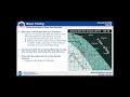
- January 22, 2026 - 2:30 pm CST - WINTER VIDEO BRIEFING
- Runtime
- 4:33
- Date posted
- 8 months ago
- Description
- This is the weather briefing during the afternoon of 22 January 2026 for the winter storm expected 24-25 January.
---------------------------------
National Weather Service
Weather Forecast Office
Kansas City, MO

- Title
- 21 January 2026 - 1526 CST - WINTER WEATHER VIDEO BRIEFING
- Runtime
- 4:54
- Date posted
- 8 months ago
- Description
- This video briefing given on Wednesday 1/21 goes over the expectations for snow expected to affect the area Saturday 1/24.
---------------------------------
National Weather Service
Weather Forecast Office
Kansas City, MO
- Title
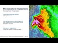
- 2026 Spotter Training - NWS Kansas City
- Runtime
- 33:00
- Date posted
- 8 months ago
- Description
- This presentation is geared toward residents of western Missouri and eastern Kansas, so that they may access the 2026 Skywarn Spotter Training at any time.
Those that complete the entire video are considered Skywarn trained and will be guided to how to receive their completion certificate at www.weather.gov/kc/skywarn
---------------------------------
National Weather Service
Weather Forecast Office
Kansas City, MO
- Title
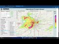
- July 17, 2025 Flash Flood - MRMS Radar Interval Max
- Runtime
- 0:23
- Date posted
- 1 year ago
- Description
- MEMC Flash Flood Presentation - Multi-Radar Multi-Sensor (MRMS) Radar Interval Max July 17, 2025
---------------------------------
National Weather Service
Weather Forecast Office
Kansas City, MO
- Title
- July 17, 2025 Flash Flood - MRMS Crest Unit Flow
- Runtime
- 0:24
- Date posted
- 1 year ago
- Description
- MEMC Flash Flood Presentation - Multi-Radar Multi-Sensor (MRMS) Crest Unit Flow July 17, 2025
---------------------------------
National Weather Service
Weather Forecast Office
Kansas City, MO

- Title
- July 17, 2025 Flash Flood - MRMS Radar Rainfall Rate
- Runtime
- 0:23
- Date posted
- 1 year ago
- Description
- MEMC Flash Flood Presentation - Multi-Radar Multi-Sensor (MRMS) Radar Rainfall Rate July 17, 2025
---------------------------------
National Weather Service
Weather Forecast Office
Kansas City, MO

- Title
- July 17 2025 Flash Flood - MRMS Reflectivity at Lowest Level
- Runtime
- 0:24
- Date posted
- 1 year ago
- Description
- July 17 2025 Flash Flood Event - Multi-Radar Multi-Sensor (MRMS) Reflectivity at lowest level.
---------------------------------
National Weather Service
Weather Forecast Office
Kansas City, MO

- Title
- 8 August 2025 - 5:15 PM CDT - Weekend Thunderstorms and Heavy Rainfall Briefing
- Runtime
- 3:59
- Date posted
- 1 year ago
- Description
- Video briefing describing the risk of thunderstorms and heavy rainfall beginning Saturday night and continuing through Monday Morning.
---------------------------------
National Weather Service
Weather Forecast Office
Kansas City, MO

- Title
- Potential Dangerous Heavy Rainfall and Flooding Event Tonight - July 24-25, 2025
- Runtime
- 4:00
- Date posted
- 1 year ago
- Description
- This video update provides some information on our thoughts and concerns with heavy rainfall and flooding tonight across the region.
---------------------------------
National Weather Service
Weather Forecast Office
Kansas City, MO

- Title
- 3 July 2025 - Fourth of July Outlook - NWS Kansas City
- Runtime
- 3:39
- Date posted
- 1 year ago
- Description
- Video briefing of expected conditions for the July Fourth Holiday and the weekend ahead.
---------------------------------
National Weather Service
Weather Forecast Office
Kansas City, MO

- Title
- 16 June 2025 - 12:45 PM CDT - Tuesday (6/17) Severe Storm Risk
- Runtime
- 3:28
- Date posted
- 1 year ago
- Description
- This video briefing gives a quick glance at what we're expecting with severe thunderstorms Tuesday night into early Wednesday morning across the region.
---------------------------------
National Weather Service
Weather Forecast Office
Kansas City, MO

- Title
- 16 June 2025 - 3:45 PM CDT - Tuesday (6/17) Night Severe Storm Risk
- Runtime
- 3:51
- Date posted
- 1 year ago
- Description
- This video briefing gives a quick glance at what we're expecting with severe thunderstorms Tuesday night into early Wednesday morning across the region.
---------------------------------
National Weather Service
Weather Forecast Office
Kansas City, MO

- Title
- 2 June 2025 - Tuesday 6/3/25 Heavy Rain and Severe Storms Update
- Runtime
- 4:28
- Date posted
- 1 year ago
- Description
- This video was recorded Monday, 6/2/2025, afternoon and covers current expectations from storms and heavy rainfall beginning early Tuesday (6/3) morning and ending through Tuesday night.
---------------------------------
National Weather Service
Weather Forecast Office
Kansas City, MO

- Title
- 19 May 2025 - 9:45 AM CDT - Today's Severe Storm Update
- Runtime
- 4:05
- Date posted
- 1 year ago
- Description
- Some uncertainty in coverage and evolution of storms. We know there will be two rounds, one around midday and the other late afternoon and through the evening. Today is definitely an important day to stay up to date on the weather.
---------------------------------
National Weather Service
Weather Forecast Office
Kansas City, MO

- Title
- 18 MAY 2025 - 530am CDT - SEVERE VIDEO BRIEFING
- Runtime
- 4:58
- Date posted
- 1 year ago
- Description
- For details on hazards associated with severe thunderstorms Sunday 18 MAY 2025 and Monday 19 MAY 2025, please see the DSS packet online. This video will focus more on timing of thunderstorms.
---------------------------------
National Weather Service
Weather Forecast Office
Kansas City, MO

- Title
- 28 April 2025 - 1230pm CDT - Severe Weather Potential Briefing
- Runtime
- 4:57
- Date posted
- 1 year ago
- Description
- Potential for severe storms for late this afternoon and evening have increased through the morning hours. Includes the potential for very large hail, damaging winds, and tornadic activity. Activity carries into the overnight, but severe threat begins to lessen.
---------------------------------
National Weather Service
Weather Forecast Office
Kansas City, MO

- Title
- NWS Kansas City - Looking Ahead to Monday (28 Apr 2025) Severe Storm Potential
- Runtime
- 4:22
- Date posted
- 1 year ago
- Description
- This video will give a quick overview of the potential for severe storms Monday (28 Apr 2025) evening and overnight.
---------------------------------
National Weather Service
Weather Forecast Office
Kansas City, MO

- Title
- March 31st 2025 - 3:15 PM CDT - SEVERE VIDEO BRIEFING
- Runtime
- 4:17
- Date posted
- 1 year ago
- Description
- Severe storm chances will exist late Tuesday into early Wednesday Morning across the region.
---------------------------------
National Weather Service
Weather Forecast Office
Kansas City, MO





