NWS Grand Junction
NWS Grand Junction May 10 2013 Snowpack/Outlook Briefing

- Title
- NWS Grand Junction May 10 2013 Snowpack/Outlook Briefing
- Runtime
- 4:07
- Date posted
- 13 years ago
- Description
- NWS Grand Junction May 10 2013 Snowpack/Outlook Briefing
---------------------------------
National Weather Service
Weather Forecast Office
Grand Junction, CO

- Title
- NWS Grand Junction May 3 2013 Snowpack/Outlook Briefing
- Runtime
- 7:49
- Date posted
- 13 years ago
- Description
- NWS Grand Junction May 3 2013 Snowpack/Outlook Briefing
---------------------------------
National Weather Service
Weather Forecast Office
Grand Junction, CO

- Title
- NWS Grand Junction April 26 2013 Dust/Snowpack Briefing
- Runtime
- 4:58
- Date posted
- 13 years ago
- Description
- NWS Grand Junction April 26 2013 Dust/Snowpack Briefing
---------------------------------
National Weather Service
Weather Forecast Office
Grand Junction, CO

- Title
- Review for Snowy April 2013 in Utah and Colorado (UPDATE)
- Runtime
- 7:31
- Date posted
- 13 years ago
- Description
- This is a review for the month of April as of April 25th that brought a series of storms with significant snowfall for the mountains and some valley areas. The snow helped improve the snowpack. This has been updated to include the most recent snowpack maps and drought conditions for better representation of the changes the snow in April so far has had.
---------------------------------
National Weather Service
Weather Forecast Office
Grand Junction, CO

- Title
- Review of Snowy April 2013 in Utah and Colorado
- Runtime
- 7:11
- Date posted
- 13 years ago
- Description
- This is a review of the snowy month of April 2013 in eastern Utah and western Colorado and the impact that the significant snowfall had on the mountain snowpack. Upwards of 3 to 5 feet of snow fell in the mountains of northeast Utah and northwest Colorado throughout the month of April.
---------------------------------
National Weather Service
Weather Forecast Office
Grand Junction, CO
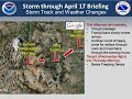
- Title
- Morning UPDATE (4-17-2013): Storm Through This Evening
- Runtime
- 5:13
- Date posted
- 13 years ago
- Description
- The following is a morning update for the strong storm bringing winter weather to eastern Utah and western Colorado through this evening which is Wednesday, April 17th. Includes what happened over the last 24 hours and what is expected through this evening. For the latest information, check our website at www.weather.gov/gjt.
---------------------------------
National Weather Service
Weather Forecast Office
Grand Junction, CO

- Title
- UPDATE (4-16): Storm Through Wednesday, April 17 2013
- Runtime
- 6:55
- Date posted
- 13 years ago
- Description
- This is an updated weather briefing for the storm impacting eastern Utah and western Colorado through Wednesday, April 17th 2013. For the latest, check www.weather.gov/gjt.
---------------------------------
National Weather Service
Weather Forecast Office
Grand Junction, CO

- Title
- UPDATE (4-15): Storm through Wednesday, April 17 2013
- Runtime
- 5:59
- Date posted
- 13 years ago
- Description
- The following is an updated weather briefing for the storm impacting eastern Utah and western Colorado through Wednesday, April 17. Heavy snow in the mountains and some higher valleys, with colder air moving in Tuesday night.
---------------------------------
National Weather Service
Weather Forecast Office
Grand Junction, CO

- Title
- April 14, 2013 Briefing: Long Duration Storm April 15-17, 2013
- Runtime
- 4:57
- Date posted
- 13 years ago
- Description
- The following is a weather briefing created on the evening of Sunday, April 14th for the long duration storm, or period of unsettled weather from April 15th through the 17th. This will bring significant snowfall to the mountains, with colder temperatures. For the latest, check our website at www.weather.gov/gjt.
---------------------------------
National Weather Service
Weather Forecast Office
Grand Junction, CO

- Title
- UPDATE(April 9): Strong Storm Through Tonight (April 9, 2013)
- Runtime
- 5:44
- Date posted
- 13 years ago
- Description
- The following is a morning update for the strong spring storm that will continue to impact eastern Utah and western Colorado through tonight, Tuesday April 9th, 2013, with heavy snow in the mountains and snow in some valleys. For the latest information, check www.weather.gov/gjt.
---------------------------------
National Weather Service
Weather Forecast Office
Grand Junction, CO

- Title
- UPDATE (4-08): Strong Storm Continues Through April 9, 2013
- Runtime
- 4:24
- Date posted
- 13 years ago
- Description
- Here is an update made on the evening of Monday, April 8th regarding the powerful spring storm that continues to impact eastern Utah and western Colorado through Tuesday, April 9th bringing high winds and heavy snow to many areas, including blizzard conditions in northeast Utah and western Colorado. See www.weather.gov/gjt for the latest information.
---------------------------------
National Weather Service
Weather Forecast Office
Grand Junction, CO

- Title
- Late Night Update(April 7):Powerful Spring Storm April 8-9, 2013
- Runtime
- 4:51
- Date posted
- 13 years ago
- Description
- This is a late night update on April 7th for the powerful spring storm set to impact the region Monday, April 8th through Tuesday, April 9th with a variety of weather and big changes to the area. For the latest information, please go to www.weather.gov/gjt.
---------------------------------
National Weather Service
Weather Forecast Office
Grand Junction, CO

- Title
- UPDATE: Powerful Spring Storm Impacts area Monday, April 8th through Tuesday, April 9th
- Runtime
- 4:39
- Date posted
- 13 years ago
- Description
- This is an updated briefing as of April 7th for the powerful spring storm that will impact the area Monday, April 8th through Tuesday, April 9th. A variety of weather and big changes are in store, including heavy snow, potential blizzard for northeast Utah and northwest Colorado, as well as high winds and fire weather concerns. See www.weather.gov/gjt for the latest on this evolving storm.
---------------------------------
National Weather Service
Weather Forecast Office
Grand Junction, CO

- Title
- Major Spring Storm will impact the Region Monday Night and Tuesday (April 8-9, 2013)
- Runtime
- 4:13
- Date posted
- 13 years ago
- Description
- A major spring storm will bring heavy snow, strong winds and much colder weather to much of eastern Utah and western Colorado on Monday April 8th and Tuesday April 9th. Blizzard conditions will be possible across portions of northeast Utah and extreme northwest Colorado north of U.S. Highway 40. Over a foot of snow will be possible for the mountains with lighter amounts across the northern valleys.
---------------------------------
National Weather Service
Weather Forecast Office
Grand Junction, CO

- Title
- No current Multimedia Weather Briefing is in effect at this time.
- Runtime
- 0:17
- Date posted
- 13 years ago
- Description
- No Multimedia Weather Briefing is in effect at this time.
These briefings will be updated as time permits and are
not a substitute to receiving current weather and warning
information through official NWS dissemination processes.
---------------------------------
National Weather Service
Weather Forecast Office
Grand Junction, CO

- Title
- UPDATE (3-09-13): Winter Storm March 8-9
- Runtime
- 6:04
- Date posted
- 13 years ago
- Description
- Update for the winter storm affecting eastern Utah and western Colorado through this evening.
---------------------------------
National Weather Service
Weather Forecast Office
Grand Junction, CO

- Title
- March 8-9, 2013 Winter Storm
- Runtime
- 6:43
- Date posted
- 13 years ago
- Description
- Weather briefing discussing winter storm impacting eastern Utah and western Colorado March 8 through 9, 2013. Significant snowfall expected for the mountains with rain and snow in the valleys.
---------------------------------
National Weather Service
Weather Forecast Office
Grand Junction, CO

- Title
- Weather Briefing: February 13-19, 2013.
- Runtime
- 2:32
- Date posted
- 13 years ago
- Description
- This is a weather briefing for the period of February 13-19, 2013. We will be looking at two events: the period of northern mountain snow today-Friday and another potential storm system late Sunday through Monday. Several upper level disturbances will pass overhead today-Friday, with 6-12 inches of snow expected in the Park and Flattop Mountains, an inch or two of snow for the northern valleys and several inches in the central mountains. Elsewhere dry conditions and slightly below normal temperatures will continue into the weekend. The next potential storm system approaches Sunday morning as a surface low and cold front, which are expected to bring another round of mountain snow late Sunday-Monday, with a slight chance of light rain/snow over the lower valleys.
---------------------------------
National Weather Service
Weather Forecast Office
Grand Junction, CO

- Title
- Update: February 9-11, 2013 Winter Storm
- Runtime
- 6:51
- Date posted
- 13 years ago
- Description
- Media update to the winter storm impacting eastern Utah and western Colorado over the weekend from February 9th through the 11th. This storm will continue to bring widespread snowfall to the mountains through Monday afternoon where accumulations will vary from 8 inches to near 2 feet. The northern and southern valleys will also see significant snowfall through this period with 4 to 12 inches expected.
---------------------------------
National Weather Service
Weather Forecast Office
Grand Junction, CO

- Title
- Winter Storm from February 9 through the 11th impacting Utah and Colorado
- Runtime
- 6:40
- Date posted
- 13 years ago
- Description
- This is a multi-media weather briefing regarding a winter storm moving through the Utah and Colorado region. This storm will bring 10 to 20 inches of new snow to the mountains between February 9th through the 11th with light amounts across the valleys. This storm will eventually move out in the high plains, impacting Nebraska, South Dakota, Minnesota and Wisconsin where blizzard warnings and watches are in effect.
---------------------------------
National Weather Service
Weather Forecast Office
Grand Junction, CO