NWS Binghamton
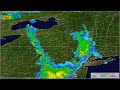
National Weather Service radar loop from August 31 to September 3, 2026
- Title
- National Weather Service radar loop from August 31 to September 3, 2026
- Runtime
- 1:27
- Date posted
- 13 days ago
- Description
- The radar loop is from the National Weather Service radars. This is a loop of MRMS Low Level Composite Reflectivity. The loop was from 08:00 PM EDT August 31, 2026 (0000 UTC September 1, 2026) to 07:58 PM EDT September 3, 2026 ( 2358 UTC September 3, 2026).
There is no audio with this video.
----------------------------------------------
National Weather Service
Weather Forecast Office
Binghamton, NY
https://www.weather.gov/bgm/
https://www.facebook.com/NWSBinghamton
https://x.com/NWSBinghamton
- Title
- NWSBinghamtonSummerHazardsCampingVideo
- Runtime
- 26:32
- Date posted
- 2 months ago
- Description
- Summer is a very active time both for outdoor activities and thunderstorms/heat/flooding, which enhances public exposure to weather hazards. This video reviews how to anticipate impactful weather in Northeast PA-Central NY, maintain situational awareness, and receive weather warnings when they get issued.
----------------------------------------------
National Weather Service
Weather Forecast Office
Binghamton, NY
https://www.weather.gov/bgm/
https://www.facebook.com/NWSBinghamton
https://twitter.com/NWSBinghamton

- Title
- KBGM Radar Loop from June 21 to 22, 2025
- Runtime
- 0:26
- Date posted
- 1 year ago
- Description
- The radar loop is from the National Weather Service radar in Binghamton, NY. This is a loop of base reflectivity at 0.5 degree elevation. The loop was from 08:01 PM EDT June 21, 2025 (0001 UTC June 22, 2025) to 07:59 PM EDT June 22, 2025 ( 2359 UTC June 22, 2025).
There is no audio with this video.
----------------------------------------------
National Weather Service
Weather Forecast Office
Binghamton, NY
https://www.weather.gov/bgm/
https://www.facebook.com/NWSBinghamton
https://twitter.com/NWSBinghamton

- Title
- KTYX Radar Loop January 1 to 5, 2025
- Runtime
- 1:02
- Date posted
- 2 years ago
- Description
- In early January 2025, a storm system traveled northeast across New York and into New England. The northeastward movement of this low pressure system created favorable winds for a prolonged lake effect snow event across parts of the Tug Hill Plateau, Finger Lakes, Mohawk Valley, and Susquehanna Regions of New York. This occurred primarily from January 1 to 5, 2025.
The radar loop is from the National Weather Service radar in Montague, NY. This is a loop of base reflectivity at 0.5 degree elevation. The loop was from 07:09 PM EST December 31, 2025 (0000 UTC January 1, 2025) to 01:36 AM EST January 6, 2025 ( 0636 UTC January 6, 2025).
Initially, the loop shows a cyclonic circulation (counterclockwise circulation), indicating the presence of a low pressure center. As the system progresses, winds shift to a northwest and west direction, leading to the development of prominent lake effect snow bands downwind of Lake Ontario.
There is no audio with th...

- Title
- KBGM Radar Loop November 20 to 23, 2024
- Runtime
- 0:48
- Date posted
- 2 years ago
- Description
- This is a radar loop of base reflectivity from the National Weather Service in Binghamton, New York. The loop is from 7:02 PM EST November 20, 2024 ( 0002 UTC November 21, 2024) to 6:58 PM EST November 23, 2024 (2358 UTC November 23, 2024).
A storm system moved across central New York and northeast Pennsylvania from November 20th to 23rd 2024. As this system moved eastward, an area of low pressure developed in the vicinity of Long Island and produced heavy wet snowfall across parts of central New York and northeast Pennsylvania.
There is no audio with this video.
----------------------------------------------
National Weather Service
Weather Forecast Office
Binghamton, NY
https://www.weather.gov/bgm/
https://www.facebook.com/NWSBinghamton
https://twitter.com/NWSBinghamton
- Title
- Radar Loop August 9, 2024
- Runtime
- 0:22
- Date posted
- 2 years ago
- Description
- There is no audio with this video.
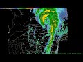
The remnants of Hurricane Debby moved inland over parts of northern Florida into parts of southern Georgia. It slowed/stalled over the Carolinas, then moved northward across the northeastern part of the United States. As it moved over parts of northeast Pennsylvania and central New York it produced heavy rainfall that caused some flooding, especially along rivers and streams.
This is a Multi-Radar Multi-Sensor (MRMS) composite reflectivity (1 km) loop from 03:00 AM EDT August 9, 2024 (0700 UTC August 9, 2024) to 08:34 PM EDT August 09, 2024 (0034 UTC August 10, 2024).
More on MRMS at https://mrms.nssl.noaa.gov/
More information can be found here, https://www.weather.gov/bgm/pastFloodAugust092024
----------------------------------------------
National Weather Service
Weather Forecast Office
Binghamton, NY
https://www.weather.gov/bgm/
https://www.facebook.co...

- Title
- Satellite Loop August 4 to 10, 2024
- Runtime
- 1:18
- Date posted
- 2 years ago
- Description
- There is no audio with this video.
The remnants of Hurricane Debby moved inland over parts of northern Florida into parts of southern Georgia. It slowed/stalled over the Carolinas, then moved northward across the northeastern part of the United States. As it moved over parts of northeast Pennsylvania and central New York it produced heavy rainfall that caused some flooding, especially along rivers and streams.
The satellite loop was from GOES East IR Channel 15 from 08:01 PM EDT August 4, 2024 (0001 UTC August 5, 2024) to 01:01 PM EDT August 10, 2024 (1701 UTC August 10, 2024).
More information can be found here, https://www.weather.gov/bgm/pastFloodAugust092024
----------------------------------------------
National Weather Service
Weather Forecast Office
Binghamton, NY
https://www.weather.gov/bgm/
https://www.facebook.com/NWSBinghamton
https://twitter.com/NWSBinghamton

- Title
- Smoky GeoColor Satellite Loop June 4-8, 2023
- Runtime
- 1:08
- Date posted
- 3 years ago
- Description
- There is no audio with this video.
This is a GeoColor GOES East satellite loop from June 3, 2023 7:56 PM EDT (2356 UTC) to June 8, 2023 8:51 AM EDT (1251 UTC).
Here are some times of notable events in this satellite loop.
00:24 - Plumes of smoke top middle of video.
00:34 - First dense plume of smoke, light tan color.
00:48 - Second dense plume of smoke, light tan color.
Depending on its density, the smoke can be identified as milky white/tan translucent plume. The denser smoke stands out clouds as a tan plume.
The smoke reduced visibility across parts of New York and Pennsylvania on June 6 and 7, 2023.
You can find satellite imagery at,
https://www.star.nesdis.noaa.gov/GOES/sector.php?sat=G16§or=ne
More information about GeoColor images,
https://www.star.nesdis.noaa.gov/GOES/documents/QuickGuide_CIRA_Geocolor_20171019.pdf
For air quality i...

- Title
- Smoky GeoColor Satellite Loop June 05, 2023
- Runtime
- 0:13
- Date posted
- 3 years ago
- Description
- There is no audio with this video.
This is a GeoColor GOES East satellite loop from 8:56 AM EDT (1256 UTC) to 3:31 PM EDT (1931 UTC) on June 5, 2023. In the loop, the smoke is shown as a milky, translucent haze that spreads over most of New York and Pennsylvania. The brighter white areas are clouds. The smoke was from fires in Quebec, Canada.
You can find satellite imagery at,
https://www.star.nesdis.noaa.gov/GOES/sector.php?sat=G16§or=ne
More information about GeoColor images,
https://www.star.nesdis.noaa.gov/GOES/documents/QuickGuide_CIRA_Geocolor_20171019.pdf
Summary of this event,
https://www.weather.gov/bgm/pastNonPrecipJune052023
Similar event occurred July 6, 2002
https://www.weather.gov/bgm/WeatherInActionSmokePlume
----------------------------------------------
National Weather Service
Weather Forecast Office
Binghamton, NY
https://www.weather.gov/...

- Title
- Northeast Radar Loop from April 26, to May 01, 2023
- Runtime
- 0:27
- Date posted
- 3 years ago
- Description
- There is no audio with this video.
A radar loop from NWS radars in the northeast part of the United States. The loop was from 08:00 PM EDT April 26, 2023 (0000 UTC April 27, 2023) to 06:50 PM EDT May 01, 2023 (2250 UTC May 01, 2023).
A summary with rainfall amounts can be found at, https://www.weather.gov/bgm/pastfloodMay012023
----------------------------------------------
National Weather Service
Weather Forecast Office
Binghamton, NY
https://www.weather.gov/bgm/
https://www.facebook.com/NWSBinghamton
https://twitter.com/NWSBinghamton
- Title
- Satellite Loop April 26 to May 01, 2023
- Runtime
- 0:58
- Date posted
- 3 years ago
- Description
- There is no audio with this video.
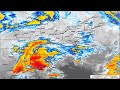
A storm system moved slowly over the Great Lakes region of the United States from April 26 to May 01, 2023. This helped produce a series of rain events across parts of central New York and northeast Pennsylvania. This resulted in some flooding, especially along rivers and streams.
The satellite loop was from GOES East IR Channel 15 from 08:01 PM EDT April 26, 2023 (0001 UTC April 27, 2023) to 07:57 PM EDT May 01, 2023 (2351 UTC May 01, 2023).
A summary with rainfall amounts can be found at, https://www.weather.gov/bgm/pastfloodMay012023
----------------------------------------------
National Weather Service
Weather Forecast Office
Binghamton, NY
https://www.weather.gov/bgm/
https://www.facebook.com/NWSBinghamton
https://twitter.com/NWSBinghamton

- Title
- Satellite/Northeast Radar Loop March 13-15, 2023, Nor’easter
- Runtime
- 1:25
- Date posted
- 4 years ago
- Description
- There is no audio with this video.
A Nor’easter developed and moved up the east coast of the United States from March 13 to 15, 2023. This produced heavy snowfall across parts of the northeast including the eastern sections of central New York and parts of northeast Pennsylvania. Strong gusty winds also accompanied the storm.
Notable:The area of low pressure moves off the North Carolina coast and then northeast just off the US coastline. This is most visible in the GEOCOLOR loop.
There are three parts to the video. First, a satellite loop from GOES East IR Channel 15 from 08:01 PM EDT March 12, 2023 (0001 UTC March 13, 2023) to 7:59 PM EDT March 15, 2023 ( 2359 UTC March 15,2023).
Second, is a GOES East GEOCOLOR loop, northeast sector, from 07:56 PM EDT March 12, 2023 (2356 UTC March 12, 2023) to 08:01 PM EDT March 15, 2023 (0001 UTC March 16, 2023).
The third is a northeast radar loop from 08:00 PM EDT March 12, 2023...
- Title
- KBGM Radar Loop from January 22 to 23, 2023
- Runtime
- 0:27
- Date posted
- 4 years ago
- Description
- There is no audio with this video.
National Weather Radar (KBGM) 0.5 reflectivity loop from 8:59 AM EST January 22, 2023 (1359 TC January 22, 2023) to 6:54 PM EST January 23, 2023 (2354 UTC January 23, 2023).
Notables: as the storm system moves through lake effect bands, oriented from northwest to southeast, spread across the area starting around 01/23/2023 at 1425 UTC or starting around 18 seconds into the video.
Summary page with snowfall amounts can be found at https://www.weather.gov/bgm/pastWinterJanuary232023
----------------------------------------------
National Weather Service
Weather Forecast Office
Binghamton, NY
https://www.weather.gov/bgm/
https://www.facebook.com/NWSBinghamton
https://twitter.com/NWSBinghamton
- Title
- Satellite and KBGM Radar Loop December 2022 Arctic Front
- Runtime
- 1:45
- Date posted
- 4 years ago
- Description
- There is no audio with this video.
GOES East IR Channel 15 satellite loop from 07:01 PM EST December 20, 2022 (0001 UTC December 21, 2022) to 6:46 PM EST December 24, 2022 (2346 UTC December 24, 2022).
National Weather Radar (KBGM) 0.5 reflectivity loop from 12:52 AM EST December 22, 2022 (0552 UTC December 22, 2022) to 1:49 PM EST December 24, 2022 (1849 UTC December 24, 2022).
00:00 GOES East Satellite
01:08 KBGM Radar
Summary webpage https://www.weather.gov/bgm/pastWinterDecember232022
----------------------------------------------
National Weather Service
Weather Forecast Office
Binghamton, NY
https://www.weather.gov/bgm/
https://www.facebook.com/NWSBinghamton
https://twitter.com/NWSBinghamton

- Title
- Satellite and KBGM Radar Loop December 15-16, 2022, Winter Storm
- Runtime
- 1:21
- Date posted
- 4 years ago
- Description
- There is no audio with this video.
GOES East IR Channel 15 satellite loop from 07:01 PM EST December 13, 2022 (0001 UTC December 14, 2022) to 12:26 PM EST December 17, 2022 (1726 UTC December 17, 2022).
National Weather Radar (KBGM) 0.5 reflectivity loop from 07:05 PM EST December 14, 2022 (0005 UTC December 15, 2022) to 12:27 PM EST December 17, 2022 (1727 UTC December 17, 2022).
00:00 GOES East Satellite
00:42 KBGM Radar
----------------------------------------------
National Weather Service
Weather Forecast Office
Binghamton, NY
https://www.weather.gov/bgm/
https://www.facebook.com/NWSBinghamton
https://twitter.com/NWSBinghamton

- Title
- 4/27/22 Basic Skywarn.
- Runtime
- 2:03:38
- Date posted
- 4 years ago
- Description
- ----------------------------------------------
National Weather Service
Weather Forecast Office
Binghamton, NY
https://www.weather.gov/bgm/
https://www.facebook.com/NWSBinghamton
https://twitter.com/NWSBinghamton

- Title
- Radar & Satellite comparision of April 18-19, 2022 and December 16-17, 2020 Nor'Easters
- Runtime
- 0:16
- Date posted
- 4 years ago
- Description
- ----------------------------------------------
National Weather Service
Weather Forecast Office
Binghamton, NY
https://www.weather.gov/bgm/
https://www.facebook.com/NWSBinghamton
https://twitter.com/NWSBinghamton

- Title
- Radar/Satellite Loop April 18 to 19, 2022 Snow Storm
- Runtime
- 0:55
- Date posted
- 4 years ago
- Description
- This video starts with the 0.5 degree base reflectivity from the NWS radar at Binghamton, NY. The radar section was from 08:05 AM EDT (or 12:05 UTC) April 18, 2022 to 07:54 PM EDT (or 23:54 UTC) April 19, 2022.
The satellite loop is GOES East IR Channel 15 from 08:01 PM EDT April 17, 2022 ( or 00:01 UTC April 18, 2022) to 07:56 PM EDT (or 23:56 UTC) April 19, 2022.
00:00 KBGM radar loop
00:21 Satellite Loop
Summary webpage: https://www.weather.gov/bgm/pastWinterApril192022
There is no audio with this video.
----------------------------------------------
National Weather Service
Weather Forecast Office
Binghamton, NY
https://www.weather.gov/bgm/
https://www.facebook.com/NWSBinghamton
https://twitter.com/NWSBinghamton

- Title
- Satellite Loop March 10 to 13, 2022
- Runtime
- 0:35
- Date posted
- 5 years ago
- Description
- This shows a storm system that moves across the eastern half of the United States. This produced heavy snow across parts of New York and Pennsylvania on March 12, 2022. The loop is from 07:01 PM EST March 10, 2022 to 07:56 PM EDT March 13, 2022.
There is no audio with this video.
----------------------------------------------
National Weather Service
Weather Forecast Office
Binghamton, NY
https://www.weather.gov/bgm/
https://www.facebook.com/NWSBinghamton
https://twitter.com/NWSBinghamton

- Title
- Radar Loop March 11 to 12, 2022
- Runtime
- 0:14
- Date posted
- 5 years ago
- Description
- Radar reflectivity loop from the National Weather Service Radar at Binghamton, NY (KBGM). This loop shows a storm system moving across the area producing heavy snowfall across parts of central NY and northeast Pennsylvania. Note as the main area of snow moves out of the area, lake effect snow bands develop near the end of the video. The loop is from 07:05 PM EST March 11, 2022 to 06:58 PM EST March 12, 2022.
There is no audio with this video.
----------------------------------------------
National Weather Service
Weather Forecast Office
Binghamton, NY
https://www.weather.gov/bgm/
https://www.facebook.com/NWSBinghamton
https://twitter.com/NWSBinghamton

- Title
- Radar/Satellite Loop March 7 to 8, 2022
- Runtime
- 0:30
- Date posted
- 5 years ago
- Description
- A strong cold front moved across central New York and northeast Pennsylvania on the evening of March 7, 2022. A line of showers and isolated thunderstorms crossed the area and produced locally damaging winds.
This video starts with the 0.5 degree base reflectivity from the NWS radar at Binghamton, NY. The radar section was from 03:04 PM EST ( or 1904 UTC) on March 07, 2022 to 12:04 AM ( or 0504 UTC) on March 8, 2022.
The satellite part was from 07:00 PM EST March 7 ( or 0000 UTC March 8) to 07:31 AM EST March 8 2022 ( or 1231 UTC).
There is no audio with this video.
----------------------------------------------
National Weather Service
Weather Forecast Office
Binghamton, NY
https://www.weather.gov/bgm/
https://www.facebook.com/NWSBinghamton
https://twitter.com/NWSBinghamton

- Title
- Lake Effect Snow Radar Loop January 08 to 11, 2022
- Runtime
- 1:00
- Date posted
- 5 years ago
- Description
- Radar reflectivity loop from the KTYX Montague radar. The loop is from 7:01 PM EST 01/08/2022 to 2:04 PM EST 01/11/2022 (or (0001 UTC 01/09/2022 to 1804 UTC 01/11/2022).
The loop shows a storm system move through then a lake effect snow bands develop (around 24 seconds). A persistent snow band produced snow amounts of around 20 inches in some parts of northern Oneida county. As winds became northerly the band moved south and dissipated.
What is a Lake Effect Snow? https://www.weather.gov/safety/winter-lake-effect-snow
There is no audio with this video.
----------------------------------------------
National Weather Service
Weather Forecast Office
Binghamton, NY
https://www.weather.gov/bgm/
https://www.facebook.com/NWSBinghamton
https://twitter.com/NWSBinghamton

- Title
- GOES 16 Satellite IR loop from December 15 to 18, 2020
- Runtime
- 0:35
- Date posted
- 5 years ago
- Description
- GOES 16 Satellite IR loop from 07:01 PM EST December 15, 2020 ( 0001 UTC December 16, 2020) to 06:56 PM EST December 18, 2020 ( 2356 UTC December 18.2020). This video shows a Nor'easter that moved slowly up the US eastern coastline on the afternoon of December 16, 2020 through December 17, 2020. The storm system produced very heavy snowfall across parts of central New York and northeast PA.
There is no audio with this video.
Summary page: https://www.weather.gov/bgm/pastWinterDecember172020
----------------------------------------------
National Weather Service
Weather Forecast Office
Binghamton, NY
https://www.weather.gov/bgm/
https://www.facebook.com/NWSBinghamton
https://twitter.com/NWSBinghamton

- Title
- Northeast Radar Loop October 23 to 27, 2021
- Runtime
- 0:21
- Date posted
- 5 years ago
- Description
- This is a loop of National Weather Service radar across part of the northeast and mid-Atlantic region of the United States. The loop starts at 08:00 PM EDT October 23, 2021 (or 0000 UTC October 24, 2021) through 07:50 PM EDT October 27, 2021 (or 2350 UTC October 27, 2021).
This loop shows the autumn Nor’easter that impacted the northeast part of the United States.
Note: The KBGM WSR-88D radar was down during this time. Information about this can be found at https://www.weather.gov/bgm/radarOutage
There is no audio with this video.
Summary page at, https://www.weather.gov/bgm/pastFloodOctober272021
----------------------------------------------
National Weather Service
Weather Forecast Office
Binghamton, NY
https://www.weather.gov/bgm/
https://www.facebook.com/NWSBinghamton
https://twitter.com/NWSBinghamton

- Title
- GOES 16 Satellite IR loop from October 24 to 27, 2021
- Runtime
- 0:35
- Date posted
- 5 years ago
- Description
- GOES 16 Satellite IR loop from 08:01 PM EDT October 24 (0001 UTC October 25, 2021) to 07:56 PM EDT October 27, 2021 (2356 UTC October 27, 2021). The video shows a Nor’easter move up the eastern US coastline, merge with another area of low pressure moving east from the Great Lake region, wobble a bit, and then out to sea.
There is no audio with this video.
Summary page at, https://www.weather.gov/bgm/pastFloodOctober272021
----------------------------------------------
National Weather Service
Weather Forecast Office
Binghamton, NY
https://www.weather.gov/bgm/
https://www.facebook.com/NWSBinghamton
https://twitter.com/NWSBinghamton

- Title
- Time Lapse KBGM WSR-88D Dome and Pedestal Removal.
- Runtime
- 2:49
- Date posted
- 5 years ago
- Description
- This video shows the removal of the KBGM WSR-88D dome in order to replace the radar’s pedestal. First is the removal of the dome. Then around 1:45 minutes into the video is when the pedestal is removed. There is no audio with this video.
Additional information:
The KBGM WSR-88D operated by NOAA’s National Weather Service in Binghamton, NY has been down since October 25. It will be down for approximately two weeks for an important upgrade. Technicians will refurbish and replace the pedestal, one of the most critical components of the radar, which is necessary for antenna rotation and positioning to capture data in all directions. The components are extremely heavy and will require the radar dome to be removed by crane and replaced when the work is completed.
The radar and pedestal were designed to last 25 years, and this radar has exceeded its life-span. This activity is necessary to keep the radar functioning for another 20 years or more. The pedesta...

- Title
- National Weather Service in Binghamton (KBGM) Radar Loop September 22 to 23, 2021
- Runtime
- 0:32
- Date posted
- 5 years ago
- Description
- Radar Loop from 08:03 PM EDT September 22, 2021 (0003 UTC September 23, 2021) to 08:04 AM EDT September 24, 2021 (1204 UTC September 24, 2021).
There is no audio with this loop.
----------------------------------------------
National Weather Service
Weather Forecast Office
Binghamton, NY
https://www.weather.gov/bgm/
https://www.facebook.com/NWSBinghamton
https://twitter.com/NWSBinghamton

- Title
- GOES 16 Satellite IR Loop September 21 to 24, 2021
- Runtime
- 0:44
- Date posted
- 5 years ago
- Description
- GOES 16 Satellite IR loop from 08:01 PM EDT September 21 (0001 UTC September 22, 2021) to 01:31 PM EDT September 24, 2021 (1731 UTC September 24, 2021). Shows a band of heavy rainfall forming during the early morning hours on September 23 and moving across parts of northeast Pennsylvania and southeast New York.
There is no audio with this video.
----------------------------------------------
National Weather Service
Weather Forecast Office
Binghamton, NY
https://www.weather.gov/bgm/
https://www.facebook.com/NWSBinghamton
https://twitter.com/NWSBinghamton

- Title
- GOES 16 Satellite IR Loop - Hurricane Ida
- Runtime
- 1:03
- Date posted
- 5 years ago
- Description
- GOES 16 Satellite IR loop from 08:01 PM EDT August 27 to 07:06 AM EDT September 2, 2021 or 0001 UTC August 28, 2021 to 1106 UTC September 2, 2021.
This loop shows Hurricane Ida making landfall on the southeast Louisiana coast. The hurricane then weakens as it moves farther inland. The remains of Ida move northeast and across parts of northeast Pennsylvania and southeast New York.
Note: Some of the satellite data is missing. This can be seen as missing tiles moving across the video.
No audio with this video.
Summary page: https://www.weather.gov/bgm/pastFloodSeptember012021
----------------------------------------------
National Weather Service
Weather Forecast Office
Binghamton, NY
https://www.weather.gov/bgm/
https://www.facebook.com/NWSBinghamton
https://twitter.com/NWSBinghamton

- Title
- KBGM Radar Loop Remnants of Hurricane Ida
- Runtime
- 0:31
- Date posted
- 5 years ago
- Description
- Radar Loop from 08:03 PM EDT August 31, 2021 to 09:55 AM EDT September 2, 2021 or 0003 UTC September 1, 2021 to 1355 UTC September 2, 2021
The video shows the remains of Hurricane Ida as it moved over parts of Pennsylvania and southeast New York. Heavy rainfall occurred with the passage of what was left of Hurricane Ida.
No audio with this video.
Summary page: https://www.weather.gov/bgm/pastFloodSeptember012021
----------------------------------------------
National Weather Service
Weather Forecast Office
Binghamton, NY
https://www.weather.gov/bgm/
https://www.facebook.com/NWSBinghamton
https://twitter.com/NWSBinghamton

- Title
- Satellite Loop of Remnants of Fred August 16 to 19, 2021
- Runtime
- 0:35
- Date posted
- 5 years ago
- Description
- GOES 16 Satellite IR loop from 08:11 PM EDT (0011 UTC) August 16 to 07:56 PM EDT (2356 UTC) August 19, 2021.
Show the remnants of Tropical Storm Fred.
Not audio with this video.
Summary page at, https://www.weather.gov/bgm/pastFloodAugust202021
----------------------------------------------
National Weather Service
Weather Forecast Office
Binghamton, NY
https://www.weather.gov/bgm/
https://www.facebook.com/NWSBinghamton
https://twitter.com/NWSBinghamton

- Title
- Satellite Loop of Henri August 19 to 23, 2021
- Runtime
- 0:47
- Date posted
- 5 years ago
- Description
- GEOCOLOR GOES 16 Satellite loop from 01:11 PM EDT (1711 UTC) August 19 to 01:36 PM EDT (1736 UTC August 23, 2021.
This shows Hurricane Henri moving northward and over parts of southeast New York.
There is no audio with this video.
----------------------------------------------
National Weather Service
Weather Forecast Office
Binghamton, NY
https://www.weather.gov/bgm/
https://www.facebook.com/NWSBinghamton
https://twitter.com/NWSBinghamton

- Title
- KBGM Radar Loop Remnants of Henri August 2021
- Runtime
- 0:23
- Date posted
- 5 years ago
- Description
- Radar Loop from 08:02 AM EDT (12:02 UTC) August 22 to 11:19 AM EDT (15:19 UTC) August 23, 2021.
This shows the remains of the circulation of Hurricane Henri moving over parts of southeast New York near the end of the video. Note the bands of heavy rain that move across parts of central New York and northeast Pennsylvania producing flash flooding in some locations. Also note the swirl over Monticello, NY near the end of the video.
No audio with this video.
----------------------------------------------
National Weather Service
Weather Forecast Office
Binghamton, NY
https://www.weather.gov/bgm/
https://www.facebook.com/NWSBinghamton
https://twitter.com/NWSBinghamton

- Title
- Northeast Radar Loop from August 17 to 20, 2021 - Remnants of Tropical Storm Fred.
- Runtime
- 0:19
- Date posted
- 5 years ago
- Description
- This is a loop of National Weather Service radar across part of the northeast and mid-Atlantic region of the United States. The loop starts at 06:00 PM EDT August 16, 2021 (or 0000 UTC August 17, 2021) through 11:40 AM EDT August 20, 2021 (or 1540 UTC August 20, 2021).
This loop shows the moisture and remnants of Tropical Storm Fred as it moves across the region. Note the swirl that moves from Charleston, WV over Binghamton, NY, towards the Boston area.
There is no audio with this video.
Summary page,
https://www.weather.gov/bgm/pastFloodAugust202021
----------------------------------------------
National Weather Service
Weather Forecast Office
Binghamton, NY
https://www.weather.gov/bgm/
https://www.facebook.com/NWSBinghamton
https://twitter.com/NWSBinghamton

- Title
- NWS Binghamton Radar Loop January 03-04, 2021
- Runtime
- 0:23
- Date posted
- 6 years ago
- Description
- This is a loop of the NWS Binghamton, NY WSR-88D radar from 03:04 AM EST (0804 UTC) January 03, 2021 to 6:50 AM EST (1150 UTC) January 04, 2021.
There is no audio with this video.
Summary page: https://www.weather.gov/bgm/pastWinterJanuary032021
----------------------------------------------
National Weather Service
Weather Forecast Office
Binghamton, NY
http://www.weather.gov/bgm/
https://www.facebook.com/NWSBinghamton
http://twitter.com/NWSBinghamton

- Title
- NWS Binghamton Radar Loop December 23-25, 2020
- Runtime
- 0:38
- Date posted
- 6 years ago
- Description
- This is a loop of the NWS Binghamton, NY WSR-88D radar from 07:02 PM EST (0002 UTC) December 23, 2020 to 6:42 PM EST (2342 UTC) December 25, 2020.
A strong storm system moved over the area producing warm temperatures, high humidity and strong winds. There was a significant amount of snow on the ground across parts of central NY and northeast PA. These conditions produced a significant amount of snow melt. The storm also produced heavy rainfall with some areas seeing 2 to almost 3 inches of rain. This lead to river flooding across parts of central NY and northeast PA.
Summary web page is over here; https://www.weather.gov/bgm/pastFloodDecember252020
There is no audio with this video.
----------------------------------------------
National Weather Service
Weather Forecast Office
Binghamton, NY
http://www.weather.gov/bgm/
https://www.facebook.com/NWSBinghamton
http://twitter.com/NWSBinghamton
- Title
- 16 to 17 December 2020 Snowstorm
- Runtime
- 0:31
- Date posted
- 6 years ago
- Description
- This is a loop of the MRMS (Multi-Radar Multi-Sensor) Seamless Hybrid Scan Reflectivity from 13 UTC Dec 16 to 23 UTC Dec 17, 2020.
----------------------------------------------
National Weather Service
Weather Forecast Office
Binghamton, NY
http://www.weather.gov/bgm/
https://www.facebook.com/NWSBinghamton
http://twitter.com/NWSBinghamton

- Title
- NWS Binghamton Radar Loop December 16-17, 2020
- Runtime
- 0:23
- Date posted
- 6 years ago
- Description
- This is a loop of the NWS Binghamton, NY WSR-88D radar from 06:57 AM EST (1157 UTC) December 16, 2020 to 12:21 PM EST (1721 UTC) December 17, 2020.
NOTE: A band of higher reflectivity develops in a southwest to northeast orientation over the radar site, shown in yellow. This is where the highest snowfall rates were occurring. Snowfall amounts ranged from 30 to 45 inches in total in the band area.
A summary page can be found here, https://www.weather.gov/bgm/pastWinterDecember172020
There is no audio with this video.
----------------------------------------------
National Weather Service
Weather Forecast Office
Binghamton, NY
http://www.weather.gov/bgm/
https://www.facebook.com/NWSBinghamton
http://twitter.com/NWSBinghamton

- Title
- Winter Skywarn #3
- Runtime
- 1:38:33
- Date posted
- 6 years ago
- Description
- Meteorologist Mike Murphy goes over our winter Skywarn class. To be added to our official spotter database please contact mitchell.gaines@noaa.gov if you are in PA/NY.
----------------------------------------------
National Weather Service
Weather Forecast Office
Binghamton, NY
http://www.weather.gov/bgm/
https://www.facebook.com/NWSBinghamton
http://twitter.com/NWSBinghamton
- Title
- Behind the Scenes How the NWS uses your spotter reports!
- Runtime
- 1:08:30
- Date posted
- 6 years ago
- Description
- Meteorologist Mitchell Gaines goes through how the NWS uses your spotter reports along with a behind the scenes look at our office!
----------------------------------------------
National Weather Service
Weather Forecast Office
Binghamton, NY
http://www.weather.gov/bgm/
https://www.facebook.com/NWSBinghamton
http://twitter.com/NWSBinghamton

- Title
- Educational Webinar: Mount Washington Weather
- Runtime
- 59:52
- Date posted
- 6 years ago
- Description
- ----------------------------------------------
National Weather Service
Weather Forecast Office
Binghamton, NY
http://www.weather.gov/bgm/
https://www.facebook.com/NWSBinghamton
http://twitter.com/NWSBinghamton

- Title
- Outdoor Weather Safety
- Runtime
- 43:19
- Date posted
- 6 years ago
- Description
- ----------------------------------------------
National Weather Service
Weather Forecast Office
Binghamton, NY
http://www.weather.gov/bgm/
https://www.facebook.com/NWSBinghamton
http://twitter.com/NWSBinghamton
- Title
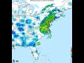
- National Radar Loop August 1 to 5, 2020 Hurricane Isaias
- Runtime
- 0:26
- Date posted
- 6 years ago
- Description
- National radar loop showing Hurricane Isaias moving up the eastern United States.
There is no audio with this video.
----------------------------------------------
National Weather Service
Weather Forecast Office
Binghamton, NY
http://www.weather.gov/bgm/
https://www.facebook.com/NWSBinghamton
http://twitter.com/NWSBinghamton
- Title
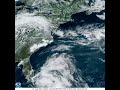
- GOES East Satellite loop from July31 to August 5, 2020 Hurricane Isaias
- Runtime
- 0:59
- Date posted
- 6 years ago
- Description
- GOES East Satellite loop from July31 to August 5, 2020. The loop shows Hurricane Isaias moving up the eastern parts of the United States.
For more information about Hurricane Isaias please see https://www.nhc.noaa.gov/archive/2020/ISAIAS.shtml?
The satellite images use the GeoColor curve and more information and images can be found at, https://www.star.nesdis.noaa.gov/GOES/sector.php?sat=G16§or=eus
There is no audio with this video.
----------------------------------------------
National Weather Service
Weather Forecast Office
Binghamton, NY
http://www.weather.gov/bgm/
https://www.facebook.com/NWSBinghamton
http://twitter.com/NWSBinghamton

- Title
- Flood Safety Awareness Week Day 5: Continued Interview with Hydrologist Jim Brewster.
- Runtime
- 1:46
- Date posted
- 7 years ago
- Description
- ----------------------------------------------
National Weather Service
Weather Forecast Office
Binghamton, NY
http://www.weather.gov/bgm/
https://www.facebook.com/NWSBinghamton
http://twitter.com/NWSBinghamton

- Title
- Flood Safety Awareness Week Day 3: Continuation of Interview with Hydrologist James Brewster
- Runtime
- 2:58
- Date posted
- 7 years ago
- Description
- ----------------------------------------------
National Weather Service
Weather Forecast Office
Binghamton, NY
http://www.weather.gov/bgm/
https://www.facebook.com/NWSBinghamton
http://twitter.com/NWSBinghamton

- Title
- Flood Safety Awareness Week Day 1 Interview with Hydrologist James Brewster.
- Runtime
- 3:00
- Date posted
- 7 years ago
- Description
- ----------------------------------------------
National Weather Service
Weather Forecast Office
Binghamton, NY
http://www.weather.gov/bgm/
https://www.facebook.com/NWSBinghamton
http://twitter.com/NWSBinghamton

- Title
- NWS Radar Loop December 1 to 3, 2019
- Runtime
- 0:52
- Date posted
- 7 years ago
- Description
- First part of video is a radar loop of the NWS Binghamton, NY WSR88D radar. The loop is from 1:02 AM EST ( 0602 UTC ) December 1, 2019 to 6:59 PM EST ( 2359 UTC ) December 2, 2019.
Second part of the video is a regional radar reflectivity composite. The loop is from 1:08 AM EST ( 0608 UTC ) December 1, 2019 to 6:58 PM EST ( 2358 UTC ) December 3, 2019.
There is no audio with this video.
More on radar modes, https://www.weather.gov/jetstream/doppler_intro
----------------------------------------------
National Weather Service
Weather Forecast Office
Binghamton, NY
https://www.weather.gov/bgm/
https://www.facebook.com/NWSBinghamton
https://twitter.com/NWSBinghamton

- Title
- NWS Binghamton NY Radar Loop April 14 to 15, 2019
- Runtime
- 0:24
- Date posted
- 8 years ago
- Description
- Radar reflectivity loop from the NWS Binghamton, NY WSR88D radar showing a line of thunderstorms that moved across the area. Some of the thunderstorms were severe producing damaging wind gusts, isolated tornadoes and hail.
Around 16 seconds into this video the line of storms that produced the severe weather starts to sweep across the area.
This radar loop was from 07:45 AM EDT ( 1145 UTC ) to 03:06 AM EDT ( 0706 UTC).
There is no audio with this video.
Summary here, https://www.weather.gov/bgm/pastSevereApril152019
More on radar modes, https://www.weather.gov/jetstream/doppler_intro
----------------------------------------------
National Weather Service
Weather Forecast Office
Binghamton, NY
http://www.weather.gov/bgm/
https://www.facebook.com/NWSBinghamton
http://twitter.com/NWSBinghamton

- Title
- NWS Binghamton NY Radar Loop January 19 to 20, 2019
- Runtime
- 0:31
- Date posted
- 8 years ago
- Description
- Radar reflectivity loop from the NWS Binghamton, NY WSR88D radar.
This radar loop was from 01:02 AM EST ( 0602 UTC ) to 6:58 PM EST ( 2358 UTC).
There is no audio with this video.
Summary here, https://www.weather.gov/bgm/pastWinterJanuary202019
More on radar modes, http://www.srh.noaa.gov/jetstream/dop...
----------------------------------------------
National Weather Service
Weather Forecast Office
Binghamton, NY
http://www.weather.gov/bgm/
https://www.facebook.com/NWSBinghamton
http://twitter.com/NWSBinghamton





