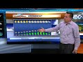
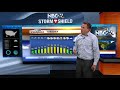
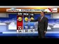
Today will be breezy and cooler with highs in the upper-60s. Skies will become clear tonight with our lows dropping into the upper-40s. There may be a few patches of fog with light winds. There will be a slight chance of a stray shower or T'storm on Thursday afternoon with highs in the low-70s. This system will be passing through Thursday night bringing with it a few scattered showers or a T'storm. Lows will be in the upper-50s. Most of this precip is out of here by Friday during the day. Temperatures will stay below normal through this upcoming weekend. The weekend looks downright cool with temps not even making it out of the 60s.
Officials are investigating an officer-involved shooting near Delanglade Street and Hyland Avenue in Kaukauna. It happened after a police pursuit that started in Appleton and ended in Kaukauna around 1:15 a.m. Tuesday.
After the warmest day in two weeks (with widespread 80s)......a cold front (now moving away from the area) will usher in much cooler weather for Wednesday. Tonight looks breezy and quiet with partly cloudy skies and lows in the low-50s. Wednesday will be breezy and cooler with highs in the upper-60s. There will be a slight chance of a stray shower or T'storm on Thursday with highs in the low-70s. Temperatures will stay below normal through this upcoming weekend. The weekend might actually be downright cool with temps not even making it out of the 60s.
More scattered T'storms will be rolling through this morinng with a warm front. This could make for a soggy start to school, but this won't be an all-day rain. With a cold front on the way this afternoon, there probably will be a break for awhile before we could start to re-fire some scattered storms. A few of these could contain a little gusty wind. It's going to be a windy, warm day with highs around 80°. Tonight looks windy and quiet with partly cloudy skies and lows in the low-50s. Wednesday will be breezy and cooler with highs in the upper-60s. There will be a slight chance of a stray shower or T'storm on Thursday with highs in the low-70s. Temperatures will stay below normal through this upcoming weekend. The weekend might actually be downright cool with temps not even making it out of the 60s.
The weather will turn active overnight with a thunderstorm complex approaching from the north. They will slowly be losing their punch, but still, they could brings some gusty wind or hail, especially the farther northwest you live. The wind is really going to be picking up with lows around 60. As kids go back to school, the first batch of early morning T'storms will be departing to the SE. Then there may be a break for awhile before we could start to re-fire some scattered storms going into the afternoon. A few of these could contain a little gusty wind. It's going to be a windy, warm day with highs around 80°. Any lingering evening activity will depart early, then the skies will clear out and it will cool down. Lows will be in the low-50s. Wednesday will be breezy and cooler with highs in the upper-60s. Temperatures will stay below normal through next weekend.
Labor Day at the moment looks fairly quiet. There will be a slight chance of a sprinkle or stray light rain shower, but don't cancel your plans. Highs will be in the low/mid-70s. Things looks to get more active overnight tonight with a round of T'storms approaching from the north. They will slowly be losing their punch, but still, they could brings some gusty wind or hail, especially the farther northwest you live. The wind is really going to be picking up with lows around 60. As kids go back to school, the first batch of early morning T'storms will be departing to the SE. Then there may be a break for awhile before we could start to re-fire some scattered storms going into the afternoon. A few of these could contain a little gusty wind. It's going to be a windy, warm day with highs around 80°. Any lingering evening activity will depart early, then the skies will clear out and it will cool down. Lows will be in the low-50s. Wednesday will be breezy and cooler with highs in the upp...
Sunday night, we still could see a few sprinkles or showers working through, but it won't be an all night deal. Lows will be in the upper-50s. Labor Day at the moment looks fairly quiet. There will be a slight chance of an afternoon shower well to the north but don't cancel your plans. Highs will be in the low/mid-70s. As kids go back to to school on Tuesday will we have a better chance of showers/storms & highs near 80°.
Sunday will be partly to mostly cloudy and a little breezy with highs in the low-70s. We'll have a chance of a few sprinkles or showers, with most of this activity to the southeast. Sunday night, we still could see a few sprinkles or showers working through, but it won't be an all night deal. Lows will be in the upper-50s. Labor Day at the moment looks fairly quiet. There will be a slight chance of an afternoon shower well to the north but don't cancel your plans. Highs will be in the upper-70s. As kids go back to to school on Tuesday will we have a better chance of showers/storms & highs near 80°.
Saturday will be pleasant with a mix of clouds & sun. Highs will once again be in the low-70s. Sunday will be partly cloudy and a little breezy with highs in the low-70s. Both days will have a chance of a shower or sprinkle. Monday, a front will be approaching bringing a slight chance of an afternoon shower/storm with warmer highs in the upper-70s. Most of your Holiday Weekend is looking pretty good! As kids go back to to school on Tuesday will we have a better chance of showers/storms & highs near 80°.
Today looks nice with plenty of sun and highs in the low-70s. Some patchy fog is possible late tonight with cool lows in the 40s. Saturday should be fine for the most part with partly cloudy skies at times. Highs will once again be in the low-70s. Saturday night we'll have a slight chance of a sprinkle or a stray light rain shower with lows in the low-50s. Sunday will be partly cloudy and a little breezy with highs in the mid-70s. Monday, a front will be approaching bringing a slight chance of an afternoon shower, mainly north with warmer highs in the upper-70s. Most of your Holiday Weekend is looking pretty good!
Today looks nice with plenty of sun and highs in the low-70s. Some patchy fog is possible late tonight with cool lows in the 40s. Saturday should be fine for the most part with partly cloudy skies at times. Highs will once again be in the low-70s. Saturday night we'll have a slight chance of a sprinkle or a stray light rain shower with lows in the low-50s. Sunday will be partly cloudy and a little breezy with highs in the mid-70s. Monday, a front will be approaching bringing a slight chance of an afternoon shower, mainly north with warmer highs in the upper-70s. Most of your Holiday Weekend is looking pretty good!