Alabama Weather Network
Ridge Weakens, Storms Return Late Week: Alabama Forecast for Thurs. Late Morning September 10, 2026

- Title
- Ridge Weakens, Storms Return Late Week: Alabama Forecast for Thurs. Late Morning September 10, 2026
- Runtime
- 8:10
- Date posted
- 2 months ago
- Description
- Meteorologist Drew McCombs brings your Alabama Weather Network statewide forecast for Thursday late morning, September 10, 2026.
Alabama gets another warm and mostly sunny start, but the pattern is starting to nudge. A slow-moving front is easing southeast toward the state and will stall Friday and Saturday, and the ridge that has been suppressing storms begins to weaken. A few showers are already rolling in off the Gulf along the southwestern coast this morning.
Temperatures are already hitting 90 in spots, and highs will settle into the low to mid 90s statewide, with Tuscaloosa and Florence flirting with the upper 90s. Dewpoints have crept back into the low 70s, so the muggy feel is coming back.
Showers and storms fire mainly across South Alabama this afternoon, particularly Mobile, Washington, and Baldwin counties. Coverage jumps Friday afternoon as the ridge breaks down. A few showers or rumbles could be around Friday night high school footbal...

- Title
- Heat Holds Today, Showers Increase Fri/Sat: Alabama Forecast for Thursday Morning September 10, 2026
- Runtime
- 4:21
- Date posted
- 2 months ago
- Description
- Meteorologist James Spann brings your Alabama Weather Network statewide forecast for Thursday morning, September 10, 2026.
Alabama starts Thursday with clear skies and plenty of heat ahead. Highs reach the low to upper 90s across much of the state, with only a few isolated showers or storms, mainly over the southern half. A new Regions SkyCam Network view from Lookout Mountain offers a beautiful start over Fort Payne.
The ridge weakens a little Friday and Saturday, allowing scattered showers and thunderstorms to become more common. Friday night football could see a passing shower or storm, especially during the first half, while Saturday's college games may also feature a few interruptions. It will not rain everywhere, but Saturday brings the best coverage.
Showers thin out Sunday as the ridge rebuilds, and the heat returns next week with highs over 90 on most days. The tropics are quiet at the climatological peak of hurricane season, with no trop...

- Title
- Wedge Front Splits the State: Alabama Forecast for Tuesday Evening September 8, 2026
- Runtime
- 4:28
- Date posted
- 2 months ago
- Description
- Meteorologist James Spann brings your Alabama Weather Network statewide forecast for Wednesday evening, September 9, 2026.
Alabama is rain-free this Wednesday evening and clear statewide after a hot, quiet day. Temperatures are mostly in the low and mid 90s, including 94 in Birmingham and 95 in Tuscaloosa, while the Gulf Coast is near 90 with muggy air. A new Regions SkyCam Network view from Lookout Mountain gives us a beautiful look over Fort Payne and DeKalb County.
A few scattered showers and storms return Thursday, mainly across the southern counties, but many communities will stay dry. Coverage increases Friday and Saturday, with a few showers or storms possible around Friday night football and during the weekend. There is no organized setup highlighted, but any storm can produce lightning and gusty winds.
The ridge remains firmly in control, so highs stay at or above 90 through next week. Storm coverage should thin early next week as the rid...

- Title
- Quiet Radar, Storms Return Late Week: Alabama Forecast for Wednesday Afternoon September 9, 2026
- Runtime
- 5:40
- Date posted
- 2 months ago
- Description
- Meteorologist Drew McCombs brings your Alabama Weather Network statewide forecast for Wednesday afternoon, September 9, 2026.
The radar is empty across Alabama this afternoon, and that is no accident. A push of drier air showing up plainly on water vapor has moved in on top of the ridge, keeping showers and thunderstorms suppressed statewide.
Highs are running warm but not oppressive, with most spots in the low-mid 90s. There are still a few heat index readings around 100, but the widespread triple digit heat index values from last week are gone.
Overnight lows will settle into the low to mid 70s, with a few spots in the northeast dipping back into the upper 60s. Tomorrow looks similar to today with maybe a degree or two of warming, and a better chance of a few isolated showers/storms mainly in South Alabama.
Friday and Saturday, a front approaches from the north and stalls, and the added lift boosts shower and storm coverage. Friday ...

- Title
- The Story Is Not Changing: Alabama Forecast for Wednesday Midday September 9, 2026
- Runtime
- 6:55
- Date posted
- 2 months ago
- Description
- Meteorologist Drew McCombs brings your Alabama Weather Network statewide forecast for Wednesday midday, September 9, 2026.
Alabama sits under sunshine and puffy cumulus at midday with no rain to speak of. A few showers are trying to sneak up out of South Georgia toward the southeastern counties later, and offshore storms should stay offshore, but for most of the state today is another warm and mostly dry one.
Temperatures are already running a degree or two warmer than yesterday at this hour. Hamilton and Tuscaloosa are at 90, Sulligent 91, Demopolis 90, Thomasville 89, Auburn 86, Eufaula 85, and Gulf Shores 86. Dewpoints are still on the friendlier side across North Alabama, mostly in the 60s, which is why the mornings have felt a touch more comfortable this week.
A front is easing toward the state from the northwest and should stall in Tennessee, but it will help ramp up shower and storm coverage Thursday and especially Friday and Saturday. Frid...

- Title
- Ridge Holds Through Next Week: Alabama Forecast for Wednesday Morning September 9, 2026
- Runtime
- 4:20
- Date posted
- 2 months ago
- Description
- Meteorologist James Spann brings your Alabama Weather Network statewide forecast for Wednesday morning, September 9, 2026.
Wednesday starts clear and comfortable across Alabama, with morning temperatures in the upper 60s and 70s. The state heats up quickly today, with highs in the low to mid 90s and only about a 10 percent chance of rain for any one spot.
A stubborn upper ridge keeps the heat locked in through the weekend and into next week. Widely scattered afternoon and evening showers and storms become a little more likely Thursday through Sunday, mainly across the southern half of the state, generally between noon and 9 PM.
The first real fall front may still be at least two weeks away, while the tropics remain remarkably quiet for September. North and South Alabama both stay in the low to mid 90s for the next seven days, with morning lows in the 70s.
0:00 Introduction
0:27 Florence SkyCam
0:43 Huntsville SkyCam
...

- Title
- Wedge Front Splits the State: Alabama Forecast for Tuesday Evening September 8, 2026
- Runtime
- 4:22
- Date posted
- 2 months ago
- Description
- Meteorologist James Spann brings your Alabama Weather Network statewide forecast for Tuesday evening, September 8, 2026.
Muscle Shoals, Florence, Sheffield, and Tuscumbia all picked up healthy downpours, with some flooding around Muscle Shoals, and Florence has cooled to 77 behind the rain. Most of the rest of the state stayed dry, and East Alabama has been the lower humidity winner, thanks to a wedge front that pushed drier air in from the east.
You can feel that split on the map tonight. Auburn sits at 86, Dothan at 89 with a dewpoint of 65, and Montgomery is at 89 with noticeably drier air. West of I-65 the muggy feel hangs on, with Selma at 95, Mobile at 89 with dewpoints back in the 70s, and Fairhope at 93 under a bright sky over Mobile Bay.
Also worth noting on this peak day of the Atlantic hurricane season: there are no hurricanes or tropical storms expected anywhere in the basin over the next 7 days. Gulf Shores is sitting at 88 under a ne...

- Title
- A Few Showers/Storms, Otherwise Warm/Dry: Alabama Forecast for Tuesday Afternoon September 8, 2026
- Runtime
- 7:58
- Date posted
- 2 months ago
- Description
- Meteorologist Drew McCombs brings your Alabama Weather Network statewide forecast for Tuesday afternoon, September 8, 2026.
North Alabama has been the busy spot this afternoon. A cell over north central Lauderdale County dropped a couple of inches of rain in about an hour, prompting an earlier flash flood warning, and steady rain is still working across the Florence and Muscle Shoals area with a gust to 28 mph. A few more showers are scattered from Fayette to Tuscaloosa, but most of the rest of the state is dry.
The heat has backed off compared to last week. Tuscaloosa did hit 101 yesterday, breaking the daily record of 100 from 1980, but today most spots are running in the low 90s. Birmingham is at 93, Tuscaloosa 91, Monroeville 93, and rain-cooled Cullman is down to 81. Dewpoints have dropped into the 60s across the east, with Auburn at 65 and Dothan at 66, so eastern and northeastern Alabama will feel a little more comfortable tonight and tomorrow morning.<...

- Title
- Slightly Drier Air, Low Rain Chances: Alabama Forecast for Tuesday Late Morning September 8, 2026
- Runtime
- 7:07
- Date posted
- 2 months ago
- Description
- Meteorologist Drew McCombs brings your Alabama Weather Network statewide forecast for Tuesday late morning, September 8, 2026.
An easterly wind is dragging slightly drier air in around the top of a high to the northeast, and it shows up on the numbers. Cullman, Gadsden, and Greenville are all at 81, Anniston at 84, and even Montgomery only at 83, a bit cooler than the mornings we ran last week. Dewpoints have dropped into the upper 60s across the north and east, so the mugginess is easing at the same time in those areas.
Highs today land in the 90 to 95 degree range statewide, with the low 90s common in the north and mid 90s down south. That is still a hair above average for early September, but a big step down from the upper 90s and triple digits of last week. Overnight lows tonight sit in the 70s, with the northeast dipping into the upper 60s.
The rest of this week stays mostly dry. An isolated pop-up shower is possible each afternoon through Th...

- Title
- Quiet Midweek, Spotty Storms Return Friday: Alabama Forecast for Tuesday Morning September 8, 2026
- Runtime
- 4:04
- Date posted
- 2 months ago
- Description
- Meteorologist James Spann brings your Alabama Weather Network statewide forecast for Tuesday morning, September 8, 2026.
Alabama starts Tuesday with clear skies and temperatures in the 70s. Most of the day stays dry, but it will be hot, with highs in the 90 to 95 degree range, well above the average high for early September.
Rain chances are not zero today through Thursday, but most communities stay dry and the radar is quiet this morning. A few spotty afternoon showers or storms return Friday and Saturday as a front stalls north of Alabama, although coverage should remain scattered rather than widespread.
The upper ridge remains in control for the next 10 days, keeping temperatures above average and rain chances below average.
0:00 Introduction
0:13 Florence SkyCam
0:35 Huntsville SkyCam
0:50 Cullman SkyCam
0:55 Anniston SkyCam
1:01 Birmingham SkyCam
1:10 Tuscaloosa SkyCam
1:18 Auburn SkyCam<...

- Title
- Dry to North, Scattered Showers South: Alabama Forecast for Monday Evening September 7, 2026
- Runtime
- 4:14
- Date posted
- 2 months ago
- Description
- Meteorologist James Spann brings your Alabama Weather Network statewide forecast for Monday evening, September 7, 2026.
Alabama ends Labor Day with a split weather story. Drier air kept the Tennessee Valley mostly rain-free, while showers and storms focused south of I-20 and west of I-65.
Temperatures ranged from the low and mid 80s in east Alabama to the upper 90s around Demopolis and Thomasville, with coastal spots near 90. The Gulf Coast stayed mostly sunny this evening after a waterspout passed south of Pensacola Beach early today.
Tuesday brings more of the same: highs in the low and mid 90s with isolated afternoon showers or storms. There is no organized severe-weather risk in the forecast, but any storm can produce a brief gust. The ridge shifts a little west, so heat is more bearable than last week, while many locations see no rain.
Storm coverage may increase Friday and Saturday as a weak front approaches from the north. Even...

- Title
- Scattered Storms South, Low to Mid 90s: Alabama Forecast for Monday Mid-Afternoon September 7, 2026
- Runtime
- 10:19
- Date posted
- 2 months ago
- Description
- Meteorologist Sadie Morris brings your Alabama Weather Network statewide forecast for Monday mid-afternoon, September 7, 2026.
Pop-up showers and storms are firing across the southern and western half of Alabama this afternoon as peak heating kicks in. The action is mostly south of I-20 and west of I-65, from Mobile and Baldwin counties through Lowndes, Chilton, Coosa, and Clanton. Any one cell can turn briefly gusty, so keep a watch if you are outside for Labor Day.
Drier air has locked in from Anniston and Gadsden east and north, keeping storms from firing there. The temperature spread also runs close to 10 degrees across the state right now, with Anniston, Gadsden, and Auburn in the mid to upper 80s while Demopolis, Thomasville, and Selma sit at 97. Heat index values stay in the triple digits in most spots west of I-65.
The rest of the week trends more mild. Highs settle into the 90 to 94 range, isolated afternoon storms remain possible each da...

- Title
- Isolated Storms South, 90s for Labor Day: Alabama Forecast for Monday Mid-Morning September 7, 2026
- Runtime
- 9:15
- Date posted
- 2 months ago
- Description
- Meteorologist Sadie Morris brings your Alabama Weather Network statewide forecast for Monday mid-morning, September 7, 2026.
Labor Day is off to a clear start across most of the state, with a bright blue sky and just a little upper-level cloud cover away from the coast. A few showers and storms are firing up along the beaches, and the Regions SkyCam Network caught a waterspout off Orange Beach this morning during sunrise.
Highs today top out in the low to mid 90s statewide, cooler than yesterday's triple digits in a few spots. Dew points still sit in the mid to upper 70s, so heat index values across the western half will feel like the triple digits again, while the eastern half will feel closer to the actual 90s as drier northerly flow starts to work in behind the front.
The Storm Prediction Center has a Marginal Risk (1 of 5) confined to the far southwestern corner today for a briefly gusty pop-up storm. Most spots elsewhere stays quiet through t...

- Title
- Labor Day Waterspout
- Runtime
- 0:29
- Date posted
- 2 months ago
- Description
- Check out this waterspout that formed along the panhandle of Florida this morning, visible from our Regions Skycam Network in Orange Beach, AL. What a way to start Labor Day!! Did you happen to catch it?
#waterspout #weather #beach #alabama #florida #weather

- Title
- Showers & Storms Fizzle, 90s for Labor Day: Alabama Forecast for Sunday Evening September 6, 2026
- Runtime
- 10:05
- Date posted
- 2 months ago
- Description
- Meteorologist Sadie Morris brings your Alabama Weather Network statewide forecast for Sunday evening, September 6, 2026.
Scattered showers and storms fired up in the western portion of the state around 1 to 2 pm and rolled south along the front, prompting a few severe thunderstorm warnings before losing their punch quickly. A few showers are still hanging on across Coffee, Henry, and Dale counties, but the rest of the state is quieting down fast.
Rainfall was very hit-or-miss where storms fired up. Highs today still hot outside of rain-cooled spots, with many areas in the upper 90s.
Heat Advisories expire at 8 pm Sunday evening and are not being extended, so Labor Day Monday will start out at least a bit less oppressive. Overnight lows settle into the low to mid 70s, cooler in spots that are rain cooled.
For Labor Day, 90s and a few pop-up showers are possible, more likely in the southern quarter of the state Monday afternoon, otherwi...

- Title
- Scattered Showers & Storms Sunday: Alabama Forecast for Sunday Mid-Afternoon September 6, 2026
- Runtime
- 10:38
- Date posted
- 2 months ago
- Description
- Meteorologist Sadie Morris brings your Alabama Weather Network statewide forecast for Sunday mid-afternoon, September 6, 2026.
It’s a hot, humid Sunday across Alabama, with isolated showers and storms popping up this afternoon as a front crosses the state. Most areas remain below severe limits, but lightning and gusty winds are possible, and the Storm Prediction Center has a Level 1 of 5 Marginal Risk statewide through this evening. The Heat Advisory remains in effect until 8 p.m.
The best rain coverage is staying very isolated, so many communities remain sunny and steamy while a few spots get a quick downpour and a burst of wind. Most storms fade by sunset, with temperatures running from the 80s to the upper 90s and heat index values reaching the triple digits. The beaches stay mostly dry, though a stray shower cannot be ruled out.
Monday brings another hot day, with low to mid 90s east of I-65 and upper 90s west of I-65. The ridge builds farth...

- Title
- Scattered Showers & Storms Sunday, Keeps Heat: Alabama Forecast for Sunday Mid-Day September 6, 2026
- Runtime
- 9:11
- Date posted
- 2 months ago
- Description
- Meteorologist Sadie Morris brings your Alabama Weather Network statewide forecast for Sunday mid-day, September 6, 2026.
Bright blue sky rules Labor Day Sunday across Alabama at the lunch hour, with the radar quiet after early morning rain. Birmingham had just over a third of an inch before sunrise.
A weak cold front will nudge through this afternoon, and while it will not do much to cool us off, it will spark a few pop-up showers and storms from about 2 pm through the dinner hour and sunset. The Storm Prediction Center has all 67 counties in a Marginal Risk (1 of 5) for a storm or two capable of gusty winds. The beaches are excluded but can still see a stray shower.
Highs today keep climbing into the upper 90s across the northern half of the state, with Tuscaloosa forecast at 101 and a few other spots flirting with triple digits after the Birmingham airport hit 102 yesterday. The southern half runs mid to low 90s under a bit more cloud cover expe...

- Title
- Weather Briefing for Sunday Morning September 6, 2026
- Runtime
- 8:42
- Date posted
- 2 months ago
- Description
- Meteorologist Sadie Morris brings your Alabama Weather Network weather briefing for Sunday morning, September 6, 2026.
Labor Day Sunday starts with rain across parts of the state. Showers pushed through Cullman, Jefferson, Shelby, St. Clair, Lauderdale, Jackson, and DeKalb counties early this morning, with a few more sneaking along the coast in Mobile and Baldwin counties as well.
Anywhere the sun does break out, humidity levels are up and it will not take long to feel muggy. The Storm Prediction Center has a Marginal Risk (1 of 5) across most of the state today for gusty pop-up storms through the afternoon. While the beaches are excluded from that risk, a few showers can still drift in. Rain and storm chances are brief through the morning, then ramp up between the lunch hour and sunset.
The Heat Advisory continues until 8 pm tonight from Barbour County north to the Tennessee Valley. Highs still climb into the mid to upper 90s, and Tuscaloosa and...

- Title
- Isolated Showers & Storms Sunday, Still Hot: Alabama Forecast for Sunday Morning September 6, 2026
- Runtime
- 9:07
- Date posted
- 2 months ago
- Description
- Meteorologist Sadie Morris brings your Alabama Weather Network statewide forecast for Sunday morning, September 6, 2026.
Labor Day Sunday starts with rain across parts of the state. Showers pushed through Cullman, Jefferson, Shelby, St. Clair, Lauderdale, Jackson, and DeKalb counties early this morning, with a few more sneaking along the coast in Mobile and Baldwin counties as well. Anywhere the sun does break out, humidity levels are up and it will not take long to feel muggy.
The Storm Prediction Center has a Marginal Risk (1 of 5) across most of the state today for gusty pop-up storms through the afternoon. While the beaches are excluded from that risk, a few showers can still drift in. Rain and storm chances are brief through the morning, then ramp up between the lunch hour and sunset.
The Heat Advisory continues until 8 pm tonight from Barbour County north to the Tennessee Valley. Highs still climb into the mid to upper 90s, and Tuscaloosa an...

- Title
- September Triple Digits in Birmingham: Alabama Forecast for Saturday Evening September 5, 2026
- Runtime
- 10:07
- Date posted
- 2 months ago
- Description
- Meteorologist Sadie Morris brings your Alabama Weather Network statewide forecast for Saturday evening, September 5, 2026.
Birmingham's airport hit 102 this afternoon, which is a mark this city has not touched in September since 1931 and 1927. Anywhere a shower or storm rolled through was much more mild.
The I-85 corridor was the rain bullseye. Montgomery, Prattville, and Hayneville all picked up over an inch, with locally three to five inches in a few spots. Everywhere else stayed dry or picked up trace amounts. Showers are fizzling with sunset. Brief severe thunderstorm warnings covered northern Jackson County and southern Madison County this evening, but the storms quickly fizzled.
The Heat Advisory stays in effect until 8 pm Sunday for the northern two-thirds of the state. For Sunday, West of I-65 sits in the upper 90s with Tuscaloosa flirting with triple digits again, while east of I-65 runs cooler in the low to mid 90s. The SPC has a Margina...

- Title
- Hot Weekend, Isolated Showers: Alabama Forecast for Saturday Mid-Afternoon September 5, 2026
- Runtime
- 10:49
- Date posted
- 2 months ago
- Description
- Meteorologist Sadie Morris brings your Alabama Weather Network statewide forecast for Saturday mid-afternoon, September 5, 2026.
Most of the state has been very hot today with full sunshine. Where showers rolled through, it feels like a different story. Selma and Montgomery are sitting in the 70s under the clouds, while Tuscaloosa is 95 and the Tennessee Valley is in the upper 90s with heat index values at the triple digits.
The I-85 corridor has been a hotspot for rain over the past 24 hours. Prattville picked up 1.27 inches, Montgomery 1.19, Hayneville 1.13, with lighter totals stretching into Demopolis, Chatom, and Grove Hill. Everywhere else stayed dry. Game day is wrapping up in Tuscaloosa, but Alabama A&M in Huntsville, Troy, Alabama State, USA in Mobile, and Jacksonville State all kick off in the next few hours. Expect 90s at kickoff, cooling into the low 80s by the drive home.
The Heat Advisory continues for the northern two-thirds of the ...

- Title
- Heat Through Labor Day Weekend: Alabama Forecast for Saturday Mid-Morning September 5, 2026
- Runtime
- 8:58
- Date posted
- 2 months ago
- Description
- Game day will be hot across the state!! 80s on the Regions SkyCam Network at Bryant-Denny with a dewpoint of 75, and it climbs fast from here. A few showers and storms are pushing through the southern third of the state near Dallas, Montgomery, Wilcox, and Lowndes counties, but the rest of Alabama is sunny and hot.
The Heat Advisory continues for the northern three-fourths of the state through Sunday evening. Highs top out in the mid to upper 90s across most of the state, with the Tennessee Valley and cities like Gadsden, Huntsville, Cullman, and Tuscaloosa flirting with 100. Heat index values could reach 110 in Tuscaloosa by kickoff and beyond. If you are at the game or heading anywhere outdoors, hydrate and check on the folks around you.
The southern half runs a bit more mild with more cloud cover, upper 80s to low 90s, and a slightly better shot at a pop-up storm. Rain totals stay light across most of the state, trace to a quarter inch.
A weak ...
- Title
- Weather Briefing for Saturday Morning September 5, 2026
- Runtime
- 8:21
- Date posted
- 2 months ago
- Description
- Meteorologist Sadie Morris brings your Alabama Weather Network weather briefing for Saturday morning, September 5, 2026.
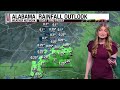
Happy Saturday!! Labor Day weekend and SEC football kick off together today, and the ridge is keeping conditions hot, especially for North Alabama. A mostly clear radar this morning, with just a few scattered showers around the southern third of the state near Wilcox and Montgomery counties, and a Dense Fog Advisory in spots along I-10 in the far south where dewpoints and temperatures are running within a degree of each other.
The Heat Advisory continues for the northern two-thirds of the state through Sunday evening. Highs today climb into the low 100s across much of north and central Alabama, upper 90s along the I-20 corridor, with heat index values approaching 110 in spots. The southern half stays a touch cooler thanks to more cloud cover, with upper 80s to low 90s.
Football will be hot, so be sure to hydrate. The 11 am Alaba...

- Title
- Isolated Showers & Hot Labor Day Weekend: Alabama Forecast for Saturday Morning September 5, 2026
- Runtime
- 11:49
- Date posted
- 2 months ago
- Description
- Meteorologist Sadie Morris brings your Alabama Weather Network statewide forecast for Saturday morning, September 5, 2026.
Happy Saturday!! Labor Day weekend and SEC football kick off together today, and the ridge is keeping conditions hot, especially for North Alabama. A mostly clear radar this morning, with just a few scattered showers around the southern third of the state near Wilcox and Montgomery counties, and a Dense Fog Advisory in spots along I-10 in the far south where dewpoints and temperatures are running within a degree of each other.
The Heat Advisory continues for the northern two-thirds of the state through Sunday evening. Highs today climb into the low 100s across much of north and central Alabama, upper 90s along the I-20 corridor, with heat index values approaching 110 in spots. The southern half stays a touch cooler thanks to more cloud cover, with upper 80s to low 90s.
Football will be hot, so be sure to hydrate. The 11 am Ala...
- Title
- Labor Day Weekend Heat: Alabama Forecast for Friday Evening September 4, 2026
- Runtime
- 7:25
- Date posted
- 2 months ago
- Description
- Meteorologist Drew McCombs brings your Alabama Weather Network statewide forecast for Friday evening, September 4, 2026.
Central Alabama baked while a few heavier downpours worked across parts of the Tennessee Valley and South Alabama. Any leftover storms fade through the evening.
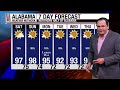
The story does not really change. The heat ridge stays parked overhead, so highs run in the mid to upper 90s for the next several days, heat index values keep climbing into the triple digits, and the Heat Advisory for the northern two-thirds of the state runs through Sunday at 8 pm. Overnight lows only slip into the mid 70s.
The biggest heat concern remains Saturday's 11am Alabama vs. Eastern Carolina game in Tuscaloosa. Upper 90s with a triple-digit heat index in the stands is a rough combination. Later kickoffs across the state will still feel like the 90s. Rain chances stay slim to the north, with a slightly better shot at scattered storms across south Alabama through...

- Title
- Heat Locks In for Football Saturday: Alabama Forecast for Friday Afternoon September 4, 2026
- Runtime
- 8:09
- Date posted
- 2 months ago
- Description
- Meteorologist Drew McCombs brings your Alabama Weather Network statewide forecast for Friday afternoon, September 4, 2026.
The heat is still winning across Alabama, but a few storms are finally getting in on the act. Some heavy rain has moved through Mobile, Baldwin, Washington, Choctaw, and Clarke counties this afternoon, while a gusty cell rolled past Florence with wind gusts around 35 mph. Nothing severe, just some welcome downpours and heat relief.
Everywhere else is baking under mostly sunny skies. Central and West Alabama sit in the upper 90s, with heat index values well into the triple digits.
For Saturday's 11am Alabama/ECU kickoff in Tuscaloosa, the heat index could climb past 105 during the game. Auburn plays indoors in Atlanta, but any tailgating plans will be hot. Troy's evening kickoff is a little friendlier as the sun goes down, and USA in Mobile should get some cloud cover and maybe a passing shower or storm early.
Rain chance...

- Title
- Heat Advisory Extended Through Sunday: Alabama Forecast for Friday Late Morning September 4, 2026
- Runtime
- 7:58
- Date posted
- 2 months ago
- Description
- Meteorologist Drew McCombs brings your Alabama Weather Network statewide forecast for Friday late morning, September 4, 2026.
A few showers are sliding around south Alabama and the coast this morning, but most of the state is dry, sunny, and already climbing into the 90s well before noon. Highs today land back in the mid to upper 90s across most of Alabama. The southern part of the state runs a little cooler under more cloud cover and a slightly better chance of a passing shower.
The Heat Advisory for the northern two-thirds of the state has been extended through Sunday at 8 pm, hith heat index values of 105 or greater possible each afternoon. Overnight lows only slip into the mid 70s, so there is very little recovery from the heat before the next afternoon.
Rain chances stay slim across north Alabama through the weekend. South Alabama gets slightly better coverage of isolated showers and storms, mostly in the afternoons, but plenty of places stil...

- Title
- Labor Day Weekend Heat: Alabama Forecast for Friday Morning September 4, 2026
- Runtime
- 4:07
- Date posted
- 2 months ago
- Description
- Meteorologist James Spann brings your Alabama Weather Network statewide forecast for Friday morning, September 4, 2026.
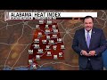
Clear skies and temperatures in the 70s start Friday across Alabama, but another day of intense heat is ahead. Highs reach the mid to upper 90s, and parts of north and west Alabama could touch 100. Heat index values will climb above 100 in the hottest spots.
A few isolated afternoon and evening showers and storms are possible, with the better coverage over the southern counties. Most communities stay dry.
The heat will be especially tough for Saturday's 11 a.m. Alabama home game in Tuscaloosa, where temperatures could flirt with 100 by the fourth quarter and the heat index will exceed 100. Auburn plays in a climate-controlled stadium, while Troy's evening game should cool through the 80s.
The upper ridge holds through Labor Day and into next week. Highs may ease a little next week, but above-average heat and isolated...
- Title
- Heat Ridge Holds Through Weekend: Alabama Forecast for Thursday Evening September 3, 2026
- Runtime
- 7:14
- Date posted
- 2 months ago
- Description
- Meteorologist Drew McCombs brings your Alabama Weather Network statewide forecast for Thursday evening, September 3, 2026.
The showers and a few storms that popped up this afternoon are fizzling with sunset, and most of the state stayed dry anyway. Spots that caught a downpour got a real break, but everyone else stayed hot. Even now, plenty of thermometers around Alabama are still sitting in the 90s as the sun goes down.
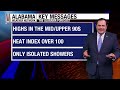
The story for the weekend has not changed. The heat ridge stays parked overhead, so highs run in the mid to upper 90s for the next several days and heat index values keep climbing into the triple digits each afternoon. That keeps the Heat Advisory in place for the northern two-thirds of the state through Saturday evening. Down south, a little more cloud cover and a slightly better shot at rain will take the edge off.
South Alabama gets the better rain chances Friday and into the weekend as leftover moisture drifts up from the Gulf...
- Title
- Heat Continues: Alabama Forecast for Thursday Afternoon September 3, 2026
- Runtime
- 9:10
- Date posted
- 2 months ago
- Description
- Meteorologist Drew McCombs brings your Alabama Weather Network statewide forecast for Thursday mid-afternoon, September 3, 2026.
Alabama is still baking this afternoon. A few isolated showers have popped up here and there, mostly across the Tennessee Valley, west Alabama, and a handful of spots in the central counties, but nothing widespread and nothing severe. If you got wet, you got a small break. Everybody else is sitting under bright sun and calm winds with the heat doing its thing.
Central and west Alabama are the hottest zones today, with triple digits showing up in a few places. Heat index values are running above 105 in enough spots to keep the Heat Advisory going for the northern two-thirds of the state through Saturday evening. The coast is the one part of the state getting any real relief, thanks to a light breeze coming off the Gulf.
The bigger story is how stubborn this pattern is. The ridge overhead has locked in, rain has been hard ...

- Title
- Heat Sticks Around, Drought Expands: Alabama Forecast for Thursday Late Morning September 3, 2026
- Runtime
- 9:17
- Date posted
- 2 months ago
- Description
- Meteorologist Drew McCombs brings your Alabama Weather Network statewide forecast for Thursday mid-morning, September 3, 2026.
Another scorcher is already underway. It is 96 in Birmingham, 95 in Tuscaloosa, 94 in Montgomery, and 91 in Huntsville before noon, with dewpoints in the 70s pushing feels-like values into the triple digits. Highs today land in the upper 90s, and Huntsville, Tuscaloosa, and Selma could flirt with 100 again. Down at the coast, Mobile is a slightly milder 86 but plenty muggy with dewpoints near 80.
Yesterday brought some record heat. Montgomery tied its record at 99, Birmingham broke its record with 99, and Tuscaloosa broke its record by hitting 101. We are moving into the historical stretch of the 1925 heat wave, so records will be tougher to top in the days ahead, but the heat sticks around.
The Heat Advisory continues for the northern two-thirds of the state through Saturday evening, so if you are going to any football ga...
- Title
- Heat Holds Through Labor Day: Alabama Forecast for Thursday Morning September 3, 2026
- Runtime
- 4:05
- Date posted
- 2 months ago
- Description
- Meteorologist James Spann brings your Alabama Weather Network statewide forecast for Thursday morning, September 3, 2026.
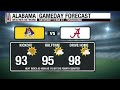
Alabama starts Thursday with clear skies and temperatures in the 70s and low 80s, but this turns into another sizzling day. Highs reach the mid to upper 90s, and heat index values will climb over 100.
A few widely spaced showers and storms may pop up this afternoon and evening, but the chance at any one spot stays small. No organized severe-weather threat is highlighted.
The weekend stays hot through Labor Day, with plenty of sunshine along the Gulf Coast and only a few isolated showers. The upper ridge holds into next week, keeping highs in the 90s before easing toward the low 90s Tuesday and Wednesday.
0:00 Introduction
0:24 Florence SkyCam
0:32 Decatur SkyCam
0:37 Huntsville SkyCam
0:46 Cullman SkyCam
0:50 Gadsden SkyCam
0:56 Birmingham SkyCam
1:04 Tuscaloosa SkyCam
- Title
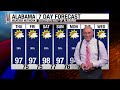
- Heat Grip Holds Until Late Month: Alabama Forecast for Wednesday Evening September 2, 2026
- Runtime
- 4:30
- Date posted
- 2 months ago
- Description
- Meteorologist James Spann brings your Alabama Weather Network statewide forecast for Wednesday evening, September 2, 2026.
Alabama sizzled through September 2nd. Tuscaloosa hit 101 earlier today, a record high for the date, before showers cooled it to 93 this evening. Selma and Demopolis are still at 99, Birmingham 97, Fairhope 96 on the eastern shore of Mobile Bay, Montgomery 96, Walker County 95, and Florence 94. Auburn dropped to 82 after a passing shower, and Mobile is at 87 after a decent downpour earlier.
The tropics are quiet, with TS Edouard remnants over east Texas moving away from us and no impact here. The heat ridge stays parked overhead. Rain chances tomorrow run about 10 to 20 percent statewide, and any showers should be small and short-lived.
Expect more of the same for the next five days. Highs land in the mid to upper 90s, with some west Alabama spots reaching 100 again. Heat index values stay above 100 every afternoon. Saturday's...

- Title
- Hot/Dry Weather Continues: Alabama Forecast for Wednesday Afternoon September 2, 2026
- Runtime
- 8:12
- Date posted
- 2 months ago
- Description
- Meteorologist Drew McCombs brings your Alabama Weather Network statewide forecast for Wednesday afternoon, September 2, 2026.
It's a sizzling afternoon across the state, with upper 90s in many areas and a few spots hitting 100. A few isolated showers/storms have popped up in central and southwestern parts of the state, but everyone else is dry.
Heat index values are in the triple digits across almost everywhere. A heat advisory runs through Saturday night for the northern two-thirds of Alabama, with the northern half of the state under a major to extreme heat risk for Saturday.
Highs tomorrow stay mid to upper 90s, and rain chances stay slim through Thursday, then coverage nudges up Friday and Saturday, especially across south and southwest Alabama, while north Alabama stays mostly dry. Any storms should be scattered rather than a soaking rain.
The ridge overhead starts to shift a bit late in the weekend, and a little troughing works...
- Title
- Heat Continues through the Weekend: Alabama Forecast for Wednesday Late Morning September 2, 2026
- Runtime
- 7:20
- Date posted
- 2 months ago
- Description
- Meteorologist Drew McCombs brings your Alabama Weather Network statewide forecast for Wednesday mid-morning, September 2, 2026.
It is not even noon and Alabama already feels like an oven. Heat index values are already in the triple digits statewide, with readings of 104 in Demopolis and 103 in Atmore. In a few spots, it's not quite as hot, as Monte Sano is a relatively cool 88 with the elevation, and Orange Beach is in the upper 80s with a little Gulf breeze.
The Heat Advisory issued by the National Weather Service in Huntsville and Birmingham started this morning and runs through Saturday night for roughly the northern two-thirds of the state, with heat index values expected to reach 105 to 110 in spots. South Alabama stays just as hot even without an advisory. Tuscaloosa hit 100 yesterday, and today Montgomery could flirt with their daily record.
Rain chances stay slim, with only isolated showers this afternoon and a slightly better chance acros...

- Title
- Heat Builds Into Labor Day: Alabama Forecast for Wednesday Morning September 2, 2026
- Runtime
- 4:07
- Date posted
- 2 months ago
- Description
- Meteorologist James Spann brings your Alabama Weather Network statewide forecast for Wednesday morning, September 2, 2026.
Clear skies and 70s are greeting Alabama this morning, but the heat will take over quickly. Highs reach the mid to upper 90s through Sunday, with daily heat indices over 100. A shower is possible, but rain chances are only 10 to 15 percent in the north and 20 to 25 percent in the south, so most communities stay dry.
Saturday's Alabama home game could be one of the hottest on record, with upper 90s likely by the fourth quarter and a heat index near 110. Auburn's game is indoors in Atlanta, and Troy's evening kickoff will come with temperatures falling through the 80s.
Tropical Storm Edouard is inland and dissipating over southeast Texas, well away from Alabama. The ridge remains firmly in place, keeping showers very isolated and the Gulf Coast mostly sunny through Labor Day, with only a passing shower possible.
0:0...

- Title
- Calm Night, Hot and Dry: Alabama Forecast for Tuesday Evening September 1, 2026
- Runtime
- 4:43
- Date posted
- 2 months ago
- Description
- Meteorologist James Spann brings your Alabama Weather Network statewide forecast for Tuesday evening, September 1, 2026.
September 1st felt more like the 1st of August across Alabama, with much of the state in the mid-upper 90s. A few passing showers cooled Mobile to 85, but the northern half of the state stayed rain-free.
Tropical Storm Edouard is inland between Port Arthur and Beaumont, Texas, moving away from us with no impact here. The ridge stays parked overhead, capping off almost any shower that tries to develop. Rain chances tomorrow run about 10 percent north and 20 percent south, and any showers should be small, slow-moving, and short-lived.
Saturday's Alabama game at Bryant-Denny Stadium is on track to be one of the hottest on record, with upper 90s expected by the fourth quarter and heat index values approaching 110. Auburn plays a climate-controlled game indoors, and Troy's evening kickoff will cool through the 80s. Take the heat you ...

- Title
- Heat Continues, Edouard Makes Landfall: Alabama Forecast for Tuesday Afternoon Sept 1, 2026
- Runtime
- 7:02
- Date posted
- 2 months ago
- Description
- Meteorologist Drew McCombs brings your Alabama Weather Network statewide forecast for Tuesday afternoon, September 1, 2026.
Alabama is baking this afternoon. Birmingham, Hamilton, and Montgomery are all sitting at 97, Florence 96, Troy 95, Livingston 94, and Jasper and Decatur at 93. A sea breeze is keeping Mobile in the upper 80s and Dauphin Island at 86, but nearly everywhere else is running mid to upper 90s. Combined with dewpoints in the upper 60s to mid 70s, heat index values are in the triple digits across most of the state.
Tropical Storm Edouard just made landfall in Louisiana and will dissipate inland with no impact on Alabama. Elsewhere it stays quiet: just a stray shower over Baldwin County trying to cross toward Mobile Bay, and a few isolated showers south of I-65.
Heat Advisories run from tomorrow morning through Saturday evening for most of central and north Alabama. South Alabama is not under the advisory, but it will be just as hot...
- Title
- Heat Advisory Wed-Sat: Alabama Forecast for Tuesday Midday September 1, 2026
- Runtime
- 6:55
- Date posted
- 2 months ago
- Description
- Meteorologist Drew McCombs brings your Alabama Weather Network statewide forecast for Tuesday midday, September 1, 2026.
September 1st is the first day of meteorological fall, but you would never know it looking outside. The state is already in the 90s under bright sun and just a few cumulus clouds.
Highs today land between 94 and 98 pretty commonly - tonight offers little relief, with lows only sliding to the low to mid 70s and a muggy start Wednesday morning.
The National Weather Service in Huntsville and Birmingham has issued a Heat Advisory that begins tomorrow at 11 am and runs through Saturday at 8 pm. It covers everything roughly north of a line from Eufaula to Troy to Selma to Demopolis. Heat index values around 110 are expected heading into Labor Day weekend, and it will be hot statewide even outside the advisory line.
Rain chances stay slim. Isolated showers are possible each afternoon, with a slightly better chance in south...

- Title
- Hot First Day of Fall, Little Rain: Alabama Forecast for Tuesday Morning September 1, 2026
- Runtime
- 4:47
- Date posted
- 2 months ago
- Description
- Meteorologist James Spann brings your Alabama Weather Network statewide forecast for Tuesday morning, September 1, 2026.
Tuesday is the first day of meteorological fall, but it still feels like summer across Alabama. Clear skies and temperatures in the 70s start the day, followed by highs from 94 to 98. A few isolated afternoon showers are possible, but most communities stay dry.
An upper-level ridge remains firmly in place, keeping rain coverage low and the heat locked in through the upcoming holiday weekend. Today's shower odds are only about 10 to 20 percent, and the broader stretch stays quiet with no organized severe-weather concern highlighted.
The heat will be especially important for Saturday's Alabama home game against East Carolina. The 11 a.m. kickoff could be followed by upper 90s in the fourth quarter, with a heat index near 110.
North Alabama holds highs well into the 90s with lows in the 70s and only a tiny rain chance...

- Title
- 90s for Early September: Alabama Forecast for Monday Evening August 31, 2026
- Runtime
- 4:27
- Date posted
- 2 months ago
- Description
- Meteorologist James Spann brings your Alabama Weather Network statewide forecast for Monday evening, August 31, 2026.
Alabama had a hot and mostly dry Monday, with many communities in the low to mid 90s and Selma reaching 98. A few spotty showers cooled portions of Mobile and Baldwin counties, but most of North Alabama stayed rain-free.
Heat is the main story through Labor Day weekend. Highs run 94 to 98 through Friday, and the heat index will exceed 100 in many spots as dewpoints rise. Rain chances remain limited, about 10% in North Alabama and 20% across southern counties.
A tropical depression in the Gulf should move toward southeast Texas or southwest Louisiana, well west of Alabama, so it is not a local concern. Showers stay small and widely spaced here, with no meaningful break from the heat in sight.
North Alabama reaches upper 90s Friday and Saturday before easing to the low 90s on Labor Day. South Alabama holds mid to upper ...

- Title
- Heat Increasing: Alabama Forecast for Monday Mid-Afternoon August 31, 2026
- Runtime
- 8:15
- Date posted
- 2 months ago
- Description
- Meteorologist Sadie Morris brings your Alabama Weather Network statewide forecast for Monday mid-afternoon, August 31, 2026.
Most of Alabama is in the low to mid 90s this afternoon. There have been a few showers riding along I-10 in Mobile and Baldwin counties, with Fairhope cooled to 85 under a rain shaft. Elsewhere, Alabama is dry.
The tropical depression south of Louisiana is still expected to strengthen into Edouard tonight before tracking along the southwest Louisiana/southeast Texas coast tomorrow. Its track stays well west of Alabama.
Tuesday spikes the heat into the mid to upper 90s. Wednesday goes statewide upper 90s with the potential for triple digits in a few spots. September 1st officially kicks off meteorological fall, but it will not feel like it.
Rain chances stay slim, roughly a 1 in 10 chance north of I-85 and 2 in 10 south. Overnight lows sit average in the low 70s tonight, and warm into the mid to upper 70s later i...
- Title
- Heat Ramps Up: Alabama Forecast for Monday Late Morning August 31, 2026
- Runtime
- 6:03
- Date posted
- 2 months ago
- Description
- Meteorologist Drew McCombs brings your Alabama Weather Network statewide forecast for Monday late morning, August 31, 2026.
What started the day as Potential Tropical Cyclone 5 is expected to become Tropical Storm Edouard later today, then make landfall near the Texas and Louisiana border tomorrow as a minimal tropical storm. Its track is well west of Alabama, so no direct impacts here.
Locally, the radar is quiet, skies are a mix of blue and puffy cumulus statewide, and dewpoints in the 70s are making it feel muggy. Temperatures are already well into the 80s and 90s before noon, with Birmingham, Hamilton, and Selma at 90 and Demopolis climbing to 90 as well.
Highs today land in the low to mid 90s and then stair-step higher through the week as the ridge builds in overhead. Expect mid to upper 90s later in the week and into the weekend, with heat index values running well into the triple digits statewide. Overnight lows stay warm and muggy, with li...
- Title
- Hot Week Ahead, Little Rain: Alabama Forecast for Monday Morning August 31, 2026
- Runtime
- 4:46
- Date posted
- 2 months ago
- Description
- Meteorologist James Spann brings your Alabama Weather Network statewide forecast for Monday morning, August 31, 2026.
Alabama starts Monday with clear skies and temperatures in the 70s, but the heat builds quickly. Highs reach the 90s statewide, and some spots could see upper 90s later this week. A tropical feature headed toward southeastern Texas will not affect Alabama's Gulf Coast. A few isolated afternoon showers may pop up, but most spots stay dry.
An upper-level ridge settles over the Deep South and keeps the main storm track north of Alabama. That means a hot stretch through the next 5 to 7 days, with only widely separated showers and no organized severe weather threat.
0:00 Introduction
0:20 Florence SkyCam
0:35 Moulton SkyCam
0:44 Huntsville SkyCam
0:50 Fairview SkyCam
0:58 Gadsden SkyCam
1:04 Birmingham SkyCam
1:19 Tuscaloosa SkyCam
1:44 Auburn SkyCam
1:56 Sylacauga SkyCam
2:03...

- Title
- Rain Fizzles, Heat Builds: Alabama Forecast for Sunday Evening August 30, 2026
- Runtime
- 7:19
- Date posted
- 2 months ago
- Description
- Meteorologist Sadie Morris brings your Alabama Weather Network statewide forecast for Sunday evening, August 30, 2026.
Ending Sunday with a rainbow over the University of Alabama in Tuscaloosa and quiet conditions!
Temperatures are hanging in the mid to upper 80s across most of the state Sunday at sunset. Dewpoints in the low 70s are average for late August, and it is humid without being oppressive.
Overnight lows settle in the low to mid 70s, with slightly warmer lows west of I-65 as the ridge starts to nose in. Monday brings mid to upper 90s west of I-65 and low 90s east, and by Tuesday it is mid to upper 90s statewide as high pressure locks in.
Rain chances are minimal through Saturday. Trace amounts across most of the state, but scattered showers are possible each afternoon, while minimal. The disorganized system the National Hurricane Center now has a 70% chance of development continues to track west into Louisiana and Texas, tak...

- Title
- Spotty Rain South, Mostly Clear North: Alabama Forecast for Sunday Mid-Afternoon August 30, 2026
- Runtime
- 9:27
- Date posted
- 2 months ago
- Description
- Meteorologist Sadie Morris brings your Alabama Weather Network statewide forecast for Sunday mid-afternoon, August 30, 2026.
Very isolated rain showers have popped up this afternoon, mostly south of I-20. The coast is rain-cooled in the 80s. Most of the rest of the state is in the mid to upper 90s. Dewpoints are manageable for now in spots, with Troy at 66 and Tuscaloosa at 69.
The ridge takes over through the week. Monday brings mid to upper 90s west of I-65 and low 90s east. Tuesday increases the heat statewide: 98 in Tuscaloosa, 97 in Montgomery, 96 in Demopolis and Hamilton, and 95 in Chatom and Anniston. Wednesday and Thursday rinse and repeat in the mid to upper 90s.
Rain chances are limited through the week. Trace to no rain is likely north of I-20, and local spots in the southwest could still pick up around an inch locally. Overnight lows west of I-65 warm into the mid 70s, while the east stays average in the low 70s.
#alwx #a...

- Title
- Showers at Coast, Elsewhere Mostly Clear: Alabama Forecast for Sunday Mid-Morning August 30, 2026
- Runtime
- 7:59
- Date posted
- 2 months ago
- Description
- Meteorologist Sadie Morris brings your Alabama Weather Network statewide forecast for Sunday mid-morning, August 30, 2026.
Rain is pouring down on Gulf Shores and Orange Beach live cams mid-morning, keeping temperatures cooler along the beaches. Gulf Shores is at 77, Orange Beach 79, and Dauphin Island 81 as the rest of the state warms into the mid to upper 80s. A disorganized low in the Gulf is driving the shower activity, and gusts along the coast are still sub-severe in the 15 to 17 mph range.
Elsewhere the state is gorgeous, in the 80. Dewpoints are muggier than yesterday, running in the low to mid 70s statewide.
Highs today land in the low to mid 90s, with the warmest air west of I-65: Tuscaloosa 95, Demopolis and Selma 94, and lower 90s across the east from Auburn to Troy to Alexander City. Overnight lows stay average in the low 70s.
The ridge really takes over Monday and Tuesday. Highs west of I-65 push into the mid to upper 90...
- Title
- Weather Briefing for Sunday August 30, 2026
- Runtime
- 8:57
- Date posted
- 2 months ago
- Description
- Meteorologist Sadie Morris has your Alabama Weather Network weather briefing for Sunday, August 30, 2026.
#alwx #alabamaweather #wx #forecast
alabamaweathernetwork.com

- Title
- Heat Builds, Mostly Dry: Alabama Forecast for Sunday Morning August 30, 2026
- Runtime
- 8:19
- Date posted
- 2 months ago
- Description
- Meteorologist Sadie Morris brings your Alabama Weather Network statewide forecast for Sunday morning, August 30, 2026.
A gorgeous Sunday sunrise across the Regions SkyCam Network, and the state is essentially dry heading into the day. The only exception is a few showers pushing in just north of the beaches, south of I-10, as a disorganized low sits in the Gulf.
Humidity is in place. Dewpoints are running just a couple degrees below the air temperature, with Albertville at 70 and a 68 dewpoint and Auburn at 73 with 71. Tuscaloosa is already a warmer 77 as it sits closer to the building ridge.
Highs today land in the low to mid 90s statewide. Overnight lows stay average in the low 70s.
Through the work week, the ridge takes over. Highs on Monday climb into the mid to upper 90s. Rain stays trace across most of Alabama through the week, with a slightly better chance south.
#alwx #alabamaweather #wx #forecast
0:0...

- Title
- Scattered Showers Fade, 90s Return Statewide: Alabama Forecast for Saturday Evening August 29, 2026
- Runtime
- 8:40
- Date posted
- 2 months ago
- Description
- Meteorologist Sadie Morris brings your Alabama Weather Network statewide forecast for Saturday evening, August 29, 2026.
Most of Alabama stayed completely dry today. A few sub-severe showers popped up around eastern Tuscaloosa, Jefferson, and Clarke counties late in the afternoon.
Temperatures are mild across the north with Huntsville at 81 and a dewpoint of 69 under an orange-hued sunset. Birmingham is at 84, Cullman 88, Sylacauga 89, and Tuscaloosa reached 91. At the coast, Orange Beach and Gulf Shores are 82 with a mix of sun and clouds. The northwest corner is still holding dewpoints in the low 60s.
Lows overnight settle into the mid to upper 60s across the north and low 70s most everywhere else. The lingering boundary is finally inching out, and Sunday brings low to mid 90s. Watch for a spotty afternoon shower along the coast and up toward I-10.
The bigger story is the ridge that builds coast to coast and centers over Alabama by ...