Alabama Weather Network
Alabama Weather Network Live Storm Coverage

- Title
- Alabama Weather Network Live Storm Coverage
- Runtime
- 8:55
- Date posted
- 8 days ago
- Description
- The Alabama Weather Network delivers live and on-demand coverage from across the state, featuring Chief Meteorologist James Spann and his expert team. Providing hyper-local forecasts, severe weather updates, and in-depth analysis for all 67 Alabama counties, keeping communities safe and informed.

- Title
- Alabama Weather Network Live Storm Coverage
- Runtime
- 22:27
- Date posted
- 8 days ago
- Description
- The Alabama Weather Network delivers live and on-demand coverage from across the state, featuring Chief Meteorologist James Spann and his expert team. Providing hyper-local forecasts, severe weather updates, and in-depth analysis for all 67 Alabama counties, keeping communities safe and informed.

- Title
- Isolated Storms Building: Alabama Forecast for Thursday Mid-Afternoon August 20, 2026
- Runtime
- 10:15
- Date posted
- 8 days ago
- Description
- Meteorologist Sadie Morris delivers the Alabama Weather Network statewide forecast for Thursday mid-afternoon, August 20, 2026.
The Storm Prediction Center has the northern half of the state in a Level 2 Slight Risk this afternoon and evening, with the rest of Alabama south of I-20 in a Level 1 Marginal Risk. A front is pushing through and will focus a line of stronger storms tonight, with gusty winds and microbursts the main threat. Scattered activity is already firing across Mobile and Baldwin Counties and up into Sumter, Marengo, and Choctaw.
Temperatures are running just a step lower than earlier in the week, but still hot. Livingston is at 99, Tuscaloosa 98, Demopolis and Selma 97, Clanton and Geneva 97, and Montgomery 94. Tuscaloosa is still riding a five-day triple-digit streak, but is likely to fall just short today. Heat advisories hold through this evening from Marion County south to Mobile and Baldwin, with feels-like values pushing 110 in the south...
- Title
- Scattered Storms, Most Likely North: AWN Statewide Forecast for Mid-Morning August 20, 2026
- Runtime
- 9:06
- Date posted
- 8 days ago
- Description
- Meteorologist Drew McCombs brings your Alabama Weather Network statewide forecast for Thursday mid-morning, August 20, 2026.
Tennessee storms this morning mostly stayed north of the state, though a few showers tried to approach Lauderdale County. A front is nudging in and should focus another round of scattered thunderstorms across the state this afternoon and evening. The northern half of the state is under a Level 2 out of 5 Slight Risk, while the southern half remains under a Level 1 Marginal Risk from the Storm Prediction Center, with downbursts and gusty winds as the main threat.
Temperatures are already in the 90s in Birmingham, Gadsden, Tuscaloosa, and Montgomery. Highs run into the low to mid 90s across the north and mid to upper 90s across the south, with a few spots nearing 100. Tuscaloosa is on a stretch of five straight days with triple-digit temperatures. Heat advisories still cover the state from I-22 south through this evening, and feels-like va...

- Title
- Scattered Showers/Storms, Drier Weekend Ahead: AWN Statewide Forecast for Morning August 20, 2026
- Runtime
- 5:15
- Date posted
- 9 days ago
- Description
- Meteorologist James Spann brings your Alabama Weather Network statewide forecast for Thursday morning, August 20, 2026.
Classic summer mix ahead today, sun, heat, and scattered thunderstorms across Alabama. An MCS is pouring rain into Nashville this morning, and a few of those storms have slid south into the Tennessee Valley over parts of Limestone, Madison, and Jackson Counties. Most of the state stays dry through the morning, with cloudy skies from Decatur to Tuscaloosa and mostly clear at Troy. Fairhope had a brief thunderstorm early last night before things settled down.
The better chance of rain arrives after noon. All 67 Alabama counties sit in a Level 1 Marginal Risk from the Storm Prediction Center. That doesn't mean it will rain everywhere, but where storms do fire they could pack a punch, with strong straight-line winds and the occasional microburst the main concern. Odds of any one spot getting a storm today run about 30 to 40 percent.
...

- Title
- Return to Scattered Storm Setup: Alabama Forecast for Wednesday Evening August 19, 2026
- Runtime
- 4:46
- Date posted
- 9 days ago
- Description
- Meteorologist Sadie Morris delivers the Alabama Weather Network statewide forecast for Wednesday evening, August 19, 2026.
A mixed bag across Alabama tonight, sun and heat for some, with storms for others. The Tennessee Valley stayed dry with an evening SkyCam view of clear conditions from Moulton to Huntsville, dewpoints in the 60s making a rare August appearance to the north. Meanwhile, a summer soaker hit western Tuscaloosa County and Mobile Bay. Dothan had a wet microburst come through Ashford this afternoon causing some damage.
Tomorrow, Alabama is under a Level 1 out of 5 Marginal Risk for severe storms from the Storm Prediction Center, with strong winds as the main threat. High school football kicks off tomorrow night and again Friday, and the chance any one spot gets a storm runs about 4 in 10 tomorrow and 3 in 10 Friday.
The tropics stay quiet, with a possible Atlantic wave next week that would recurve, remaining far east of the United S...

- Title
- Alabama Weather Network Live Storm Coverage
- Runtime
- 6:31
- Date posted
- 9 days ago
- Description
- The Alabama Weather Network delivers live and on-demand coverage from across the state, featuring Chief Meteorologist James Spann and his expert team. Providing hyper-local forecasts, severe weather updates, and in-depth analysis for all 67 Alabama counties, keeping communities safe and informed.

- Title
- Isolated Showers Building with Heat: Alabama Forecast for Wednesday Mid-Afternoon August 19, 2026
- Runtime
- 9:17
- Date posted
- 9 days ago
- Description
- Meteorologist Sadie Morris delivers the Alabama Weather Network statewide forecast for Wednesday mid-afternoon, August 19, 2026.
Scattered storms are firing across the western and southern quarters of the state, right on cue with the Storm Prediction Center's Marginal Risk. Choctaw and Sumter Counties are picking up showers along the Mississippi line, and a heavier cell is working through eastern Tuscaloosa County into western Jefferson. Escambia and Covington Counties are also seeing storms fire up, though everything has stayed sub-severe so far.
Heat advisories run through this evening, and it shows up in the feels-like readings. Chatom and Mobile push near 112 this afternoon, Gulf Shores around 109. Actual temperatures are riding the 100 line in the west. Cotton-ball cumulus clouds bubbling up on the Regions SkyCam Network are the giveaway that peak heating is doing its work.
Thursday runs a similar script, upper 90s to triple digits with feels...

- Title
- Late August Forecast for Alabama!! #alwx #alabamaweather #forecast #weather #wx
- Runtime
- 2:03
- Date posted
- 9 days ago
- Description
- The Alabama Weather Network

- Title
- Highs in the 90s, Scattered Showers West: Alabama Forecast for Wednesday Mid-Morning August 19, 2026
- Runtime
- 8:39
- Date posted
- 9 days ago
- Description
- Meteorologist Sadie Morris delivers the Alabama Weather Network statewide forecast for Wednesday mid-morning, August 19, 2026.
A bright blue sky stretch across the entire state to start Wednesday. Radar is empty and the western half is warming up quickly again, with Birmingham, Tuscaloosa, Hamilton, Demopolis, and Chatom all sitting at 91 or 92 before lunch. The eastern half runs a touch cooler in the upper to mid 80s, with slightly drier air across northern Alabama.
Heat advisories stay in effect through this evening for the western and southwestern portions of the state, mainly west of I-65. Feels-like values push 110+. Highs run in the mid to upper 90s.
The Storm Prediction Center has the western half of the state in a Level 1 Marginal Risk for gusty winds this afternoon and evening. Scattered showers and thunderstorms fire near peak heating around 3 p.m. to sunset, with fast rain rates possible where storms do form. Many spots stay dry.
...

- Title
- Alabama Weather Network Live Storm Coverage
- Runtime
- 1:39:46
- Date posted
- 10 days ago
- Description
- The Alabama Weather Network delivers live and on-demand coverage from across the state, featuring Chief Meteorologist James Spann and his expert team. Providing hyper-local forecasts, severe weather updates, and in-depth analysis for all 67 Alabama counties, keeping communities safe and informed.

- Title
- Hot Again Today: Alabama Forecast for Wednesday Morning August 19, 2026
- Runtime
- 5:06
- Date posted
- 10 days ago
- Description
- James Spann has your Alabama statewide forecast for Wednesday morning, August 19, 2026. The day starts with relatively dry air in the Tennessee Valley, but heat returns quickly.
Expect hot conditions with scattered storms developing after noon and fading by around midnight, with the best opportunity generally between noon and 9 p.m. The western half of Alabama is under a marginal SPC severe-storm risk today for storms capable of strong gusty winds, heavy rain, and frequent lightning. Tomorrow, a small marginal risk covers the northwestern corner, with scattered storms possible statewide.
High school football begins Thursday and Friday nights. Temperatures should fall through the 80s during the games, but random storms may be nearby. The tropics are exceptionally quiet for mid-August, and the Gulf Coast is set for mostly sunny days with an occasional passing storm.
The 7-day pattern is a broad summer one, with highs in the low to mid 90s, morning l...

- Title
- North Alabama Cools While Storms Fire in the South: Alabama Evening Forecast for August 18, 2026
- Runtime
- 4:16
- Date posted
- 10 days ago
- Description
- James Spann delivers the Alabama Weather Network statewide forecast for Tuesday evening, August 18, 2026.
The Regions SkyCam Network captures the sharp split: North Alabama is enjoying drier air and blue skies, while West Alabama is still dealing with intense heat. Demopolis reached 101, and storms are active across the southern part of the state.
Storms currently in progress have potential for strong straight-line winds and small hail as storms drop south this evening. Storms in eastern Mississippi could move into parts of Sumter and Greene Counties. North and East Alabama stay dry tonight, then Wednesday brings another round of scattered afternoon storms, with the better coverage over the southern counties. Thursday's high school football games and Friday night continue to depend on radar trends.
The seven-day pattern stays warm and humid, with highs in the 90s and random afternoon and evening storms. North Alabama reaches 96 Wednesday before ea...

- Title
- Slightly Cooler Start Tomorrow, Hot Afternoon Again: Alabama Forecast for Afternoon August 18, 2026
- Runtime
- 10:39
- Date posted
- 10 days ago
- Description
- Meteorologist Drew McCombs brings your Alabama Weather Network statewide forecast for Tuesday afternoon, August 18, 2026.
North Alabama is enjoying pleasantly drier air, with Huntsville at 88, Florence 89, Cullman 90, and Albertville sitting at 87 with a 67 dewpoint. Meanwhile, the south is still cooking. Selma is at 100, Geneva 99, Tuscaloosa 98, Chatom 98, Demopolis 97, and Point Clear even reached 97 by the bay with mid 70 dewpoints.
Scattered showers and thunderstorms are already firing across the southwestern part of the state near Covington, Monroe, southern Butler, and Washington Counties, with storms moving toward Chatom and Jackson. The Storm Prediction Center has a Level 1 Marginal Risk south of I-22 and west of I-65 covering Demopolis, Selma, and Montgomery, extending south toward Andalusia and Geneva. Any storm that fires could pack gusty winds, heavy rain, and lightning.
Heat advisories cover everywhere from a Hamilton to Birmingham t...

- Title
- Front Dials Down Temps North, South AL Still Hot: Alabama Forecast for Late Morning August 18, 2026
- Runtime
- 7:41
- Date posted
- 10 days ago
- Description
- Meteorologist Drew McCombs brings your Alabama Weather Network statewide forecast for Tuesday late morning, August 18, 2026.
The cool front pushed through the state overnight, and North Alabama is running about 10 degrees cooler than this time yesterday. Florence sits at 82 under blue skies, Huntsville 83 with a 70 dewpoint from atop Monte Sano, and Section is at 80 on Sand Mountain. A northwesterly breeze is slowly filtering in drier air. South Alabama is a different story, with Selma and Monroeville at 91, Greenville 90, Troy 91, Clanton 90, and Fairhope 87 before noon.
Heat alerts have been trimmed back. The Heat Advisory now stretches from a line between Hamilton and Auburn southward and expires later tonight. An Excessive Heat Warning stays in place for the southern parts of Mobile and Baldwin Counties, where heat index values still push 105 to 110. Highs today reach the low to mid 90s in the north and the mid to upper 90s in the south, with a couple of t...

- Title
- Not as Hot Today: Alabama Forecast for Tuesday Morning August 18, 2026
- Runtime
- 4:31
- Date posted
- 11 days ago
- Description
- Meteorologist James Spann delivers the Alabama Weather Network statewide forecast for Tuesday morning, August 18, 2026.
A beautiful sunrise is developing through patches of valley fog, and the statewide radar is quiet after robust thunderstorms clipped parts of the Tennessee Valley and South Alabama yesterday. Heat levels are down a little today, with highs mostly in the 90s.
Scattered afternoon storms are most likely across the southern counties, with a few possible over western Alabama. Tomorrow may bring a better chance to southwest Alabama, but storms will be widely spaced and any one location has only a 20 to 30 percent chance of getting wet.
The 7-day pattern stays summery and random, with a daily storm chance. Heat levels gradually ease, and both North and South Alabama trend toward low 90s by the weekend.
Rainfall will be uneven because storms will be scattered rather than widespread. The Atlantic basin is also quiet, with no ...

- Title
- Alabama Weather Network Live Storm Coverage
- Runtime
- 52:36
- Date posted
- 11 days ago
- Description
- The Alabama Weather Network delivers live and on-demand coverage from across the state, featuring Chief Meteorologist James Spann and his expert team. Providing hyper-local forecasts, severe weather updates, and in-depth analysis for all 67 Alabama counties, keeping communities safe and informed.

- Title
- Alabama Weather Network Live Storm Coverage
- Runtime
- 1:28:55
- Date posted
- 11 days ago
- Description
- The Alabama Weather Network delivers live and on-demand coverage from across the state, featuring Chief Meteorologist James Spann and his expert team. Providing hyper-local forecasts, severe weather updates, and in-depth analysis for all 67 Alabama counties, keeping communities safe and informed.

- Title
- Stormy in Spots, Hot Elsewhere: Alabama Forecast for Evening August 17, 2026
- Runtime
- 4:34
- Date posted
- 11 days ago
- Description
- Meteorologist James Spann delivers the Alabama Weather Network statewide forecast for Monday evening, August 17, 2026.
Monday showed the sharp contrast that comes with spotty summer storms. The University of Alabama campus reached a 103-degree air temperature, while a major downpour cooled Mobile into the mid-70s. Storms also brought gusty winds to the Tennessee Valley and useful rain to parts of Mobile and Baldwin counties.
Those storms will settle down later tonight. Tuesday starts dry with temperatures in the 70s, followed by spotty, random afternoon showers and thunderstorms, with somewhat better activity over western and southern Alabama. Wednesday looks similar. Highs remain in the 90s, but most spots should stay under 100.
The upper ridge is shifting west, allowing heat levels to slowly come down. North Alabama keeps a daily shower chance, 20% through Thursday and 30% Friday through Sunday, with temperatures gradually easing. South Alabama...

- Title
- Alabama Weather Network Live Storm Coverage
- Runtime
- 23:25
- Date posted
- 11 days ago
- Description
- The Alabama Weather Network delivers live and on-demand coverage from across the state, featuring Chief Meteorologist James Spann and his expert team. Providing hyper-local forecasts, severe weather updates, and in-depth analysis for all 67 Alabama counties, keeping communities safe and informed.

- Title
- Heat Remains, Brief Relief in North AL: Alabama Forecast for Late Morning August 17, 2026
- Runtime
- 8:02
- Date posted
- 11 days ago
- Description
- Meteorologist Drew McCombs brings your Alabama Weather Network statewide forecast for Monday late morning, August 17, 2026.
Radar is empty statewide before noon, but a cool front is sliding into Arkansas and Tennessee and will sag into North Alabama later this afternoon and evening, focusing showers and thunderstorms.
Temperatures are already running very hot before lunch. Gadsden, Cullman, Hamilton, and Tuscaloosa all sit at 95, Demopolis 97, Geneva 94, Birmingham 93, and Greenville, Chatom, Mobile, Anniston, and Montgomery all at 91 or 92. Dewpoints are in the 70s statewide and heat index values are already in the triple digits, with some approaching or right at 110.
Heat advisories cover most of the state, with an Excessive Heat Warning in effect for the Birmingham National Weather Service coverage area, where feels-like values could top 110. Highs today reach 95 to 100 across the state, with triple digits possible in Montgomery, Gadsden, and e...

- Title
- Heat Sticks Around: Alabama Forecast for Monday Morning August 17, 2026
- Runtime
- 4:21
- Date posted
- 12 days ago
- Description
- Meteorologist James Spann delivers the Alabama Weather Network statewide forecast for Monday morning, August 17, 2026.
A hot, muggy August morning is underway, with clear skies from Florence to the Gulf Coast and temperatures already in the upper 70s and 80s. The summer ridge is strong enough to cap most shower development, setting up another day of heat with highs from 95 to 100 and heat index values well above 100.
Any storm that develops later today through Wednesday will be isolated, but it could be strong. The main story is very limited coverage, followed by a modest increase in scattered showers and storms Friday through Sunday as the ridge shifts west.
The seven-day pattern brings low 90s by Friday, Saturday, and Sunday in both North and South Alabama. Rain stays spotty rather than widespread, with the southern quarter favored for a little more activity late in the week and over the weekend.
Chapters:
0:00 Introduction

- Title
- Very Hot Start to the Week: Alabama Forecast for Sunday Evening August 16, 2026
- Runtime
- 10:22
- Date posted
- 12 days ago
- Description
- Meteorologist Sadie Morris delivers the Alabama Weather Network statewide forecast for Sunday evening, August 16, 2026.
The only storm of the day fired in Baldwin County late this afternoon, but otherwise, it was a sunny and steamy Sunday. Maplesville hit 98, Hamilton and Florence 96, Hoover 95, and Tuscaloosa and Demopolis were still in the triple digits at 6 p.m.
The Birmingham National Weather Service Excessive Heat Warning kicks in at 9 p.m. tonight and runs through 9 p.m. Monday for central Alabama. Mobile and Huntsville NWS are keeping heat advisories through the weekend. Heat index values stay in the triple digits statewide Monday, with highs pushing the upper 90s to 100s statewide.
A front clips the far northeastern corner of Alabama on Monday afternoon and evening. Jackson and DeKalb Counties sit in a Level 2 Slight Risk for gusty storms, north of I-20. The southern quarter of the state carries the better shot at scattered pop-up showers ...

- Title
- Alabama Weather Network Live Storm Coverage
- Runtime
- 10:54
- Date posted
- 12 days ago
- Description
- The Alabama Weather Network delivers live and on-demand coverage from across the state, featuring Chief Meteorologist James Spann and his expert team. Providing hyper-local forecasts, severe weather updates, and in-depth analysis for all 67 Alabama counties, keeping communities safe and informed.

- Title
- Hot and Humid Early Week: Alabama Forecast for Sunday Mid-Afternoon August 16, 2026
- Runtime
- 11:40
- Date posted
- 12 days ago
- Description
- Meteorologist Sadie Morris delivers the Alabama Weather Network statewide forecast for Sunday mid-afternoon, August 16, 2026.
Sunshine and upper 90s to triple digits for Sunday afternoon. Only a few spotty showers have popped up in Mobile, Baldwin, Escambia, Clarke, and Conecuh Counties this afternoon.
The Birmingham National Weather Service has issued an Excessive Heat Warning for central Alabama from 9 p.m. tonight through 9 p.m. Monday. That includes Birmingham, Tuscaloosa, Anniston, Montgomery, and Troy. Mobile and Huntsville National Weather Service are keeping heat advisories in place.
Monday's heat indices push past 110 in some spots. Highs reach 100 to upper 90s.
The ridge finally starts propagating west by midweek and clears out by late week, sending temperatures back toward the low 90s.
#alwx #alabamaweather #wx #forecast
0:00 Introduction
0:09 Regional Radars
0:27 Current Temperatures<...
- Title
- Heat Climbs, Low Chance for Showers/Storms: Alabama Forecast for Sunday Mid-Morning August 16, 2026
- Runtime
- 8:04
- Date posted
- 12 days ago
- Description
- Meteorologist Sadie Morris delivers the Alabama Weather Network statewide forecast for Sunday mid-morning, August 16, 2026.
Full sunshine statewide before noon, and we're already heating up fast. The Birmingham National Weather Service has issued an Extreme Heat Warning for central Alabama through Monday evening, while Huntsville and Mobile NWS keep heat advisories in place through the weekend
Feels-like values are hot: Selma at 111, Mobile, Gulf Shores, and Chatom at 106, Birmingham and Tuscaloosa at 104. Highs today push into the triple digits to upper 90s. Rain chances stay minimal, though a stray pop-up shower can't be ruled out south of I-20 by late afternoon.
Monday is a rinse and repeat with even higher heat indices. A front clips the far northeastern corner, putting DeKalb and Jackson Counties in a Level 2 Slight Risk for gusty storms, with a Level 1 Marginal Risk across Cherokee to Lawrence and Lauderdale Counties.
The ridge ...

- Title
- Hot Early Week, Minimal Showers: Alabama Forecast for Sunday Morning August 16, 2026
- Runtime
- 11:03
- Date posted
- 13 days ago
- Description
- Meteorologist Sadie Morris delivers the Alabama Weather Network statewide forecast for Sunday morning, August 16, 2026.
A gorgeous Sunday sunrise across Alabama!! Skies are clear statewide, and Orange Beach is already at 84 as the sun comes up. Highs push into the upper 90s to triple digits again today across much of the state, with feels-like values past 100.
Heat advisories remain in effect for the entire state through the weekend, with extreme heat warnings staying just to our west in Louisiana, Mississippi, and Tennessee. Rain chances stay minimal today, though a stray shower can't be ruled out.
The Storm Prediction Center has a Level 2 Slight Risk clipping the far northeastern corner of Alabama for Monday, including Jackson and DeKalb Counties, with a Level 1 Marginal Risk extending across Lawrence to Cherokee Counties. Any pop-up storm Monday afternoon or evening could pack strong wind gusts.
The ridge finally starts pushing wes...
- Title
- Weather Briefing for Sunday August 16, 2026
- Runtime
- 11:58
- Date posted
- 13 days ago
- Description
- Meteorologist Sadie Morris has your Alabama Weather Network weather briefing for Sunday, August 16, 2026.
#alwx #alabamaweather #wx #forecast
alabamaweathernetwork.com

- Title
- Rain Dwindles South, Heat Continues: Alabama Forecast for Saturday Evening August 15, 2026
- Runtime
- 7:25
- Date posted
- 13 days ago
- Description
- Meteorologist Sadie Morris delivers the Alabama Weather Network statewide forecast for Saturday evening, August 15, 2026.
Hot Saturday across Alabama. Highs peaked at 103 in Tuscaloosa, 101 in Hamilton and Demopolis, 100 in Gadsden, and 99 in Birmingham. Only one severe thunderstorm warning fired across the southern half of the state, with the rest of the storms fizzling out by sunset. A few leftover showers hang on tonight in Dale, Geneva, and Coffee Counties along with light rain near the coast.
Heat advisories continue for the entire state through the weekend. Overnight lows only fall to the upper 70s, with a few spots near 80. Sunday runs a rinse and repeat: highs push into the triple digits again west of I-65 with feels-like values well past 100 statewide. A 2 in 10 shot at a pop-up storm hangs on from lunch through the evening.
The ridge finally starts to propagate west by Tuesday into Wednesday, and temperatures slide back toward the mid 90...

- Title
- Showers Southeast, Heat Ramps Up: Alabama Forecast for Saturday Mid-Afternoon August 15, 2026
- Runtime
- 8:46
- Date posted
- 13 days ago
- Description
- Meteorologist Sadie Morris delivers the Alabama Weather Network statewide forecast for Saturday mid-afternoon, August 15, 2026.
Scattered showers and storms are firing across the southeastern half of the state this afternoon, dropping into Mobile, Baldwin, Escambia, Covington, Crenshaw, Montgomery, and Tallapoosa Counties. A few could bring gusty winds and heavy rain rates, but as of 3 pm, all storms have remained sub-severe.
West of I-65 stays dry and hot. Selma is at 99, Demopolis 99, Tuscaloosa 98, Gadsden 97, and Birmingham 95. Feels-like values are are up to the triple digits across the state. East of I-65, rain-cooled spots are running much cooler.
Heat advisories cover the entire state through the weekend, with extreme heat warnings just to our west in Louisiana, Mississippi, and Tennessee. Overnight lows only fall to the upper 70s, with Gulf Shores holding at 80.
Sunday looks a lot like today: mid to upper 90s to triple digit...

- Title
- Hot Temperatures, Scattered Showers South: Alabama Forecast for Saturday Mid-Morning August 15, 2026
- Runtime
- 10:00
- Date posted
- 13 days ago
- Description
- Meteorologist Sadie Morris delivers the Alabama Weather Network statewide forecast for Saturday mid-morning, August 15, 2026.
Much of the state is already hitting 90 before lunch. Feels-like values are already in the triple digits statewide, and it's only going to ramp up.
Highs today land in the mid to upper 90s, with the best chance for triple digits west of I-65. Heat indices climb to 106 in Birmingham and 110 in Mobile by mid afternoon. Heat advisories cover the entire state through the weekend, with extreme heat warnings just to our west in Mississippi and Tennessee.
Most of the state stays dry, but the southeastern corner, including Houston, Henry, Geneva, Dale, and Barbour Counties, has a Level 1 Marginal severe risk from the Storm Prediction Center for spotty afternoon and evening storms. Any storm that fires could pack heavy rain rates and gusty winds.
Sunday runs a rinse and repeat with feels-like values back in the triple d...

- Title
- Hottest Weekend of Summer Yet: Alabama Forecast for Saturday Morning August 15, 2026
- Runtime
- 10:23
- Date posted
- 14 days ago
- Description
- Meteorologist Sadie Morris delivers the Alabama Weather Network statewide forecast for Saturday morning, August 15, 2026.
Happy Saturday!! Temperatures are running in the upper 70s to low 80s statewide before 7 a.m., and it will feel like the triple digits before lunch. West of I-65 is running noticeably warmer than the east.
The story today is the high pressure system bullseyed over the Southeast. The western half of the state has the best shot at triple digits, with 100 possible in Gadsden and 101 possible in Demopolis. Most other spots land in the upper 90s. Feels-like values push well past 100 statewide, and heat advisories remain in place through the weekend. Extreme heat warnings are already up in Mississippi and western Tennessee.
Rain chances stay slim, only about a 2 in 10 shot anywhere. The southeastern corner has the best chance for a spotty storm from lunch through midnight, with Henry, Barbour, Geneva, and Houston Counties clipped by ...

- Title
- Weather Briefing for Saturday August 15, 2026
- Runtime
- 12:42
- Date posted
- 14 days ago
- Description
- Meteorologist Sadie Morris has your Alabama Weather Network weather briefing for Saturday, August 15, 2026.
#alwx #alabamaweather #wx #forecast
alabamaweathernetwork.com

- Title
- Storms in Spots, Hot Elsewhere: Alabama Forecast for Friday Evening August 14, 2026
- Runtime
- 4:22
- Date posted
- 14 days ago
- Description
- Meteorologist James Spann delivers the Alabama Weather Network statewide forecast for Friday evening, August 14, 2026.
Friday offered a sharp contrast across the state: Auburn and Montgomery turned rain-cooled after afternoon storms, while West Alabama remained near 98 degrees with a heat index well over 100. The Regions SkyCam Network also showed a hot 94-degree evening in Florence, while the Gulf Coast stayed sunny and quiet.
The hottest weekend so far this year is ahead. Highs should run from 95 to 100 Saturday, Sunday, and Monday, with a few spots possibly reaching 100 Sunday. Spotty showers and thunderstorms are most likely from noon to midnight, with better chances across the southern half of Alabama. Coverage at any one location should remain relatively low, but storms can produce heavy rain, frequent lightning, and gusty winds.
The ridge holds through the weekend before shifting west late next week. North Alabama peaks near 98 Monday, then...

- Title
- Alabama Forecast for Friday Afternoon August 14, 2026
- Runtime
- 9:35
- Date posted
- 14 days ago
- Description
- Meteorologist Drew McCombs brings your Alabama Weather Network statewide forecast for Friday afternoon, August 14, 2026.
Storms are firing along the I-85 corridor this afternoon, mainly between I-20 and I-85. Some storms have been strong, with heavy rain, frequent lightning, and gusts to 30 or 40 mph. Flood advisories are up in a few spots where the rain has trained over one area, but no flash flood warnings have been needed. An outflow boundary is drifting through Henry and Dale Counties that could spark a few more storms. Mobile and Baldwin Counties stay pretty quiet with just a few garden variety showers.
Where the rain has moved through, temperatures have crashed. Auburn dropped to 72 after a downpour with a 31 mph gust, and Troy tumbled from 98 to 86 as an outflow boundary raced in ahead of an approaching storm. Everywhere else stays hot, Tuscaloosa 98, Demopolis 98, with heat indices at 111 in Monroeville and 110 in Atmore.
Heat advisories c...

- Title
- Sizzling Morning Heat: Alabama Forecast for Late Morning, Friday, August 14, 2026
- Runtime
- 7:11
- Date posted
- 14 days ago
- Description
- Meteorologist Drew McCombs brings your Alabama Weather Network statewide forecast for Friday late morning, August 14, 2026.
A few showers/storms are firing across the eastern half of the state this late morning. None are severe, but expect heavy downpours in any storm that develops. Most of the rest of the state stays hot and mostly sunny.
Yesterday's high at the Montgomery Airport officially hit 101, and Birmingham set a record high minimum temperature overnight. Heat indices are already in the triple digits before noon, and heat advisories remain in effect statewide through the weekend. Extreme heat warnings could be issued for parts of the state if index values push into the 110 to 115 range. Values in the 105 to 110 range look very common across the state each afternoon.
Highs today land in the 95 to 100 range, with Tuscaloosa, Demopolis, and Montgomery good candidates to touch 100. Lows tonight only fall to the mid to upper 70s, so it's a war...
- Title
- The Heat Continues: Alabama Forecast for Friday Morning August 14, 2026
- Runtime
- 3:55
- Date posted
- 15 days ago
- Description
- James Spann presents the Alabama Weather Network statewide forecast for Friday morning, August 14, 2026.
A warm sunrise gives way to a furnace-like afternoon as an upper-level ridge strengthens across the Deep South. Most of Alabama will reach 95 to 100 degrees, while isolated afternoon showers and storms are most likely over the eastern and southern counties.
The seven-day pattern stays hot, sticky, and steamy through early next week. Heat continues Monday with highs in the upper 90s, then levels slowly come down late next week.
Rainfall remains spotty today, with only about a one-in-five chance for any particular location to get a shower or storm. There is no broad soaking rain signal in this forecast, so most places will stay dry while a few neighborhoods catch a brief downpour.
Chapters:
0:00 Introduction
0:13 Skycam Network
2:04 Upper Level Pattern
2:21 Radar
2:24 Forecast Highs
2:37 Current Te...

- Title
- Heat Ramps Up Through the Weekend: AWN Statewide Forecast for Thursday Evening August 13, 2026
- Runtime
- 4:25
- Date posted
- 15 days ago
- Description
- Meteorologist James Spann brings your Alabama Weather Network statewide forecast for Thursday evening, August 13, 2026.
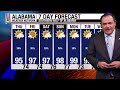
Much of the state stayed hot and dry today, but East Alabama got the fireworks. A severe thunderstorm rolled through Opelika around 3 o'clock this afternoon with pretty good sized hail and strong winds. Temperatures there crashed from the 90s all the way to 72 during the downpour before recovering to 80 this evening. Auburn caught a good soaker as well, and pockets of deep convection fired across parts of East Alabama and Georgia. Everything has moved on to the east and things are quiet this evening.
The heat has been the bigger story. Montgomery officially hit 101 for a high today. Selma reached 99 and Tuscaloosa 97. Fairhope is 89 with a dewpoint at 80, about as muggy as it gets. That is the hottest weather we've seen so far this summer, and it looks like this is the pattern for the foreseeable future.
Tomorrow morning starts i...
- Title
- Ridge Anchors In: AWN Statewide Forecast for Thursday Afternoon, August 13, 2026
- Runtime
- 7:46
- Date posted
- 15 days ago
- Description
- Meteorologist Drew McCombs brings your Alabama Weather Network statewide forecast for Thursday afternoon, August 13, 2026.
Most of the state is hot and dry this afternoon, but a few scattered showers and thunderstorms are firing. East central Alabama has isolated cells, and a heavier one has weakened over Jackson County. Bigger cells over Coosa and Tallapoosa Counties are pushing toward southern Chambers County and heading for Lee County and Auburn. Down on the coast, a stronger cell is moving along I-10 across eastern Baldwin County. None are severe, but any storm that develops can pack heavy rain, gusty winds, and frequent lightning.
The heat is the bigger story. Feels-like values are well into the triple digits across most of the state, and some spots are approaching 110. Heat advisories remain in effect statewide through the weekend.
Lows tonight only fall to the mid to upper 70s, so it's a muggy overnight and a warm start to Friday. Tomorrow ...

- Title
- Hot Days Ahead: Alabama Statewide Forecast for Late Morning, Thursday, August 13, 2026
- Runtime
- 7:14
- Date posted
- 15 days ago
- Description
- Meteorologist Drew McCombs brings your Alabama Weather Network statewide forecast for Thursday, August 13, 2026.
It's pretty calm across the state as we look at satellite and radar this morning. Lots of sunshine, hardly any showers, just a few that moved through the Gulf Coast earlier. Temperatures are already hot with 90 in Anniston, 92 in Birmingham, 92 in Monroeville, and Oneonta already at 95. Dewpoints are in the 70s statewide.
Heat indices are running well into the triple digits before lunch. Heat advisories are in effect for the entire state through the weekend, with values reaching near 110 possible.
Highs today climb into the mid to upper 90s, and a few spots on the western side of the state could touch 100. Lows tonight only fall to the mid to upper 70s, so it's a muggy overnight and a warm start to Friday. An upper level ridge is building in with surface high pressure and sinking air, which keeps organized storm systems well to the nort...

- Title
- Heat Ramps Up: Alabama Forecast for Thursday Morning August 13, 2026
- Runtime
- 4:04
- Date posted
- 16 days ago
- Description
- Meteorologist James Spann brings your Alabama Weather Network statewide forecast for Thursday morning, August 13, 2026.
A warm sunrise is underway from north Alabama to the Gulf Coast, but the larger story is the upper ridge building across the Deep South. That ridge keeps the main storm track north and leaves Alabama in a hot, steamy summertime pattern.
Mid-90s are expected for most of Alabama today and tomorrow. Showers and storms will be random and widely scattered, with the best window from noon to midnight and about a 20 percent chance at any one spot. Any storm could still produce gusty winds, heavy rain, and tremendous lightning.
The weekend turns hotter, with upper 90s statewide and a few western spots potentially touching 100. Morning lows remain in the 70s, and widely scattered daytime storms continue through next week.
Rain relief is limited in this pattern. The only cooling shower comes from random daytime heating storms, ...

- Title
- Isolated Storms Fizzle, Heat Ramping Up: Alabama Forecast for Wednesday Evening August 12, 2026
- Runtime
- 3:45
- Date posted
- 16 days ago
- Description
- Meteorologist James Spann brings your Alabama Weather Network statewide forecast for Wednesday evening, August 12, 2026.
Storms today were more isolated than yesterday, and everything remaining will fade quickly after sunset.
The big story is the heat, as per usual in August. Temperatures this evening are still hot at the dinner hour. Areas that saw showers earlier are running cooler in the 80s.
Tomorrow morning starts in the 70s and climbs to the mid 90s statewide, then Friday looks the same. Upper 90s take over for Saturday and Sunday, and a spot or two will likely touch 100, especially over on the western side of South Alabama. Heat index numbers ride even higher thanks to dewpoints near 80.
Rain chances stay locked in around 2 in 10 the rest of the week and much of next week with this ridge in place, so most spots stay dry. Gulf Coast looks beautiful with sunny days, fair nights, and no tropical trouble on the horizon.

- Title
- Scattered Showers Northeast, Heat Builds: Alabama Forecast for Wednesday Afternoon August 12, 2026
- Runtime
- 10:41
- Date posted
- 16 days ago
- Description
- Meteorologist Sadie Morris brings your Alabama Weather Network statewide forecast for Wednesday afternoon, August 12, 2026.
Isolated showers and storms are firing across the northern and eastern sliver of the state this afternoon while much of the south stays dry and sizzling. Rain has been scattered through Franklin, Lawrence, Morgan, Montgomery and Lee Counties.
Heat advisories now cover the entire state after the National Weather Service in Mobile joined Huntsville and Birmingham in issuing them. Feels-like numbers are running in the triple digits, with humidity making it feel much hotter than the actual temperatures.
The Storm Prediction Center has a Marginal Risk of severe storms, level 1 of 5, for the far northern sliver and the eastern portion of the state, mainly for gustier winds. Fast rain rates are the other concern, with a chance of localized flash flooding, similar to yesterday.
Highs push into the upper 90s statewide thr...

- Title
- Heat Builds Across Alabama: Alabama Forecast for Wednesday Mid-Day August 12, 2026
- Runtime
- 8:54
- Date posted
- 16 days ago
- Description
- Meteorologist Sadie Morris brings your Alabama Weather Network statewide forecast for Wednesday morning, August 12, 2026.
Heat advisories continue for much of the central and north central portions of the state, and feels-like temperatures are already breaking triple digits before lunch.
Most of the state is dry with plenty of sunshine, aside from a quick rain shower moving north of the beaches along I-10. The far northeastern corner of the state sits under a Marginal Risk of severe storms and a Marginal flash flood risk today, similar setup to yesterday when flash flood warnings had to be issued for Cherokee County.
Highs this afternoon climb into the mid to upper 90s. Lows tonight stay above average in the mid to upper 70s.
A strong ridge, is bullseyed over Alabama through Friday and into the weekend. Upper 90s will become the story by Sunday, and rain chances drop to about 2 in 10.
#alwx #alabamaweather #wx #forecast...

- Title
- Hottest Weekend of Summer Approaches: Alabama Forecast for Morning August 12, 2026
- Runtime
- 4:21
- Date posted
- 17 days ago
- Description
- Meteorologist James Spann brings your Alabama Weather Network statewide forecast for Wednesday morning, August 12, 2026.
It's mid-August, it's going to be hot, it's going to be humid, and somebody's going to see a storm this afternoon, maybe some strong winds again today especially for the northern and eastern counties. The Storm Prediction Center has painted a Marginal Risk of severe storms, level 1 of 5, for areas north and east of a line from near Muscle Shoals down to about Phenix City. Storms could produce very heavy amounts of rain, strong winds, and a lot of lightning, and they should start firing after 12 noon.
Yesterday's storms in east and northeast Alabama packed a punch with heavy rain and scattered wind damage, but the state starts this morning calm and rain-free. We're on the eastern periphery of an upper high and this Ring of Fire pattern keeps the storm chance focused across the northern and eastern counties. Down at the Gulf Coast, weather loo...
- Title
- Northwest Alabama Storms, Temps Climbing: Alabama Forecast for Tuesday Evening August 11, 2026
- Runtime
- 4:04
- Date posted
- 17 days ago
- Description
- Meteorologist James Spann brings your Alabama Weather Network statewide forecast for Tuesday evening, August 11, 2026.
Most of Alabama has been hot and dry, but the far northeastern corner picked up some summer storms with parts of northern Cherokee County reporting 3 to 5 inches of rain over just a few hours, prompting flash flood warnings this afternoon.
Showers across Jackson, DeKalb, Cleburne, Calhoun, Etowah, Marshall, and parts of Madison Counties were scattered throughout the afternoon as well. Everywhere else stayed rain-free with low to mid 90s for highs.
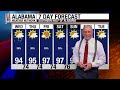
Tomorrow morning starts in the 70s and highs push into the mid to upper 90s by the late afternoon. Some of the hottest weather we've seen all summer is on the way as an upper ridge builds in from the west. Rain chances tomorrow only about 1 in 5.
Heading into the weekend, upper 90s become the story with highs near 97 to 98 down by Sunday. The morning lows will stick to the 7...

- Title
- Alabama Weather Network Live Storm Coverage
- Runtime
- 4:56
- Date posted
- 17 days ago
- Description
- The Alabama Weather Network delivers live and on-demand coverage from across the state, featuring Chief Meteorologist James Spann and his expert team. Providing hyper-local forecasts, severe weather updates, and in-depth analysis for all 67 Alabama counties, keeping communities safe and informed.

- Title
- Showers in Northwest Alabama, Heat Increases: Alabama Forecast for Tuesday Afternoon August 11, 2026
- Runtime
- 8:24
- Date posted
- 17 days ago
- Description
- Meteorologist Sadie Morris brings your Alabama Weather Network statewide forecast for Tuesday afternoon, August 11, 2026.
A flash flood warning is up for the northern half of Cherokee County, where rain rates of 3 to 4 inches per hour with continuous rainfall have prompted the alert. That warning runs until 6:15 tonight.
The rest of the state has stayed hot with plenty of sunshine. Heat advisories remain in effect from Montgomery County northward, with heat indices running from the upper 90s into the triple digits.
Overnight lows tonight sit above average in the mid to upper 70s. Wednesday looks a lot like today with mid 90s in many spots and pop-up shower coverage right around 30%, mostly during the afternoon and evening.
By Thursday and Friday a ridge locks in, and highs will climb into the mid to upper 90s as rain chances drop closer to 20% into the weekend.
#alwx #alabamaweather #wx #forecast
0:00 Introd...

- Title
- Alabama Weather Network Live Storm Coverage
- Runtime
- 4:52
- Date posted
- 17 days ago
- Description
- The Alabama Weather Network delivers live and on-demand coverage from across the state, featuring Chief Meteorologist James Spann and his expert team. Providing hyper-local forecasts, severe weather updates, and in-depth analysis for all 67 Alabama counties, keeping communities safe and informed.

- Title
- Temperatures Increasing: Alabama Forecast for Tuesday Mid-Day August 11, 2026
- Runtime
- 8:46
- Date posted
- 17 days ago
- Description
- Meteorologist Sadie Morris brings your Alabama Weather Network statewide forecast for Tuesday morning, August 11, 2026.
Plenty of sunshine across Alabama, and with it comes increasing temperatures. Heat indices are already breaking triple digits at midday, and the National Weather Service has put much of the state under heat advisories through the middle of the week.
Highs today land in the low to mid 90s, but with dewpoints in the mid to upper 70s, feels-like numbers push into the upper 90s to triple digits.
Wednesday is more of the same with highs bumping into the mid to upper 90s. Rain chances stay limited all week thanks to a ridge parked over the southeast, and most spots pick up only trace amounts to a quarter or half inch of rain through Monday.
By Thursday, Friday, and into the weekend, we're looking at the potential for upper 90s and rain chances dropping.
#alwx #alabamaweather #wx #forecast
0:00 Int...





