NWS Twin Cities
National Water Prediction Service website demo -- NWS Twin Cities

- Title
- National Water Prediction Service website demo -- NWS Twin Cities
- Date posted
- 4 days ago
- Description
- This recorded webinar discusses the features of the new NWPS website, which will replace AHPS in late May 2024.
---------------------------------
National Weather Service
Weather Forecast Office
Twin Cities/Chanhassen, MN
- Title
- Brief video to show how to find HEFS forecasts on the AHPS website.
- Date posted
- 1 year ago
- Description
- This is a quick video used as part of a slide set to show how to find HEFS forecast information on the NWS AHPS website.
---------------------------------
National Weather Service
Weather Forecast Office
Twin Cities/Chanhassen, MN
- Title
- Isaias Special Balloon Launch
- Date posted
- 4 years ago
- Description
- Though thousands of miles away from where Hurricane Isaias will trick, will still providing support to forecasters by providing upper air observations from our office 4 times per day (2 more than we normally do).
---------------------------------
National Weather Service
Weather Forecast Office
Twin Cities/Chanhassen, MN
- Title
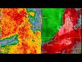
- July 15, 1980 Southern Twin Cities and Western Wisconsin Windstorm - NWS MSP WSR-57 Radar
- Date posted
- 4 years ago
- Description
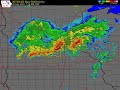
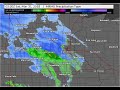
- A devastating windstorm on July 15, 1980 moved across the southern suburbs of Minneapolis-St. Paul and into western Wisconsin, where it intensified and produced widespread severe damage. It was Wisconsin's costliest storm up to that time. There were four fatalities: one in Minnesota and three in Wisconsin. Radar film from the NWS WSR-57 at the MSP International Airport was recently discovered and digitized.
Two loops and several still images are shown in this clip along with some explanations. The first loop, from 00:19 to 00:44, shows the broader picture. The second loop is shown from 1:44 to 2:13 and is zoomed in. There is no audio. The radar loops are shown from 11:51 a.m. to 10:34 p.m. CDT (in UTC, 1651z to 0334z). Eau Claire is about 85 miles east of MSP. When not zoomed in, the outer circle is 290 miles (250 nautical miles) from the MSP radar (brighter range rings are spaced at 58 miles). The zoomed in images and loops have the thicker gray circles at 58 and 116 mile...

- Title
- Weather-Ready Nation
- Date posted
- 4 years ago
- Description
- This video covers how to prepare for summer weather hazards including storms, tornadoes, heat, and flooding.
---------------------------------
National Weather Service
Weather Forecast Office
Twin Cities/Chanhassen, MN
- Title
- September 24, 2019 Elk Mound/Wheaton, WI EF3 Tornado
- Date posted
- 5 years ago
- Description
- Here is a detailed radar overview of the last Tuesday's (9/24/19) Elk Mound/Wheaton, WI EF3 tornado.
---------------------------------
National Weather Service
Weather Forecast Office
Twin Cities/Chanhassen, MN
- Title
- Radar Loop - July 5, 2016
- Date posted
- 5 years ago
- Description
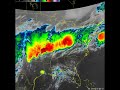
- Radar loop showing storms as they move across central and southern Minnesota on July 5, 2016. Storms produced tornadoes near Appleton in western Minnesota, and near Dennison in southeastern Minnesota
---------------------------------
National Weather Service
Weather Forecast Office
Twin Cities/Chanhassen, MN
- Title
- Radar Loop - September 20, 2018
- Date posted
- 5 years ago
- Description
- Radar reflectivity loop as tornadoes moved across central and southern Minnesota, and western Wisconsin. Storms occurred during the early evening on September 20, 2018
---------------------------------
National Weather Service
Weather Forecast Office
Twin Cities/Chanhassen, MN
- Title
- Radar Loop - Tornado Debris Signature: 20 Sept 2018
- Date posted
- 5 years ago
- Description
- The 5-minute radar loop shows the debris detected just northeast of Morristown MN as the storms raced northeast at nearly 70 mph.
---------------------------------
National Weather Service
Weather Forecast Office
Twin Cities/Chanhassen, MN
- Title
- Radar Loop - June 4, 2019
- Date posted
- 5 years ago
- Description
- Radar loop from June 4, 2019. Strong winds and large hail occurred as storms moved across central and southern Minnesota.
---------------------------------
National Weather Service
Weather Forecast Office
Twin Cities/Chanhassen, MN
- Title
- Radar Loop - March 30-31, 2018 Winter Storm
- Date posted
- 5 years ago
- Description
- Radar loop from the winter storm on March 30-31, 2018. Heavy snow fell from central Minnesota into northern and central Wisconsin
---------------------------------
National Weather Service
Weather Forecast Office
Twin Cities/Chanhassen, MN
- Title
- Radar Loop - July 3, 2018 Flooding
- Date posted
- 5 years ago
- Description
- Radar loop showing rainfall during the flooding rains in southwest Minnesota on July 3, 2018. This radar loop is courtesy of the College of Dupage
---------------------------------
National Weather Service
Weather Forecast Office
Twin Cities/Chanhassen, MN

- Title
- Radar Loop from Winter Storm on March 23-24, 2018
- Date posted
- 5 years ago
- Description
- This video shows a radar loop during the winter storm on March 23-24, 2018. Heavy snow fell over much of western and southwestern Minnesota.
---------------------------------
National Weather Service
Weather Forecast Office
Twin Cities/Chanhassen, MN
- Title
- Radar Loop - June 20, 2019
- Date posted
- 5 years ago
- Description
- Radar loop over southwest Minnesota, from June 20, 2019. Tornadoes touched down this day in Redwood County, Brown County and Watonwan County
---------------------------------
National Weather Service
Weather Forecast Office
Twin Cities/Chanhassen, MN

- Title
- Radar Loop - July 4, 2019
- Date posted
- 5 years ago
- Description
- Radar loop from July 4, 2019, as a tornado touched down in Rusk County, Wisconsin.
---------------------------------
National Weather Service
Weather Forecast Office
Twin Cities/Chanhassen, MN
- Title
- Radar Loop - July 28, 2019
- Date posted
- 5 years ago
- Description
- Radar loop from July 28, 2019. Loop shows the radar images as tornadoes were touching down over central and east central Minnesota. Storms eventually produced tornadoes in west central Wisconsin as well.
---------------------------------
National Weather Service
Weather Forecast Office
Twin Cities/Chanhassen, MN
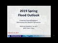
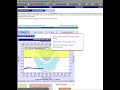
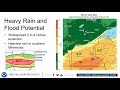
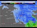
- Title
- 2019 Spring Flood Outlook -- NWS Twin Cities (Feb 27)
- Date posted
- 5 years ago
- Description
- Initial spring flood outlook for the Minnesota, Upper Mississippi, and western Wisconsin river basins. Bottom line -- The flood potential is elevated due to the heavy snowpack over the region; extent of flooding will be determined by weather conditions later in March into April.
Link to long range outlooks for forecast points: https://water.weather.gov/ahps2/long_range.php?wfo=mpx
Craig Schmidt, Senior Service Hydrologist
---------------------------------
National Weather Service
Weather Forecast Office
Twin Cities/Chanhassen, MN

- Title
- Radar Loop for January 18, 2019 Snow Event
- Date posted
- 5 years ago
- Description
- Radar loop from 12 p.m. to 6 p.m. Friday January 18, 2019 as heavy snow spread across southern Minnesota.
---------------------------------
National Weather Service
Weather Forecast Office
Twin Cities/Chanhassen, MN
- Title
- Tour of the NWS Twin Cities Office
- Date posted
- 6 years ago
- Description
- This video is a virtual tour of our office. We discuss our weather instruments, a look at the main operations area, programs we use to diagnose and predict the weather, the process of issuing warnings, and how our website can help you make the best possible decisions.
---------------------------------
National Weather Service
Weather Forecast Office
Twin Cities/Chanhassen, MN
- Title
- Decision Support Weather Briefing for Heavy Rain & Severe Weather, September 19-20, 2018
- Date posted
- 6 years ago
- Description
- Showers and thunderstorms with heavy rainfall could lead to flash flooding across portions of the area tonight into Thursday, with the possibility of severe storms Thursday afternoon into Thursday evening (September 19-20, 2018).
---------------------------------
National Weather Service
Weather Forecast Office
Twin Cities/Chanhassen, MN

- Title
- Radar Loop of the Historic April 13-16 Blizzard
- Date posted
- 6 years ago
- Description
- Radar loop showing the evolution of the winter storm/blizzard.
---------------------------------
National Weather Service
Weather Forecast Office
Twin Cities/Chanhassen, MN
- Title
- Radar Loop from February 24, 2018 winter storm
- Date posted
- 6 years ago
- Description
- Radar evolution of the snow shield from 9:00 AM CST February 24, 2018 through 3:00 AM CST February 25, 2018
---------------------------------
National Weather Service
Weather Forecast Office
Twin Cities/Chanhassen, MN

- Title
- August 11, 2016 Radar Loop
- Date posted
- 6 years ago
- Description
- Radar loop from heavy rainfall event on August 10-11, 2016
---------------------------------
National Weather Service
Weather Forecast Office
Twin Cities/Chanhassen, MN
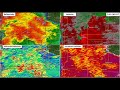
- Title
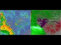
- July 12, 2017 Radar Loop
- Date posted
- 6 years ago
- Description
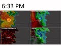
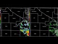
- Radar reflectivity (left) and storm relative velocity (right) loop of tornadic storm across far eastern Anoka and northwestern Washington counties from 227 AM through 237 AM.
---------------------------------
National Weather Service
Weather Forecast Office
Twin Cities/Chanhassen, MN
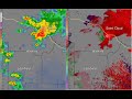
- Title
- July 9, 2017 Radar Loop
- Date posted
- 6 years ago
- Description
- Radar reflectivity (left) and storm relative velocity (right) loop of tornadic storm in southern Nicollet & northwest Blue Earth Counties from 1005 PM through 1045 PM.
---------------------------------
National Weather Service
Weather Forecast Office
Twin Cities/Chanhassen, MN
- Title
- Radar Loop - June 11, 2017
- Date posted
- 6 years ago
- Description
- Radar Loop from 6:05AM to 12:54 PM on June 11, 2017
- Title
- KDLH May 6, 2017 Radar Velocity Loop
- Date posted
- 6 years ago
- Description
- KDLH storm relative velocity loop from 356 PM CDT to 730 PM CDT, May 6, 2017. A tornado traveled across northwestern Wisconsin during this time frame.
- Title
- May 6, 2017 KMPX Radar Velocity Loop
- Date posted
- 6 years ago
- Description
- KMPX storm relative velocity loop from 330 PM CDT to 730 PM CDT, May 6, 2017. A tornado traveled across northwestern Wisconsin during this time frame.
- Title
- May 6, 2017 KDLH Radar Loop
- Date posted
- 6 years ago
- Description
- DLH Radar reflectivity loop from 318 PM CDT to 730 PM CDT, May 6, 2017. A tornado traveled across northwestern Wisconsin during this time frame.
---------------------------------
National Weather Service
Weather Forecast Office
Twin Cities/Chanhassen, MN
- Title
- May 6 ,2017 KMPX Radar Loop
- Date posted
- 6 years ago
- Description
- Radar reflectivity loop from 315 PM CDT to 730 PM CDT, May 6, 2017. A tornado traveled over much of northwestern Wisconsin during this time
---------------------------------
National Weather Service
Weather Forecast Office
Twin Cities/Chanhassen, MN

- Title
- March 6, 2017 Radar Loop
- Date posted
- 6 years ago
- Description
- Base Radar Reflectivity loop from 4:30 PM to 8:00 PM as the storms moved across Minnesota into Wisconsin.
---------------------------------
National Weather Service
Weather Forecast Office
Twin Cities/Chanhassen, MN
- Title
- Radar Loop of wind damage near Glencoe, MN on 8/19/2016
- Date posted
- 6 years ago
- Description
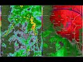
- This 10 minute loop shows radar reflectivity (left) and radar velocity (right) as the storm moved over Glencoe MN. Wind speeds in excess of 90 mph were measured at 1350 ft above the ground, but the strongest winds measured at the airport were only 47 mph.
---------------------------------
National Weather Service
Weather Forecast Office
Twin Cities/Chanhassen, MN
- Title
- Radar Loop of wind damage near Glencoe, MN on 8/19/2016
- Date posted
- 6 years ago
- Description
- The loop above shows 80 minutes or radar reflectivity (left) and radar velocity (right) starting at 1:20 AM and ending at 2:40 AM CDT. Notice the enhanced area of wind indicated by the blue colors that develops near Glencoe. This is the area that had the worst damage from the second round of storms.
---------------------------------
National Weather Service
Weather Forecast Office
Twin Cities/Chanhassen, MN

- Title
- Radar Loop of Hollandale Tornado on Aug 28, 2016
- Date posted
- 6 years ago
- Description
- This 10 minute loop shows radar reflectivity (left) and radar velocity (right) as the storm moved over Hollandale MN. Notice the slight appendage on reflectivity that coincided with a weak circulation on the velocity. A weak EF0 tornado was confirmed just west of Hollandale.
---------------------------------
National Weather Service
Weather Forecast Office
Twin Cities/Chanhassen, MN

- Title
- Radar Loop of Hollandale Tornado on Aug 18, 2016
- Date posted
- 6 years ago
- Description
- The loop above shows 90 minutes or radar reflectivity (left) and radar velocity (right) starting at 3:30 PM and ending at 5:00 PM CDT. Over that time the storm moves from Mankato to northeast of Albert Lea. Notice in the reflectivity how the storm "bows out" into a backwards "C-shape" which is a sign of strong winds. These strong winds can be seen in the velocity by the tan/white colors which indicate speeds of 75 to 85 mph at around 6000 ft above the ground.
---------------------------------
National Weather Service
Weather Forecast Office
Twin Cities/Chanhassen, MN
- Title
- Radar Loop of Watkins Tornado from July 11, 2016
- Date posted
- 6 years ago
- Description
- Radar Reflectivity Loop showing storm that produced a tornado in Watkins, Minnesota on July 11, 2016
---------------------------------
National Weather Service
Weather Forecast Office
Twin Cities/Chanhassen, MN

- Title
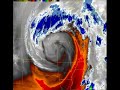
- GOES-16 IR Loop of Harvey, August 23-27, 2017
- Date posted
- 7 years ago
- Description
- Harvey is currently producing catastrophic flooding in Texas. Here's a satellite view of its evolution over the past four days (817 AM CDT Wednesday through 817 AM CDT today).
The GOES-16 data posted on this page are preliminary, non-operational data and are undergoing testing. Users bear all responsibility for inspecting the data prior to use and for the manner in which the data are utilized.
---------------------------------
National Weather Service
Weather Forecast Office
Twin Cities/Chanhassen, MN
- Title
- GOES-16 Total Eclipse Visible Satellite Data from 8/21/17
- Date posted
- 7 years ago
- Description
- GOES_16 Channel 02-0.64 micron imagery from the total solar eclipse on Monday, August 21st 2017. Note: GOES-16 data are preliminary, non-operational).
---------------------------------
National Weather Service
Weather Forecast Office
Twin Cities/Chanhassen, MN
- Title
- Satellite Loop of Tornadic Supercell - June 28, 2017
- Date posted
- 7 years ago
- Description
- This one hour loop (from 405 PM to 505 PM on Wednesday, June 28, 2017) shows 1-minute satellite imagery from the GOES-16 satellite, encompassing the time period during which a tornadic supercell impacted portions of Pierce County, Wisconsin. he tornado occurred during a portion of this time period, roughly during the middle portion of the loop. The top image shows the storm from the satellite's visible channel, and the bottom image shows it from an infrared window channel. Since the satellite is in orbit above the equator, the combination of the storm's height and the curvature of the Earth result in parallax, which causes the storm to appear slightly north of its actual location. Meteorologists take this effect into account when evaluating satellite data in conjunction with radar and other data sources.
The GOES-16 data posted on this page are preliminary, non-operational data and are undergoing testing. Users bear all responsibility for inspecting the data prior to use a...
- Title
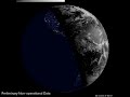
- Visible Satellite Loop - June 25-28, 2017
- Date posted
- 7 years ago
- Description
- Here's a look at Visible Satellite Imagery of the Earth from GOES-16 since Sunday morning. You can see four sunrises and three sunsets over the time frame captured. It is overlaid on NASA's Earth at Night imagery (https://earthobservatory.nasa.gov/Features/NightLights/) to give some perspective of how lights at night can appear from space.
The GOES-16 data posted on this page are preliminary, non-operational data and are undergoing testing. Users bear all responsibility for inspecting the data prior to use and for the manner in which the data are utilized.
---------------------------------
National Weather Service
Weather Forecast Office
Twin Cities/Chanhassen, MN
- Title
- The Week in Review, June 11-17, 2017
- Date posted
- 7 years ago
- Description
- As is often the case at this time of year, it was a fairly busy week weather-wise across our area. Here's a look back at how things went from last Sunday morning through this morning. The three images are in sync with one another. Radar imagery is at the top, the GOES-16 infrared window channel is in the middle, and the GOES-16 infrared mid-level water vapor channel is at the bottom. Be sure to view the video in HD!
The GOES-16 data posted on this page are preliminary, non-operational data and are undergoing testing. Users bear all responsibility for inspecting the data prior to use and for the manner in which the data are utilized.
---------------------------------
National Weather Service
Weather Forecast Office
Twin Cities/Chanhassen, MN
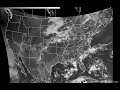
- Title
- Monitoring the weather from space, April 30 - May 1, 2017
- Date posted
- 7 years ago
- Description
- The GOES-16 data posted on this page are preliminary, non-operational data and are undergoing testing. Users bear all responsibility for inspecting the data prior to use and for the manner in which the data are utilized.
Here is a 25-hour animation of GOES-16 water vapor satellite imagery following the upper level low pressure system associated with the current storm as it moved from the Southern Plains yesterday morning into the Upper Mississippi Valley this morning.
---------------------------------
National Weather Service
Weather Forecast Office
Twin Cities/Chanhassen, MN
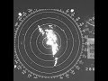
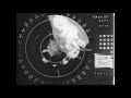
- Title
- MSP WSR-57 Radar from April 30, 1967
- Date posted
- 7 years ago
- Description
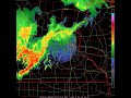
- Severe thunderstorms and a series of tornadoes impacted Minnesota and Iowa on 4/30/1967, with 13 deaths in Minnesota (there were no tornado deaths in other states that day). Residents refer to it as "Black Sunday." This video is an animation of individual 35 mm frames taken off of the then US Weather Bureau's WSR-57 radar in Minneapolis. The bright rings represent intervals of 50 nautical miles (58 statute miles), with the most distant ring having a radius of 250 nautical miles (290 statute miles). The radar was located at MSP International Airport and in use until 1996.
The tornadoes in MN and IA occurred to the southwest, south and southeast of MSP from 1550 to 2010 CST, roughly during the time from :04 to :12 seconds in the video. The radar operator on this day appears to have not applied any attenuation to the signal, resulting in most echoes being bright white. Therefore it is not easy to see any meaningful shapes such as hook echoes. Still, the overall pattern is...
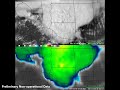
- Title
- GOES-16 Infrared Satellite Loop for April 28-29, 2017
- Date posted
- 7 years ago
- Description
- The GOES-16 data posted on this page are preliminary, non-operational data and are undergoing testing. Users bear all responsibility for inspecting the data prior to use and for the manner in which the data are utilized.
Flooding rains are occurring over a huge area from Oklahoma through the Ohio Valley. Here is a mesmerizing infrared satellite loop from GOES-16 covering the past 24 hours, showing where showers and thunderstorms have continued to re-develop and impact the same areas. Be sure to enable HD viewing!
---------------------------------
National Weather Service
Weather Forecast Office
Twin Cities/Chanhassen, MN

- Title
- Winter Storm and Cold Dec 16-18
- Date posted
- 8 years ago
- Description
- 1 min weather briefing
---------------------------------
National Weather Service
Weather Forecast Office
Twin Cities/Chanhassen, MN

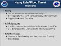
- Title
- Winter storm and Blizzard November 18 2016
- Date posted
- 8 years ago
- Description
- Decision support briefing for upcoming winter storm
---------------------------------
National Weather Service
Weather Forecast Office
Twin Cities/Chanhassen, MN
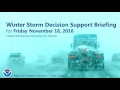
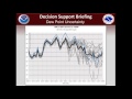
- Title
- Winter Storm Friday November 18, 2016
- Date posted
- 8 years ago
- Description
- Decision Support Weather Briefing for Friday, November 18.
---------------------------------
National Weather Service
Weather Forecast Office
Twin Cities/Chanhassen, MN
- Title
- Periods of heavy rain will increase flooding risk this week
- Date posted
- 8 years ago
- Description
- This short video discusses the potential for heavy rain and flooding this week.
---------------------------------
National Weather Service
Weather Forecast Office
Twin Cities/Chanhassen, MN
- Title
- Dangerous heat is expected Wednesday through Friday.
- Date posted
- 8 years ago
- Description
- This short video discusses the dangerous heat expected later this week.
---------------------------------
National Weather Service
Weather Forecast Office
Twin Cities/Chanhassen, MN

- Title
- Overview of Storms on Saturday, June 25, 2016
- Date posted
- 8 years ago
- Description
- Here is a brief discussion/summary of the storms which impacted portions of the area yesterday, while leaving many locations high and dry.
---------------------------------
National Weather Service
Weather Forecast Office
Twin Cities/Chanhassen, MN